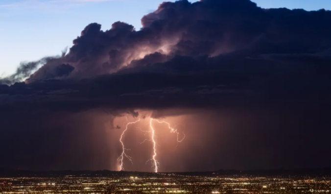
After one of the driest starts to the summer monsoon season on record across the Front Range, things have started to change somewhat following a surge of monsoon rainfall in the final days of July. We review what has transpired so far this summer, look at where 2022 fits into the historical monsoon climatology, and discuss the temperature and precipitation outlook for the month of August.
We discuss Boulder and Denver weather every single day on BoulderCAST Premium. Sign up today to get access to our daily forecast discussions every morning, complete six-day skiing and hiking forecasts powered by machine learning, access to all our Front Range specific weather models (including smoke forecasts), additional storm updates and much more!

N
ow that we’ve breached the first week of August, it’s important to recognize that the historical climax of monsoon season for northeast Colorado has just come and gone. The peak is in the last few days of July and we’re already on a downward trajectory. Ironically, for many of you, it may seem like the 2022 monsoon season never even started!
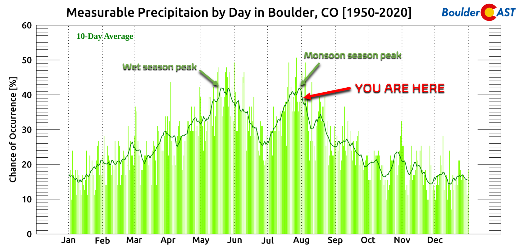
We originally posted our summer season outlook back in late June. At that time, we were seeing all the signs pointing to a dry summer headlined by a lack-luster monsoon season for the area. That prediction has mostly verified so far, but things are starting to change for the better — perhaps…
Feelings about this year’s monsoon season thus far have been mixed across the Front Range. Those around Boulder have expressed joy that it’s been such a rainy monsoon season for once, whereas folks in Denver are salty about how dry it has been. Boulder’s close proximity to the Foothills is to blame for the regional discrepancy in perception. Thunderstorms that develop over the terrain often will move eastward and weaken rapidly when they move out across the drier lower elevations. Boulder many times will catch the last dying gasps of these dissipating storms, producing just a little rainfall and wind before they completely fall apart. This happened countless times this summer — at points it seemed like a daily occurrence. Areas even just a few miles east, like Louisville and Erie, missed out on the rain entirely most of the time.
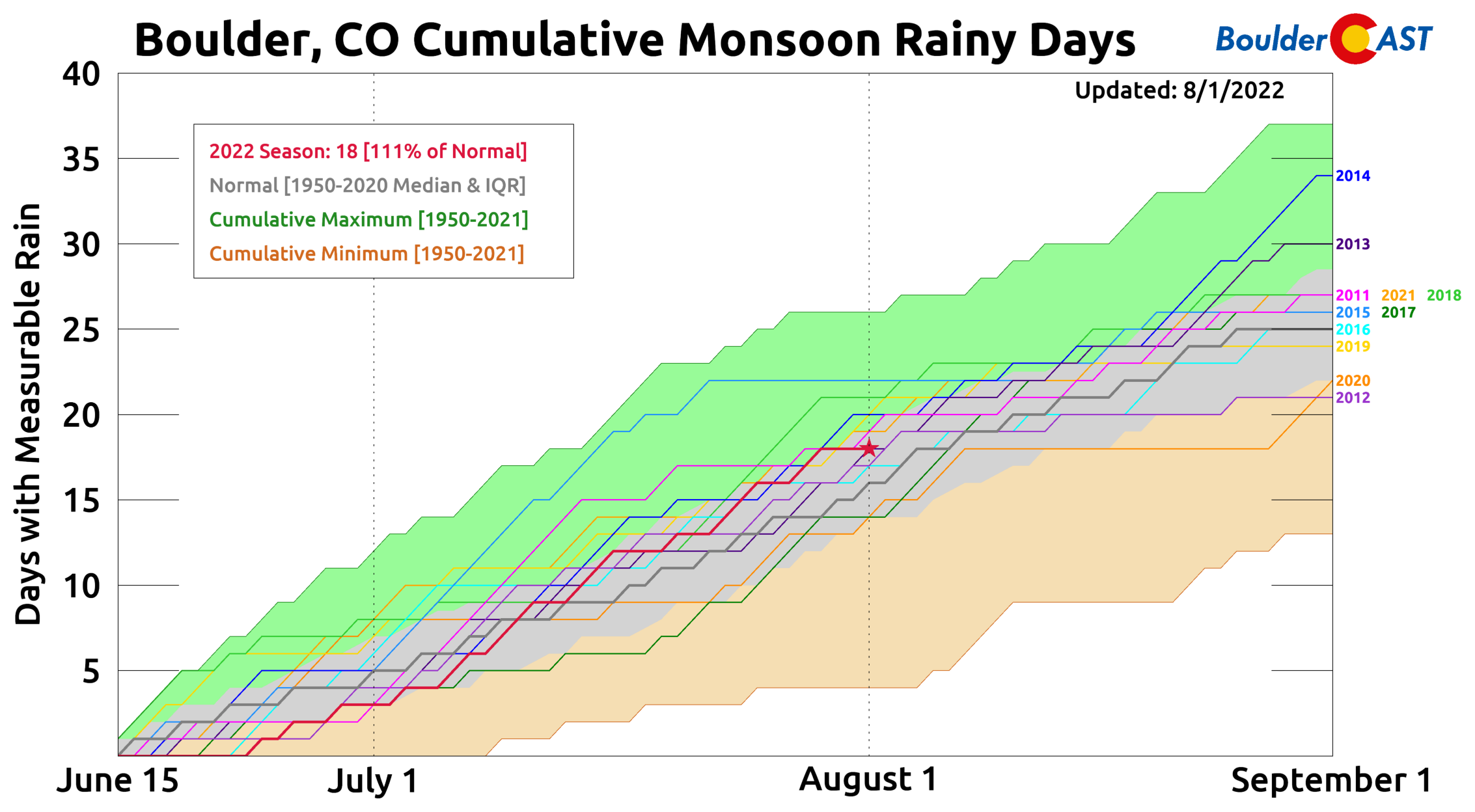
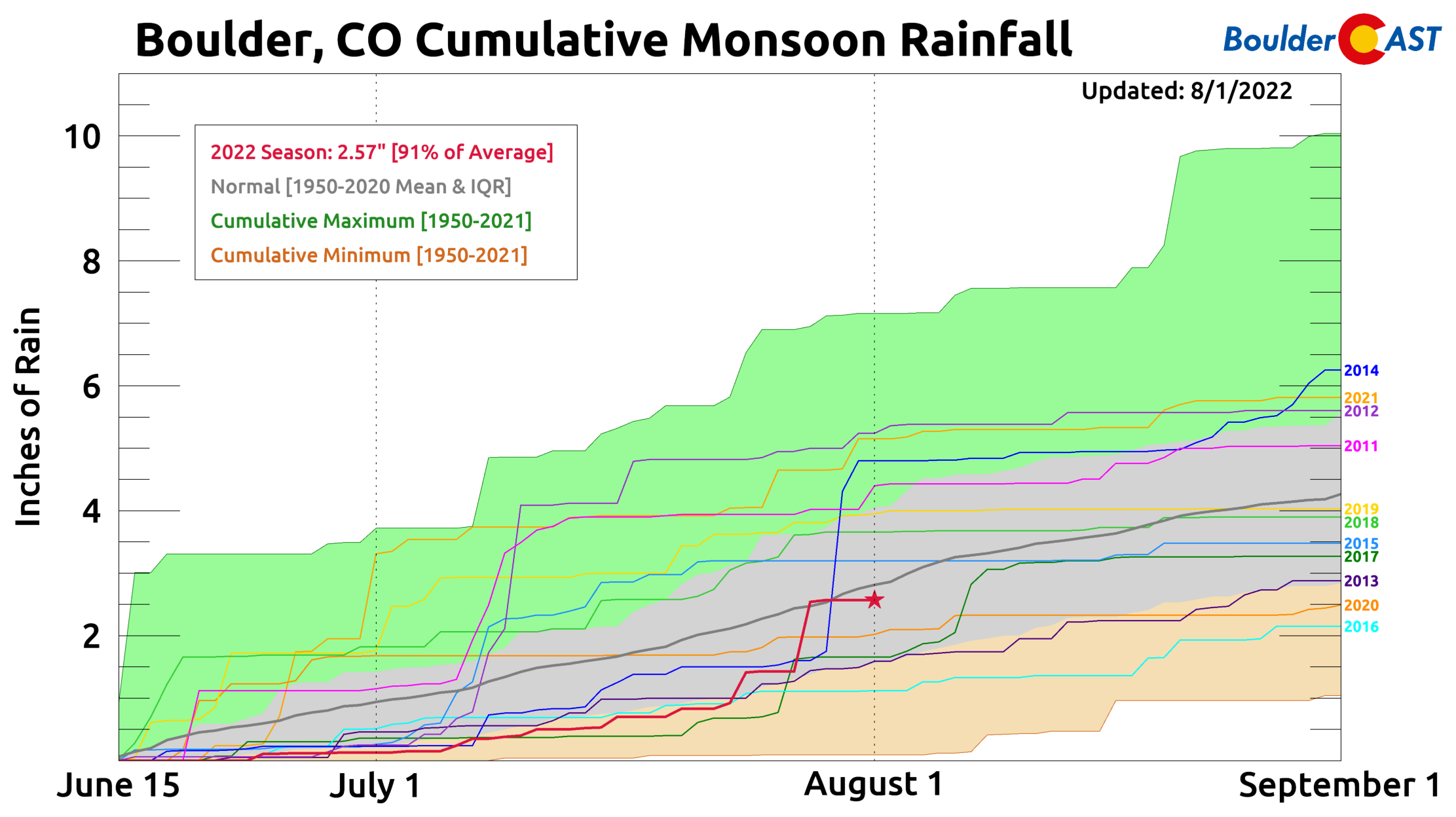
The perception of a wet summer by Boulderites is not unfounded: the city has indeed had a rainy monsoon season, at least in terms of the number of days with measurable rainfall. That count, now up to 18 days through August 1st, has been trending above normal since early July (see red line below).
The problem is that most of those rainy days produced very little actual rainfall — with weak showers or thunderstorms falling into a fairly dry low-level airmass. Of those 18 days so far with measurable rainfall in Boulder, a whopping 9 of them were for 0.03″ or less — an amount that barely wets the pavement! Not even counted here, there were also an additional 9 days where it sprinkled but wasn’t measurable at all. On the contrary, only 2 days have recorded more than 0.17″ of rain!
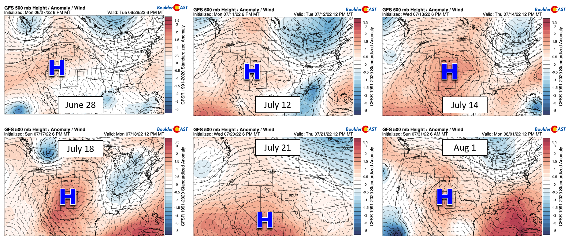
Front Range Colorado has largely been devoid of deep monsoon moisture this summer, owing mainly to a persistent unfavorable pattern — a ridge of high pressure camped out directly over the Four Corners. This pesky high pressure was present much of the month of July and is still lingering even now into early August. Underneath this ridge, one would expect hotter and drier than normal conditions to unfold — and with a few exceptions, that has been the case for us the last seven weeks.
Last week’s deep monsoonal surge, the first of its kind this summer to reach the Denver area, produced more than 1.7″ of rain in Boulder. To put this into perspective, that is the same amount of rain that fell over the previous seven drought-stricken weeks! After a dismal start to monsoon season this summer in terms of rainfall accumulation, those few days of hearty slow-moving thunderstorms last week pushed our monsoon rainfall total briefly above normal (see the red line below). We must mention that it’s not uncommon for a big chunk of our summertime rainfall to occur on just a few days when the right thunderstorm hits in just the right way. In fact, that actually happens most years. The graphic below also shows the timelines of monsoon rainfall from the last 10 summers. How many super-soaker rain days can you spot?
The map below shows rainfall totals across the Front Range since June 15th. The highest totals have been across the Foothills and Mountains with 2.5 – 5″. Most of the Denver area has recorded 1 – 3″. Some particularly unlucky spots? Less than 1″.
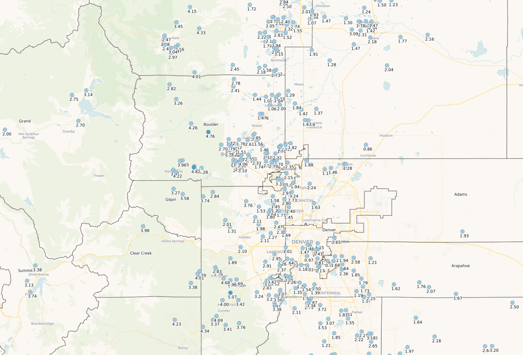
Front Range Colorado rainfall totals (June 15-August 1, 2022)
Due to the spotty nature of monsoon thunderstorms, there is quite the spread on totals, even within relatively small geographic areas. For example, just within the small city limits of Boulder, rainfall totals range from 1.5″ to over 4″.
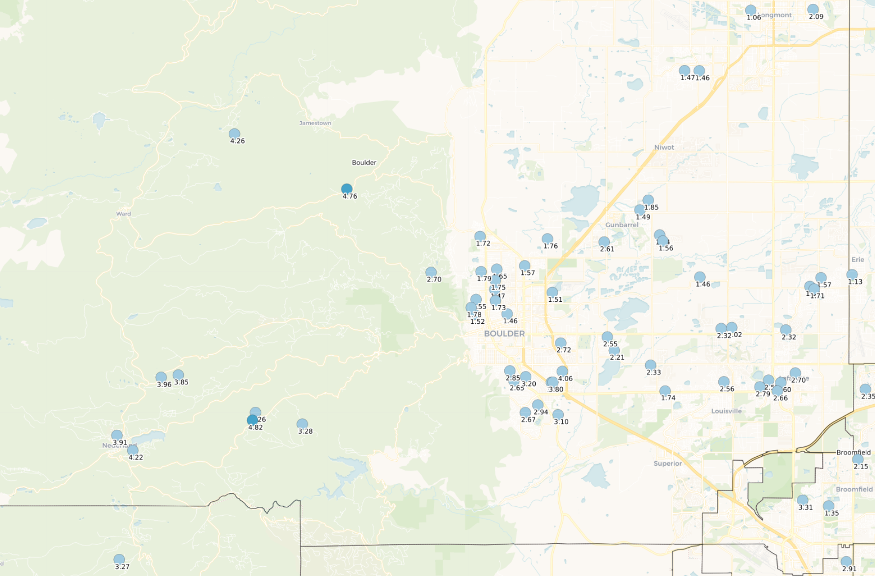
Boulder County rainfall totals (June 15-August 1, 2022)
However, much of this difference is related to the single stationary thunderstorm complex that produced localized urban flooding in mainly south Boulder on July 27th.
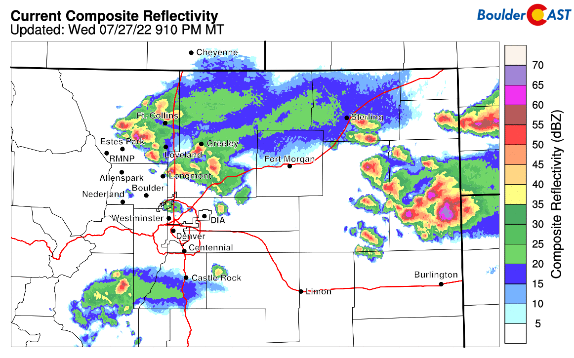
Late evening radar animation from northeast Colorado on July 27th. The cluster of storms that developed over Boulder this night produced around half the summer’s rainfall so far…
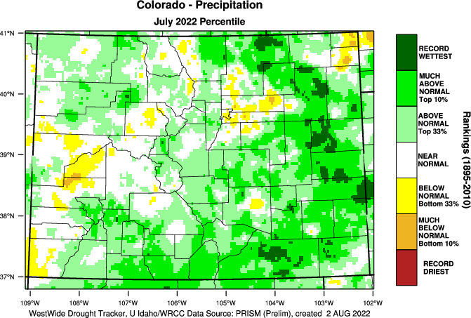
July 2022 concluded with above normal precipitation in Boulder, the other western suburbs of Denver and in the Foothills. Based on the graphic below, the eastern Denver Metro was one of the few notably dry spots in the state. In fact, a large portion of eastern Colorado had an extremely soggy month, and in the case of the areas shaded in dark green, their wettest July on record!
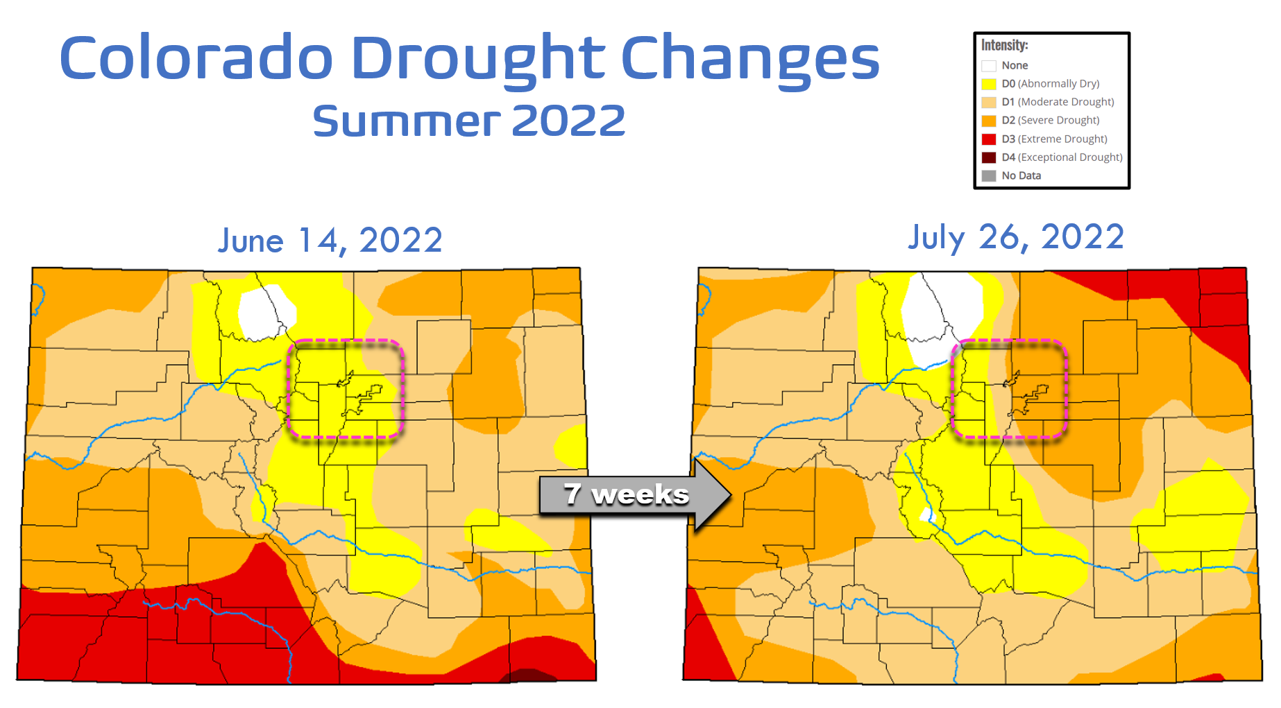
Since mid-June, we’ve seen substantial drought improvement across much of southern Colorado, with some mild improvement in the northern Mountains, too. However, the drought has intensified across the Front Range and much of northeast Colorado. We do note that a large portion of the widespread heavy rain from last week has not been taken into account by the United State Drought Monitor yet (it will be in their update later this week). With that rainfall included, we do expect to see some improvement in the Boulder-Denver area.
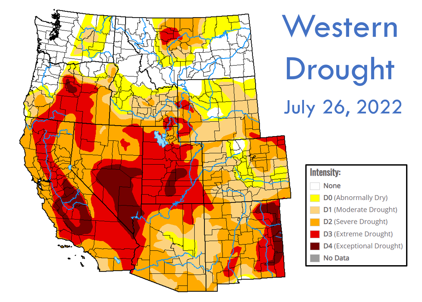
Drought is of course not only a pressing issue in Colorado — it’s currently plaguing much of the West.
After a fairly quiet start to the fire season, especially considering the widespread drought, things have taken a turn for the worst the last few weeks with several large wildfires igniting in the “Western Tinderbox”. Some of the headliners are the McKinney Fire (56k acres, 0% contained) and Oak Fire (19k acres, 75% contained) in California and the Moose Fire (58k acres, 20% contained) in Idaho. Whether they realize it or not, a huge portion of the country has been bombarded with smoke from these fires (and many others) the last few weeks. Thankfully, most of this smoke has been lofted high up in the atmosphere, so overall impacts to downstream air quality have been minimal.
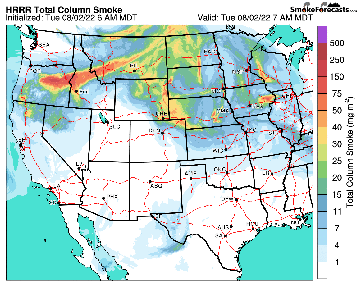
Total column smoke forecast for the next two days across the western United States
Here in Colorado, we’ve seen some smoke advect in at times, but nothing all that persistent. Just this past weekend, though, smoke from the McKinney Fire tinted our skies orange and partially blocked out the sun for a few hours.
Take a look up! A fairly significant batch of smoke from the #McKinneyFire in California just moved over the Denver area. Don't be alarmed. It's quite high up in the atmosphere with no impacts to air quality at the moment! 💨 #COwx #CAwx #Smoke #Denverweather #Boulder pic.twitter.com/6VyHssS1hd
— BoulderCAST Weather (@BoulderCAST) July 31, 2022
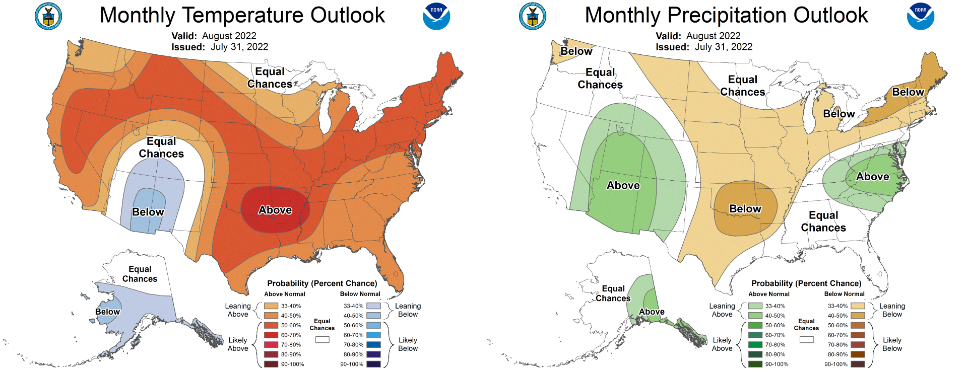
Looking ahead to August, the Climate Prediction Center is favoring a strong monsoon pattern in the heart of the Four Corners region, indicated by the elevated chances for above normal rainfall and below normal temperatures in that area. The Front Range is not really included in that statement, though. Our area is on the edge of their wet and hot chance shadings. Their forecast for us is actually not very helpful…
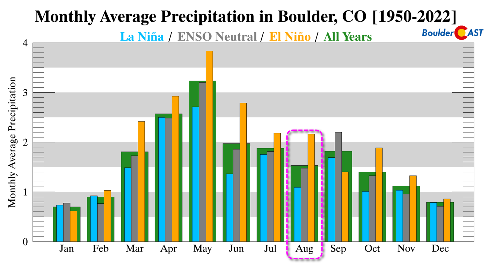
With La Niña continuing to hold in the Pacific Ocean, the outlook for August is a dry one in Boulder. The city averages ONE FULL INCH LESS RAINFALL when La Niña is active compared to El Niño.
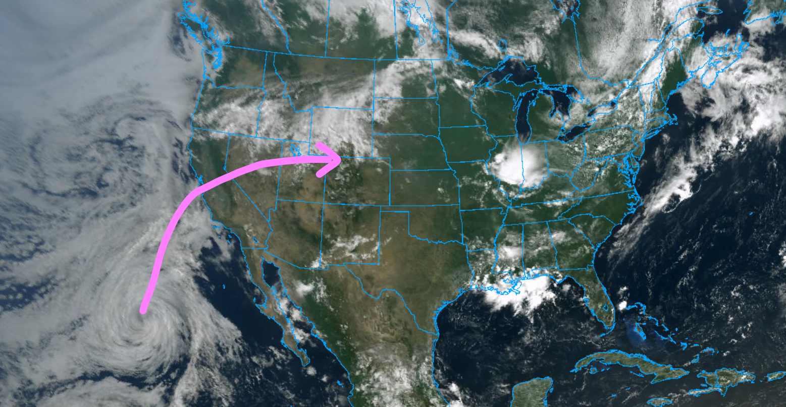
We’re hopeful that August 2022 will buck the parched trend typical in La Niña summers, but if the hot and dry forecast to kick off the month is any indication, that doesn’t appear likely. We are keeping a watchful eye on the upcoming weekend as tropical moisture associated with the remnants of once-Hurricane Frank in the Pacific will move into the northern Rockies with better storm chances pegged for the Front Range in the extended.
Finally, now through the end of August use promo code MONSOON to save 25% on BoulderCAST Premium. Sign up HERE!

Get BoulderCAST updates delivered to your inbox:
Enjoy our content? Give it a share!


You must be logged in to post a comment.