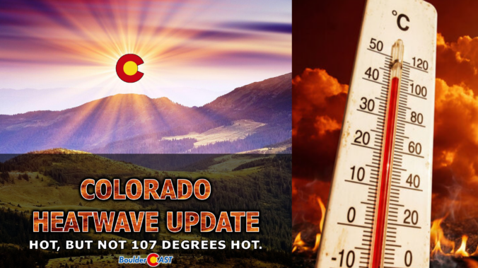
Category: Climatology (Page 1 of 70)

These posts contain information about the long-term weather patterns of Boulder County. Potential topics may include 30-day weather outlooks, El Nino/La Nina, and seasonal forecasts. You will find less about the day-to-day weather, with more focus on longer trends and patterns.

This Week in Colorado Weather: May 11, 2026

A warm, summer-like pattern is about to take over the Front Range in the middle of May. This week’s weather is driven by a robust mid‑level ridge anchored over the Desert Southwest, producing strong subsidence and a sustained warm anomaly across Colorado. A weak cold front on Tuesday will briefly cool us off, but its effect will be short-lived, with near-record heat building back in by midweek. Rain chances through the extended period remains quite low given the setup, but the late-week period is somewhat uncertain. We break down the dynamics driving this pattern and the implications it will have for the Denver–Boulder corridor through this warm, mostly dry stretch ahead.

Continue reading

April 2026 Graphical Weather Review: A warm, bone-dry month that sure didn’t rescue Colorado’s snowpack

April 2026 wrapped up as another water‑starved month along the Front Range, trading March’s record heat for a parade of fast‑moving systems that looked promising on paper but rarely delivered meaningful moisture. Temperatures still ran warmer than average overall, punctuated by a few sharp cold fronts that briefly returned a wintry feel before the pattern snapped back to mild, windy, and dry. Fire danger stayed elevated on many days, and despite several rounds of light precipitation, Colorado’s snowpack remained historically low heading into May. Let’s take a graphical look at how April unfolded across Boulder, Denver, and the Front Range — and how it stacked up against climatology.

Continue reading

Colorado Forecast Update: Much-needed moisture will soak Colorado on Thursday, but the Front Range is on the outside looking in again

This brief lull in the action Wednesday morning won’t last long as the pattern is set to turn unsettled again in a hurry. A pair of poorly aligned disturbances is gearing up to bring the Front Range a long‑overdue dose of moisture — along with snow in the higher terrain. While the bullseye of heaviest precipitation is frustratingly expected to be south of our area again, a slew of marginal ingredients are coming together for what should be our most meaningful storm in months. We break down what to expect as we head into a soggy, colder, and in some cases, snowier end to the week.

Continue reading

El Niño Is Coming — But Colorado Likely Faces a Hyperactive Fire Season First

Colorado headlines have been buzzing about a looming “Super El Niño,” but the story behind the hype is far more layered than the headlines let on. Before leaning into the dramatic graphics and sweeping claims, it’s worth unpacking where this narrative actually came from and why one overzealous model run has taken on a life of its own. More importantly, we must consider what this all really means for our state as we limp into summer with record‑low snowpack, deepening drought, and a fire season that has already been sharpening its teeth. The truth is far more nuanced than the current online discourse suggests.

Continue reading

This Week in Colorado Weather: April 20, 2026

The atmosphere is gearing up for a dramatic mid‑week pivot, and the Front Range is about to feel every bit of it. We start the week under a warm, bone‑dry ridge that will send temperatures soaring and fire danger spiking—especially by Wednesday, when downslope winds and exceptional dryness are set to collide. But just as quickly, the pattern will flip. A pair of incoming troughs will drag us into a cooler, unsettled stretch of weather heading into the weekend, with several chances for much‑needed moisture and even the prospect of a few snowflakes mixing in at times. It’s a true tale of two patterns this week! Read on for all the details.

Continue reading

Winter Storm Recap: That brief burst of heavy snow was great, but the drought marches on

Friday delivered one of those classic Colorado curveballs. The storm showed up fashionably late, then hit harder than expected once it finally got going. It left behind a fast‑melting blanket of spring snow and cleared out almost as quickly as it arrived. In today’s update, we break down the wild midday burst of snow, take a look at how the forecast held up, and highlight why the real headline may have been what happened — or didn’t happen — after the flakes stopped.

Continue reading

Colorado Winter Weather Update: From Fire Danger to Snowflakes in Just 12 Hours, Then Comes a Hard Freeze

A sharp pattern shift is lining up for the Front Range to end the week, and it’s going to feel a lot different than the stretch of mild, breezy days we’ve been riding lately. Thursday brings one more round of elevated fire danger, but by tonight a much colder airmass barrels in and sets the stage for a quick burst of snowflakes Friday morning — followed by a hard freeze Friday night that may end up being the most impactful part of the whole event. Here’s what to expect as winter makes a brief, timely return to the Denver-Boulder area.

Continue reading

This Week in Colorado Weather: April 13, 2026

As we roll into mid‑April, the Front Range finally snaps back into an active pattern with fire danger, two storm systems, and even a shot at late‑season snow all packed into one busy week. From warm, windy days to Mountain snow and the possibility of flakes reaching the Denver–Boulder corridor by Friday, there’s a lot happening in the days ahead. Read on for all the details.

Continue reading

« Older posts