
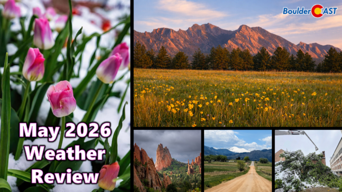
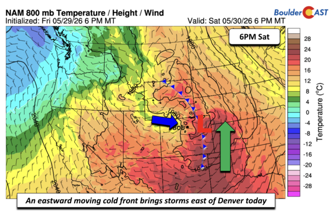
May 2026 delivered a true roller‑coaster pattern along the Front Range. Despite finishing warmer than average, the month was punctuated by two significant chilly precipitation events that funneled a remarkable amount of moisture into Boulder and Larimer Counties. The first arrived as a damaging late‑season snowstorm, wrecking leafed‑out trees across the region, while the second system — fortunately — remained all rain at lower elevations.
Together, these systems provided meaningful drought relief, though the broader hydrological picture across Colorado and the West remains deeply strained. Here’s a graphical look at how May unfolded across Boulder, Denver, and the Front Range — and how it compared to climatology.
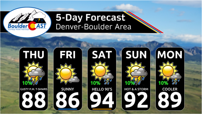

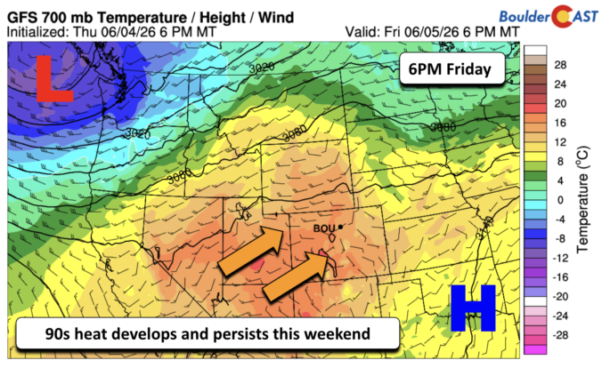
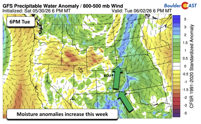
Spring’s grip on our wet season is loosening, and the atmosphere is starting to hint at the drier pattern ahead — but not before we squeeze out a few more days of spotty storm potential. This week brings a mix of low‑end daily rain chances, early‑week severe storms, and a slow warm‑up that could push us toward our first 90° reading of the year by the weekend. Read on as we break down what to expect as we ride out this transitional stretch of early June.

Live View of Boulder

Current Conditions

Live Radar

Recent Premium Posts

BoulderCAST Daily – Fri 06/05/26 | A streak of 90s set in through the weekend
🥵 A streak of 90s today through the weekend with low to middle …
This Weekend in Colorado Weather: Early-Season Heat Ramps Up — First 90s of the Year on the Horizon
🌬️ West–northwest flow Thursday supports high‑based convection with gusts to 35 MPH; virga …
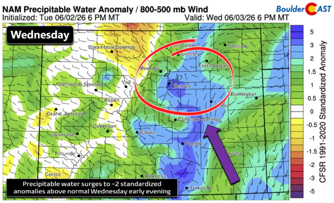
BoulderCAST Daily – Wed 06/03/26 | Scattered P.M. storms again as moisture peaks for the week
🌬️ Weak westerly flow aloft today with no major synoptic features nearby; only …
3-Day Forecast

Trending Content

© 2026 Front Range Weather, LLC