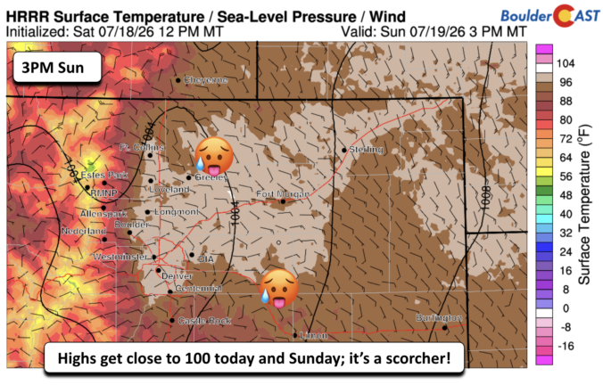
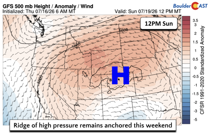
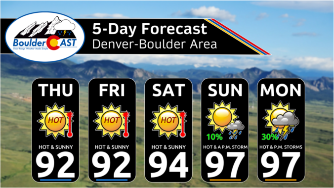
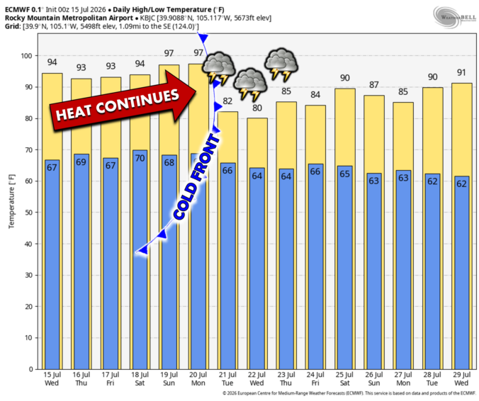
After more than a week of relentless heat, the Front Range is finally heading into a pattern change — but not before we break a few records and squeeze out one more day near 100°. This week will bring a notable shift: true monsoon moisture is poised to surge over the Continental Divide, storm chances finally return and temperatures finally ease… at least for a moment. We break down what’s driving this stubborn heat, when the storms arrive, and why flash-flood concerns may quickly replace heat and fire danger as Colorado’s primary weather story.

Page 2 of 576

*Premium* BoulderCAST Daily – Tue 07/14/26 | The Front Range Continues to Bake Under Expansive Ridge
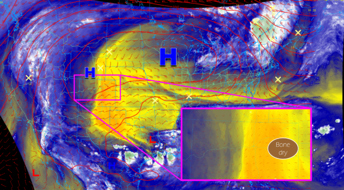
Summer isn’t just knocking, it’s kicking the door wide open across the Front Range this week. An unusually stubborn ridge of high pressure is staying put overhead, sending temperatures soaring across the Denver Metro area for days to come with barely a cloud in the sky. Fire danger, air quality, and even the long‑awaited monsoon will all play a role eventually this week. We break down what this pattern means for heat records, fire concerns, and when rain chances might finally return to the area.

Live View of Boulder

Current Conditions

Live Radar

Latest Smoke Forecast

Recent Premium Posts

BoulderCAST Daily – Tue 07/28/26 | Front Range Primed for Widespread Thunderstorms as Monsoon Reloads
🌩️ Monsoon moisture surge — Deep moisture availability today, both aloft and at …
BoulderCAST Daily – Sun 07/26/26 | Record Heat Continues…
🔥 Heat Advisory Still in Effect — Near-record temperatures near‑100° this afternoon. 🌩️ …
BoulderCAST Daily – Sat 07/25/26 | Temps soar into the upper 90s to near-100°
🔥 Heat Advisories — Heat Advisory this weekend as temps soar toward the …
3-Day Forecast

Trending Content

© 2026 Front Range Weather, LLC