


A series of subtle weather shifts will shape the upcoming week along the Front Range, beginning with a return to warmer temperatures and a brief interruption of monsoonal moisture. A midweek frontal passage then reintroduces instability, moisture transport, and an uptick in storm coverage — including the potential for some severe cells. Heat will rebuild late week as the ridge re-strengthens over the area, before another likely resurgence of monsoonal flow enters the discussion for next week. Read on for all the details.
This week’s highlights include:
- 📊 Monsoon rainfall totals the last several days vary wildly across the Front Range, from almost nothing to over 4 inches.
- 🌡️ Warmup returns through Tuesday as westerly flow dries out the boundary layer and shuts down monsoon moisture.
- 🌤️ Storm chances stay very low Monday (<10%), with isolated convection mainly far east toward Kansas/Nebraska.
- 🌬️ Cold front approaches Tuesday–Wednesday, boosting moisture anomalies and storm coverage across northern Colorado.
- ⛈️ Wednesday storms expand, with scattered thundershower activity and cooler highs in the mid–to-upper 80s.
- ⚠️ Marginal flood + severe risks Wednesday as instability and shear increase.
- 🔥 Heat rebuilds Thu–Fri, highs near 90° Thursday and mid‑90s Friday as the Four Corners ridge re-strengthens.
- 🌄 Isolated storms persist, mainly Foothills/Palmer Divide, with overall low coverage into the weekend.
- 🔄️ Monsoon may reload next week as the Southwest high shifts east, bringing back daily storm chances.
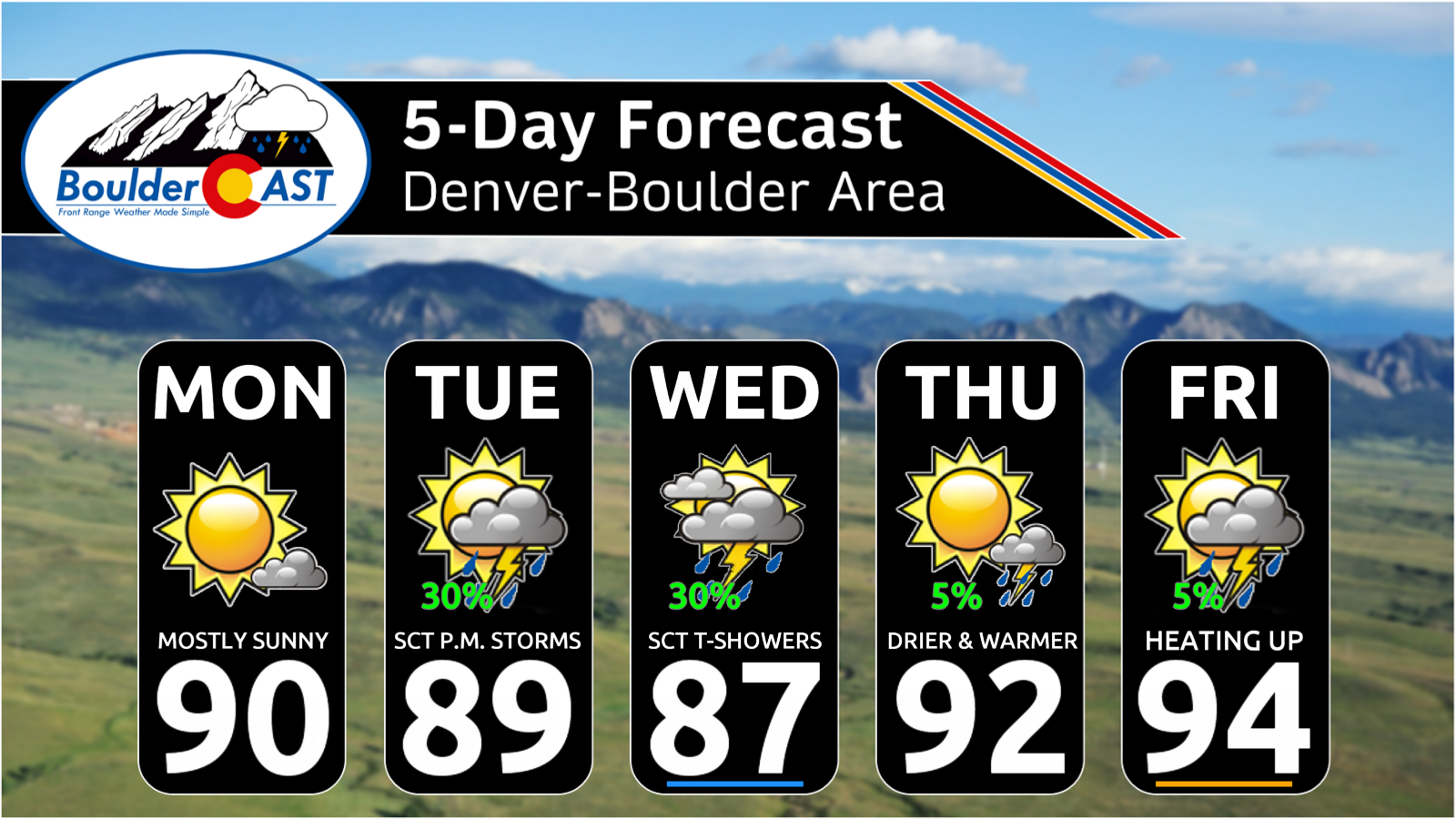
DISCLAIMER: This weekly outlook forecast is created Monday morning and covers the entire upcoming week. Accuracy will decrease as the week progresses as this post is NOT updated. To receive daily updated forecasts from our team, among many other perks, subscribe to BoulderCAST Premium.

Go Premium, get all the perks.
Daily Forecast Updates
Get our daily forecast discussion every morning delivered to your inbox.
All Our Model Data
Access to all our Colorado-centric high-resolution weather model graphics. Seriously — every one!
Ski & Hiking Forecasts
6-day forecasts for all the Colorado ski resorts, plus more than 120 hiking trails, including every 14er.
Smoke Forecasts
Wildfire smoke concentration predictions up to 72 hours into the future.
Exclusive Content
Weekend outlooks every Thursday, bonus storm updates, historical data and much more!
No Advertisements
Enjoy ad-free viewing on the entire site.
T
he monsoon delivered a solid five‑day run across the Front Range, producing repeated rounds of efficient convection. As is typical with warm‑season precipitation, the distribution was highly uneven — a sharp contrast to the more uniform stratiform/upslope events we see outside of summer. Some areas cashed in, others were largely bypassed, and the gradients were stark.
Rain totals ranged from ~0.1″ in portions of eastern Boulder County to 3″+ across the southern Foothills and southern Denver suburbs.
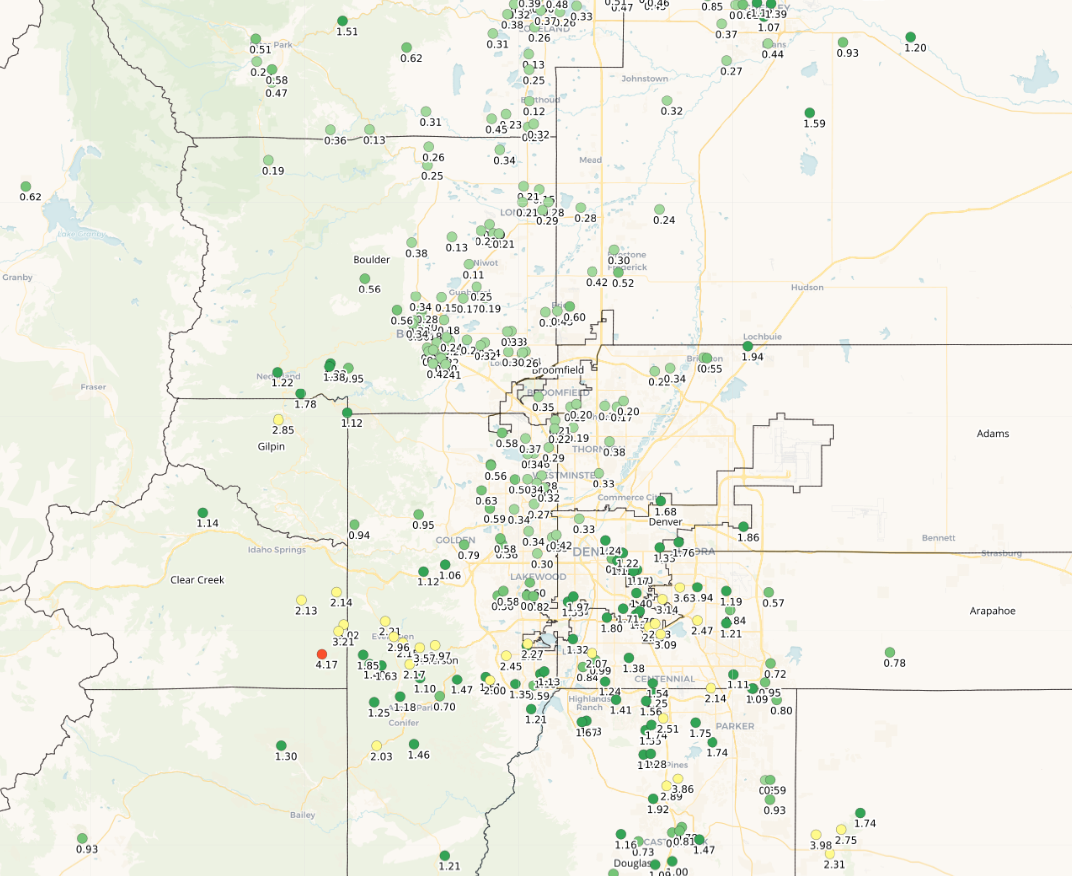
The corridor from Boulder → Longmont → Broomfield → Westminster notably underperformed throughout the period, repeatedly missing the deeper moisture and storm cores.
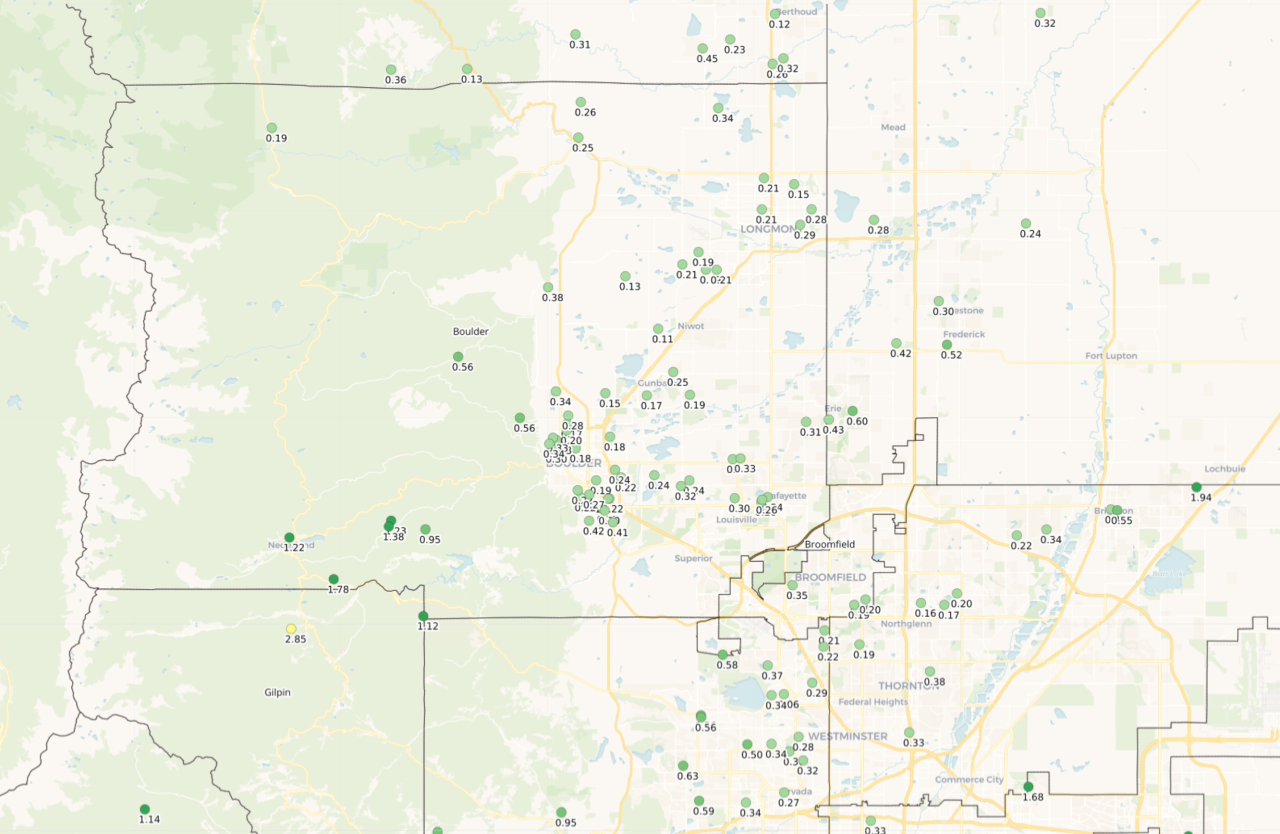
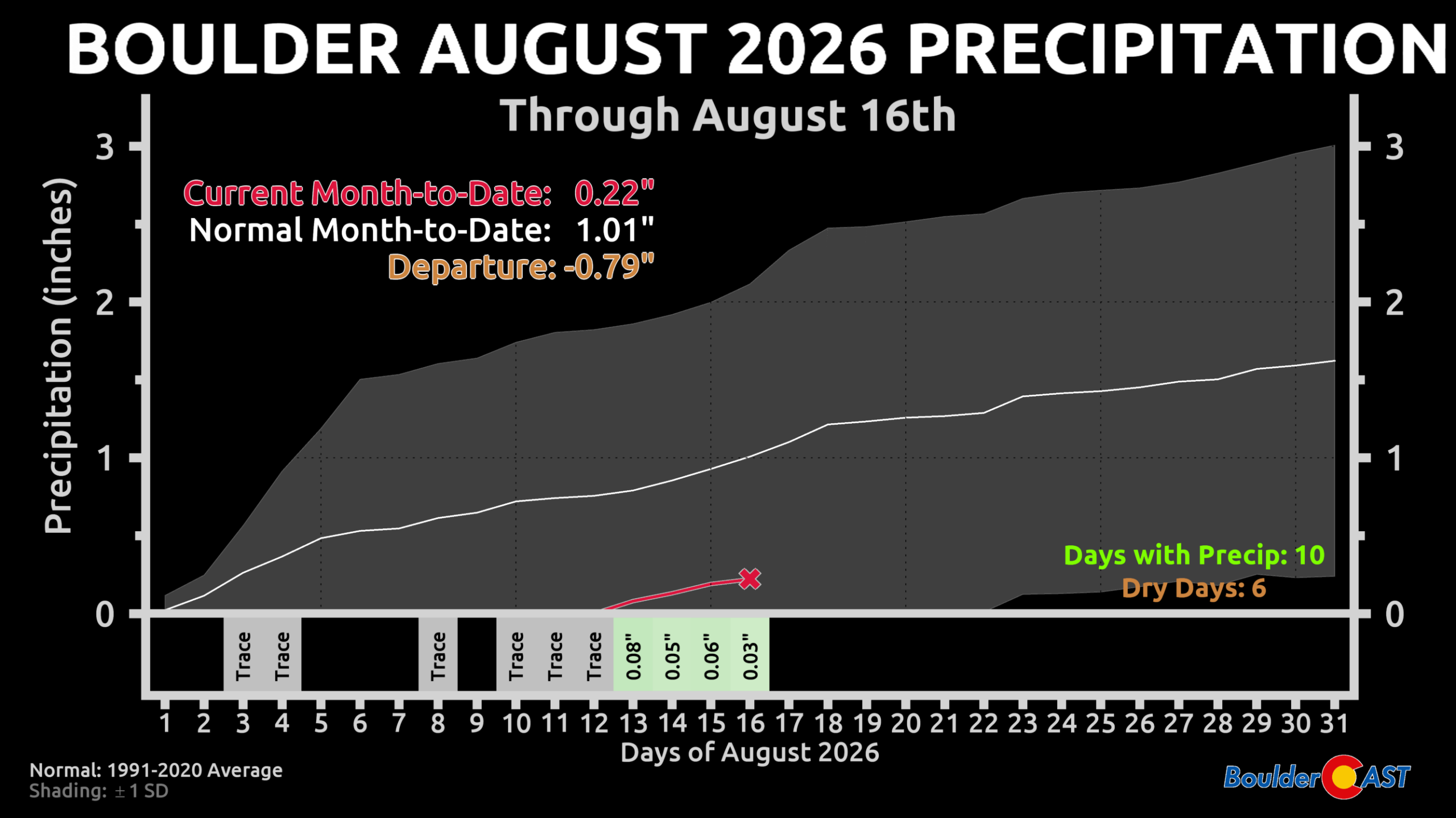
Despite raindrops falling from the sky every single day in the last week, Boulder has only logged 0.22″ for August month‑to‑date.
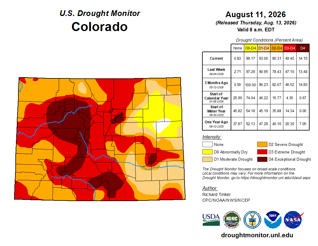
Most of Colorado remains entrenched in Severe or worse drought, and while localized improvements are possible where heavier monsoon rains fell, widespread drought relief is unlikely. Much of the highest rainfall occurred in narrow corridors and, in many cases, ran off quickly rather than meaningfully soaking into the soil.
Front Range Warming Up — Brief Monsoon Timeout
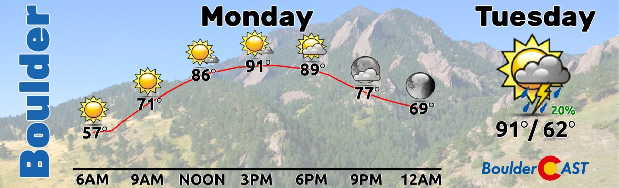
After several cooler‑than‑normal days, the Front Range is headed back into a warmer stretch through Tuesday. The monsoon takes a short breather, thanks to a notable drop in moisture both aloft and at the surface as winds turn more westerly and dew points dry out.
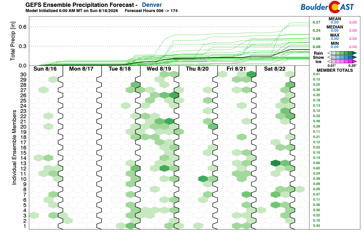
Storm chances won’t be zero early in the week, just uninspired. Monday looks largely dry with <10% coverage. A few isolated storms may pop this afternoon, but the real action stays way out east toward the Colorado–Kansas-Nebraska realm. Better storm chances return Tuesday and Wednesday — and that’s where things get interesting.
Cooling Midweek as Storm Coverage Expands
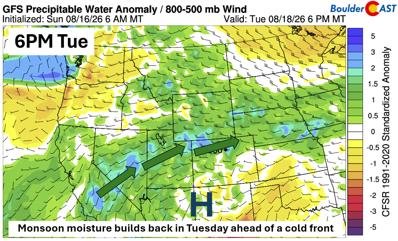
A slow‑moving cold front Tuesday into Wednesday will reintroduce moisture and large‑scale forcing. Precipitable water anomalies Tuesday evening show a classic setup: ridging over the Four Corners with anomalous moisture arcing into Utah and northern Colorado. Expect storms to fire across the northern tier first, but coverage will increase across the Boulder–Denver corridor as well by late afternoon or evening.
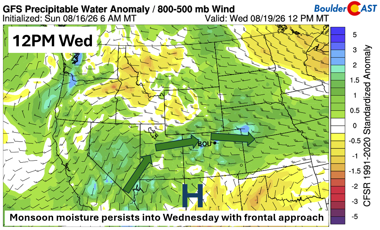
By Wednesday, the front fully settles in and moisture spreads south along the Front Range. Result: scattered afternoon/evening storms and cooler highs in the mid–upper 80s.
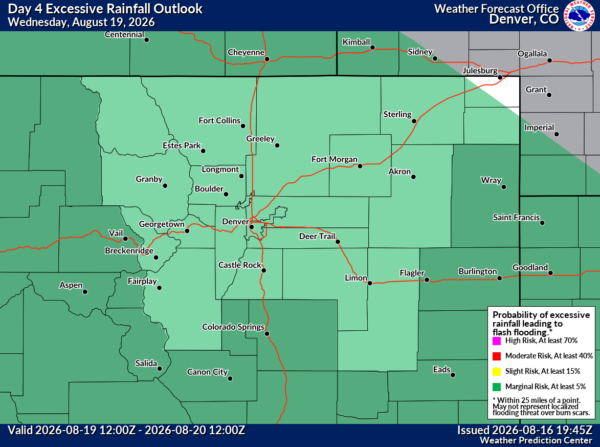
The Weather Prediction Center already has the region under a Level 1 Marginal Risk for excessive rainfall Wednesday — a signal that could easily be upgraded if moisture or forcing trends stronger. This is most likely south of Interstate 70.
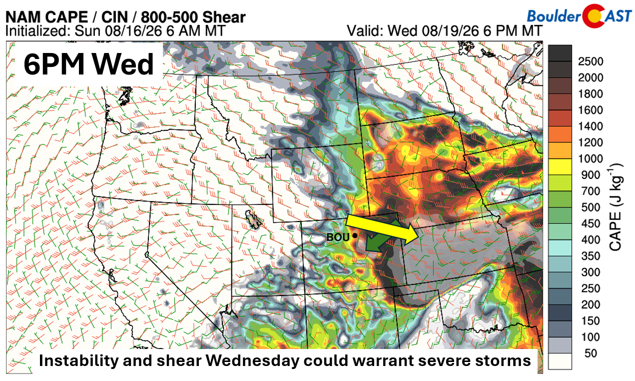
The NAM is also hinting at a healthy mix of instability and shear Wednesday evening across central and eastern Colorado. Upper‑level flow (yellow arrow) and low‑level flow (green arrow) align in a way that supports severe storm potential.
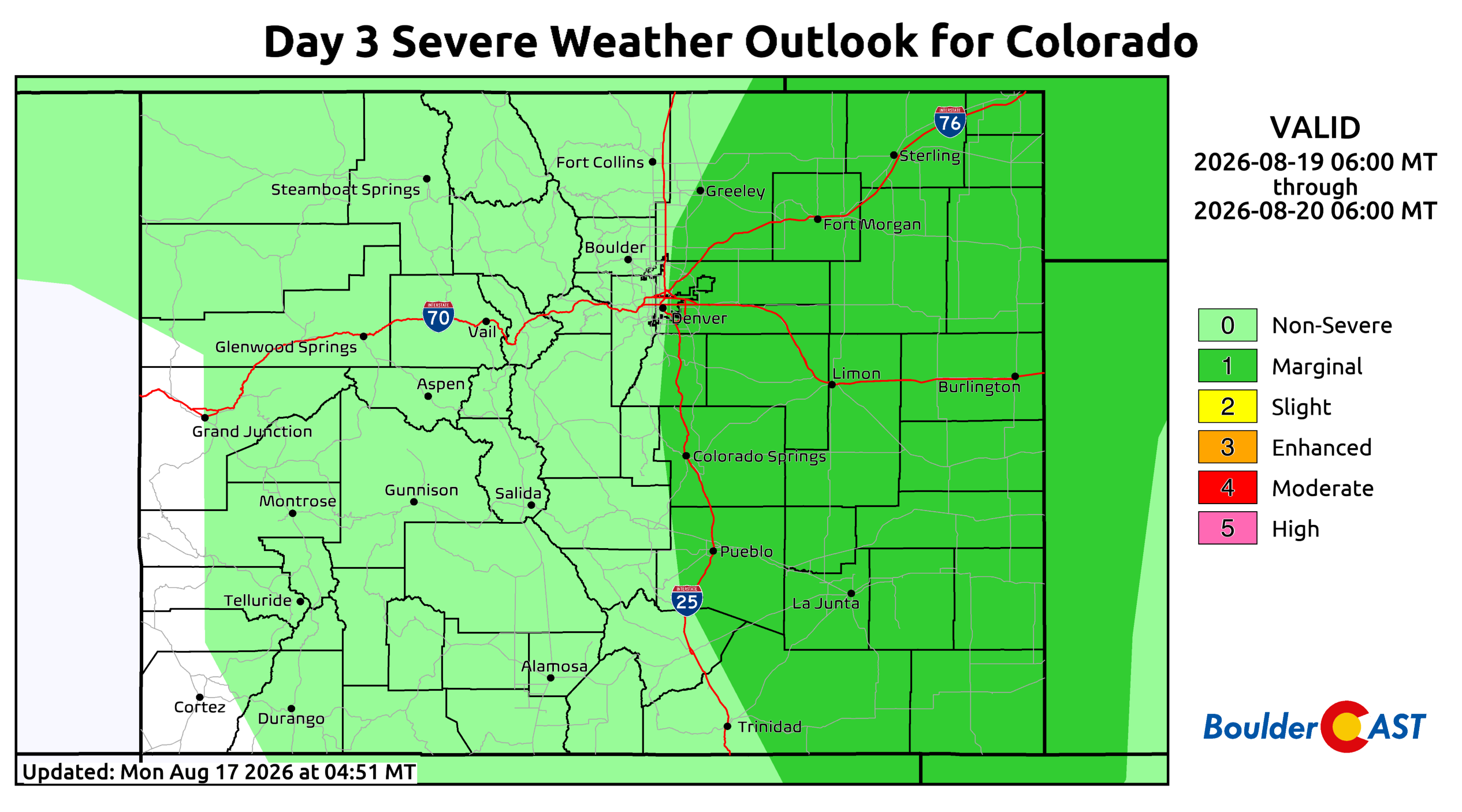
The Storm Prediction Center mirrors this with a Marginal Risk for severe storms across most of eastern Colorado Wednesday. Expect refinements — and likely upgrades — as we get closer. The Boulder-Denver area may be fighting a lack of instability locally due to the cooler airmass, but we believe there will be enough support for some storm activity, and depending on how things evolve, a low-end severe risk as well.
Late Week: Heat Rebuilds, Storms Scale Back
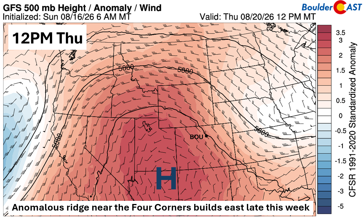
Thursday and Friday bring a return to heat as an anomalous ridge re-strengthens near the Four Corners. With northwesterly flow into the Front Range, highs climb back toward 90° Thursday. Storms remain possible but mainly isolated, focused on the Foothills and Palmer Divide.
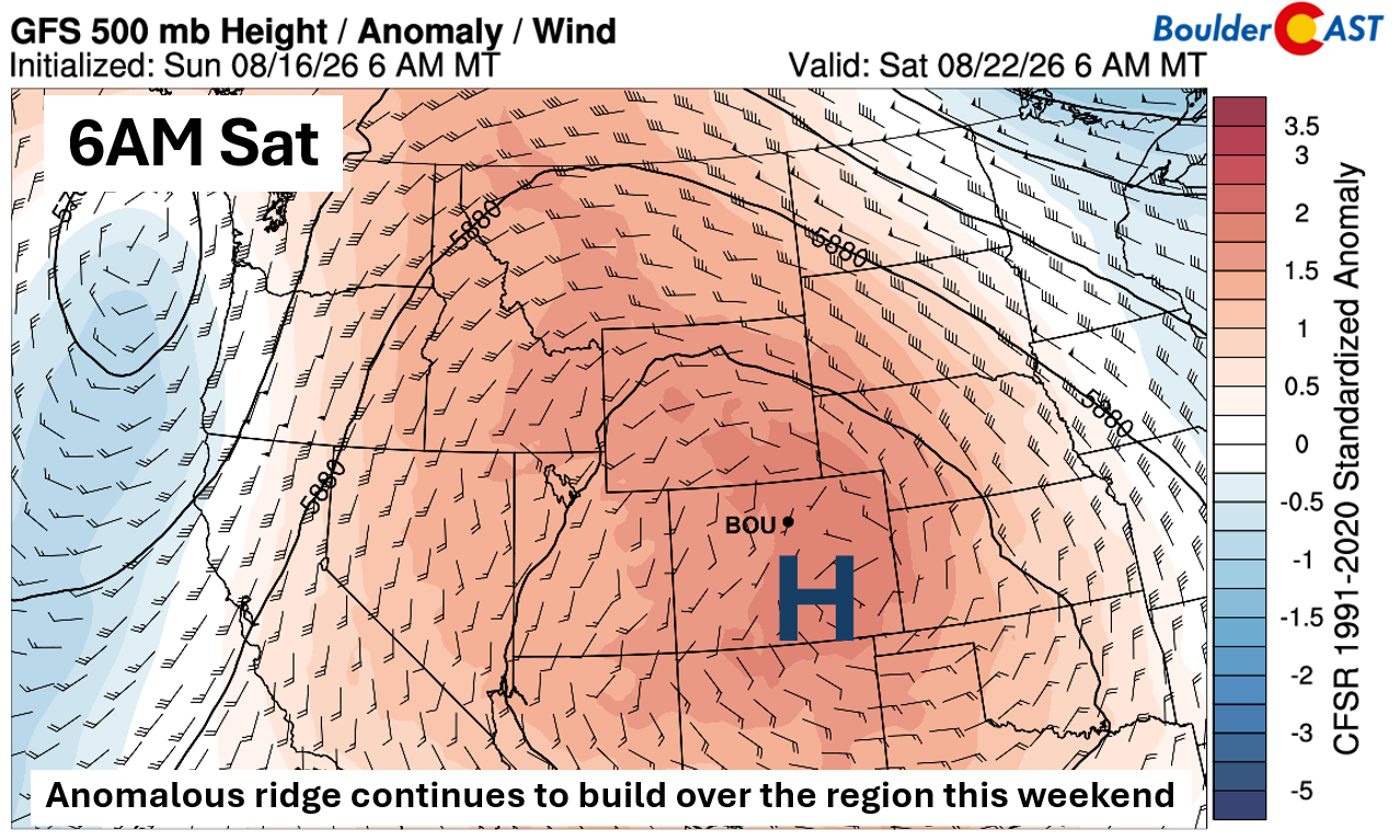
By Friday, highs will push into the mid‑90s, with some amount of heat lingering into the weekend as the ridge centers directly overhead. Storms don’t disappear entirely, but coverage looks low, with the High Country holding the best chances.
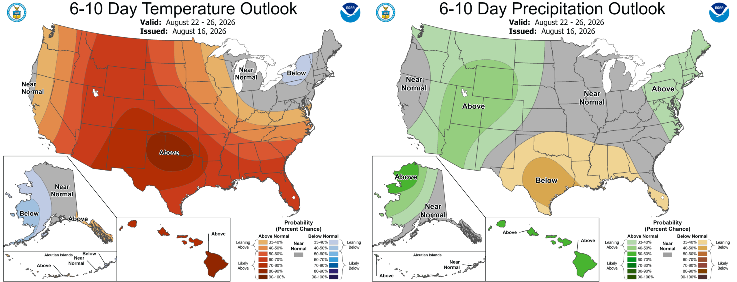
Overall we’re looking at a drier stretch than last week, with temperatures near or slightly above normal through the extended.
Next Week: Monsoon Reload?
Signals point to monsoonal flow picking back up late weekend into next week as the Southwest high shifts east toward Texas. That will open the door for southwesterly moisture transport back into Colorado.
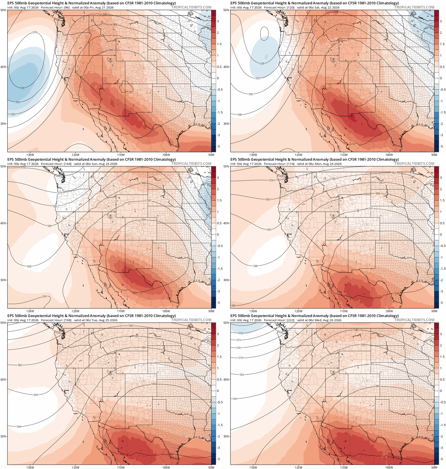
Temperatures will stay warm to hot under this setup unfortunately, but daily storm chances should begin creeping upward again starting Sunday.
Hawai‘i: Hurricane Lala’s Narrow Miss
A radar loop over the weekend captured Category 1 Hurricane Lala sliding just south of the Big Island — missing a direct landfall by roughly 35 miles, preserving a 150‑year streak without a landfalling hurricane on the island.
But “near‑miss” doesn’t mean “no impacts.” The windward (eastern) side of Hawai’i saw 10–30 inches of rain. If only Colorado could get a small sliver of that moisture…
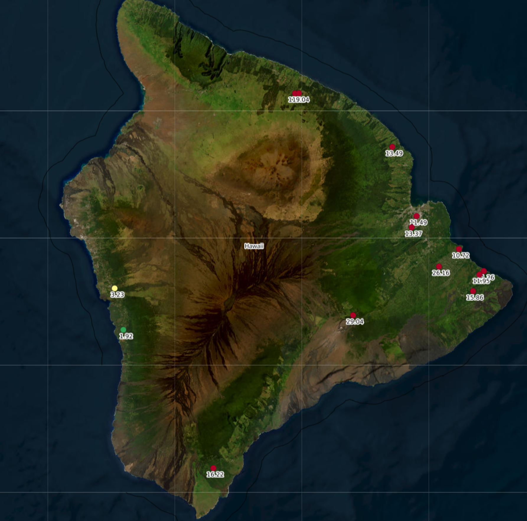
Rainfall totals over the weekend as Hurricane Lala passed just south of Hawai’i
Forecast Verification: August 10-14, 2026 (Last Week)
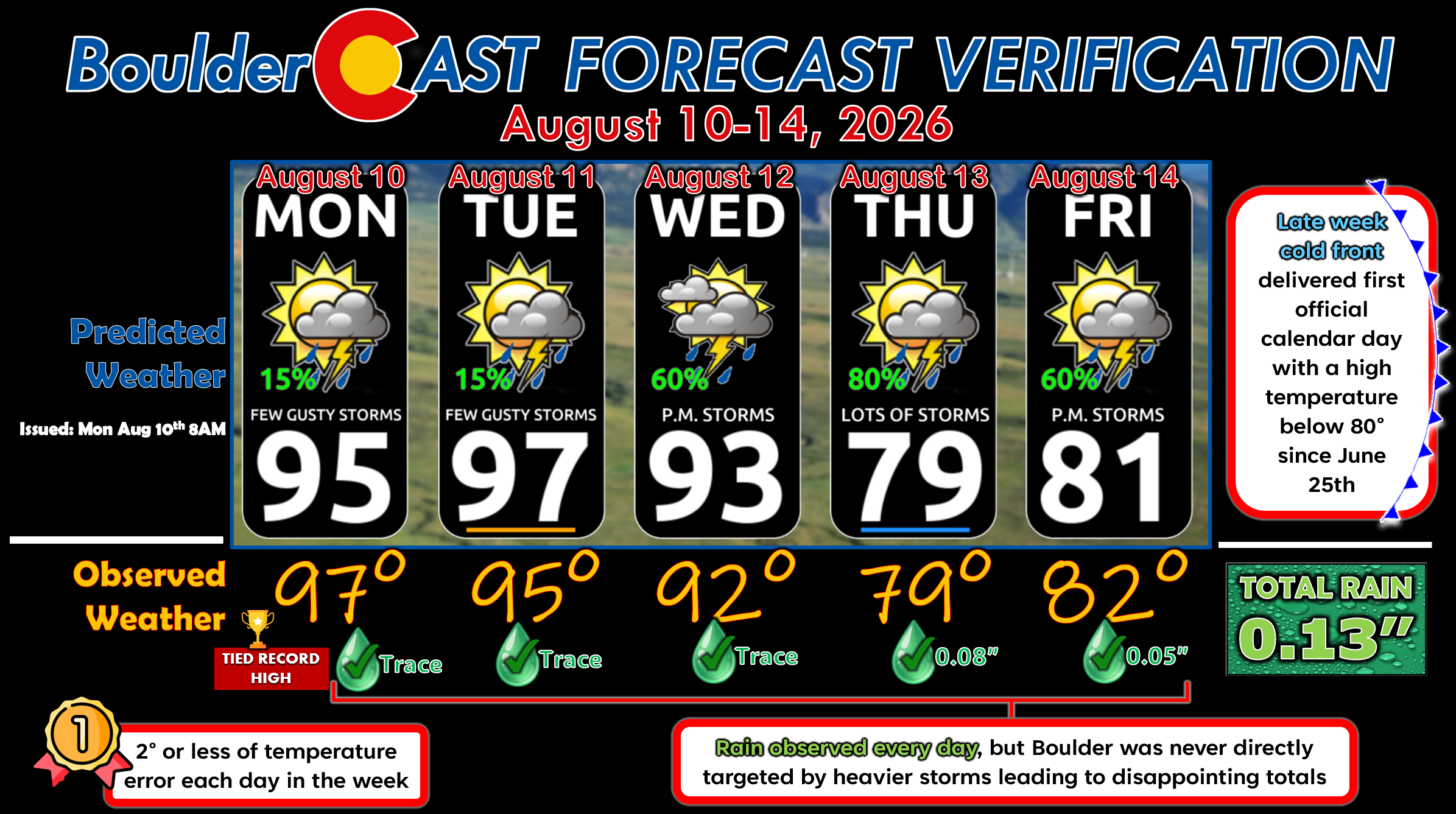
Not the most productive week of monsoon rain in Boulder, but it did technically rain every day. Our temperature forecasts were nearly perfect, including nailing the late-week cold front that brought our first official calendar day below 80° since June 25th. Boulder tied one record high on Monday at 97°, the hottest day of the week.
DISCLAIMER: This weekly outlook forecast is created Monday morning and covers the entire upcoming week. Accuracy will decrease as the week progresses as this post is NOT updated. To receive daily updated forecasts from our team, among many other perks, subscribe to BoulderCAST Premium.
Go Premium, get all the perks.
Daily Forecast Updates
Get our daily forecast discussion every morning delivered to your inbox.
All Our Model Data
Access to all our Colorado-centric high-resolution weather model graphics. Seriously — every one!
Ski & Hiking Forecasts
6-day forecasts for all the Colorado ski resorts, plus more than 120 hiking trails, including every 14er.
Smoke Forecasts
Wildfire smoke concentration predictions up to 72 hours into the future.
Exclusive Content
Weekend outlooks every Thursday, bonus storm updates, historical data and much more!
No Advertisements
Enjoy ad-free viewing on the entire site.
Enjoy our content? Give it a share!












You must be logged in to post a comment.