


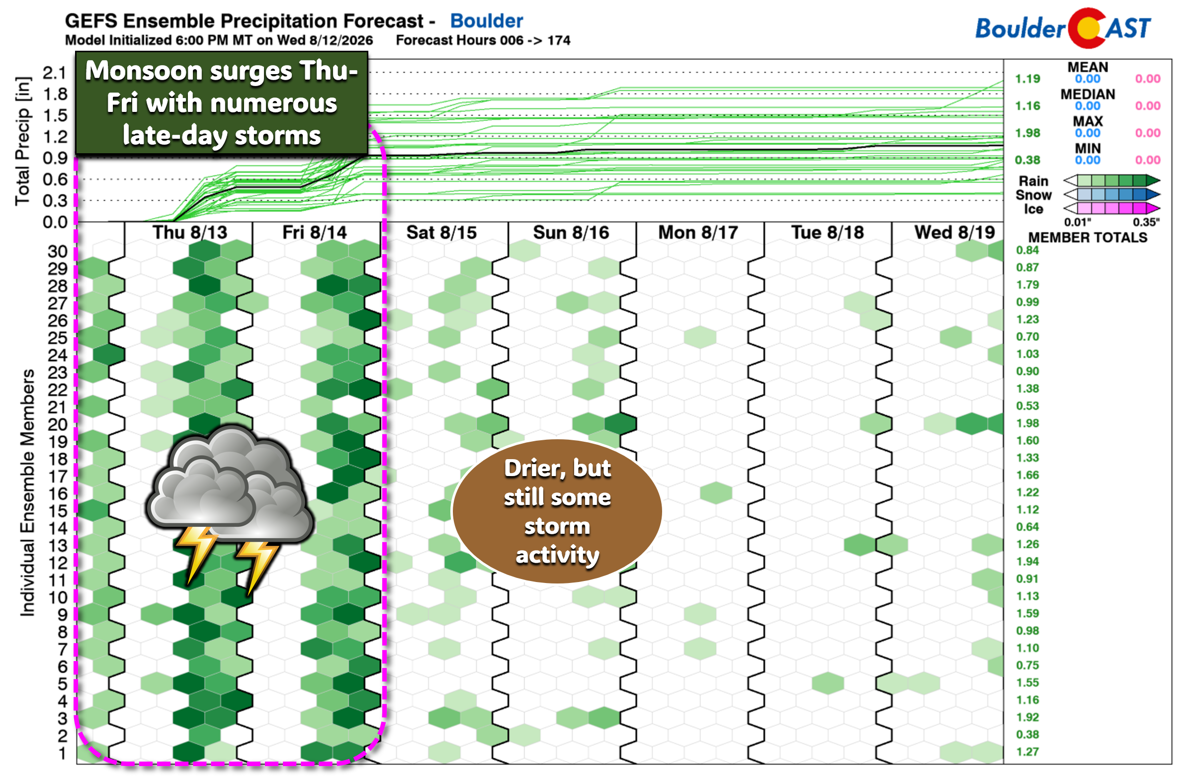
After weeks of sizzling heat and hydrological disappointment, a deep surge of monsoon moisture is pushing into the Front Range today, with precipitable water values approaching 200% of normal and a highly efficient rainfall environment already in place. Satellite imagery and overnight boundary interactions are signaling an active convective day ahead, with both severe and flooding hazards on the table Thursday. Monsoon storm chances will progressively decrease but ultimately stick around through the weekend alongside below normal temperatures. We dive into the forecast specifics, including the monsoon moisture transport, mesoscale boundaries, severe and flood risk, expected rainfall amounts, and how the weekend will play out as subtropical moisture slowly retreats.
What You Need to Know
- 🌧️ Monsoon moisture peaks Thursday with PWAT values near 180% of normal — fueling highly efficient rainfall.
- 💦 Lots of juice from the monsoonal plume flowing into Colorado, plus an overnight boundary from a Nebraska MCS adding upslope and low-level moisture.
- 🌡️ Dew points have jumped into the upper 50s, boosting instability and storm efficiency; early storms may bring 1″ hail and 60 MPH winds Thursday.
- ⚠️ Flash flooding risk rises as slow storm motions (<15 MPH) combine with deep moisture, especially east of Denver where soils are moistened from recent rain.
- 🌩️ Storms fire around lunchtime, spreading east; severe threat 11AM–4 PM, then transitioning to a flood risk east with rain chances near 80% locally.
- 📉 Temps stay cooler (70s–low 80s) with 0.5–1.5″ widespread rainfall and localized 2–5″ possible by Monday; storm chances taper gradually into the weekend.
- 😊 Smoke improves as persistent southwest flow draws in cleaner air.

Go Premium, get all the perks.
Daily Forecast Updates
Get our daily forecast discussion every morning delivered to your inbox.
All Our Model Data
Access to all our Colorado-centric high-resolution weather model graphics. Seriously — every one!
Ski & Hiking Forecasts
6-day forecasts for all the Colorado ski resorts, plus more than 120 hiking trails, including every 14er.
Smoke Forecasts
Wildfire smoke concentration predictions up to 72 hours into the future.
Exclusive Content
Weekend outlooks every Thursday, bonus storm updates, historical data and much more!
No Advertisements
Enjoy ad-free viewing on the entire site.
Hello Again, Monsoon!
As discussed over the last few days, monsoon moisture is peaking today along the Front Range, with precipitable water values punching up toward 180% of normal — a truly juiced atmosphere. We’re talking ~1.5″ PWAT across the eastern Plains and ~1.25″ in the Boulder–Denver corridor.
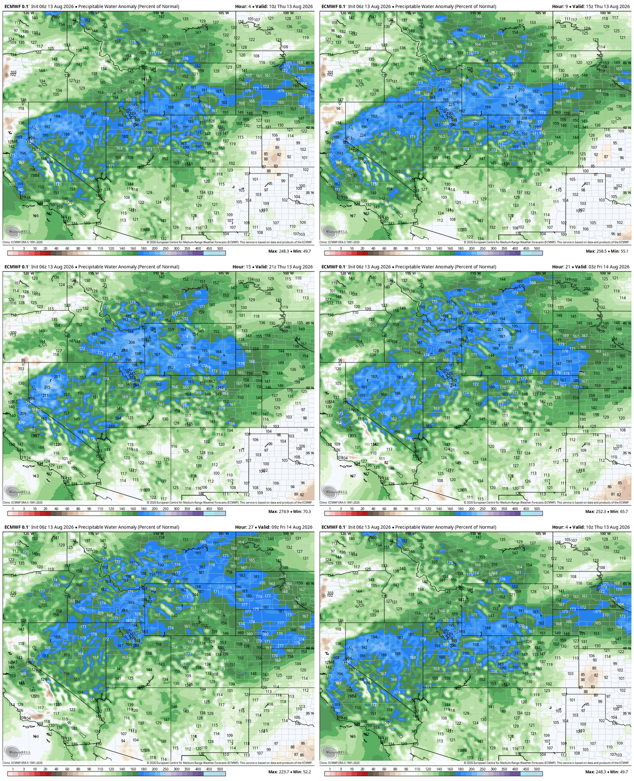
Precipitable water % of normal forecast animation from the Euro model for Thursday into Thursday night.
GOES-East imagery shows the SSW-erly monsoonal conveyor belt streaming straight into Colorado. At the surface, a weak boundary slid into northeast Colorado overnight, boosting low-level moisture and upslope. Odds are this boundary is a leftover outflow from the nocturnal MCS that absolutely rocked all of Nebraska last night.
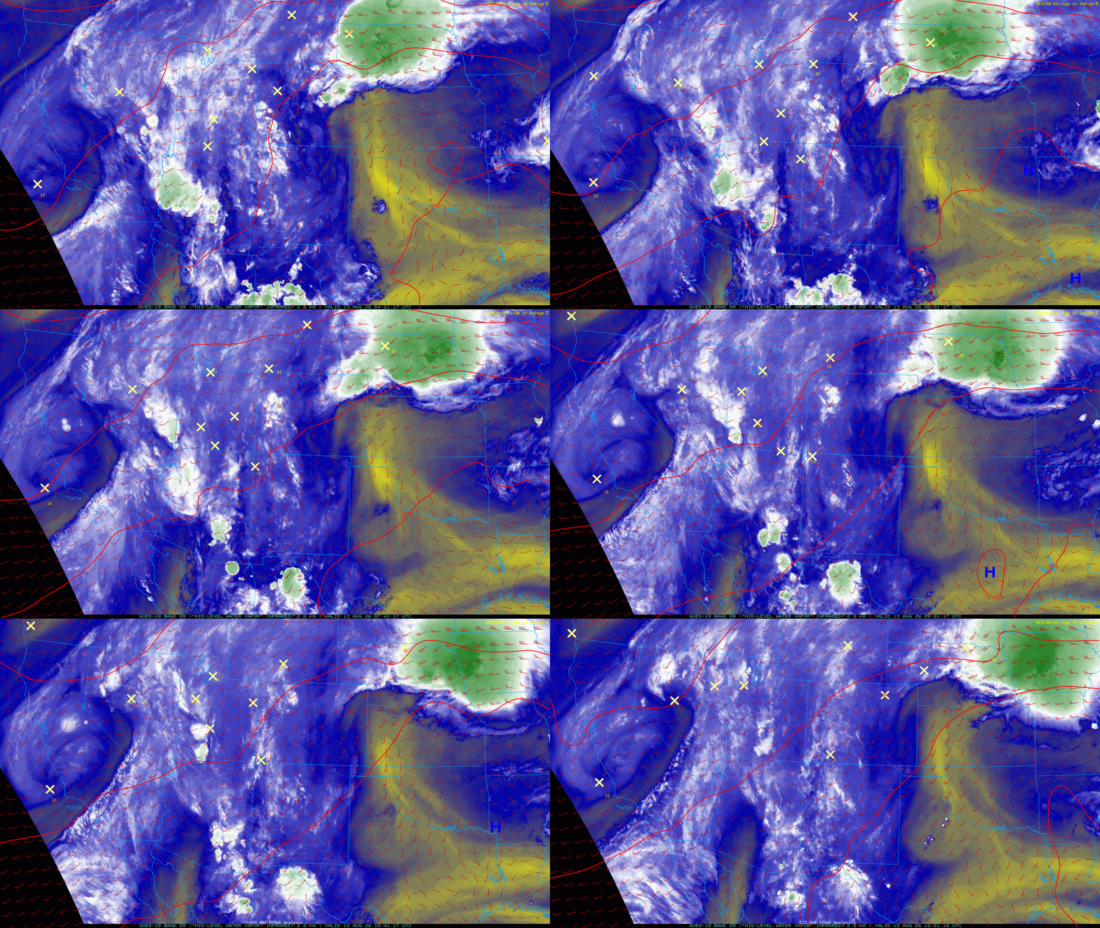
GOES-East water vapor animation from Thursday morning showing the monsoonal plume into Colorado
Dew points have climbed into the mid to upper 50s, ~10° higher than yesterday. Storms today will have far more fuel, meaning highly efficient rainfall production and better actual accumulation potential.
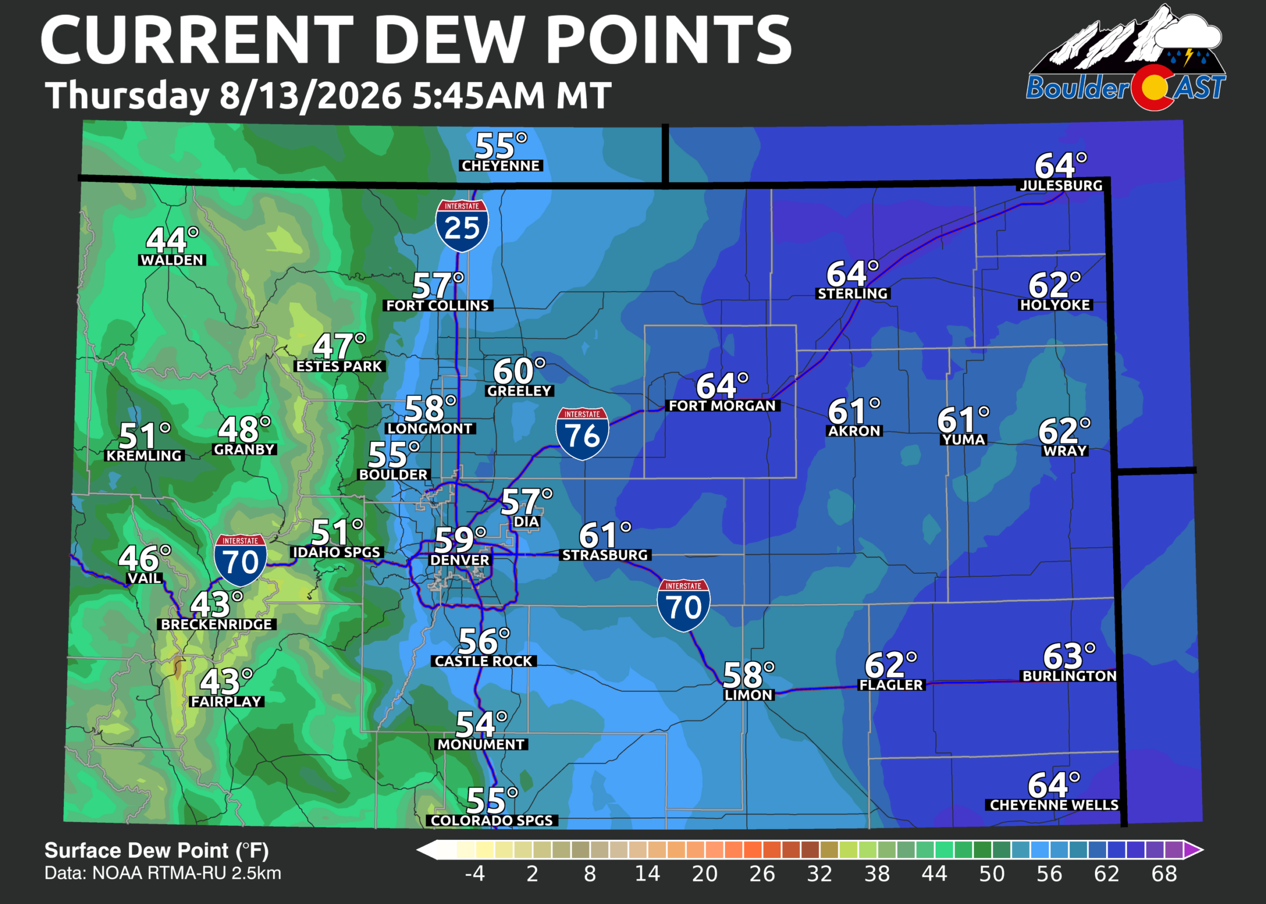
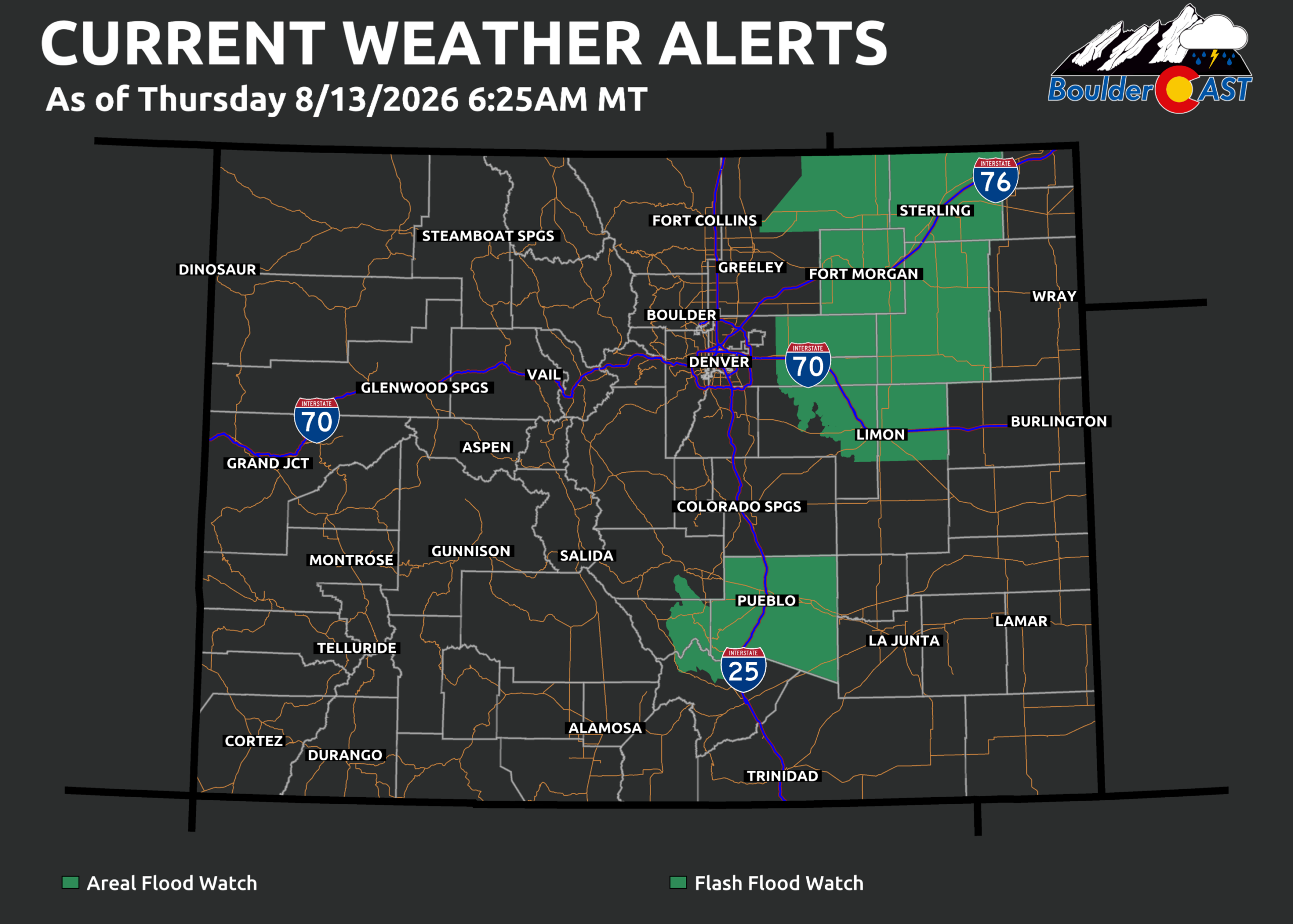
With mid‑ and low‑level moisture this elevated — and steering winds under 15 MPH — the setup today favors flash flooding from slow‑moving monsoon storms, especially across Eastern Plains zones that already soaked up some rain last night.
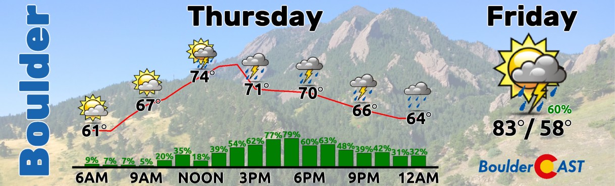
Short‑range guidance lights up convection starting before lunchtime in the Foothills, spreading east through Boulder, Denver and eventually the Eastern Plains through the afternoon and evening.
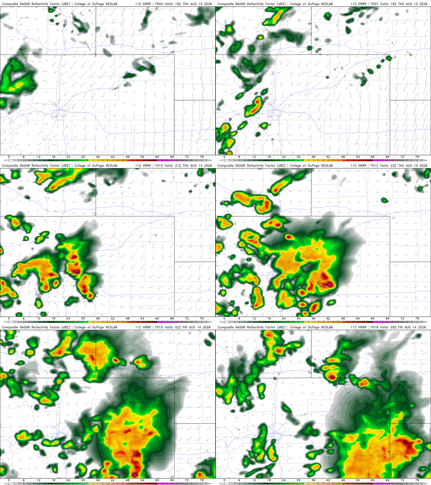
HRRR model-simulated radar animation for Thursday showing widespread storm activity across NE Colorado
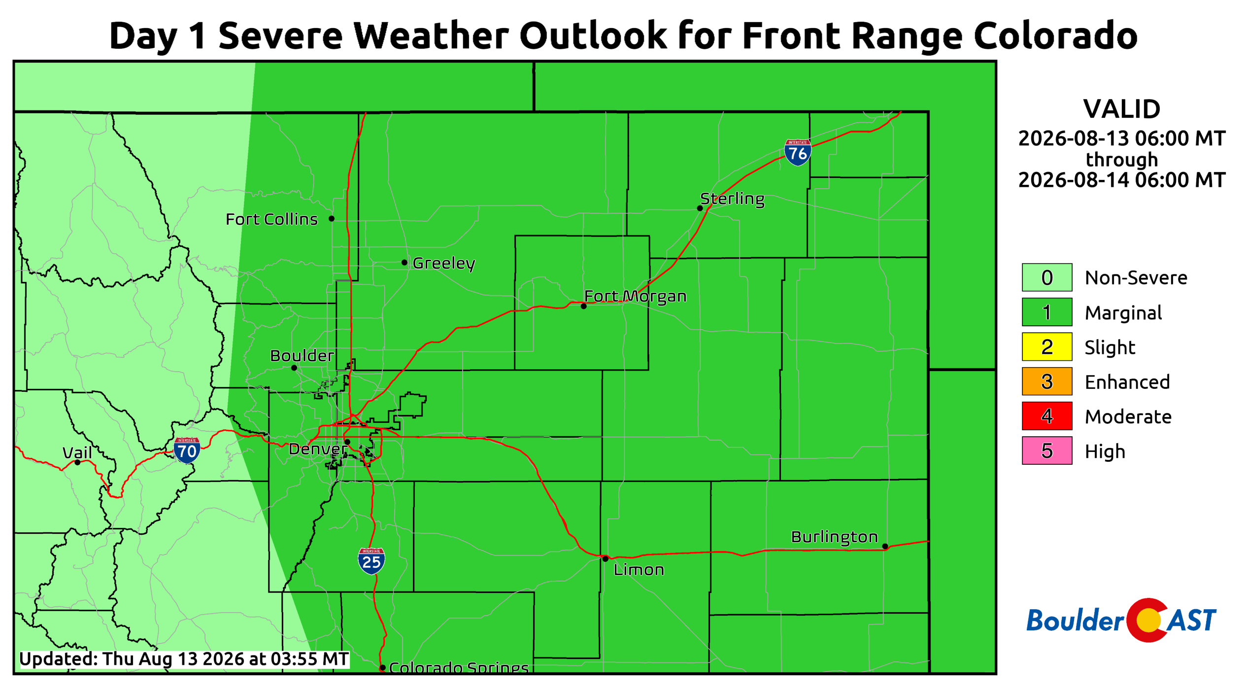
Early storms may produce quarter‑size hail and 60 MPH winds. The Storm Prediction Center has all of eastern Colorado under a Marginal Risk, with the severe window locally running from about Noon to 4 PM. After that, the threat transitions toward flooding, with storm chances tapering off near midnight.
Our hesitation — as usual — is what we like to call the Denver–Boulder dead zone. Too much cloud cover and cooler temps could limit instability right over the Metro area. The Foothills should still pop nicely, and deeper moisture east of the Front Range will support stronger and more numerous storms. But Boulder and Denver may once again struggle to sustain convection despite sky‑high monsoon moisture. We may need to rely on colliding outflow boundaries to squeeze out the promised rain. Even so, we’re forecasting ~80% rain chances, with a few early severe storms possible before shifting to a heavy rain risk this evening mainly to the east. Highs stay capped in the mid 70s to low 80s thanks to cloud cover and the early onset of storms.
Subtropical moisture will remain elevated Friday into the weekend, though it will trend downward each day.
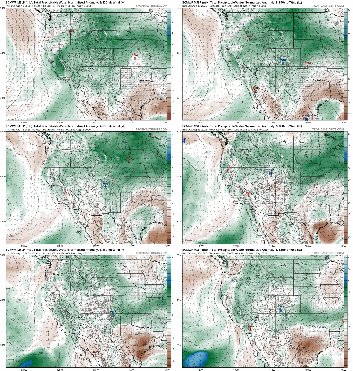
Euro forecast animation of precipitable water anomaly through the weekend into early next week. Monsoon moisture persists but wanes each day.
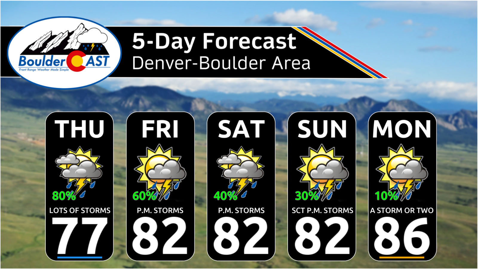
Daily storm chances stay in the 30–50% range through Sunday, then become more isolated by Monday. And honestly, sometimes these “less ideal” setups perform better for Boulder–Denver, so don’t sleep on them.
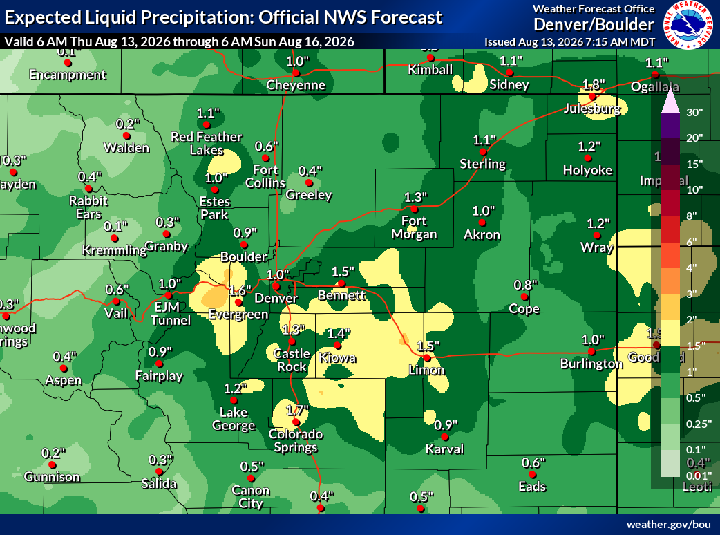
Rain totals will vary wildly from this monsoon surge, as always. Broadly we expect 0.5″–1.5″ through the weekend. Localized bullseyes of 3–5″ are possible where storms repeatedly train — that is most likely to happen east and southeast of Denver along I‑70 toward Kansas.
Highs will stay below normal in the mid 70s to mid 80s through Monday — a forecast we can all certainly get behind.
We won’t be able to avoid the summer heat forever, though. By next Tuesday, we’ll be back to near 90°.
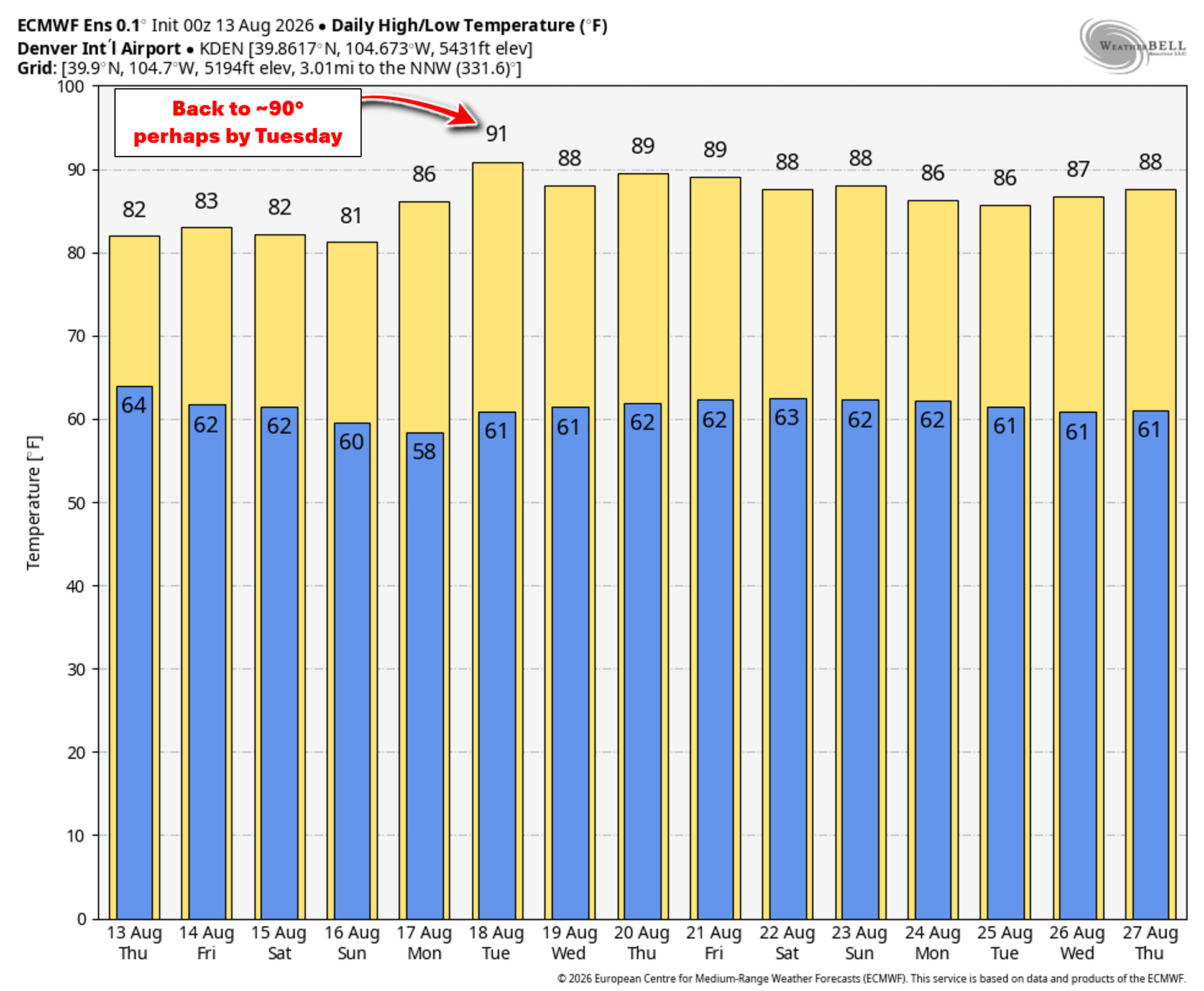
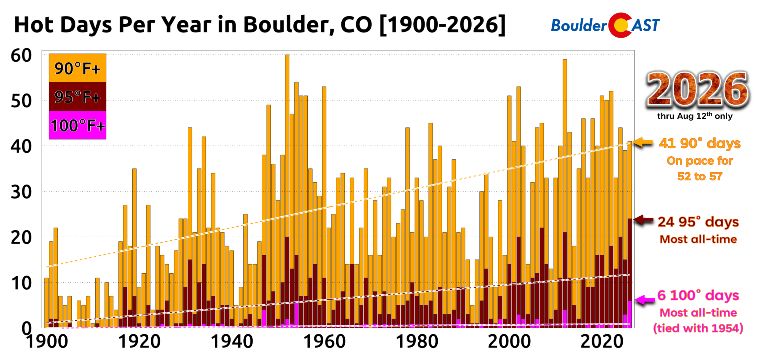
At least for the next several days, we’ll get a brief pause from adding to 2026’s already eye‑popping tally of record‑setting hot days…
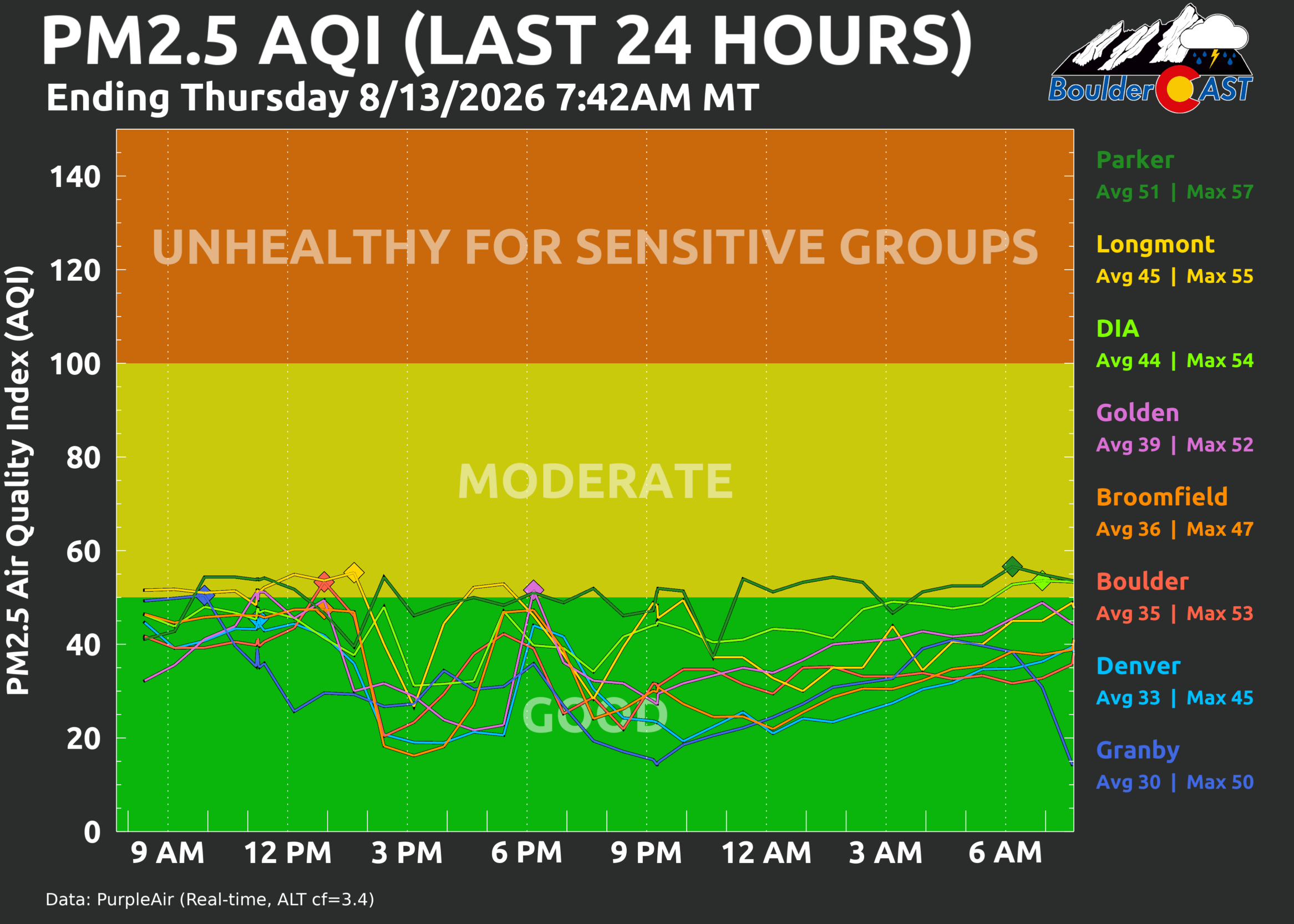
Finally, the smoke will be fully clearing out of Colorado alongside this monsoonal surge. There is still a little bit of lingering haze around Thursday morning, but it will be clearing up nicely later today with that cleaner air holding through the weekend under southwest flow.
We’re already seeing Good PM2.5 air quality for most Front Range cities and this will only improve in the days ahead.
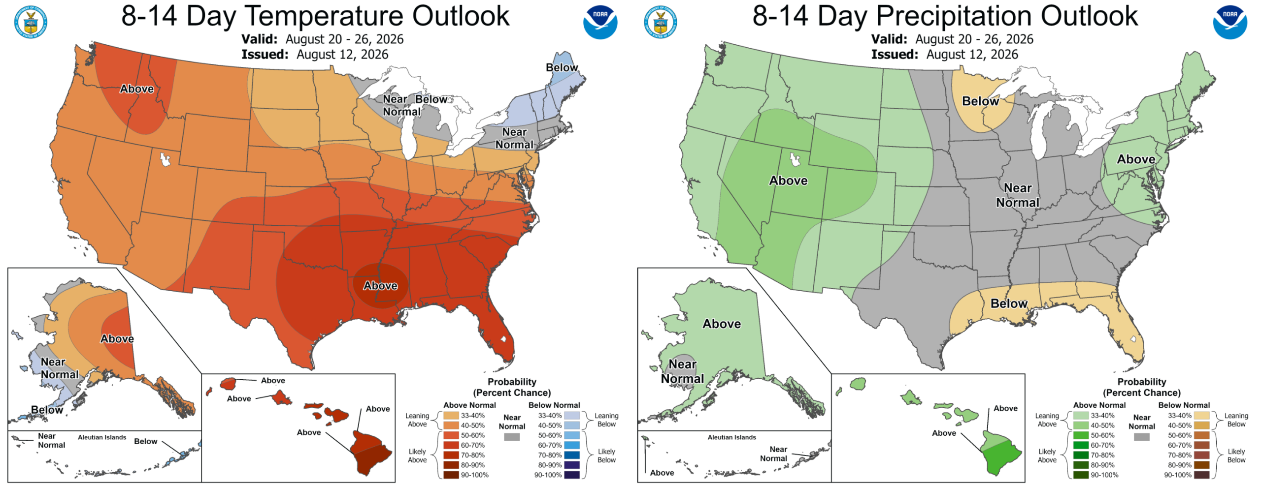
Looking further out, we continue to see warm and wet conditions favored for the state through the end of August.
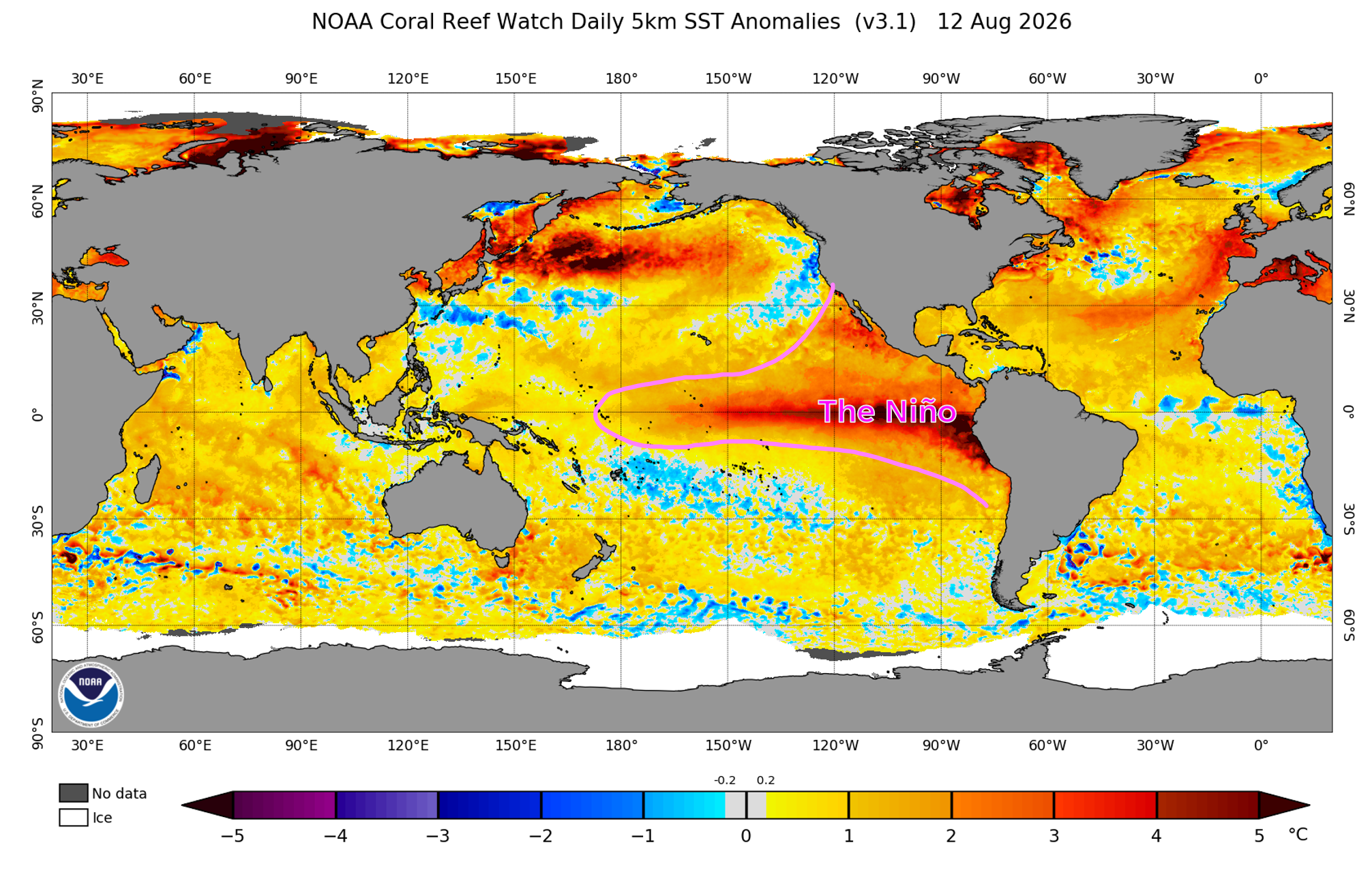
As we discussed months ago, it’s likely the ongoing very strong El Niño in the Pacific will be enhancing, and perhaps extending, North American Monsoon season well into September.
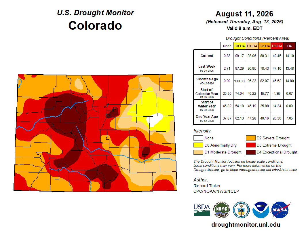
This is great news for our state, which desperately needs any and all moisture it can get. Without an uptick in monsoon production in the coming weeks, fire season will undoubtedly linger well into autumn, not unlike what unfolded in 2020 and 2021.
Spread the word, share our crazy Colorado weather:
Go Premium, get all the perks.
Daily Forecast Updates
Get our daily forecast discussion every morning delivered to your inbox.
All Our Model Data
Access to all our Colorado-centric high-resolution weather model graphics. Seriously — every one!
Ski & Hiking Forecasts
6-day forecasts for all the Colorado ski resorts, plus more than 120 hiking trails, including every 14er.
Smoke Forecasts
Wildfire smoke concentration predictions up to 72 hours into the future.
Exclusive Content
Weekend outlooks every Thursday, bonus storm updates, historical data and much more!
No Advertisements
Enjoy ad-free viewing on the entire site.












About El Nino, you say:
“As we discussed months ago, it’s likely the ongoing very strong El Niño in the Pacific will be enhancing, and perhaps extending, North American Monsoon season well into September. This is great news for our state, which desperately needs any and all moisture it can get.”
How confident are you that El Nino will result in increased precipitation for us, from monsoons into winter snowfall? My read of your post about El Nino was that Colorado sits right on the border of increased and decreased precip effects from ENSO. I also understand that the latest long term Euro guidance has DJF precip under climatology. Given how El Nino is shaping up, what is your latest thinking about drought recovery?
I am not very confident that El Niño will help Boulder/Denver directly with monsoon rains. We’re always on the fringe of the monsoon, even in the best scenarios. More confident that western and central Colorado could see a good 6 to 12 weeks ahead with a monsoon season refusing to die across the Southwest. Some drought recovery is possible statewide.
As for winter, personally I wouldn’t trust any outlook really. The models have never seen an El Niño this strong. Yes, the latest trends are towards a normal/below normal winter for northern Colorado’s Mountains, Perhaps above for the San Juans. That’s not unusual for a standard El Niño.
That said, I think everyone, including our team, will learn a lot about what an extreme El Niño event can actually do around the globe. Plenty of good, important research will come from this winter season. It all just theory right now.