


Still waiting on that first flake? You’re not alone. We’re nearly halfway through November, and Boulder hasn’t measured a single flake of snow yet. By now we’d normally have about 11 inches. This week won’t fix that. A stubborn omega block will build over the West and steer every storm around Colorado. That means another week of sunshine and 60s, with two dry cold fronts that barely make a dent. Meanwhile, parts of the Southeast US may see snow before we do. In the long range, though, there’s a hint of a pattern change around November 17–21. With last year’s latest-first-snow record suddenly within reach, a lot is riding on it. Read our full breakdown of the week ahead.
This week’s highlights include:
☀️ Omega block locks in — A strong ridge parks over the western US, steering every storm around Colorado and giving us a full week of sunshine.
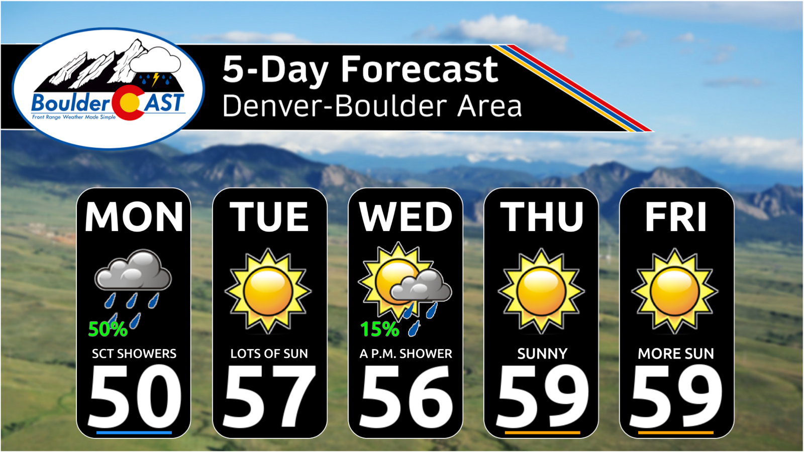
🤗 Mild all week — Highs stay in the 60s every day, 5 to 15 degrees above our seasonal averages.
⬇️ Two dry cold fronts — The polar jet clips eastern Colorado Tuesday night into Thursday. That takes the edge off the warmth, but “cooler” here means low 60s instead of upper 60s, with no precipitation.
💦❄️ A shake-up next week? — Ensemble and CPC guidance both point to a more active pattern around November 17–21, but the spread is huge. Boulder’s long wait for its first snow continues for now.
⛰️ Winter outlook and Super El Niño update — The latest data may surprise you. If you missed our recent deep dive, find it here.
DISCLAIMER: This weekly outlook forecast is created Monday morning and covers the entire upcoming week. Accuracy will decrease as the week progresses as this post is NOT updated. To receive daily updated forecasts from our team, among many other perks, subscribe to BoulderCAST Premium.

Go Premium, get all the perks.
Daily Forecast Updates
Get our daily forecast discussion every morning delivered to your inbox.
All Our Model Data
Access to all our Colorado-centric high-resolution weather model graphics. Seriously — every one!
Ski & Hiking Forecasts
6-day forecasts for all the Colorado ski resorts, plus more than 120 hiking trails, including every 14er.
Smoke Forecasts
Wildfire smoke concentration predictions up to 72 hours into the future.
Exclusive Content
Weekend outlooks every Thursday, bonus storm updates, historical data and much more!
No Advertisements
Enjoy ad-free viewing on the entire site.
I
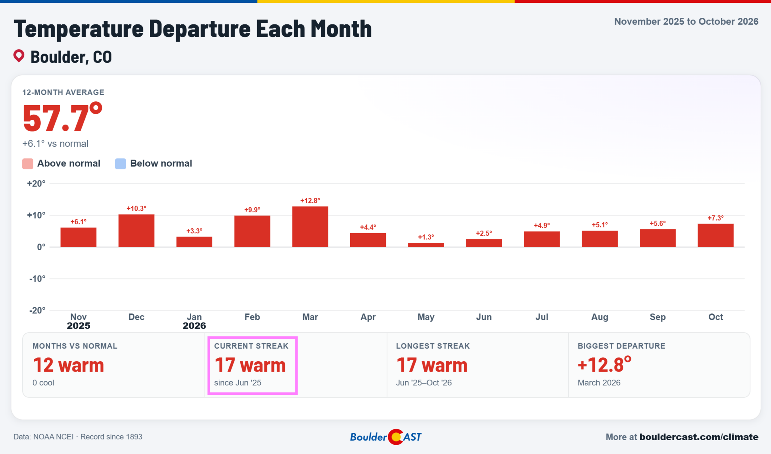
f you’ve been hoping for a pattern change, this isn’t the week. It’s the second week of November, and Boulder still hasn’t recorded a single flake of snow. We normally have about 11 inches on the books by now. The week ahead won’t change that. High pressure will hold firm over the Interior West, sending storms around Colorado and keeping the Denver Metro area sunny, dry and mild. The run of warmer-than-normal months is now at 17 straight for Boulder, and November is off to a very good start at making it 18.
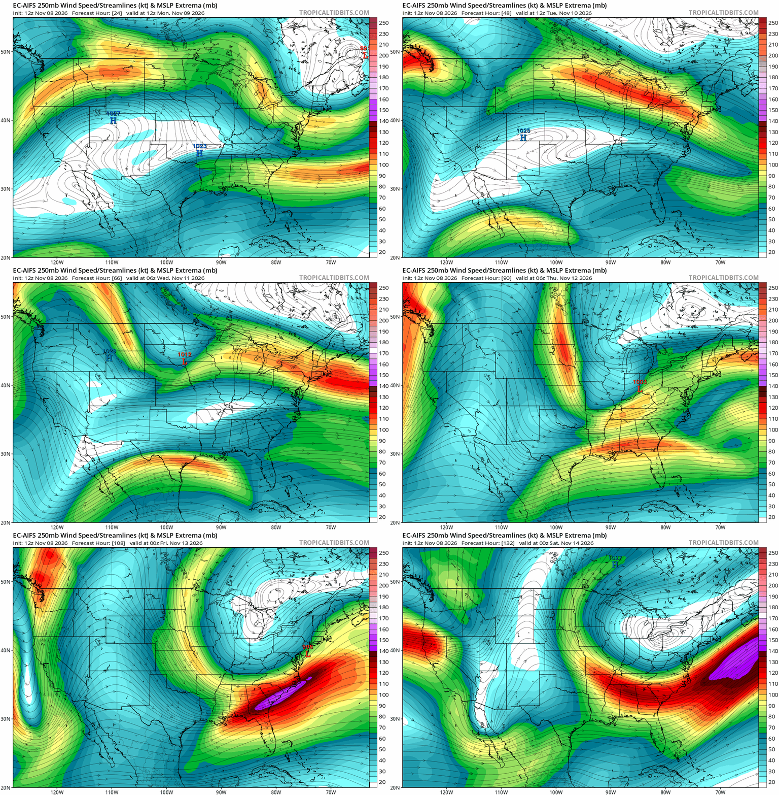
The animation below shows the 250-mb jet stream across the country through the week. The big story is a deepening trough over the eastern half of the nation starting midweek. The polar jet dives south out of Canada into the Midwest and phases with the subtropical jet over the eastern US. The East gets a dose of early-season cold, while the West stays under the ridge. For us, the polar jet only grazes eastern Colorado Tuesday night through early Thursday. The bulk of the Arctic air pours into the Ohio Valley and Mid-Atlantic instead.
An Omega Block Keeps Colorado High and Dry
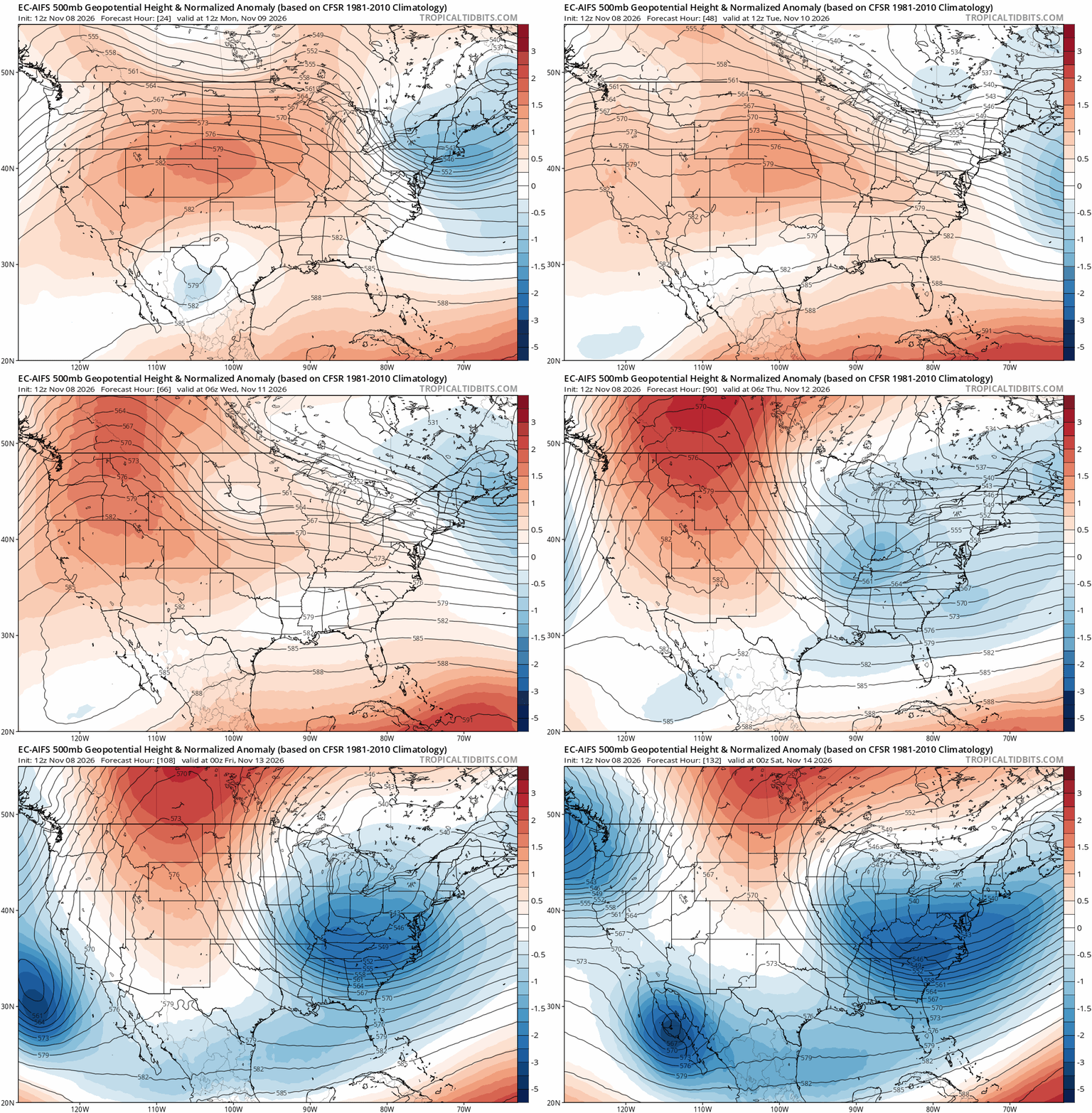
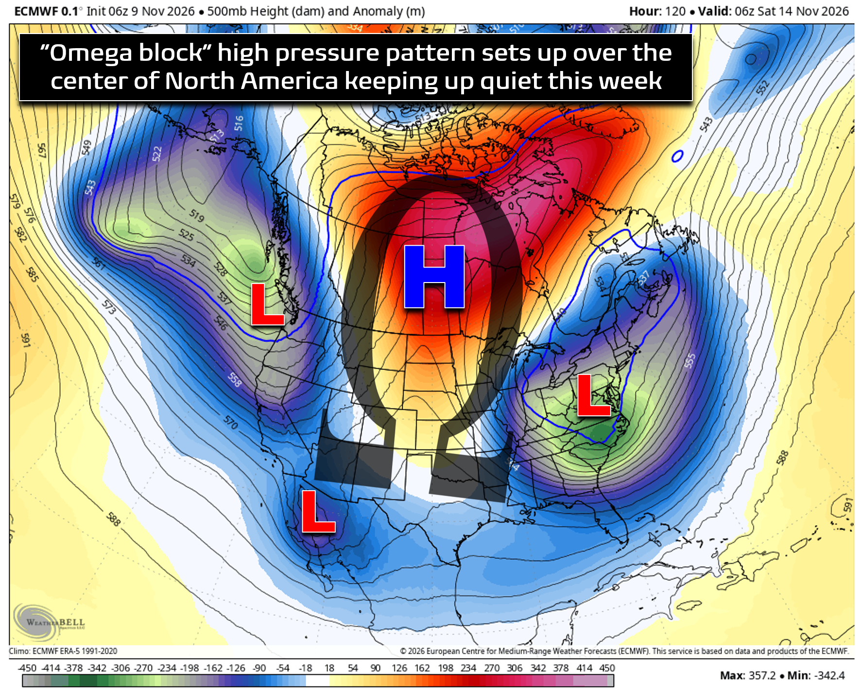
At 500 mb, the setup is a classic Omega block. Deep troughs sit along both coasts, with a sprawling ridge between them over the western US.
On the map, the pattern looks like the Greek letter Ω. These blocks are notoriously stubborn. The ridge pushes the storm track well to our north, then steers it down the backside into the East. Under the ridge, sinking air keeps skies clear and temperatures mild. Translation: nothing makes it into Colorado this week.
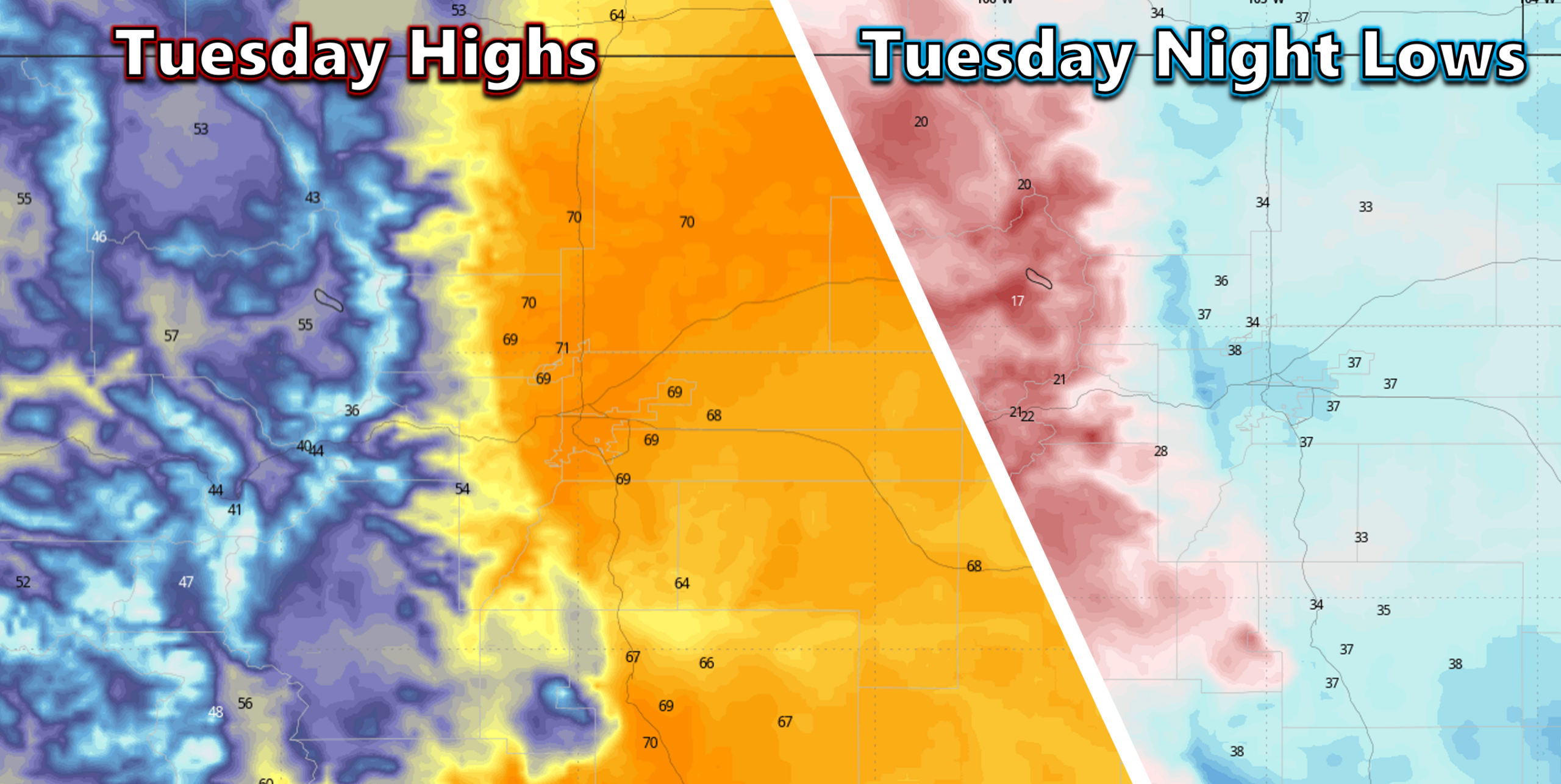
The start of the week is the warmest stretch. Expect highs in the upper 60s Monday and Tuesday, and a few spots could eclipse 70°. That’s 10 to 15° above the mid-50s normal for this time of year. Overnight lows stay mild, too. Clear skies, very dry air and light winds will still let the usual cold spots and valleys radiate efficiently, so expect a wide spread between highs and lows (30 to 40°).
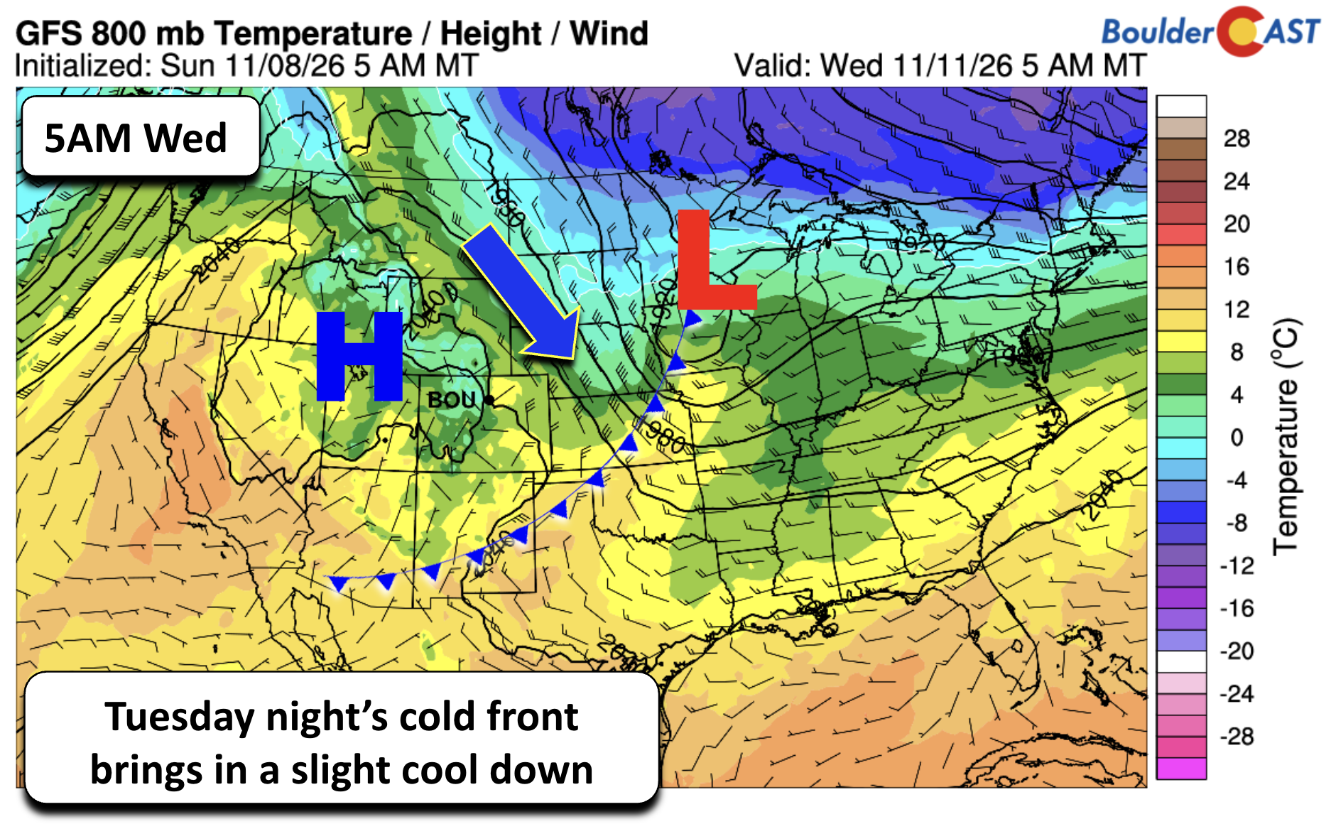
As the eastern trough deepens, two dry cold fronts will slide down the Plains of eastern Colorado. The first arrives Tuesday night into early Wednesday as low pressure tracks into the Upper Mississippi Valley. It brings a northerly wind shift and knocks highs back to the low 60s on Wednesday. Moisture is essentially non-existent, so don’t expect anything more than a few high clouds.
The second front, late Wednesday into Thursday, is the stronger of the two. Its coldest air is aimed at the Midwest and Great Lakes. Despite being stronger, latest trends have it further east with lesser influence on our weather, with highs returning to the mid to upper 60s. However, if the cold air is shallower and banks further west against the Front Range than the models show now, upper 50s are on the table. That would still be right around seasonal normals. Neither front looks capable of anything beyond a slight wind shift.
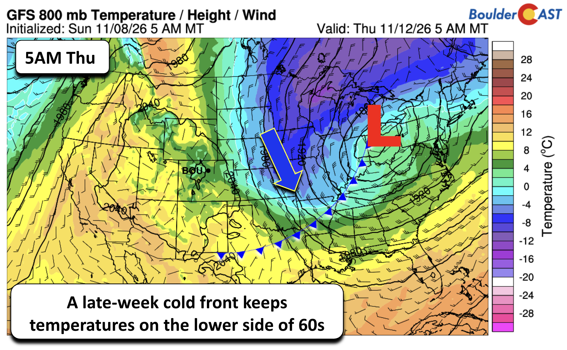
The ridge rebuilds Friday and through the weekend, and highs climb back into the middle to upper 60s.
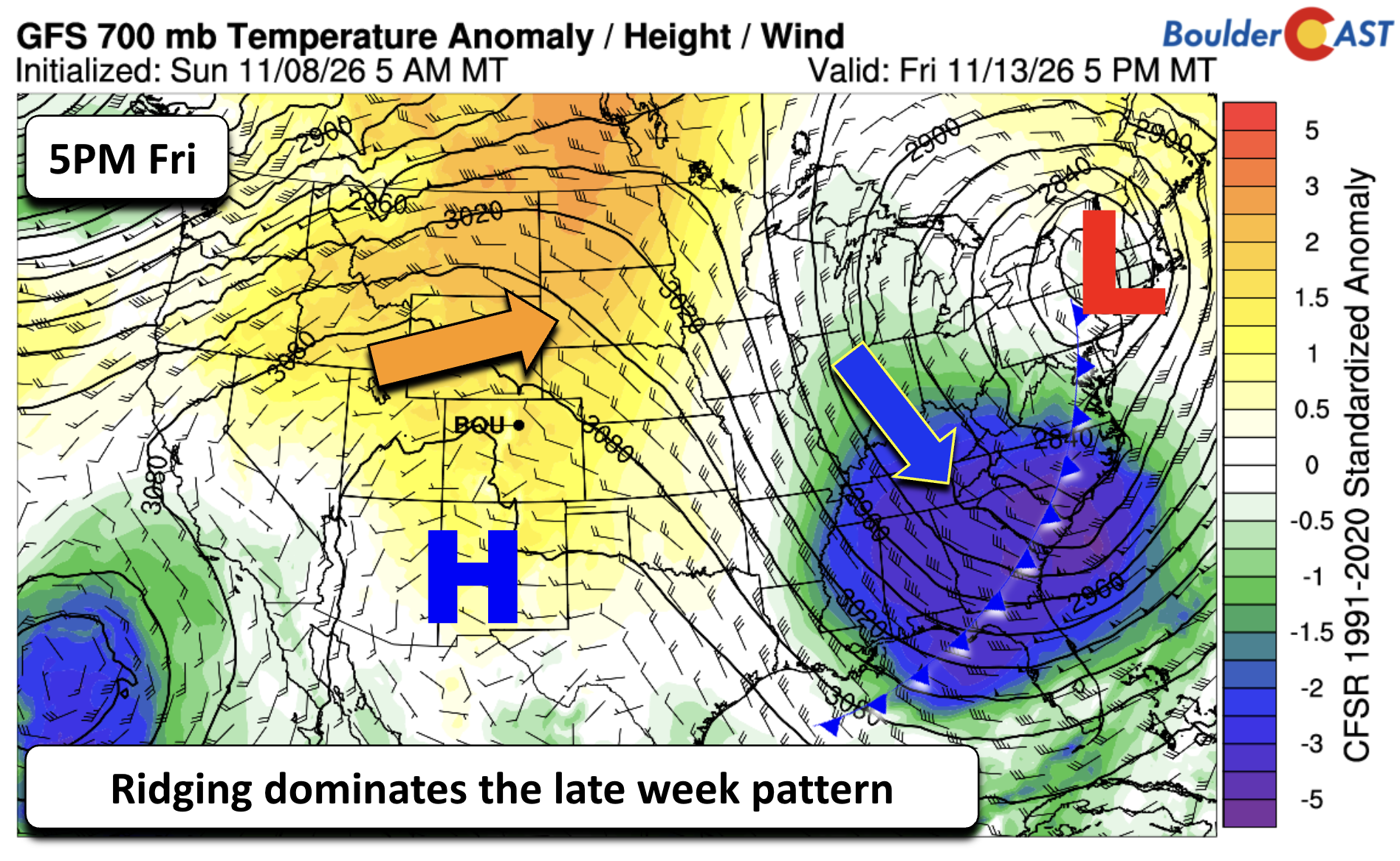
Meanwhile, the anomalously cold air in the East will bring a widespread frost and freeze across the Southeast. Parts of the Appalachians and interior Southeast could even see their first snowflakes of the season before Denver does.
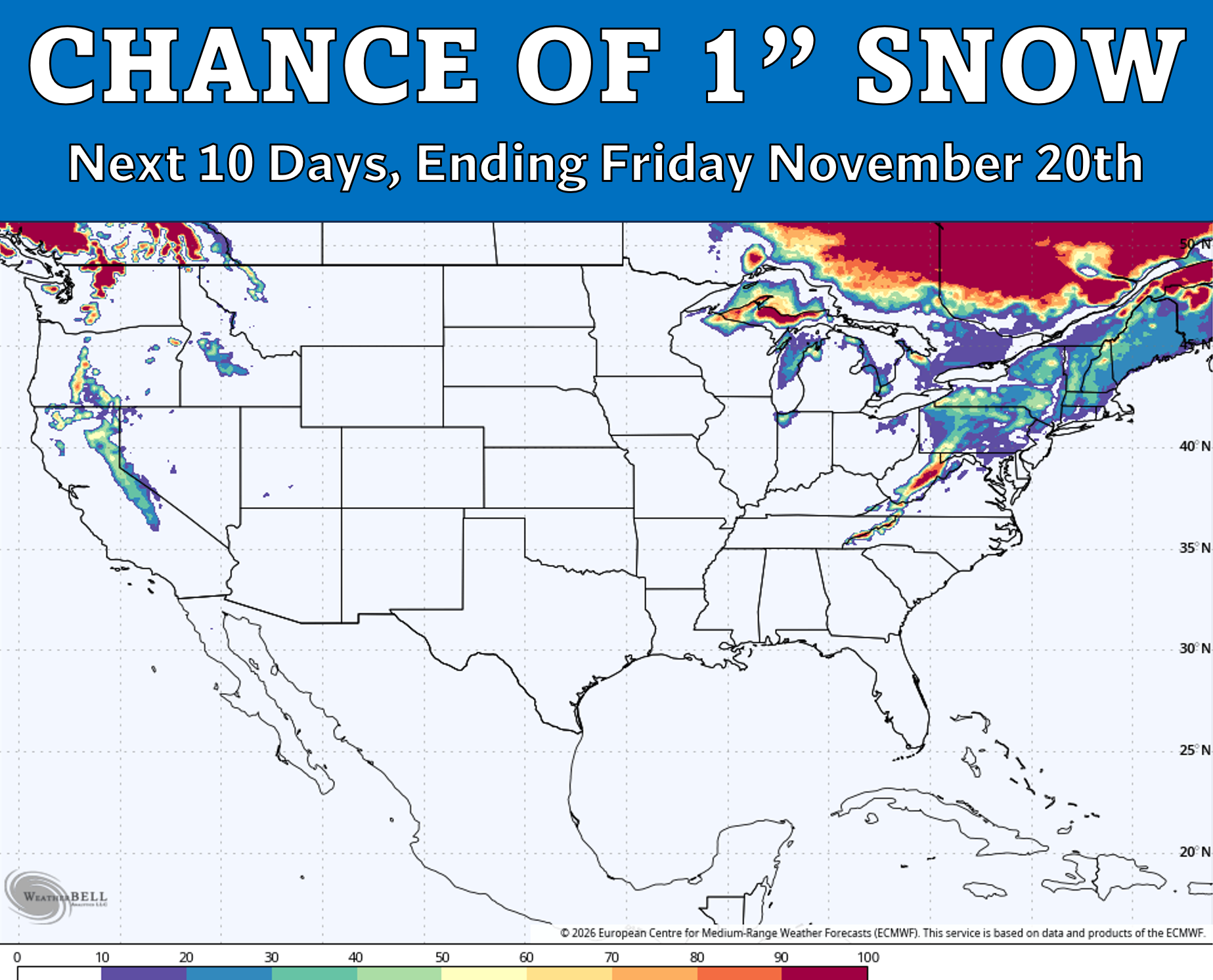
The southern Appalachians getting snow before the Front Range is not a sentence we enjoy writing in November, but that’s the card Mother Nature has dealt us this year it seems.
A Pattern Change Next Week? Maybe…
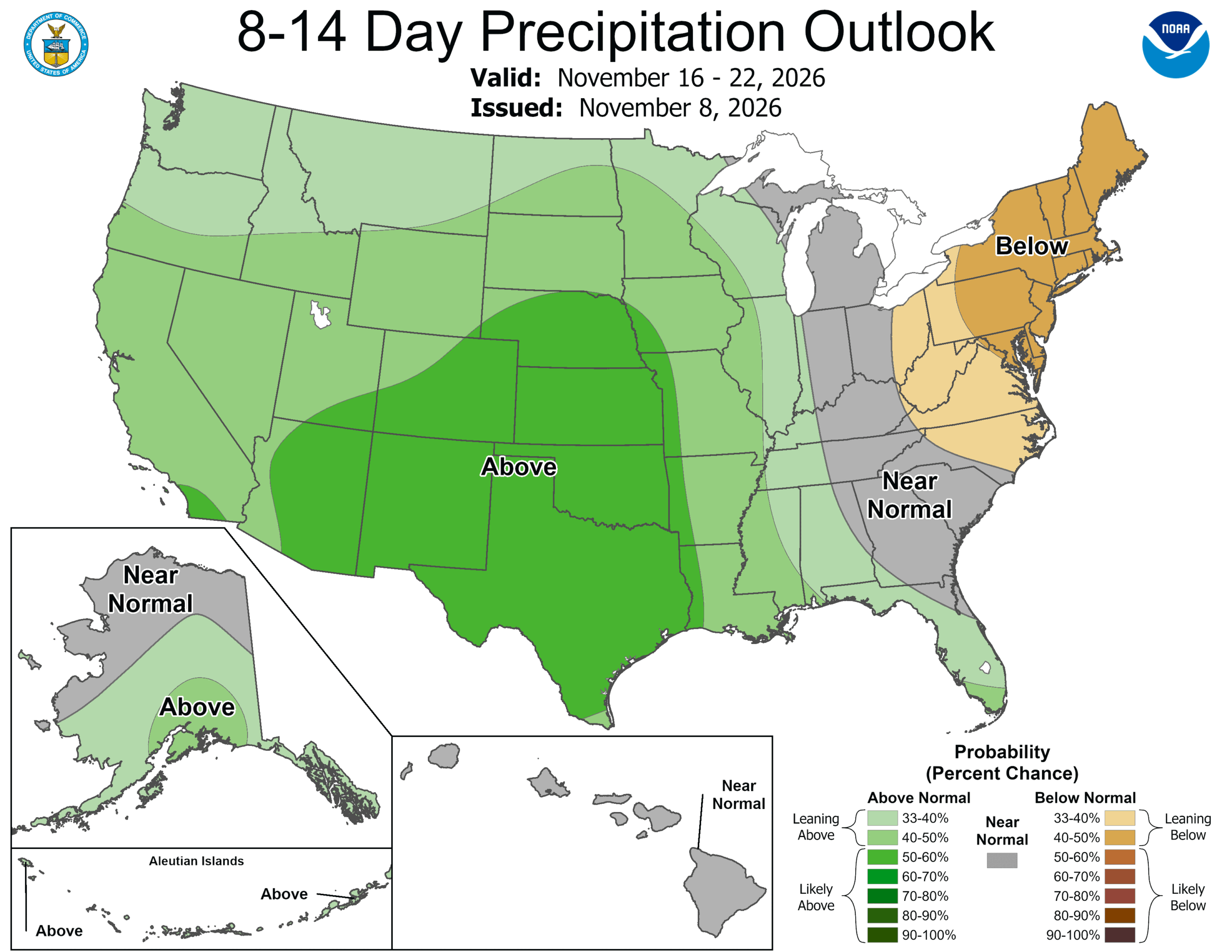
There are signs that the omega block breaks down and the pattern turns more active by early to mid next week. The Climate Prediction Center’s 8–14 day outlook has a 50 to 60 percent chance of above-normal precipitation for the Front Range from November 16 to 22. That’s a notable signal this far out.
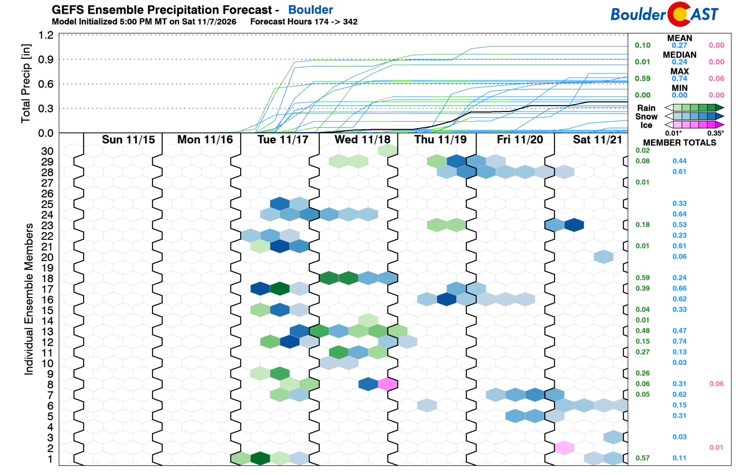
Our GEFS ensemble plume shows the same idea, with several members bringing rain or snow to Boulder between the 17th and 21st. The spread is wide, though. Members range from about an inch of liquid to barely a trace, and the ensemble mean is dragged up by a few wet outliers. The timing, track and moisture of any storm during this period are still far from settled, so there’s not much to say beyond it’s “worth watching.”
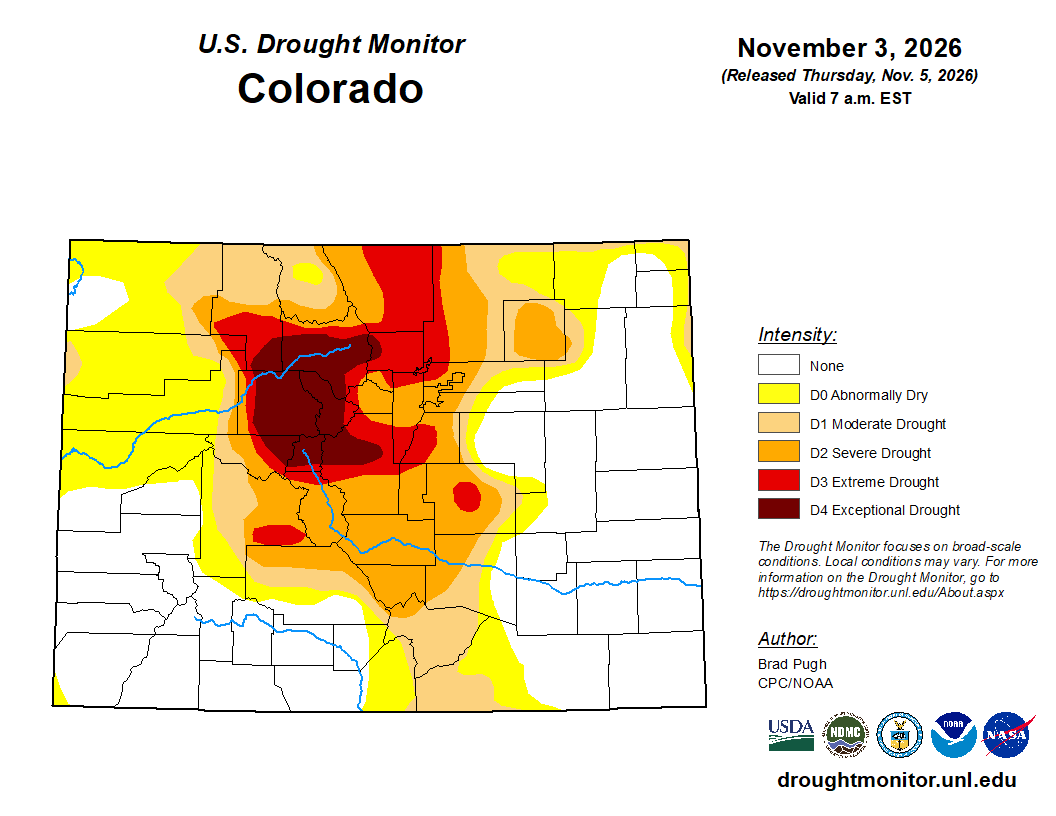
There’s a lot riding on the pattern shifting soon. Even after a soaking mid-October storm, extreme to exceptional drought (D3–D4) still covers much of the northern Front Range, including Boulder and Larimer counties.
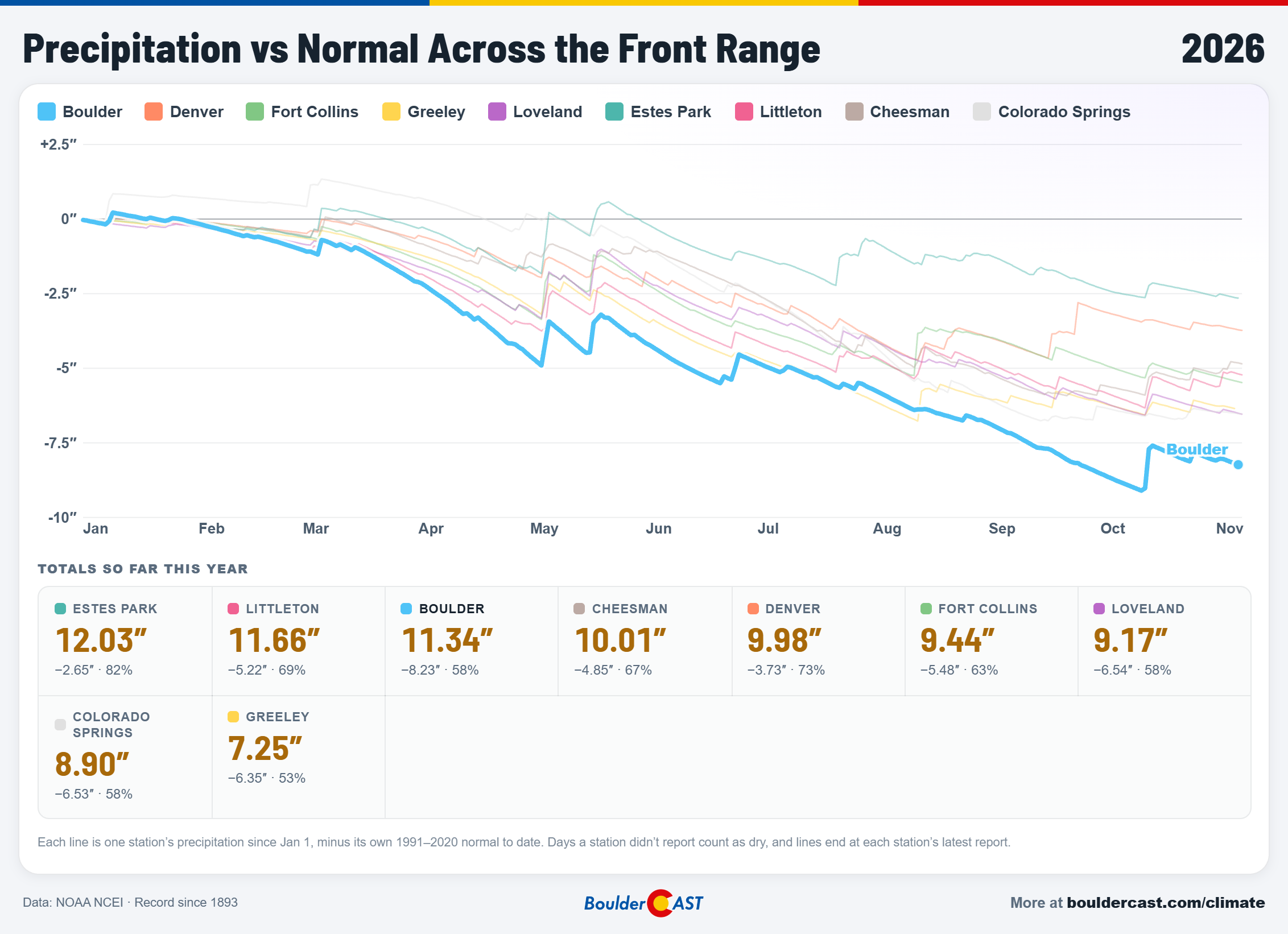
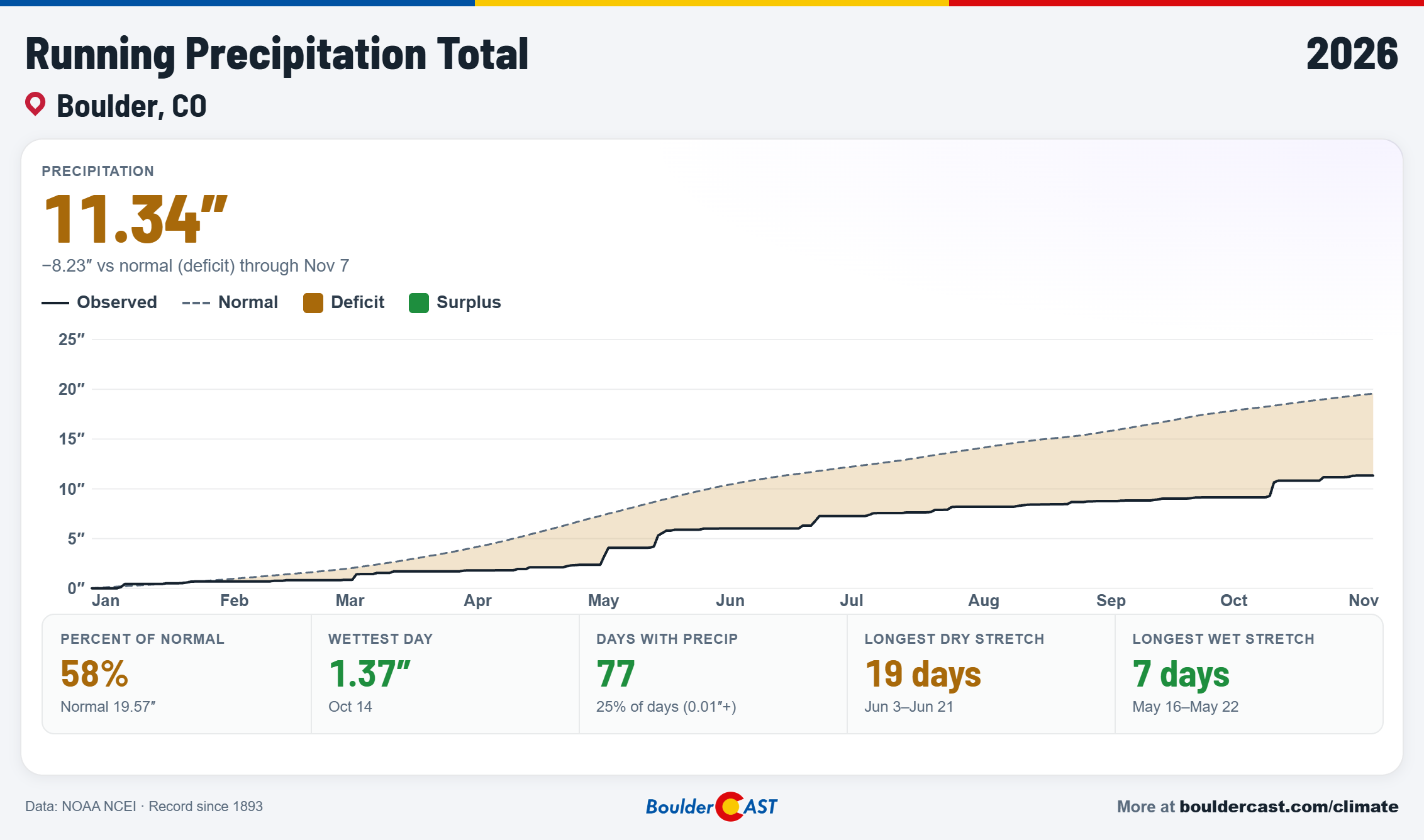
Boulder’s 2026 precipitation sits at just 58% of normal, and the rest of the Front Range isn’t doing much better.
On the snow front, last winter we had to wait until November 29 for our first measurable snow, the latest on record. With nothing on the board through mid-November this year, that record is starting to look within reach. A wet, snowy storm around the 20th would ease the drought and settle our first snow contest with some satisfaction. But for now, that’s just a pie in the sky.
Until then, enjoy another week of sunshine and 60s. It’s great weather for the trails, but every dry day adds to our long-running deficit.
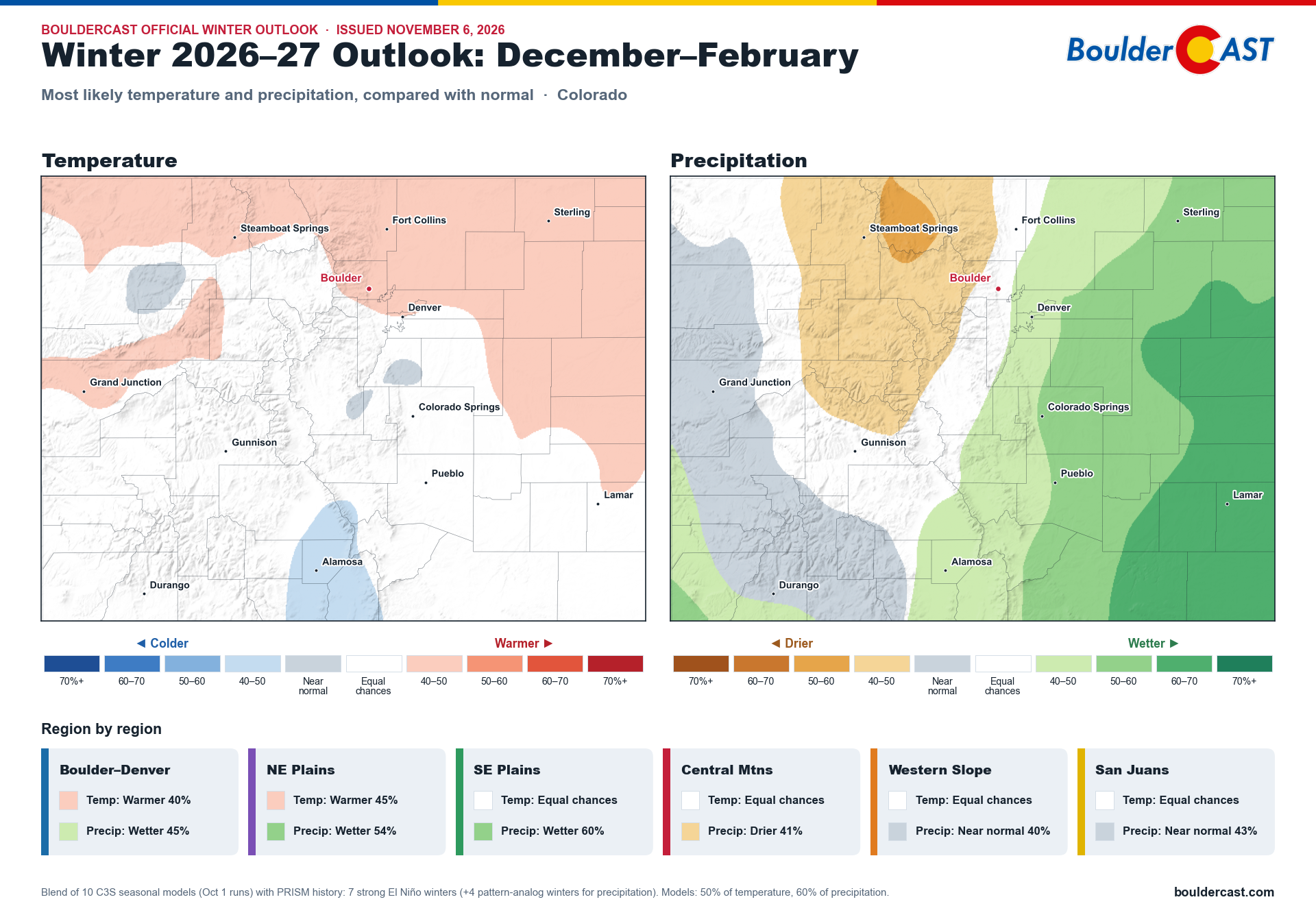
And if you missed it, we published our big winter outlook deep dive over the weekend. We looked at what a historic Super El Niño could mean for Colorado this winter, using 10 seasonal climate models and 131 years of Colorado records. The results are encouraging for the Front Range and eastern Plains, less so for the mountains, and come with a warning that winter may be slow to arrive. You can find it here.
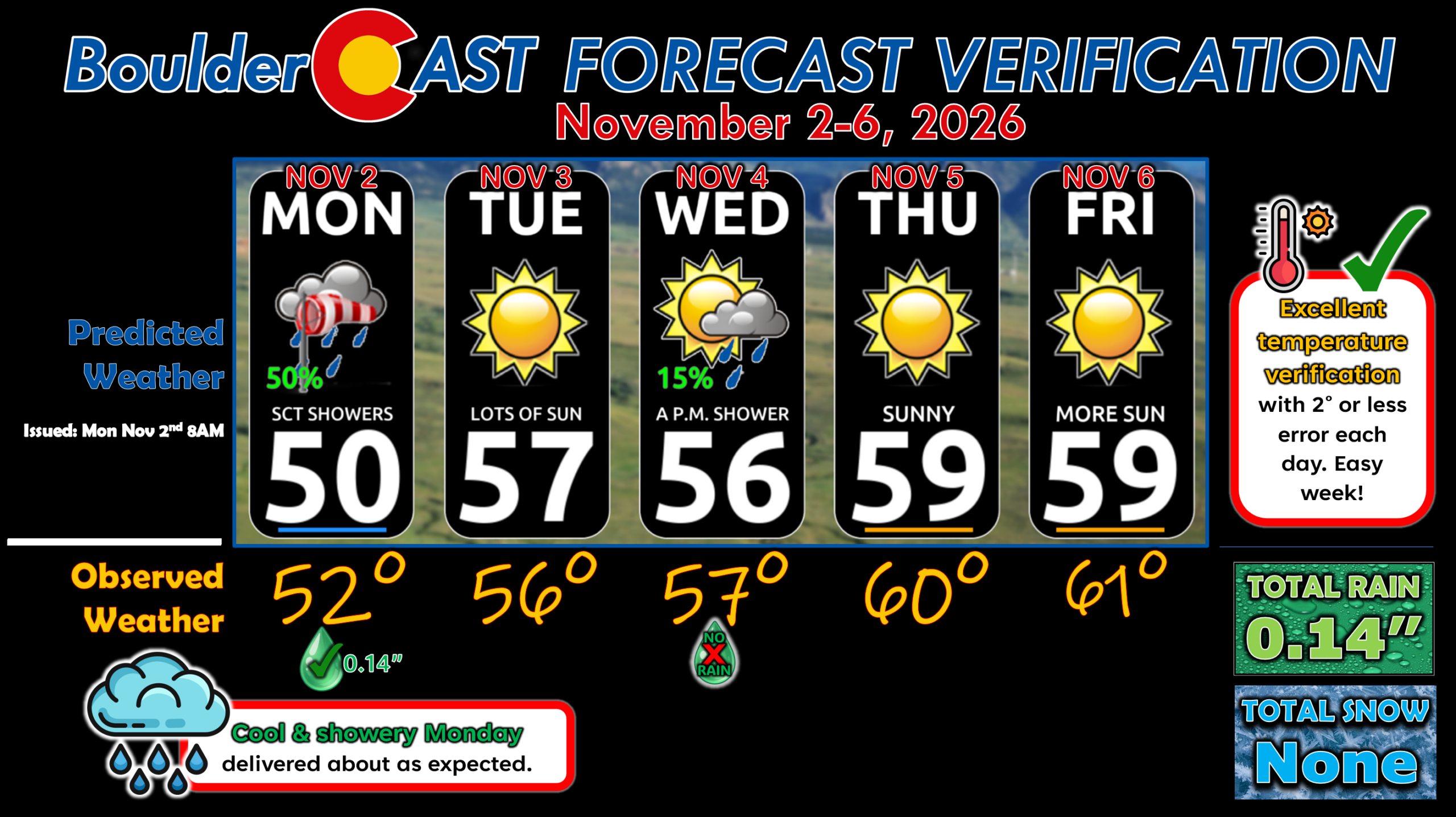
Forecast Verification: November 2-6, 2026 (Last Week)
- 🌡️ Easy-peasy temperatures with 2° or less of error each day
- ☔️ Showery Monday verified, with Boulder recording 0.14″ of rain.
- 📔 Near normal temps all week in the 50s to lower 60s.
DISCLAIMER: This weekly outlook forecast is created Monday morning and covers the entire upcoming week. Accuracy will decrease as the week progresses as this post is NOT updated. To receive daily updated forecasts from our team, among many other perks, subscribe to BoulderCAST Premium.
Go Premium, get all the perks.
Daily Forecast Updates
Get our daily forecast discussion every morning delivered to your inbox.
All Our Model Data
Access to all our Colorado-centric high-resolution weather model graphics. Seriously — every one!
Ski & Hiking Forecasts
6-day forecasts for all the Colorado ski resorts, plus more than 120 hiking trails, including every 14er.
Smoke Forecasts
Wildfire smoke concentration predictions up to 84 hours into the future.
Exclusive Content
Weekend outlooks every Thursday, bonus storm updates, historical data and much more!
No Advertisements
Enjoy ad-free viewing on the entire site.
Enjoy our content? Give it a share!







Leave a Reply
You must be logged in to post a comment.