
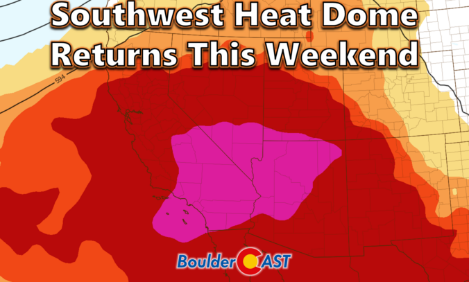
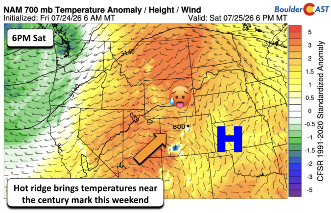
After a lively stretch of monsoon storms and even some flooding across the state, the atmosphere is shifting in a way that favors heat, haze, and a temporary shutdown of our storm pipeline for the Front Range. A stout Southwest heat dome is about to take center stage, triple‑digit temperatures are lining up for Boulder and Denver, and wildfire smoke is poised to make an unwelcome return. We break down the ridge, the records, the smoke, and the eventual cooldown.
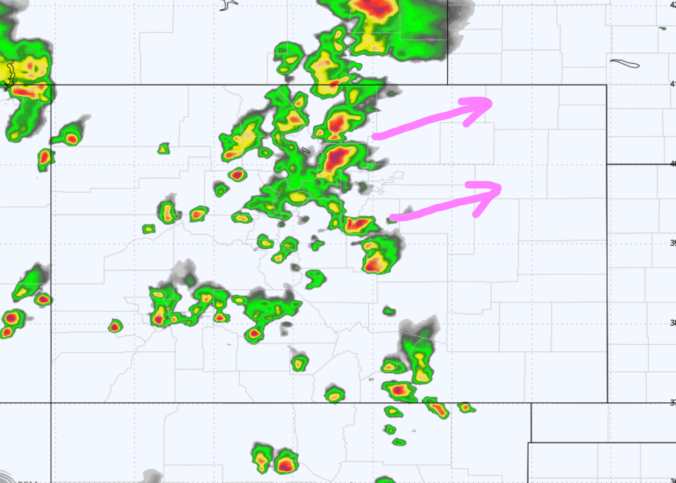
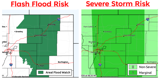
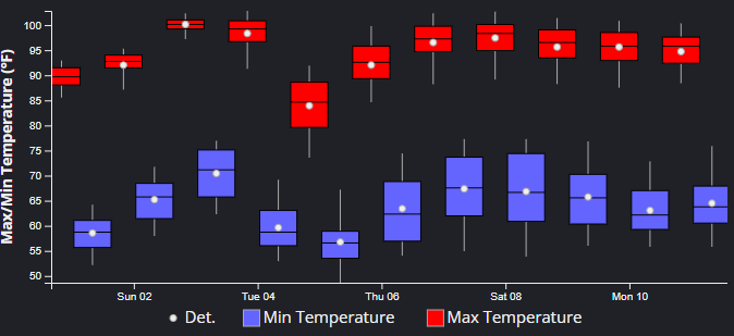
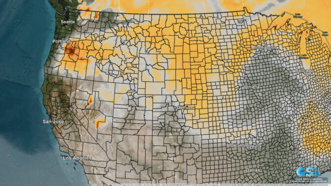
Eastern Colorado just came off a truly blistering weekend, with Denver and Boulder both shattering daily records as temperatures surged past 100°F on back‑to‑back days. Now the pattern is shifting, at least temporarily. An unusually juiced monsoon plume will set the stage for more robust afternoon storms through mid‑week, including a legitimate threat for locally heavy rainfall and burn‑scar flooding. But the faucet will shut off quickly. A rapidly intensifying Southwest heat dome will retrograde into Arizona late‑week, cutting off monsoon flow, drying out northern Colorado, and potentially steering wildfire smoke from the Pacific Northwest into the state as winds shift. By the weekend, the Front Range will sit on the fringe of that expanding heat dome, meaning another round of hot, dry weather and potential triple-digit readings again. Read on for all the details.


Live View of Boulder

Current Conditions

Live Radar

Latest Smoke Forecast

Recent Premium Posts

BoulderCAST Daily – Sat 08/01/26 | Hot Temperatures Build This Weekend
🌡️ Dangerous Heat and Air Quality — Boulder and Denver return to triple …
BoulderCAST Daily – Fri 07/31/26 | Marginal Risk of Severe Storms with Smoke and Haze
🌧️ Isolated Storms — This afternoon and evening, with a marginal risk of …
BoulderCAST Daily – Wed 07/29/26 | Final Storm‑Filled Afternoon Before an Expanding Desert Southwest Heat Dome Takes Over
🌧️ Lingering Monsoon Moisture — Lingering Tap One last day of beneficial rainfall …
3-Day Forecast

Trending Content

© 2026 Front Range Weather, LLC