


A blistering heat wave will end with one of the more dynamic forecast days we’ve seen all summer. From potentially record‑setting triple‑digit heat to a late‑day cold front, gusty virga showers, and a thick wall of wildfire smoke set to drop into the Front Range tonight, Monday packs an unusually busy mix of weather hazards and changes. We’ll walk you through the timing, the impacts, and the brief but welcome multi-day cooldown ahead — plus why the heat dome isn’t done with us yet. We also look ahead to when the monsoon could return.
This week’s highlights include:
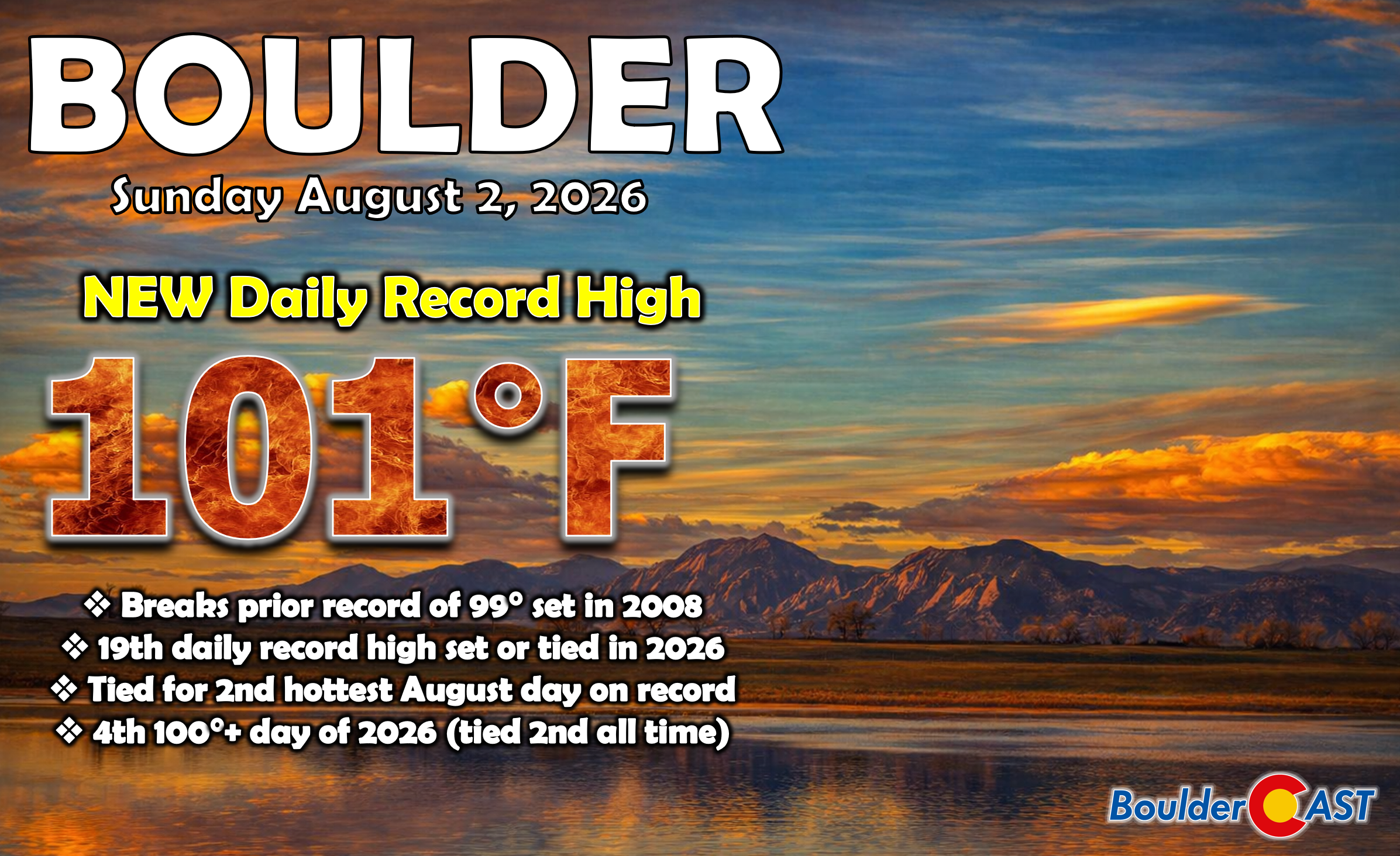
- 🔥 Record heat observed Sunday: Triple‑digit temps surged across northeast Colorado, with Boulder smashing its daily record at 101° and Denver hitting 102°.
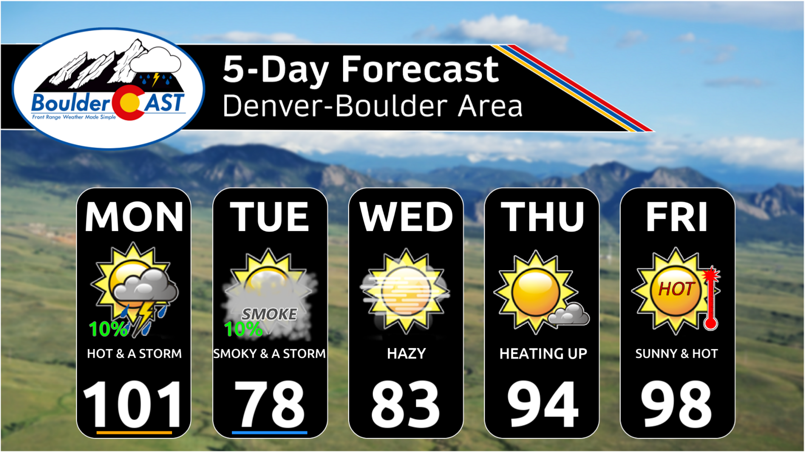
- 🌡️ One more scorcher Monday: The Southwest ridge keeps extreme heat in place, pushing most areas to 97–102° before a cold front arrives.
- 🌬️ Gusty virga & dry storms: High‑based showers produce 40 MPH gusts but almost no rainfall. Isolated dry lightning may spark new fires.
- 🧭 Cold front timing 3–6 PM: A Canadian‑Montana trough sends us a sharp NNE wind shift and brief near‑critical fire conditions.
- 🌫️ Smoke surge behind the front: Denser ground-level smoke from Pacific Northwest fires arrives mid‑to‑late evening, prompting some Air Quality Alerts.
- 📉 Big cooldown Tue–Wed: Highs fall into the upper 70s and mid‑80s, though lingering smoke keeps skies hazy and visibility low.
- ⚡ Spotty storms Tuesday: Limited instability means only isolated PM storms along the Palmer Divide and Foothills.
- 🔥 Heat dome rebuilds late week: High pressure expands again, sending temps back into the 90s Thursday and near 100° Friday.
- 🌧️ Monsoon set to return next week: Monsoonal moisture will increase again next week with daily showers and storm chances returning to Colorado.
DISCLAIMER: This weekly outlook forecast is created Monday morning and covers the entire upcoming week. Accuracy will decrease as the week progresses as this post is NOT updated. To receive daily updated forecasts from our team, among many other perks, subscribe to BoulderCAST Premium.

Go Premium, get all the perks.
Daily Forecast Updates
Get our daily forecast discussion every morning delivered to your inbox.
All Our Model Data
Access to all our Colorado-centric high-resolution weather model graphics. Seriously — every one!
Ski & Hiking Forecasts
6-day forecasts for all the Colorado ski resorts, plus more than 120 hiking trails, including every 14er.
Smoke Forecasts
Wildfire smoke concentration predictions up to 72 hours into the future.
Exclusive Content
Weekend outlooks every Thursday, bonus storm updates, historical data and much more!
No Advertisements
Enjoy ad-free viewing on the entire site.
Recap: A Record-Setting Sunday
On Sunday temperatures blasted past the century mark across northeast Colorado, with Boulder and Denver squarely in the heat bullseye. The most extreme readings clustered along the low‑lying South Platte Valley from Greeley to Fort Morgan. Even the Foothills and portions of the mountain valleys cracked 90°, including elevations above 8,500 feet — a testament to the magnitude of the warm layer overhead.
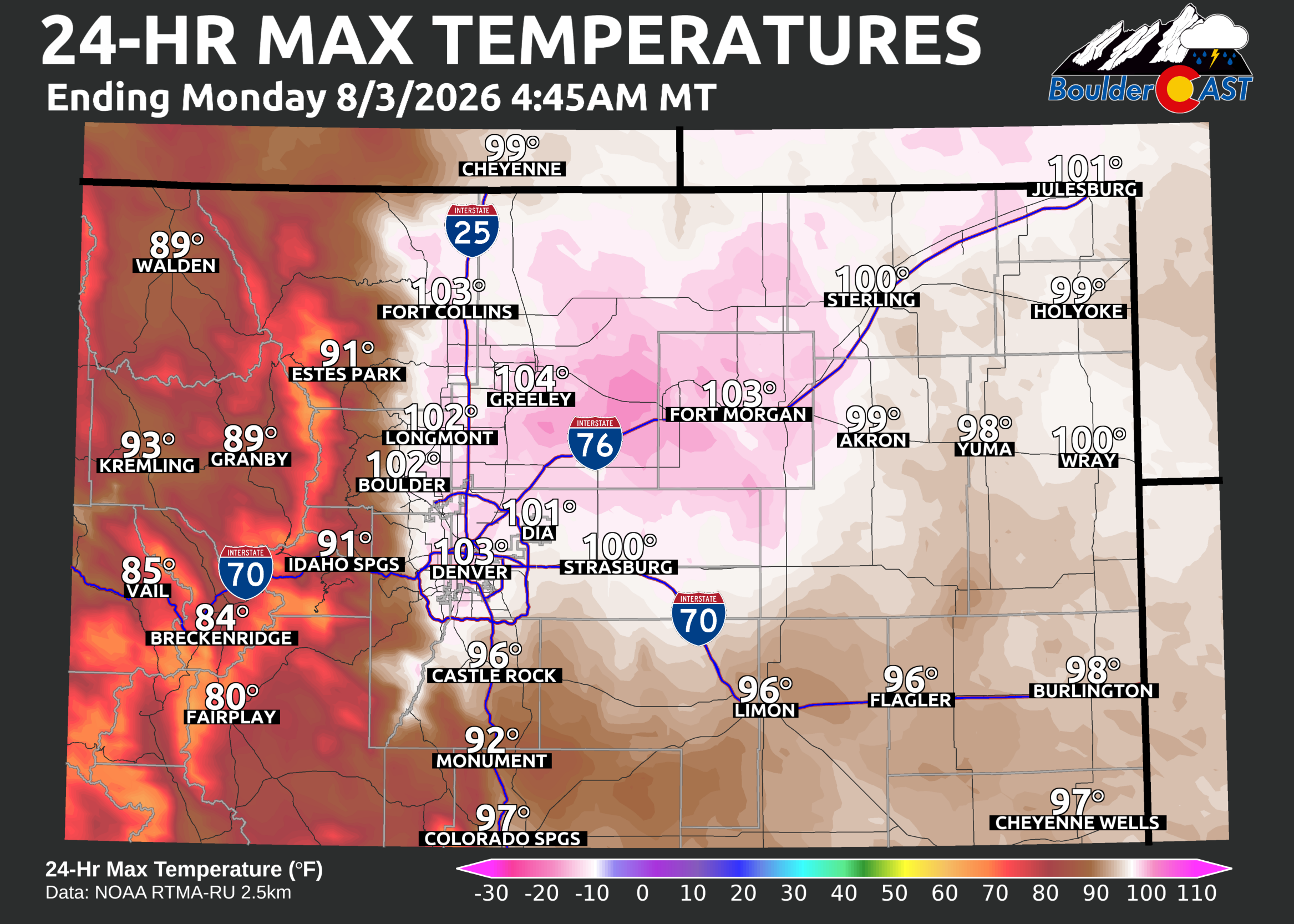
Boulder officially hit 101°, smashing the previous August 2 record of 98° (2008). It’s the city’s fourth triple‑digit day of 2026, tying this year for the second‑most 100° days ever recorded. Denver topped 102° Sunday, a single degree short of its August 2nd record high.
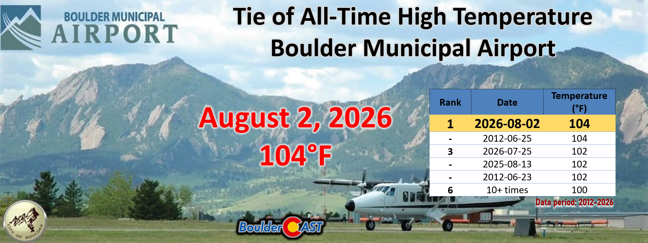
Boulder Municipal Airport hit 104° Sunday, tying the all-time record high temperature for that site. Keep in mind the data record for the airport extends only back to ~2010 and it is not the official climate station of the city.
Monday: One More Sizzler Before a Smoky Cold Front
Our most active day of weather this week will come front-loaded on Monday with a very busy day on the forecast docket.
The very same hot and dry airmass that brought us the triple-digit heat on Sunday will stick around for most of Monday as well. High pressure parked over Arizona and New Mexico will continue to extend its influence into Front Range Colorado for one more day.
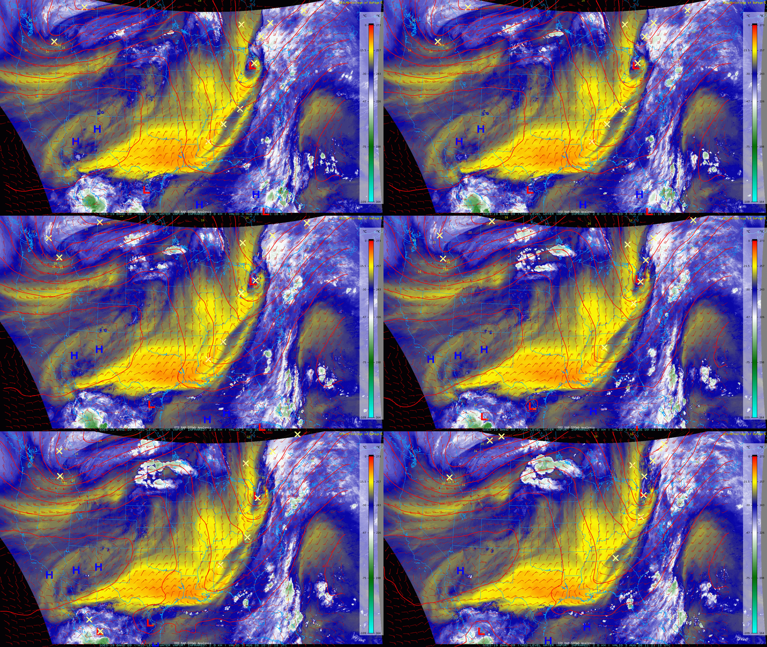
Late in the day Monday, welcomed change will take place. We are tracking the arrival of a highly-anticipated cold front tied to a trough racing through southern Canada and Montana.
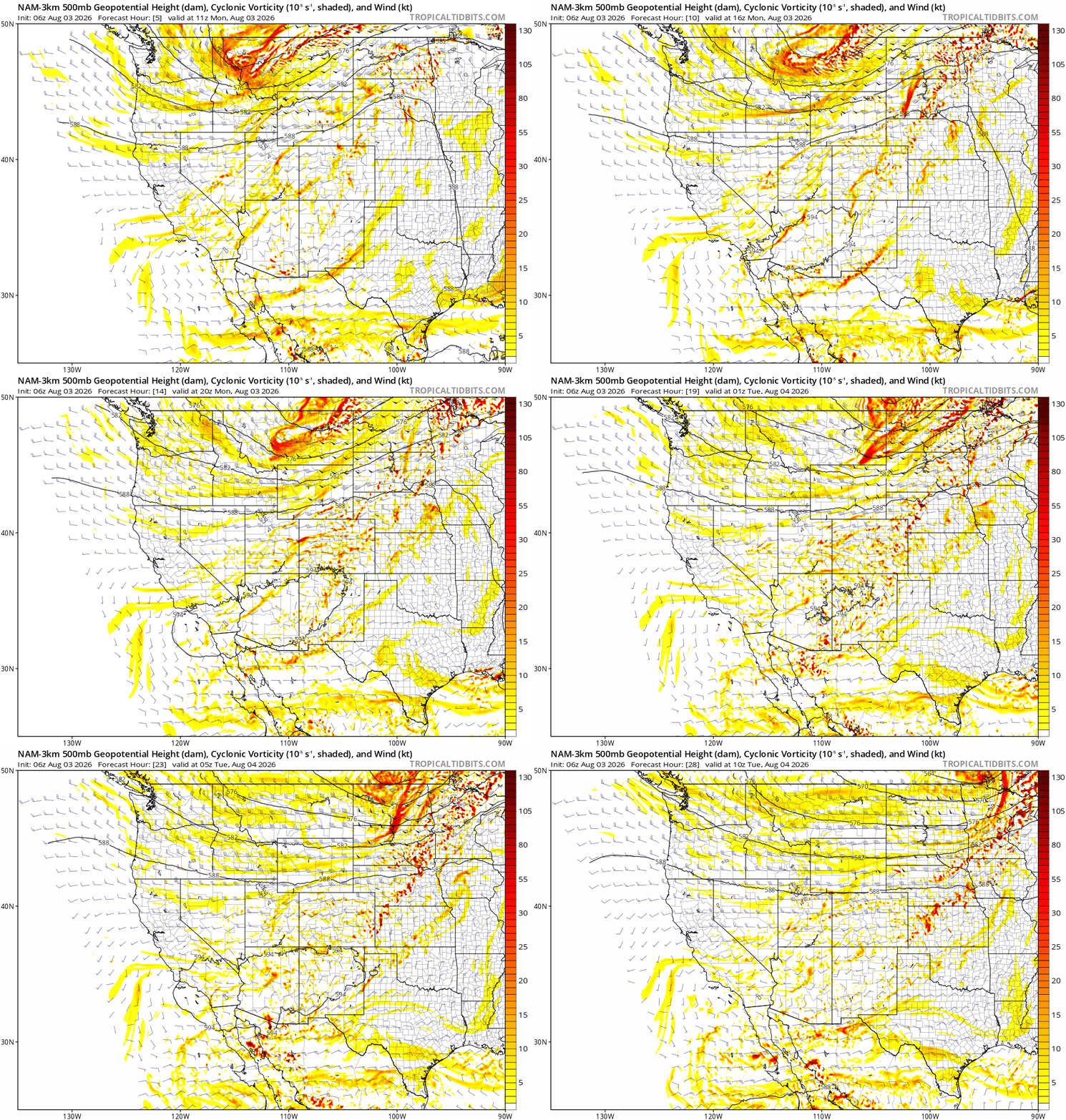
NAM 500mb height and vorticity forecast animation for Monday into Tuesday morning showing the passing shortwave along the Canadian border, the catalyst for our changes Monday evening.
Model spread remains, but the 3–6 PM window still looks most plausible for the front to show up, with the latter half of that window slightly favored.
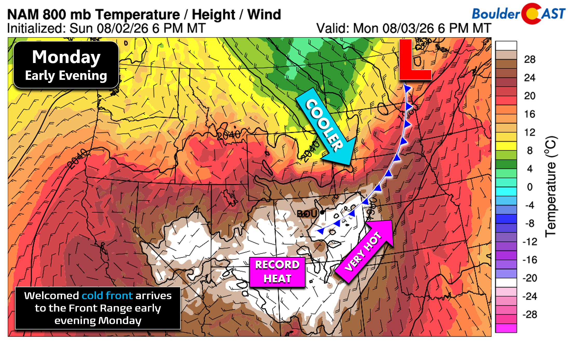
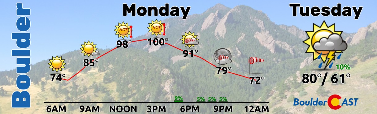
Regardless of the frontal timing, there will be a very rapid warm-up Monday morning, beginning at an elevated level due to near-record warm morning temperatures, with the Denver Metro area easily reaching the upper 90s to lower 100s before any signs of the front begin to show up. Most areas will hit 97 to 102° by early Monday afternoon. Boulder’s record high for August 3rd is only 98° (1954) — this stands a good chance to be tied to broken. Denver’s record of 100° (1878) is also in play.
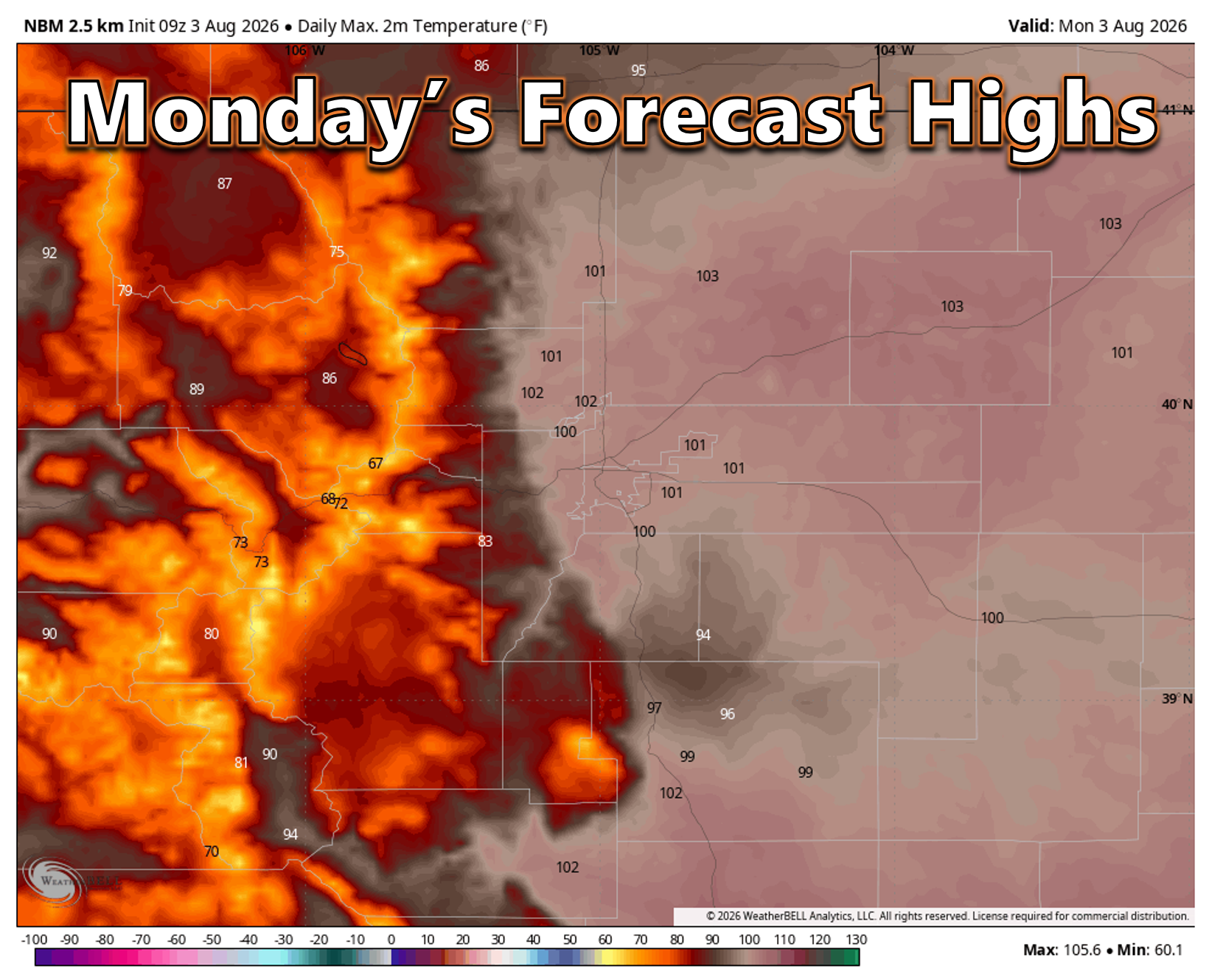
Though we must admit, the thick plume of lofted wildfire smoke present early Monday morning over the Front Range could slow the warm-up somewhat.
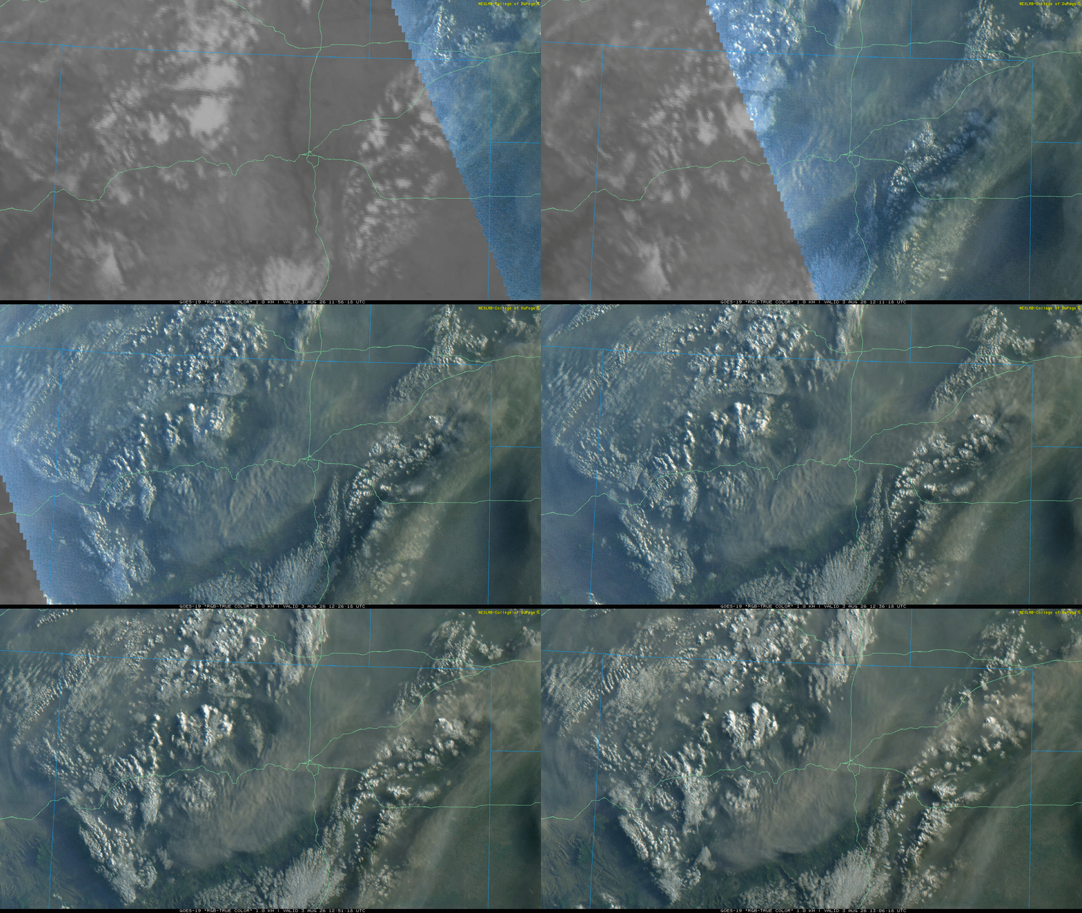
The sun rises Monday morning with a thick plume of lofted wildfire smoke over the Front Range.
As we head through the rest of the afternoon and evening, gusty virga showers and a few dry thunderstorms will bubble up across the region. While the HRRR model-simulated radar animation below looks quite ominous, almost all of this indicated shower activity will evaporate before reaching the ground, leading to minimal or no rainfall. Instead, we’ll see mostly wind with gusts up to 40 MPH, offering pockets of relief from the heat hours before the front itself arrives.
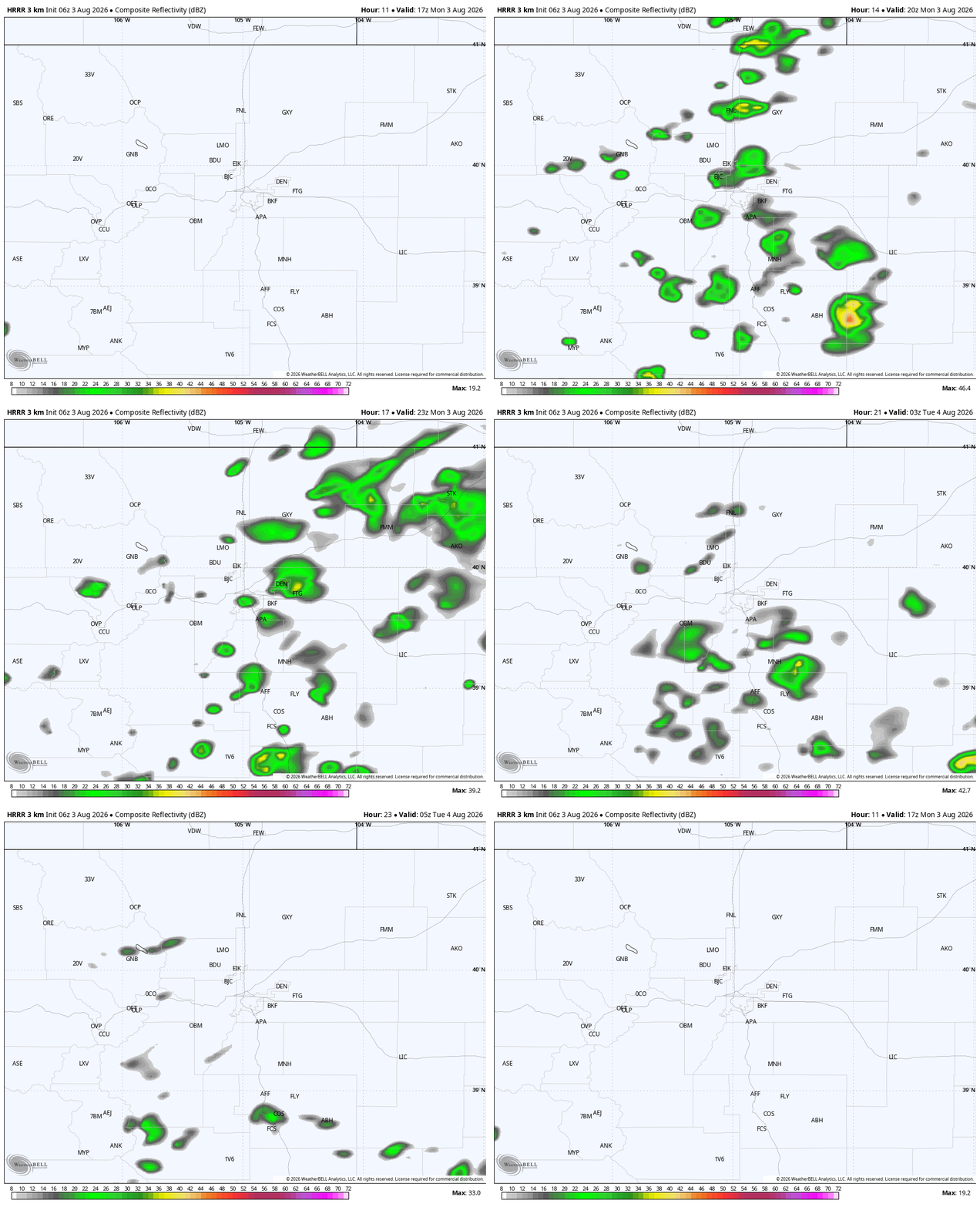
HRRR model-simulated radar animation for Monday showing a lot of shower activity, but most won’t reach the ground.
Monday’s key weather highlights:
- Virga shower window: 1 PM–9 PM. Isolated dry lightning could spark new fires.
- Peak temps: 97–102° early afternoon, dependent on how much smoke fills the skies through the morning/afternoon.
- Frontal arrival: 3–6 PM
- Post‑frontal winds: Gusty NNE flow with near‑critical fire danger until humidity rebounds around sunset.
The final piece of the puzzle in Monday’s busy forecast is the significant increase in smoke particulates expected as the post-frontal airmass filters into the Front Range Monday evening. The very same pattern that made July one of the hottest on record in the Denver area has been protecting us from most of the smoke being generated by huge and numerous wildfires burning across the West. That will change, at least for a few days, as the winds shift Monday evening. Dense smoke from Oregon, Washington, and British Columbia will arrive a few hours behind the cold front, likely mid‑to‑late evening.
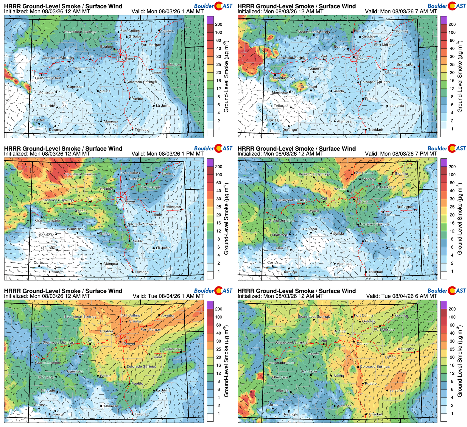
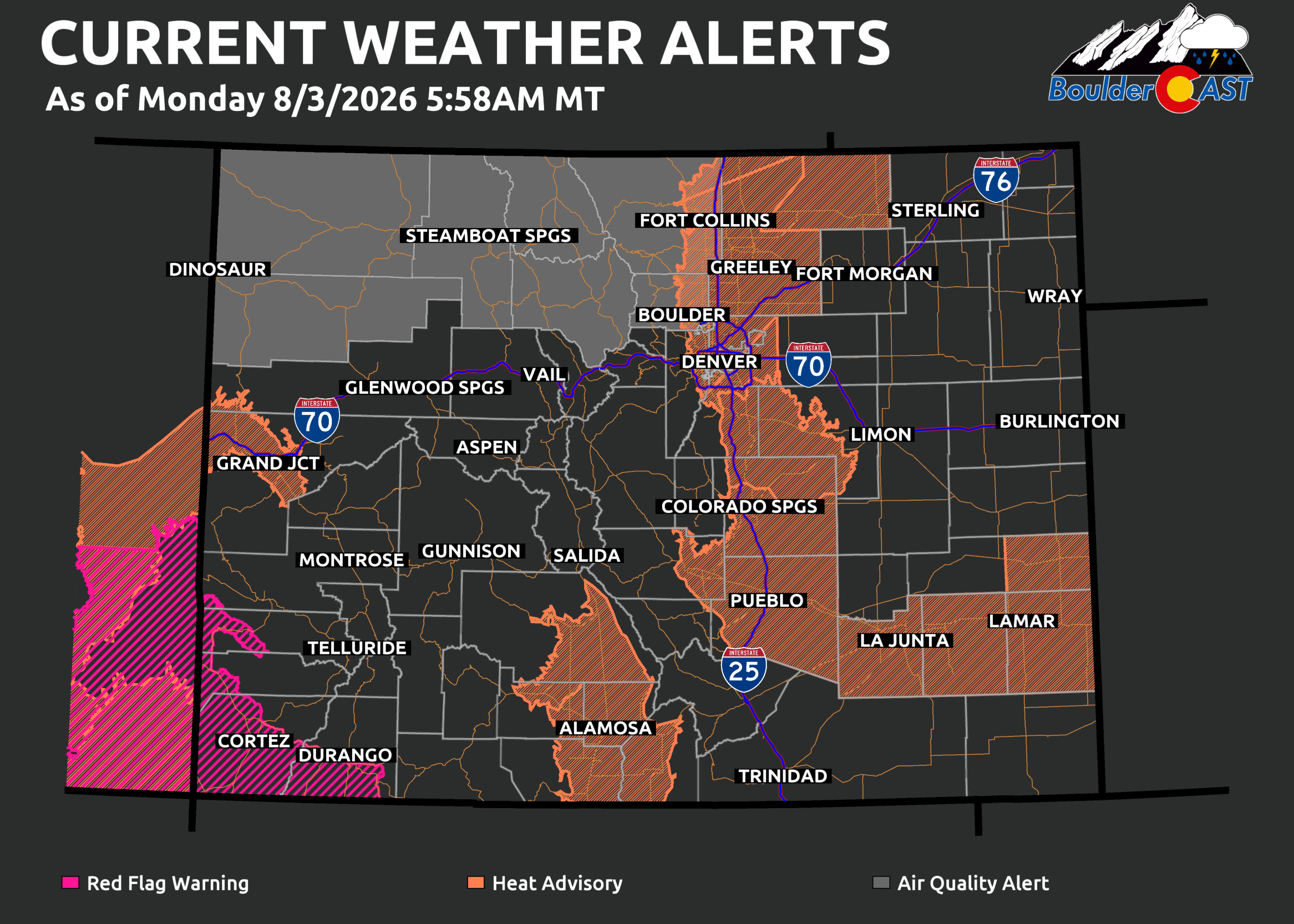
For this reason, Air Quality Alerts are already posted for northern Colorado, including Boulder and Larimer Counties, through 9 AM Tuesday. Expansion into the broader Denver area is possible.
Tuesday & Wednesday: A Dramatic Cooldown
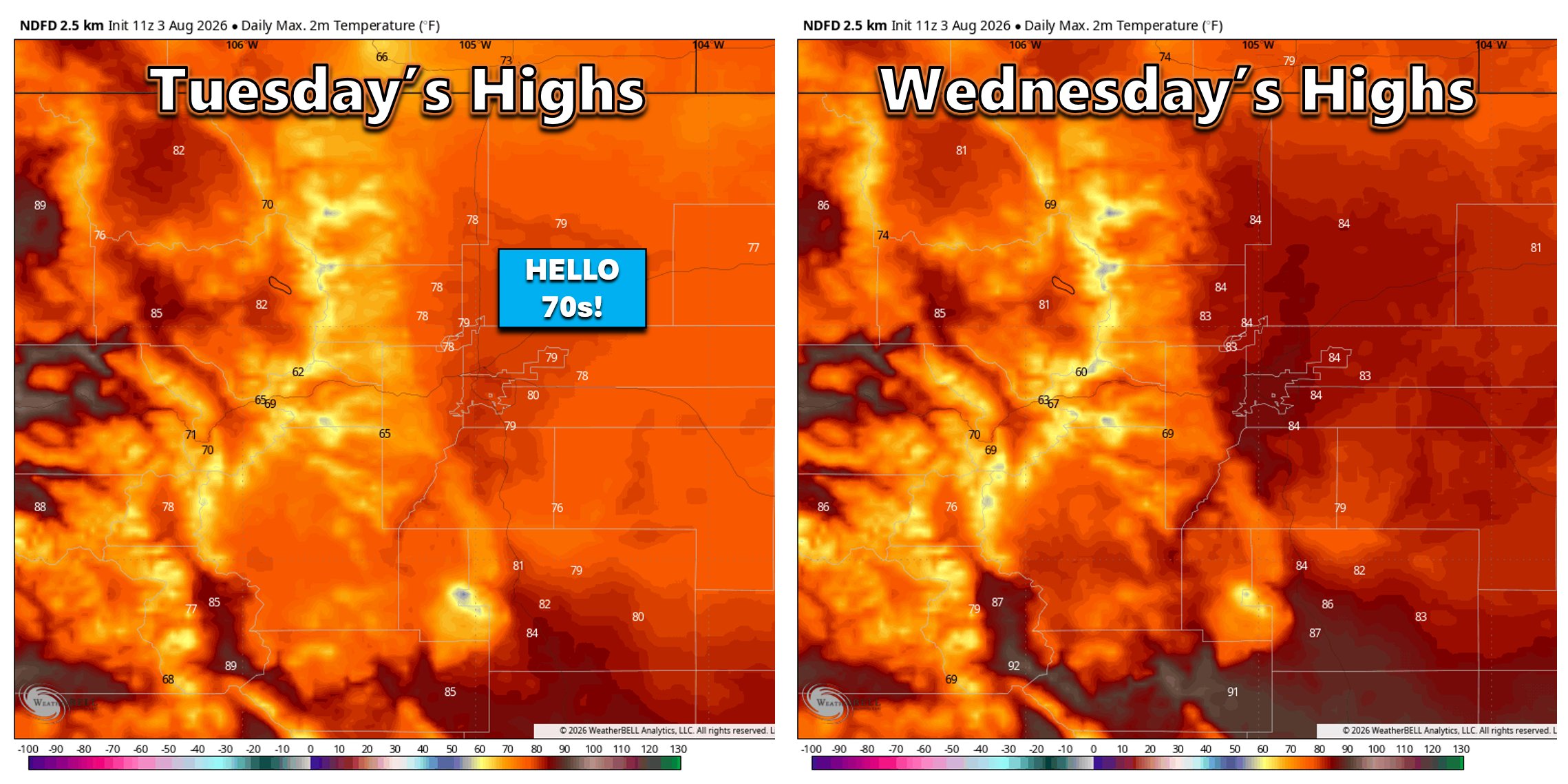
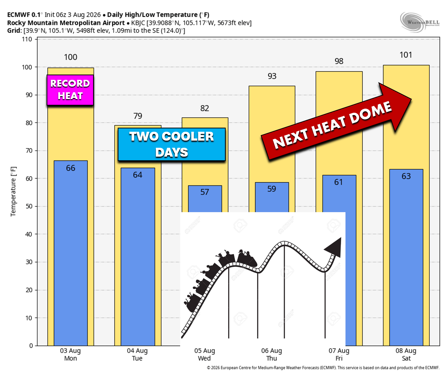
In the wake of Monday’s cold front, Tuesday and Wednesday will turn remarkably cooler. Highs tumble into the upper 70s Tuesday and mid‑80s Wednesday, breaking a seven‑week streak of 80°+ days in the Denver Metro. Tuesday may finally give us that elusive “70‑something” high we haven’t seen since mid‑June.
Tuesday will feature the best moisture availability of the week, and a few models do try to generate a couple isolated thunderstorms across the area. The cooler airmass, however, will limit instability. The best shot at a stray afternoon storm will be along the Palmer Divide and the Foothills of Jefferson/Boulder Counties.
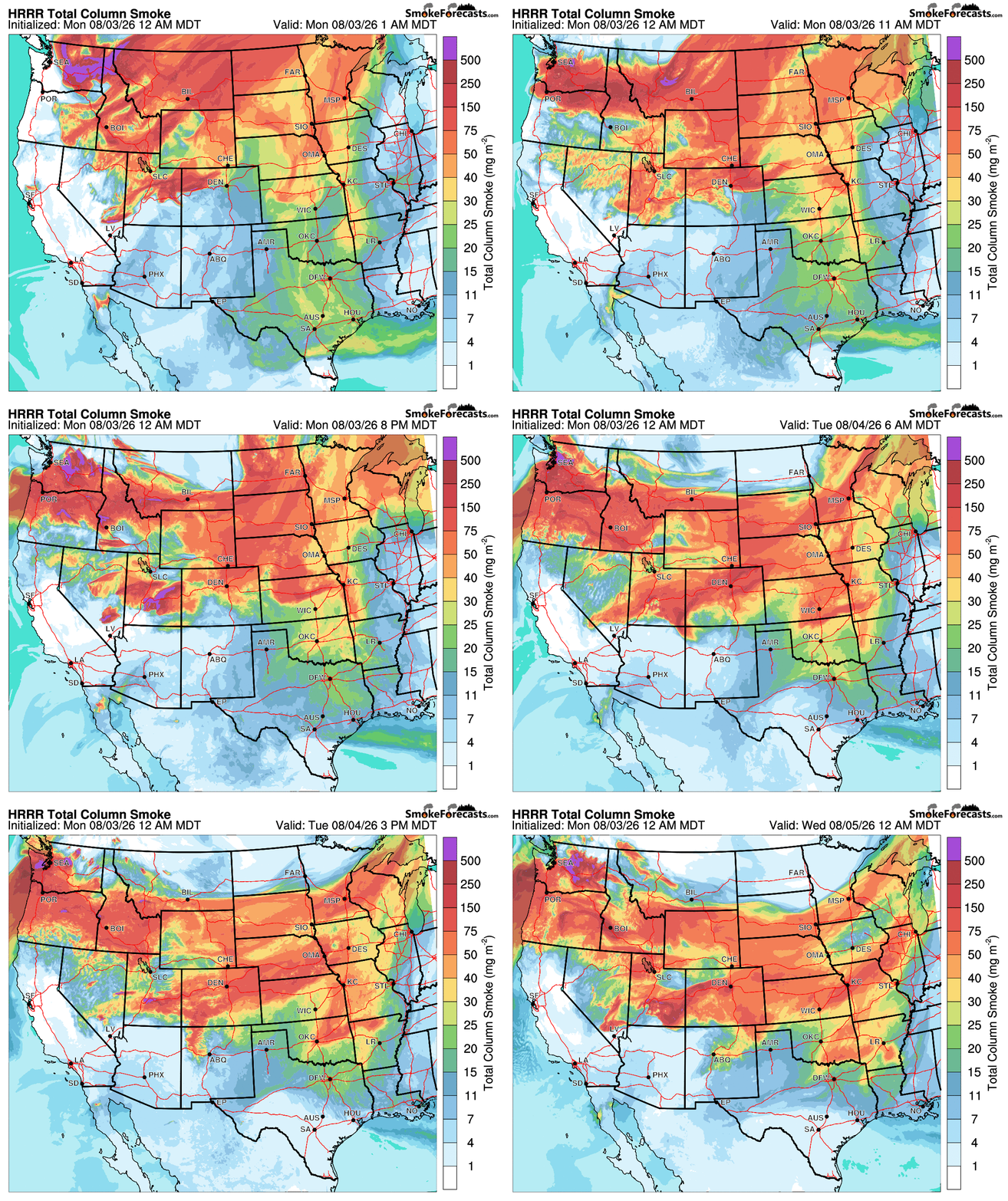
Smoke becomes a bigger storyline midweek. The thousand‑mile‑long smoke belt that has lingered north of Colorado for weeks will sag south, aided by additional contributions from fires in Utah and Nevada. Expect milky skies, reduced mountain visibility, and periods of Moderate to at times Unhealthy PM2.5 air quality at the surface.
Late Week: The Heat Dome Rebuilds
Sadly, the two relatively cooler days midweek will rapidly become a distant, forgotten memory Thursday and Friday as the intense dome under high pressure rebuilds across the Southwestern United States, quickly pushing its hot air back into Colorado to end the work-week.
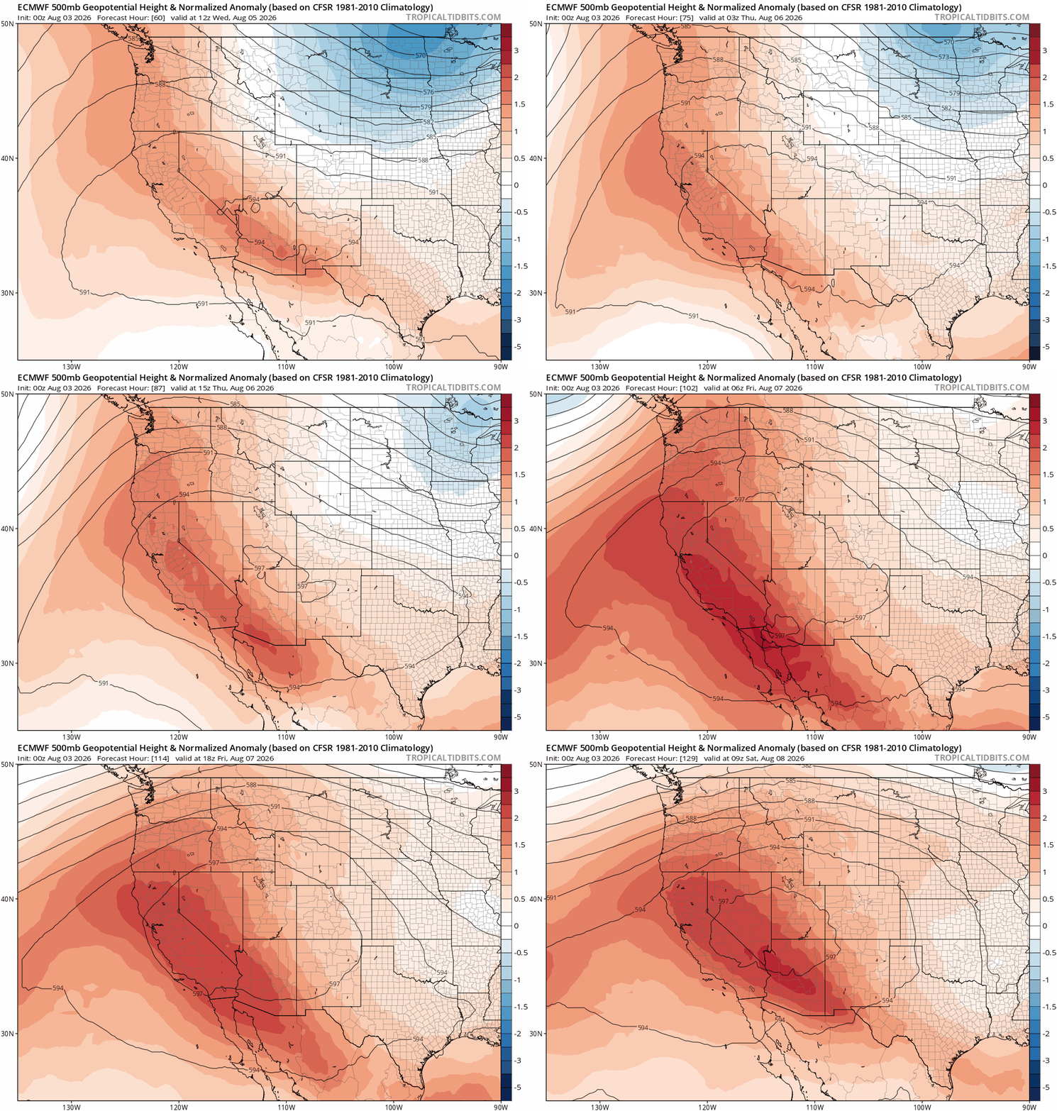
Highs are set to return to the 90s by Thursday, with the mercury rising to near 100° again Friday into the weekend. Apparently we’re all just along for the ride on Mother Nature’s roller coaster this week.
Monsoon Resurgence for the Second Week of August?
There is some potentially good news in the extended. After we endure yet another multi-day heatwave late this week through the weekend, a trough is forecast to approach the West Coast a bit further south. Ensembles show this may be enough to nudge the heat dome further east into the south-central part of the country. Yes, this will keep our area hot, but will open the door for monsoon moisture to return into the Four Corners by the early to middle part of next week.
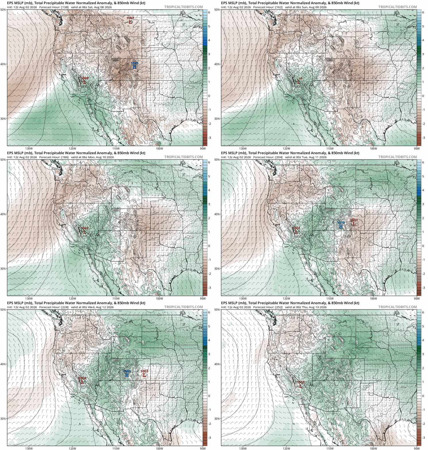
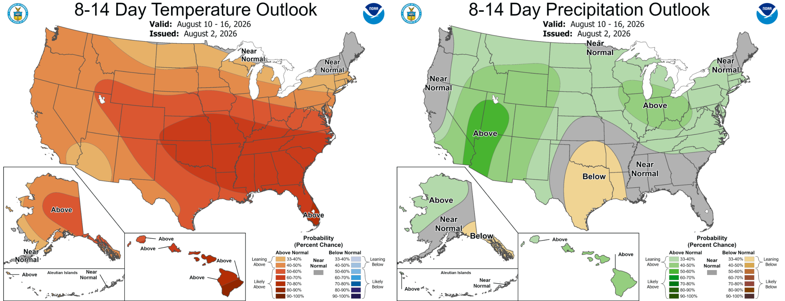
We’re optimistic that this will translate into a return of daily showers and thunderstorms for the Front Range next week — and so too is the Climate Prediction Center:
Bottom Line
Colorado is riding the sharp edge of a powerful Southwest heat dome to start the week, with one last punishing day of triple‑digit heat before a late‑day cold front flips the script. Monday will be a chaotic blend of extreme temperatures, gusty virga‑driven winds, dry thunderstorms, near‑critical fire danger, and a surge of wildfire smoke arriving behind the front. This combination is making Monday one of the more complex forecast days we’ve had in quite some time.
Relief arrives quickly, however. Tuesday and Wednesday will deliver a dramatic cooldown — our first real break from the heat in seven weeks — though the tradeoff will be hazy skies and elevated smoke as a big smoke plume finally sags south. Unfortunately, the respite will be brief: the heat dome is set to rebuild late week, pushing highs back into the 90s Thursday and flirting with 100° again by Friday and the weekend.
Finally, a migration of the heat dome eastward next week should lead to the return of daily chances for monsoon thunderstorms to most of Colorado.
Stay cool and enjoy the smoky rollercoaster ride this week!

DISCLAIMER: This weekly outlook forecast is created Monday morning and covers the entire upcoming week. Accuracy will decrease as the week progresses as this post is NOT updated. To receive daily updated forecasts from our team, among many other perks, subscribe to BoulderCAST Premium.
Go Premium, get all the perks.
Daily Forecast Updates
Get our daily forecast discussion every morning delivered to your inbox.
All Our Model Data
Access to all our Colorado-centric high-resolution weather model graphics. Seriously — every one!
Ski & Hiking Forecasts
6-day forecasts for all the Colorado ski resorts, plus more than 120 hiking trails, including every 14er.
Smoke Forecasts
Wildfire smoke concentration predictions up to 72 hours into the future.
Exclusive Content
Weekend outlooks every Thursday, bonus storm updates, historical data and much more!
No Advertisements
Enjoy ad-free viewing on the entire site.
Enjoy our content? Give it a share!











You must be logged in to post a comment.