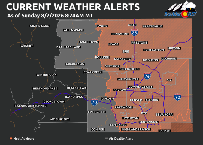
GRecord Heat Sunday & Monday OES-East water vapor imagery early this morning shows the core of the upper ridge centered over central Arizona, with a broad clockwise circulation funneling hot, desiccated air directly into Colorado. This is classic mid‑summer ridge behavior for the region: strong mid‑level warming, suppressed cloud cover, and efficient boundary‑layer mixing. A fast-moving Pacific Northwest trough will …
Ben grew up in southwestern Pennsylvania and holds both a bachelor's and a master's degree in Meteorology, the latter being from CU Boulder. His hometown received nearly three feet of snow from the Storm of the Century back in March of 1993, sparking his initial interest in impactful weather. Ben currently works on remote sensing and data analysis software at NV5 Geospatial Software in Boulder.
More Posts