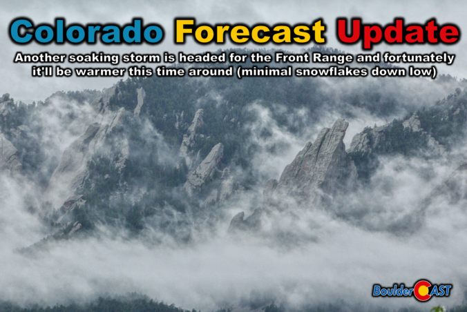
That quiet Sunday morning was lovely wasn’t it? But the sun is unfortunately gone as as powerful spring storm is digging into the West, already lighting up hazard maps from California to Montana to Kansas with snow, fire and wind warnings. For the Front Range, the approaching system will provide another round of widespread, soaking precipitation with the target once again on Boulder and Larimer Counties.
After a round of scattered showers and storms during the day Sunday, including some severe ones east of Denver, a more widespread precipitation shield will develop overnight and continue into Monday, with the Foothills grabbing accumulating snow and the lower elevations flirting with a few wet flakes as well. We break down the timing of everything, the most likely precipitation and snowfall totals, the post-storm freeze risk, and what this storm means for our ongoing drought.
What You Need to Know
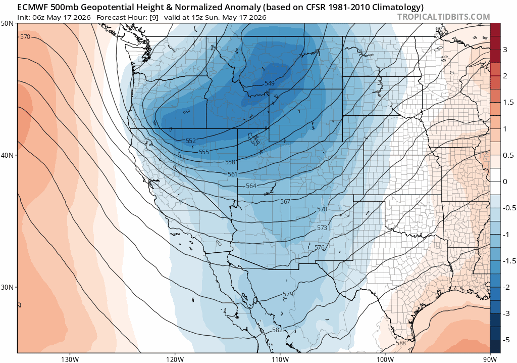
- 🌀 Major spring storm incoming — A double‑lobed trough digs into the West today, with the southern wave becoming the primary low as it tracks straight into Colorado.
- 🛰️ GOES imagery shows the impressive storm — Strong dynamics and deep moisture will target the northern Front Range late Sunday through Monday.
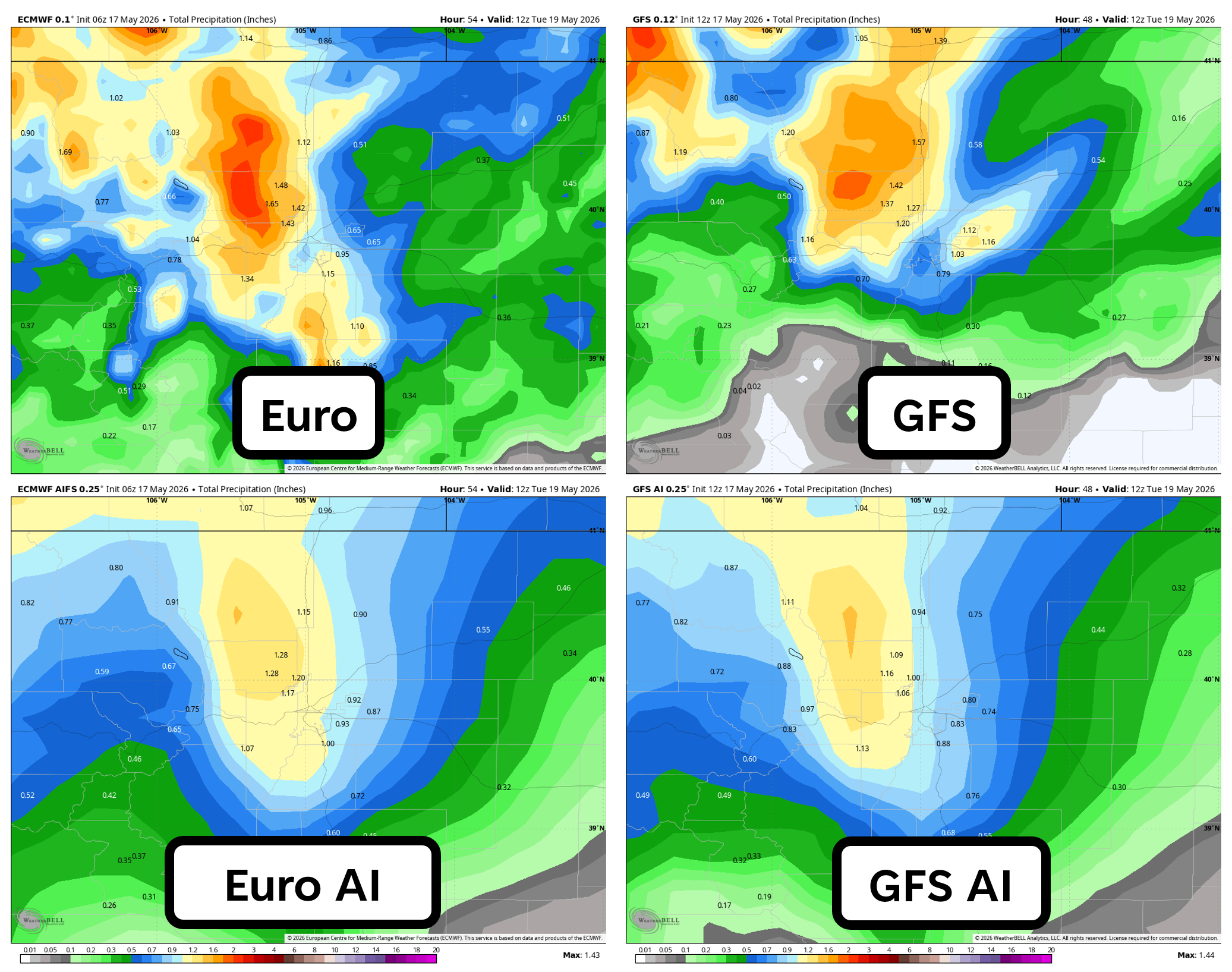
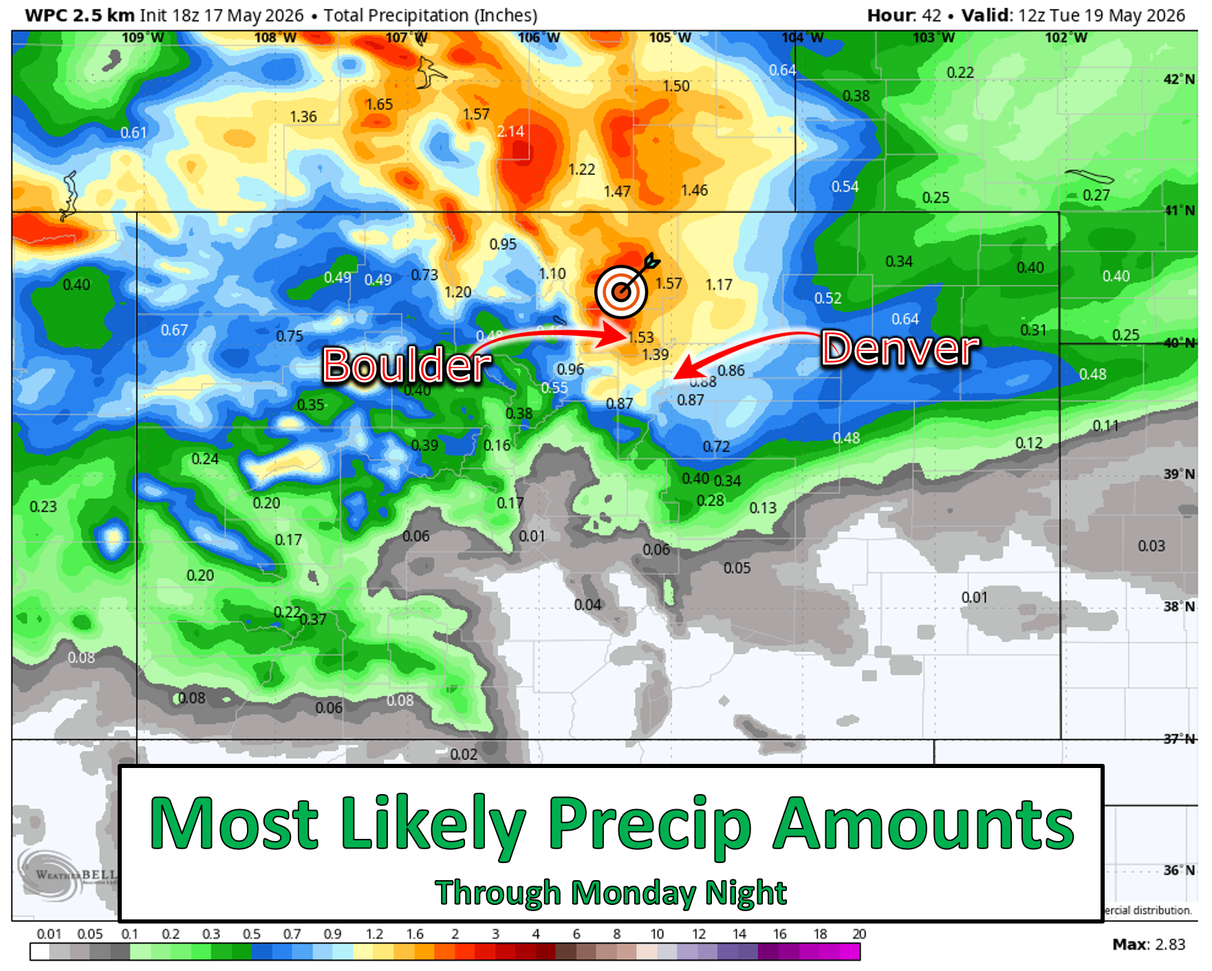
- 🌧️ Widespread soak expected — Boulder to the Wyoming border favored for 1.0–2.0″ of liquid; Denver likely 0.50–1.0″+ on the southern fringe.
- ⛈️ Severe storms stay east — A cold front will stabilize Boulder/Denver on Sunday, shifting the severe threat (hail, wind, isolated tornado) into far eastern Colorado.
- ❄️ Snow levels crash Monday — Cold air filtering in Monday will bring accumulating snow to the Foothills (up to 8 inches) and heavy totals along the Continental Divide (up to 16 inches) ; lower elevations see mostly rain with a few wet flakes.
- 🙂 Minimal impacts for Boulder and Denver — Too warm for much snow; at most a brief slushy coating on grass above ~5,500 ft.
- ❓ Foothills uncertainty remains — Slightly colder temps or longer‑lasting precip could boost totals in the 7,000–9,000 feet elevation zones.
- 🌡️ Freeze risk Monday night — Clearing skies may allow temps to dip to 30–36°F late Monday night into early Tuesday morning, but a hard freeze is unlikely; minor preparations are recommended.

Go Premium, get all the perks.
Daily Forecast Updates
Get our daily forecast discussion every morning delivered to your inbox.
All Our Model Data
Access to all our Colorado-centric high-resolution weather model graphics. Seriously — every one!
Ski & Hiking Forecasts
6-day forecasts for all the Colorado ski resorts, plus more than 120 hiking trails, including every 14er.
Smoke Forecasts
Wildfire smoke concentration predictions up to 72 hours into the future.
Exclusive Content
Weekend outlooks every Thursday, bonus storm updates, historical data and much more!
No Advertisements
Enjoy ad-free viewing on the entire site.
Another soaking storm on the way!
Happy Sunday! We hope you were able to get out and enjoy the nice weather this morning as it sure didn’t last long!
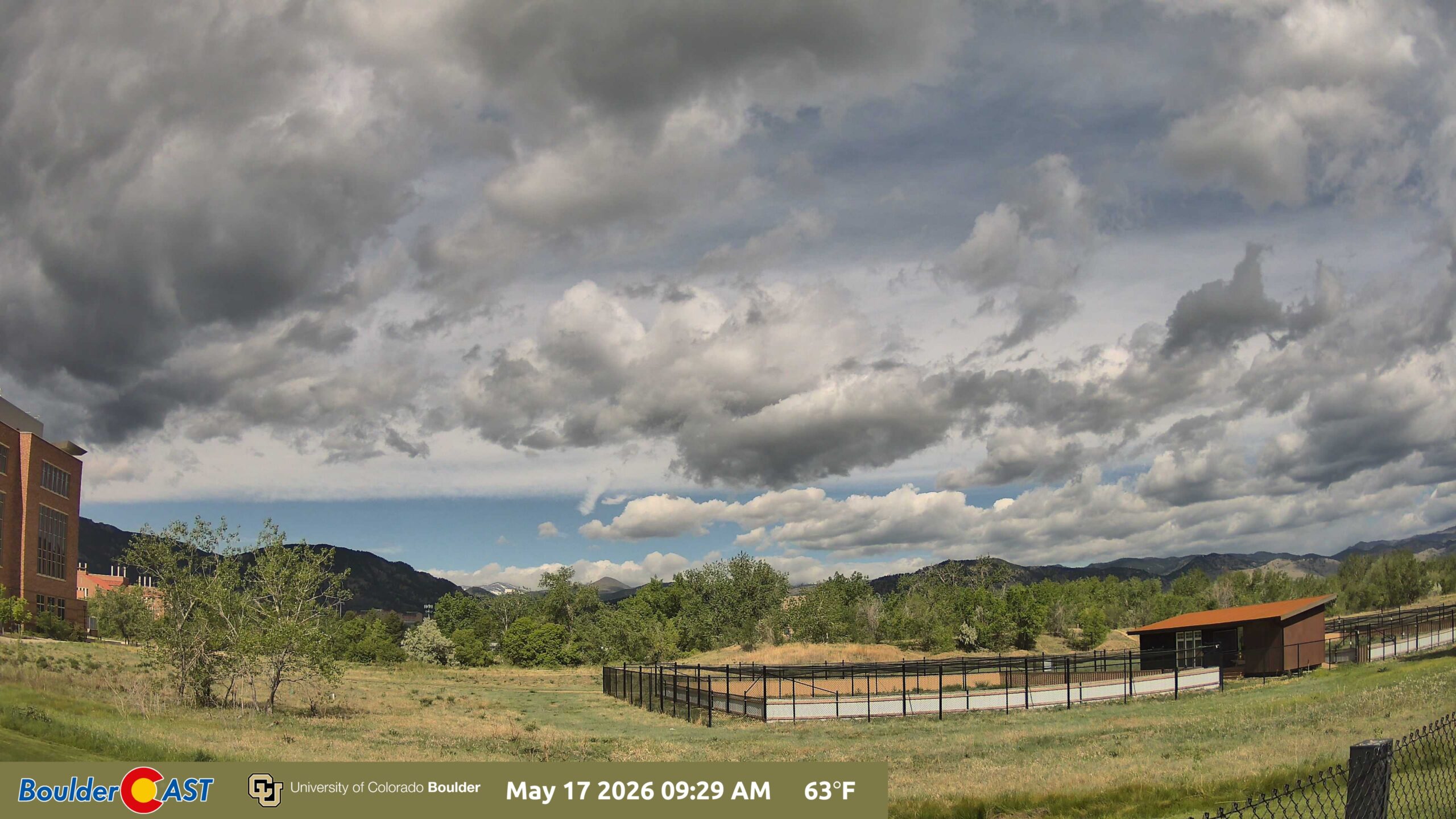
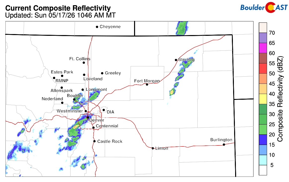
Rain showers and a few thunderstorms have invaded the Metro area as of midday — and even more are on the way tonight and tomorrow!
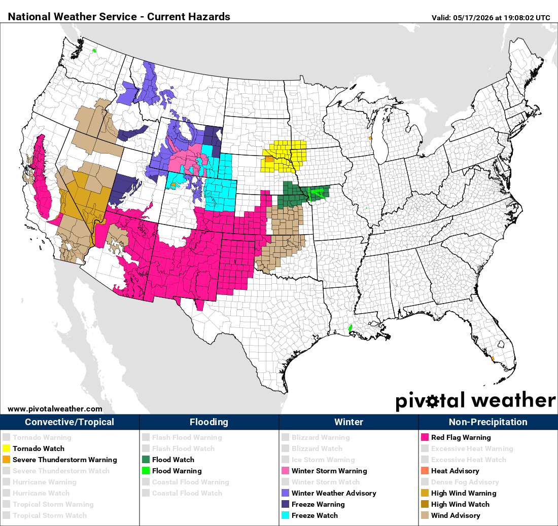
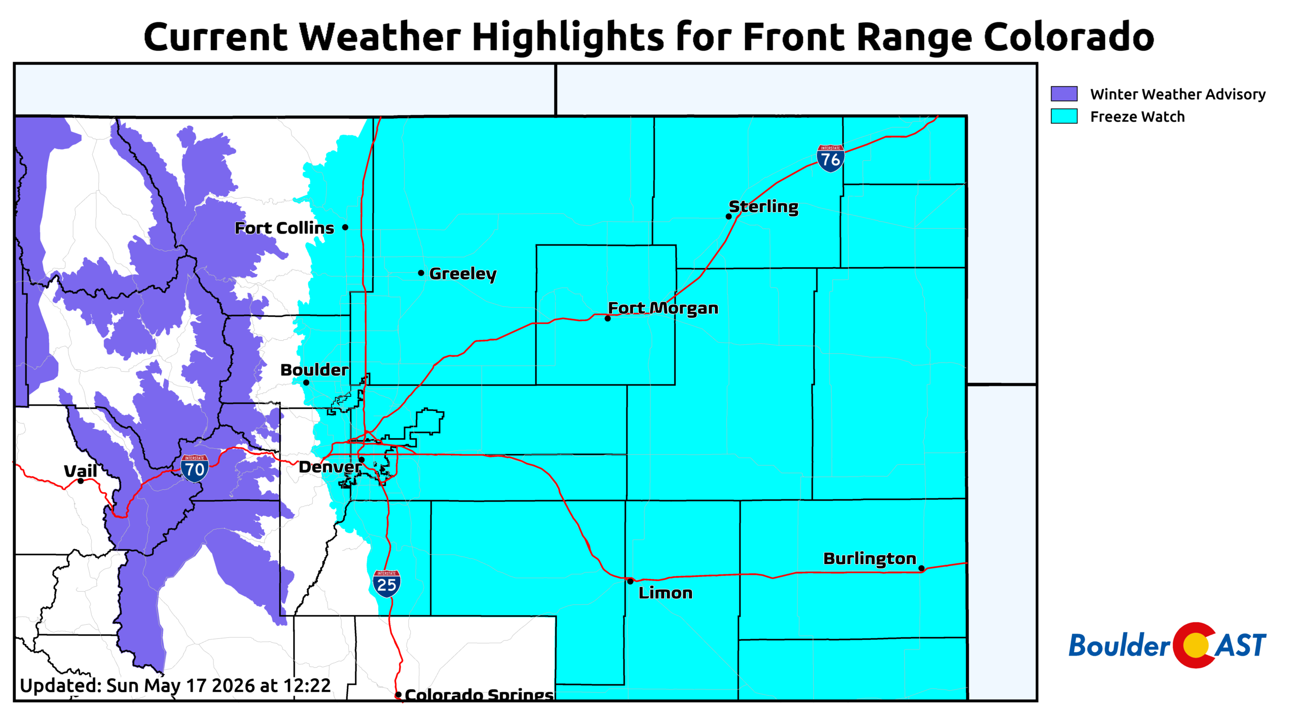
A quick glance at the current hazards map from the National Weather Service tells the story: winter weather and freeze alerts stretch from Colorado into Montana, while widespread wind and fire headlines plaster California through the Desert Southwest and into the Plains. The West is bracing for a major storm — and northern Colorado is squarely in its path again.
GOES-East visible imagery Sunday morning showed a sharply defined, rapidly deepening trough digging south and east toward Colorado.
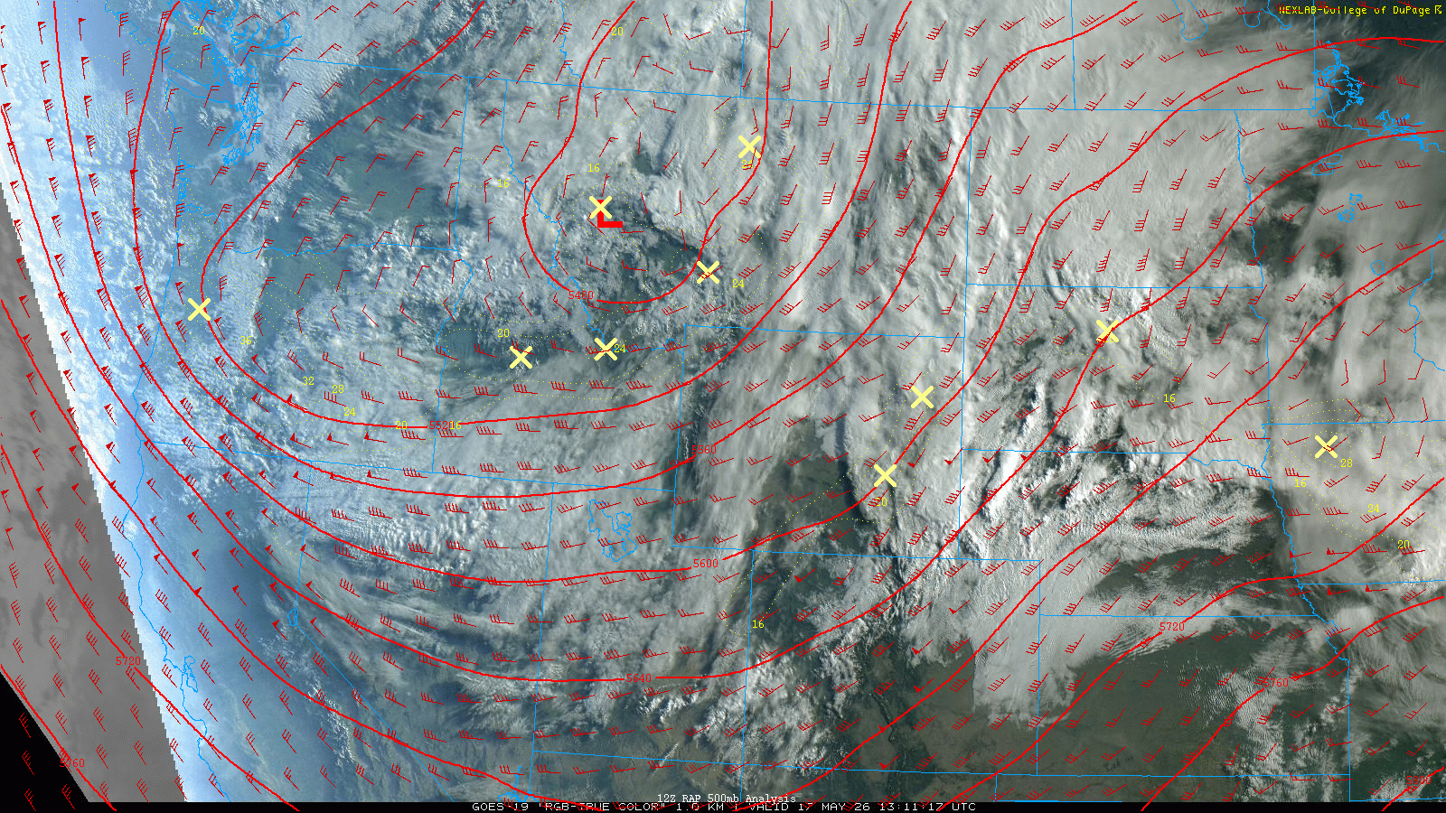
The system is currently double‑lobed, with the dominant low centered over Montana and a secondary circulation dropping into Oregon. That Oregon wave will become the primary player over the next 24 hours as it swings directly into Colorado, setting the stage for a widespread, drought‑helping soaking from Sunday night through Monday.
Model guidance is in solid agreement on the evolution of this southern lobe, but — as usual — the details matter. The strongest forcing and deepest moisture axis will align from Boulder County northward into southeast Wyoming. This corridor is favored for 1.0 to 2.0 inches of liquid, with Denver on the southern fringe but still likely to see 0.5 to 1.0 inches, possibly more if things extend farther south.
From a raw precipitation output, this storm looks similar to the big wet snowstorm we had about ten days ago.
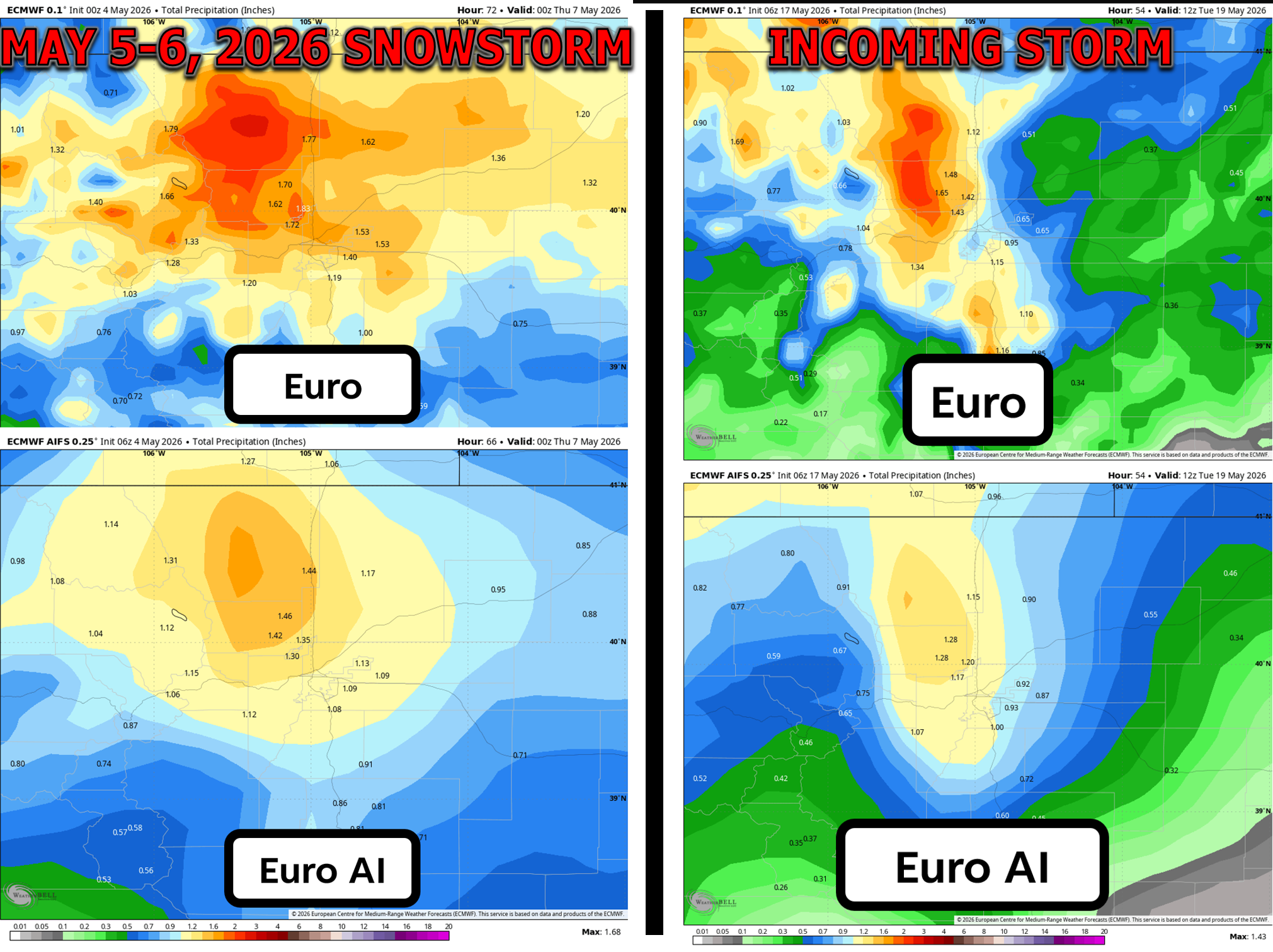
That’s about where the direct comparisons end though. The incoming storm will fortunately be several degrees warmer than the prior one, with nearly all of the precipitation falling as rain across the lower elevations. Hooray!
Sunday: Front Arrives, Severe Storms East, Showers West
An initial cold front has pushed into the Denver area early Sunday. Temperatures will peak late morning into early afternoon before clouds and showers increase. The front has stabilized the atmosphere over Boulder and Denver — a key factor preventing what otherwise could have been a significant severe weather day locally.
Instead, the severe threat will stay east in the I‑70 and I‑76 Corridor, where storms will be south of the front and can tap into richer instability. Expect large hail, damaging winds, and maybe a couple tornadoes in that zone later today.
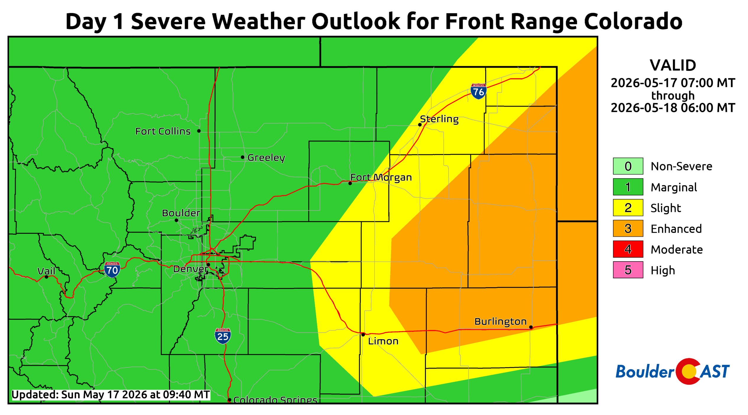
Along the Front Range, we’re looing at a ~50% chance of showers with a rumble of thunder from late morning through early evening. Activity will then taper off briefly this evening before the main event arrives Sunday night.
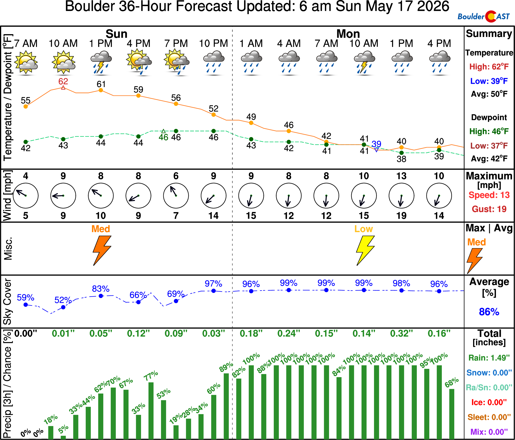
Sunday Night Into Monday: Widespread Rain, High‑Elevation Snow
A maturing surface and mid‑level low will enter northwest Colorado after midnight Sunday night. Ahead of it, southeasterly upslope strengthens and embedded waves of lift will spread across the Front Range. Widespread precipitation should begin around midnight from Boulder northward, expanding more into the Denver area by sunrise Monday.
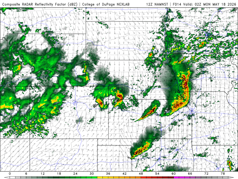
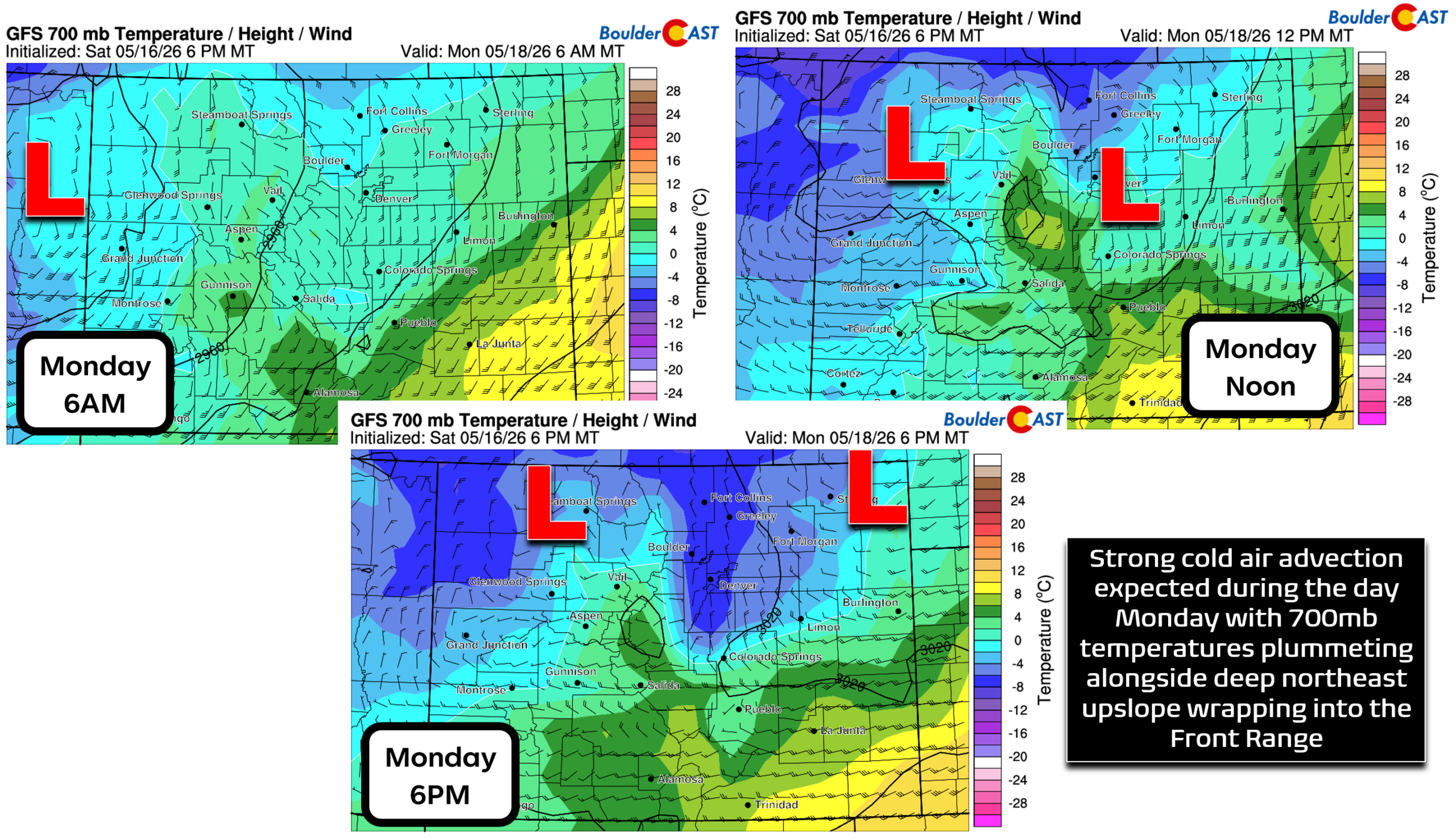
Snow levels start above 10,000 feet but fall steadily overnight. As lee cyclogenesis develops south of Denver on Monday, winds will turn more northeasterly for us, drawing in cooler air. By Monday afternoon, 700mb temperatures fall close to -5°C, cold enough for snow in the Foothills but marginal for the Urban Corridor.
At this point, we think many areas will see some wet snowflakes, especially in neighborhoods above 5,500 feet elevation during the second half of Monday. It may end up just being a mix of rain and snow for most, possibility flipping back and forth as convective showers pass through and drag the snowflakes down lower. Ultimately though, this storm is coming in several degrees warmer than the snowstorm we had earlier in the month and is not expected to cause any issues for the lower elevations in terms of any tree damage or power outages. It’s just too warm and much snow, let alone accumulation, is not likely. At worst we’re thinking maybe a brief coating of slush on the grassy surfaces with the more robust showers.
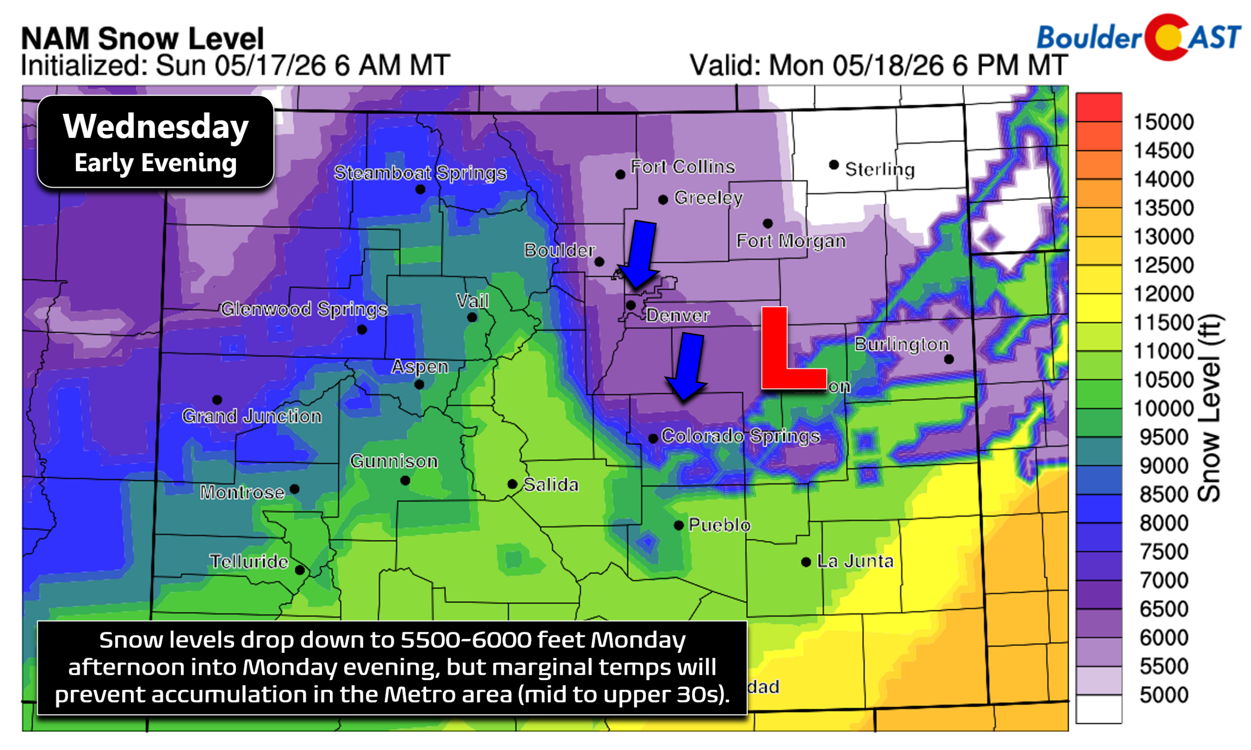
This will overwhelmingly be a rain event below ~6,500 feet, which is excellent news for drought recovery and tree owners.
Snowfall Expectations
It will be a different story in the higher terrain, though, where it will be cold enough for some snow to stick. Here’s our current thinking:
Mountains
- 8 to 16 inches along the Continental Divide from the Indian Peaks through RMNP
- Nearly all snow from late Sunday night onward
Foothills
- Above 8,000 ft: 3–8 inches
- 6,000–8,000 ft: Trace to 5 inches
- Highly elevation‑dependent, with sharp gradients over short distances
Urban Corridor (Boulder & Denver)
- Mostly rain, and a lot of it!
- Occasional wet flakes mixing on Monday during the day into the evening.
- Little to no accumulation
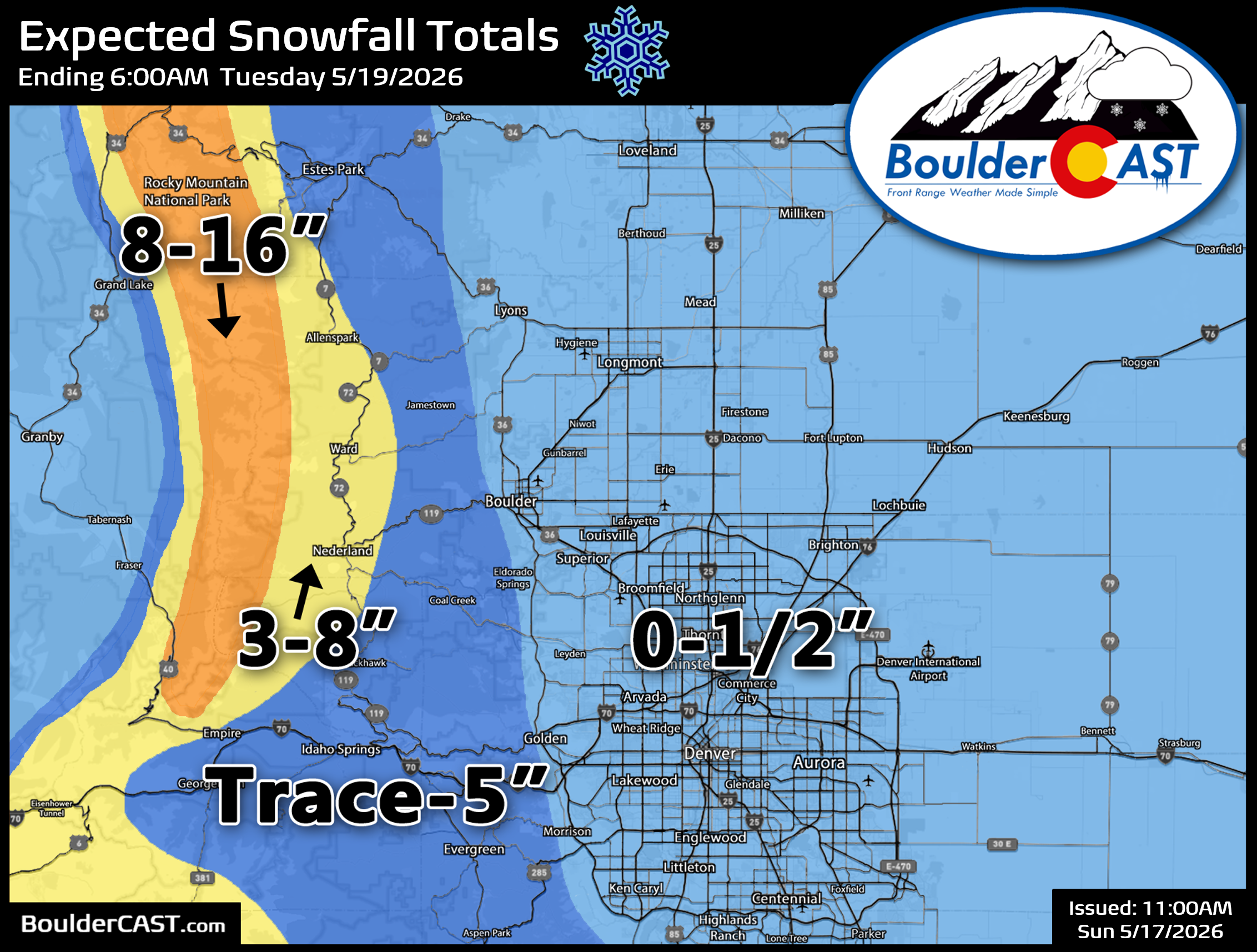
Key Uncertainties for Snow Totals
In our eyes, the biggest wildcard lies in the 7,000–9,000 foot Foothills zone. These two factors could boost totals:
- Longer duration of precipitation near end of storm: If precipitation lingers into Monday evening or overnight, snow totals will increase.
- Slightly colder profile: A mere 2–3°F colder would significantly expand accumulating snow potential.
We may need to refine our snowfall forecast map for the higher terrain as the storm approaches and models get a complete handle on these two facets of the storm. No changes for the lower elevations are expected.
Monday Night: A Non-Zero Freeze Risk
Finally, the last thing we need to cover is the potential for freezing temperatures Monday night after the precipitation tapers off and the storm ejects northeast into Nebraska. It looks like skies will indeed clear out after midnight and towards sunrise Tuesday which would allow for some radiational cooling. Though, it’s worth noting that some models hold onto enough low-level moisture and upslope to keep stratus locked in-place in and near the Foothills. There could also be some fog with so much rain having fallen from the storm.
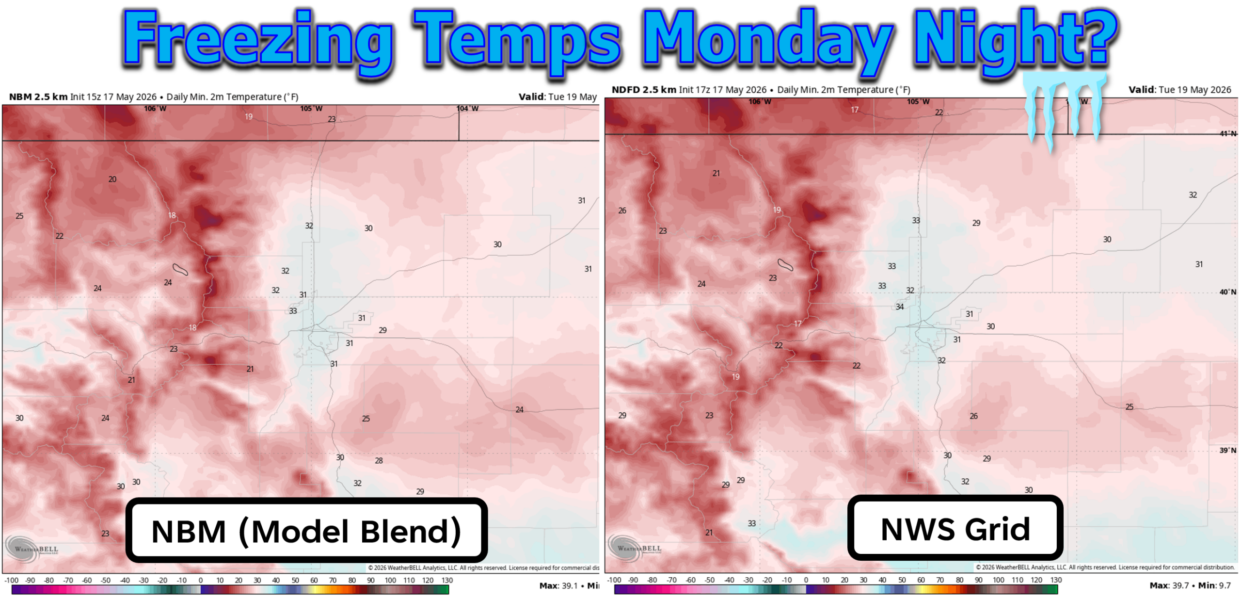
For now we’re forecasting lows generally between 30 and 36°F for the Boulder-Denver area. While some spots could briefly dip to or just below freezing, this isn’t going to be a hard freeze. It may not even be a freeze at all. Despite the doubt we have that a widespread, multi-hour freeze will occur, it’s probably worth taking precautions to protect sensitive plants, drain above ground pipes and disconnect hoses. You know the drill! Currently a Freeze Watch is in effect late Monday night into Tuesday morning.
Bottom Line: A Much‑Needed Soaker With Limited Impacts
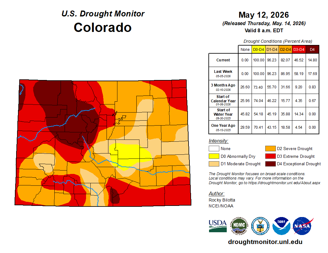
This storm is poised to deliver one of the more meaningful moisture events of our spring — and one that leans heavily toward beneficial rain rather than damaging snow for the lower elevations. Given our ongoing drought concerns and the persistent dryness of recent months, a widespread inch‑plus soaking across Boulder and Larimer Counties is exactly the kind of slow, efficient moisture we need right now. Similar to the last event, the deluge of moisture from this storm will likely knock the hardest hit bullseye zone down another drought level.
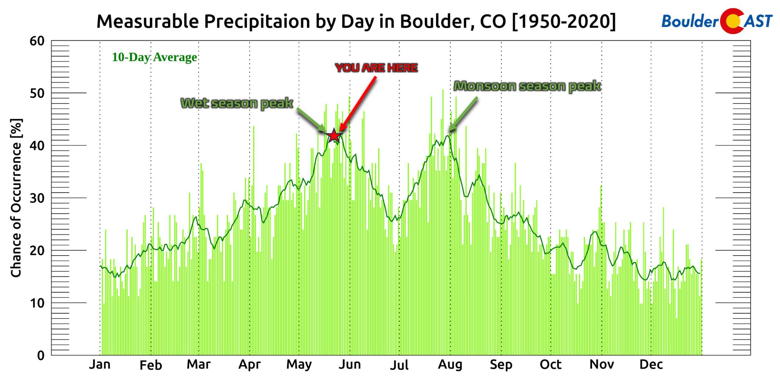
We’re currently situated right in the peak of our spring wet season. After this week, rain chances rapidly begin to decline climatologically heading into and through June until the arrival of the summer monsoon.
The higher terrain will see a healthy round of snow, but the Urban Corridor should experience minimal impacts beyond wet roads, cool temperatures, and a few novelty snowflakes. All told, this is a storm that will help far more than it hurts, unlike the last one. Enjoy the rain and snow, and check back for any updates. P.S. Please note that our usual “This Week in Colorado Weather” weekly outlook will be posted Tuesday morning this week due to the storm.
Spread the word, share our crazy Colorado weather:
Go Premium, get all the perks.
Daily Forecast Updates
Get our daily forecast discussion every morning delivered to your inbox.
All Our Model Data
Access to all our Colorado-centric high-resolution weather model graphics. Seriously — every one!
Ski & Hiking Forecasts
6-day forecasts for all the Colorado ski resorts, plus more than 120 hiking trails, including every 14er.
Smoke Forecasts
Wildfire smoke concentration predictions up to 72 hours into the future.
Exclusive Content
Weekend outlooks every Thursday, bonus storm updates, historical data and much more!
No Advertisements
Enjoy ad-free viewing on the entire site.


You must be logged in to post a comment.