⦁❶⦁ Strong thunderstorms last night produced localized flash flooding, hail, and incredible lightning across the area
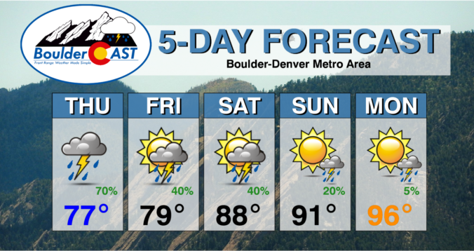
⦁❷⦁ Monsoon moisture peaks on Thursday with an excellent chance of more rain and cool temperatures
⦁❸⦁ Rain chances will decline slowly through Friday and the weekend as temperatures trend up, but flash flooding remains a concern
⦁❹⦁ We temporarily dry out early next week with temperatures returning to the middle 90s or higher by Monday
Do you want the latest BoulderCAST Daily forecast discussion delivered to your inbox every single morning? If so, join BoulderCAST Premium where we talk Boulder and Denver weather every single day.

R
ight on schedule, thunderstorms started blowing up around 9:30 PM last night across the area. One particularly big thunderstorm formed just to the west over the Foothills and sluggishly moved into Boulder producing extremely heavy rainfall and some nickel to quarter-sized hail. A Severe Thunderstorm Warning was issued for this cell, along with several Flash Flood Warnings for the Fourmile and Marshall Fire burn scars as heavy rainfall continued for more than one hour. The lightning show over Boulder and Denver was some of the most incredible we’ve seen in the last decade or more. Near-continuous lightning like that is not common in our neck of the woods, even in the heart of monsoon season!
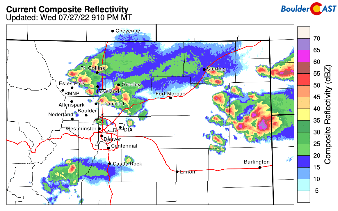
Radar animation from late Wednesday evening as a severe thunderstorm hit Boulder with hail and flooding rains
As much as 2.75″ of rain fell in about an hour from this cell as it moved through at a snail’s pace. Urban flooding of the streets and creeks within Boulder was reported during this time, including some flood damage unfortunately.
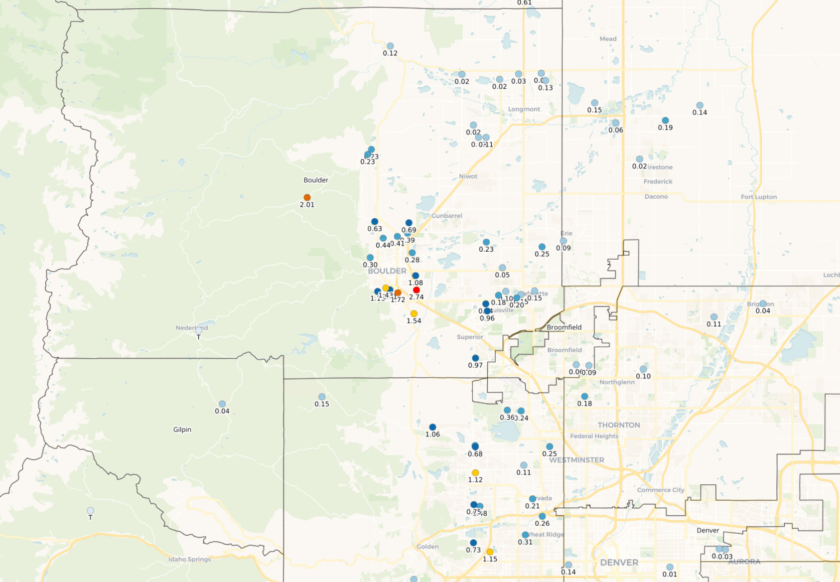
Rainfall totals from Wednesday and Wednesday night
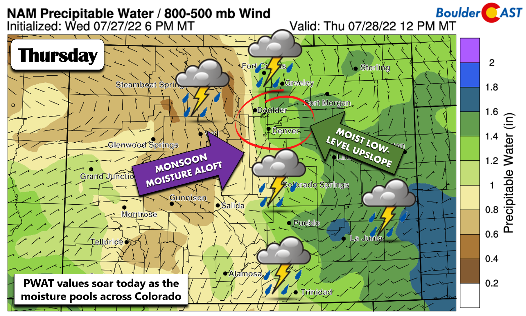
The wet weather continues in full-force for this Thursday as all of the ingredients have come together for widespread rainfall to develop through the day today.
- A cold front moved through last night ushering in low-level moisture and upslope — it’s juicy out there, folks!
- Monsoon moisture has poured into the area from the west and southwest at the mid-levels
- A weak disturbance or two will be traversing the area through the morning and afternoon as well to help offer added lift
Precipitable water values will be some of the highest yet in 2022 today —upwards of 1.3″ in the Metro area and 0.75″ in the Mountains.
Given the obvious abundance of moisture in-play, flash flooding will be the primary concern again today with steering winds aloft remaining on the weaker side (though not as weak as there were last night). Storms will be directed by the northwest flow aloft — pushing things from northwest to southeast slowly through the day. Any of the cells today will be capable of producing heavy rain, some lightning and possibly small hail.
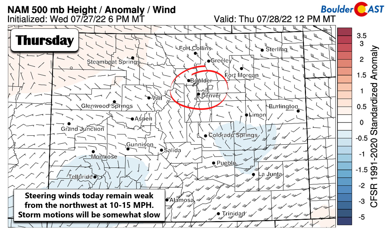
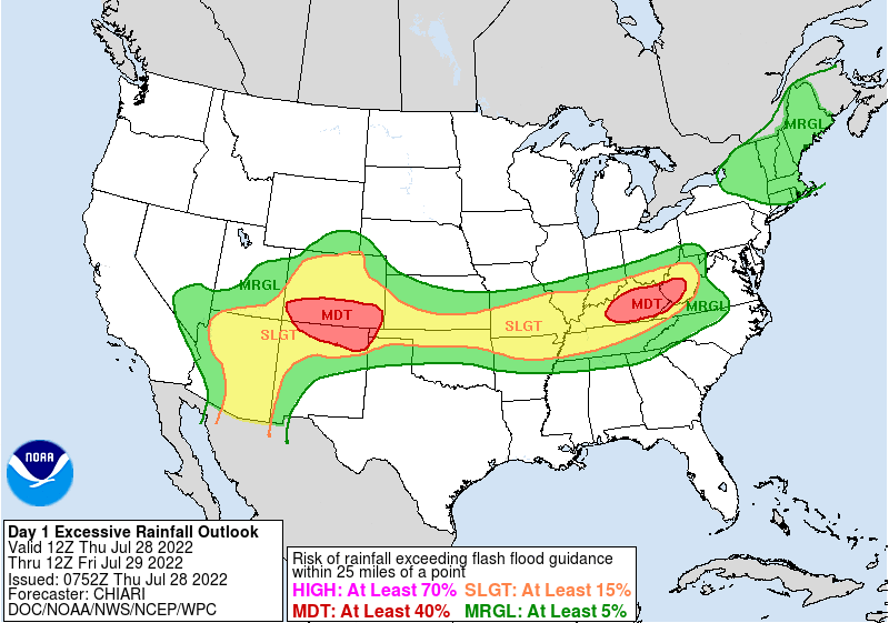
The NOAA Weather Prediction Center still includes the entire Front Range at Slight Risk (15%) for flooding rainfall today. An even greater risk is noted across the southern third of Colorado where the atmosphere will be even richer in monsoon moisture.
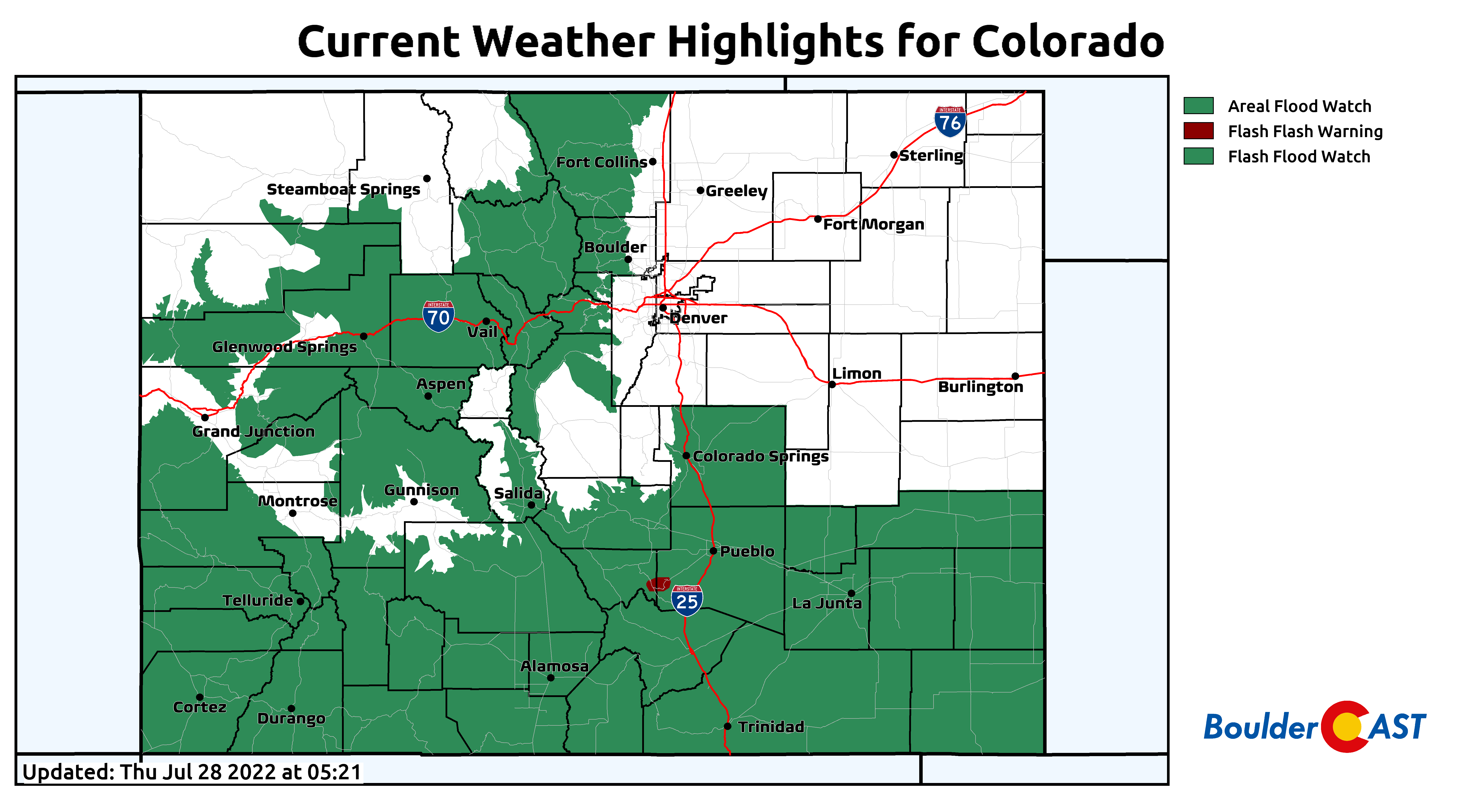
Flash Flood Watches are in effect for the higher terrain to the west. The greatest concern, as usual, will be across the burn scars. Though there are no highlights posted, the lower elevations are also at risk today — just a lesser risk.
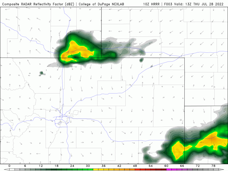
Here’s a quick look at the HRRR model-simulated radar animation for today. Storms develop first over the higher terrain around midday and then move into the Denver area during the afternoon and evening.
The best chance of storms today will be from 1PM to 9PM, but some rain before or after is not out of the question given the ingredients at hand. All of the clouds and wet weather around will keep temperatures cool with most of us topping out in the mid to upper 70s under overcast skies. Not bad at all!
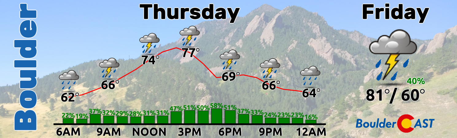
Monsoon moisture will stick around through Friday and into the weekend, though it will be declining slightly each day leading to lessening storm coverage and a reduction in the overall flood risk. These days will be more typical summertime affairs with morning sunshine giving way to scattered afternoon/evening clouds and storms. We have the chance of rain at 40% on both Friday and Saturday. With upper-level winds remaining weak, localized flash flooding risk will still be a possible headline.
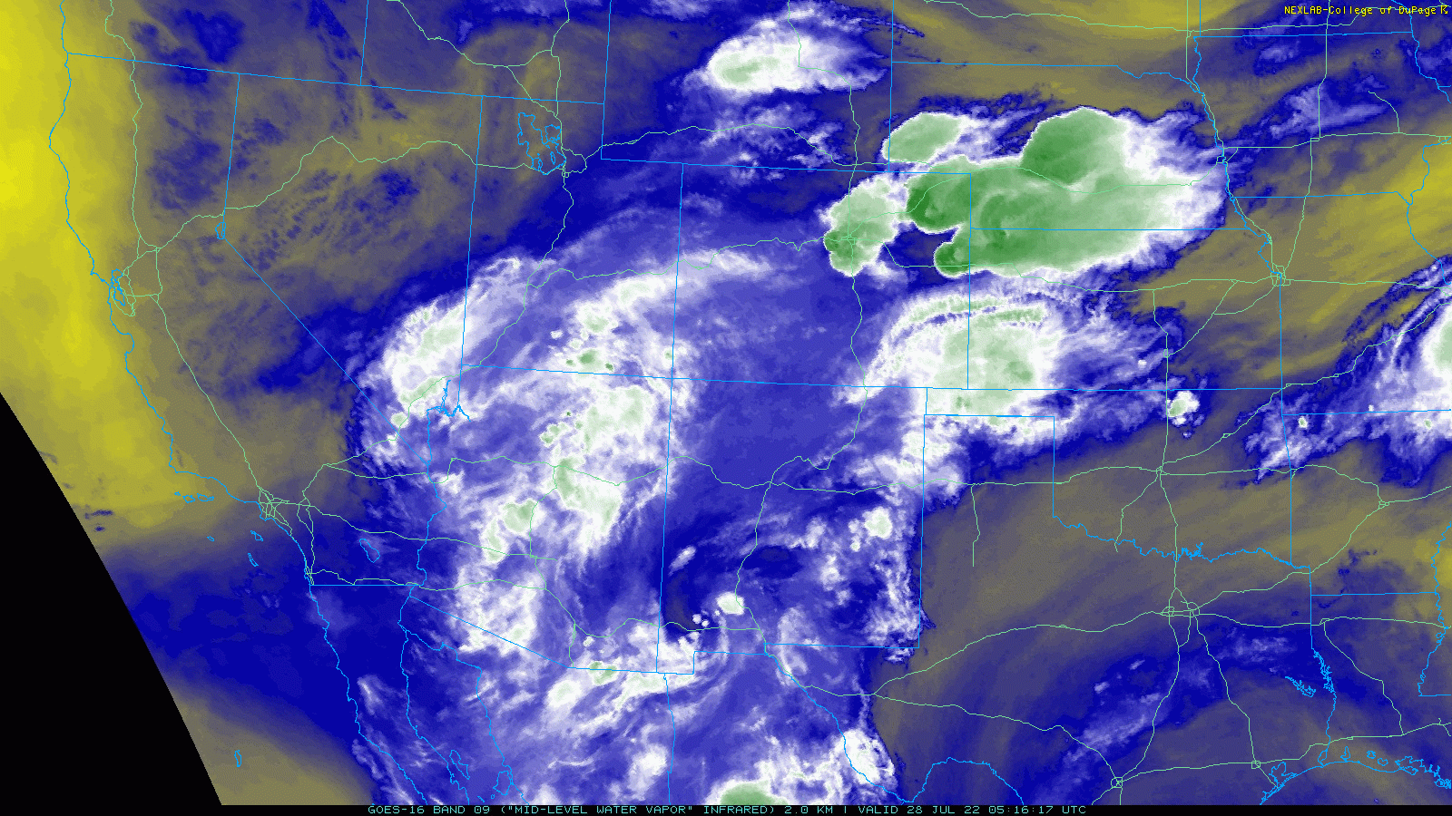
GOES-East mid-level water vapor animation from Thursday morning showing the monsoon pipeline into Colorado from Mexico
By Sunday and especially Monday, the pattern begins to shift somewhat as high pressure slides into Colorado from the West Coast. This will ultimately nix the flow of monsoon moisture into eastern Colorado temporarily and act to suppress storms from developing. However, long-range model guidance is in good agreement that this ridge will only stick around for a day or two before shifting further east. Thus, while there will be a few hot and drier days starting Sunday and continuing into early next week, we do expect the rainy weather to return in short order.
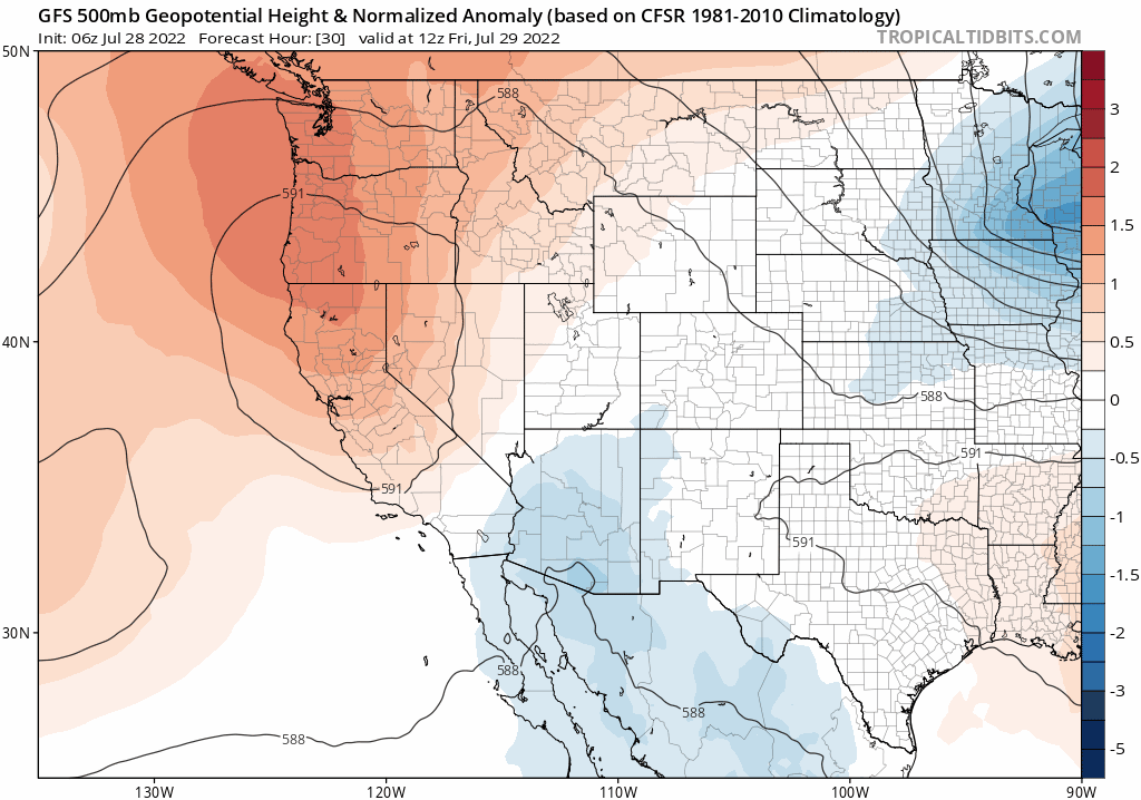
GFS 500mb height anomaly forecast animation from Saturday into Tuesday showing the ridge of high pressure migrating from California, across Colorado and then into the Southern Plains
Here’s a look at the outlook for the weekend ahead. Temperatures will be trending up as rain chances trend down. Enjoy the wet weather while you can — we all know how fickle Mother Nature can be here…

Remember, our weekend outlooks are Premium content. Periodically, we open this discussion up to all of our readers. Today is one of those days!
Help support our team of Front Range weather bloggers by joining BoulderCAST Premium. We talk Boulder and Denver weather every single day. Sign up now to get access to our daily forecast discussions each morning, complete six-day skiing and hiking forecasts powered by machine learning, first-class access to all our Colorado-centric high-resolution weather graphics, bonus storm updates and much more! Or not, we just appreciate your readership!


You must be logged in to post a comment.