
Here’s a quick and colorful rundown of our weather during February 2021 and how it relates to climatology.
Category: Verification (Page 22 of 51)
These posts take a look back at recent weather events, like snow storms or severe weather outbreaks, and evaluate how the forecast played out. We evaluate how well the models predicted what actually occurred, and offer insight into what can be learned and applied moving forward.
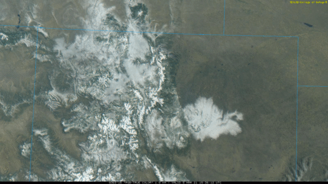
The first “warm” spring storm of the year moved across Colorado from the southwest on Thursday. Temperatures were borderline with this system, and many locations saw a trace or less of snow with rain the dominant precipitation type. However, the Foothills, Palmer Divide and southeast suburbs of Denver did see a little snow. Let’s take a look at the totals.
About half of the Front Range received snowfall right in line with our forecast last night, while the other half saw incredible snowfall amounts of a foot or more! What caused such an explosion of heavy snow in the heart of Denver last night? Let’s take a look.

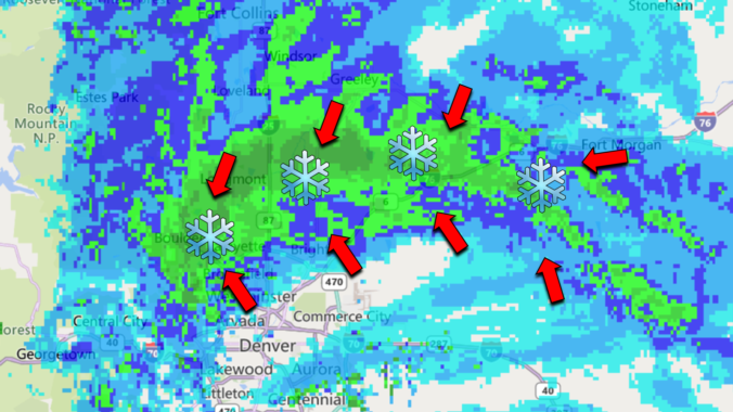
A weak storm and associated jet streak moved across Colorado on the evening of February 20th producing bands of moderate snowfall for a brief period. Southeastern portions of the Denver Metro area were hit hardest. Let’s take a look at the totals.
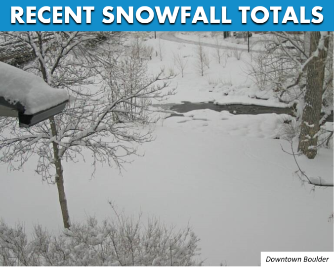
Finally, we got more snow than south Texas and Louisiana! The atmosphere was primed for an explosion of snow Wednesday evening in the Foothills and western Denver Metro area and it did not disappoint this time. Favorable conditions for convective heavy showers for a short window yesterday produced up to a foot of snow in some areas. Let’s take a quick look back at the setup and snowfall totals from across the region.
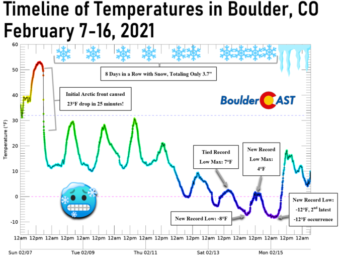
No one fully expected the Arctic airmass that arrived last Sunday evening, a solid nine days ago, to remain entrenched across the Denver Metro area for this long…but it did! We take a look back at the series of events as they unfolded over the last week, including the first regional wildfires of 2021, two dollops of light snow and the coldest temperatures for our area since 2014.
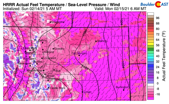
Snowfall amounts over the last few days were largely disappointing across the Denver Metro area, mostly coming in below expectations. We discuss what happened to all the snow, look ahead to the coldest temperatures which are still to come and discuss why Sunday night will actually be warmer than last night in some locations.
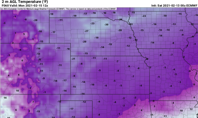
You think it was cold the last few days? Just wait and see what is coming! The coldest temperatures in nearly a decade have settled into the Front Range and it’s only going to get colder. We’re also tracking a rather unique light snowfall event that will spread accumulating snow across the area Saturday afternoon into Sunday. We discuss just how cold it will get and look at the snowfall amounts headed our way.

Live View of Boulder

Current Conditions

Live Radar

Recent Premium Posts

This Week in Colorado Weather: December 15, 2025
The Front Range has been defined by relentless warmth, gusty winds, and bone‑dry …
BoulderCAST Daily – Sun 12/14/25 | A warmup after the chilly yesterday afternoon
🌡️ Warmth Returns with no sight of snow: Highs return close to 60 …
Announcing the 2025 First Snowfall Contest Winners
Apologies for the delay, but with Boulder’s record-shattering latest first snow of the …
3-Day Forecast

Trending Content

© 2025 Front Range Weather, LLC