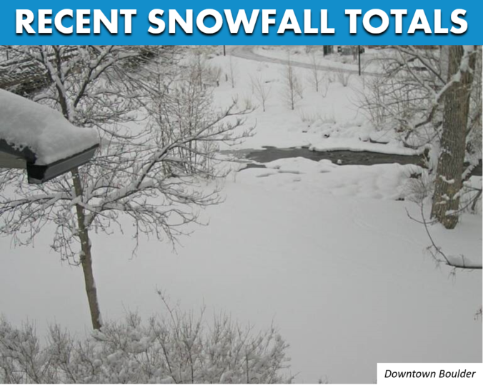
Finally, we got more snow than south Texas and Louisiana! The atmosphere was primed for an explosion of snow Wednesday evening in the Foothills and western Denver Metro area and it did not disappoint this time. Favorable conditions for convective heavy showers for a short window yesterday produced up to a foot of snow in some areas. Let’s take a quick look back at the setup and snowfall totals from across the region.
L
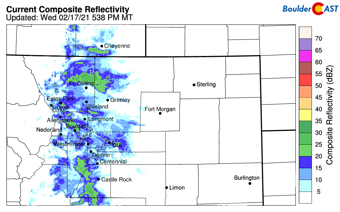
ast night’s wallop of heavy snow which impacted portions of the Denver Metro area may have caught some folks off guard, but not you of course! The potential for heavy convective snow showers was clearly laid out in our forecast issued Wednesday morning. In that forecast update, we warned you of what would likely unfold later in the day. Though there was some uncertainty into how heavy and persistent the convective showers would be, we had a feeling that the bomb was getting ready to explode after seeing the overhead temperature profile indicated by the models for Wednesday evening. With an extremely strong and deep vertical temperature gradient all the way up to the stratosphere, all we needed was a tiny trigger to displace the surface air upwards. This came in the form of shallow easterly flow at the surface which interacted with the terrain most impressively right along the steep interface with the first line of Foothills. This resulted in saturated surface air, which when lifted by the upslope, found itself warmer than all surrounding air. This was the seed for last night’s convection which resulted in BIG snow totals for some areas.
The profile overhead today is a dangerous one w/ a rapid decrease in temps all the way up to the stratosphere. The low-level upslope interacting w/ the terrain *should* be enough to fire pockets of heavy snow from late afternoon thru evening near & west of the Boulder area #cowx pic.twitter.com/06xR9Rz3MR
— BoulderCAST Weather (@BoulderCAST) February 17, 2021
The convective snow showers really got cranking Wednesday evening and lingered until after midnight in some areas.
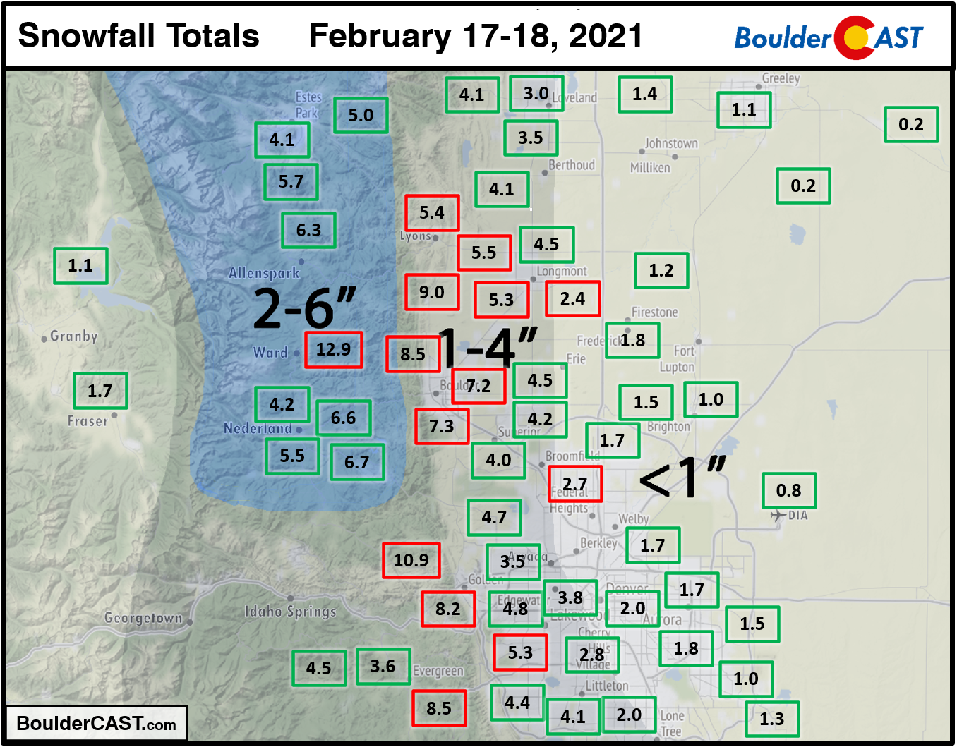
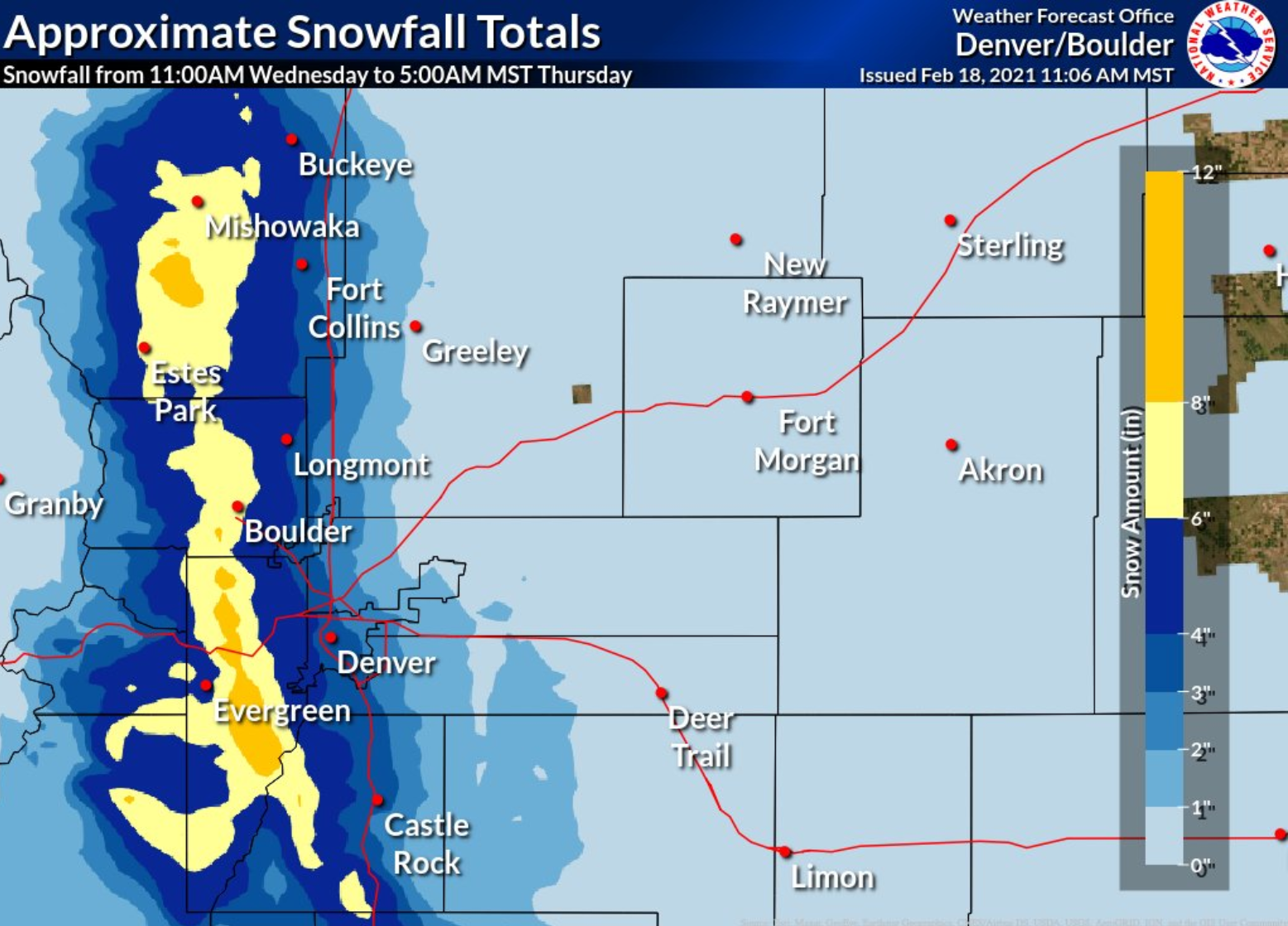
When it was all said and done, the western Denver Metro and Foothills had picked up anywhere from 4 to 12″ of new snow, with a focus right along the base of the Foothills and a few miles east or west. Boulder did quite well from this storm, picking up 7 to 9″ across the city. Depending on exactly how much snow fell before the time cut-off, we could be looking at a new daily snowfall record for February 18th in Boulder. Largely missing out on the fireworks show, areas east of Interstate 25 reported only a dusting up to 2″.
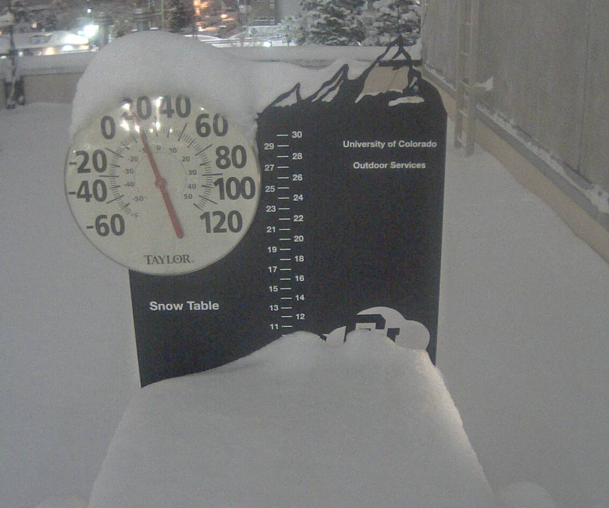
The snowy view from CU Boulder Thursday morning
Shown below is our original snowfall forecast map with actual storm totals overlaid in boxes. Green boxes indicate that our forecast verified to within one inch of the observed snowfall. Red did not. Not a bad forecast overall, but certainly eastern Boulder and Jefferson Counties exceeded expectations. With snow ratios of 15:1 to 20:1 reported, these areas picked up a much-needed half inch of moisture! It’s just too bad that it wasn’t more widespread.
Continue to 2020-2021 Winter Snow Summary
And here’s a nice interpolated snowfall analysis graphic from the National Weather Service for the storm:
Our next chance of snowfall comes late Saturday into Saturday night as a quick trough and associated jet-streak drop across Colorado. Chances are this will be a lighter snowfall event, but you just never know with the jet involved. Stay tuned and hang in there…warmer temperatures are coming next week!
*Sale Ends Friday* Help support BoulderCAST and save 25% with promo code FRIGID
Help support our team of Front Range weather bloggers by joining BoulderCAST Premium. We talk Boulder and Denver weather every single day. Sign up now to get access to our daily forecast discussions each morning, complete six-day skiing and hiking forecasts powered by machine learning, first-class access to all our Colorado-centric high-resolution weather graphics, bonus storm updates and much more! Or not, we just appreciate your readership!

.


You must be logged in to post a comment.