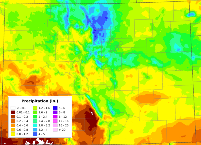
May has finally snapped the atmosphere out of its months‑long bone dry spell, and the Front Range is making up for lost time fast. A destructive early‑May snow event, followed by a second, well‑timed upslope system just ten days later, has pushed Boulder’s May precipitation total beyond everything we managed to scrape together through fall, winter, and early spring combined. We dig into what triggered the pattern reversal, how much moisture different parts of the region have banked, what this burst of wet weather actually means for our entrenched drought, and whether the upcoming Memorial Day weekend warm‑up signals a slide back toward a more aggressive drying trend.
Category: Verification (Page 1 of 53)
These posts take a look back at recent weather events, like snow storms or severe weather outbreaks, and evaluate how the forecast played out. We evaluate how well the models predicted what actually occurred, and offer insight into what can be learned and applied moving forward.
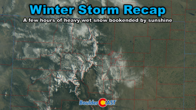
Friday delivered one of those classic Colorado curveballs. The storm showed up fashionably late, then hit harder than expected once it finally got going. It left behind a fast‑melting blanket of spring snow and cleared out almost as quickly as it arrived. In today’s update, we break down the wild midday burst of snow, take a look at how the forecast held up, and highlight why the real headline may have been what happened — or didn’t happen — after the flakes stopped.
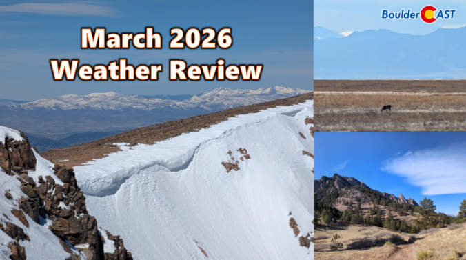
March 2026 delivered one of Colorado’s most jarring spring months on record with temperatures skyrocketing to unprecedented levels as the region shattered long‑standing warmth records for weeks on end. Western snowpack rapidly declined during this multi-week heatwave, reaching historic lows in a majority of basins across the West, including every major basin in Colorado. Brief interjections of snow occurred during the month across the Front Range, but most the state ended with well below normal precipitation. Here’s a quick and colorful graphical recap of our weather during March and how it relates to climatology.

March is supposed to bring hints of spring, not the kind of heat that rewrites the record books and eats away snowpack like it’s June. Yet here we are again, recapping another weekend of astonishing warmth, more broken records, and a dire Westwide snowpack situation that has become genuinely alarming. We walk through just how extreme the heatwave has been, why Colorado’s water outlook is now in uncharted territory, and what the coming early April pattern shift might (or might not) do to slow the damage that’s already been done. Let’s dig in.

Saturday’s storm didn’t quite live up to its wind hype, but it still delivered a sharp overnight front and a quick burst of convective snow before sunrise on Sunday.

Our late‑week spring storm delivered a far more impressive performance than early models suggested. What looked like a modest, fast‑moving system slowed down, reorganized, and ultimately dumped a surprisingly healthy swath of heavy, wet snow across the Front Range. From booming Foothills totals to a rare over‑performance at DIA, this one had plenty of action worth unpacking. Let’s take a look at how the storm evolved, where our forecast missed the mark, and just how quickly we’ll be warming back into the 70s.
As February limps toward the finish line, Colorado’s “winter” continues to behave like anything but. Last week the Mountains cashed in on a burst of Pacific moisture while the Denver Metro area stayed stubbornly snow‑starved. The week ahead brings more of that same split personality—warmth, wind, fire danger, and another round of Mountain snow. We break down the lopsided snow totals from last week, the updated but still troubling snowpack numbers, and discuss why this week will be so darn warm and windy again in the Front Range.
Much-needed snow piled up across all of the Mountains of Colorado this week, but once again Boulder and Denver missed out on almost all of the action.

Live View of Boulder

Current Conditions

Live Radar

Latest Smoke Forecast

Recent Premium Posts

BoulderCAST Daily – Fri 07/31/26 | Marginal Risk of Severe Storms with Smoke and Haze
🌧️ Isolated Storms — This afternoon and evening, with a marginal risk of …
BoulderCAST Daily – Wed 07/29/26 | Final Storm‑Filled Afternoon Before an Expanding Desert Southwest Heat Dome Takes Over
🌧️ Lingering Monsoon Moisture — Lingering Tap One last day of beneficial rainfall …
BoulderCAST Daily – Tue 07/28/26 | Front Range Primed for Widespread Thunderstorms as Monsoon Reloads
🌩️ Monsoon moisture surge — Deep moisture availability today, both aloft and at …
3-Day Forecast

Trending Content

© 2026 Front Range Weather, LLC