


A surge of true monsoon moisture is finally breaking through the Front Range’s persistent dry shield. After Tuesday night’s northern‑tier storms offered a preview, the next two days will bring the real deal: widespread convection, highly anomalous moisture, torrential rainfall rates, and the best shot at real rain we’ve had in weeks. If you’ve been waiting for a break from the seemingly never-ending heat of summer and a return of stormy skies, the next few days are poised to deliver.
What You Need to Know
- 🌧️ Northern Front Range got soaked Tuesday evening, with Longmont-to-Fort Collins getting hit with slow‑moving, moisture‑rich storms while Denver and Boulder stayed mostly dry due to poor flow alignment.
- 🌀 Monsoon moisture set to finally connect with Denver, driven by a westerly flow shift and soupy remnants of Tropical Storm Elida—pushing moisture values to 3–5σ above normal across CO/WY.
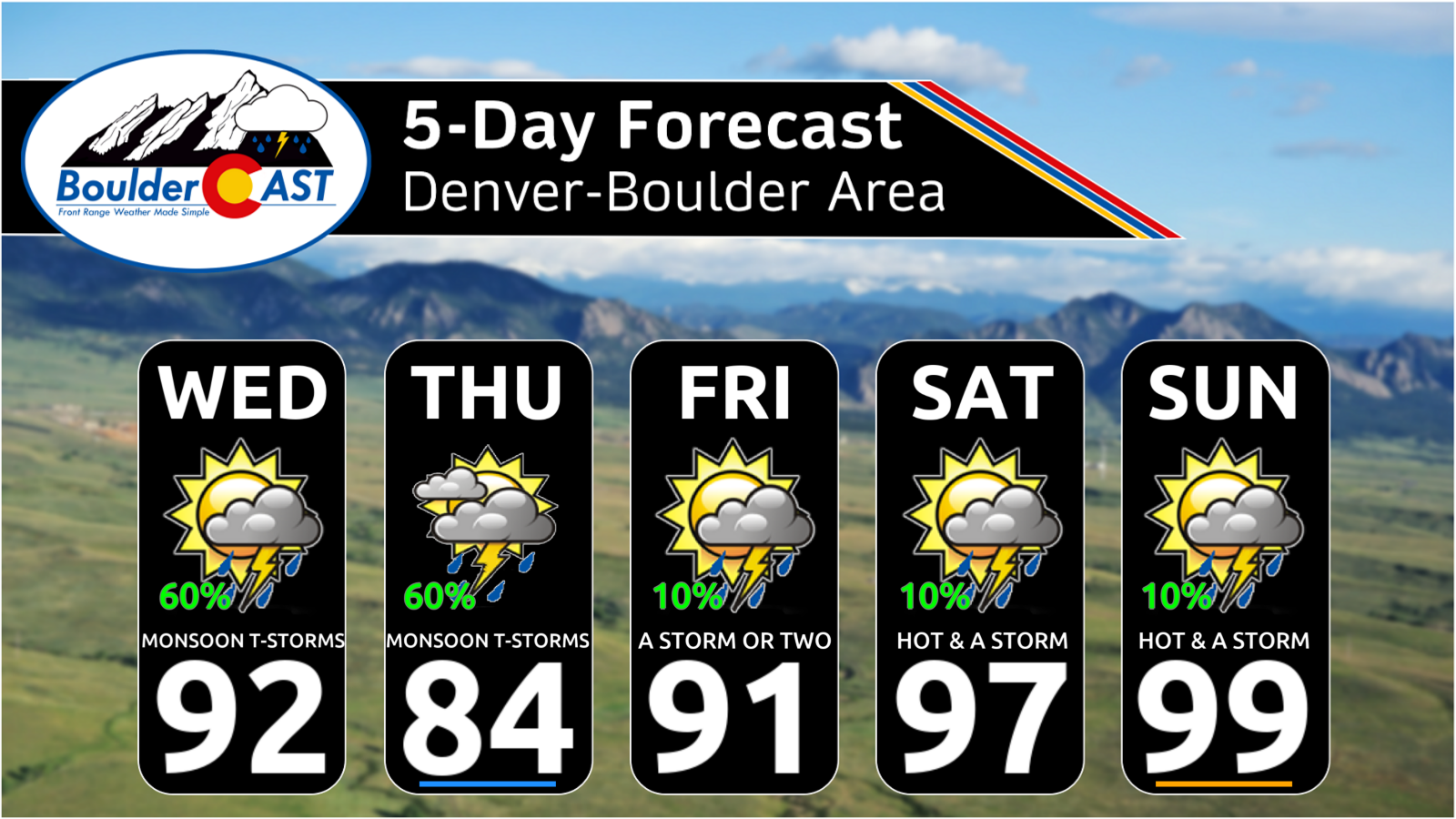
- ⛈️ Widespread storms Wednesday–Thursday, featuring efficient rainfall, gusty outflows, and localized flooding.
- 📈 Rain totals of 0.25–0.75″ for most, but repeated activity may deliver 2″+ in localized corridors.
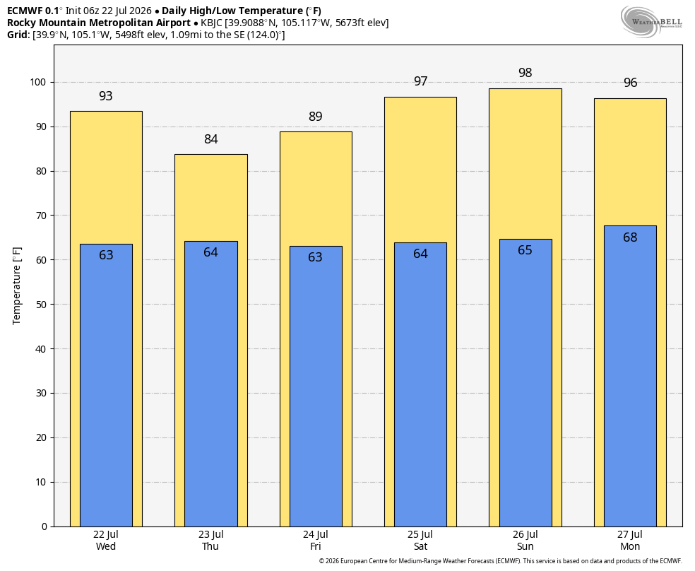
- 🧊 High temperatures finally fall below 90° on Thursday for the first time in nearly two weeks.
- 🔥 Moisture fades Friday heading into a HOT weekend: storms retreat mostly to the high terrain while the Metro area bakes in the mid to upper 90s.

Go Premium, get all the perks.
Daily Forecast Updates
Get our daily forecast discussion every morning delivered to your inbox.
All Our Model Data
Access to all our Colorado-centric high-resolution weather model graphics. Seriously — every one!
Ski & Hiking Forecasts
6-day forecasts for all the Colorado ski resorts, plus more than 120 hiking trails, including every 14er.
Smoke Forecasts
Wildfire smoke concentration predictions up to 72 hours into the future.
Exclusive Content
Weekend outlooks every Thursday, bonus storm updates, historical data and much more!
No Advertisements
Enjoy ad-free viewing on the entire site.
Tuesday Night: A Preview of What’s to Come?
Heavy monsoon rains pulsed across the northern Front Range Tuesday evening, but the Denver–Boulder corridor largely dodged the action thanks to poor flow alignment that kept storms displaced north. Instead, the atmosphere unloaded on Longmont, Loveland, and Fort Collins, where deep moisture and slow storm motions produced efficient rainfall.
Radar lit up like a Christmas tree northeast of Boulder just after 8PM, with persistent convection lingering near Fort Collins through midnight.
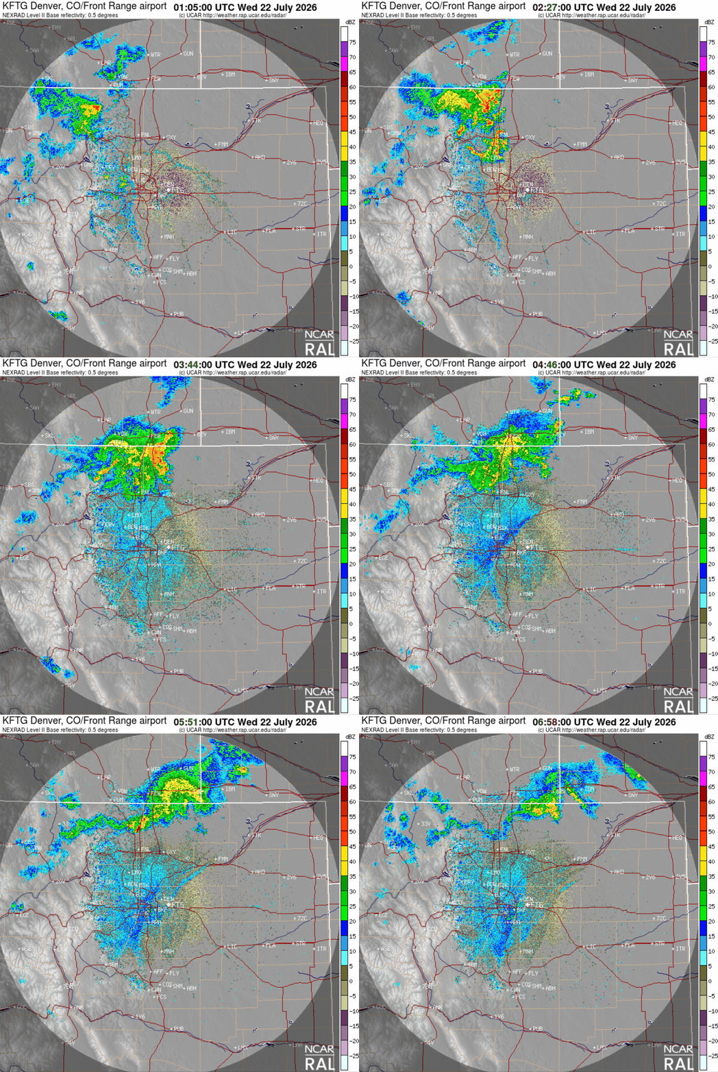
Observed radar animation from Tuesday evening showing the explosion of storms in the northern Front Range.
Rainfall was highly variable but impressive: Longmont picked up around 0.75″, while pockets of Larimer County exceeded 2″ under repeated downpours.
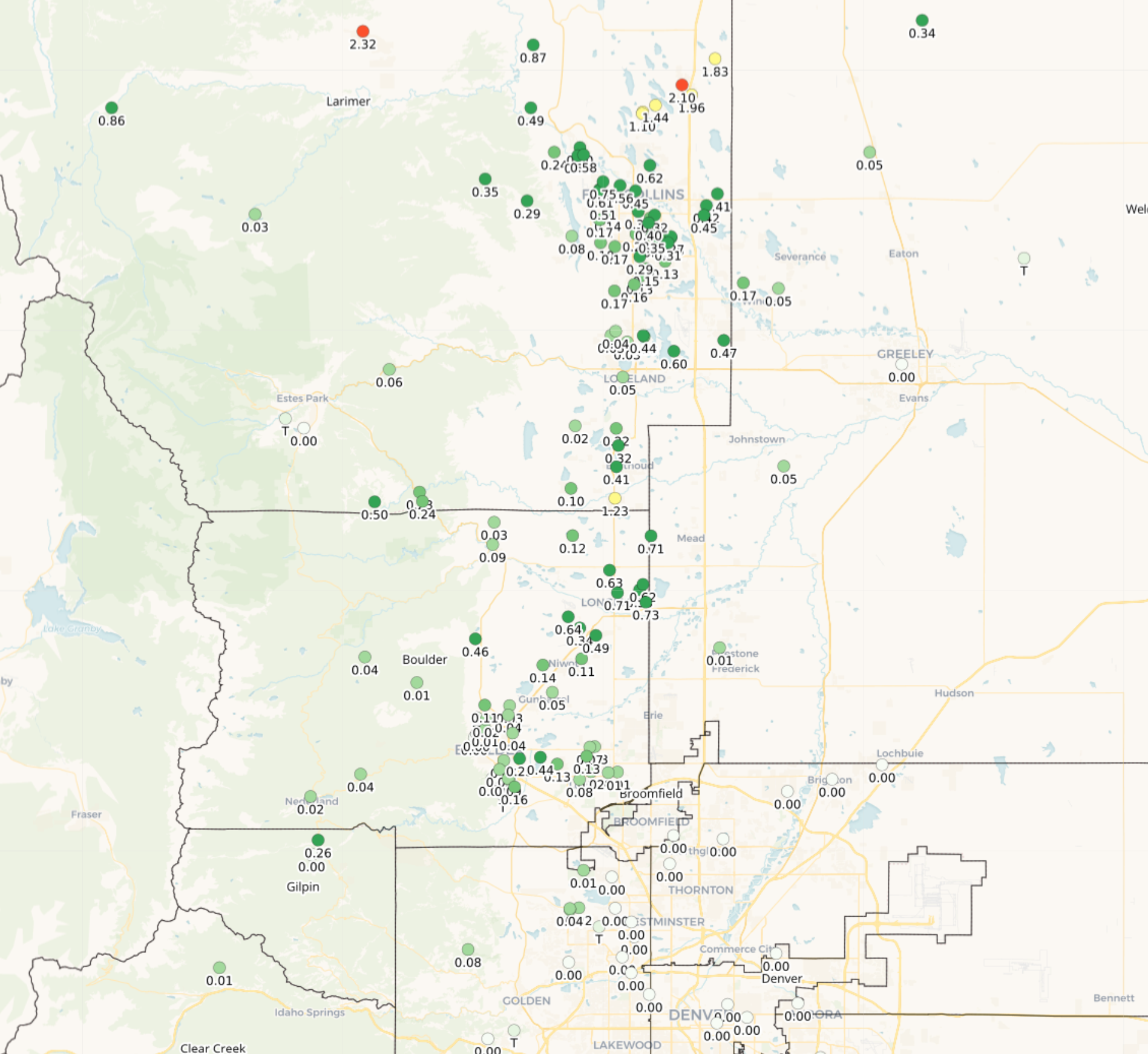
Rainfall totals from Tuesday evening across the northern Front Range.
The broader monsoon has been firing across the Desert Southwest for more than a week, generating dangerous flash flooding in the hardest‑hit areas. Meanwhile, the Front Range has stayed mostly disconnected thanks to stubborn dry easterly flow. That changes today. Steering winds turn westerly, finally opening the door for a tongue of monsoon moisture to surge directly into northern Colorado. Precipitable water values will spike to ~3σ above normal in Denver Wednesday and Thursday, with 5σ anomalies swinging across Wyoming—this is moisture tied to remnants of Tropical Storm Elida that rode north along the Baja.
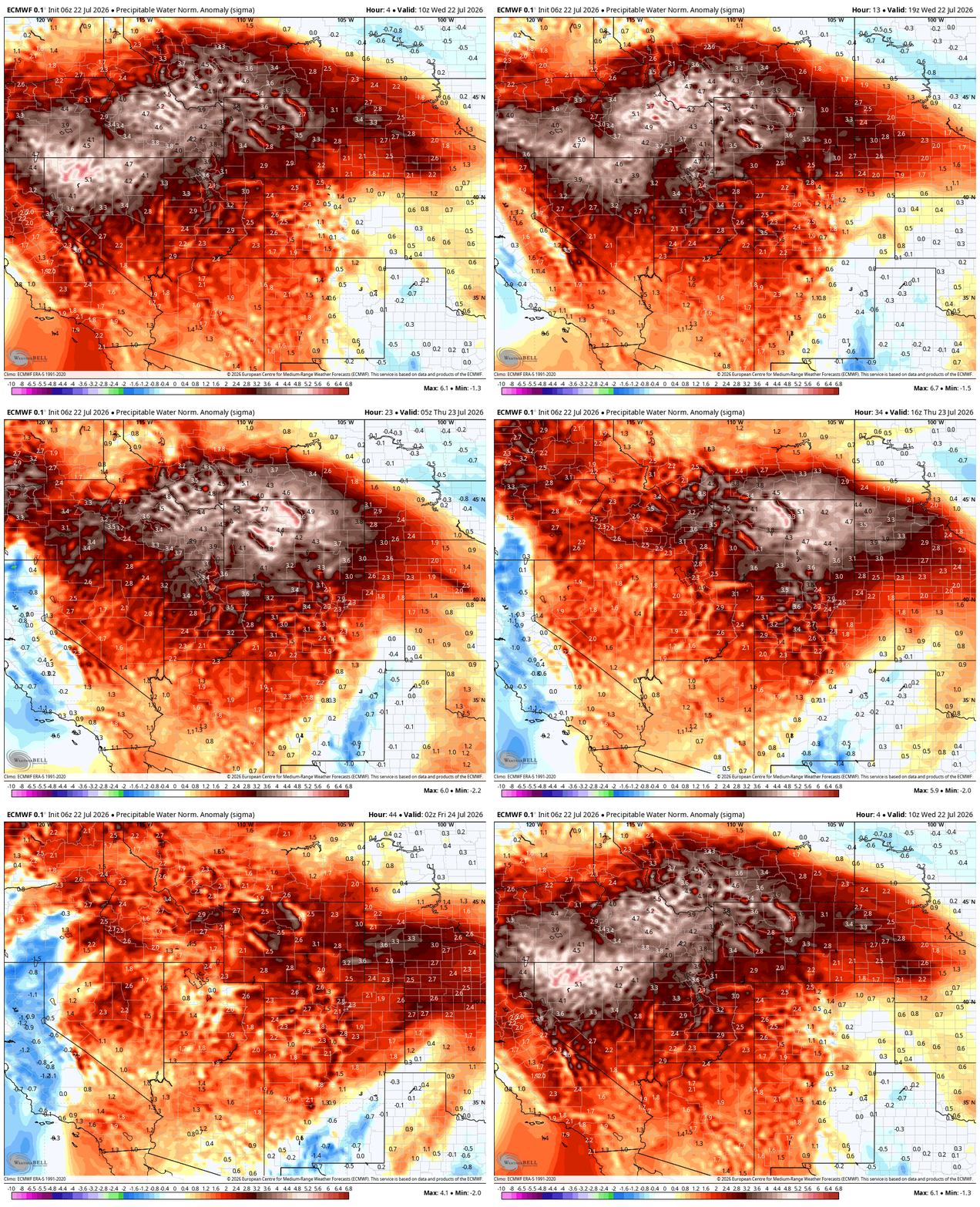
Euro model precipitable water anomaly forecast animation for Wednesday and Thursday
This shift sets the stage for our best shot at real rainfall in weeks, and the first day with truly widespread convection rather than isolated, terrain‑locked storms.
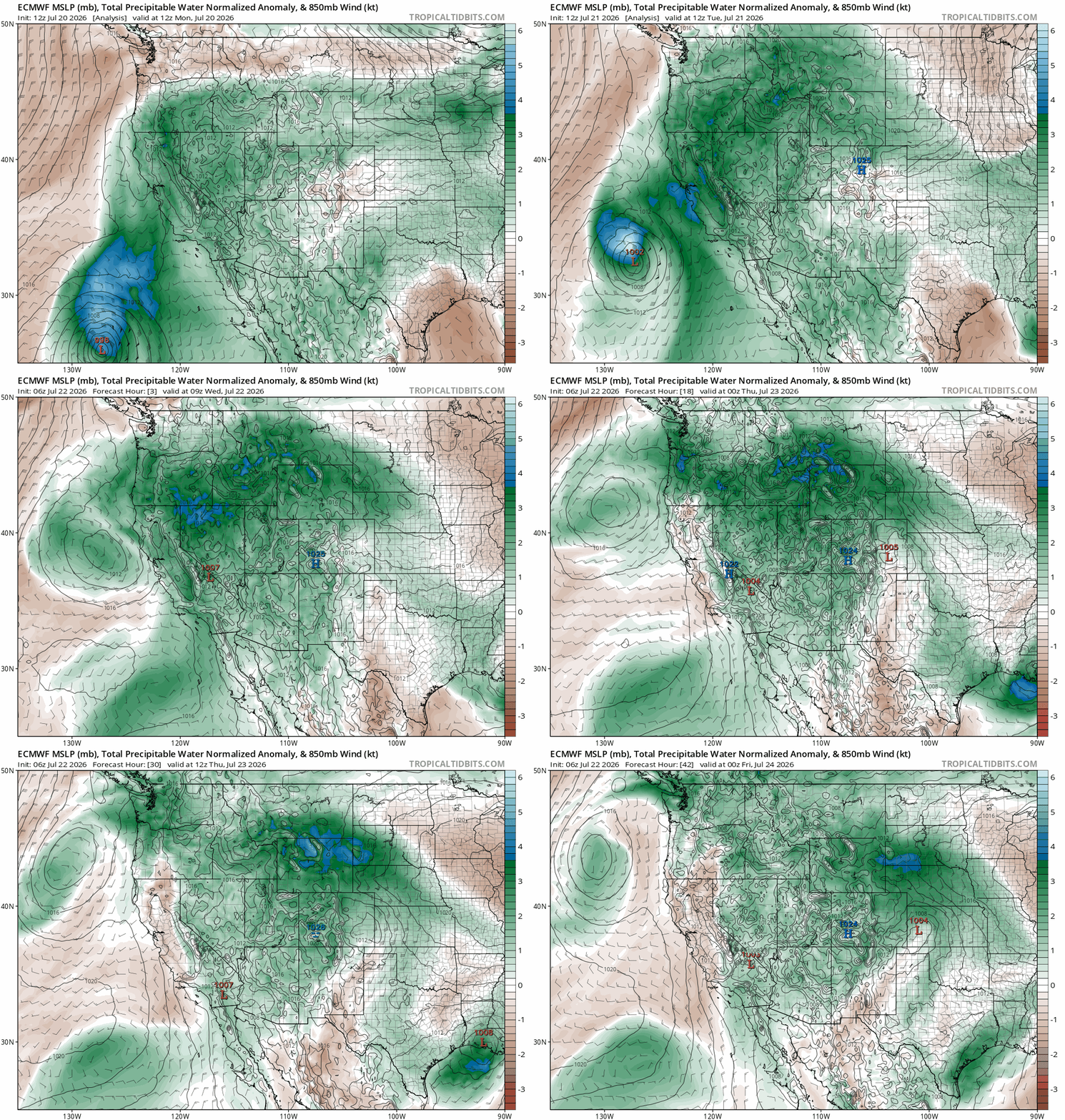
Euro model forecast animation of precipitable water anomaly showing how an offshoot of moisture from Tropical Storm Elida is getting circulated into the Interior West this week.
Storm initiation will begin around midday as strong surface heating and weak upslope spark towering cumulus along the Continental Divide. Convection will then expand east through the afternoon and evening, with additional waves overnight as moisture deepens. Storms will be highly efficient rain‑producers, capable of:
- Heavy downpours — rapid rainfall rates in short windows
- Gusty outflow winds — brief but potentially punchy
- Localized flooding — especially near burn scars and urban drainage zones.
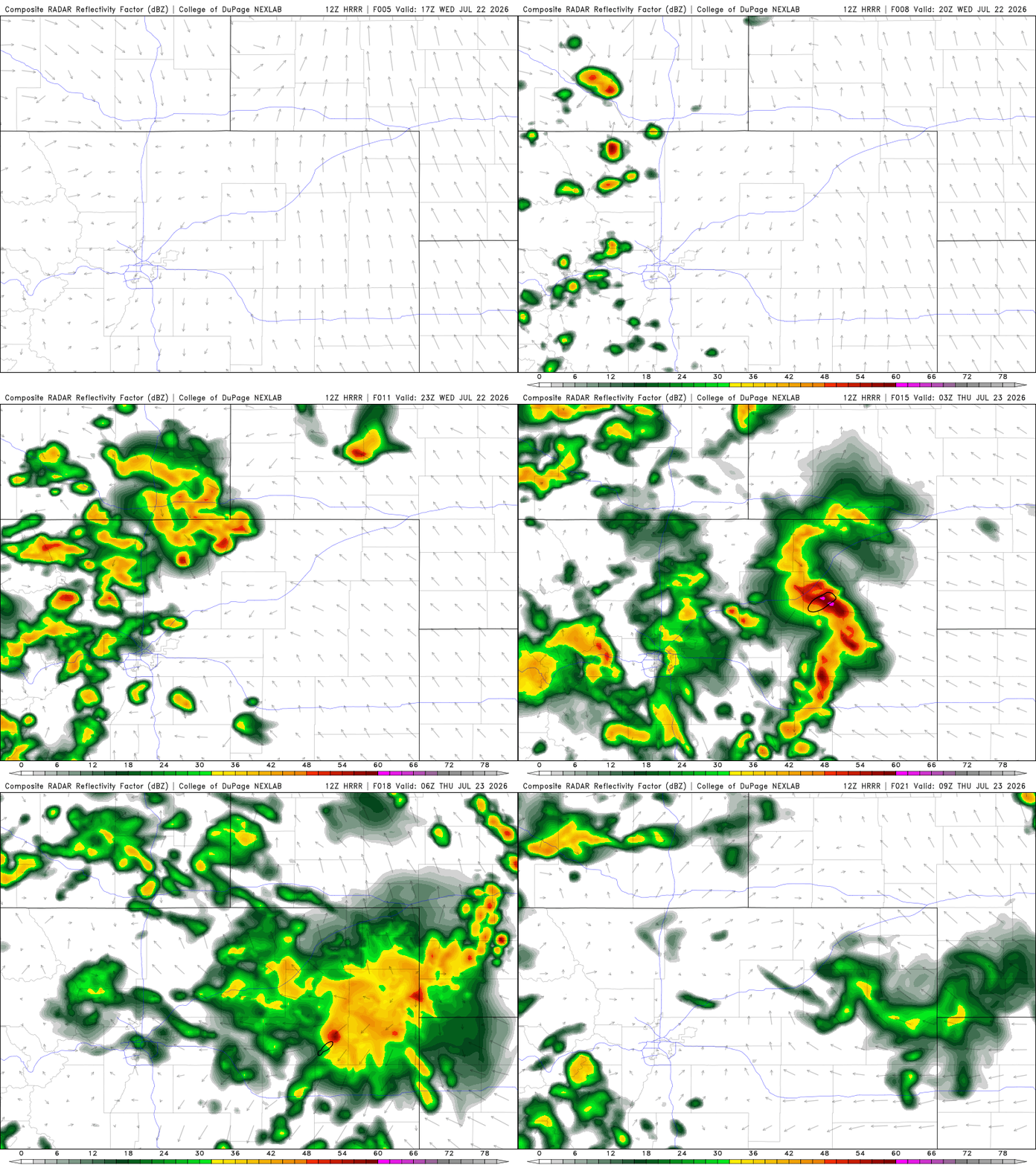
HRRR simulated radar animation for Wednesday showing the plethora of storms over the Front Range expected.
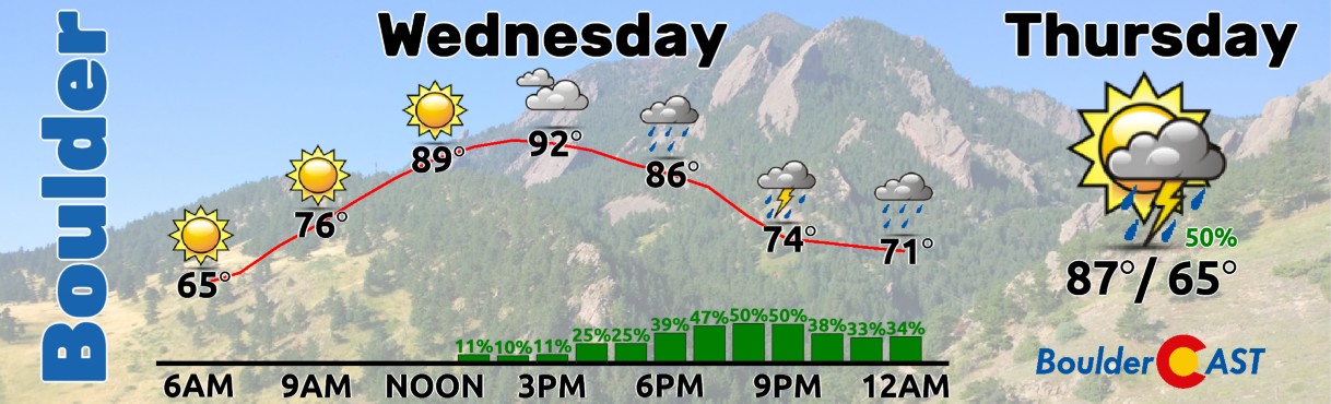
Temperatures still reach the lower to middle 90s before storms cool things off, but the heat will pale in comparison to the triple-digit temps we had earlier this week.
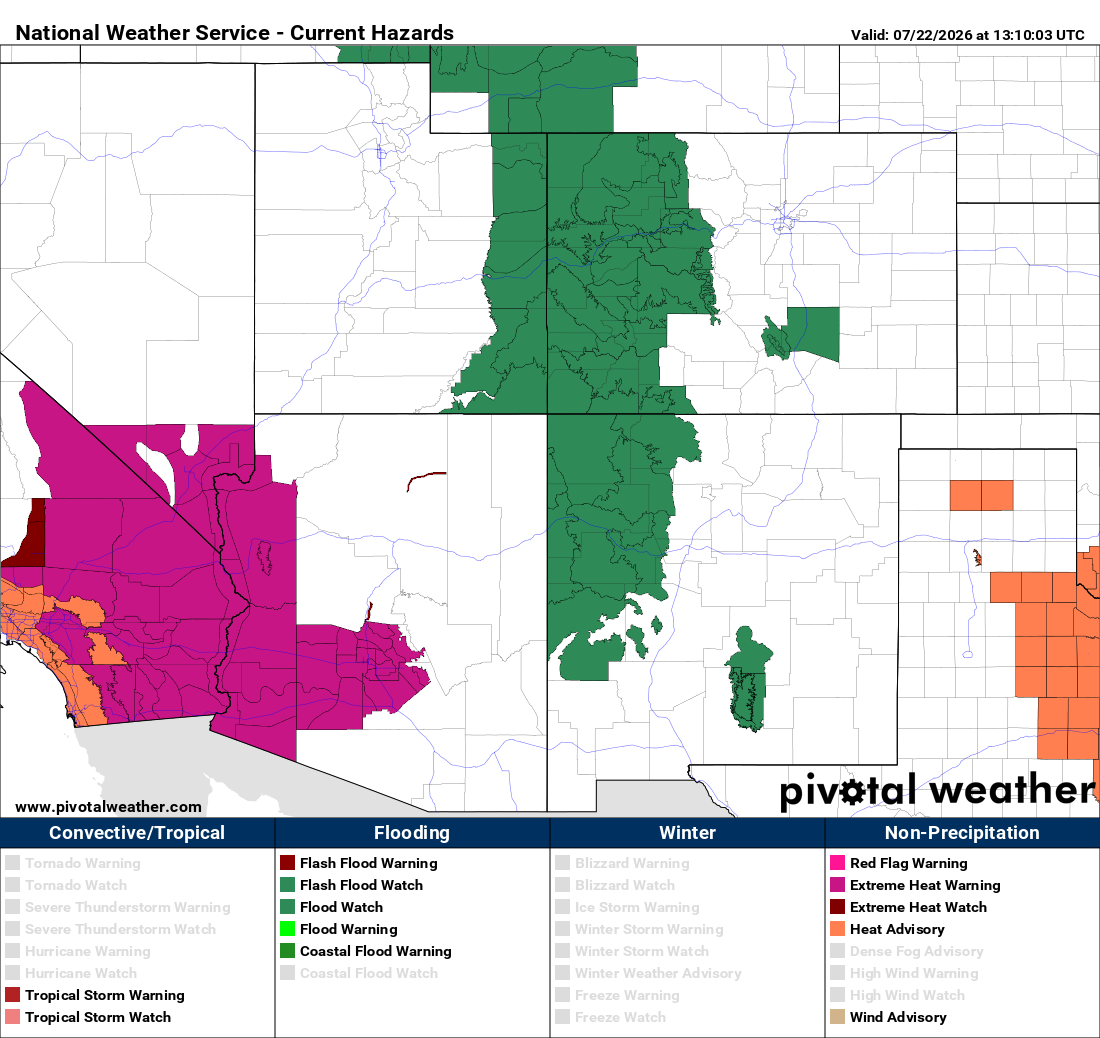
Flood Watches blanket much of the Four Corners region today, including Colorado’s Western Slope and the 100,000-acre Aspen Acres nascent burn scar near Pueblo which is especially vulnerable.
Thursday: Heavy Rain Risk Continues
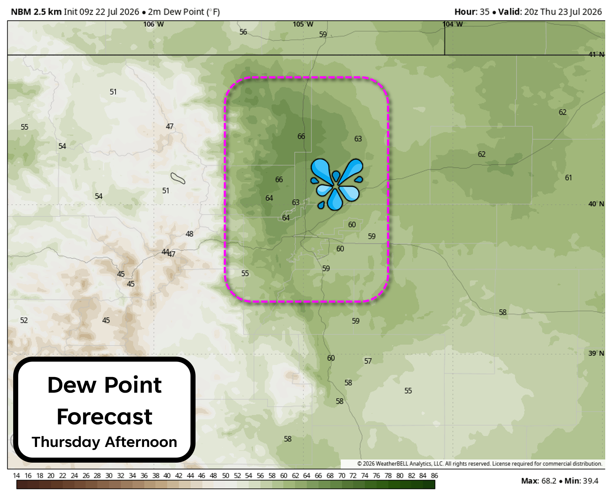
By Thursday, another fruitful round of afternoon storms will return as the monsoon moisture plume remains in place and additional weak shortwave energy ripples overhead. For the first time in a long while, daytime highs should stay below 90°, thanks to increased cloud cover and earlier storm initiation. In fact, we could see the first storms of the day arrive around noon or even a tad earlier. Dew points will also be sky high across the Denver Metro area Thursday, likely above 60° for much of the day. You will definitely be able to feel the monsoon in the air on Thursday!
Rainfall Expectations
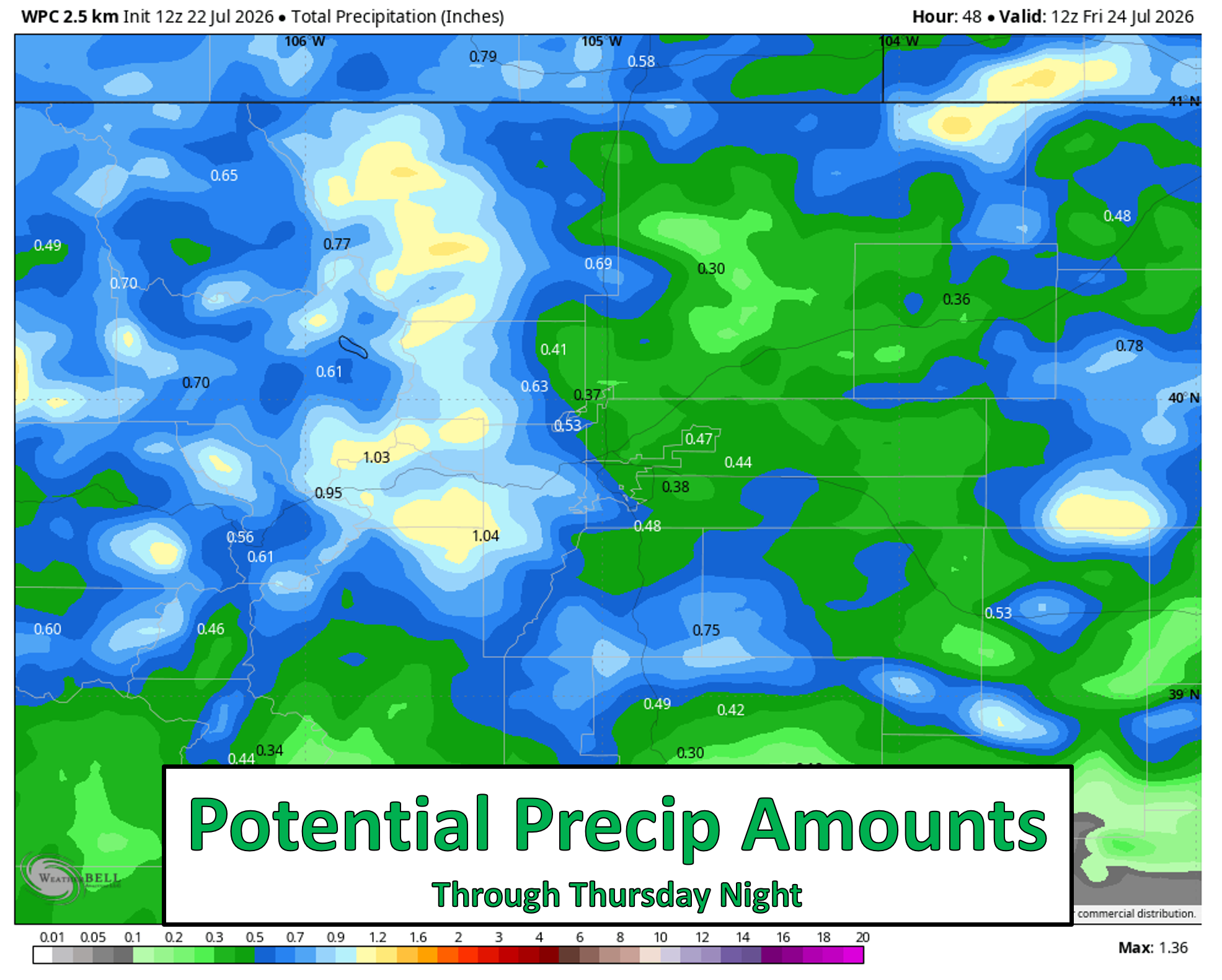
All in all, we’re looking at two solid days of monsoon rains ahead. Most areas should see 0.25–0.75″ between Wednesday and Thursday, but localized 2″+ totals are likely where repeated torrential downpours occur.
Pattern Shift Friday and Beyond
Moisture will begin to fade on Friday as high pressure builds back west across the southern Rockies where it will set up shop for the long haul. Monsoon moisture will still be present underneath this ridge, but will be notably lower than days prior. Thus, storms will still form—mainly over the high terrain—with isolated chances around Boulder and Denver.
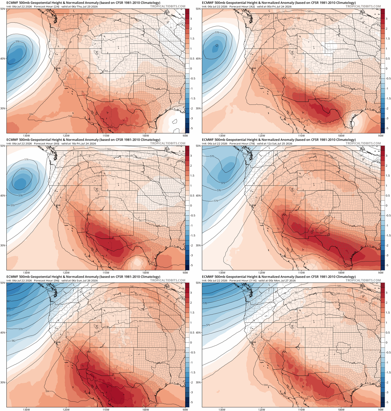
Euro 500mb height anomaly forecast for the weekend showing high pressure rebuilding west over the Four Corners.
Highs Friday will return to near 90 degrees, with mid to upper 90s in the works for the weekend and into early next week.
Enjoy the brief cooler, wetter stretch while it lasts…
Spread the word, share our crazy Colorado weather:
Go Premium, get all the perks.
Daily Forecast Updates
Get our daily forecast discussion every morning delivered to your inbox.
All Our Model Data
Access to all our Colorado-centric high-resolution weather model graphics. Seriously — every one!
Ski & Hiking Forecasts
6-day forecasts for all the Colorado ski resorts, plus more than 120 hiking trails, including every 14er.
Smoke Forecasts
Wildfire smoke concentration predictions up to 72 hours into the future.
Exclusive Content
Weekend outlooks every Thursday, bonus storm updates, historical data and much more!
No Advertisements
Enjoy ad-free viewing on the entire site.












You must be logged in to post a comment.