You think it was cold the last few days? Just wait and see what is coming! The coldest temperatures in nearly a decade have settled into the Front Range and it’s only going to get colder. We’re also tracking a rather unique light snowfall event that will spread accumulating snow across the area Saturday afternoon into Sunday. We discuss just how cold it will get and look at the snowfall amounts headed our way.
At a Glance:
- The coldest air in nearly a decade will impact the Front Range this weekend as the Arctic blast continues across the country
- Below zero high temperatures are expected Sunday in the Denver Metro area with lows near or colder than -10°F Monday morning
- Widespread and persistent light snow will overtake all of eastern Colorado Saturday afternoon into Sunday
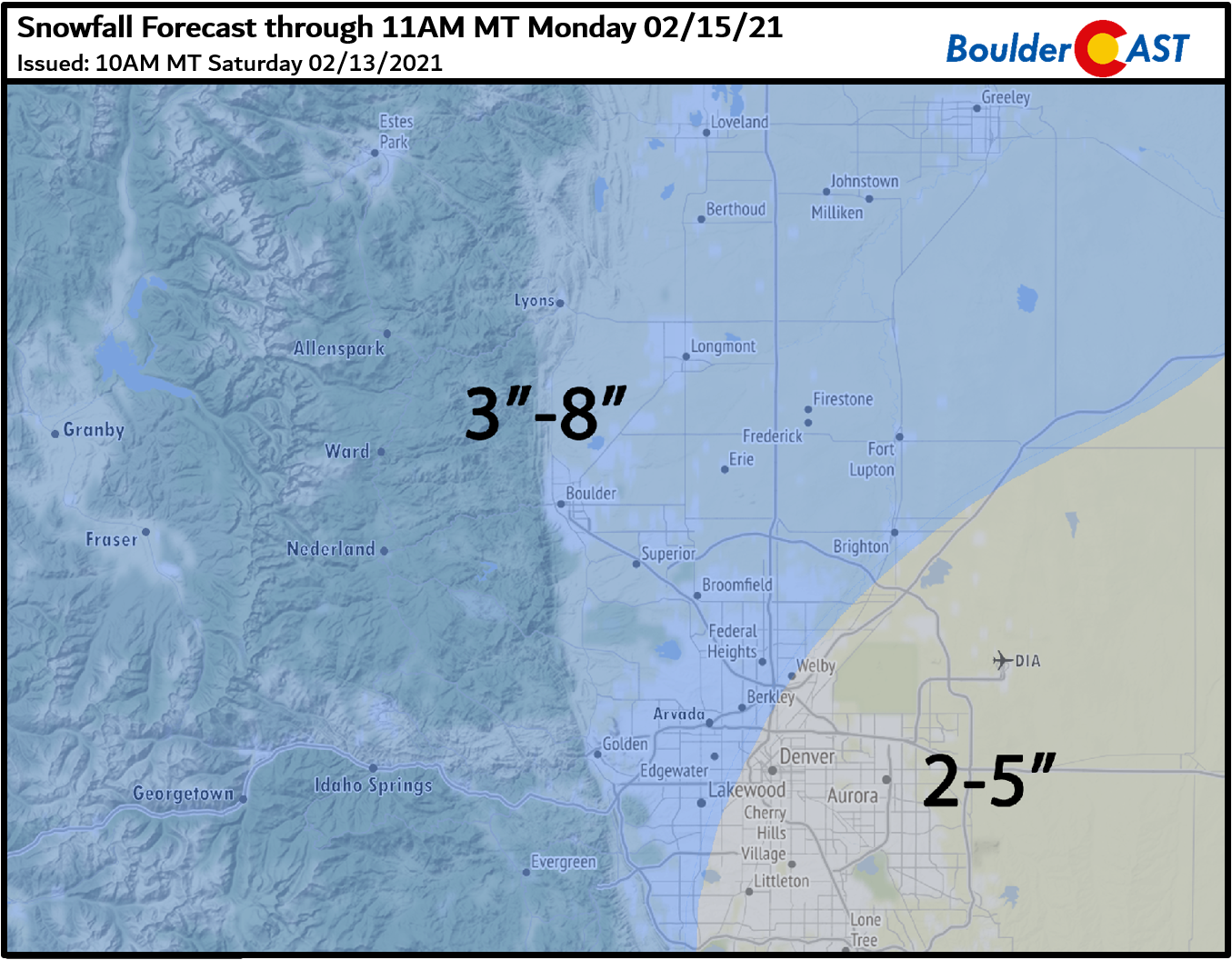
- Snowfall amounts of 3 to 8″ are expected
The cold & snowy stage is set!
The deep freeze is well-underway across much of the country and Front Range Colorado is no exception this weekend. Highs on Friday were only in the single digits and it will be even colder the next few days. As of Saturday morning, all of northeast Colorado has dropped below zero. The Arctic airmass which started out so shallow earlier in the week has slowly deepened with reinforcing surges of Arctic air multiple times through the week. The top of the Arctic airmass now sits around 9000 feet elevation, banked up against the Foothills west of the Metro area. Above 9000 feet, temperatures are in the 20’s. Below this, well…we know how cold it is!
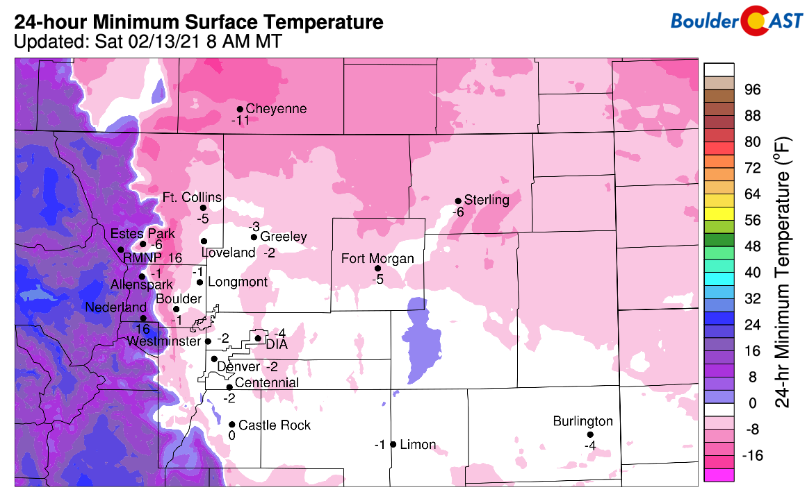
Overnight low temperatures Saturday morning
Saturday morning’s GOES-East infrared satellite animation is not very useful at all. The Arctic airmass is just as cold as most of the clouds overhead. For this reason, it’s difficult to glean exactly where the clouds are from this imagery alone. In some cases, the cloudtops are substantially warmer than the surface, like across northeast Colorado and Kansas. In these locations, the clouds ironically appear as clear areas. Not good!
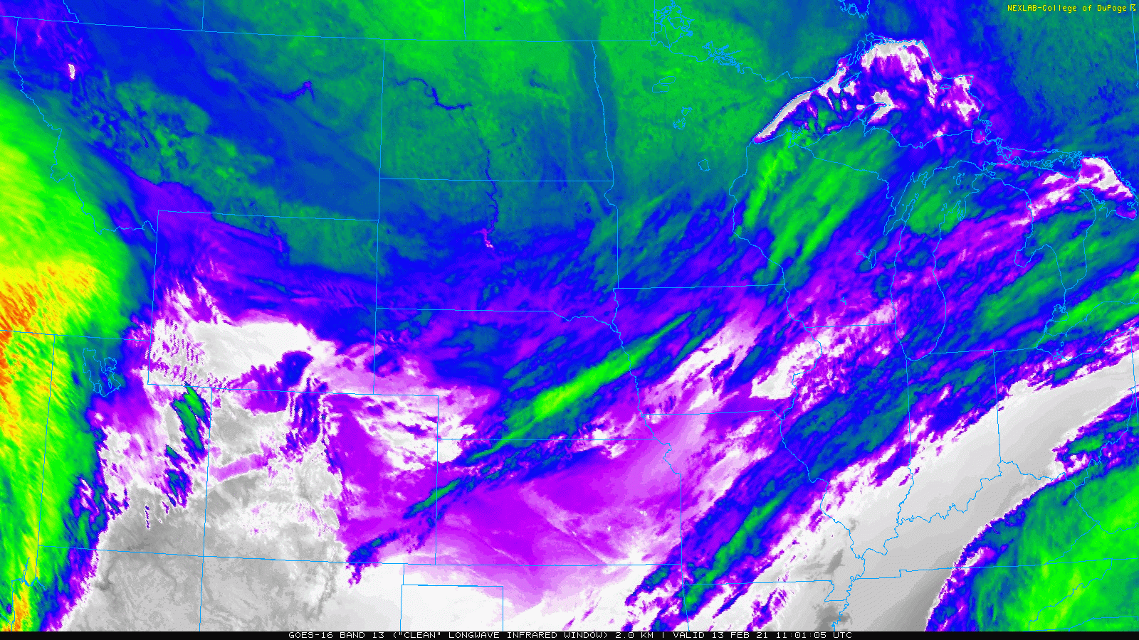
GOES-East infrared satellite animation from Saturday morning
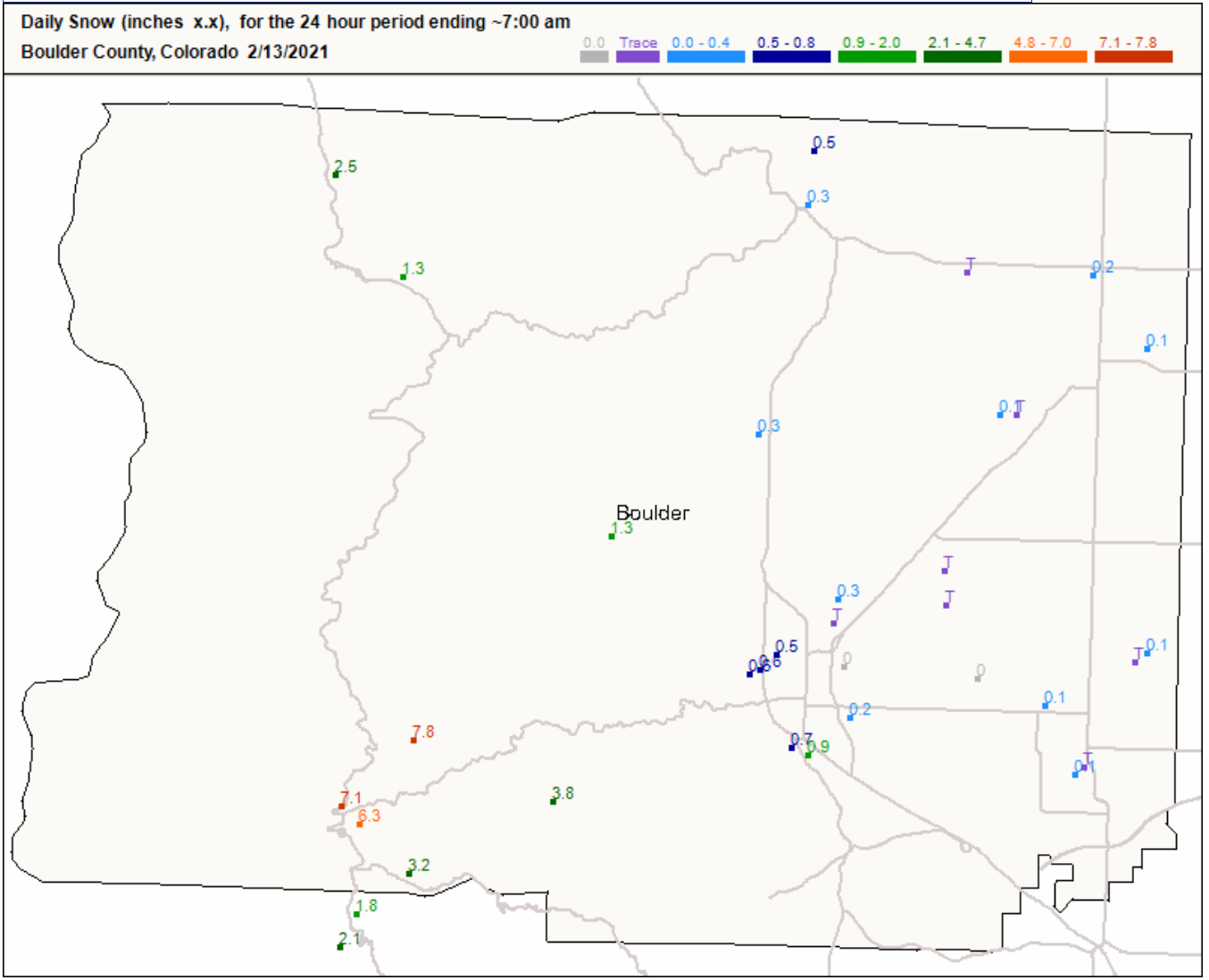
Anywhere from a dusting to 8″ of snow has fallen already across the Front Range since Thursday night. The highest totals were in the Foothills of Boulder County which received several hours of heavier spill-over snow Friday evening along Peak to Peak Highway. The city of Boulder has reported a little over 1″ of new snow so far.
So that’s where we are right now: Darn cold with a little snow. Let’s talk about what’s going to transpire through the rest of the weekend into early next week…
The well-advertised wintry mess will impact nearly the entire country in the coming days, from a rare heavy snow event in Seattle, to a wintry mix of precipitation along the Gulf Coast, to feet of snow in the Cascades, to an ice storm in our Nation’s Capital, to downright dangerous wind chills across the northern and central Great Plains. Mother Nature is throwing every bit of winter she’s got this weekend!
A very active weekend is ahead for winter weather as large parts of the U.S. experience concerns for extreme cold temperatures, heavy snow and ice. Coast to coast from the Pacific Northwest to the Mid-Atlantic, there is an array of winter weather headlines in effect. Stay safe! pic.twitter.com/cu3d2Ddlyu
— NWS Weather Prediction Center (@NWSWPC) February 13, 2021
Here in Colorado, we’ll be dealing with snow first followed by the coldest temperatures in years thereafter. If you’ve been paying attention since the Arctic front arrived last Sunday evening, you’ll know that temperatures have been running significantly colder than all model projections day in and day out. This trend will likely continue through Monday, so be aware that actual temperatures may be well below what you see in your favorite weather apps or new channels.
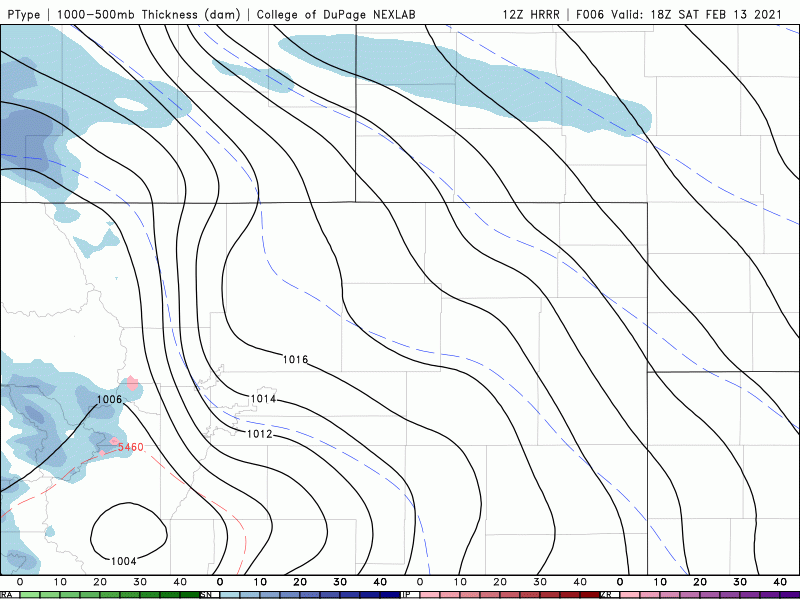
We have no major changes to our forecast which we posted on Thursday. Models have stuck to their guns in regards to the widespread snow event late Saturday and also to the accompanying bitter cold temperatures. The forcing for the snow will come in three flavors for our area, arranged below by order of importance…
1 ) The most fearsome reinforcing surge of Arctic air will arrive Saturday evening to the Denver Metro area helping to introduce slightly more intense and deeper easterly upslope flow. This is the push that will give the Arctic airmass enough oomph to finally get up and over the Continental Divide. Middle Park and North Park have been protected so far from the bitter cold temperatures. That changes Saturday night!
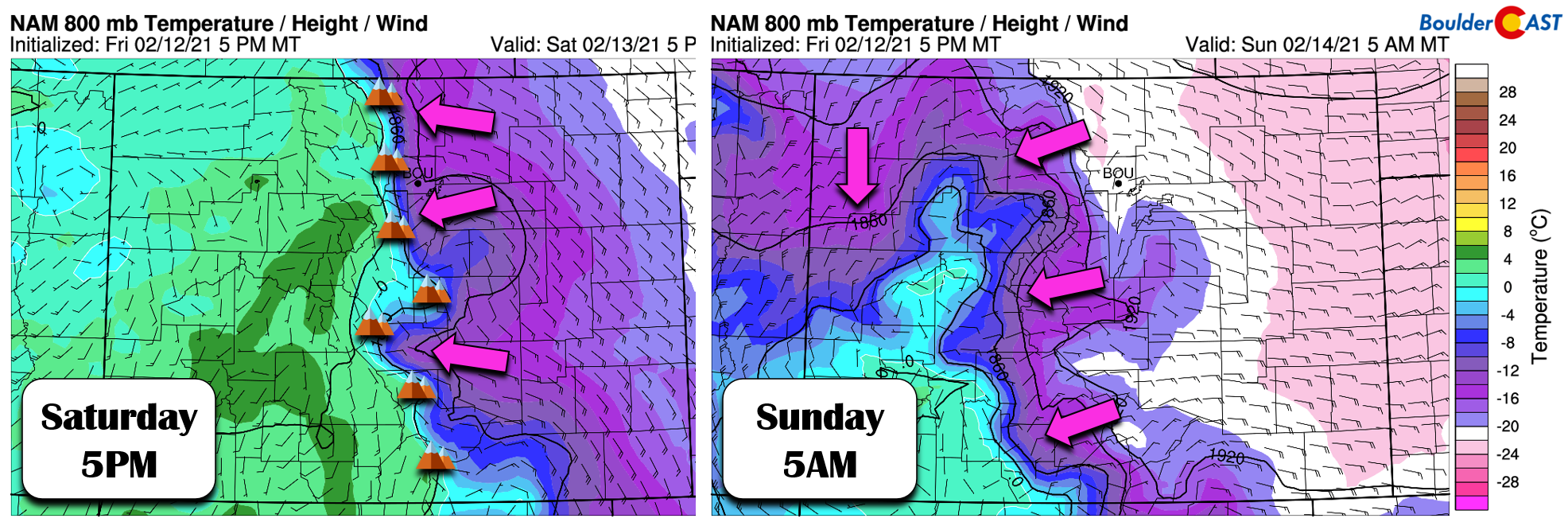
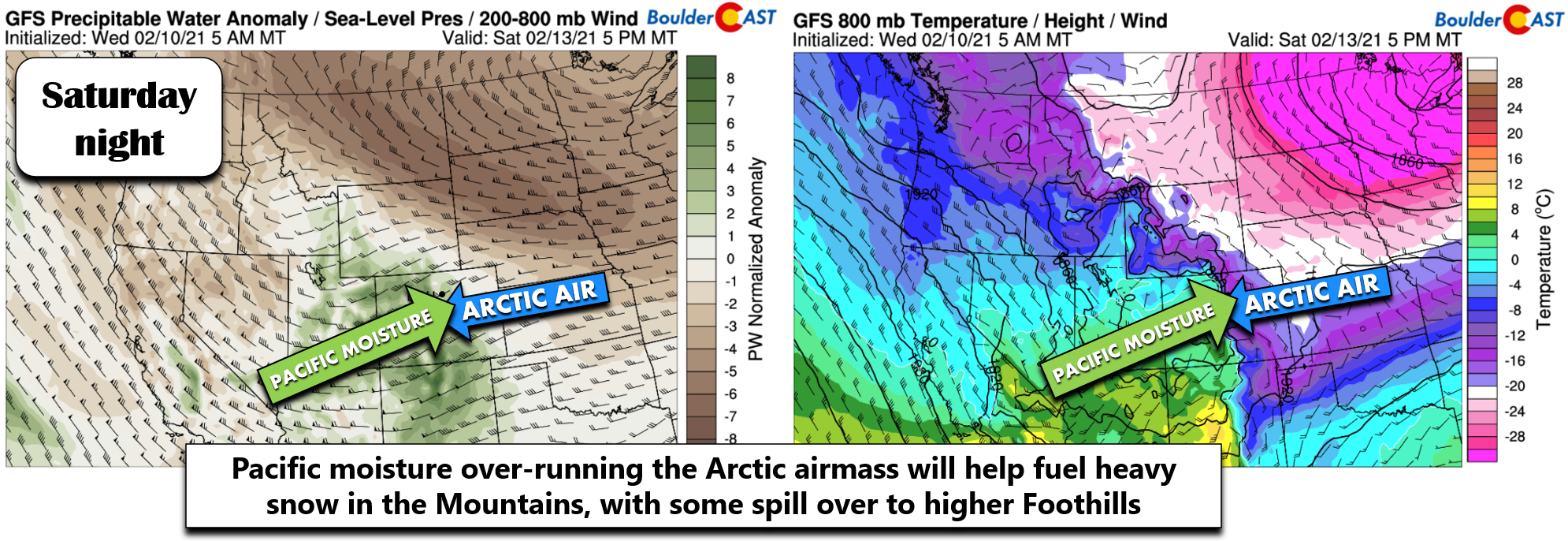
2 ) Pacific moisture will be over-running the Arctic air. When two airmasses are so different in temperature and moisture like they are with this event, the denser airmass acts almost like a mountain causing uplift of the warm and moist air. As the moisture streams into Colorado from the southwest late Saturday, it will gradually be rising leading to clouds and snowfall over all of eastern Colorado and even Nebraska and Kansas. As such, a good chunk of the snow that falls Saturday night will actually be sourced by moisture from the Pacific Ocean, whereas the surface airmass won’t by anything but polar in origin.
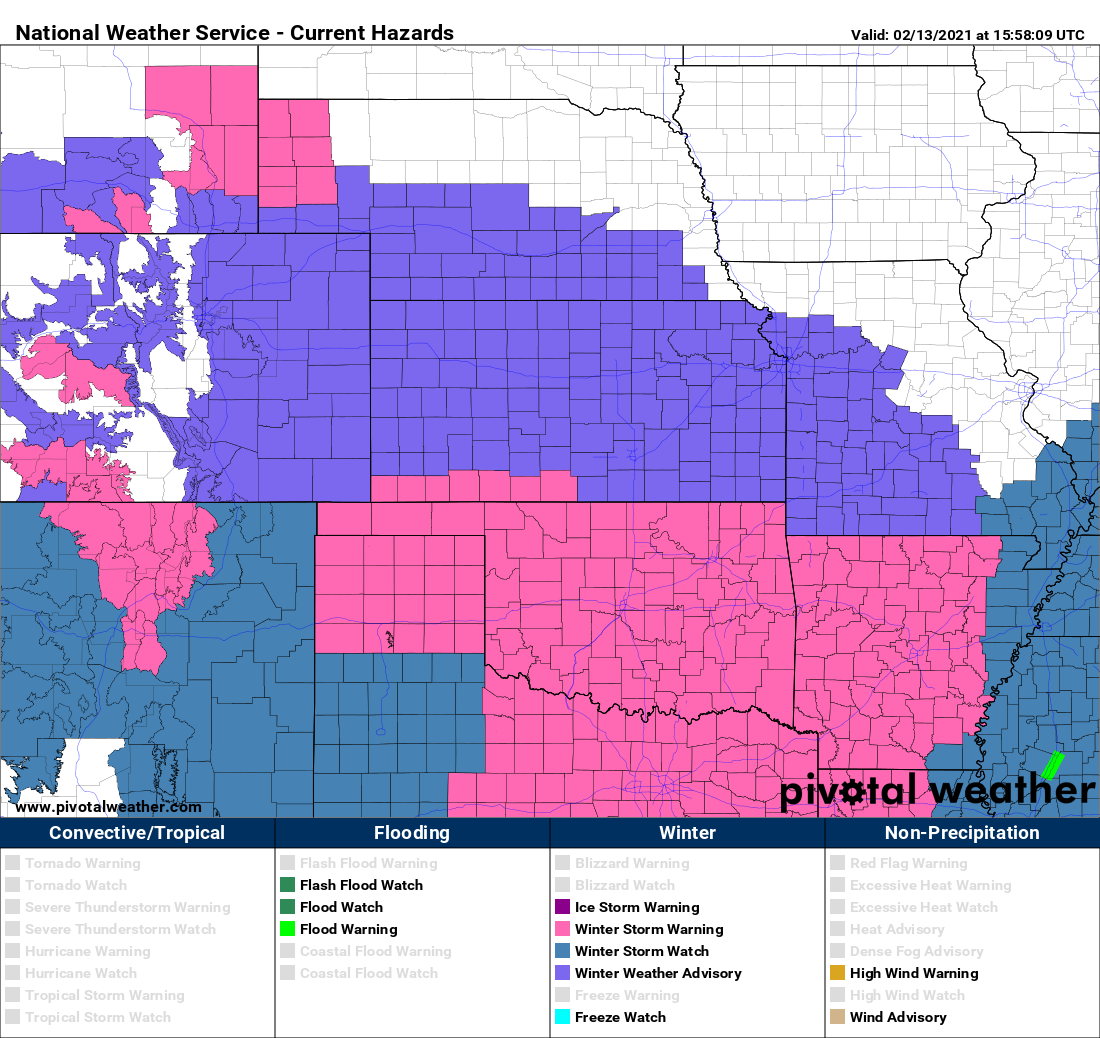
We can remember the last time there was only a bottom-of-the-barrel Winter Weather Advisory issued for ALL of eastern Colorado. This will truly be a very widespread and long-lasting snowfall event, but snowfall intensity will be fairly low throughout. We’re talking about snowfall rates of generally 1/4″ to 1/2″ per hour for a period of 12 to 18 hours.
3 ) The Pacific storm system bringing the moisture will track across the Four Corners Saturday night. We’re definitely sounding like a broken record this year, but we must say that once again the storm system is passing too far south. Most of the energy will slide from the Four Corners into New Mexico and Texas with this storm.
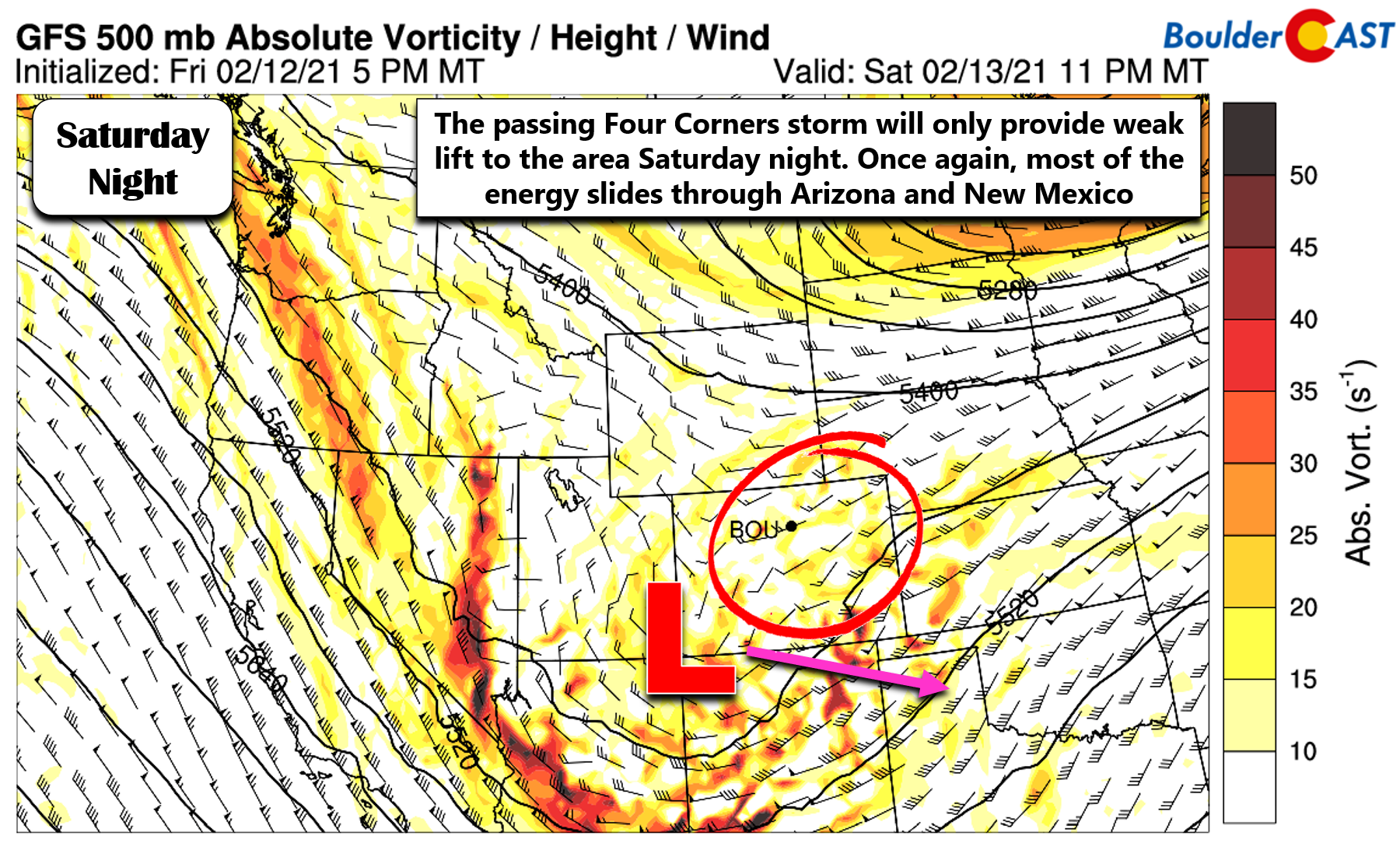
Despite this undesirable track, the Front Range will catch a period of widespread but ultimately weak lift Saturday afternoon into early Sunday from this low pressure which will help to enhance snowfall across the area a tad.
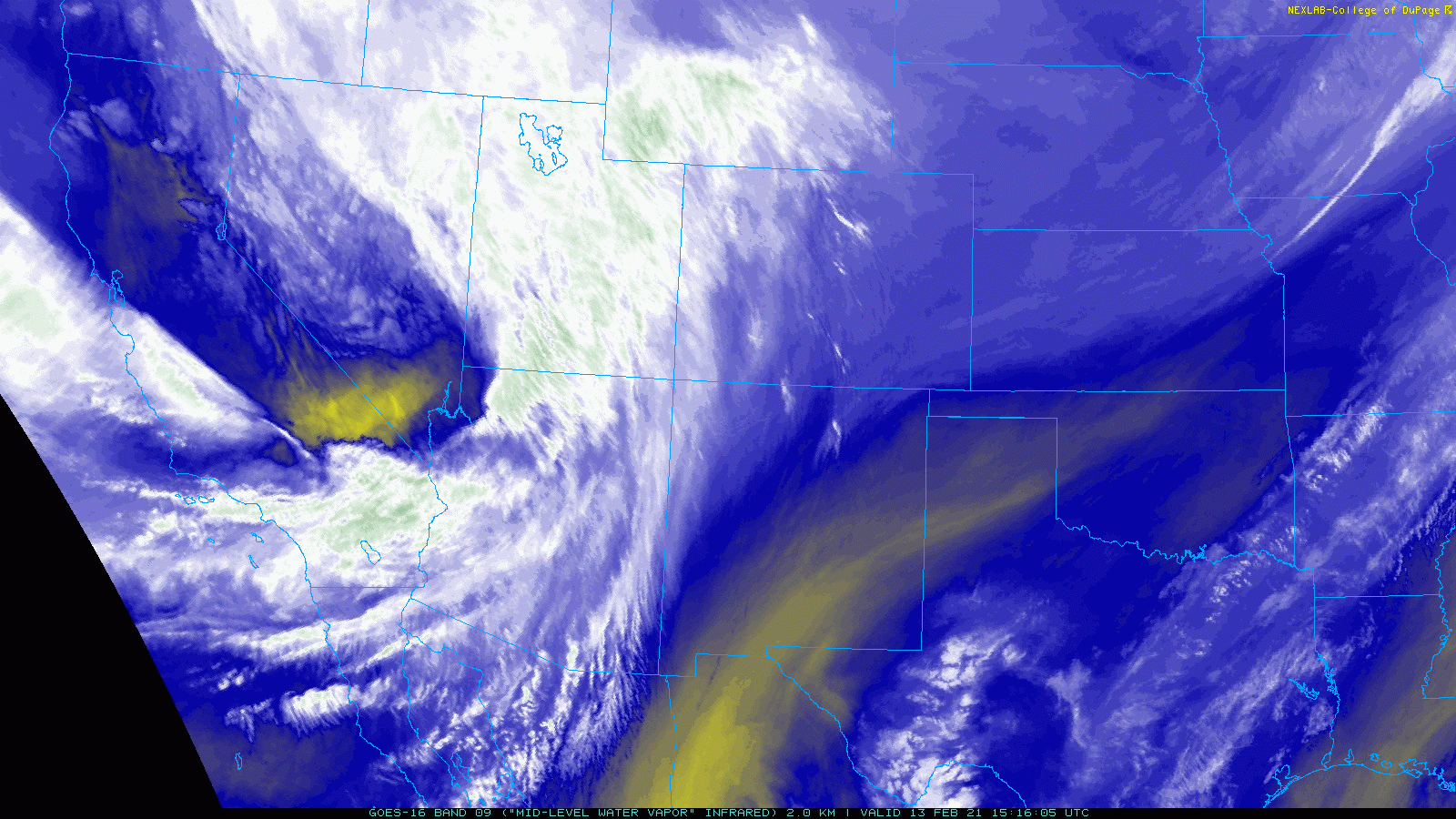
GOES-East water vapor satellite animation from Saturday morning showing the approaching storm system, currently located in central Nevada
Timeline
Snow is already falling the Mountains and higher Foothills as of Saturday morning. It will begin to spread eastward across the lower elevations by early to mid-afternoon as the ingredients start to come together for a light snowfall event. The entire western Great Plains region will become engulfed in light snow as the over-running really begins to kick in. The latest run of high-resolution HRRR model shows the widespread nature of the snow with potential for slightly higher snowfall rates from late afternoon into the late evening hours.
This window for the most “intense” snow is also evident in our NowCAST product (shown below). Snowfall will decrease in intensity after midnight Saturday night largely due to the best moisture pushing off to our south and east and a decrease in meaningful over-running. However, we do expect very light snow to continue to fall out of the frigid Arctic airmass well into Sunday morning and possibly the afternoon.
Snowfall should fully taper off late Sunday with skies partially clearing by Monday morning.
Snowfall Amounts
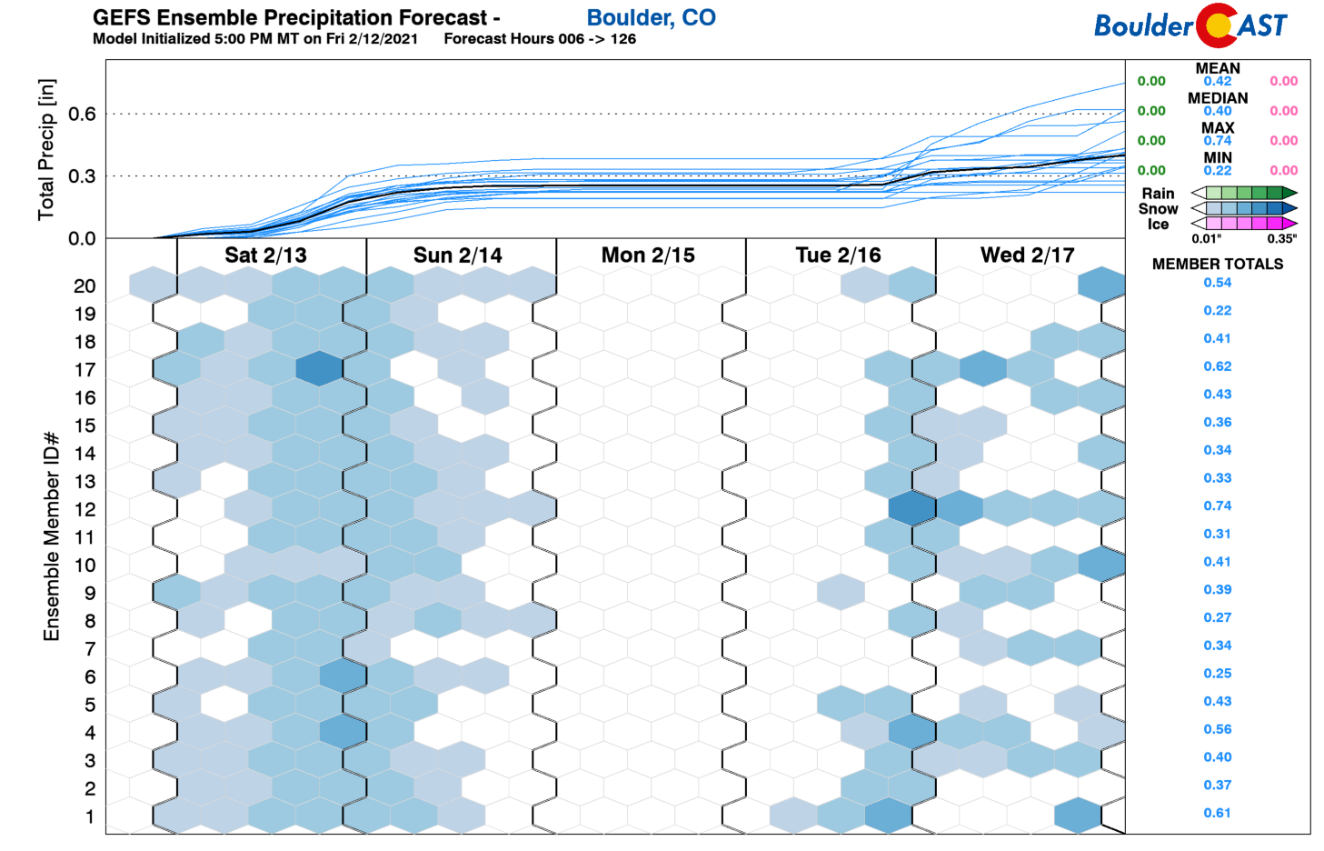
We’re seeing good model agreement on precipitation amounts with this system, with tight ranges from 0.2 to 0.4″ of liquid across the area by late Sunday. Highest amounts are expected to be in Boulder and Larimer Counties. The GFS ensembles (shown below) are clustered very closely around 0.25″ of liquid for Boulder from this event.
The biggest challenge this time around will likely be the snowfall ratios. That is, how much snow will actually accumulate from the given amount of moisture we are expecting. Initially Saturday afternoon, ratios should be quite good as there is some warmer and moisture-rich air aloft (ratios near 17 to 1 or so). This will favor the growth of large dendritic snowflakes which tend to accumulate nice and fluffy. However, as the colder air surges in through Saturday evening and overnight, it will become too cold over a deep layer of the atmosphere and we will see a shift back to tiny, compact snowflakes (ratios of 11 to 1 or so). The storm average snow ratio should land around 15:1. Thinking like a meteorologist, you can then multiply our expected moisture amounts (0.2 to 0.4″) by that storm-average snow ratio (15:1) and to get snow totals ranging from 3″ to 8″ across the Front Range area. This agrees well with the slew of weather model projections shown below.
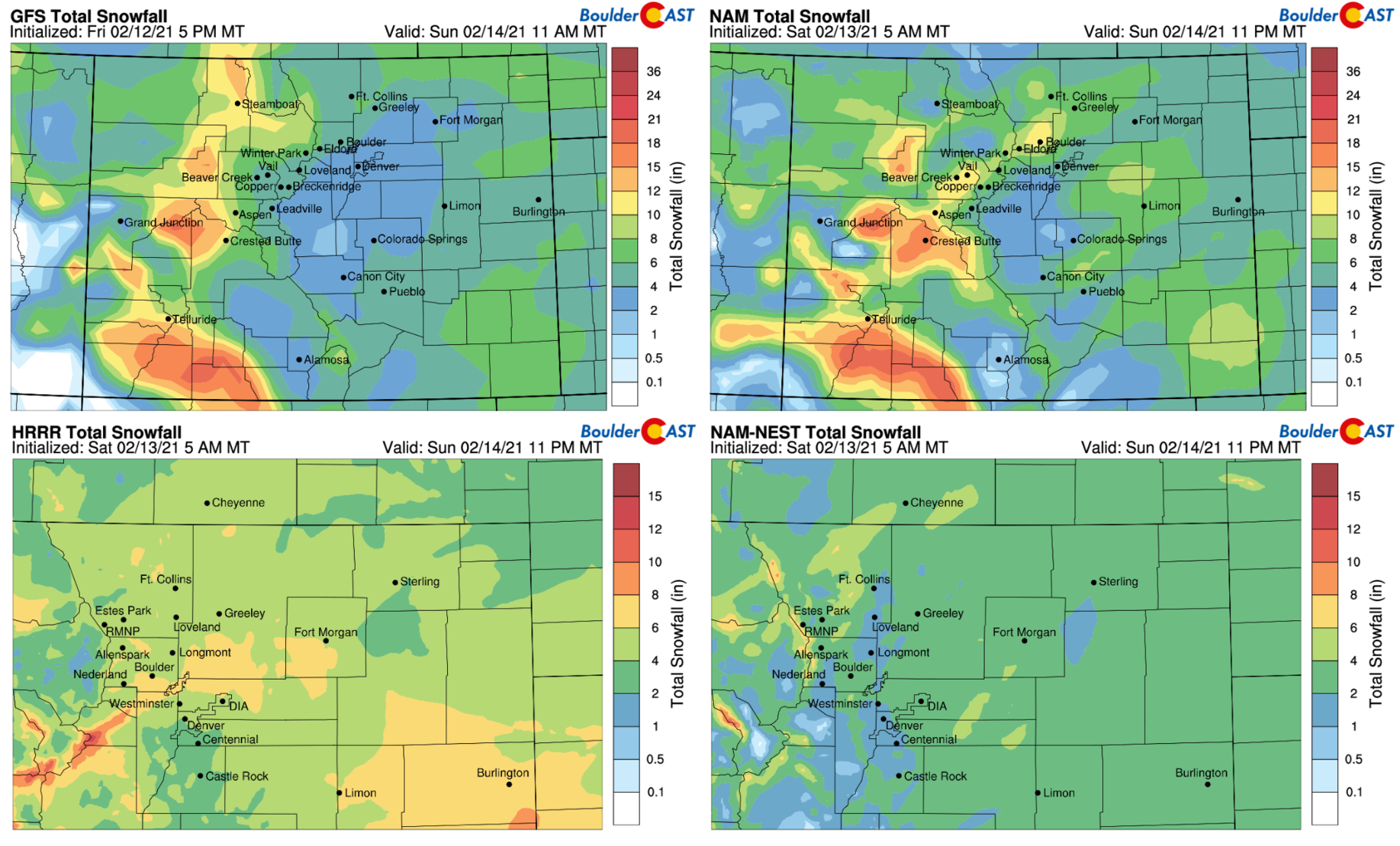
Four model forecasts for total snowfall through Sunday evening. Note that the bottom models have different color bars!
Our snowfall forecast map for the event is given below. This covers snow falling through Sunday night. There should be no surprises here. It’s virtually identical to what we discussed in our last forecast update. With the very cold temperatures, roadways are likely to become snow-covered and slick Saturday afternoon through Sunday.
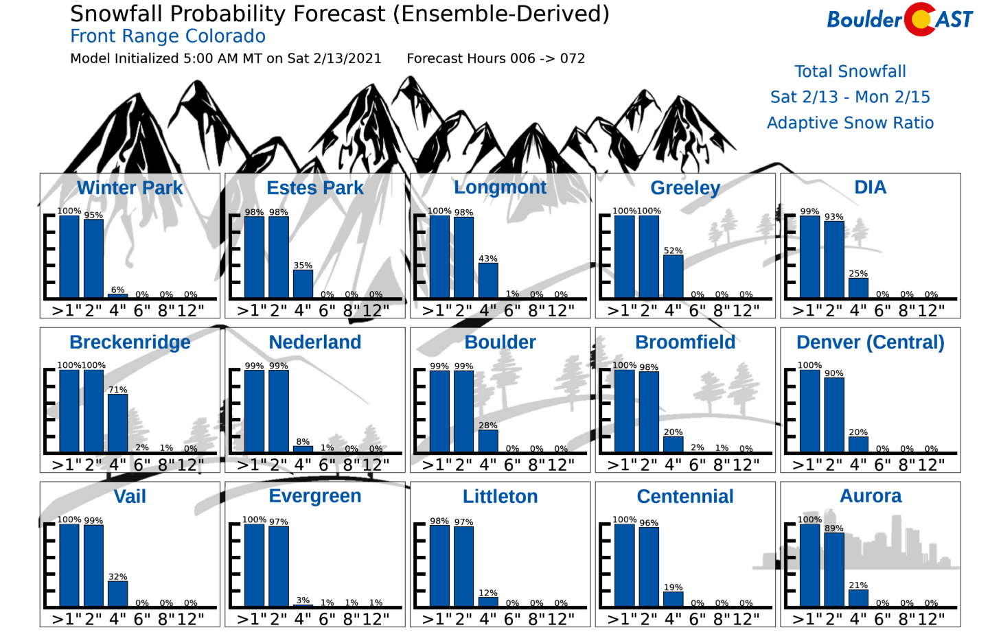
And for the gambler’s out there….
Let’s move on to the temperatures…
How cold will it be?
We were anticipating the coldest temperatures in years to arrive this weekend for a while now.
THIS WEEK IN COLORADO WEATHER:
Boulder and Denver will be in and out of the frigid air much of the week ahead as the Arctic front wobbles back and forth. The coldest air in years may be coming this weekend: https://t.co/VETAYC98wG#COwx #ArcticBlast #Snow #Denverwx #WYwx #NEwx pic.twitter.com/pnuVFqbwUq
— BoulderCAST Weather (@BoulderCAST) February 8, 2021
We’ve already endured single-digit high temperatures Friday and Saturday. Sunday will be even colder with temperatures struggling and potentially not succeeding at getting above zero across the lower elevations of the Denver-Boulder area with thick clouds and light snow socked in. The Foothills and Mountains will be WELL below zero all day long and into Monday.
The absolute coldest temperatures will occur Monday morning near sunrise. We’re still struggling to determine if clouds will clear out or not Sunday night. Models are showing at least partial clearing, but this is a little hard to believe as it rarely happens that quickly in these type of post-snowstorm Arctic scenarios. The GFS and NAM model forecasted cloud cover for early Monday morning is shown below.
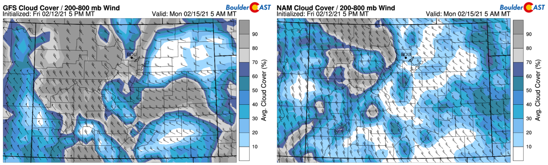
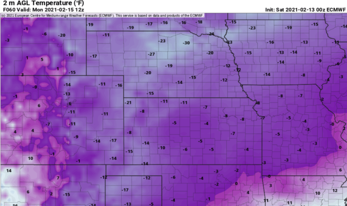
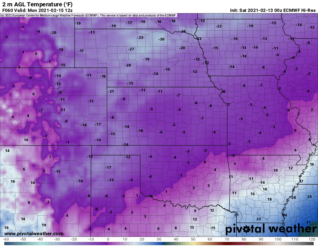
Our best guess right now is that most areas will land between -8°F and -16°F Monday morning. The warmer end of the spectrum will be for areas that keep their clouds. Those frigid colder temperatures will require partial clearing to boost radiative cooling over the fresh snow cover. The European model forecast for temperatures Monday morning is shown below. OUCH!
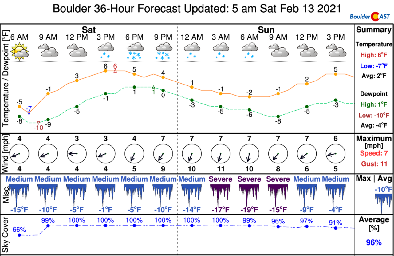
Here’s our forecast for temperatures over the next few days. Overnight lows will be especially variable across the area. These are more of area-wide averages across the Plains.
- Saturday: High 5°F / Low -5°F
- Sunday: High -2°F / Low -8°F
- Monday: High 11°F / Low -12°F (potentially as cold as -18°F)
Boulder hasn’t dropped below -15°F in nearly a decade (Feb 2011)! While it is not likely to happen on Monday morning, there is a chance, and that’s all Mother Nature needs!
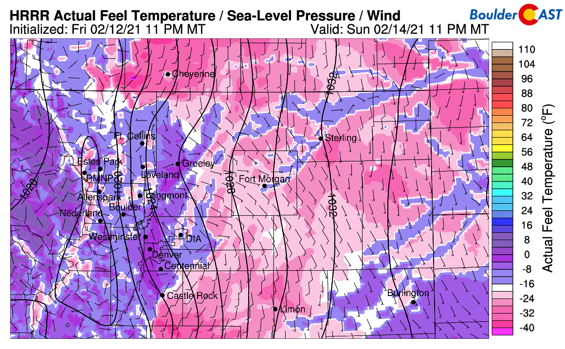
Wind chills will be dangerously cold Sunday into Monday with values bottoming out from -20 to -35°F across eastern portions of Colorado. It will be a little warmer across the Front Range, but still dangerous in the -15 to -25°F range. The wind chill forecast below is for Sunday night. BRUTAL!
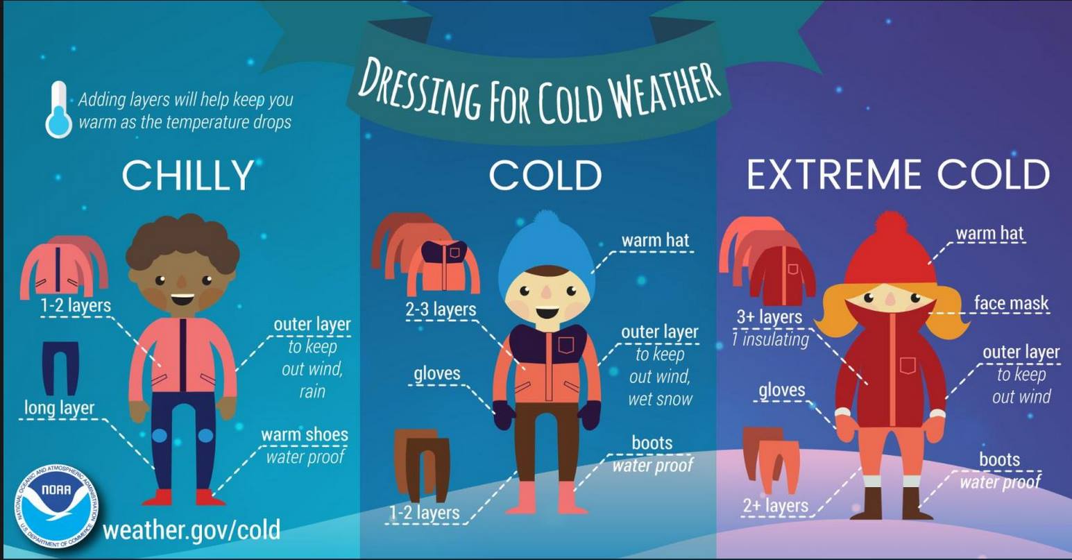
Enjoy the cold & snow and be sure to follow the extreme cold guidelines below if you must head out and about! We also hope that you are subscribed and following us on Facebook and Twitter. We will be tracking this continued Arctic intrusion over the coming days. Buckle up and bundle up!
Help support BoulderCAST and save 25% with promo code FRIGID
Help support our team of Front Range weather bloggers by joining BoulderCAST Premium. We talk Boulder and Denver weather every single day. Sign up now to get access to our daily forecast discussions each morning, complete six-day skiing and hiking forecasts powered by machine learning, first-class access to all our Colorado-centric high-resolution weather graphics, bonus storm updates and much more! Or not, we just appreciate your readership!

.
Spread the word, share the BoulderCAST forecast:
.


You must be logged in to post a comment.