
As of Monday morning, the Arctic airmass has spilled into the Front Range, but it won’t be staying for long! Boulder and Denver will be in and out of the frigid air much of the week ahead as the Arctic front wobbles back and forth. As such, some days will be more pleasant than others. While still somewhat uncertain, we are expecting the coldest air in years to inundate the region late in the week into the upcoming weekend alongside a chance of snow. Read on for our complete outlook of the upcoming week.
This week’s highlights include:
- A shallow Arctic airmass will meander back and forth across northeast Colorado through the week ahead making for a challenging forecast
- The Front Range will largely reside on the “warm” side of the front through Thursday, but not always
- The coldest air in years may infiltrate Colorado late in the week into the weekend, bringing with it a chance of snow
- Snow amounts should be light and it’s the bitter cold that will take center stage
DISCLAIMER: This weekly outlook forecast is created Monday morning and covers the entire upcoming week. Accuracy will decrease as the week progresses as this post is NOT updated. To receive daily updated forecasts from our team, subscribe to BoulderCAST Premium.

Which side of the Arctic front will we be on?
This week will offer a challenging forecast due to a persistent offshoot of the Polar Vortex residing along the border of Canada and North Dakota. The air beneath this trough is truly polar in origin. The cyclonic, counter-clockwise flow around this trough will continue to feed extremely cold air into the center part of the country making for a bitter cold week for many Americans.

GFS 500mb height anomaly animation forecast through Saturday. Notice the near-stationary low pressure in south-central Canada.
This very cold air has already flooded much of the country over this past weekend with below zero temperatures widespread.
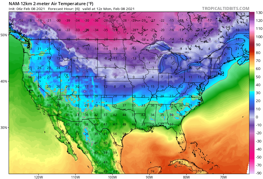
Forecast temperatures Monday morning at 5AM
The cold air was finally able to reach Front Range Colorado Sunday evening with temperatures dropping from the 50’s into the teens rather abruptly around 5:30PM as the leading edge of the Arctic air arrived.
52°F ->19°F in 80 minutes. At one point, the temperature dropped 23°F in just 20 minutes #COwx #Boulderwx #ArcticFront pic.twitter.com/1KfwEGsFS1
— BoulderCAST Weather (@BoulderCAST) February 8, 2021
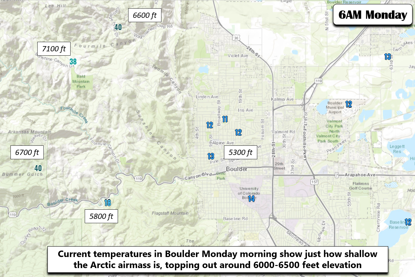
Our weather throughout the week ahead will be mostly determined by the positioning of this strong front as it wavers back and forth across the region. It doesn’t have quiet the depth or force behind it just yet to remain locked over the Denver Metro area. It is very shallow which typically causes weather forecast models to fall flat on their face in times like these. Based on local temperature observations around Boulder as of early Monday morning (below), we can see that the top of the Arctic airmass is only around 6000 to 6500 feet elevation, less than 1000 feet above the surface in Boulder. Above this level, temperatures are near 40. Below this, it’s 30 degrees colder!
As cold as it is right now Monday morning (11°F in BoulderCAST Station!) with a few flurries flying, we do anticipate that the front will retreat northeastward rather quickly through the day Monday with mild temperatures and those gusty west winds returning to the area this afternoon. Just like yesterday, elevated fire danger will be present, so do use caution, even though a Red Flag Warning may not be issued in your location. Several brush/grassland fires were reported on Sunday…one near Morrison and another in Cherry Creek State Park.
UPDATE: Multi-mission aircraft (MMA)flight over the #MorrisonRoadFire (also known as the #BearCreekFire) has the fire at 446 acres tonight. This video shows what it was like on the ground this afternoon. Fire size could be adjusted when crews get a better look after sunrise. pic.twitter.com/1re0K6u0Ja
— WestMetroFire (@WestMetroFire) February 8, 2021
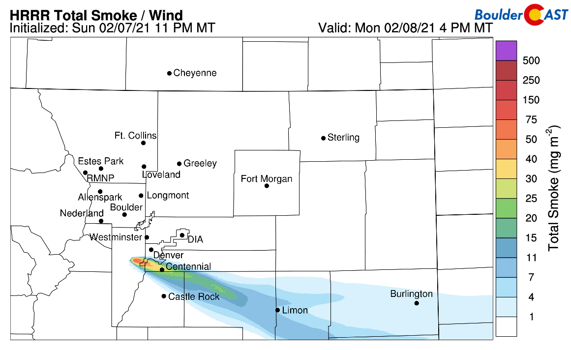
Some residual smoke indicated from the Morrison fire this afternoon once the west winds kick back up again.
It’s going to be a struggle this week determining which side of the Arctic front Denver and Boulder will lie. Each day early in the week, westerly winds will likely win out with seasonally mild temperatures being reached each afternoon. However, the reduced mixing during the nighttime hours will weaken those protective winds and open the door for the Arctic front to ooze back westward into the area. This diurnally meandering behavior, as forecast by the high-resolution HRRR model through Tuesday night, is shown below.
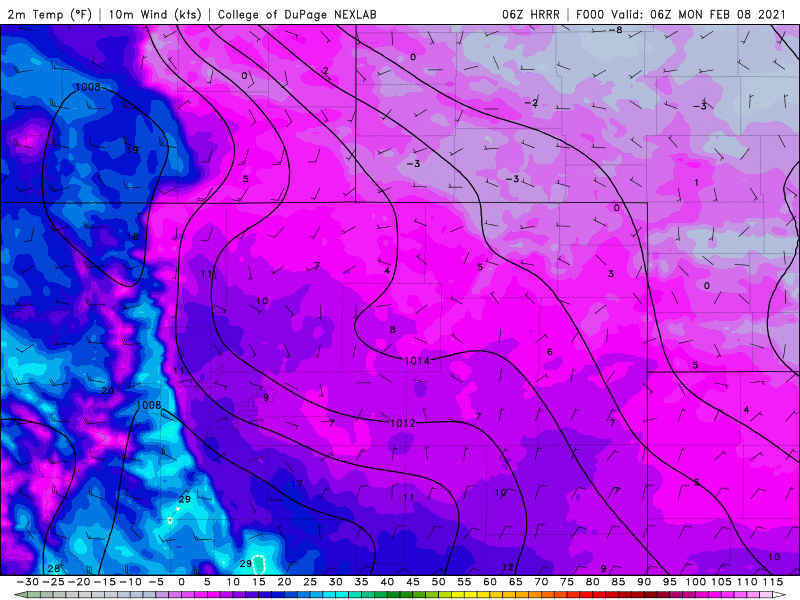
A high-resolution model forecast for surface temperatures Monday morning through Tuesday night showing the back and forth nature of the sharp frontal boundary
West of the front, highs should get well into 40’s (if not the lower 50’s) with downslope flow. East of the front, it will be bitterly cold with temperatures in the single digits and teens in far northeast Colorado. You can already see the kind of havoc this front could wreak on the forecast if its location is not correctly predicted with pinpoint accuracy. We are expecting most of the Denver Metro area to make it into the “warm” sector daily, but with a likely return of the Arctic air each evening and night. Any slight relaxation of the daytime westerly winds could see the front return abruptly and cause drastic temperature changes. This is most likely to occur east of a line from Greeley to DIA, but it’s hard to 100% rule this out for the immediate Metro area either. In any case, for Monday and Tuesday, expect highs in the 40’s with gusty winds at times. Temperatures will range from the single digits to the lower 20’s overnight, depending how much progress the front makes westward.
A very weak shortwave will move across Colorado on Wednesday likely helping to nudge the Arctic front southward a little. This should cause a drop in temperatures for the Denver Metro area Wednesday and Thursday, but the magnitude of this potential cooldown is uncertain with some afternoon scouring expected from the west winds. Highs will probably end up in the 30’s both days, but either 20’s or 40’s are not be entirely out of the question. There will also be a chance of snow on Thursday as several jet features push across the state. Most of the snow will be in Wyoming, but a few flakes could cross the border and impact areas north of Denver. No accumulation is expected.
The coldest air in years and snow for the weekend?
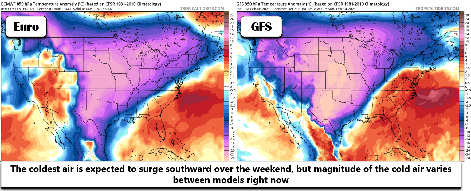
Late in the week, we are seeing strong indication that the coldest pool of Arctic air will fully push southward engulfing all of eastern Colorado, and in fact, spill southward all the way to the Gulf Coast and central Mexico. The surge is being fueled largely by a very potent 1052 millibar Arctic high pressure dropping southward out of Canada (shown below). This could have very frigid implications for the Front Range with forecasted highs tumbling Friday into the weekend and overnight lows even colder.

It’s a bit far out to say with certainty how cold it will get, as models are quite variable right now. The absolute warmest scenario would be highs in the 20’s over the upcoming weekend. On the colder end of things, we could see temperatures remain below zero entirely for two or three straight days!
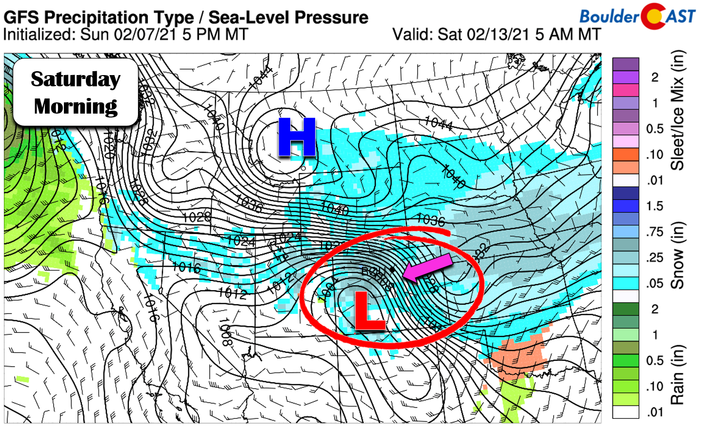
The stronger push of Arctic air will allow for more widespread and deeper upslope to develop across the Front Range likely leading to a period of widespread snow Friday into Saturday. This deeper airmass will also mean the colder air will reach up into the higher elevations, unlike Monday and the early part of the week.
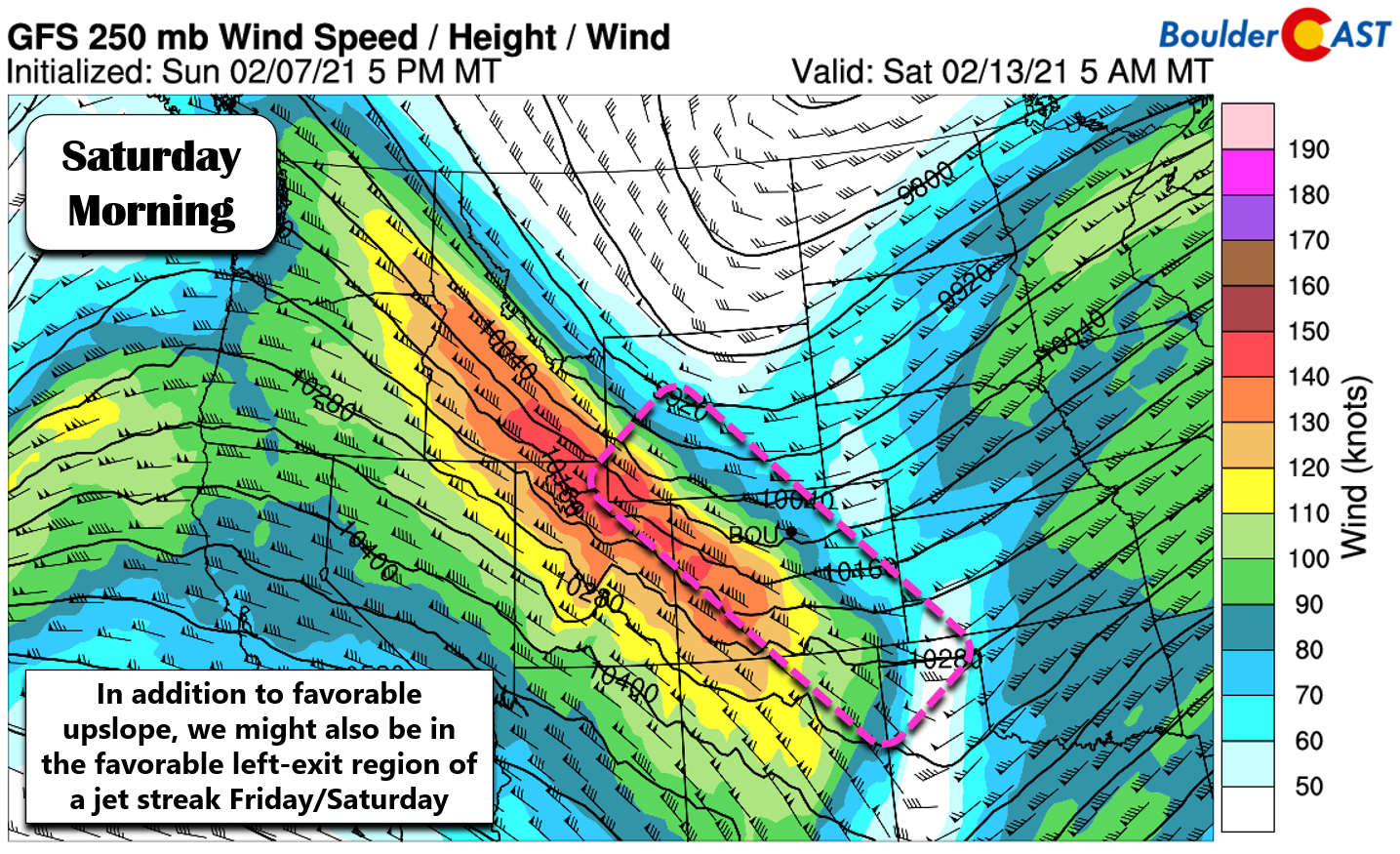
At the same time, we think the overhead jet could align favorably as well for additional lift during this time. Not unlike the winter of 2017-2018, our snowstorms this year have lived and died by the overhead jet steam.
Even with the favorable conditions for snowfall heading into the weekend, we’re still dealing with a bitterly cold Arctic airmass that will be largely devoid of any moisture. This comes with the territory; polar air is bone-dry. As such, snowfall amounts would tend to be on the light side in this scenario. However, with the overhead jet playing into things, it’s not unheard of to see some heavier snow falling out of an Arctic airmass. It’s certainly happened here before. The preliminary forecast from the GFS is predicting 2-5″ across the Denver Metro area by Saturday night (shown below). This forecast graphic also highlights another important aspect of Colorado weather this week: lots of Mountain snow! Yes the Mountains should see another 10 to 24+ inches through the week with favorable orographics much of the week. This snow won’t dump all at once, with a small helping of new powder expected most days this week into the upcoming weekend.
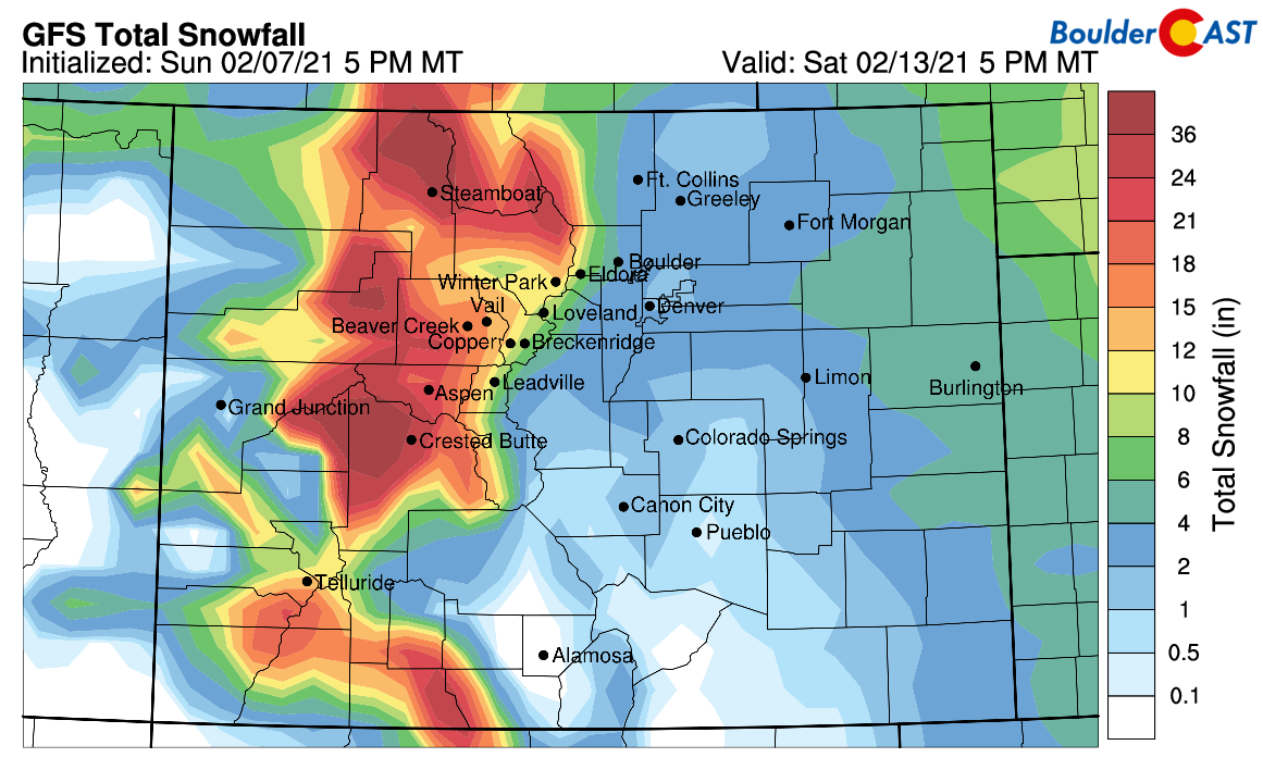
GFS model-derived snowfall forecast through Saturday evening
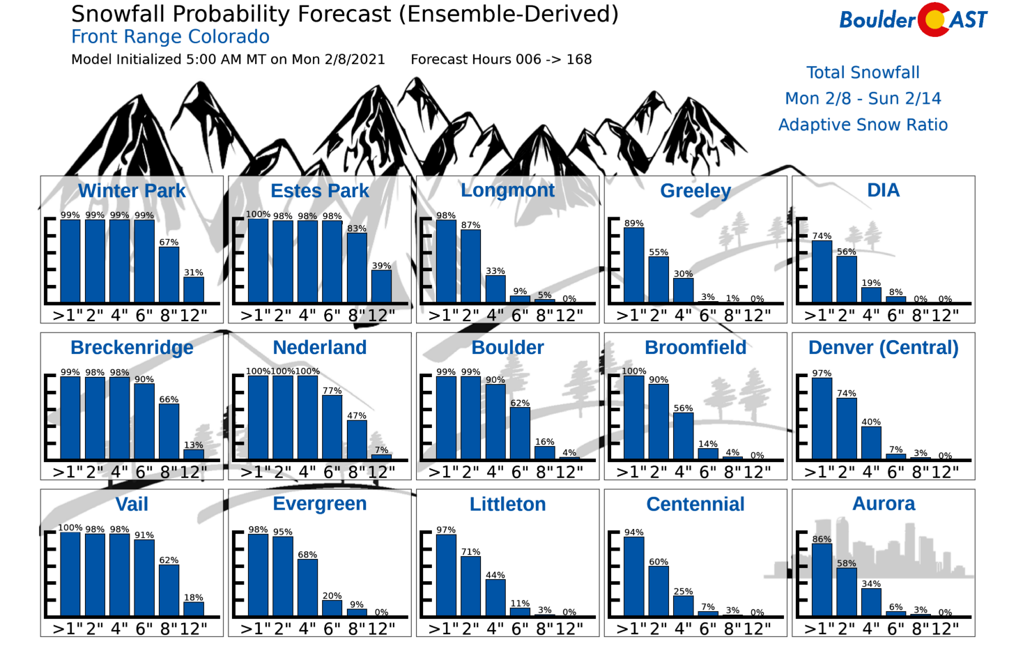
In general, for the lower elevations of the Denver Metro area, look for a trend towards much colder temperatures late in the week with chances of light snow increasing beginning Thursday. If you’re the kind of person that enjoys North Dakota weather, this could be the weekend for you! For the latest on this evolving Arctic airmass and the potential for snow, be sure to check back for updates later this week, subscribe, take a peek at our SnowTracker page , and follow us on Facebook and Twitter.
Forecast Specifics:
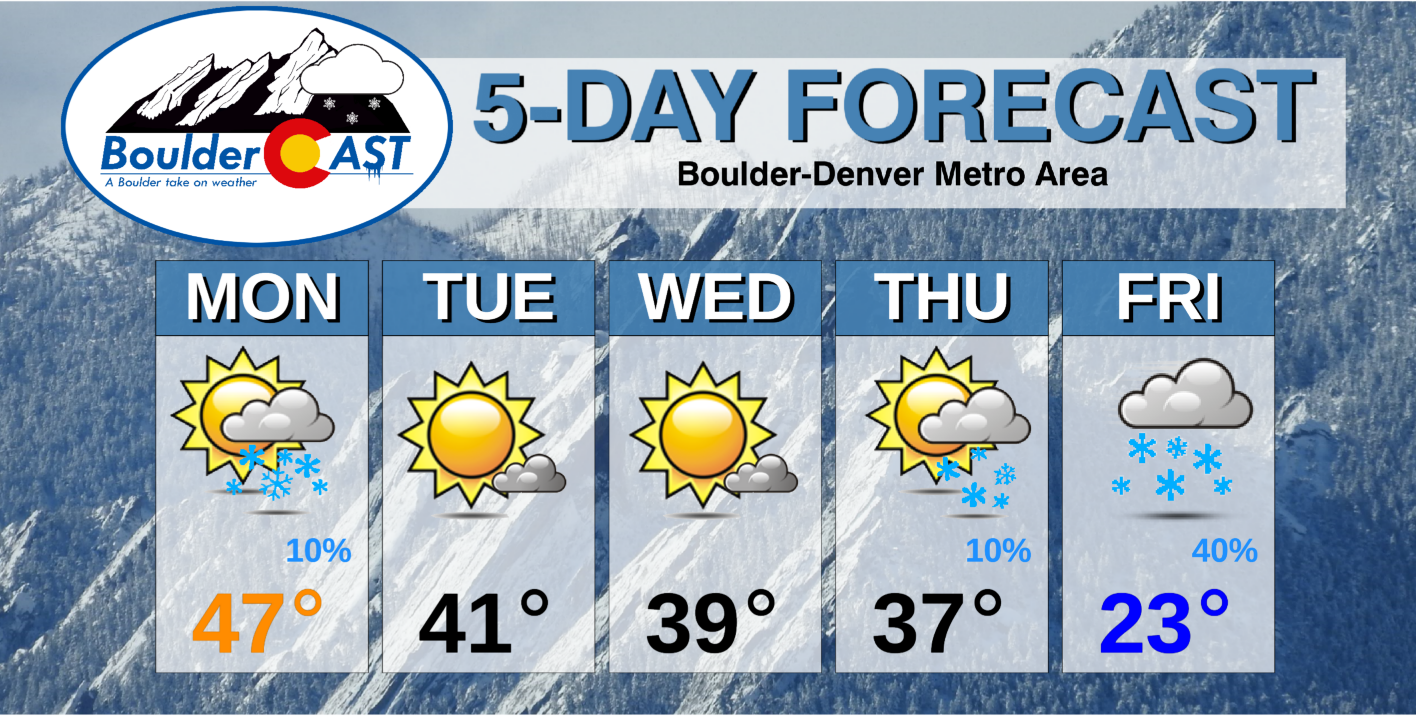
Monday: Low clouds, freezing fog and a few morning flurries in and near the Foothills, then sunny and breezy with highs in the middle 40’s. Wind gusts of 20 to 30 MPH expected.
Tuesday: Mostly sunny and dry with highs in the lower 40’s on the Plains and Foothills. It could be breezy in the afternoon.
Wednesday: Mostly sunny with highs in the upper 30’s on the Plains and Foothills.
Thursday: Cloudier and cooler with a tiny chance of snow, mainly along the Wyoming border. Highs in the 30’s on the Plains and 20’s in the Foothills.
Friday: Overcast skies and very cold. A chance of light snow through the day into the overnight with breezy northeast winds. Highs in the 20’s and likely falling through the day.
Weekend: The coldest air of the winter season so far is targeting the area this weekend. Saturday could have light snow as well, especially early in the day. For high temperatures, expect single digits or teens both Saturday and Sunday. Overnight lows will likely dip below zero.
Mountains: The Mountains will see windy but sunny conditions on Monday. Beyond that, light to moderate snow will fall daily in the High Country Tuesday onwards. The heaviest snow looks to occur in the Friday/Saturday timeframe statewide. Each day could see up to 8″ of new snow, depending on the Mountain range and exposure, with some areas picking up a foot or more on Friday into Saturday. Week long totals will range from 10 to 24″ in most ski resorts.
Help support our team of Front Range weather bloggers by joining BoulderCAST Premium. We talk Boulder and Denver weather every single day. Sign up now to get access to our daily forecast discussions each morning, complete six-day skiing and hiking forecasts powered by machine learning, first-class access to all our Colorado-centric high-resolution weather graphics, bonus storm updates and much more! Or not, we just appreciate your readership!
.
Spread the word, share the BoulderCAST forecast!
.


You must be logged in to post a comment.