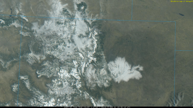
The first “warm” spring storm of the year moved across Colorado from the southwest on Thursday. Temperatures were borderline with this system, and many locations saw a trace or less of snow with rain the dominant precipitation type. However, the Foothills, Palmer Divide and southeast suburbs of Denver did see a little snow. Let’s take a look at the totals.
Here’s a view of the cut-off low pressure system as it moved across Colorado via GOES-East infrared imagery. Interestingly, we observe clear lee cyclogenesis with this system. Notice how the main core of the low was located in Utah initially. However, that circulation weakened as a new, stronger core developed rapidly in southeast Colorado.
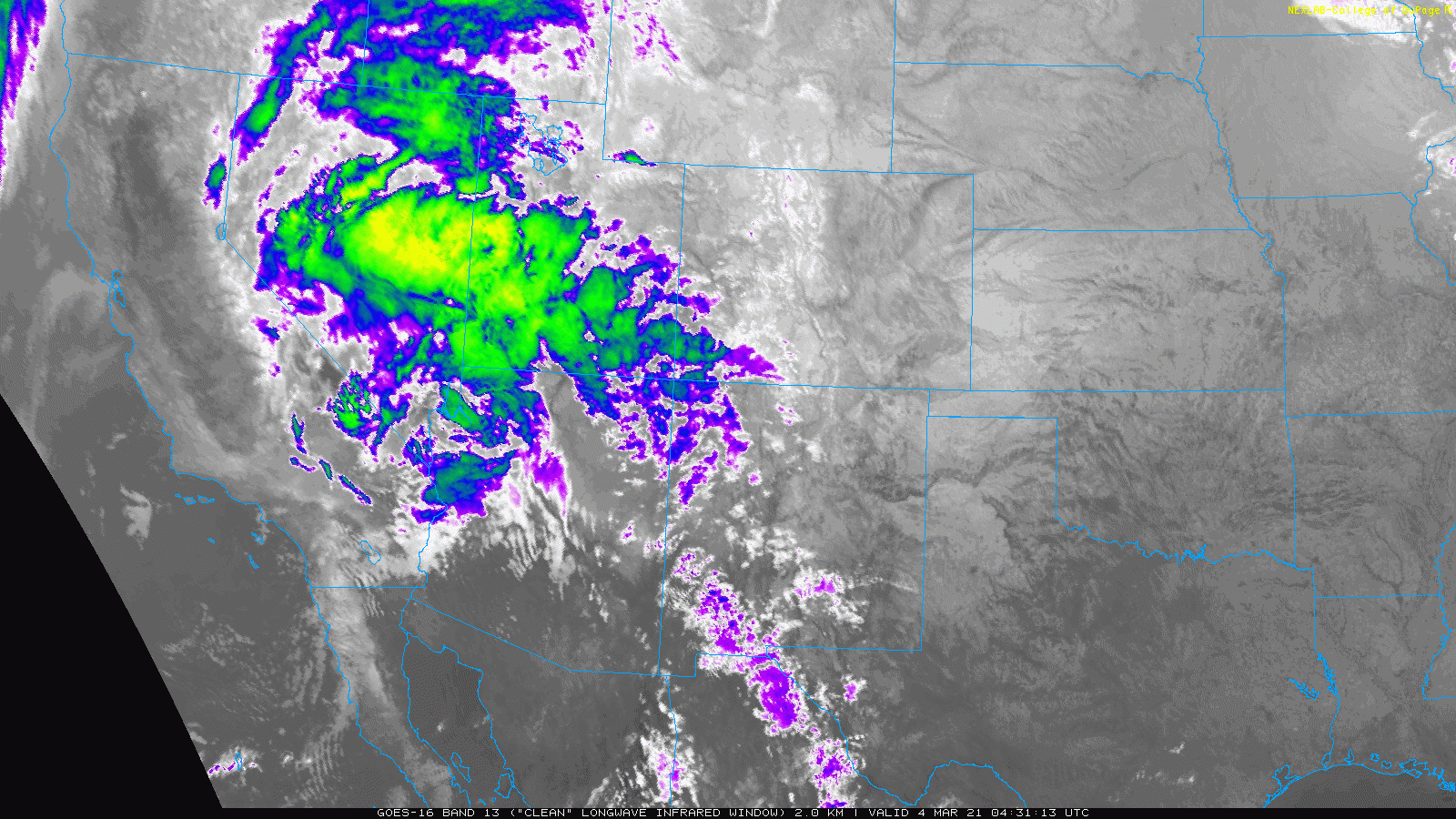
This reshuffling of atmospheric energy and moisture resulted in portions of the Denver Metro area largely missing out on this storm. The first low weakened to the west before arriving, while the second developed too far east and then moved away.
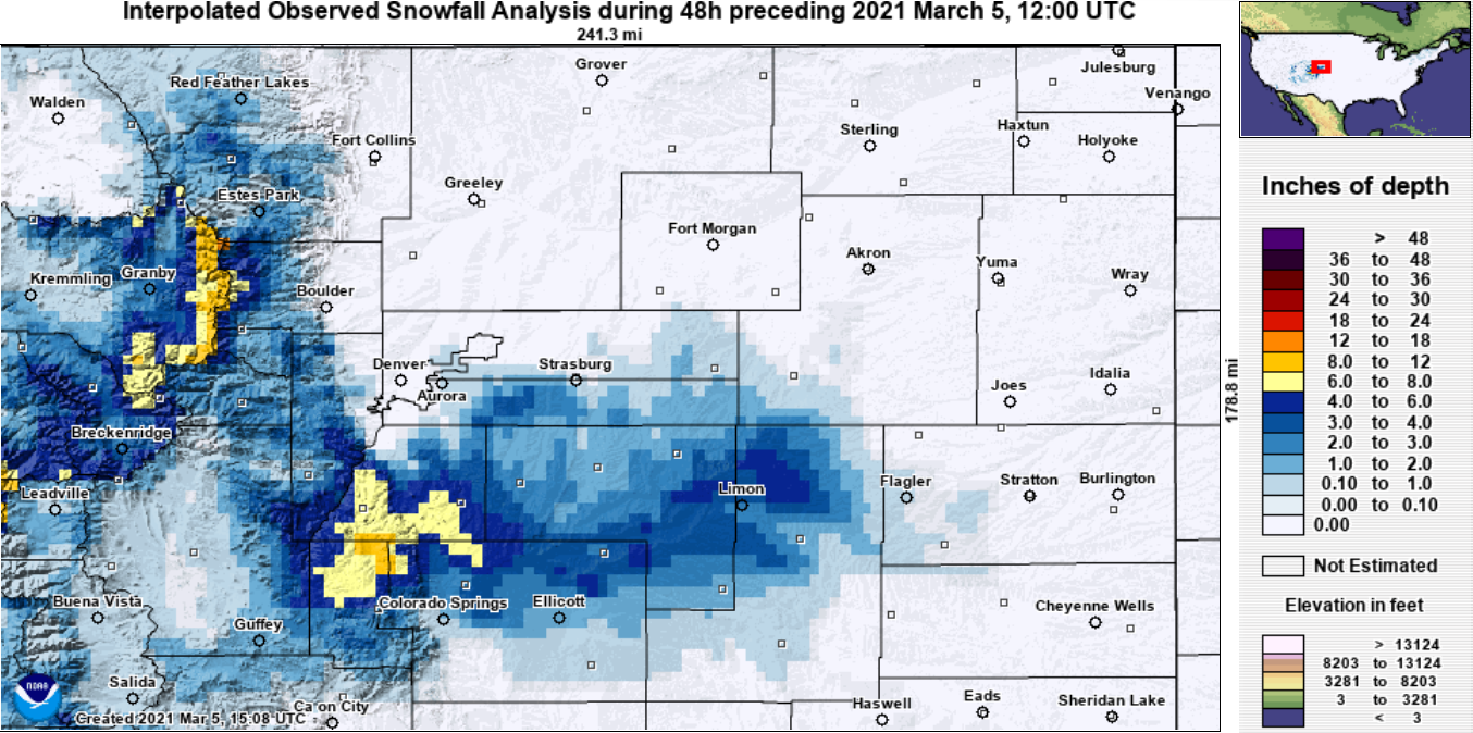
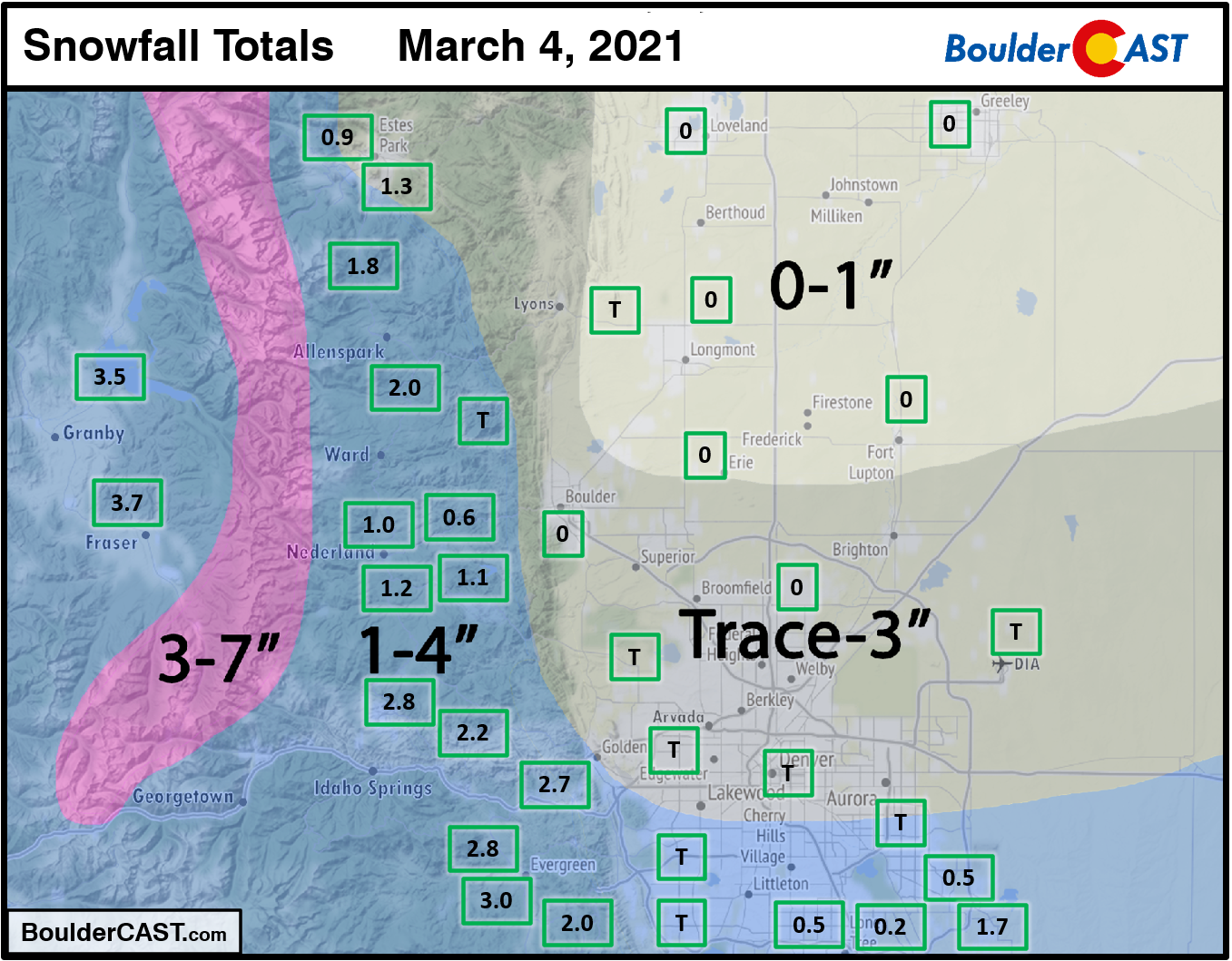
Shown below is our snowfall forecast map with actual storm totals overlaid in boxes. Green boxes indicate that our forecast verified to within one inch of the observed snowfall. Red did not (there are no red). Officially Boulder reported no snow and Denver reported just a trace. The highest totals of 2 to 4″ were notched in the higher elevations.
Continue to 2020-2021 Winter Snow Summary


You must be logged in to post a comment.