A developing Four Corners low pressure system will move across southern Colorado this weekend producing a prolonged period of moist upslope flow into the Front Range. While temperatures will (fortunately) be too warm for snowfall across the lower elevations, anywhere from 1 to 4″ of rainfall is expected to dump on our area. Where temperatures are colder, the higher Foothills and Mountains could see over 2 feet of snow from this system as well. Here’s our latest thoughts on the incoming soggy rain (snow) storm!

Go Premium, get all the perks.
Daily Forecast Updates
Get our daily forecast discussion every morning delivered to your inbox.
All Our Model Data
Access to all our Colorado-centric high-resolution weather model graphics. Seriously — every one!
Ski & Hiking Forecasts
6-day forecasts for all the Colorado ski resorts, plus more than 120 hiking trails, including every 14er.
Smoke Forecasts
Wildfire smoke concentration predictions up to 72 hours into the future.
Exclusive Content
Weekend outlooks every Thursday, bonus storm updates, historical data and much more!
No Advertisements
Enjoy ad-free viewing on the entire site.
P
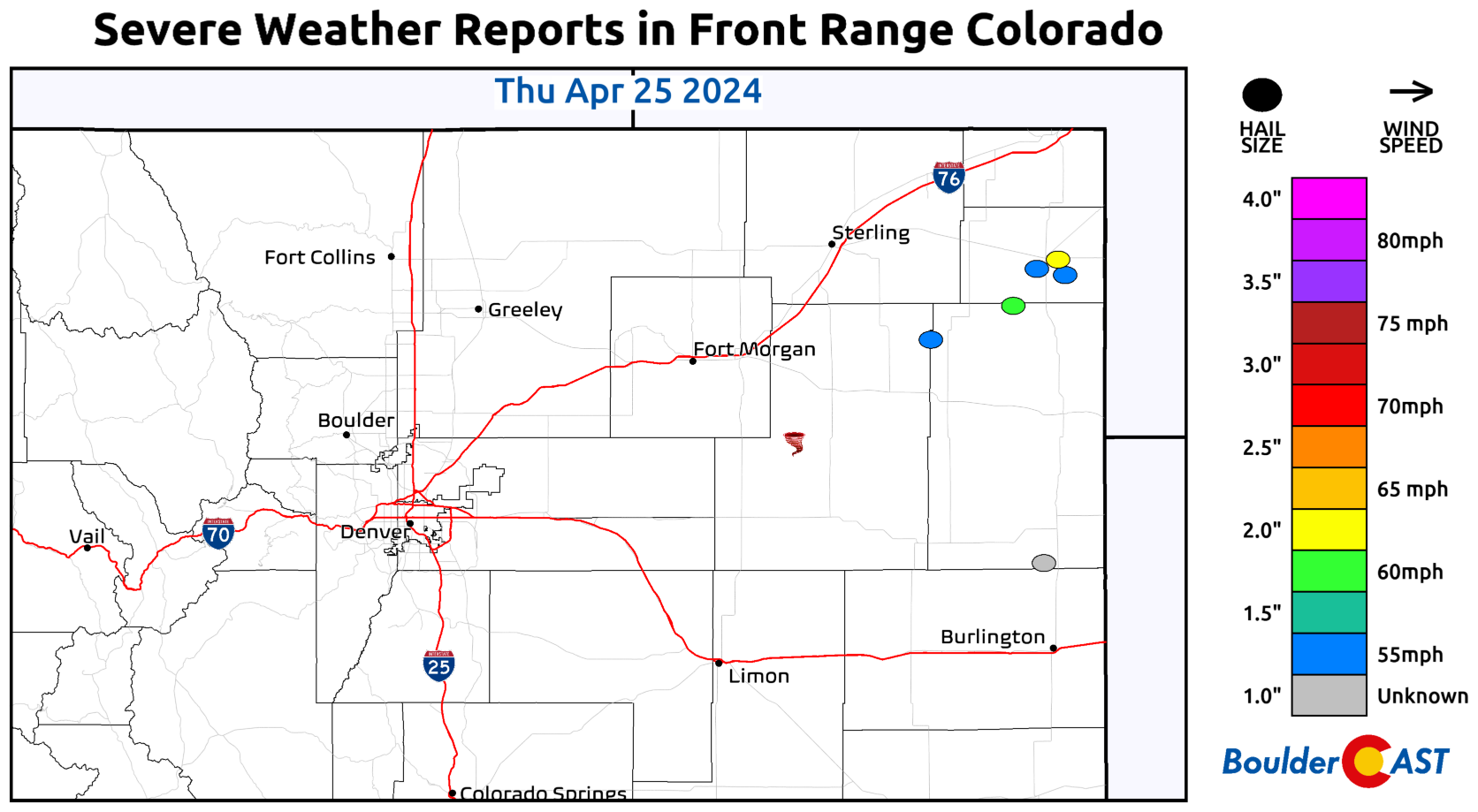
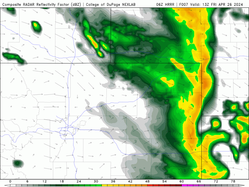
atches of rain showers and a few thunderstorms developed over the Metro area on Thursday, but as expected the best action was well east of the Denver area, including at least one tornado and numerous cells with 1-2″ diameter hail.
Rainfall amounts were generally light yesterday — just a few hundredths for most up to around a tenth in areas that saw a quick storm or two.
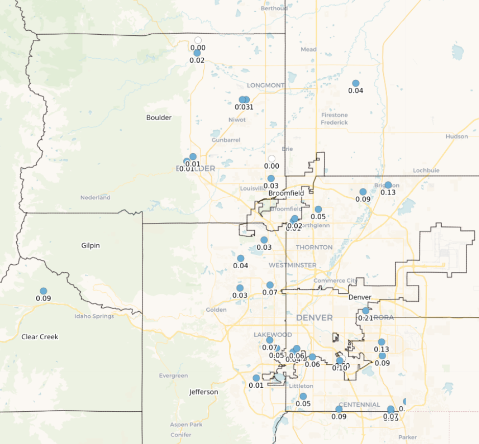
Rainfall totals from Thursday across the Metro area
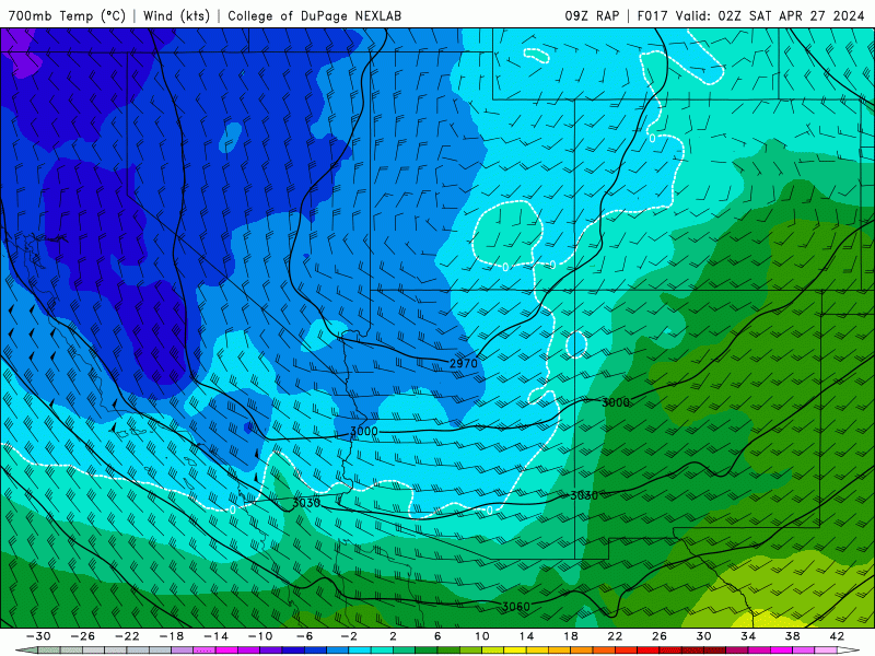
Yesterday’s rainfall was just a sample of what’s to come tonight and tomorrow as the next, stronger closed-low pressure moves into and across Colorado from the west. The storm system is currently located near northern California. Over the next 48 hours, this trough will move across the Great Basin and form a closed low over the Four Corners.
As this closed low moves slowly eastward across southern Colorado, it will facilitate a prolonged period of moist upslope flow and large-scale lift in the Front Range.
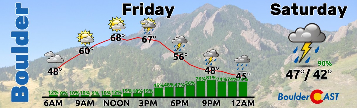
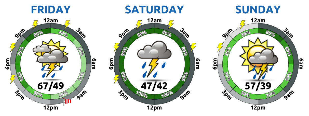
Friday will be a day of transition between the departing storm from yesterday and the one arriving this evening and tonight. Most of the day will be fairly nice, but look for rain to quickly ramp up by early evening and continuing for a solid 24 to 36 hours with little interruption.
Highs will reach the upper 60s Friday before the clouds fully thicken and rain becomes widespread.
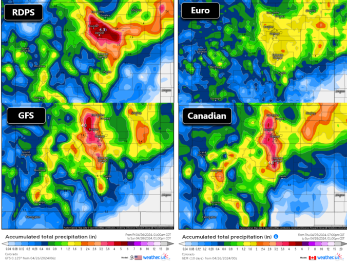
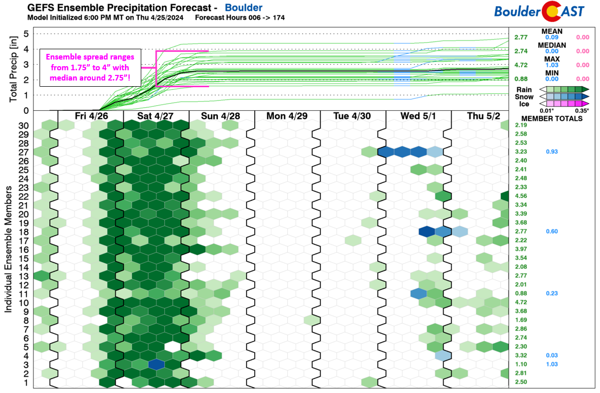
Models have trended upwards and have been consistent for the last few runs regarding precipitation amounts for us through Saturday night, with nearly every model onboard for 1.5 to 3.5 inches of rainfall in Boulder and Denver. The Euro model remains the lowest at ~1.5 inches (below, top right). Some models do have localized bullseyes above 4 inches!
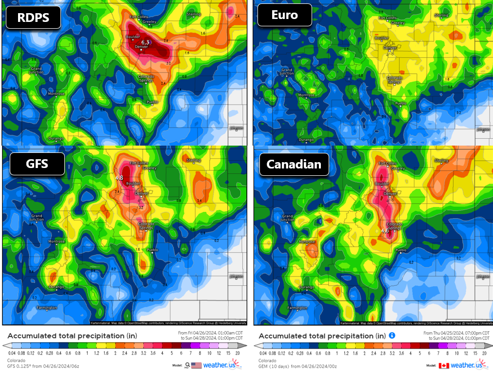
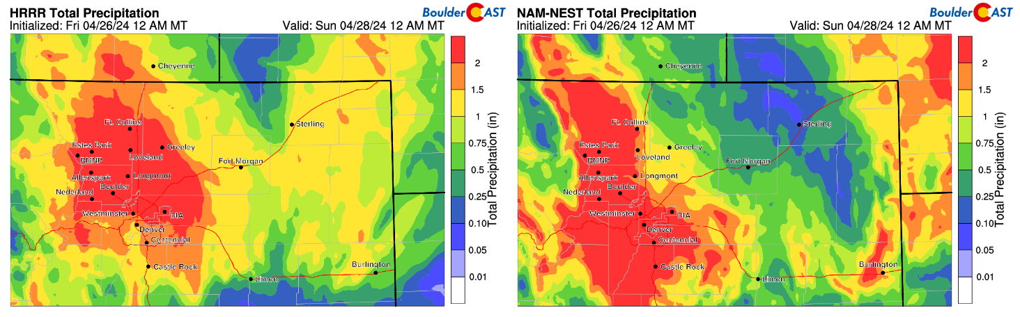
Even the ensembles are now showing over ~2″ of rainfall here, a definite uptick in the last 24 hours.
The next 48 hours will be soaking indeed! Any outdoor plans on Saturday are going to be very soggy. If you can cancel them or reschedule to Sunday, that would be advisable at this point. Rainfall chances will begin to decline after midnight Saturday night into Sunday morning, but things will remain cool and gloomy through Sunday as well with temperatures in the 55-60°F range for highs and a slight chance of a few light showers. It’s not until early next week that we finally dry out and warm up as a ridge enters the area. Highs will return to the 60s and 70s Monday through Wednesday.
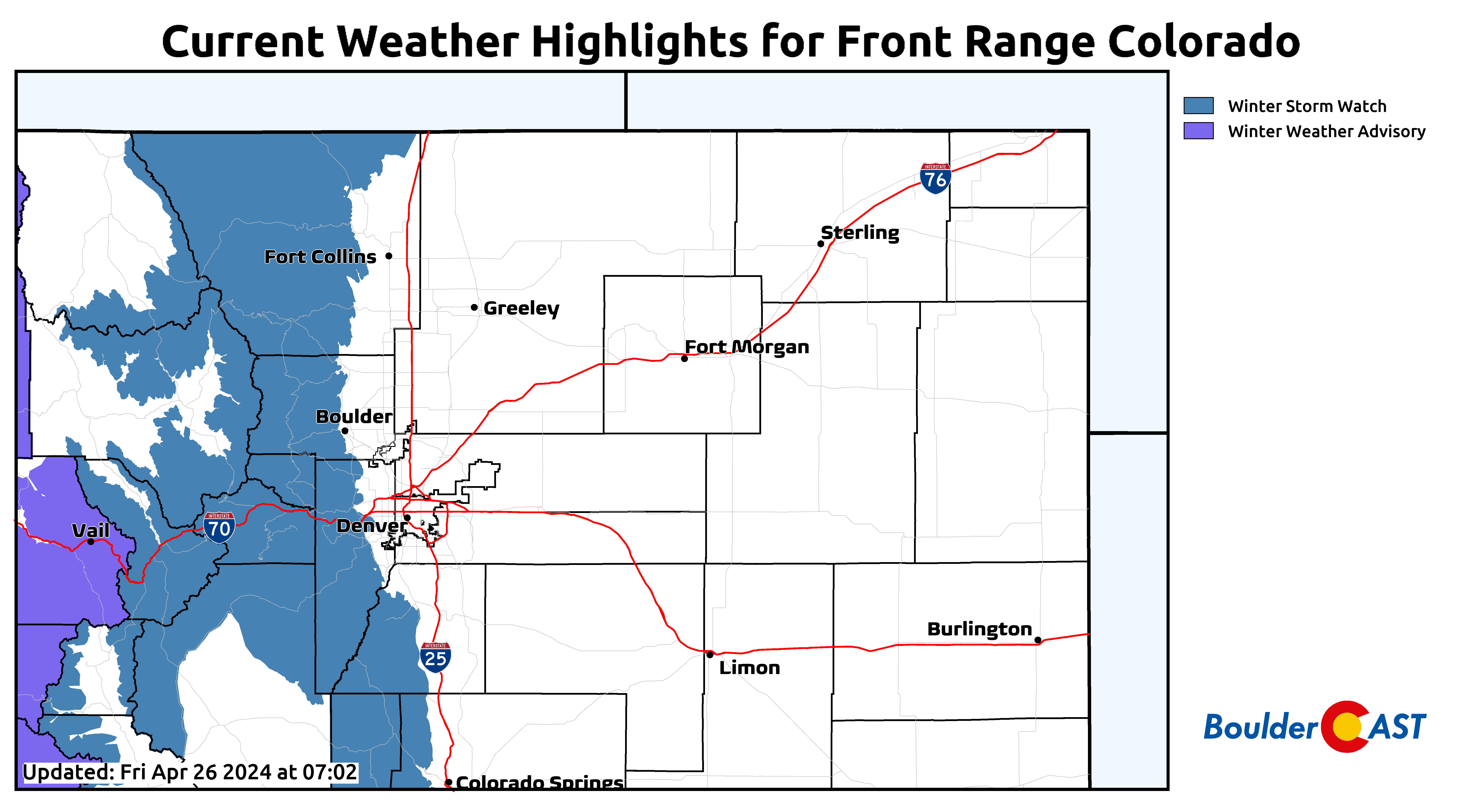
The other aspect of the impending spring storm is the heavy snow in the Mountains and higher Foothills. Snow levels vary considerably in models, but given the sheer amount of precipitation headed our way, we’re going to hedge out bets on the colder solutions with snow levels coming down to around 7500 feet for this storm. Snow totals of 6-18″ are expected between 8000 and 9500 feet elevation, with up to 30″ possible above 10,000 feet. Snowfall rates 1-2″ per hour will be common, especially during the day Saturday into Saturday evening.
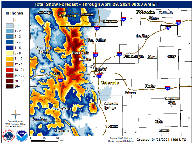
Winter Storm Watches are posted for the Mountains and (high) Foothills. Plan for winter driving conditions this weekend up there!
That’s all for now. Enjoy the soaking rain ahead — we’re extremely lucky this one isn’t cold enough to be snow!
Get BoulderCAST updates delivered to your inbox:
Go Premium, get all the perks.
Daily Forecast Updates
Get our daily forecast discussion every morning delivered to your inbox.
All Our Model Data
Access to all our Colorado-centric high-resolution weather model graphics. Seriously — every one!
Ski & Hiking Forecasts
6-day forecasts for all the Colorado ski resorts, plus more than 120 hiking trails, including every 14er.
Smoke Forecasts
Wildfire smoke concentration predictions up to 72 hours into the future.
Exclusive Content
Weekend outlooks every Thursday, bonus storm updates, historical data and much more!
No Advertisements
Enjoy ad-free viewing on the entire site.
Enjoy our content? Help us out and give it a share:


You must be logged in to post a comment.