
A weak storm and associated jet streak moved across Colorado on the evening of February 20th producing bands of moderate snowfall for a brief period. Southeastern portions of the Denver Metro area were hit hardest. Let’s take a look at the totals.
As expected, a bulk of the snow bands developed across southeast Denver. Here’s what the radar looked like near the middle of the event.
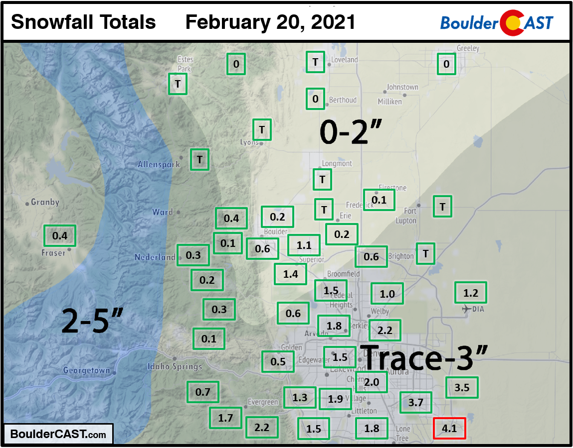
Shown below is our snowfall forecast map with actual storm totals overlaid in boxes. Green boxes indicate that our forecast verified to within one inch of the observed snowfall. Red did not. Officially Boulder reported 0.4″ of snow and Denver reported 1.2″. The highest totals, around 3 to 4″, were observed in the Aurora/Parker area.
Continue to 2020-2021 Winter Snow Summary


You must be logged in to post a comment.