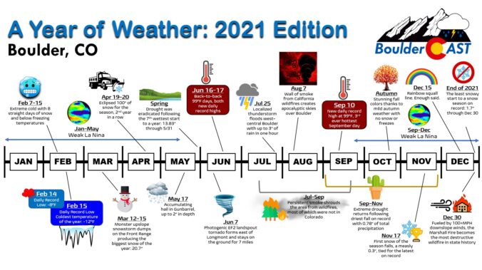
2021 was a diverse year in Colorado weather which isn’t out of the ordinary. However, 2021 definitely upped the ante a bit. The year began quite cold and wet but had a prolonged warm and parched finish. We saw the widespread drought get abolished at one point and then promptly get reinstated. Months of poor air quality from distant (and some close) wildfires characterized the summer season — not the monsoon. And of course, everything culminated in a devastating and fiery ending just before the New Year. We made 14 unique graphics that together characterize only a small slice 2021’s weather in Boulder. Enjoy!
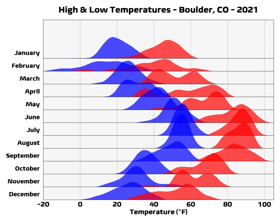
We begin with a simple graphic showing the monthly distributions of high and low temperatures throughout 2021.
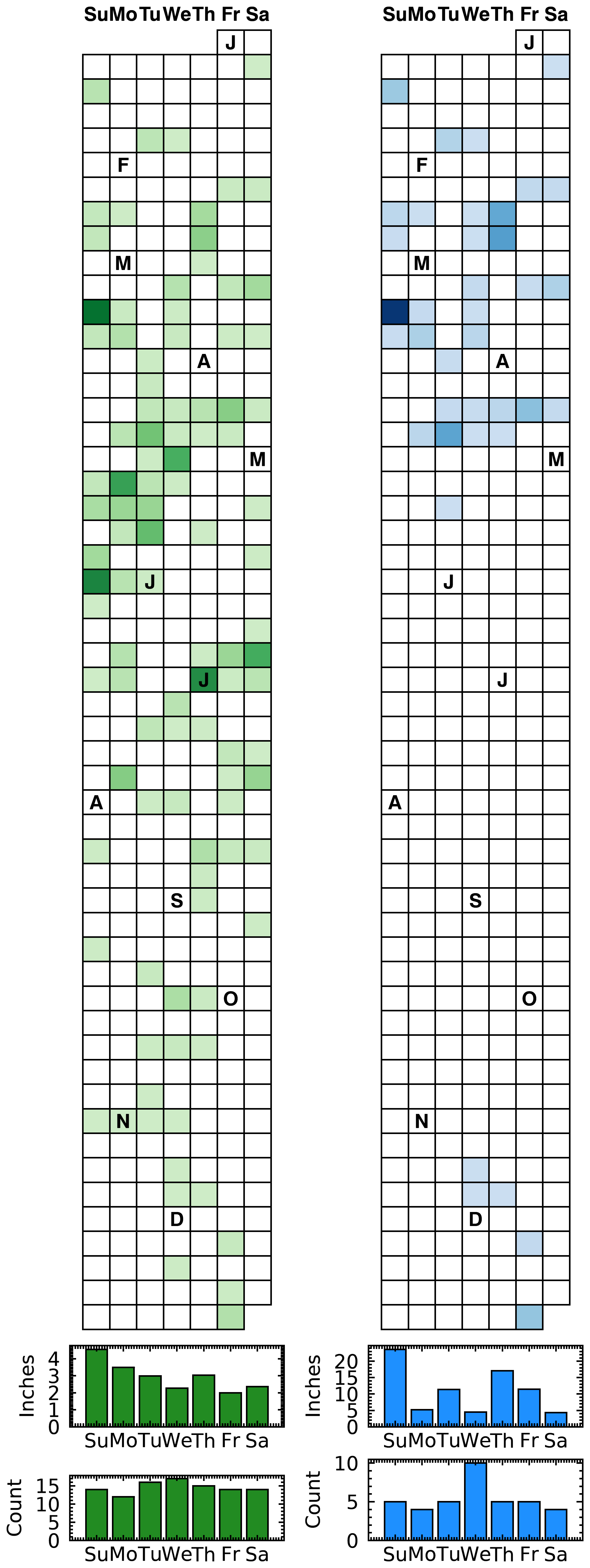
Snow was observed nearly twice as often on Wednesdays in 2021 compared to ANY other individual day of the week. However, the 10 Wednesday snow events amounted to only about 5″ of actual snow accumulation! The wettest day of the week was Sunday, mainly due to the monster March snow storm which produced nearly 2″ of liquid equivalent!
Precipitation & Snow by Day of Week – Boulder, CO – 2021
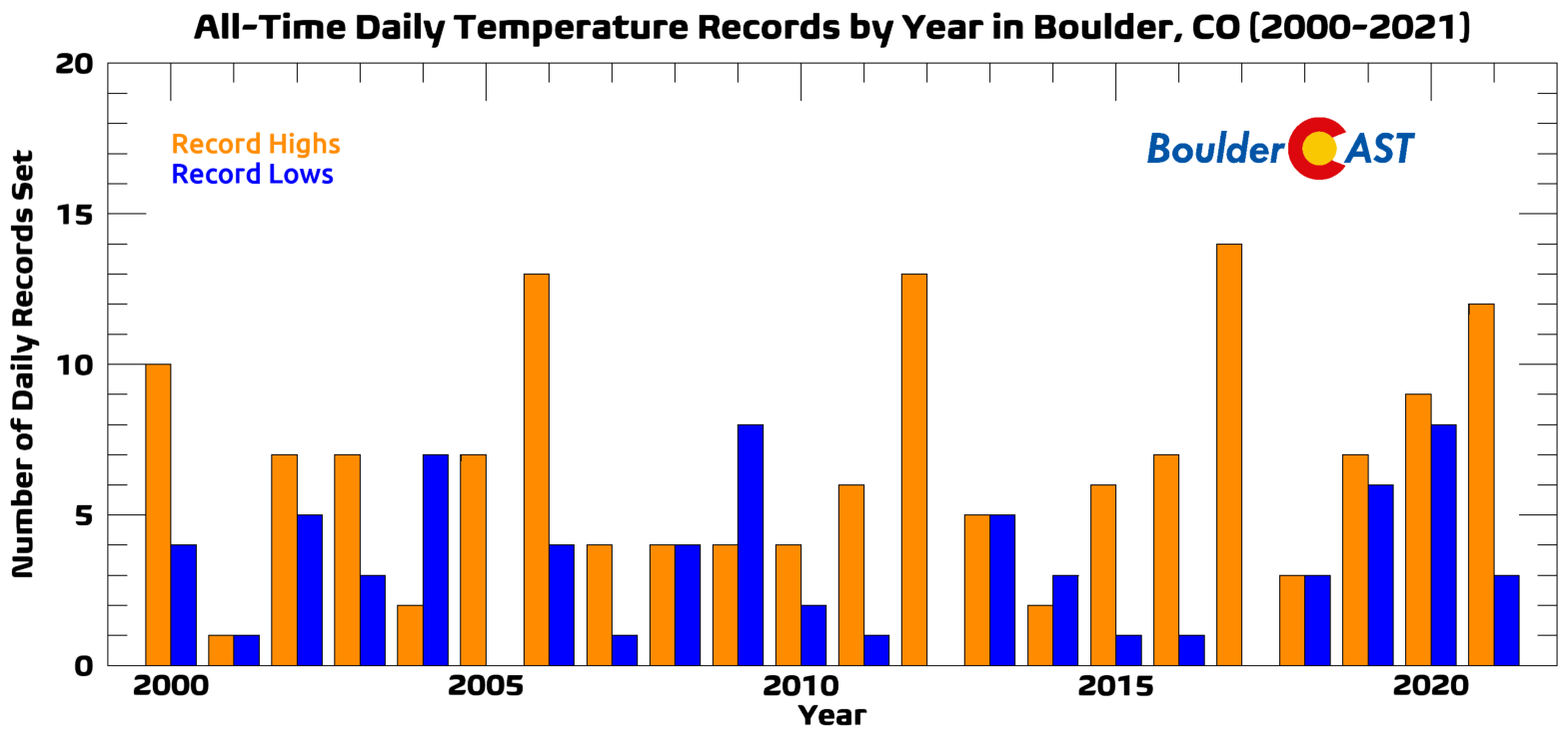
Boulder set 12 new daily record high temperatures in 2021, but just three new daily record lows. Here’s how 2021 stacks up to the last two decades for holding daily record values:
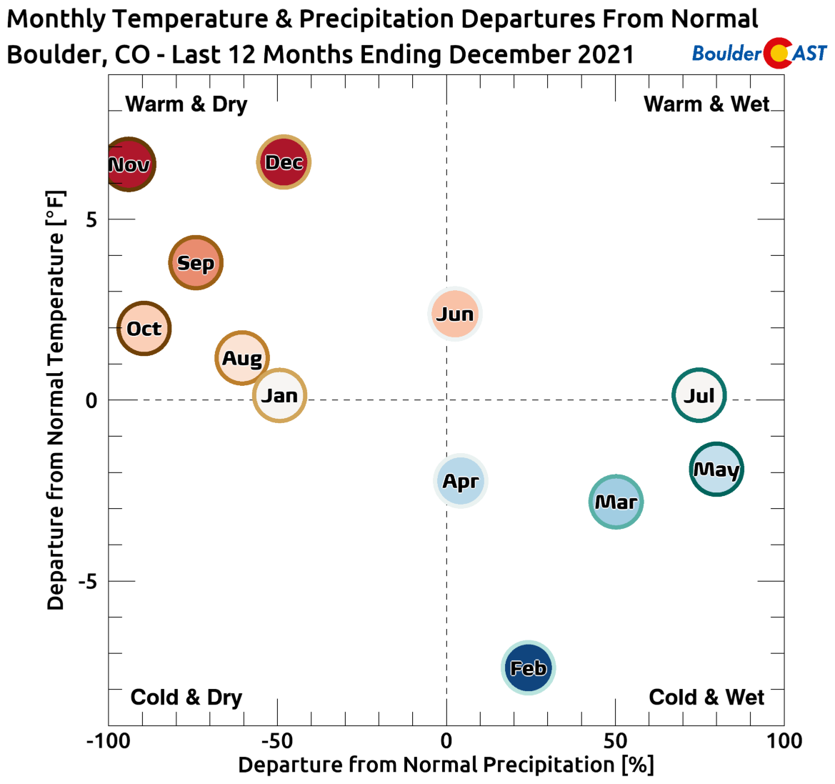
The year began as one of the wettest on record through the end of May, but things really dried out thereafter. Here’s how each month in 2021’s temperature and precipitation compared to normal.
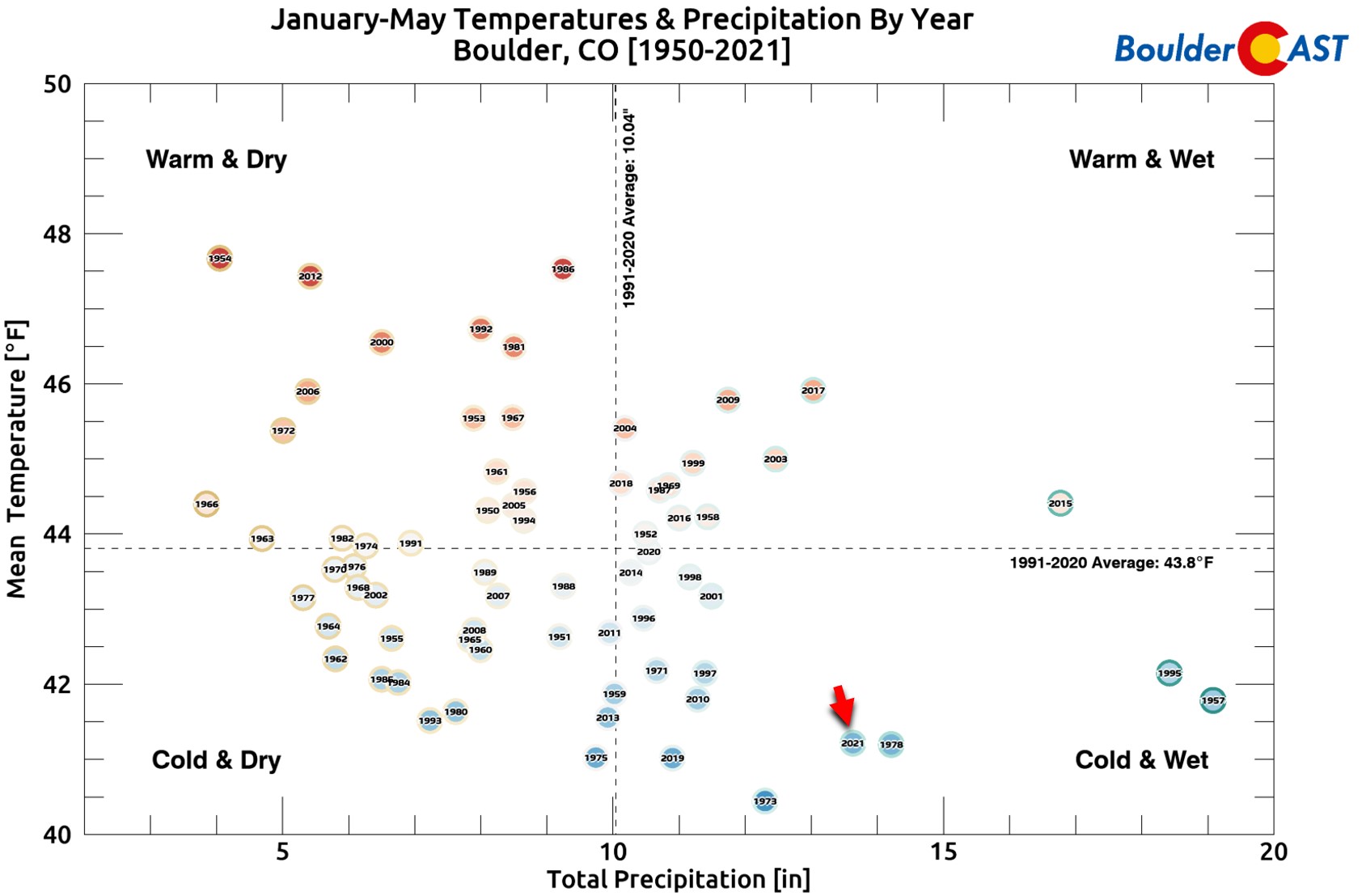
As mentioned, the first five months of the year went down as one of the coldest and wettest on record (Jan-May):
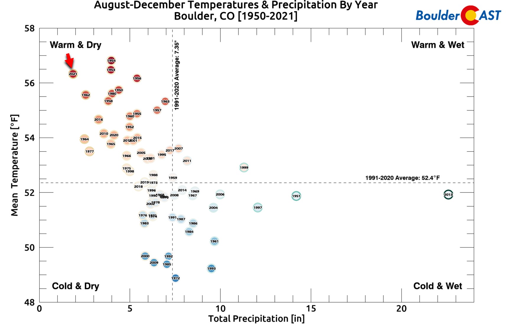
However, we know how the rest of the year played out — particularly the autumn season in which we were starved for snow and it was unseasonably warm week in and week out. The period of August to December was the driest on record and the 3rd warmest for the city of Boulder:
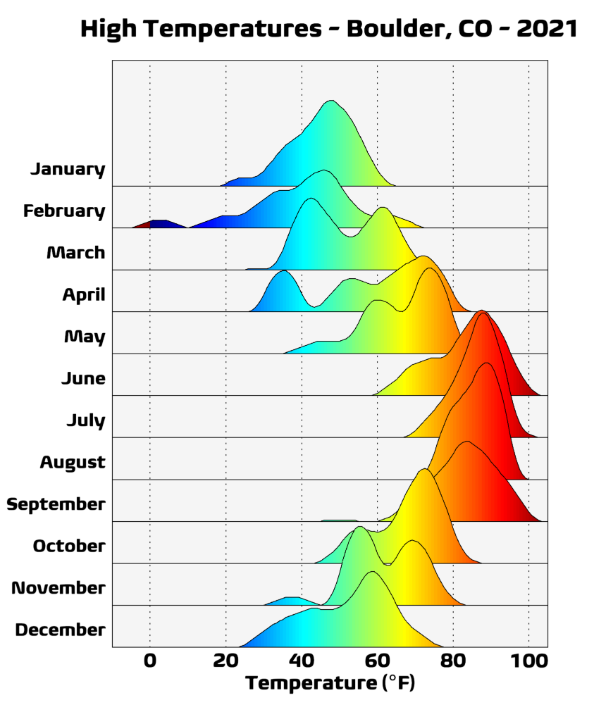
Here’s another visualization of the year’s high temperatures by month, but now with 300% more color! It’s definitely interesting to see the bi- or even tri-modal distributions in our temperatures some months.
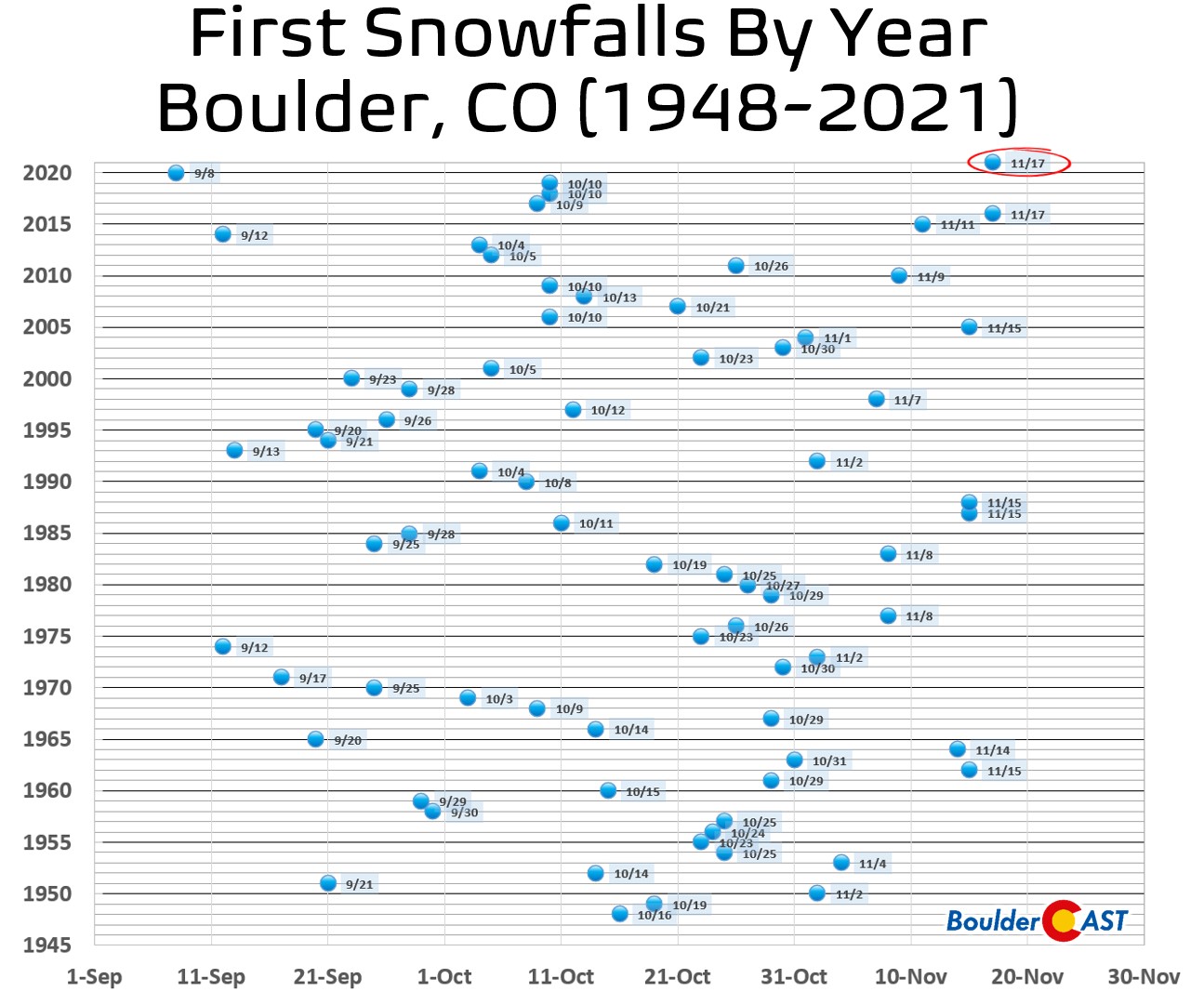
It took FOREVER to snow this season, but Boulder finally notched its first snow on November 17th — a measly 0.3″. This tied for the latest ever first snowfall on record with 2016.
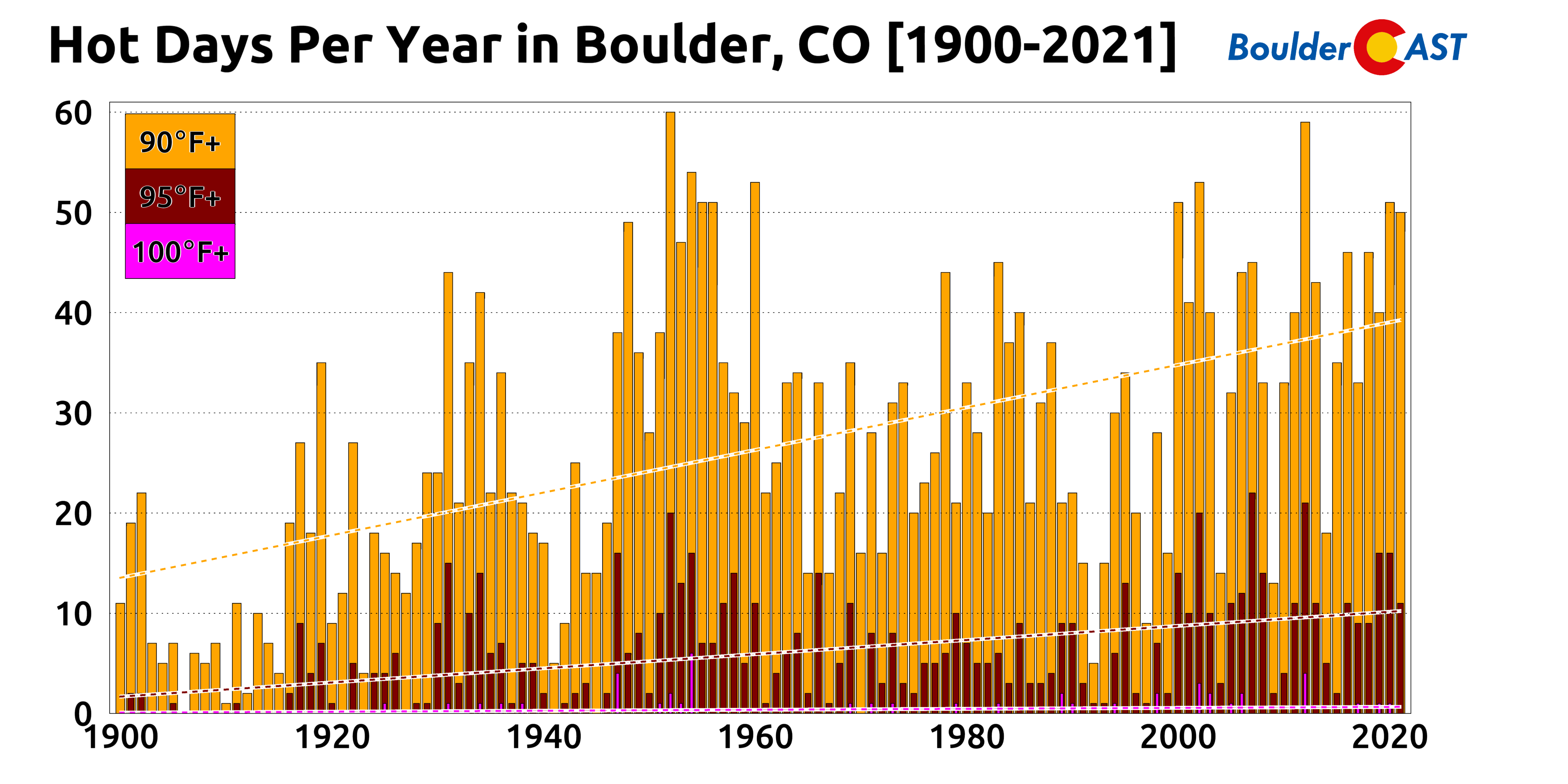
2021 was a HOT one for sure — it had 50 days at or above 90 degrees in Boulder, one less than 2020. There were 11 95-degree days, but Boulder never reached the elusive triple digits. You can see how this compares to the historical period below.
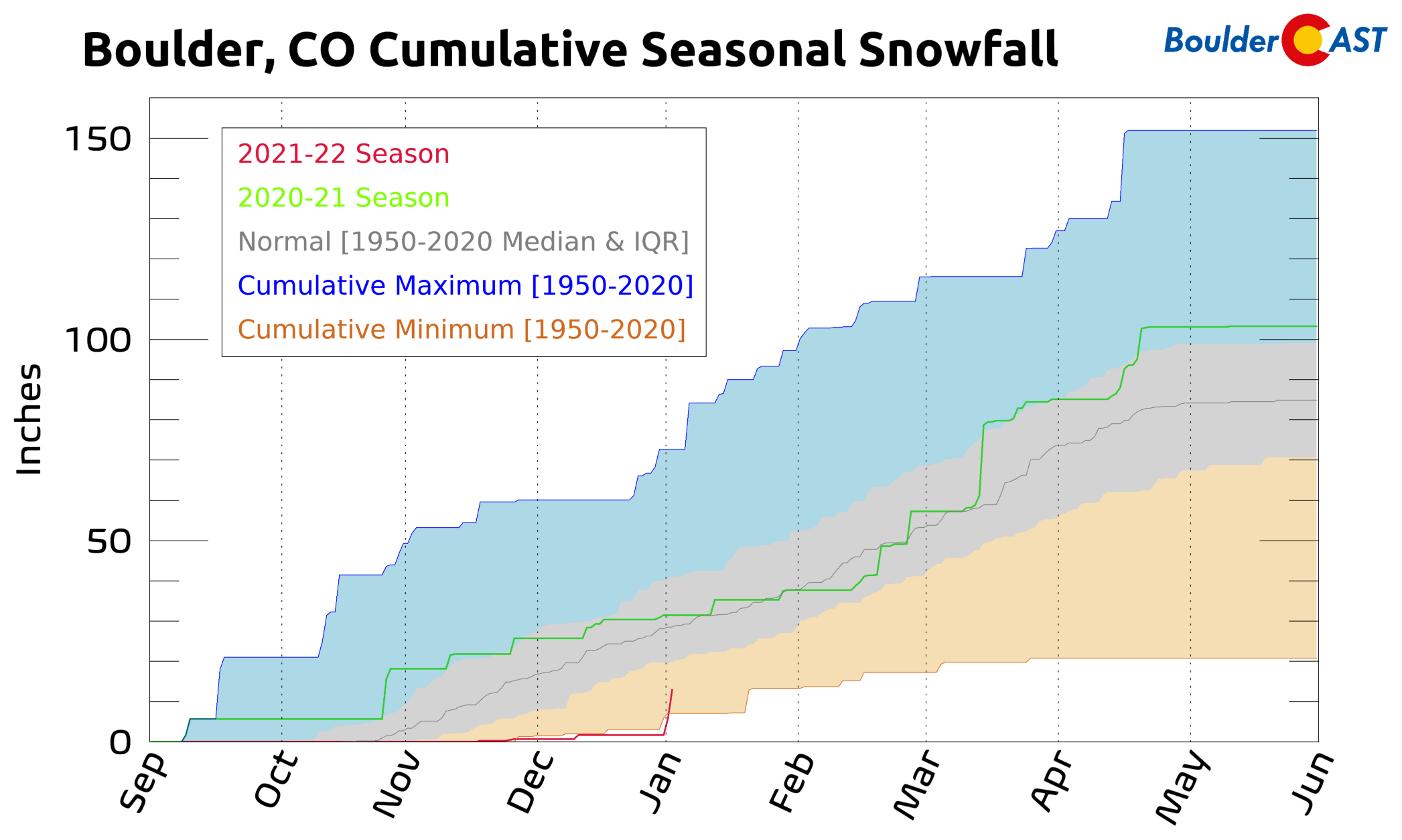
We have consistently tracked below the all-time minimum cumulative seasonal snowfall line during the 2021-2022 season. Only after the New Year’s Eve snowstorm, which produced 11.2″ in Boulder, did we move out of this last position!
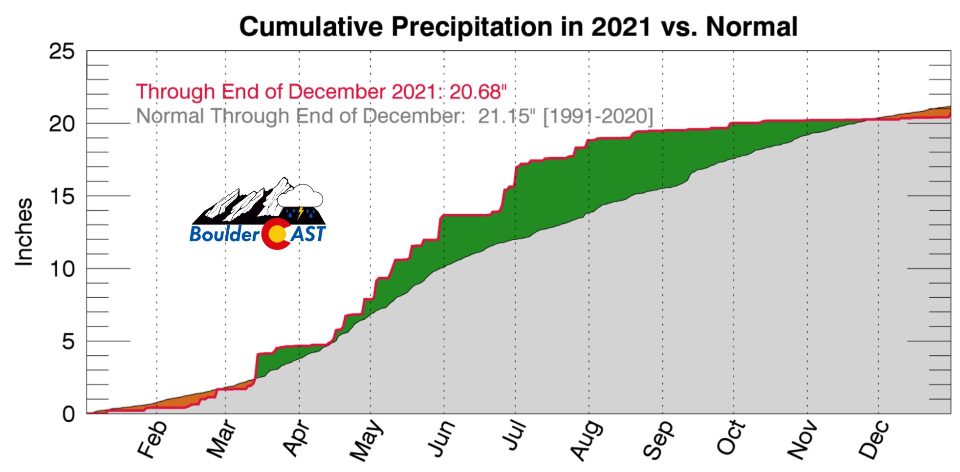
Here’s another look at the year’s precipitation. Thanks to a wet spring, we were running a surplus much of the year until late November, despite how dry it had been the four months prior. Boulder ended 2021 with 20.68″ of rain and melted snow equivalent, which is just slightly below normal from the last three decades.
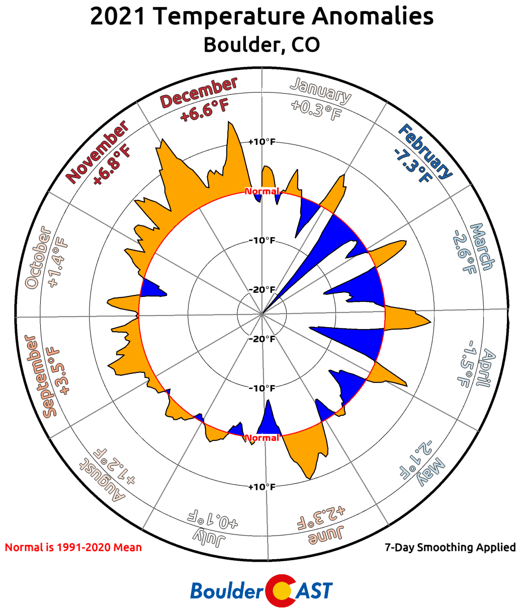
Finally, let’s “circle” back to the temperatures throughout the year. The disparity between the cold start to the year and the warm finish really hits home with this one:
A few links to the year’s biggest weather happenings:
Spread the word, share our Colorado weather:
We discuss Boulder and Denver weather every single day on BoulderCAST Premium. Sign up today to get access to our daily forecast discussions every morning, complete six-day skiing and hiking forecasts powered by machine learning, access to all our Front Range specific weather models, additional storm updates and much more!




You must be logged in to post a comment.