Happy New Year! After a welcomed snowstorm to end 2021, 2022 starts out somewhat quiet with temperatures close to seasonal normals. That, however, changes abruptly come Tuesday with another windy day followed by unsettled, cold, and wintry conditions beginning midweek. Our next snow event is taking shape for Wednesday evening into Thursday favoring potential banded snowfall, though it may end up too far north. We discuss all of this, as well as when we might expect to see warmer weather return.
This week’s highlights include:
- The first snowstorm of the season produced 4-12″ of snow to the Front Range
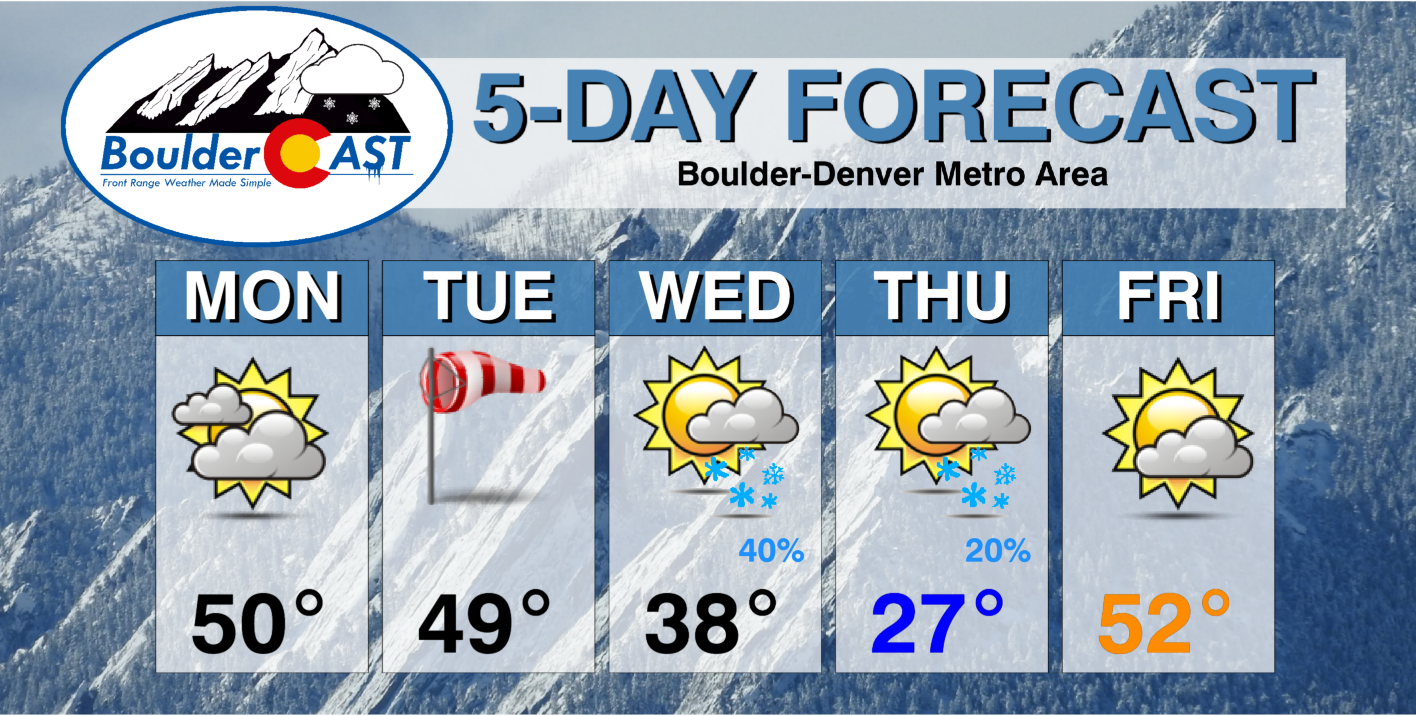
- Quiet for the first Monday of 2022 with highs near 50 degrees
- A windy day expected again for Tuesday with gusts likely exceeding 45-50 MPH
- Watching a midweek snow event with potential banded snowfall
- Cold with below average temperatures Wednesday and Thursday
- Low 50s possible by Friday
DISCLAIMER: This weekly outlook forecast is created Monday morning and covers the entire upcoming week. Accuracy will decrease as the week progresses as this post is NOT updated. To receive daily updated forecasts from our team, among many other perks, subscribe to BoulderCAST Premium.

The first snowstorm of the season arrived too late
We start with a look back at our belated first snowstorm of the season — one which unfortunately came a day too late to possibly help prevent the most destructive wildfire in Colorado history last week. Our hearts go out to those that have been affected by the Marshall Fire which destroyed or damaged more than 1200 homes in eastern Boulder County in the blink of an eye. It’s been a sombering last several days but it’s encouraging to see the community banding together to help in any way they can.
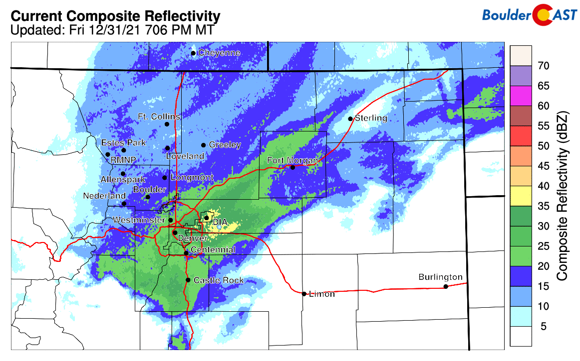
A strong trough finally moved across Colorado in a manner that was conducive for snow across the Front Range cities. It had frontal forcing, jet activity, and upslope all to accompany the push of chilly Arctic air. The heaviest snow fell from late Friday afternoon into the early evening hours inside of a well-defined snow band that lined up from southwest to northeast. This band stretched all the way from the Foothills of Jefferson County to the Wyoming border. The regional radar animation from around 4PM Friday is shown below.
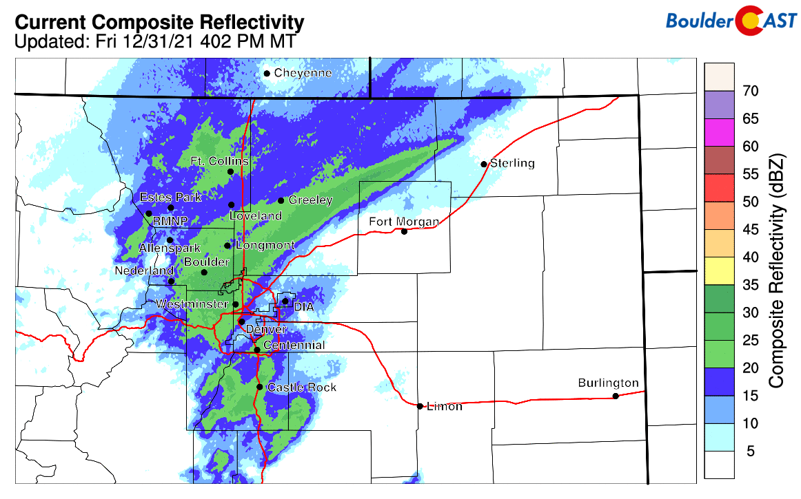
This snow band was being forced by a briefly stalled mid-level frontal boundary. Warm/moist southeasterly winds were colliding with cold/dense northerly winds right along this line producing the swath of heavier snow which lasted for several hours in this region.
Eventually this band sagged south and east through the evening impacting most of the Denver Metro area. The radar animation from 7PM on New Year’s Eve is below. After this heavier band pushed out, temperatures dropped like a rock into the single digits as light upslope-forced snow continued for another 8 to 12 hours in many locations through the overnight.
Our snowfall forecast map for the event is shown below with storm totals overlaid. Green values indicate our forecast verified to within one inch. Red did not. Overall, we had almost a perfect forecast for this storm with nearly every location seeing their allotted amount of fluffy snow. Boulder officially reported 11.2″ from this event, while Denver got 5.6″. This was our biggest snow event since the appropriately-hyped mega snowstorm back in mid-March 2021.
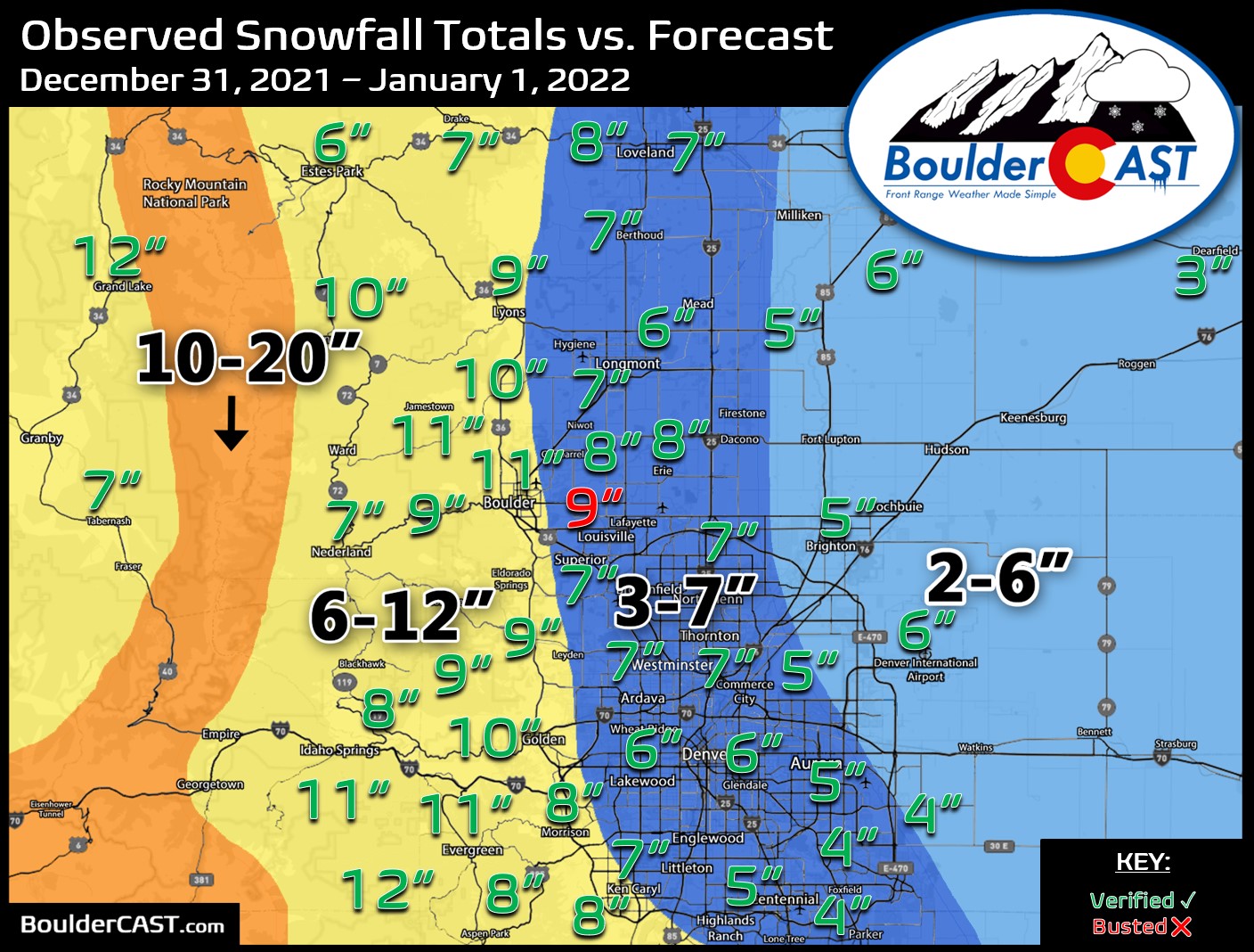
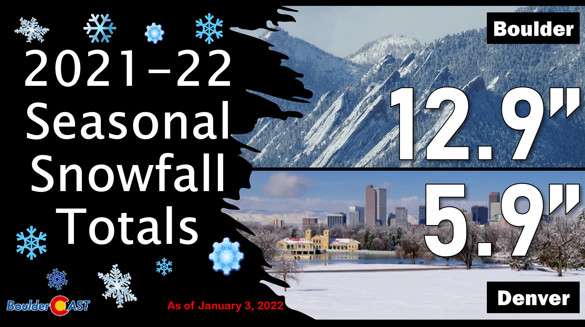
This storm certainly helped with the snow situation, but we’re not where we need to be yet — not by a long shot. Both Boulder and Denver are still running well below normal for snowfall through early January.
Quiet to start 2022!
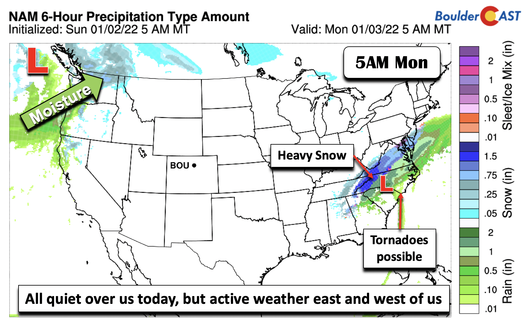
The weather starts quiet for the first full week of 2022. However, as we’ll discuss later, that changes rather abruptly come Tuesday and beyond. The mid-level pattern below shows relative ridging over the western US and Great Plains. It will be another mild day and near normal highs for the Plains with temperatures near 50 again this afternoon. More active weather is taking place on the East Coast, with severe weather including tornadoes for the Carolinas, heavy snow over the Appalachians and Virginia, and rain/snow for the Pacific Northwest.
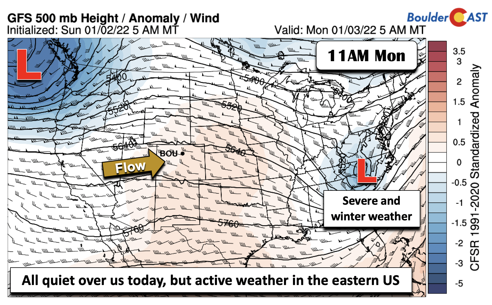
The figure below shows the active weather east and west of us today, depicted in terms of precipitation type and 3-hr amounts. Note the strong system in the east and a deep low pressure over the northwest. However, we are all dry here in Colorado!
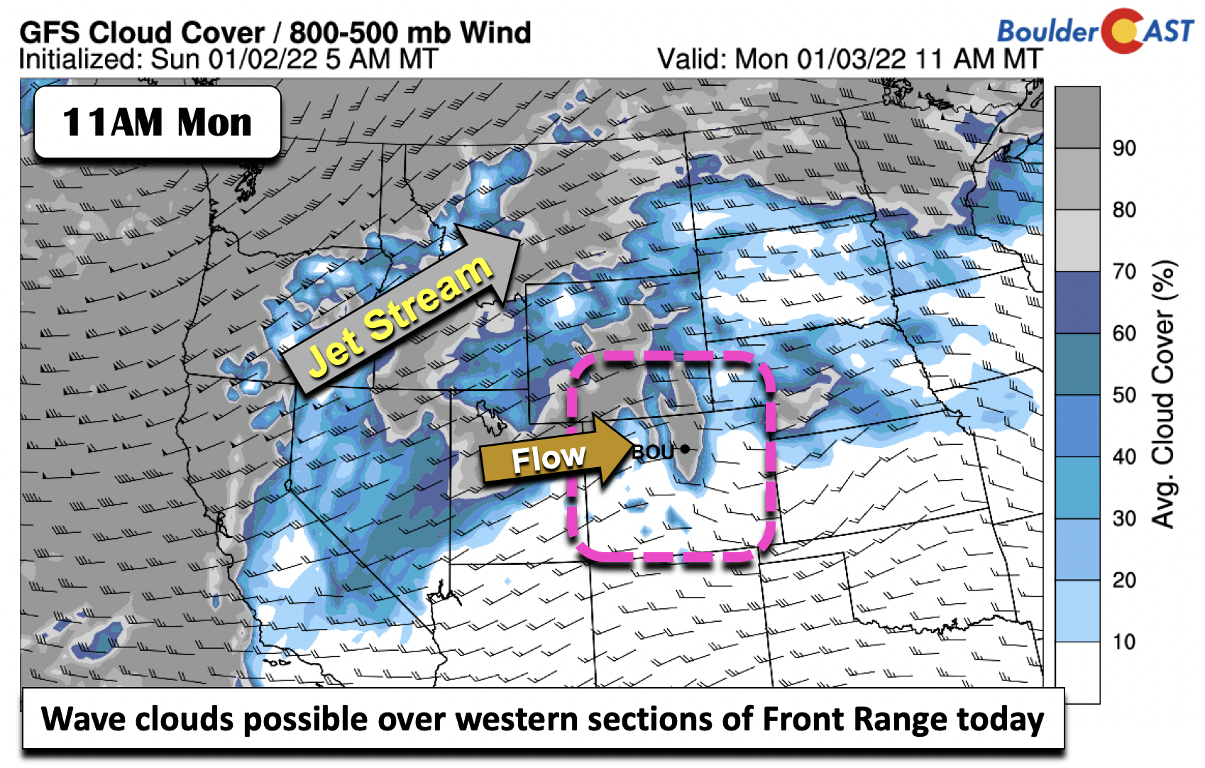
Although of little consequence, models are hinting at some wave cloud development today (below). That could lead to slightly lower high temperatures near Boulder in the upper 40s, as well as a pretty sunset early this evening.
Windy again come Tuesday
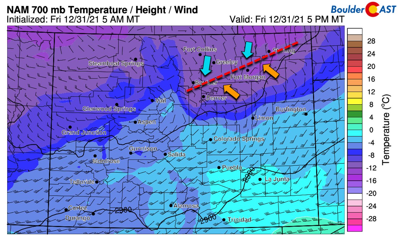
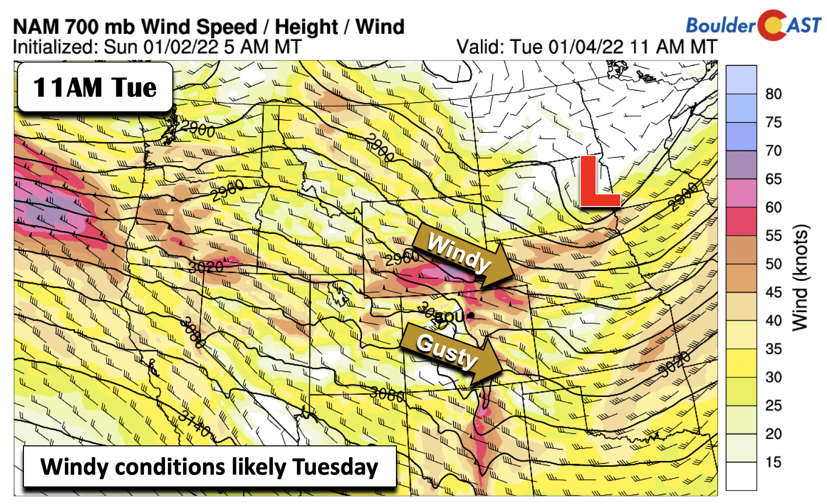
The storm system in the Pacific Northwest will move onshore and into the northern Great Plains on Tuesday. Along with it, the jet stream will take a more west-northwest flow pattern across the mountains and Front Range, setting up another day of windy conditions.
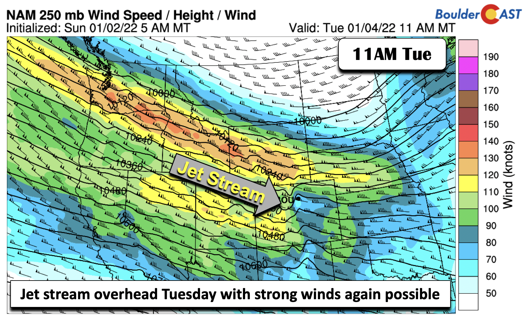
Surface and mid-level low pressure forming over South Dakota Tuesday will support a tightening height gradient across eastern Colorado, also inducing a stronger surface pressure gradient. The 700mb flow shows winds exceeding 60 MPH at 5,000 ft above the surface. At least a portion of these higher winds will mix down to ground-level, with gusts tomorrow potentially exceeding 45 MPH. Let’s hope and pray that we don’t see a repeat of last week! Highs will be in the mid to upper 40s with partly cloudy skies.
More snow on the Plains come midweek…but how much?
A strong Arctic cold front is set to move south from Montana and Wyoming Wednesday as the surface low over the Dakotas Tuesday moves into the Ohio Valley and Great Lakes. While there are some timing differences in the frontal passage in the models, the front is likely to be through the entire Denver Metro area by the afternoon to early evening hours on Wednesday. The Arctic frontal passage will setup a deep upslope period for the Front Range Wednesday into early Thursday favoring good snow potential. Highs on Wednesday will be tricky, with the front approaching and clouds/snow likely. As for now, expect temperatures much colder in the upper 30s.
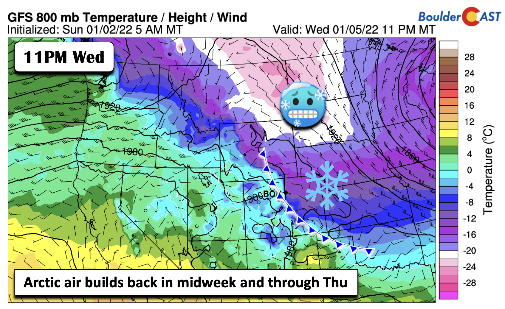
Although there remains some model uncertainty still to be ironed out, there is increasing confidence that snow is likely come midweek. The pattern is one in which two factors appear key to the snowfall totals we will receive. The first is the very cold air in place, discussed above, as temperatures Wednesday night fall into the single digits. This, combined with a deep saturated upslope layer in the very cold air mass, will produce a deep dendritic growth zone supportive of efficiently fluffy snowflakes (dendrites).
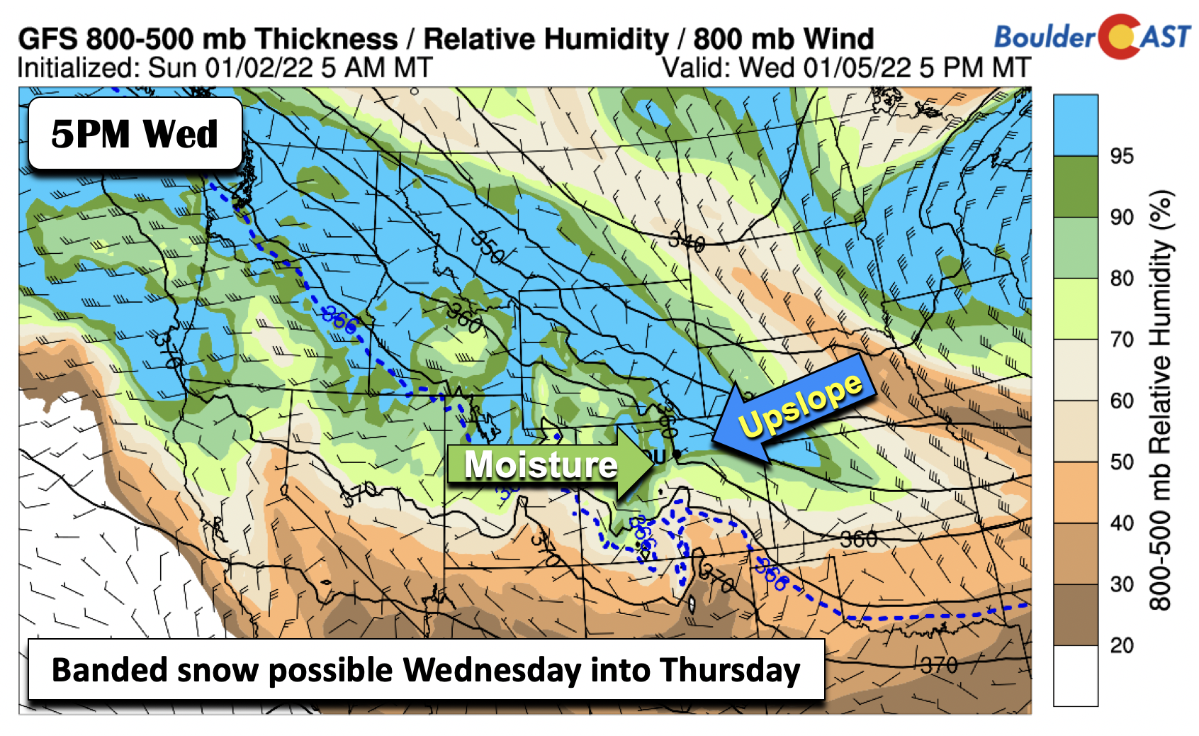
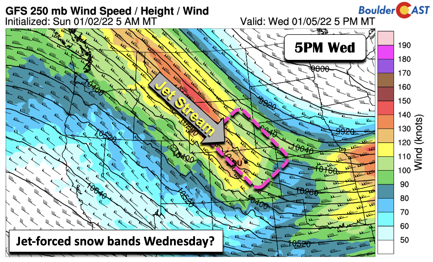
Secondly, although with more uncertainty, the location of the upper-level jet streak is projected to be northwest to southeast oriented over the state Wednesday into Thursday. The position from the GFS shows the left-exit region of the jet along and northeast of Denver and Boulder, leading to the potential for banded snowfall. These details are likely to get more refined in the next day or so. This additional factor could lead to isolated higher snowfall totals, if it were to materialize, but depends strongly on the position of the jet.
Though there remains some questions on the synoptic pattern, from an ensemble approach, there is high confidence that the Front Range will see snow Wednesday into early Thursday, with nearly every GEFS member producing at least some snow.
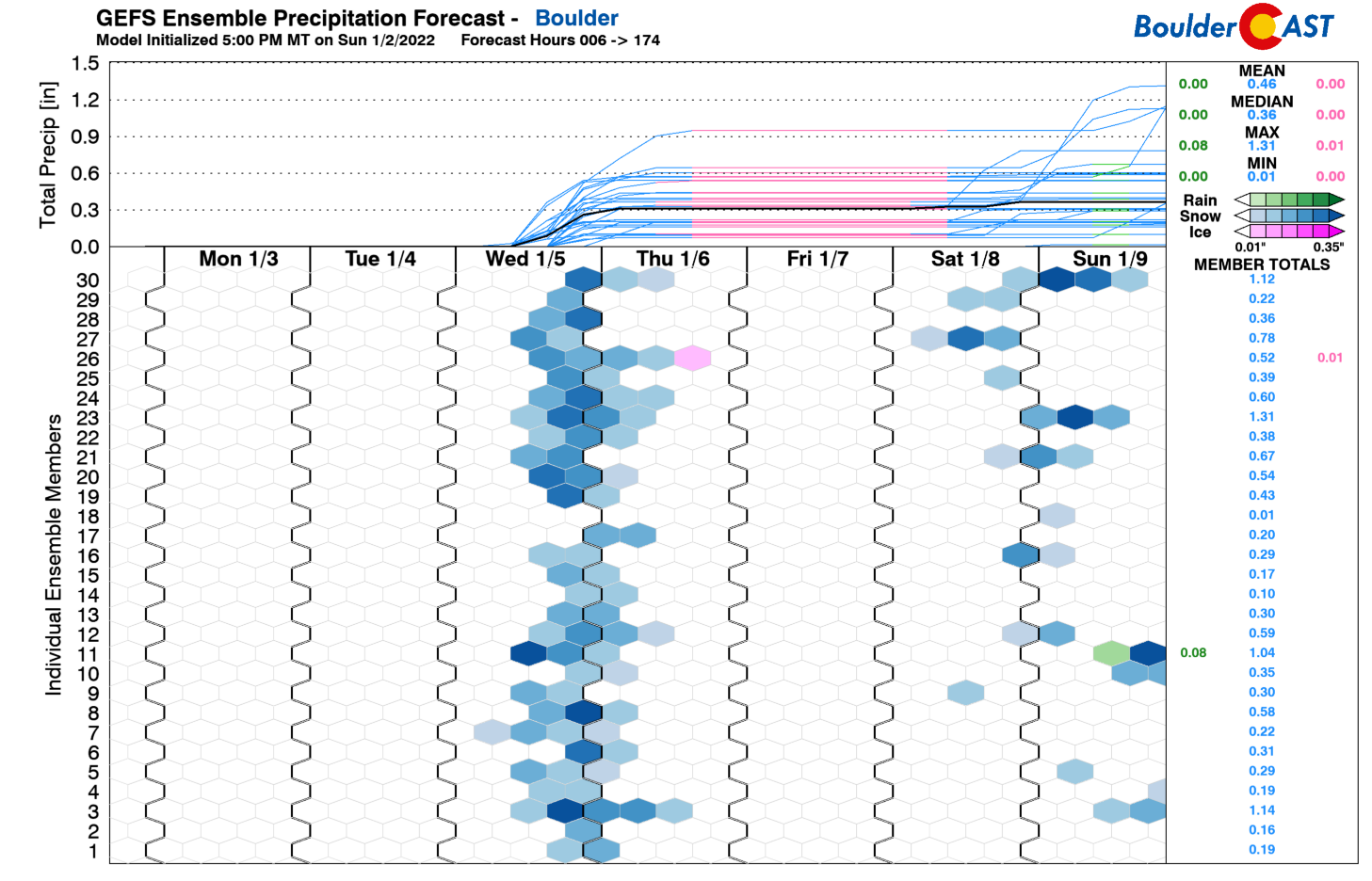
The question, then, is how much snow can we expect? Looking at our snowfall probabilities, there is a 60-80% chance of at least 2 inches in the Denver Metro area, with a ~50% chance of up to 6 inches in Boulder, dependent on the position of any jet-forced snow bands.

Shown below is the operational GFS snowfall through Thursday. While not gospel, the forecast shows how a slight deviation in the jet stream for this midweek system will play in the overall location of the heavy snow, with the GFS more north and east (up to a foot near Cheyenne!) than some of its ensemble members.
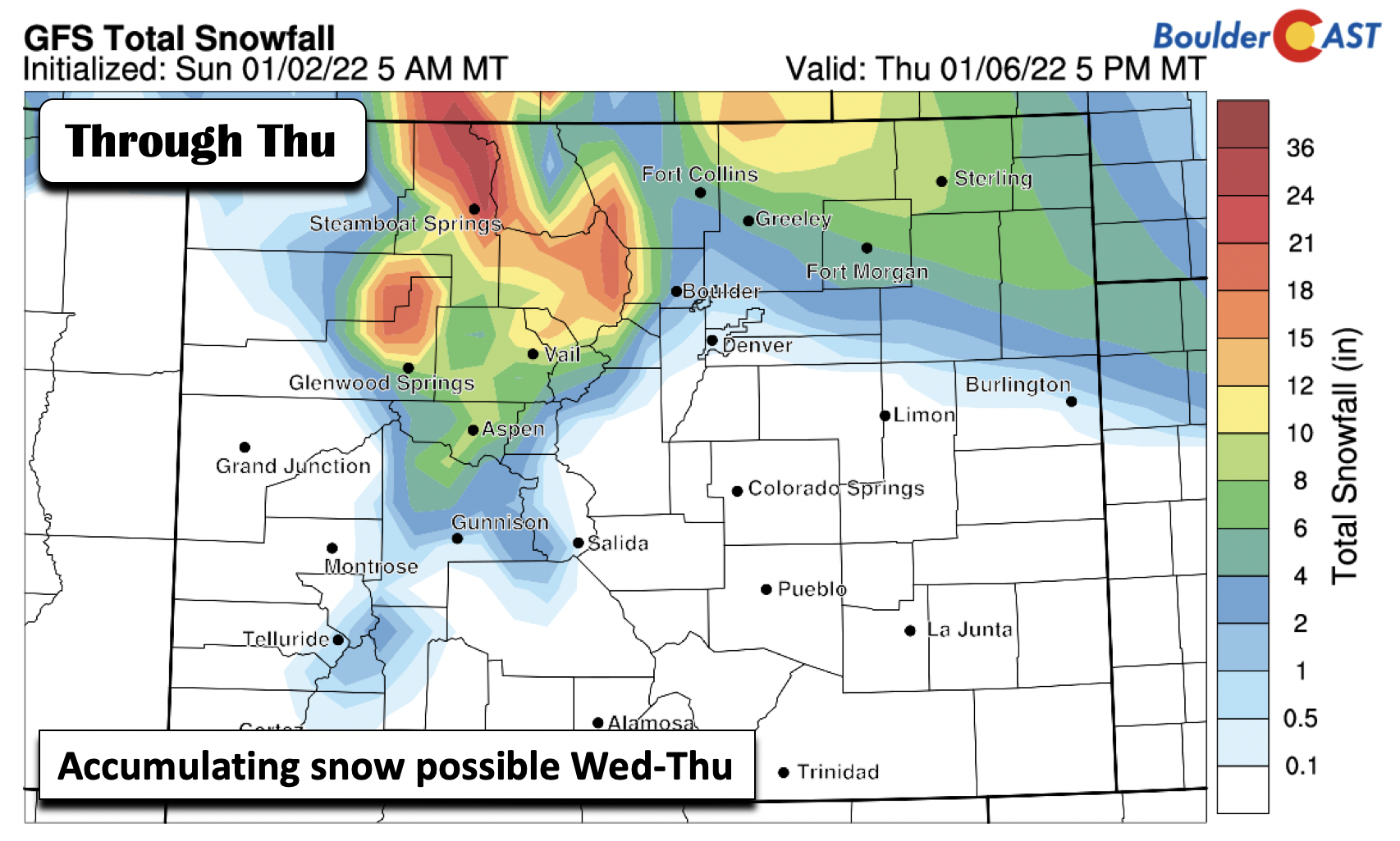
Regardless of how much snow we get, it will be cold on Thursday behind the system with upper 20s to around lower 30s for highs.
Warming up by the end of the week
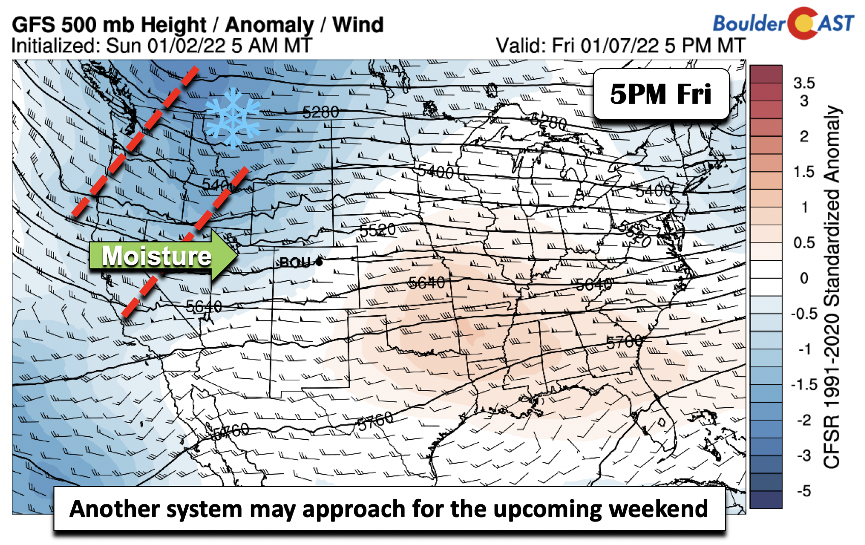
After the snow, temperatures are projected to rise back to normal by the end of the week as the Arctic air retreats back north and east of the area in response to ridging developing (below). However, it looks like the pattern will still remain active, with yet another trough set to encroach on the area by the weekend which could lead to another round of light snow Saturday into Sunday. We could see highs nearing 50 degrees by the end of the week, perhaps warmer depending on how much snow falls midweek and remains on the ground.
Enjoy your week and let’s hope for more snow!
Stay up to date with Colorado weather and get notified of our latest forecasts and storm updates:
Forecast Specifics:
Monday: Morning clouds, giving way to afternoon sunshine with highs near 50 degrees on the Plains and lower 40s in the Foothills.
Tuesday: Partly cloudy and windy with highs in the upper 40s for the Plains and upper 30s in the Foothills. Winds will gust over 45MPH.
Wednesday: Colder and breezy with snow likely developing in the afternoon or evening. Winds could gust over 35MPH at times. Light accumulations of a few inches possible by Thursday morning. Highs in the upper 30s on the Plains and upper 20s in the Foothills.
Thursday: Cold with some lingering morning snow followed by partly sunny skies. Highs cold in the upper 20s on the Plains and upper teens in the Foothills.
Friday: A quick warm-up to near 50 degrees on the Plains and in the upper 30s in the Foothills.
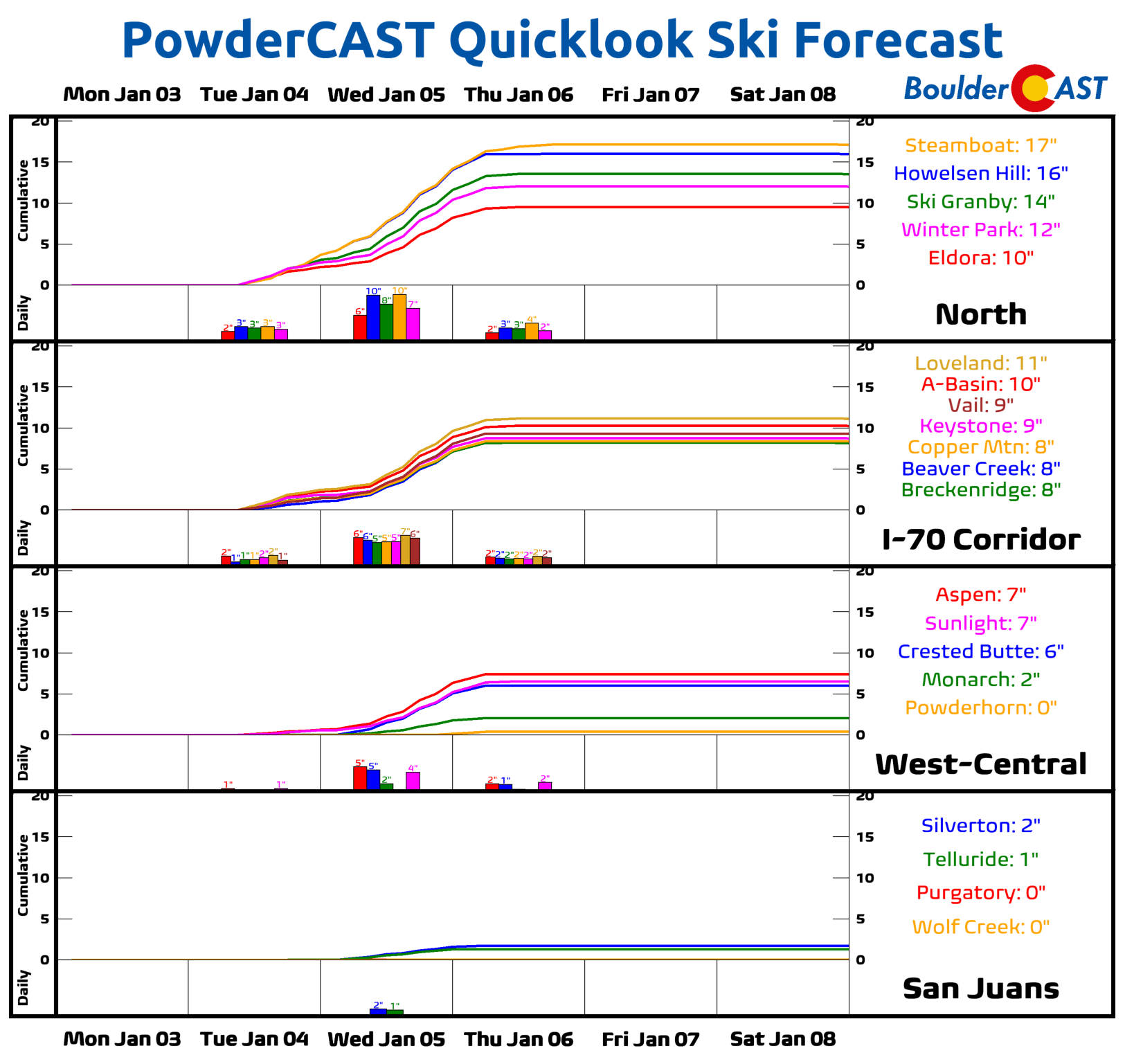
Mountains: Quiet weather will start the week in the High Country. Snowfall is favored Tuesday through Thursday, especially over northwestern sections of the ski resorts and mountain passes like Steamboat Springs. Gusty winds are likely Tuesday into Thursday as well. Quiet weather returns for the latter part of the week.
Help support our team of Front Range weather bloggers by joining BoulderCAST Premium. We talk Boulder and Denver weather every single day. Sign up now to get access to our daily forecast discussions each morning, complete six-day skiing and hiking forecasts powered by machine learning, first-class access to all our Colorado-centric high-resolution weather graphics, bonus storm updates and much more! Or not, we just appreciate your readership!
Spread the word, share the BoulderCAST forecast!


You must be logged in to post a comment.