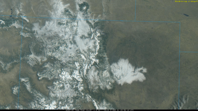
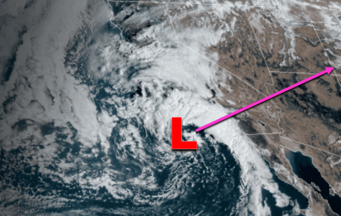
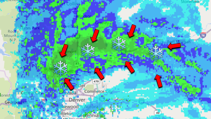
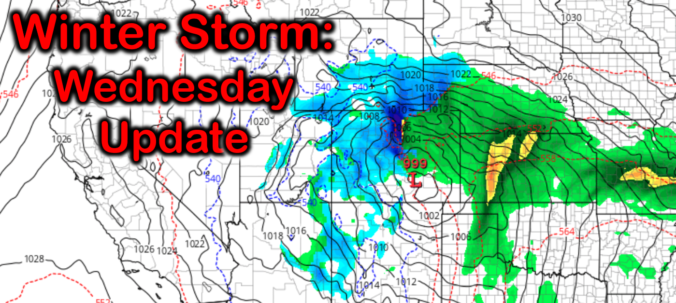
Here’s a quick and colorful rundown of our weather during February 2021 and how it relates to climatology.
This post had major contributions from at least two members of our team. The more meteorologists the better, right?
Here’s a quick and colorful rundown of our weather during February 2021 and how it relates to climatology.
The first “warm” spring storm of the year moved across Colorado from the southwest on Thursday. Temperatures were borderline with this system, and many locations saw a trace or less of snow with rain the dominant precipitation type. However, the Foothills, Palmer Divide and southeast suburbs of Denver did see a little snow. Let’s take a look at the totals.
It sure has felt like spring the last few days, but Mother Nature will remind us soon that is it very much still winter on the calendar. Warm sunshine will be replaced with thick clouds, cold rain and ultimately wet snow on Thursday. The incoming storm is lacking truly cold air, but it will have just enough for most of us (but not all of us) to see a little snow. Let’s take a look at how the first “warm” storm of 2021 will play out across the Front Range!
UPDATE (Thu 3/4/21 7:00AM): With temperatures being so marginal, uncertainty lingers in regards how much precipitation will fall and who will see accumulating snow from the storm. We discuss this and more in this morning’s Premium weather discussion, found HERE.
About half of the Front Range received snowfall right in line with our forecast last night, while the other half saw incredible snowfall amounts of a foot or more! What caused such an explosion of heavy snow in the heart of Denver last night? Let’s take a look.
Finally, we got more snow than south Texas and Louisiana! The atmosphere was primed for an explosion of snow Wednesday evening in the Foothills and western Denver Metro area and it did not disappoint this time. Favorable conditions for convective heavy showers for a short window yesterday produced up to a foot of snow in some areas. Let’s take a quick look back at the setup and snowfall totals from across the region.
No one fully expected the Arctic airmass that arrived last Sunday evening, a solid nine days ago, to remain entrenched across the Denver Metro area for this long…but it did! We take a look back at the series of events as they unfolded over the last week, including the first regional wildfires of 2021, two dollops of light snow and the coldest temperatures for our area since 2014.
You think it was cold the last few days? Just wait and see what is coming! The coldest temperatures in nearly a decade have settled into the Front Range and it’s only going to get colder. We’re also tracking a rather unique light snowfall event that will spread accumulating snow across the area Saturday afternoon into Sunday. We discuss just how cold it will get and look at the snowfall amounts headed our way.
Here’s a quick and colorful rundown of our weather during January 2021 and how it relates to climatology.
© 2026 Front Range Weather, LLC