
A weak trough moved across Colorado on the evening of March 21st producing light to moderate snowfall across the area. Southern portions of the Denver Metro area were hit hardest due to a lingering band of heavier snow along a frontal boundary. Let’s take a look at the totals.
As expected, the heaviest snow with this system was across far southern Denver and the Palmer Divide where a moderate band of snow lingered much of Sunday evening along a stalled frontal boundary (convergence line). The upslope component turned out not to be as important with this system, with moisture amounts ultimately coming in on the low end of expectations in the Foothills and adjacent Plains.
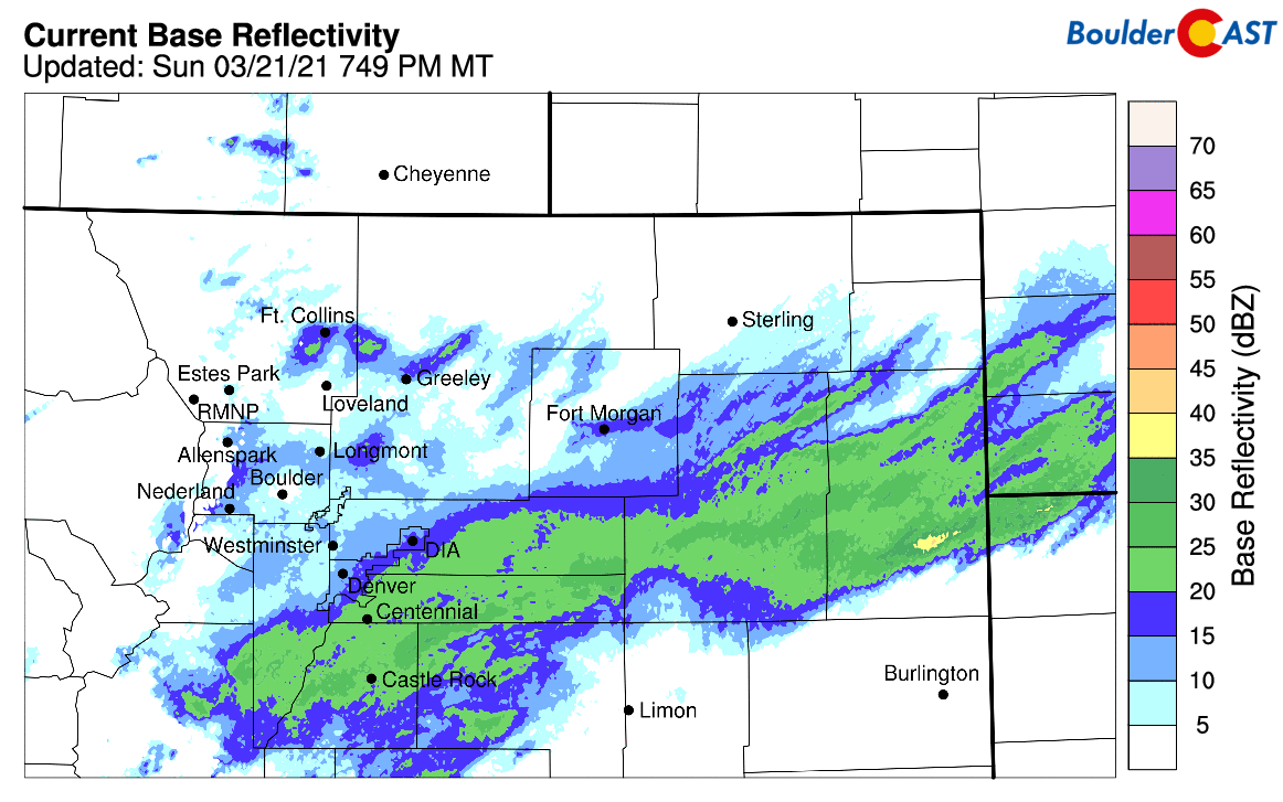
Radar animation from Sunday evening (March 21) showing the heaviest bands of snow were near and south of Denver
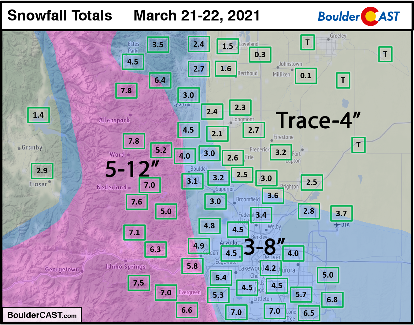
Shown below is our snowfall forecast map issued Saturday evening with actual storm totals overlaid in boxes. Green boxes indicate that our forecast verified to within one inch of the observed snowfall. Red did not (there are no red). Officially Boulder reported 3.1″ of snow and Denver reported 3.7″. The highest totals of 5 to 8″ were observed in the southern Denver Metro area, as well as in the Foothills and Palmer Divide
Continue to 2020-2021 Winter Snow Summary


You must be logged in to post a comment.