
Two, yes two, storm systems combined to produce a period of wet snow across the Front Range Tuesday afternoon and night. Let’s take a look at the totals.
Author: BoulderCAST Team (Page 29 of 48)
This post had major contributions from at least two members of our team. The more meteorologists the better, right?
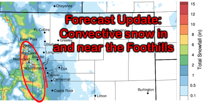
The Front Range will reside directly between two nearby storm systems Tuesday afternoon into Wednesday. Together they will provide a unique atmospheric setup favoring snowfall across mainly the Foothills, but also the western and southern Denver Metro area. Let’s take a look at the interesting setup, timing, and projected snowfall amounts.
A weak trough moved across Colorado on the evening of March 21st producing light to moderate snowfall across the area. Southern portions of the Denver Metro area were hit hardest due to a lingering band of heavier snow along a frontal boundary. Let’s take a look at the totals.
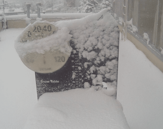
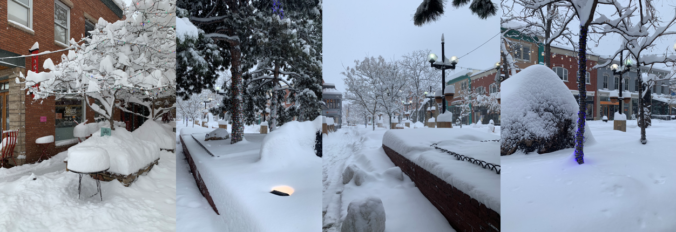
There is so much to unpack with this storm, from the moment it caught our eye a week in advance until the last snowflakes were flying, it was one-of-a-kind snowstorm and a true Front Range weather experience. We discuss the forecasting challenges leading up to the event, why many folks lost patience with this storm, and the massive snow totals the system eventually dumped across the Denver Metro area.
We provide a quick update on the situation this morning as wet snow continues to fall across the Front Range. While the storm has been underwhelming to some, we’ve still got nearly 24 hours of snowstorm left and a clear pathway to reach the lower bounds of our original snowfall prediction. Let’s run through the latest.
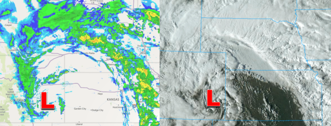
The winter storm we’ve been tracking all week long is finally bearing down on Front Range Colorado and forecast confidence is not as high as we’d like this late in the game. We discuss the latest developments, including multiple pathways for a bust east of Interstate 25, and provide our latest snowfall forecast map.
Why are some weather models predicting drastically more snowfall than others? Why does this winter storm seem more predictable than others? How much snow is each member of our team expecting in Boulder? Listen to find out!
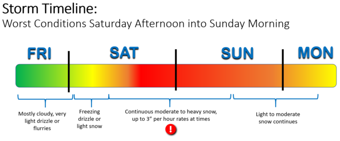
In today’s update we fine-tune the timing of the storm as it is now anticipated to progress more slowly through the region. This has delayed the onset of the snow, but in the end will lead to a longer duration storm. Projected snowfall totals haven’t changed a lot since yesterday, but let’s walk through the latest!
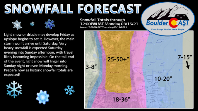
UPDATE (Fri 3/12/21 7:00AM): The recent rounds of model updates continue to support heavy snow this weekend across the Front Range, however snowfall totals have trended downward slightly as models are coming into better agreement. We discuss this and more in Friday morning’s Premium weather discussion, found HERE.

Live View of Boulder

Current Conditions

Live Radar

Recent Premium Posts

BoulderCAST Daily – Wed 06/24/26 | Another Day of Severe Weather
🌩️ Severe setup once again today with the threat of very large hail …
BoulderCAST Daily – Tue 06/23/26 | High‑End Hail Threat Targets the Denver Area, with the Risk Lingering into the Overnight
🌩️ Severe setup persists with upslope + strong westerlies aloft + copious moisture/instability …
BoulderCAST Daily – Sun 06/21/26 | First Notable Smoke Plume Arrives for the First Day of Summer
🌫️ Smoky skies return: A large wildfire in Utah has smoke surging into …
3-Day Forecast

Trending Content

© 2026 Front Range Weather, LLC