As promised, a well-advertised spring-like snowstorm delivered the goods to (almost) the entire Front Range this week with over four feet of snow falling in the Foothills and up to 2 feet across the lower elevations. We take a look back at this odd, moisture-infused winter storm, discussing how the difficult forecast evolved during the lead up and ultimately how much rain and snow pummeled the area.

Go Premium, get all the perks.
Daily Forecast Updates
Get our daily forecast discussion every morning delivered to your inbox.
All Our Model Data
Access to all our Colorado-centric high-resolution weather model graphics. Seriously — every one!
Ski & Hiking Forecasts
6-day forecasts for all the Colorado ski resorts, plus more than 120 hiking trails, including every 14er.
Smoke Forecasts
Wildfire smoke concentration predictions up to 72 hours into the future.
Exclusive Content
Weekend outlooks every Thursday, bonus storm updates, historical data and much more!
No Advertisements
Enjoy ad-free viewing on the entire site.
he lead up to this week’s monster snowstorm was unlike anything we can remember in recent times. We knew a sizable snowstorm was coming to the Front Range several days in advance. Our weekly outlook posted on Monday included a 100% chance of rain changing to snow Wednesday into Thursday. In such a typically arid and complex forecast region as ours, stamping a definite “100%” chance four days out is rarely a good idea, but there was such strong model support for this event that we felt okay allowing it this week.
We took our first crack at potential snowfall amounts back on Monday as well. At the time, there was still some uncertainty regarding the exact track of the parent storm system, as well as concern about temperatures leading to varying amounts of rain before the inevitable change-over to snow. Still, our super early forecast was for 7-14″ for the Metro area, but we noted strong suspicions that the forecast would be going up.
Our preliminary snowfall forecast for the big storm later this week is 7-14" in the #Boulder-Denver area. This forecast is likely to shift in time. However, we are seeing almost no evidence to suggest it'll be less than that. Definitely plenty to suggest more. Stay tuned! #COWx pic.twitter.com/ibvCW5q8wp
— BoulderCAST Weather 🏔️❄️ (@BoulderCAST) March 11, 2024
Subsequent days saw even stronger model support for a huge dump of precipitation across the Front Range, despite the track of the low pressure from western Canada straight into southwest Arizona being so unusual and typically not a favorable one for us. Below are just a few example of just how well models agreed on this massive dump. It’s worth noting that the Euro model was ultimately the WORST predictor of this particular storm (bottom right panel below), having not only too little precipitation in general but also being too warm (much slower change-over to snow in that model).
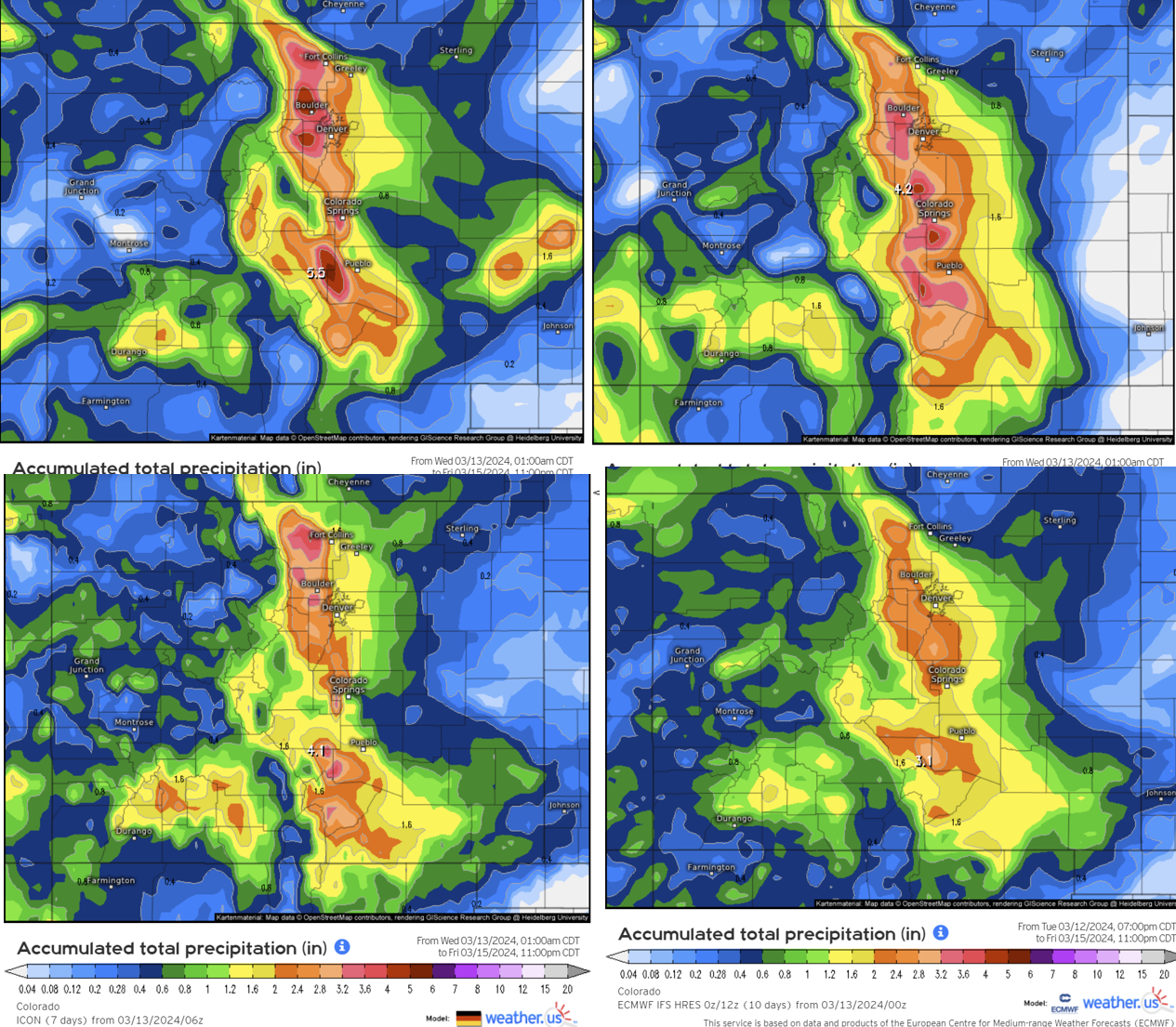
Universal model agreement that Boulder and the Foothills would see >2″ of liquid from this storm, and in some cases, over 5″.
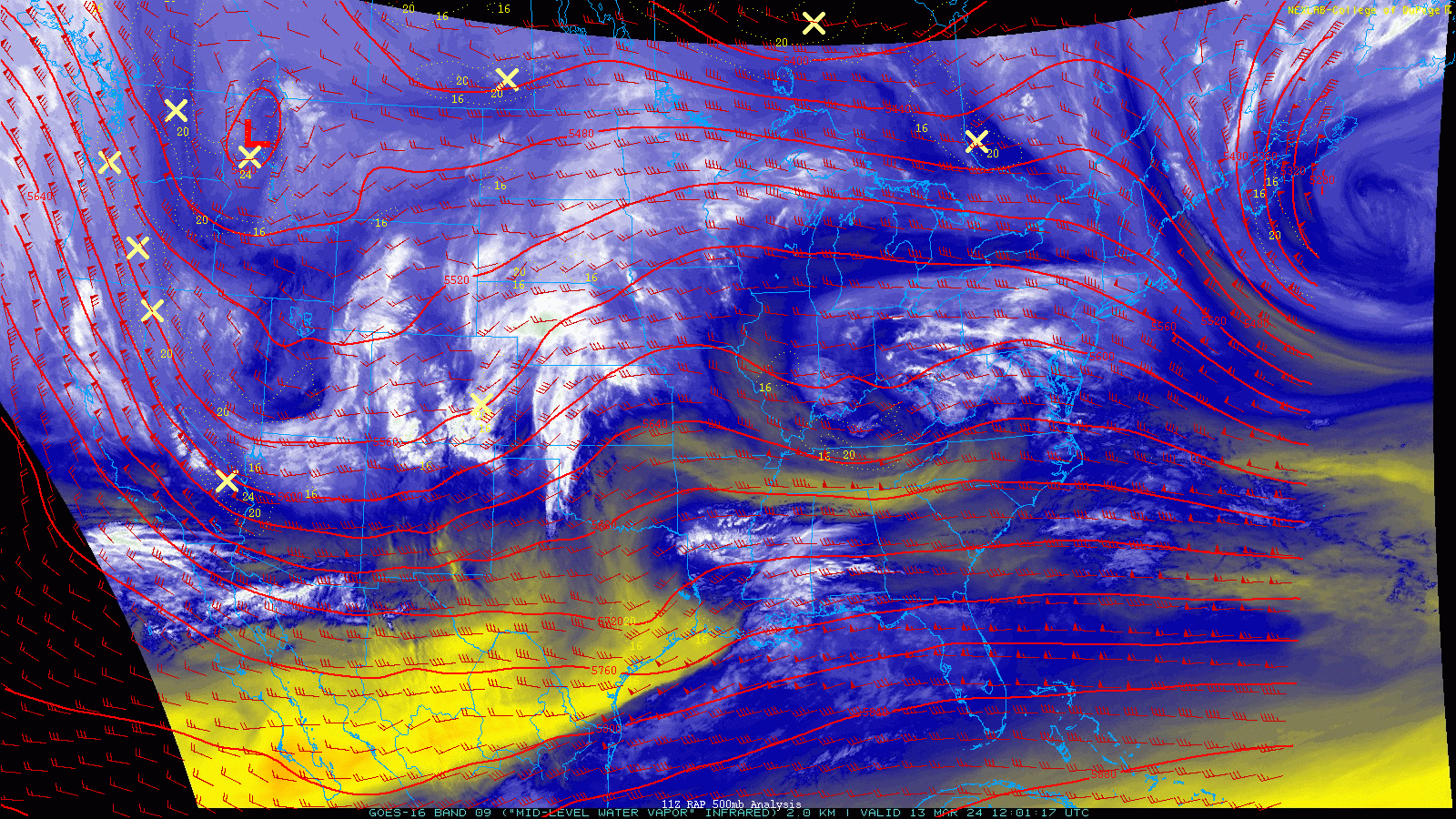
In the end, the peculiar track ended up being a “perfect storm” for eastern Colorado, with deep moisture getting pulled westward for an extended 36-hour period as the low pressure traversed right along the Utah-Nevada Border. Check out the water vapor animation below which spans from Wednesday into Friday and take note of the strong easterly (upslope) winds over the Denver area much of the time.
By the time we issued our first preliminary snowfall forecast map on Tuesday, it was clear this was going to be a significant winter storm, especially for the Foothills. We already had Boulder in our 10-20″ forecast zone, with Denver in 6-13″.
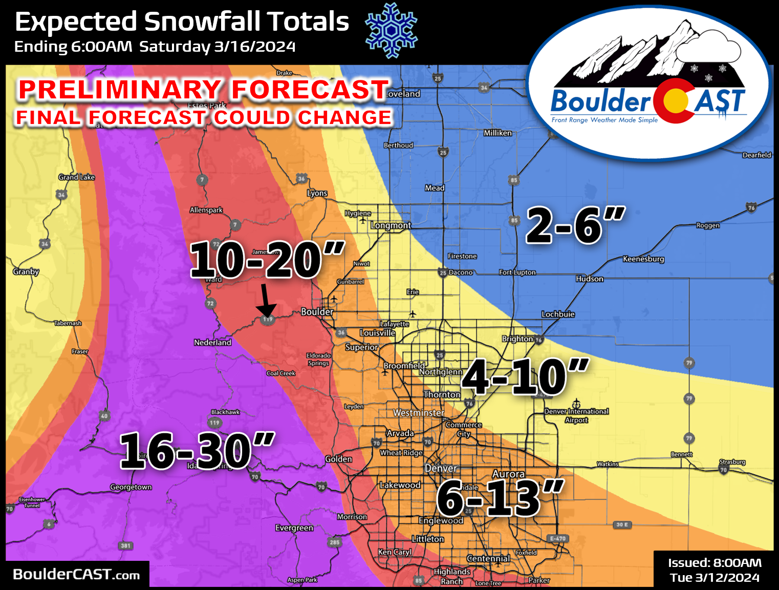
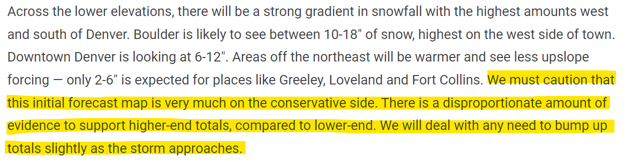
However, once again we cautioned that we still felt our forecast was likely being too conservative (see snippet below). You might be wondering then — why not just increase the forecast? In hindsight, we probably should have, but we were still feeling the effects from getting burned by a couple storms earlier this winter, with a few substantially fizzling right before arrival. Half the battle in forecasting weather anywhere is your public messaging — it’s definitely a delicate balance. You can’t just throw out drastic up and down forecast changes in the days leading up to a storm. If you are going to predict near historic snow amounts, you have to be damn sure they are going to happen — and that just wasn’t the case yet for us on Tuesday. The best course of action was a gradual build up to what we basically already knew was likely to happen.
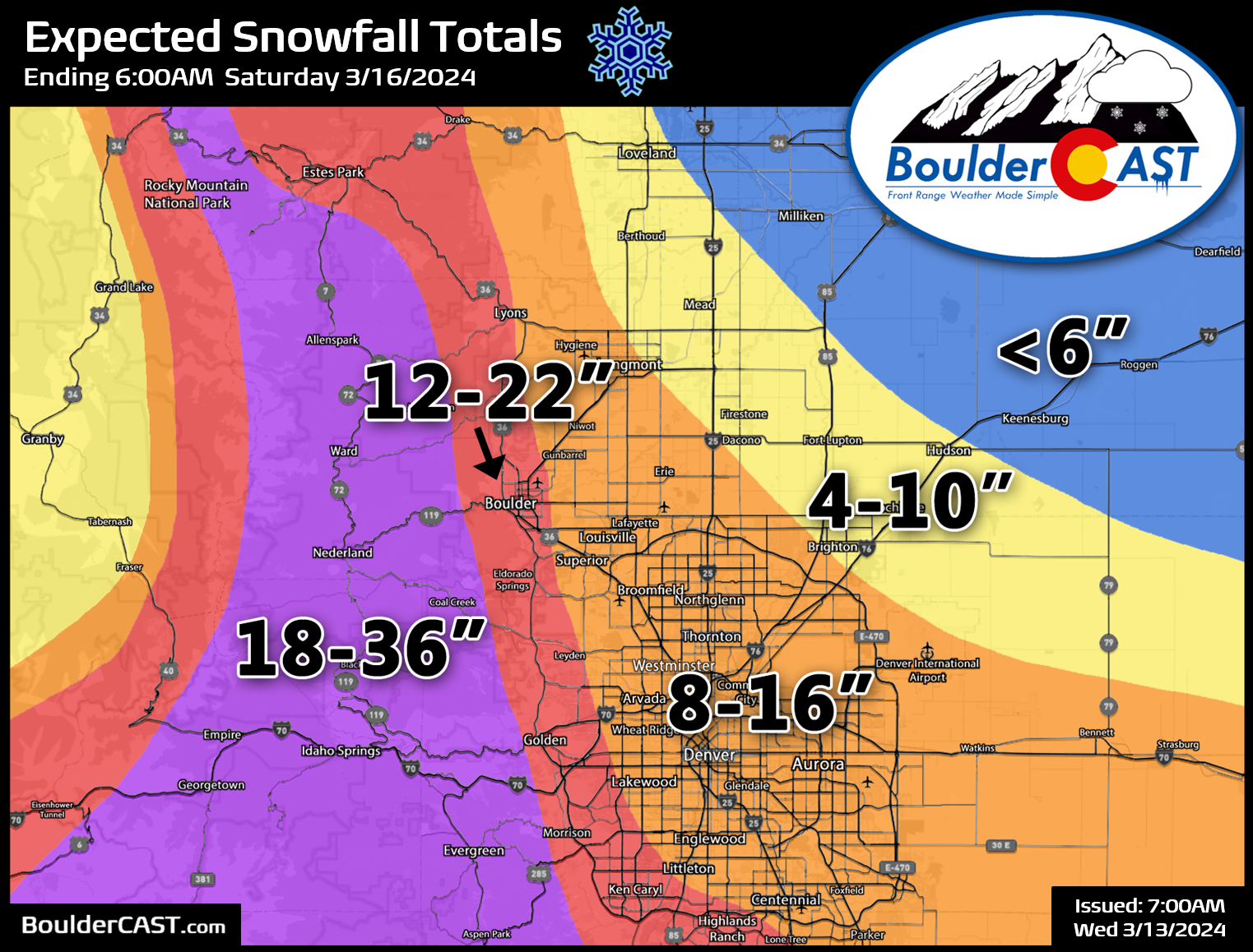
Our update on Wednesday morning included a slight bump in snow amounts for all locations as our confidence increased for those coveted higher-end outcomes.
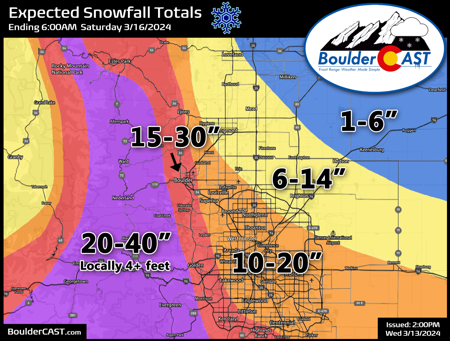
Finally, sometime Wednesday afternoon, just about 8 hours before rain would be changing to snow, we made one last upward adjustment and landed on our final snowfall forecast. This one had 20-40″ (locally 48″+) in the Foothills, 15-30″ in Boulder, 10-20″ in Denver, and as little as 1″ to the far northeast. Our team was torn on bumping things up like this again, but ultimately we did make that tough call.
The storm ended up unfolding in two distinct waves. The first was Wednesday afternoon into Thursday morning. It began with a round of thunderstorms and hail across portions of the Metro area, but temperatures cooled off quickly Wednesday evening with rain changing to heavy wet snow for (almost) everyone before midnight. Snowfall rates of 1-3″ per hour were common from this first wave Wednesday night which dumped 5-14″ across the Metro area (~10″ in Boulder), and upwards of 30″ in parts of the Foothills.
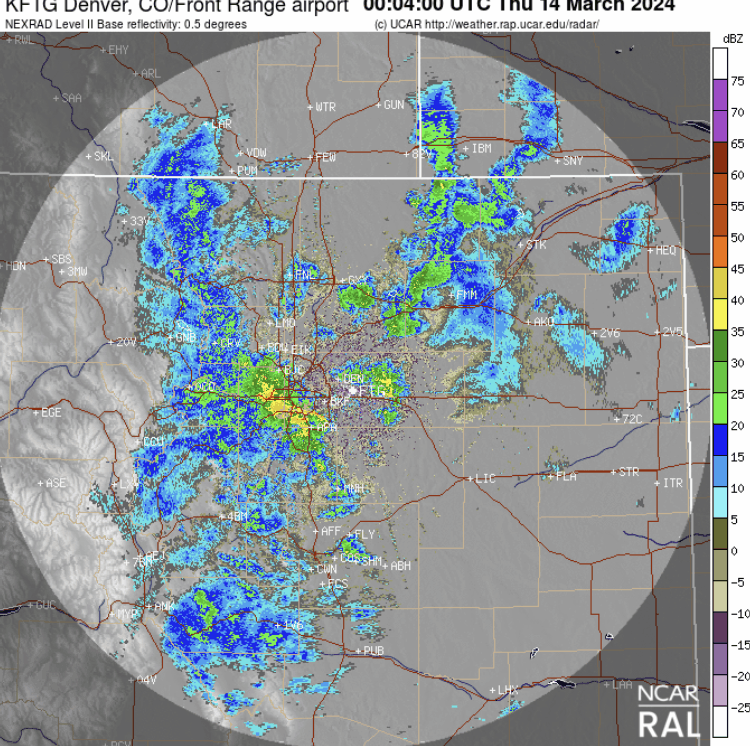
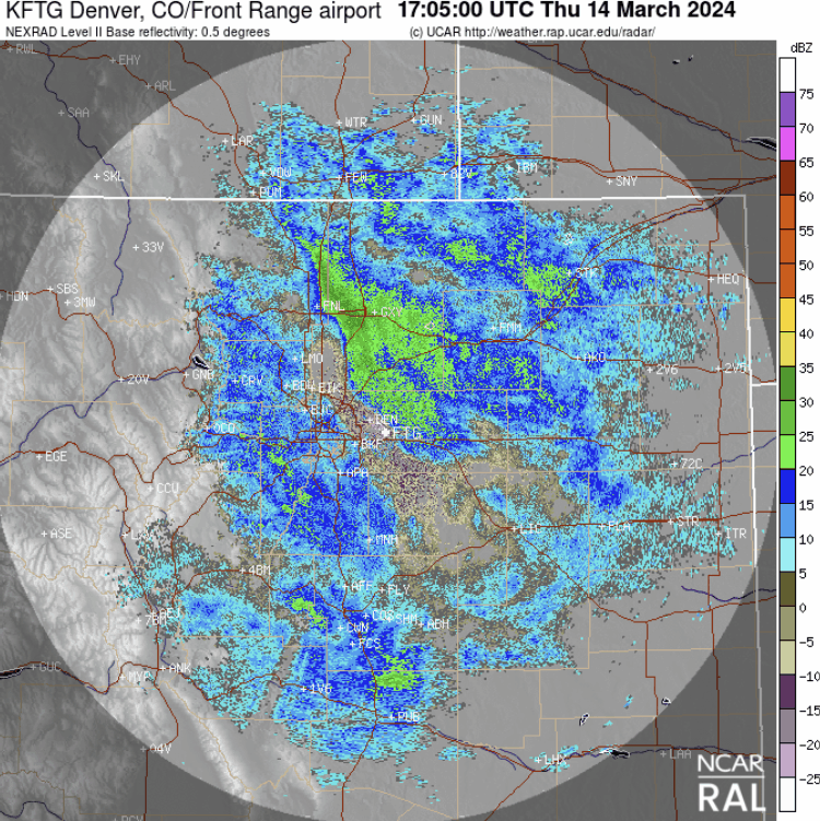
There was a brief lull in the action Thursday morning, but that didn’t last more than a few hours. A second round of heavier snow arrived in the early afternoon and continued into Thursday night as another pulse of deep moisture surged in from an almost due-easterly direction. The upslope snow machine was set to full speed, but this second wave initially had trouble sticking across the lower elevations which had slightly above freezing air temperatures, but as the mid-March sun lowered by late afternoon the snow began to pile up again. This wave lacked the raw intensity as the first pulse, but it lasted a bit longer and temperatures were a degree or two colder in the end. The snow came down fluffier and piled quickly in some locations. This second wave produced generally 5-11″ across the lower elevations, with up to 24″ in the Foothills.
When it was all said and done, snowfall totals ranged from 2″ to 51″ across our relatively small forecast domain! This is another clear example of why forecasting winter storms here can be so challenging! Our final snowfall forecast map for the event is shown below with actual storm totals overlaid. Green values indicate our forecast verified to within one inch. Red did not. Our forecast turned out quite good across most of the Metro area with near 100% verification across the lower elevations.
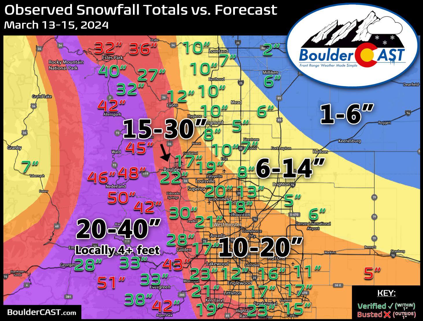
While there were numerous locations in the Foothills that exploded for more than 40″ of snow, our forecast did cover these areas well enough, with clear consistent messaging that a massive amount of wet snow was on the way and up to 4 feet was in the cards. The pictures and videos coming out of the Foothills were truly incredible! Here’s just a few:
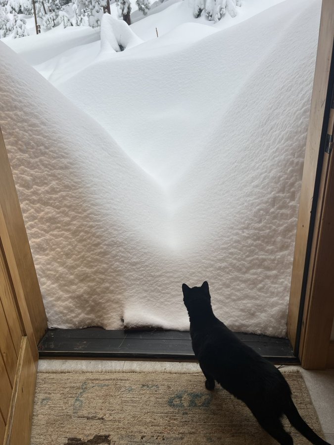
Photo by Julie Garrigue on X
Little bit here in Coal Creek Canyon. pic.twitter.com/JRcp0C3vr2
— Jaws285 (@jeff_lupear) March 15, 2024
@BoulderCAST checking in from Nederland pic.twitter.com/VlZllvemlH
— Tim D (@Timmy_Dunne) March 14, 2024
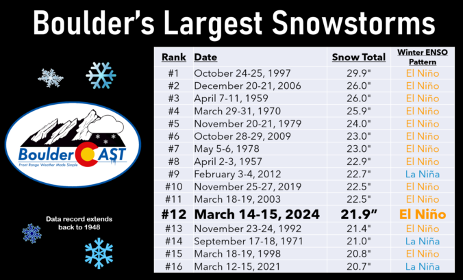
Officially 21.9″ of snow fell in Boulder making this the city’s 12th largest snowstorm since daily observations of snow began back in 1948. This storm is yet another notch in the belt for El Niño — 13 out of our top 15 largest snowstorms happened during El Niño winters (or at least ENSO positive).
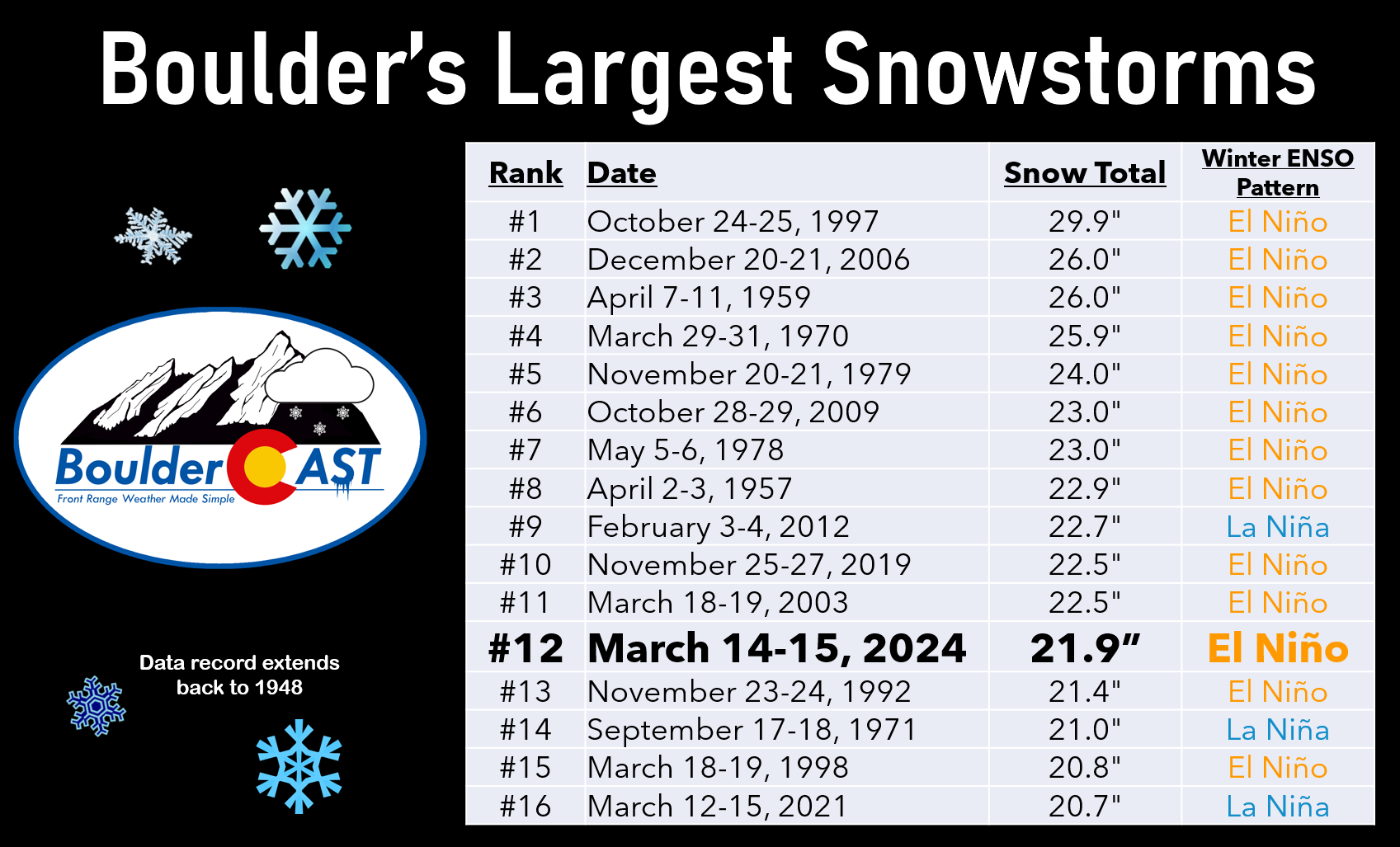
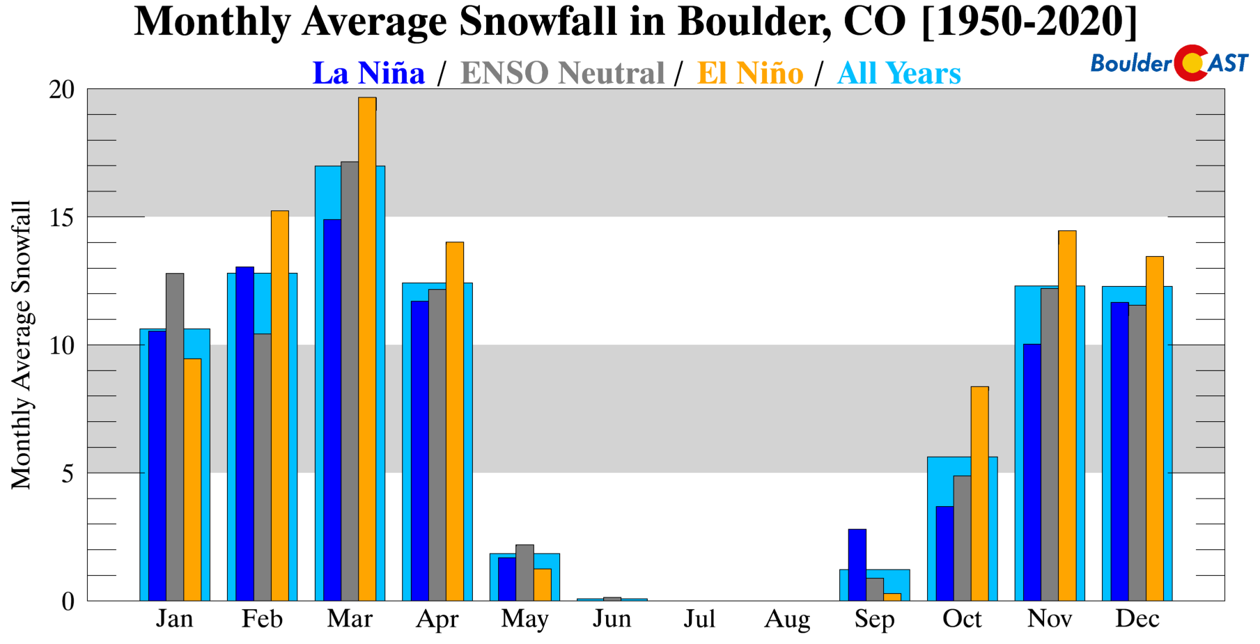
That’s no surprise as El Niño statistically provides a huge boost to monthly average snowfall in Boulder most of our snow season, especially in March!
Denver officially recorded just 5.7″ of snow from this week’s storm. As usual, that was the observation taken at Denver International Airport which remained too warm Wednesday night and received no snow at all from the first wave. Downtown Denver recorded closer to a foot of snow, with up to 20″ in other suburbs. This is yet another unfortunate example of why DIA should not be the official climate station for Denver. That battle is a lost cause, though, so let’s not get too worked up about it.
OK, this is the last view of the regional totals we will post, for now…
There were a few boomers in the Foothills, but the only real bust was at DIA! #COwx pic.twitter.com/xk8SmuJWTA
— BoulderCAST Weather 🏔️❄️ (@BoulderCAST) March 15, 2024
Despite Boulder and Denver being separated by just 20 miles as the crow flies, they are currently separated by nearly 4 FEET of snowfall this winter:
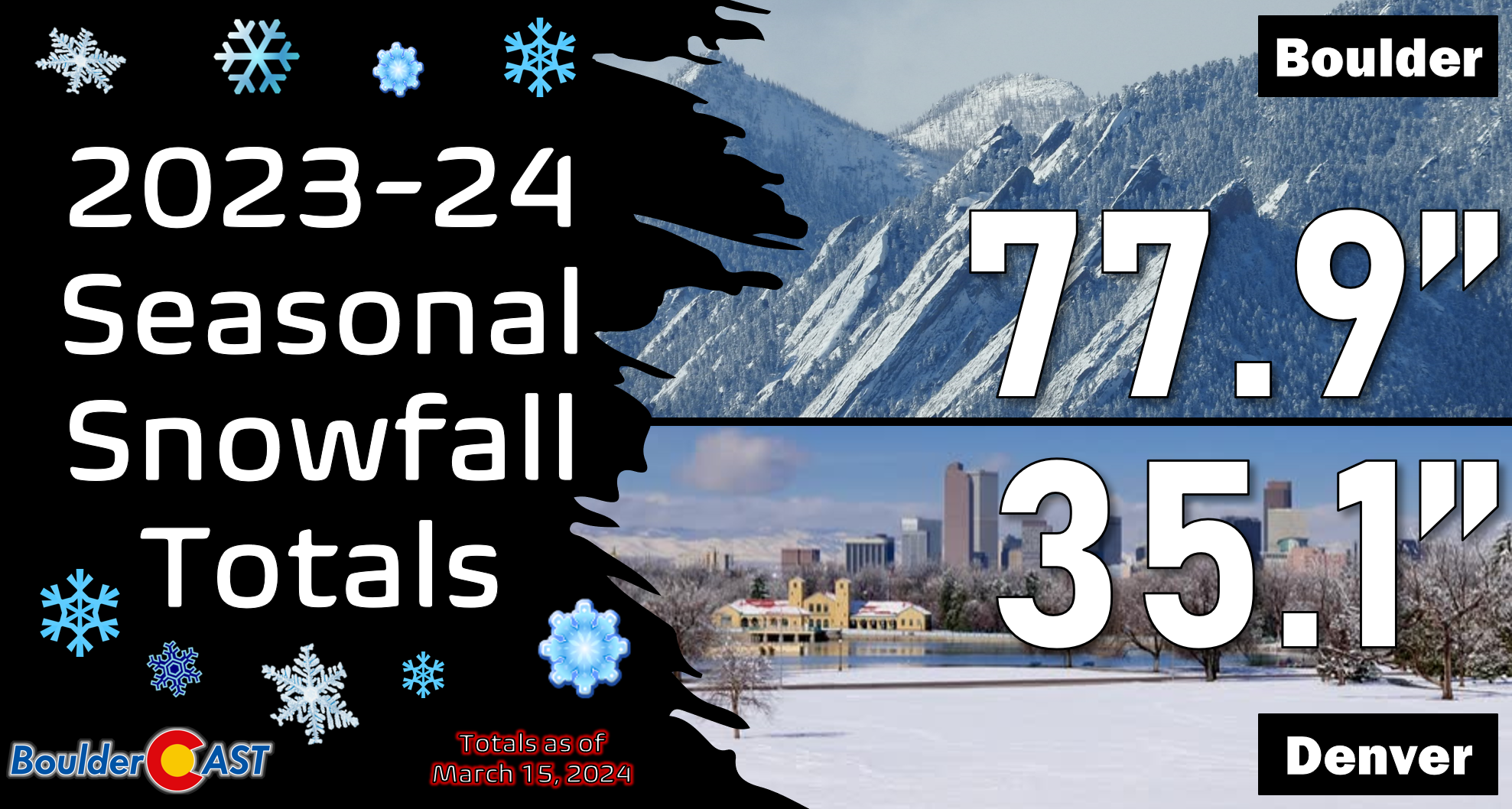
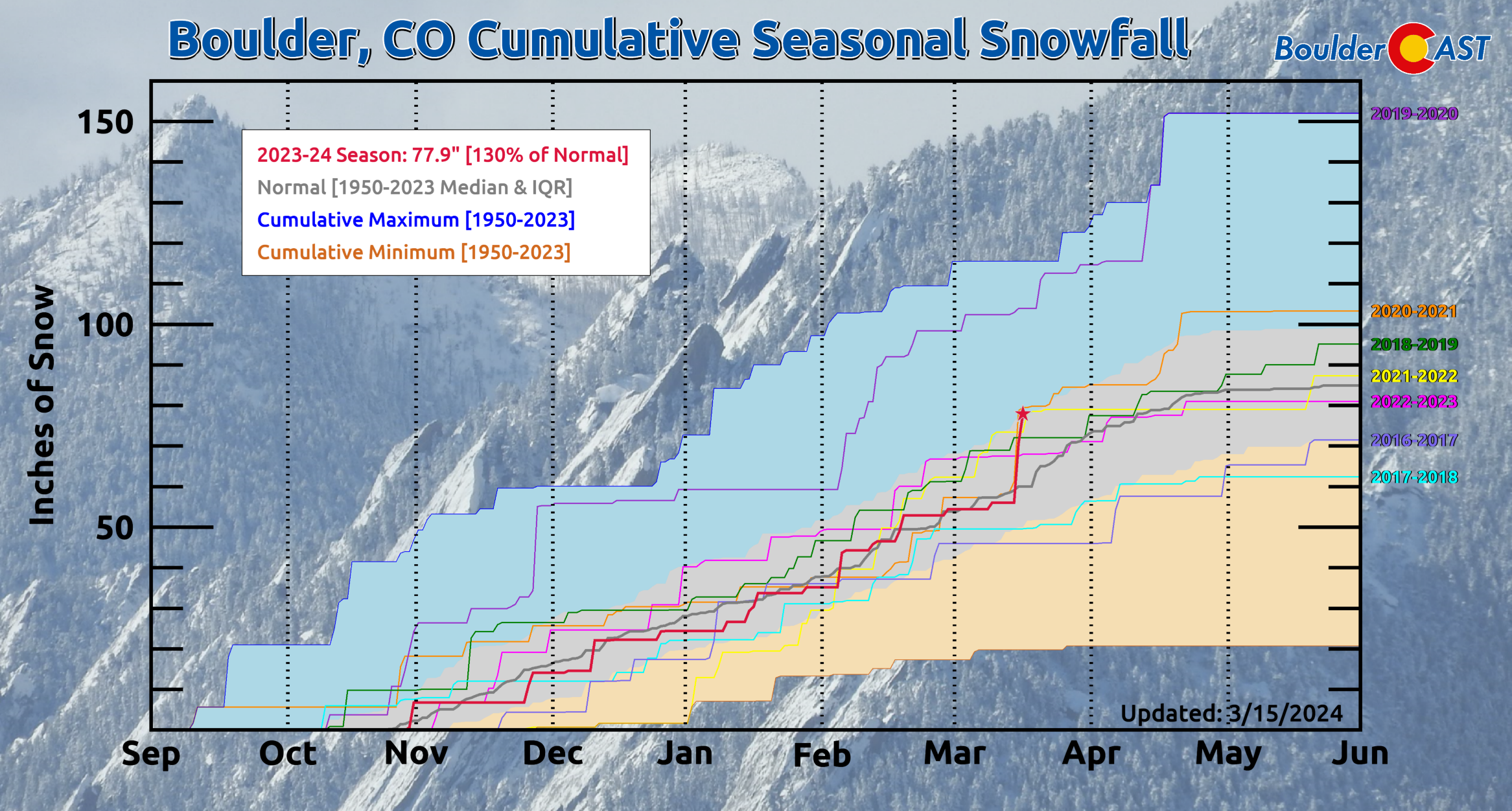
Seasonally Boulder has jumped well above normal, but that’s almost a given after any 20-inch dump of cement! Our season-to-date snow total is 77.9″ — about 30% above the long-term median of 60″!
And let’s not forget about the more important outcome of this storm — the deluge of moisture it delivered to the entire Front Range. Very few areas received less than 2″ of liquid in the past two days. Areas in and near the Foothills saw huge 3 to 4.5″ totals. Boulder reported a final total of 2.99″!
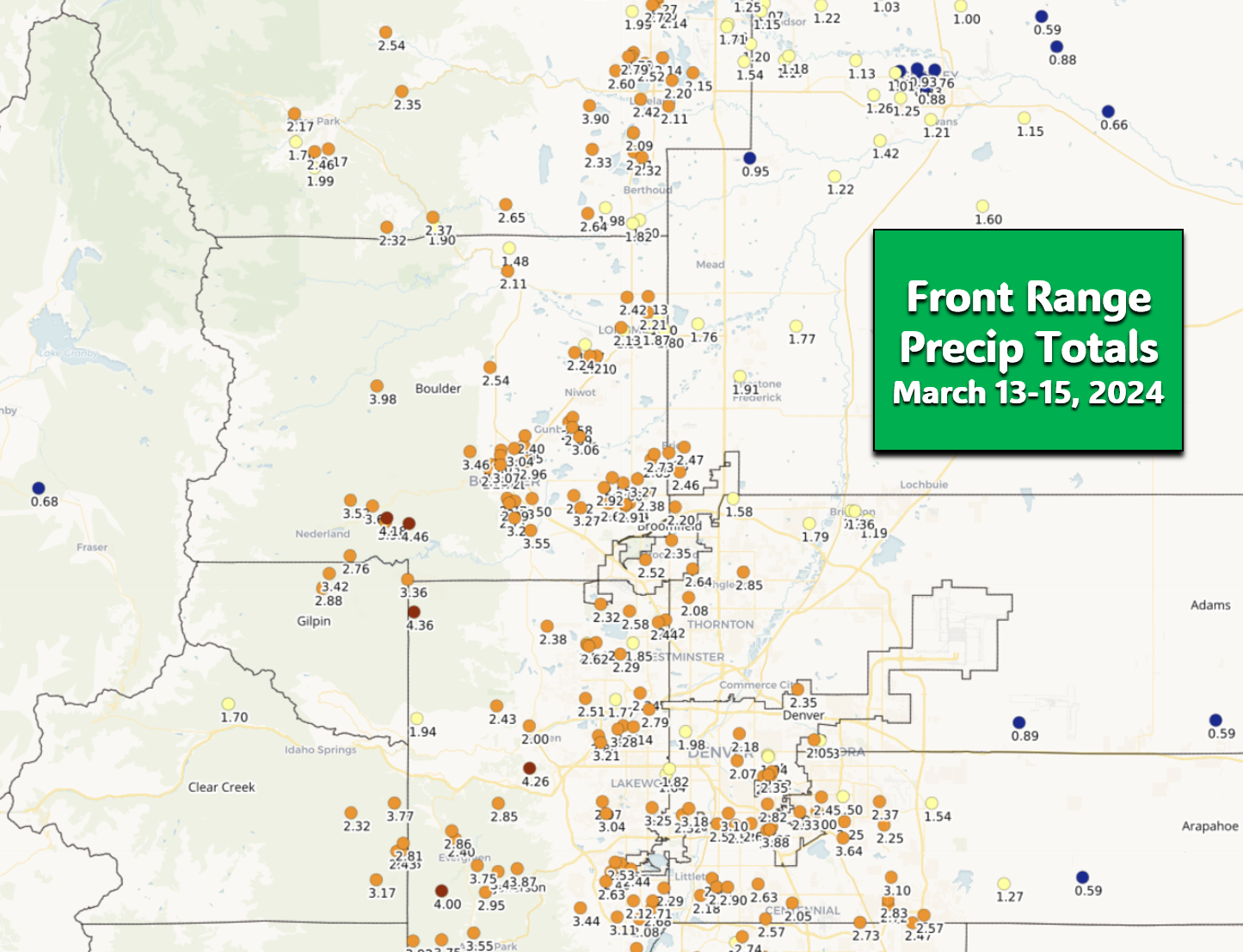
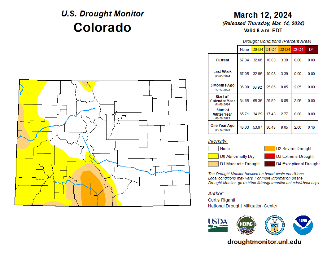
This will certainty go a long way towards keeping drought at bay for now and preventing any major forest wildfires the next couple of months.
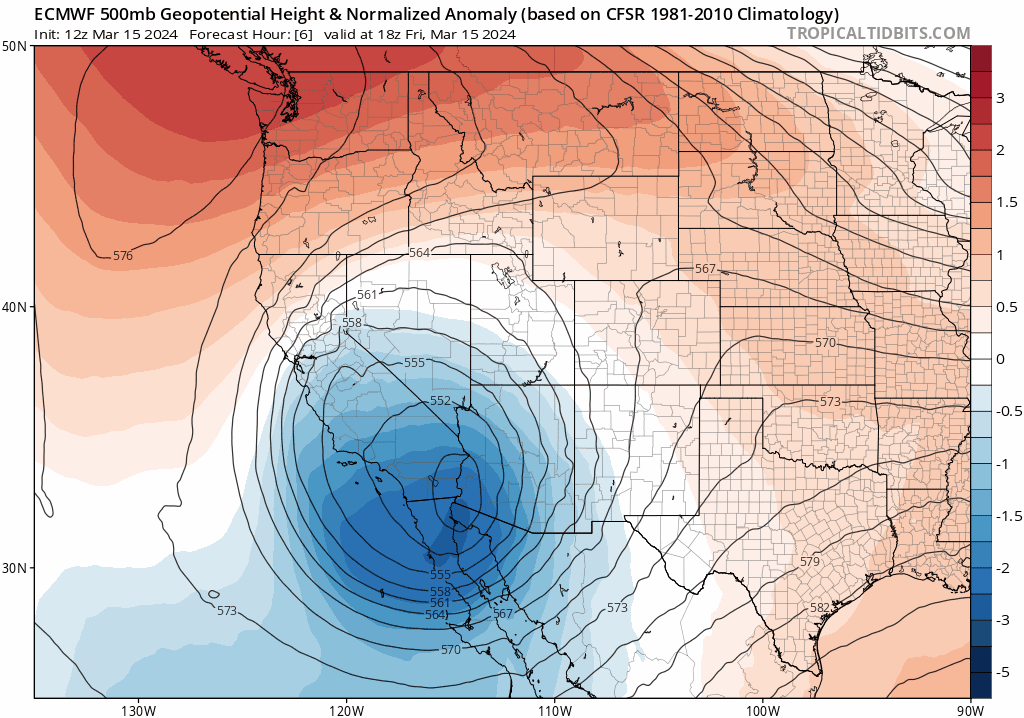
Looking ahead, the big “Arizona Low” will continue to stay off to our southwest for another five days or more but with no real impact on our weather. In fact, a broad rex block pattern forms across western North America (big closed high pressure immediately poleward of a big low pressure) which will keep things quiet here. Temperatures over the upcoming weekend will stay well below normal in the 40s for highs with a slight chance of late-day rain/snow showers both days. Most of us will be entirely dry Saturday and Sunday, however. By early next week, we’ll see a notable warm up and be back into the 60s in no time at all!
Our team will be taking a break to fully enjoy the snow, or whatever is left of it, these next few days. Thanks for following along with us on yet another fun forecasting journey. Have a superb weekend!
Seeing some complaints that the snow forecast was too hyped & roads are actually fine. While the main roads are looking okay, that's in large part because of the forecast, not in spite of it. More crews called in to plow more often, less drivers needlessly smashing it down #COwx
— BoulderCAST Weather 🏔️❄️ (@BoulderCAST) March 14, 2024
Go Premium, get all the perks.
Daily Forecast Updates
Get our daily forecast discussion every morning delivered to your inbox.
All Our Model Data
Access to all our Colorado-centric high-resolution weather model graphics. Seriously — every one!
Ski & Hiking Forecasts
6-day forecasts for all the Colorado ski resorts, plus more than 120 hiking trails, including every 14er.
Smoke Forecasts
Wildfire smoke concentration predictions up to 72 hours into the future.
Exclusive Content
Weekend outlooks every Thursday, bonus storm updates, historical data and much more!
No Advertisements
Enjoy ad-free viewing on the entire site.
Spread the word, share Colorado’s crazy weather:


You must be logged in to post a comment.