As the two largest wildfires in state history were burning across north-central Colorado this weekend, Mother Nature delivered big changes via an Arctic airmass and widespread snowfall. We take a look back at what was a mostly jet-driven snowfall event across the Front Range, go over the snowfall totals, the potential impact on the fire zones, and look ahead to warmer times.
We discuss Boulder and Denver weather every single day on BoulderCAST Premium. Sign up today to get access to our daily forecast discussions every morning, complete six-day skiing and hiking forecasts powered by machine learning, access to all our Front Range specific weather models, additional storm updates and much more!

At a Glance:
- Heavy bands of snowfall slowly moved north to south across Colorado on Sunday producing widespread snowfall statewide
- As expected, upslope was a minor contributor with this event, with the overhead jet stream delivering most of the snow
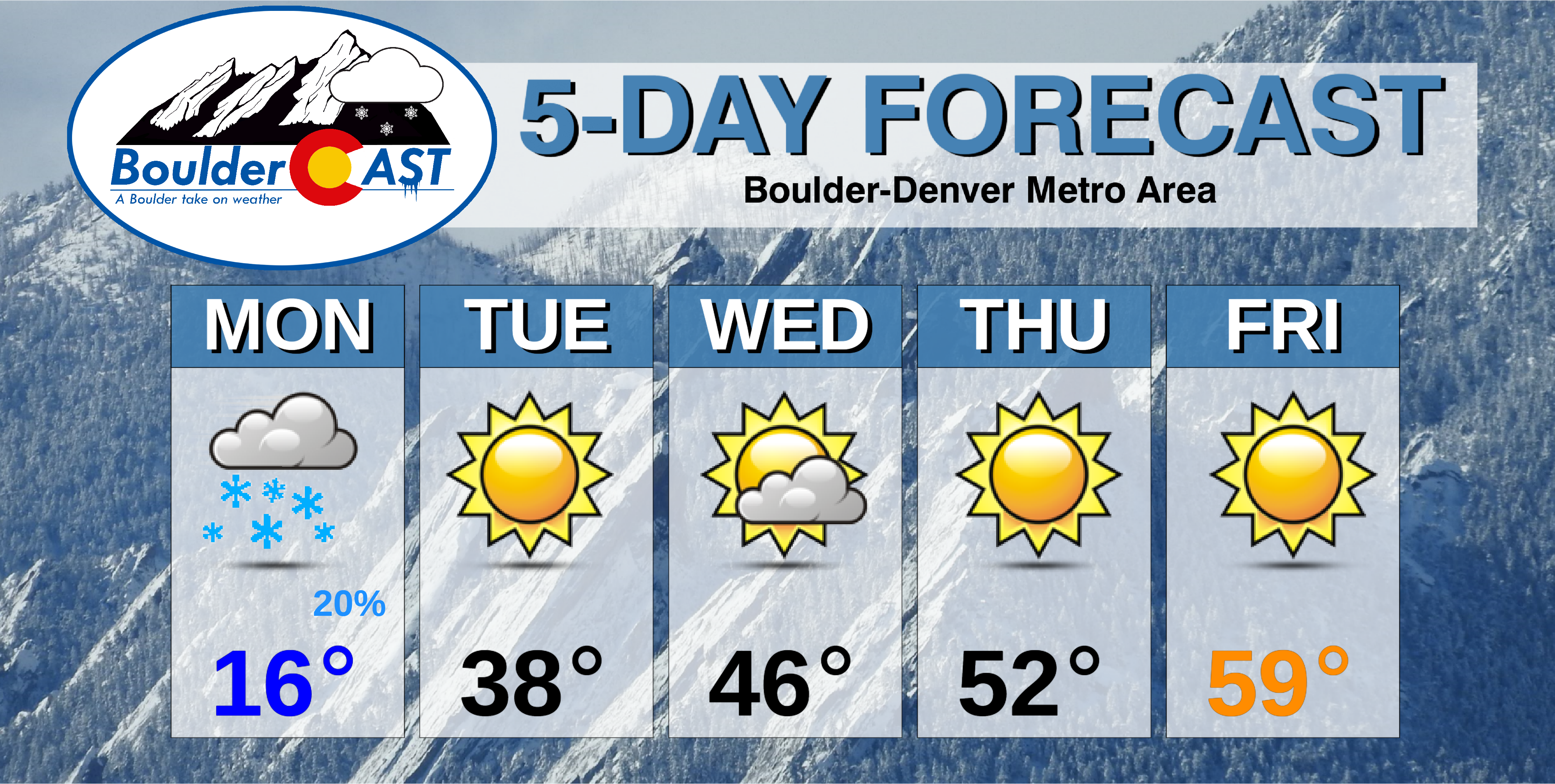
- Snow totals ranged from 4 to 7″ in Denver, but 8-13″ from Boulder to Fort Collins
- Active fire zones received snow as well, though we’re not out of the woods yet for further spreading
- The Arctic airmass accompanying the snow has brought record cold for late October to the area
- A warming and drying trend will ensue the rest of the week
W
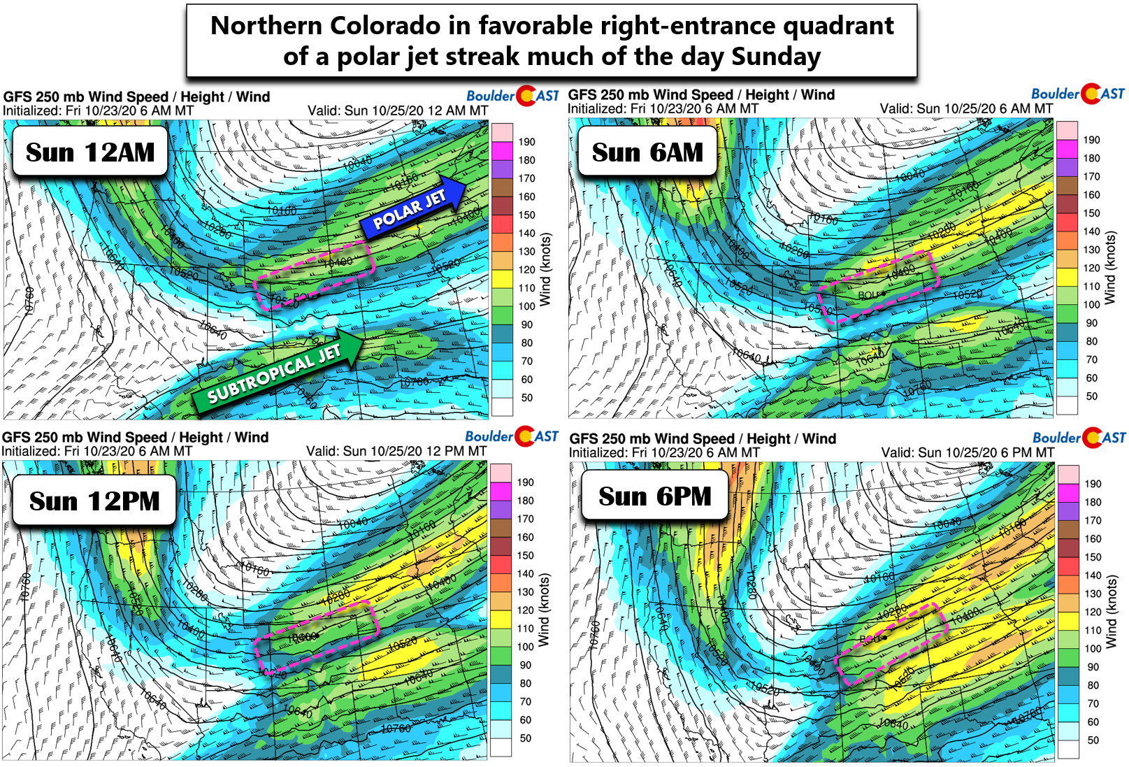
e first alerted you to the storm system that would eventually deliver the surge of Arctic air and snow nearly a week in advance. By and large, the global weather models did a very good job in identifying this storm quite a ways out, with little changes noted as the storm approached. As we reiterated all along, this wintry storm system would be a little different than what we are used to here in the Front Range. This one was less about the terrain’s interaction with the winds (upslope!), and more so just a brute-force jet-related dumping of snow that could have happened anywhere in the country. Mother Nature just chose us! The main player? The polar jet stream! Northern Colorado resided in the right-entrance region of the jet much of the day Sunday, a position favorable for the development of banded snowfall.
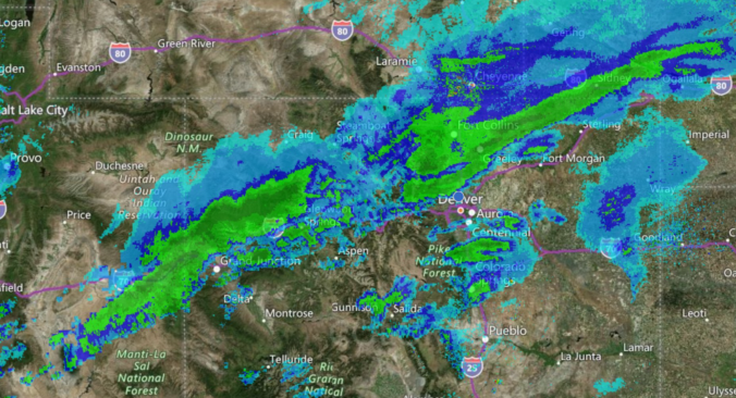
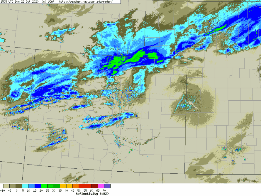
At times, a narrow band of heavy snowfall spawned by the overhead jet was nearly 600 miles long and more-or-less continuous from central Nebraska, across Colorado and into southern Utah. This radar capture below was from Sunday afternoon as the heaviest snow arrived in Boulder. This positioning lines up exactly with the right-entrance region we annotated in our forecast, as shown above. Do note that the band appears to be broken across central Colorado on radar. However, this is simply the result of radar beam blockage due to the mountainous terrain.
A key aspect for this event was that the polar jet stream was very slow to move southward as it butted-up again the subtropical jet stream which was moving northward, the opposite direction. This is shown in the animation below of 250mb wind speeds (near airplane heights).
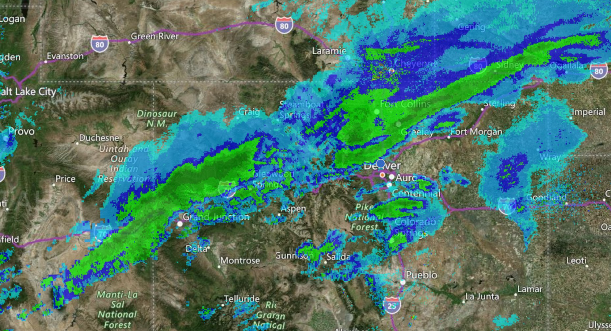
From late Saturday night into Sunday evening, the jet as a whole moved only about 100 miles southward, spreading slow-moving bands of heavy snow from Cheyenne, across the border into Colorado, and eventually into Boulder over this timeframe. That’s an average movement speed of only ~5 MPH, even though winds propagating through the core of the jet stream were moving nearly 120 MPH. The slow movement of the jet led to the bands of heavy snow lingering for much longer than we typically see in some areas. Usually the jet arrives, dumps a few inches of snow, and is gone in no time. The radar animation below spans from 9AM to 9PM Sunday. Notice how the main band takes its time to drop across the state.
The slow speed of the band caused a lot of confusion and impatience in the public when the snowfall did not arrive as quickly as they had hoped.
We only have to look upstream what is happening along the Wyoming border. NWS-Cheyenne scrambled overnight to add winter storm warnings for a band dumping near 2" per hour and is stationary.
Our team is more concerned right now about BOOMING snow totals, not BUSTING ones
— BoulderCAST Weather (@BoulderCAST) October 25, 2020
Those in Denver were particularly salty about Boulder getting all the snow most of the day 🙂
That’s been the expectation the past 7 hours for Denver, still waiting.
— Steven M Folse (@StevenMFolse) October 26, 2020
Areas from Boulder to Cheyenne got the worst of this band with numerous hours of heavy snowfall occurring with snowfall rates of 1.0 to 2.5 inches per hour. These locations saw 9 to 18″ of snow. Here’s the view from CU Boulder’s campus Sunday afternoon when the Banded-Snow Gods were clearly upset:
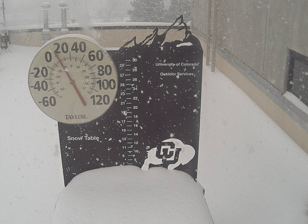
Video of heavy snow falling in Boulder during the afternoon on Sunday October 25 2020
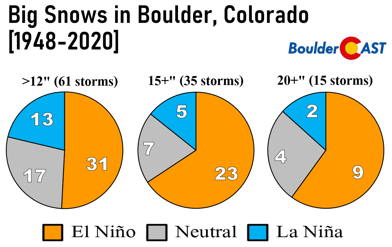
As the band moved further south into the Denver area, it started to weaken, move more quickly and become more sporadic. The result was notably less snowfall in Denver than in areas further north and west. Boulder reported just over a foot of snow. If you recall the details from our autumn La Niña post, a foot of snow in Boulder during a La Niña is fairly uncommon, happening only about 1 or 2 times per decade.
Updated graphic with this week’s snow event!
Shown below is our snowfall forecast map issued Saturday morning with actual storm totals overlaid in boxes. Green boxes indicate that our forecast verified to within one inch of the observed snowfall. Red did not (there are no red).
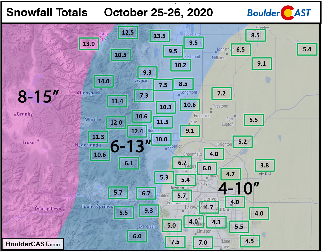
We had 100% forecast verification across the entire Metro area with just about everyone landing in our predicted ranges. It may not seem like it, but forecasting jet-forced snowfall events is extremely challenging. We never really know for sure where the heaviest bands will end up and linger the longest. Our team collaborated together and agreed with the trend in the models to target the heaviest banding north and west of Denver, which ultimately did verify quite nicely.
Zooming out and looking across all of northeast Colorado shows that snowfall was particularly heavy across the Cameron Peak Fire zone and to some degree, the East Troublesome Fire region as well. Due to a general lack of weather spotters, we don’t typically get a lot of snowfall observations out of Grand County. With the active fire and evacuations orders in place, we don’t have a good idea how much snow fell west of the Divide. Checking this morning, there are basically no observations in that area. In any case, the observed snowfall analysis map from NOAA shows that maybe only 2-6″ fell near Granby and Grand Lake, but more than foot in Estes Park.
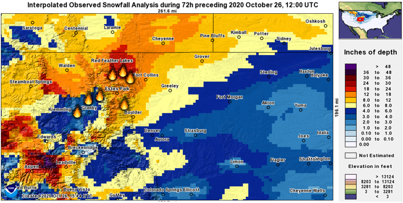
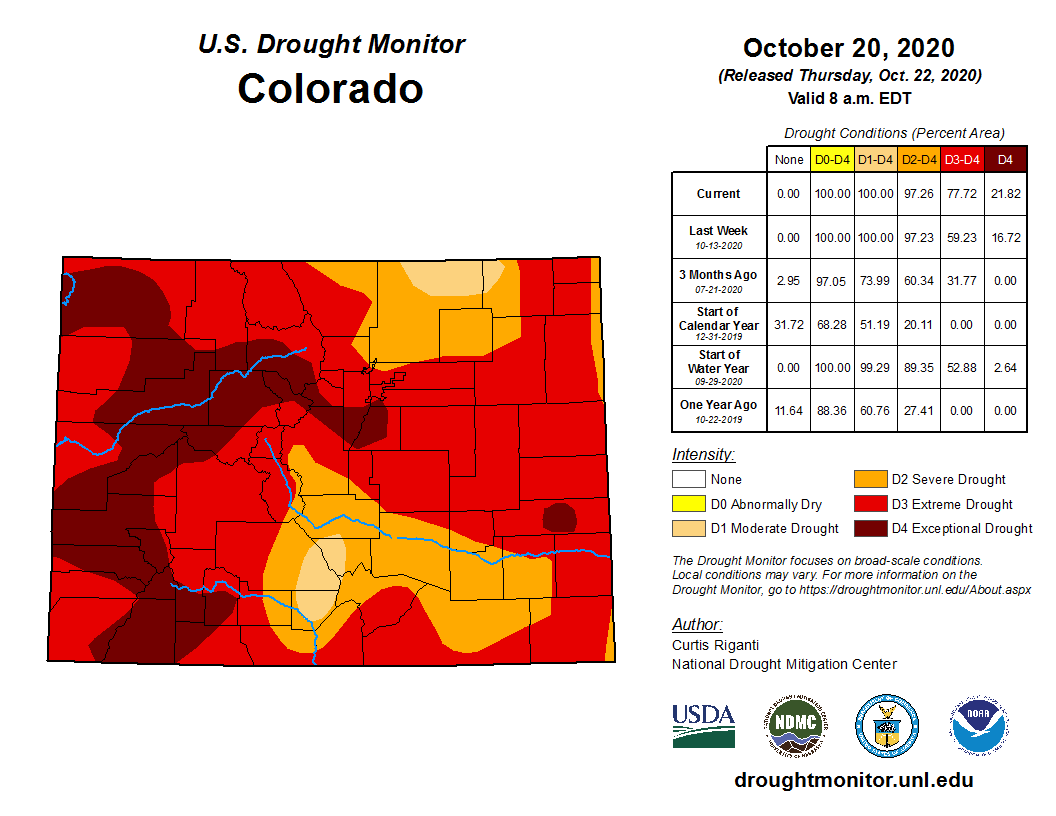
While the fresh snow and bitter cold will help quell the fires somewhat in the near-term, we’re certainly not out of the woods yet. This snow was especially fluffy, which means the moisture delivered will be relatively underwhelming. As the snow melts, the sun shines, and the winds eventually pick up again, we’ll be right back in the same boat, steered along by ongoing extreme drought statewide.
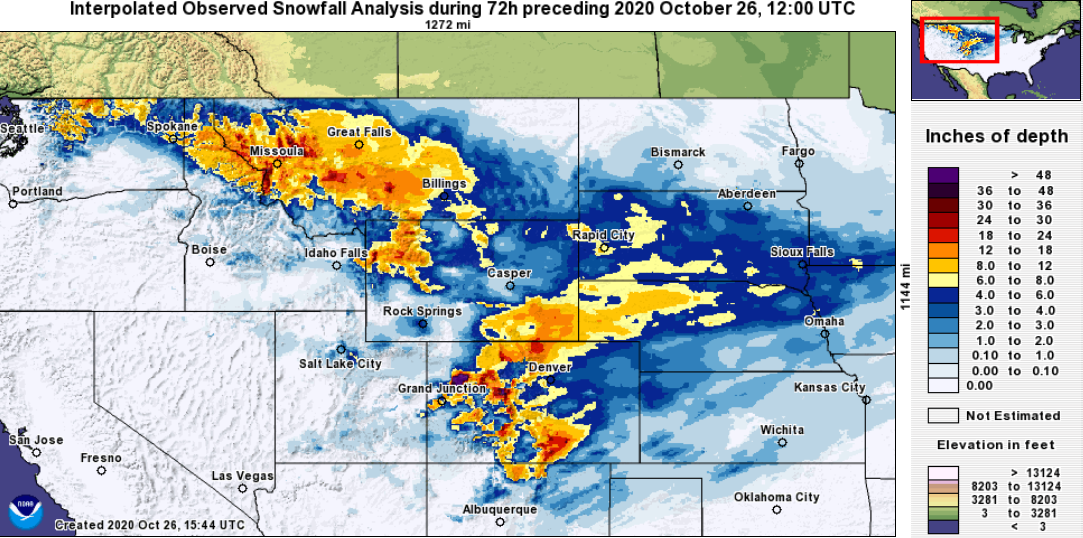
Zooming out even further, we can see that our snowstorm produced a thousand-mile-long dumping of snow from western Canada into New Mexico. Even the Dakotas caught the nose-end of the jet-forced snow band.
With the snow melting, only the bitter cold Arctic airmass will remain for another day or two before we begin the warming trend back towards normal for this time of year. Boulder will likely break three consecutive record low temperatures (Sun/Mon/Tue). We’ve already broken two as of Monday morning when the temperature plummeted to 5°F in Boulder, the earliest single digit temperature reading. The prior record had held up more than 100 years since October 29, 1917.
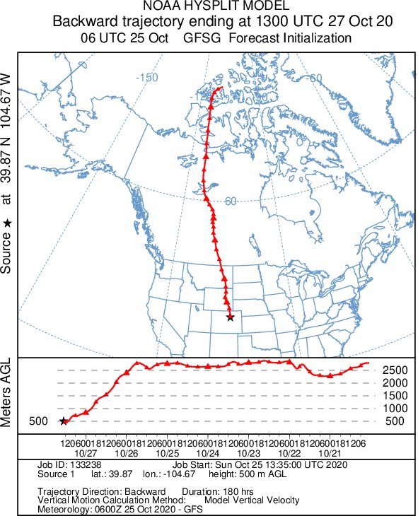
In case you were wondering if our liberal usage of “Arctic” is just us fluffing up the discussion…. it’s not. By running a backward trajectory analysis on the airmass over Colorado right now, we can locate the source region. The graphic below shows the track the frigid air took in the five days leading up to its arrival on our doorstep. Not surprisingly, it came straight to us straight from the Canadian territory of Nunavut in the Arctic Circle! That’s why it feels so frigid this morning and cold weather records are being obliterated left and right in many cities.
That’s all for now. For specifics on the upcoming weather this week, check out our weekly outlook posted earlier today. Make sure subscribe to BoulderCAST to get instant email notifications when our new forecasts go live, and don’t forget to follow us on Facebook or Twitter. Enjoy the snow and moisture!
We discuss Boulder and Denver weather every single day on BoulderCAST Premium. Sign up today to get access to our daily forecast discussions every morning, complete six-day skiing and hiking forecasts powered by machine learning, access to all our Front Range specific weather models, additional storm updates and much more!
.
Spread the word, share Colorado’s crazy weather:
.


You must be logged in to post a comment.