Brief mid-level ridging returns to Colorado today, bringing quiet conditions and sunshine to our region. We also discuss the latest forecast for the classic Front Range spring storm headed our way on Friday!
Category: Forecast (Page 126 of 169)
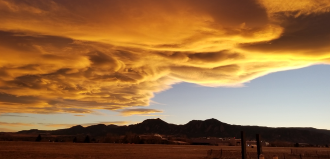
Even with thick high-level clouds overhead, yesterday saw “Fair” weather conditions reported across the Metro area, but what does this actually mean? As it turns out, “Fair” weather can signify a lot of things, with one critical caveat.
In today’s forecast, we cover a quick-hitting Pacific trough set to bring cooler temperatures and gusty winds to the Metro area today. We also provide an update on the major spring storm eyeing Colorado late in the week.

The week begins warm and breezy, with quiet conditions taking over through Thursday. However we are closely watching the potential for a significant rain and snow event on Friday for the state. Read on for complete details of the week ahead.
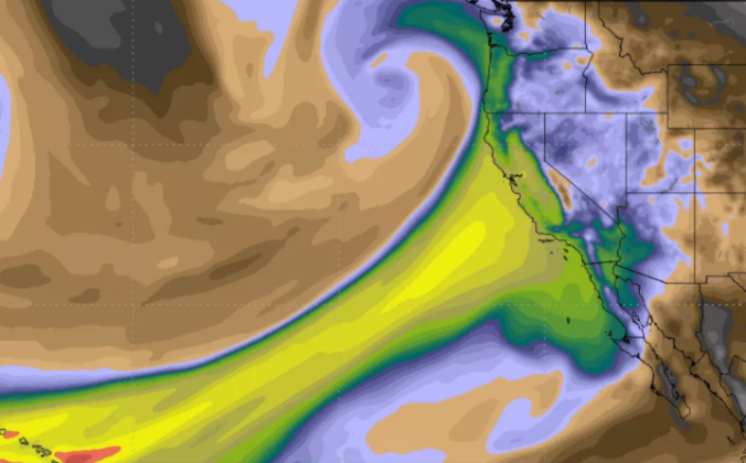
The Pineapple Express was back at it again this past weekend. Another round of soaking rain struck California, with all that tropical moisture translating into heavy mountain snow across northern Colorado.
Strong winds are poised to impact the Front Range over the next four days as a potent Pacific trough moves across the state. The winds will also accompany drastic changes in temperatures from the 70’s to the 30’s, unfortunately. Read on for details.

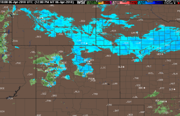
After a brief review of last Friday’s snow, we cover the forecast for the upcoming week. Overall it will be quiet with very comfortable temperatures, though we are watching a Pacific cold front set to bring Mountain snow, strong winds, and cooler weather towards the end of the week.

Live View of Boulder

Current Conditions

Live Radar

Latest Smoke Forecast

Recent Premium Posts

BoulderCAST Daily – Fri 07/17/26 | Hot and dry continues through the weekend
🥵 Heat tightens its grip this weekend — Ridge strengthens slightly over the …
This Weekend in Colorado Weather: Several More Scorching Days Ahead Before the Long‑Awaited Monsoon Pattern Arrives
☀️ Persistent heat continues — Low to mid‑90s through Saturday, spiking towards the …
BoulderCAST Daily – Wed 07/15/26 | The Ridge Rules the Rockies as Hot, Dry Pattern Holds Firm
🔥 Heat dome setup continues — A strong, stationary 500 mb ridge keeps …
3-Day Forecast

Trending Content

© 2026 Front Range Weather, LLC