Brief mid-level ridging returns to Colorado today, bringing quiet conditions and sunshine to our region. We also discuss the latest forecast for the classic Front Range spring storm headed our way on Friday!
We’ll be in-between storm systems today and tomorrow with a decently amplified mid-level ridge passing over the Rockies. The GFS 500 mb vorticity map below shows the large-scale pattern for today, including the ridge across Colorado and also the potent storm system off the coast of California that will be a major player for us later in the week.
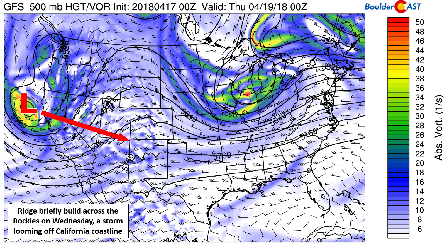
GFS 500 mb vorticity map for Wednesday
For today expect high temperatures in the low 60’s with mostly sunny skies and light winds. Tomorrow will be slightly warmer with stronger southwest flow pushing into northern Colorado. There will be more cloud cover, however.
The weather models continue to stick to their guns surrounding the evolution of the powerful cut-off storm set to impact most of Colorado Friday into Saturday. The GFS 500 mb map below shows just how beautiful the storm will be Friday afternoon…it truly is a “Four Corners” low. The reason we meteorologists love Four Corners storms so much is their ability to tap into deep Gulf of Mexico moisture. They are also often cut-off from the flow and therefore slow-moving. Both of these factors will be in play for this storm on the horizon.
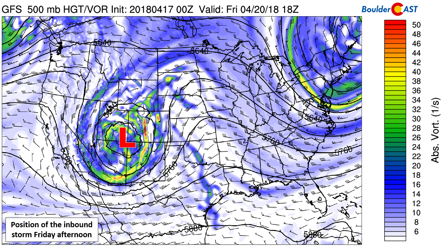
GFS 500 mb vorticity map for Friday
The storm is projected to slowly progress across extreme southern Colorado Friday afternoon and through the night. This will produce favorable and juicy easterly upslope across the Denver Metro area. We expect snow levels to begin around 8,000 feet during the day Friday, falling to around 6,000 feet by early Saturday morning. The snow level forecast for Saturday at 6:00 AM is shown below. For the lower elevations below 6,000 feet, all signs point to an almost entirely rain event. The one exception to this could be early Saturday when cooler air may overlap lingering precipitation to change things over to snow. At this time, we are not expecting major wintry impacts across the Plains.
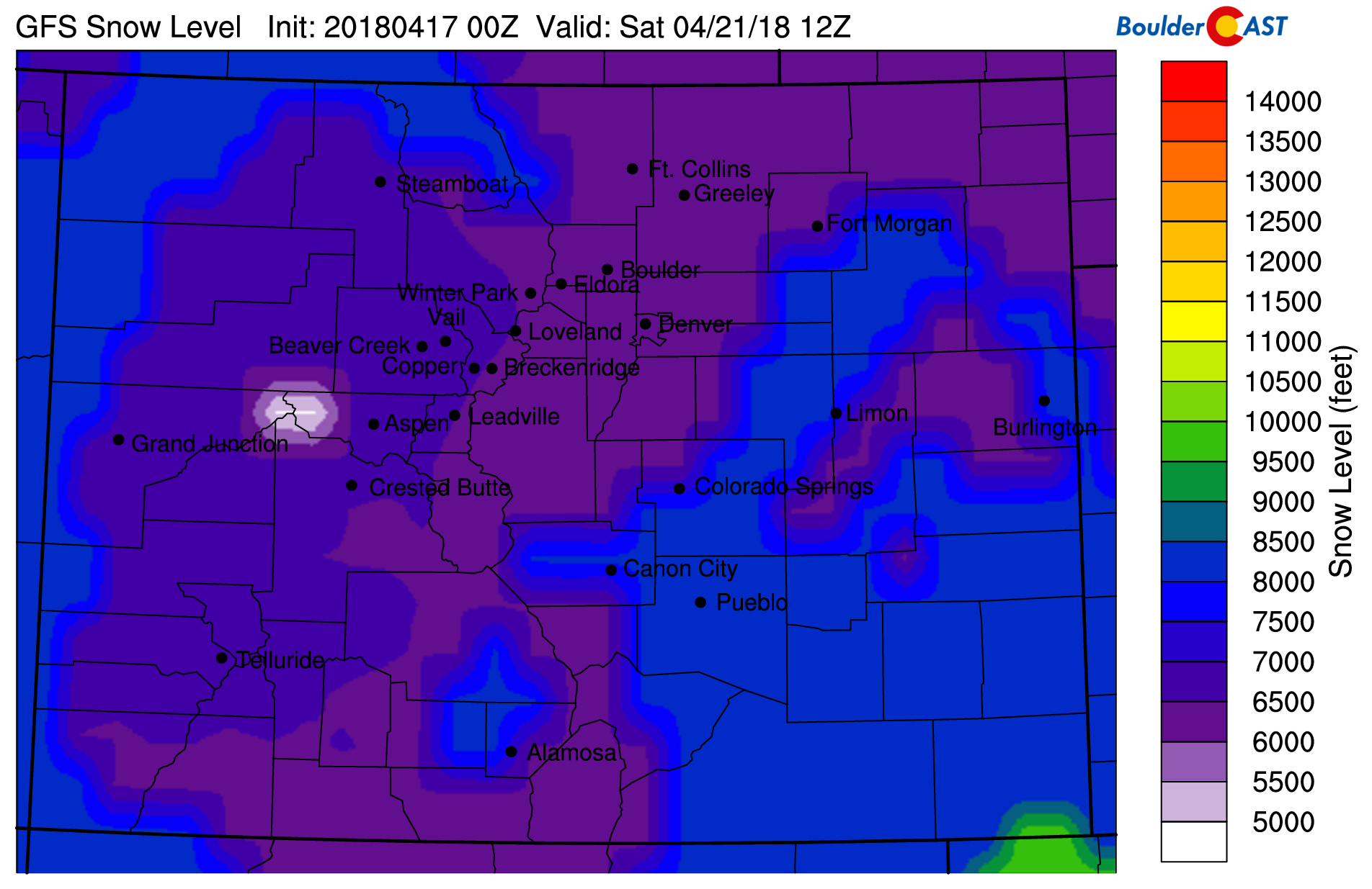
GFS model-derived snow level forecast for Saturday morning. Forecast snow levels bottom-out at 6,000 feet.
In the higher Foothills west of Boulder (elevations above 8,000 feet), snow amounts of 6 to 12+” are almost guaranteed at this point. There is a decent chance of up to 24″ as well, but it’s too early to call. We’re still seeing slight variations from run to run in liquid precipitation totals. Conservatively, it looks like a 0.5 to 1.5″ event, a significant amount for our region. On the higher end, it could be nearly double this. The toughest snowfall forecast will be in the lower Foothills and Palmer Divide areas it seems (elevations from 6,000 to 8,000 feet). It’s these locations where the rain/snow line will be hovering Friday evening and night. We’ll be monitoring this closely, but if you live in the hills, prepare for a whole lot of rain…or snow….or something in between!
These detailed daily forecasts are normally only available to our Premium members. In celebration of BoulderCAST’s recent three-year anniversary, our daily forecasts will be available to all of our readers through Friday. If you like what you see, use the promo code THREE at checkout to save 33% on an annual Premium membership. This offer ends Friday night at 11:59 PM Mountain Time. Sign up today to get the best BoulderCAST experience, including these daily forecasts every morning, complete 6-day skiing and hiking forecasts, chat room and forum access, early viewing of select content and much more!

.


You must be logged in to post a comment.