Several favorable atmospheric components aligned to produce very strong winds across the Metro area Tuesday afternoon and evening. We look at the peak wind gusts and also check out the view from the space borne GOES-16 weather satellite.
Bora or Chinook?
Don’t be mistaken, Tuesday’s winds were the bora variety, not Chinook. Use the time series of weather data from BoulderCAST Station below to justify this to yourself following these three guidelines:
- Bora winds are cold winds and temperatures will drop as the winds pick up. Chinook winds are warm winds with rising temperatures.
- Bora winds occur immediately following the passage of the upper-level storm (trough). For this reason, pressure will be increasing during bora wind events. During Chinook wind events, a lee trough develops with pressure falling.
- Bora winds generally have a direction between west and northwest (270 to 315 degrees). Chinook winds have a direction between southwest and west (225 to 270 degrees).
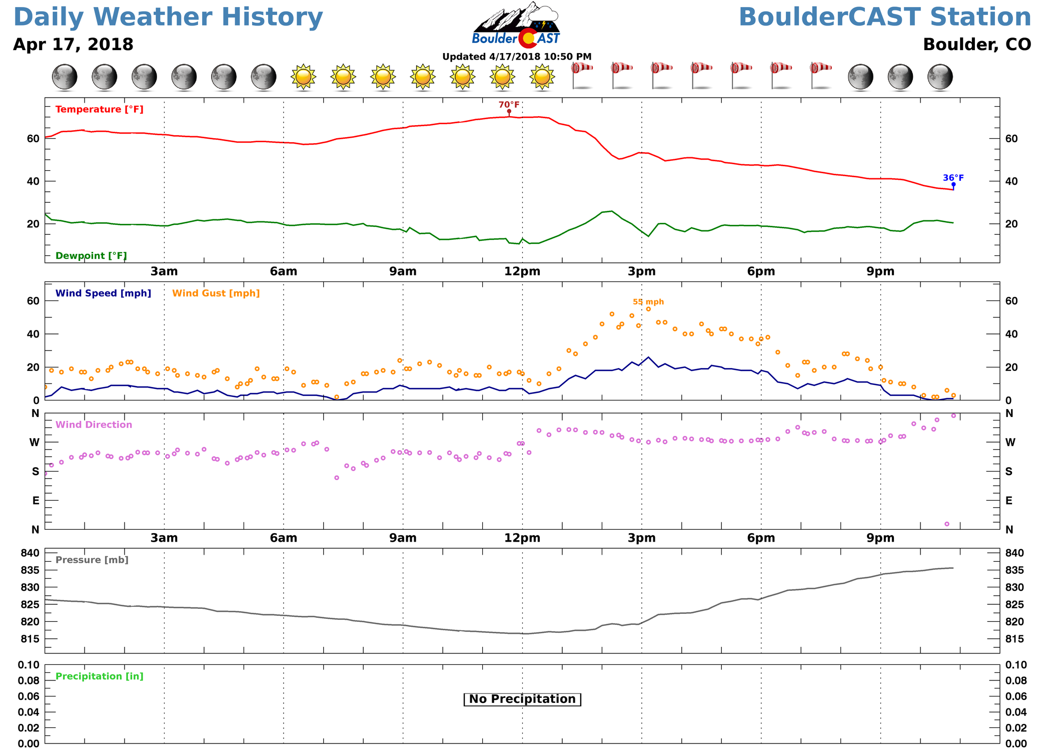
BoulderCAST Station weather data from April 17, 2018.
Here are some of the peak gusts from around the area, many of which exceeded “hurricane force”:
- Somewhere near Louisville – 89 mph
- Broomfield Airport – 86 mph
- NREL Wind Site (South of Boulder) – 83 mph
- NCAR Mesa Lab, Boulder – 81 mph
- Skywatch Observatory, CU-Boulder – 75 mph
- Interlocken in Broomfield – 75 mph
- BoulderCAST Station – 73 mph
- Boulder Airport – 68 mph
- DIA – 67 mph
- NCAR Foothills Lab, Boulder – 64 mph
The high winds led to powder outages, downed trees, roll-over car accidents, and isolated structural damage across the region. This was the strongest and most widespread windstorm in more than two years for the Boulder area. Further south, across southern Colorado, numerous brush fires formed and dust rolled across the lower elevations. The below webcam is from near Alamosa late Tuesday morning. Note: This is not Mars.
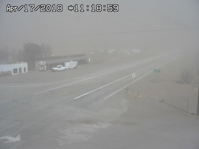
Webcam image from San Luis Valley on April 17, 2018 during a dust storm.
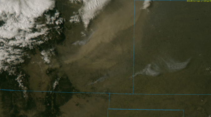
The visible satellite loop from GOES-16 shows the huge plume of dust that was picked up from the San Luis Valley (near the Great Sand Dunes). It was advected eastward over the Sangre de Cristo Mountains and all the way into Kansas through the day. Towards the end of the animation, you can see the cold front/bora winds rushing southward embedded in the dust! You should also be able to pick out at least three plumes of smoke from freshly-formed brush fires in southeast Colorado.
GOES-16 visible satellite loop covering sunrise to sunset on Tuesday April 17, 2018. Blowing dust and several wildfires are evident due to strong winds.
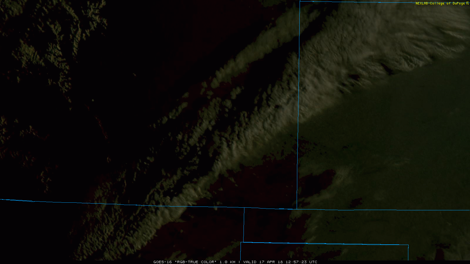
Here’s another broader look at Colorado as the upper trough passed and the strong winds exploded downwards onto the Plains. This is the GOES-16 low-level water vapor (infrared) data. Truly amazing!
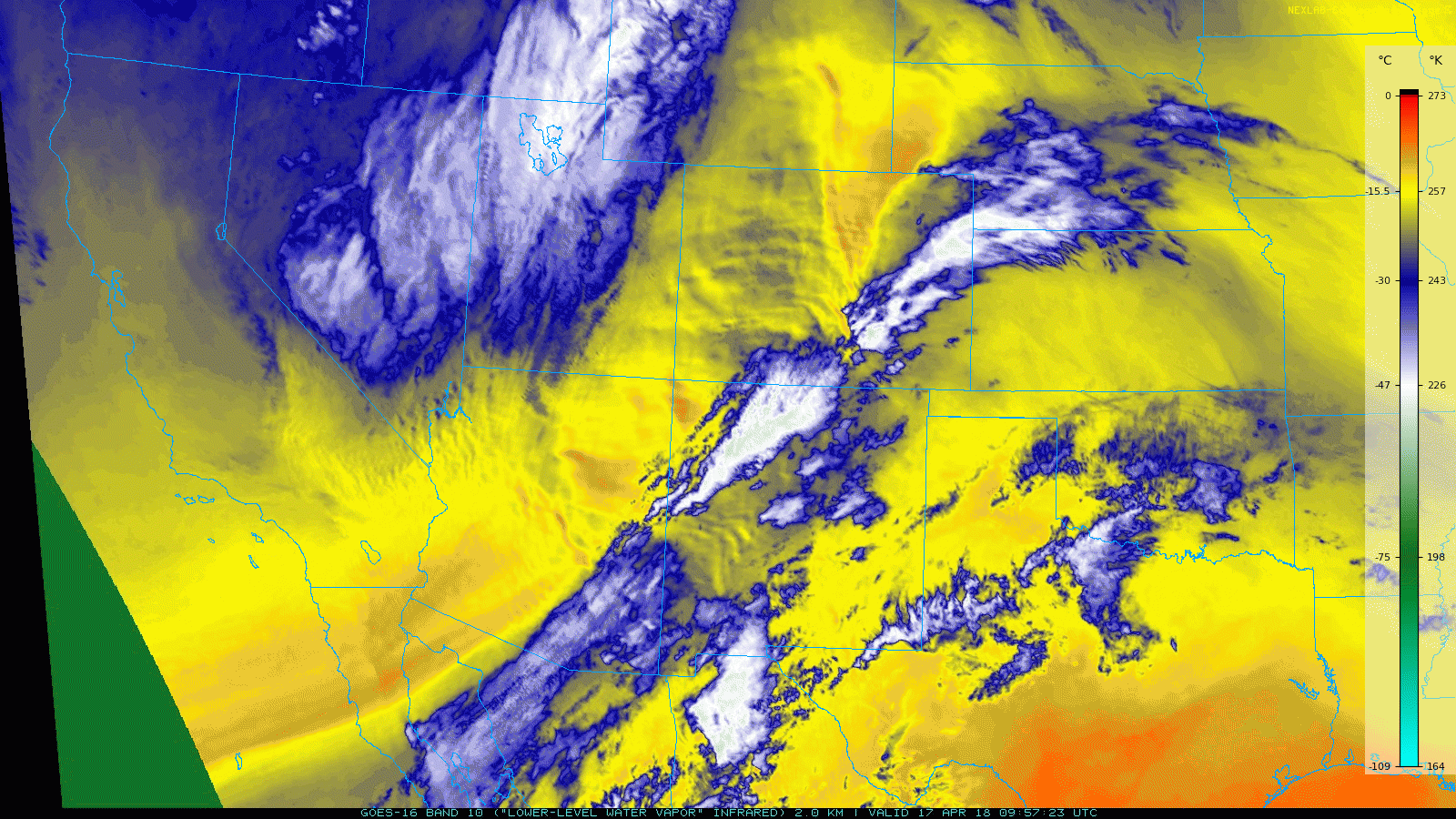
GOES-16 low-level water vapor satellite loop covering the high wind event on Tuesday April 17, 2018.
The dangerous fire conditions and high wind threat are now behind us with calmer weather and slower winds aloft moving into the Colorado for Wednesday and Thursday. Significant rain and snow are on the horizon, though…
Share this report:
.


You must be logged in to post a comment.