Nice today, not so much tomorrow…Enjoy it!
The spring storm system bearing down on our region came ashore into northern California overnight.
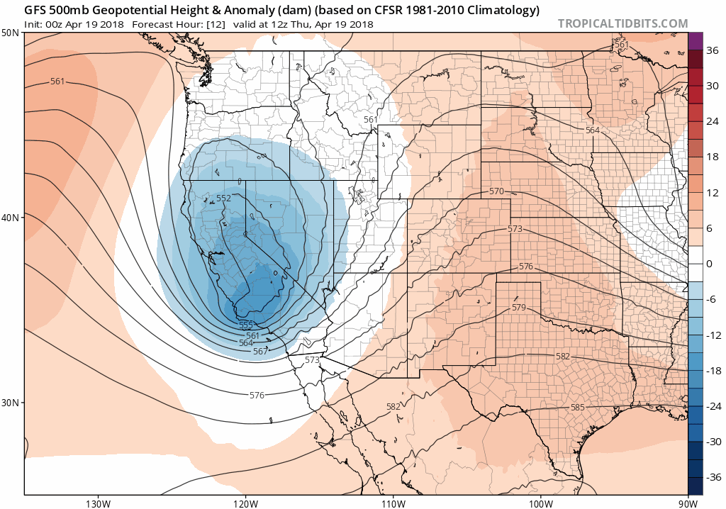
GFS 500 mb height anomaly animation from Thursday morning through Saturday.
Before this system arrives, Colorado will see strong southerly flow invade today. This will bump our temperatures up a little from yesterday, but also begin the moisture transport to spread high-level clouds across the area. Look for temperatures in the mid to upper 60’s this afternoon with generally thinly clouded skies. The winds could be a little gusty, particularly south of Denver where Red Flag Warnings are posted. Relative humidity levels look marginal at best to meet Red Flag criteria, but still, do be cautious of the primed conditions for fires. Winds could gust in the Boulder/Denver area to 30 mph this afternoon out of the south and southeast.
Big changes come tomorrow as the cut-off low moves across southern Colorado. We’ll have a more detailed look at this forecast posted later this morning, but the system will be too warm to support snow across the Plains. This isn’t our official snowfall forecast, but the GFS model-derived snowfall map below follows our thoughts in most respects. Concern for spring snowfall will be south of Denver across the Palmer Divide, and in the Foothills west of town.
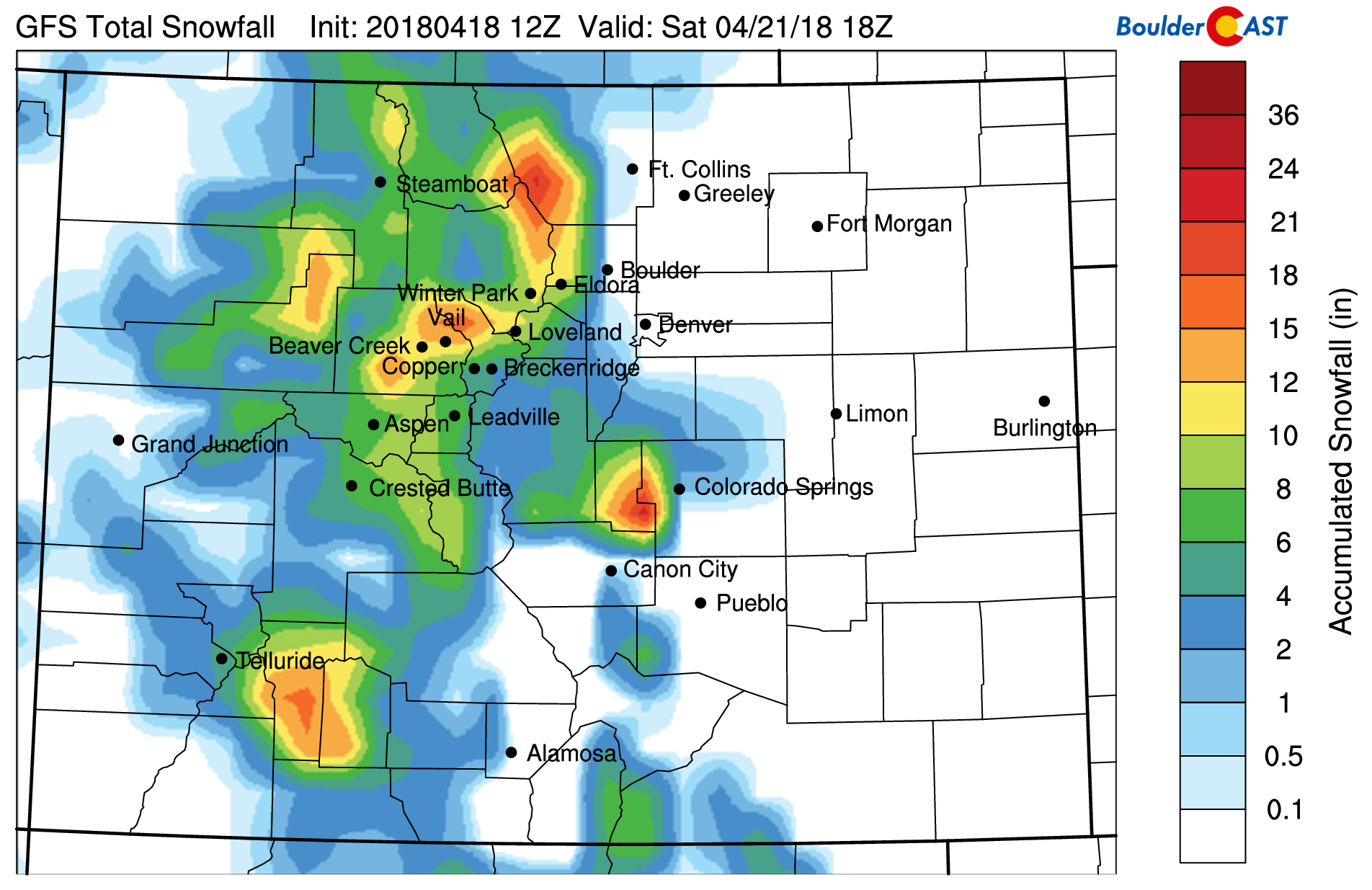
GFS snowfall forecast map for the upcoming spring storm.
Our storm update later this morning will also discuss the uncertainty surrounding snow levels and the odds of Boulder and Denver actually seeing a few flakes. Stay tuned.
These detailed daily forecasts are normally only available to our Premium members. In celebration of BoulderCAST’s recent three-year anniversary, our daily forecasts will be available to all of our readers through Friday. If you like what you see, use the promo code THREE at checkout to save 33% on an annual Premium membership. This offer ends Friday night at 11:59 PM Mountain Time. Sign up today to get the best BoulderCAST experience, including these daily forecasts every morning, complete 6-day skiing and hiking forecasts, chat room and forum access, early viewing of select content and much more!


