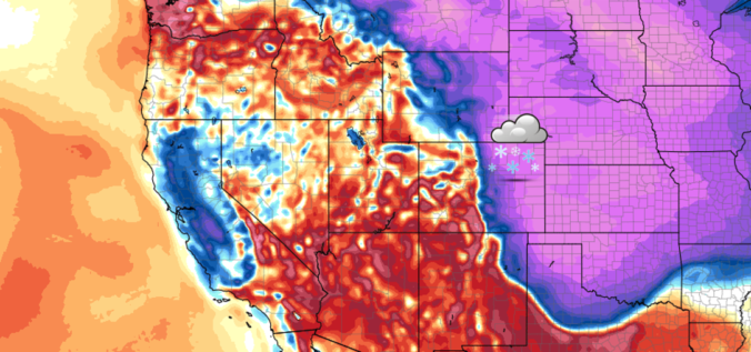
Following a relatively quiet stretch of weather, things are about to take a cold and snowy turn for the Metro area on Friday as a strong cold front moves into the region. Read our complete forecast covering the timing of those chilly temperatures and potential snow amounts.
Premium Storm Update (Fri April 6 at 12:30 PM)April snow and VERY cold temperatures have arrived: READ NOW
The weather last Friday was near-perfect for a hike to the summit of 11,427-foot Twin Sisters Peak in Rocky Mountain National Park. Thanks to the forecast guidance provided by SummitCAST, our team was able to squeeze in a fun late-March excursion with no concerns about ugly weather. Twin Sisters is just one of many lower elevation hikes coming soon to SummitCAST. We review the weather from our recent hike and update you on the status of SummitCAST development.
We hope you had a wonderful Easter holiday. For the remainder of this week, we start off with windy and chillier weather as the main story. After that, we’re expecting a brief warm-up followed by a very real chance of rain and snow. Read more to find out the full details!
A secondary weather system will bring a return of rain and snow to our region on Wednesday. This system is slightly warmer and weaker than the one earlier in the week. Nonetheless, some accumulating snow is possible later tonight. Read on for details.
Monday evening’s wet snow brings us closer to normal precipitation for the month of March. We review the snow totals from across the region and discuss our next chance of snow.
We have gotten numerous requests to streamline your ability to monitor upcoming winter weather. To answer this call, we’d like to introduce you to SnowTracker, a new hub that consolidates a wealth of weather information related to forecasting and tracking Mother Nature’s most wintry moments. SnowTracker acts as a focal point to keep an eye on developing winter storms for Colorado and what is already on the ground.
Available information includes…
Models snowfall forecast maps from the GFS and NAM
Ensemble forecasts, including our Snowfall Probability Charts
A quick glance at the latest PowderCAST forecasts for all the Colorado ski resorts
Current weather conditions, live radar, and more than a dozen live webcams from across the region
Daily snow observations and cumulative seasonal snow totals for Boulder and Denver
Current snowpack and drought coverage for Colorado
SnowTracker will be seasonally available on BoulderCAST during the months of September through May. Please do enjoy!
🔥 Heat dome setup continues — A strong, stationary 500 mb ridge keeps …
3-Day Forecast
Did You Know?
Altocumulus lenticularis, or lenticular clouds as they are more commonly known, are lens-shaped clouds that form as a result of wind flowing over terrain. They're easy to spot around the Front Range...just keep an eye out for white UFOs!