A secondary weather system will bring a return of rain and snow to our region on Wednesday. This system is slightly warmer and weaker than the one earlier in the week. Nonetheless, some accumulating snow is possible later tonight. Read on for details.
The moist southwest flow that brought all that moisture to our region a few days ago has backed to northwesterly now. Our next weather system has already dropped out of Canada and will be moving across the state today and overnight. The 500 mb forecast map below for this evening shows the subtlety of the wave; there is not much energy with this one. The largest impact will be near and west of the Continental Divide where northwest flow will provide orographic snows.
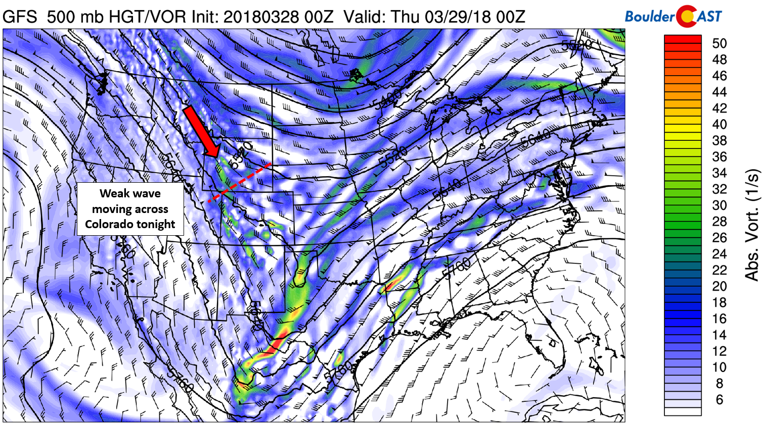
GFS 500 mb vorticity map for Wednesday evening showing the weak passing wave.
For the Metro area, the forcing for this event will come in many flavors:
- Daytime heating
- Weak large-scale ascent from the trough
- Marginal lift provided this evening by the jet stream (see below)
- Weak north-northeasterly low-level upslope
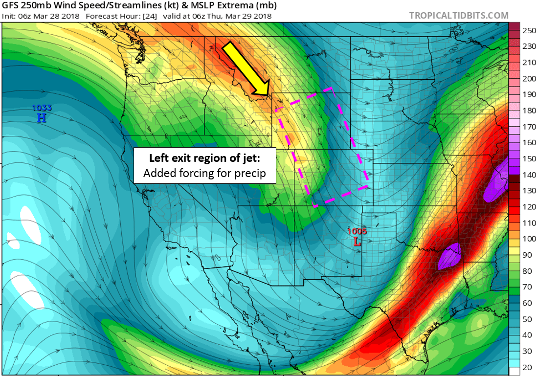
GFS 250 mb wind forecast map for Wednesday night. A jet-streak to our north will add additional forcing for precipitation across eastern Colorado.
None of the facets of the storm mentioned above are strong enough to bring much precipitation. Everything is kind of “meh”. Therefore, we expect generally light and spotty showers through the day and into the nighttime hours. The focus for precipitation will be across two regions…1) North of Boulder to the Wyoming border and 2) in far eastern Colorado. Across our immediate area, amounts will be less the 0.25″ with spotty coverage overall.
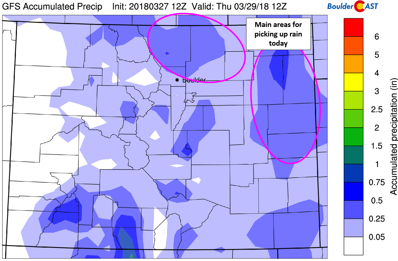
GFS precipitation accumulation forecast for today and tonight. Less than 0.25″ is expected for Boulder and Denver.
With temperatures in the 40’s this afternoon and limited upslope, we expect much of the precipitation that does occur to fall as rain or rain/snow mix across the lower elevations, with all snow above 7,000 feet. We do note that this system is running a few degrees warmer than the storm earlier in the week. Nonetheless, cooler air will be filtering through the day, with temperatures becoming cold enough for a change-over to snow across the Plains between 3:00PM and 7:00 PM. Exact snow amounts are hard to pin down considering the melting and timing. However, they will be lighter than our last storm, regardless of the change-over timing.
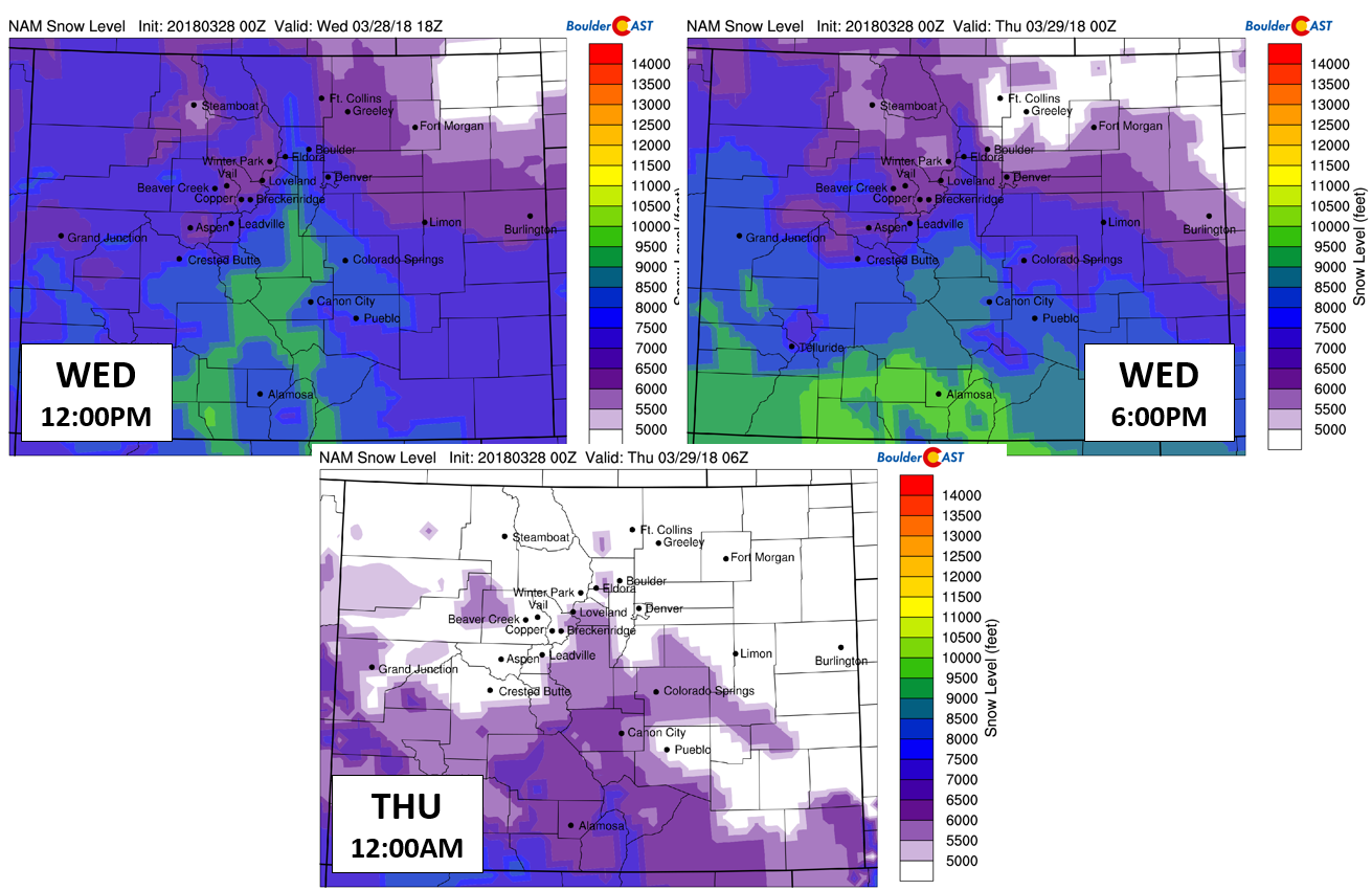
NAM model-derived snow levels for this afternoon (top left), this evening (top right), and tonight (bottom).
Given the lighter and patchier nature of the precipitation, snow accumulations should be minimal in most areas, 1/2″ or less. However, with convective cells and jet-forced snow banding possible, it wouldn’t be surprising if a few places see a quick inch or two. The best chances of this happening will be in the eastern and southeastern portions of Denver. Travel should not be impacted significantly, or at all, in most locations. Roads will be just wet of briefly slushy if a heavier snow band passes overhead.
Here is what we are thinking:
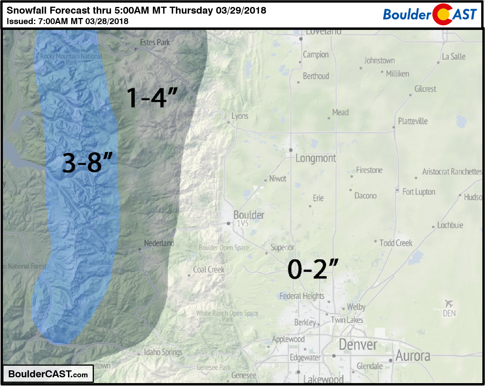
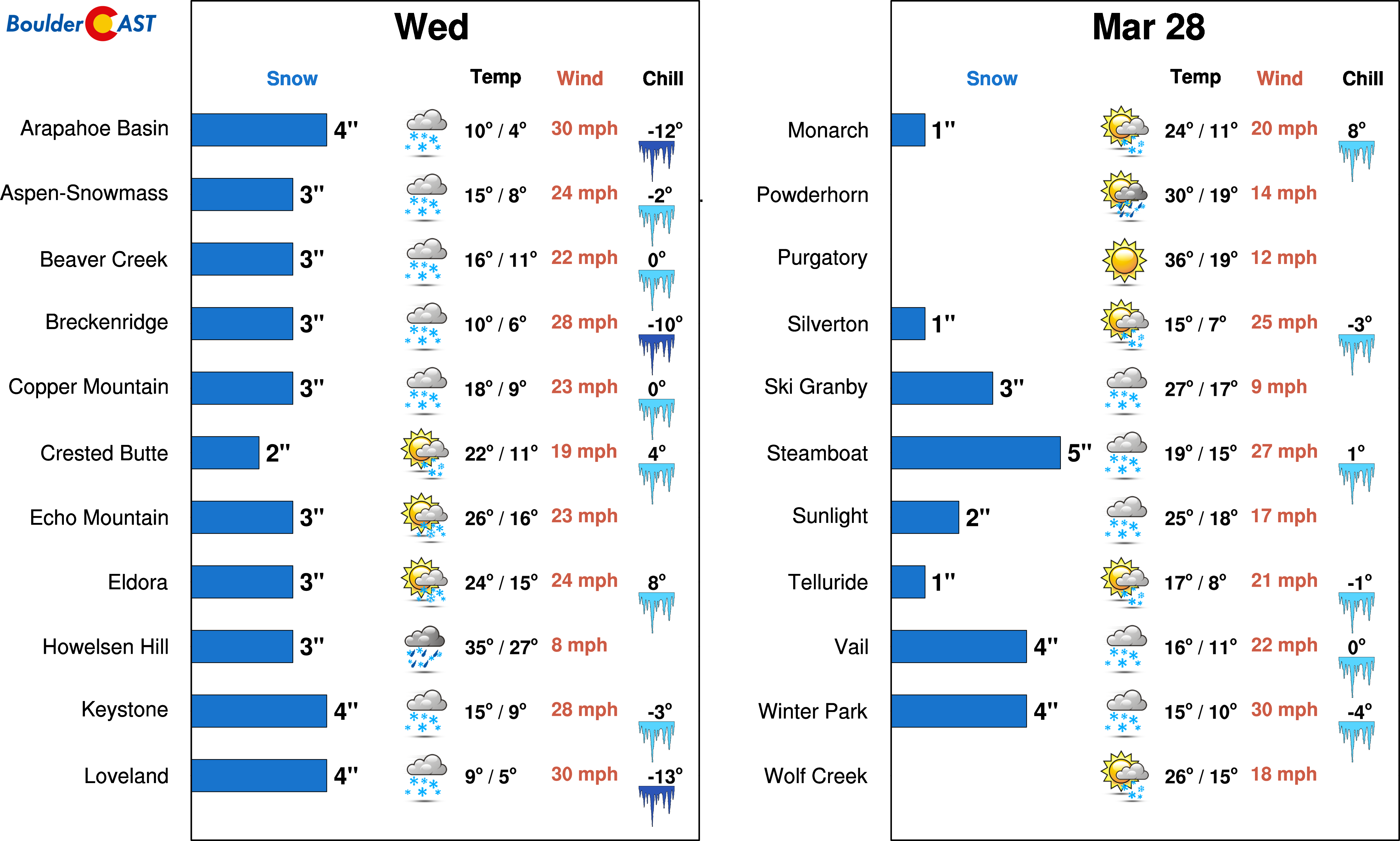
The Mountains north of Interstate 70 will see 3-8″ by tomorrow morning (hooray northwest flow!). The higher Foothills from Ned northward into Larimer County are looking at 1-4″ of snow, some of which will be spill-over from the snows on the Divide. Winter Park and Steamboat are the favored ski resorts for this weak storm.
Tonight will likely be our last chance of snow for the month of March. The monthly total thus far is only 4.1″ in Boulder, WELL BELOW the normal of 17″. How does this bode for your entry in our ongoing Snowfall Forecast Contest?!
Enjoy another day of so-called spring… temperatures will be trending upward into the weekend with 60’s and 70’s not far off!
Share this forecast:
.


You must be logged in to post a comment.