Following a relatively quiet stretch of weather, things are about to take a cold and snowy turn for the Metro area on Friday as a strong cold front moves into the region. Read our complete forecast covering the timing of those chilly temperatures and potential snow amounts.
Premium Storm Update (Fri April 6 at 12:30 PM) April snow and VERY cold temperatures have arrived: READ NOW
We have been enjoying a relatively pleasant stretch of weather recently…
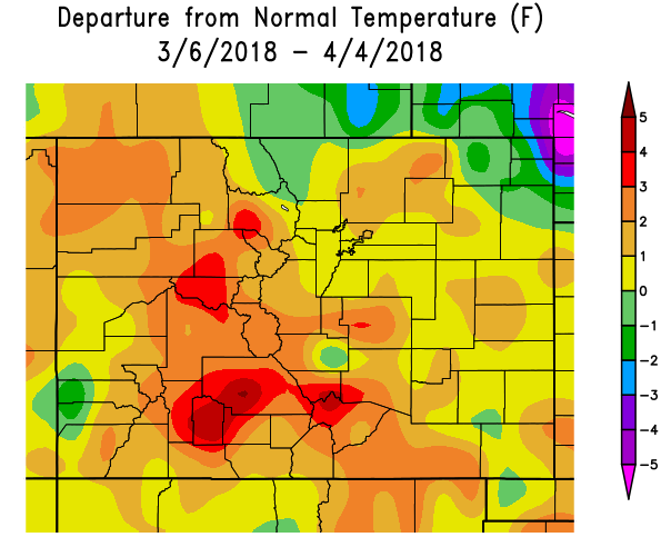
Over the last thirty days, temperatures have been above normal for most of Colorado (save the northeast corner), including not a single day with high temperatures below 45 degrees in Boulder. During this time, there were only four “major” precipitation events, an element that has cultivated the tranquil feeling of late. Despite this, Boulder did finish March with 2.23″ of precipitation….a good bit above normal (which is 1.8″). The cold and the wet did not overlap all that well, so the 2.23″ of precipitation led to just 6.8″ of snow, dismal compared to the March median of 17.4″.
Mother Nature will upset our normality Friday morning as a potent cold front plows into northeastern Colorado. The front itself is tied to a VERY weak shortwave passing across Colorado at 500 mb. The forecast map below from the GFS for Friday shows very little “dipping” in the height lines and essentially insignificant vorticity. This is a rare occasion where the 500 mb map doesn’t help us much with the forecast…other than letting us know that conditions are NOT great at the middle of the atmosphere for precipitation.
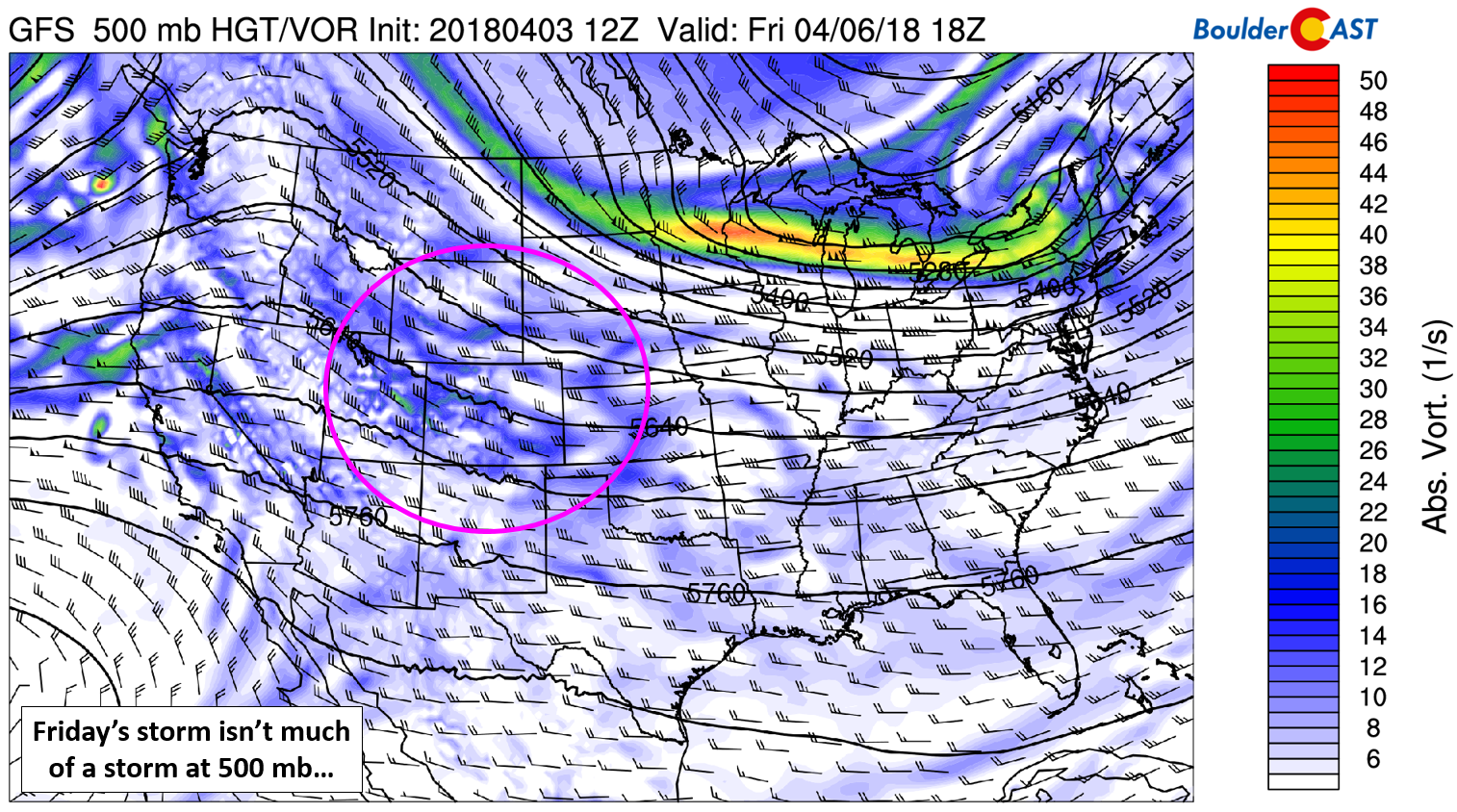
GFS 500 mb map for Friday. The “storm” is circled in pink…
Luckily we have more favorable conditions closer to the surface…a cold front, plenty of moisture, and good upslope directionality and strength. These are the main factors leading to the wet/snowy forecast. The 800 mb temperature map below from the NAM model shows the position of the initial cold front at 6:00 PM on Thursday. It will only be impacting the northeast corner of the state, with mild conditions and downslope flow prevailing across the Denver Metro area for one more day. Despite thick wave clouds Thursday afternoon, temperatures will be pleasant in the middle 60’s for us.
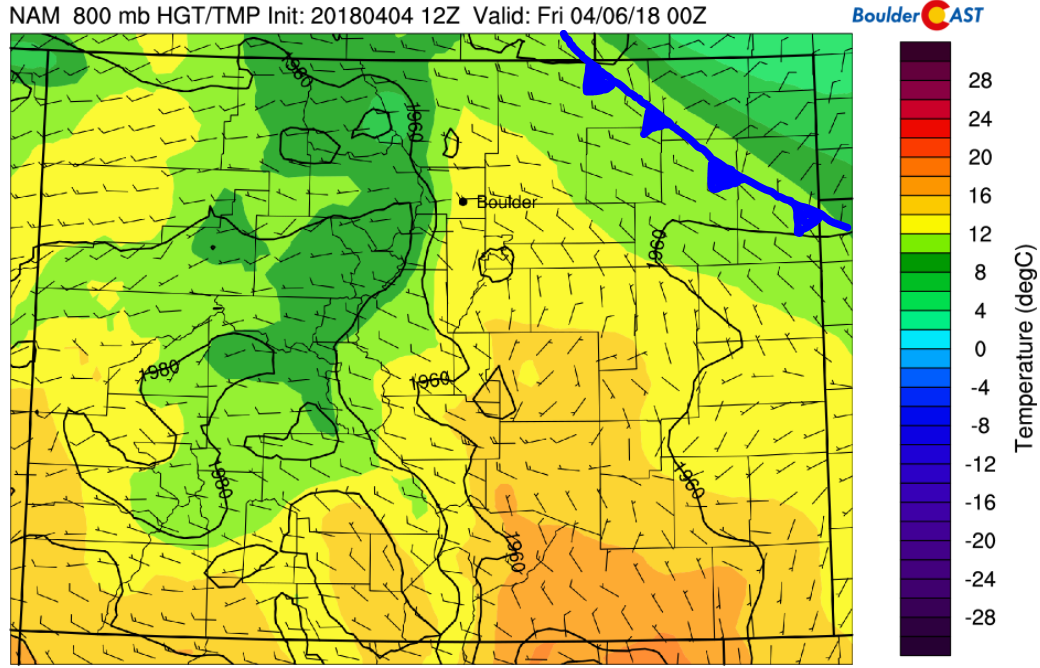
NAM 800 mb temperature map for Thursday evening. The first sign of the cold front is visible….
Friday morning, things get even colder as a secondary front pushes into eastern Colorado. This front is the “real deal” and it will be packing very cold temperatures and gusty winds on the backside. 25 to 35 mph northeast winds are indicated just above the surface in Boulder at 800 mb. Though shallow, this will be very efficient upslope for the lower Foothills and adjacent Plains. Models have remained in good agreement for this cold air being drawn southward, which brings us confidence that rain will quickly be changing to snow late Friday morning. With upslope the main forcer here, precipitation will likely be focused across the western Metro area in and near the Foothills.
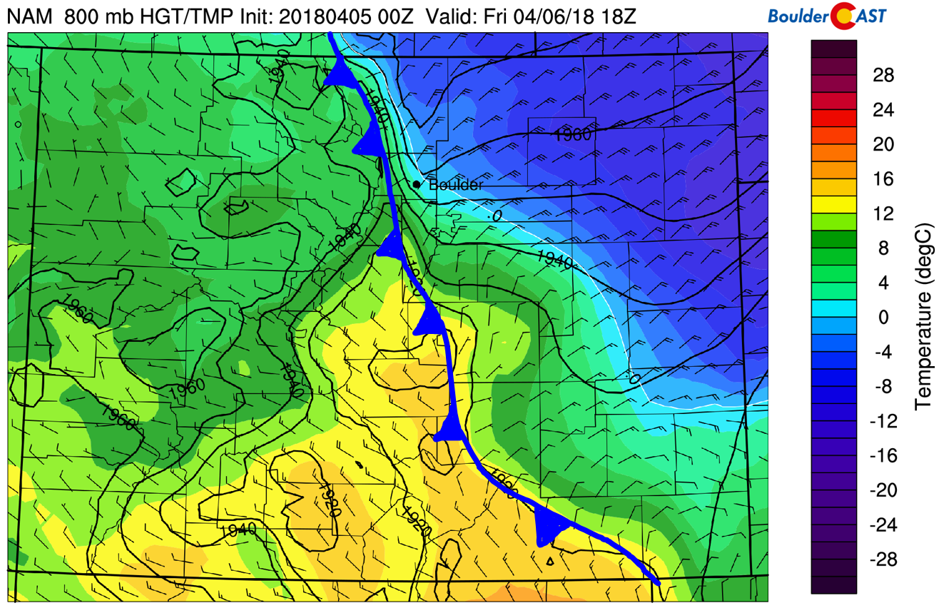
NAM 800 mb temperature map for Friday at noon. Hello cold air!
The timing of this reinforcing cold front looks to be mid-morning on Friday for the Boulder and Denver area. Temperatures beforehand will peak in the low to middle 40’s, with falling temperatures into the low 30’s or even upper 20’s by early evening Friday. Precipitation will begin as rain Friday morning and quickly change to snow for everyone before the lunch hour. The heaviest snow will accompany the best upslope, which will be during the afternoon hours, roughly from 10AM to 4PM. We expect the snow to taper off in most locations by early evening, with light snow lingering in and near the Foothills a little longer.
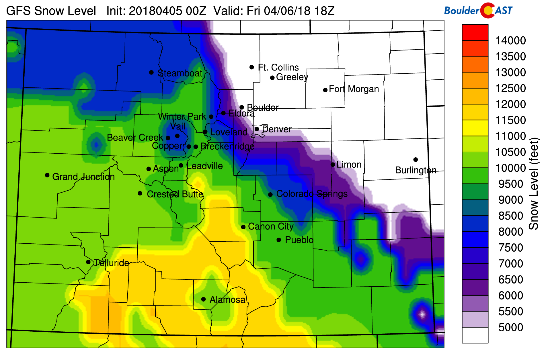
GFS model-derived snow level forecast for Friday at noon. It’s already cold enough for snow in Boulder/Denver.
We’re also watching the jet stream for the potential to enhance precipitation rates across the Metro area during the day Friday. There will be two jet streaks, one small and one larger. They will be sweeping across Colorado rather quickly, but we should end up in the left-exit regions of both of them for a few hours on Friday….once in the morning and once in the early afternoon. As a result of these jets, we could see brief enhancement of rain or snowfall rates, but specific locations and timing for this is tough to pin down.
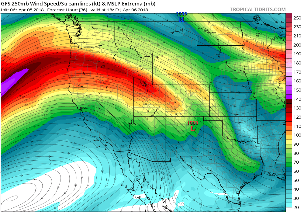
250 mb wind speed forecast for Friday afternoon. Two jet streaks will be moving across Colorado.
As we move through the month of April, snow accumulation during the daytime becomes difficult with the higher sun angle. Friday’s snow will be occurring at about the worst time of day possible for accumulation. Only areas that have moderate to heavy snowfall rates will see much of anything stick, and mainly just on grassy surfaces. In the Foothills, where temperatures are a little colder, a few inches will be possible. Roads will largely remain just wet.
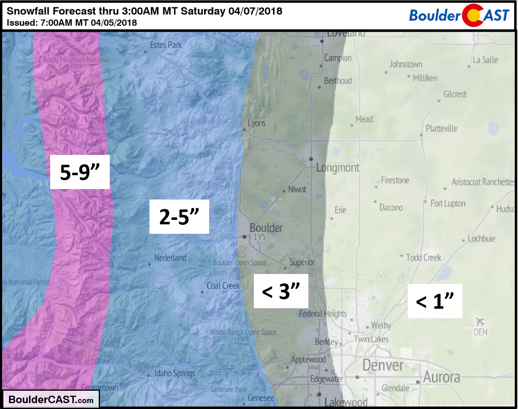
Our snowfall forecast map is below. This won’t be a major snow event for anyone…there isn’t enough mid and upper-level support. Areas away from the Foothills may only see a few snowflakes with no accumulation at all. If you’re headed to the Rockies Home Opener in the afternoon on Friday, dress warm and expect some wet/snowy weather. While it is possible to see delays, downtown Denver should be outside the thick of it and we expect the game will not be postponed entirely as many news sources are insinuating.
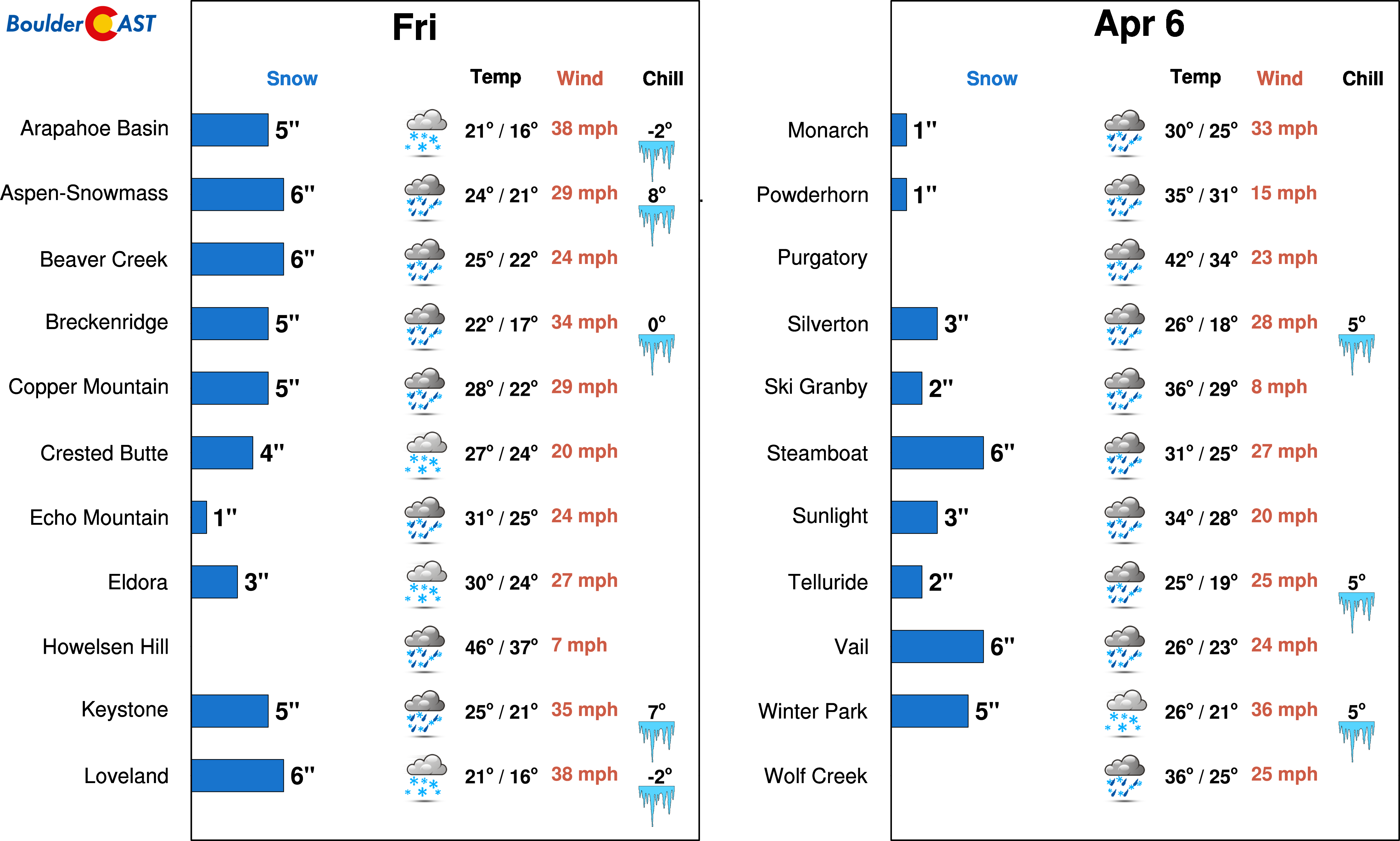
Most of the northern Colorado and I-70 ski resorts will see 3-7″ of snow beginning Thursday night continuing through Friday evening.
Another wave of snow will hit the Mountains over the weekend as a deep fetch of tropical Pacific moisture moves into Colorado. This second wave is associated with an atmospheric river with origins near Hawaii (i.e. the “Pineapple Express”). Precipitable water levels on Saturday across Colorado are projected to annihilate record values for early April. Some locations in western Colorado could see readings reach above one inch! This flow pattern will be warmer overall, with snow levels way up near 11,000 feet! The lower parts of many ski resorts will see rain as a result, while the summits of higher resorts could pick up BIG snow… maybe a foot or so by the end of the weekend. If you’re travelling through the Mountains late Saturday or early Sunday, expect nasty delays and travel impacts, especially if heading over any mountain passes.
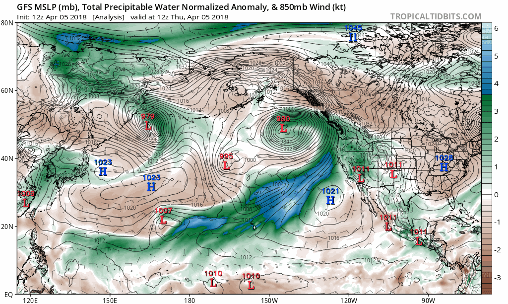
GFS forecast moisture anomaly for Thursday through Sunday. Tropical moisture will be funneling into our region this weekend.
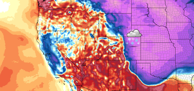
Great and much needed moisture is indeed headed to Colorado in the short-term….let’s all be thankful for that! This however is but drops in the bucket compared to the historic precipitation event impacting the Pacific Northwest and California right now.
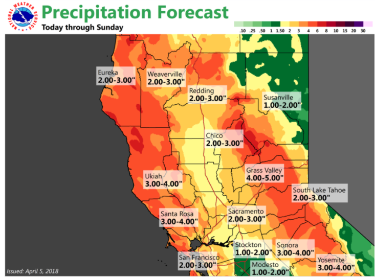
Forecast rainfall in northern California due to atmospheric river event (April 5-8 2018)
Have a great week’s end and enjoy the brief return of those winter-like temperatures!
Join our email list!
As a BoulderCAST email subscriber, you will get:
- Instant email notifications for all of our storm updates, forecasts, and posts
We respect your privacy. You can unsubscribe at any time.
Share this forecast:
.


