
We hope you had a wonderful Easter holiday. For the remainder of this week, we start off with windy and chillier weather as the main story. After that, we’re expecting a brief warm-up followed by a very real chance of rain and snow. Read more to find out the full details!
What a difference a day makes!
Highs in the 70’s on Easter Monday, only to change with temperatures in the 40’s today. This is all thanks to a strong cold front which has pushed through in the northwest flow. Below shows that an area of low pressure has moved off into eastern Nebraska. On the backside, northwest winds have pushed into the High Country, Foothills, and Plains. At times during the morning on Tuesday, winds out of the north and northwest will gust up to 45 mph, and up to 65 mph in the Foothills.
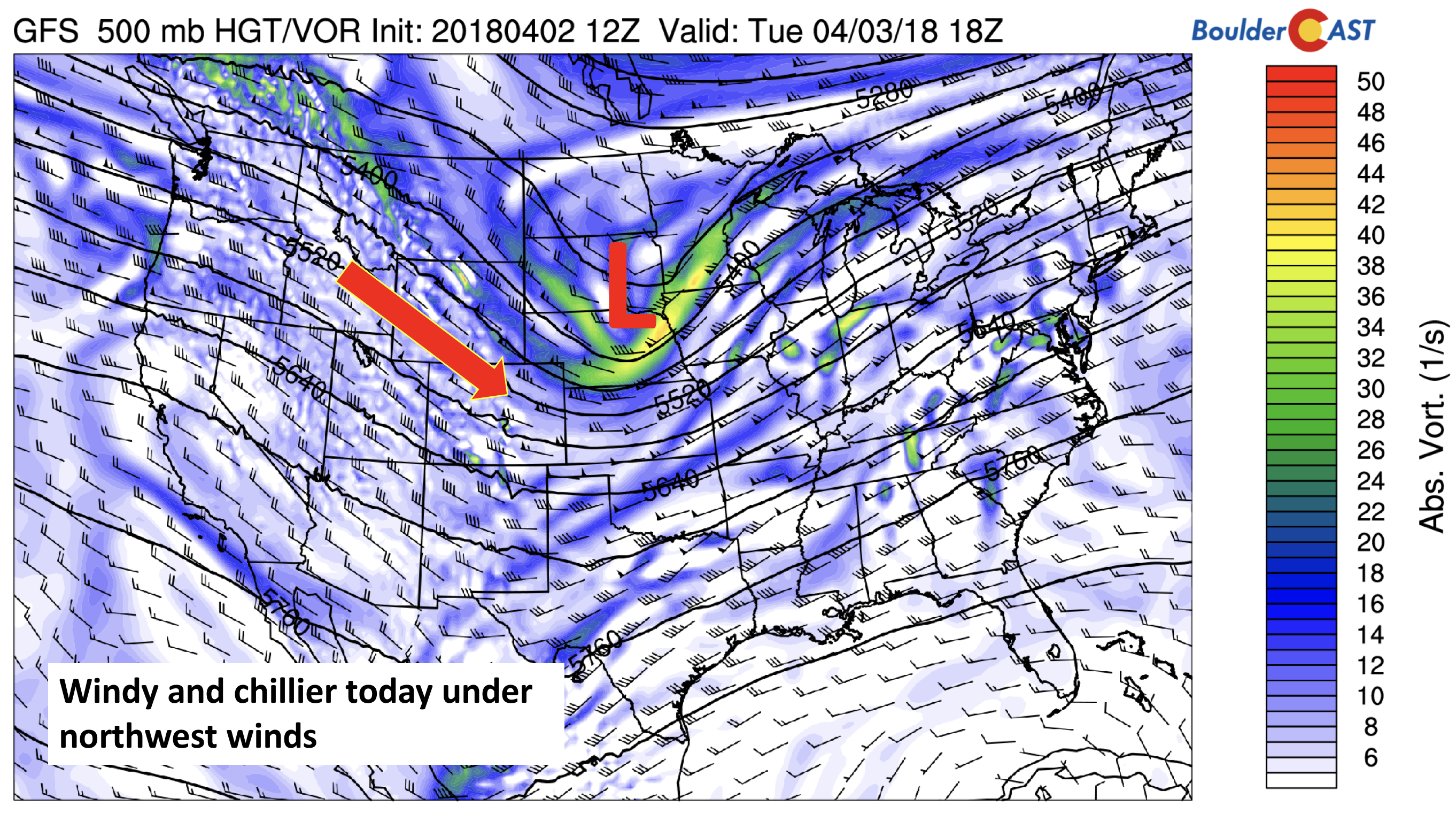
GFS 500mb absolute vorticity today
A more detailed forecast for Tuesday is shown below, . Notice wind gusts in the morning approaching 45 mph. These winds should die down slowly as we go into the afternoon hours, decreasing to 10 to 20 mph. Expect highs in the mid to upper 40’s under sunny skies.
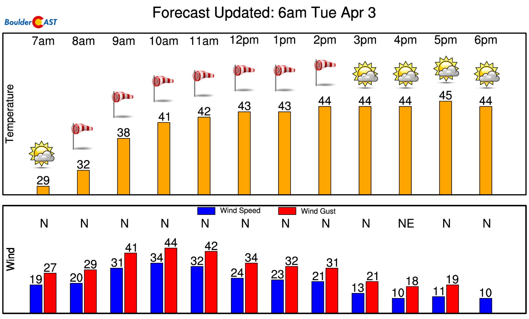
NowCAST forecast for Tuesday
Mild Wednesday and Thursday
On Wednesday and Thursday, a very similar pattern will emerge (see below). That pattern is that of a persistent west-northwest flow across the state and much of the Inter-mountain West. This will aid in slight downslope warming Wednesday and Thursday, but also continued upper-level Pacific moisture streaming from west to east across the area. Our best expectation is mild weather for these two days around the middle 60’s with occasional mid and high-level clouds from time to time.
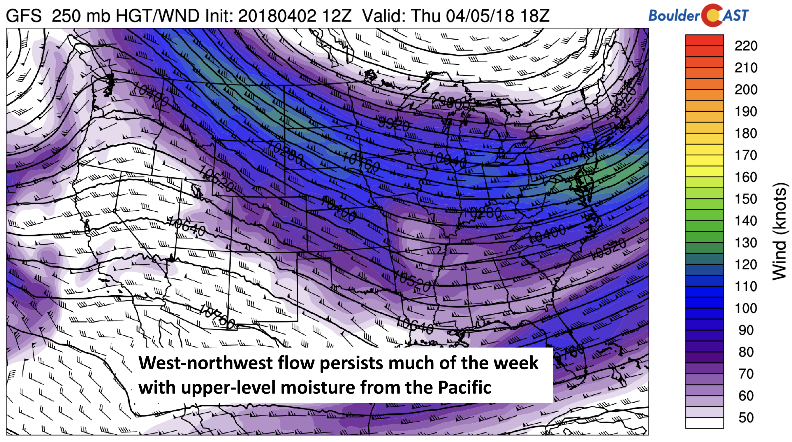
GFS 250 mb upper-level jet stream for Thursday
Something to watch on Friday…
On Friday, the weather turns backward once again. And while there is considerable uncertainty, the potential for snow is increasing it appears in the latest forecast models. By late Thursday night, height falls in the upper-levels will force a strong cold front through the area. At the same time, northeast Colorado is expected to be in the favorable jet-forcing region (see below) for both low and upper-level lift for precipitation.
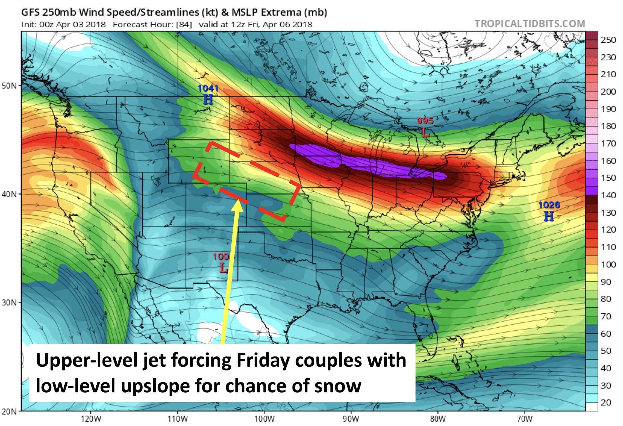
GFS 250 mb jet stream on Friday
The below image is from the latest GFS precipitation type forecast for Friday morning. It shows a widespread snowfall event for much of the state, and northeast upslope flow over the Plains. This model run had up to 7″ of snow in portions of the area, so something to watch for sure. At minimum, this forecast hints at much colder temperatures to end the week!
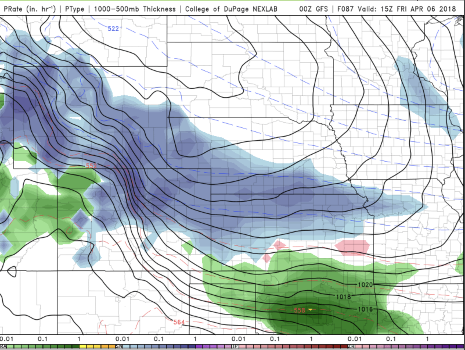
GFS precipitation type for Friday
There also appears to be some consensus in the GFS ensembles, shown below. Virtually all of the members have precipitation, but disagree on type (rain or snow). If the GFS is any indication (it has trended colder), we could see another light snow event. But we know how models can flip-flop from run to run. Earlier runs were showing mostly rain for the Plains, with snow in the higher elevations. Be sure to check back for the latest updates as we head into Friday.
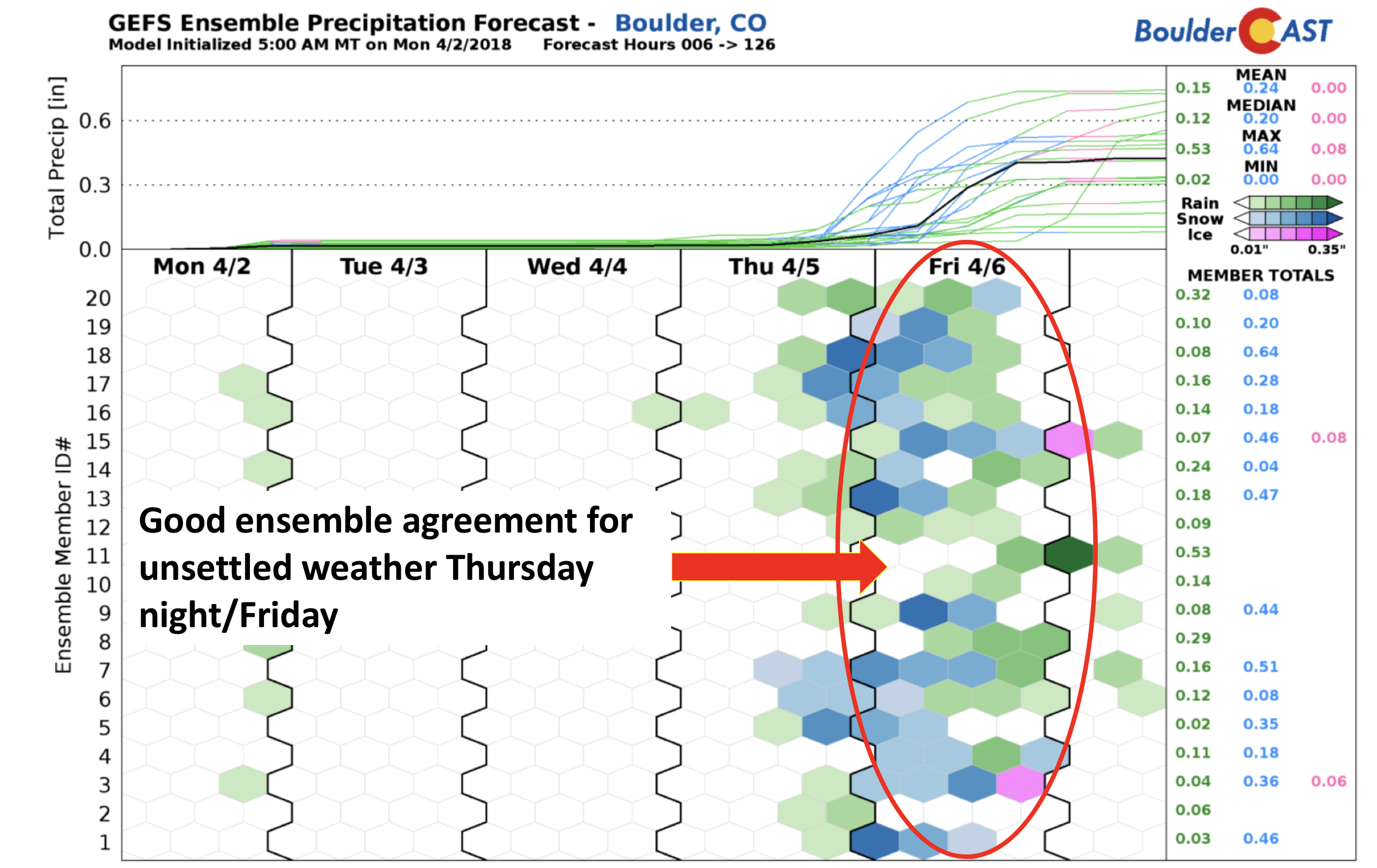
GEFS precipitation forecasts through Friday. There is considerable uncertainty in timing and type for the precipitation on Friday.
Are you feeling lucky?
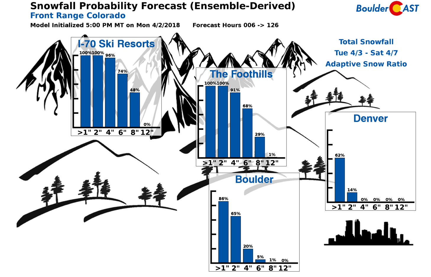
Snowfall probabilities through Saturday.
While there is only a chance of snow over the Plains, the High Country certainly has it coming, with predicted snow totals over 12″ in several places by Sunday. Have a great week and let’s hope for some snow!
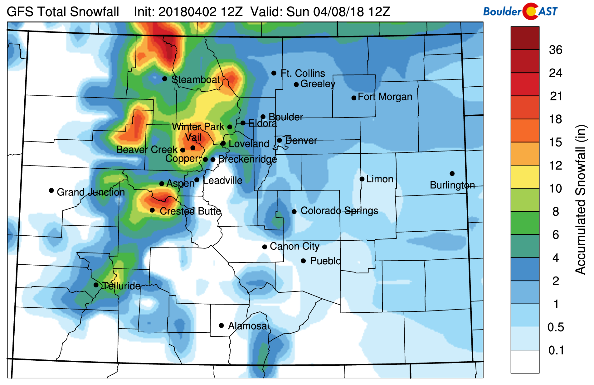
GFS accumulated snowfall through the weekend
Forecast Specifics:
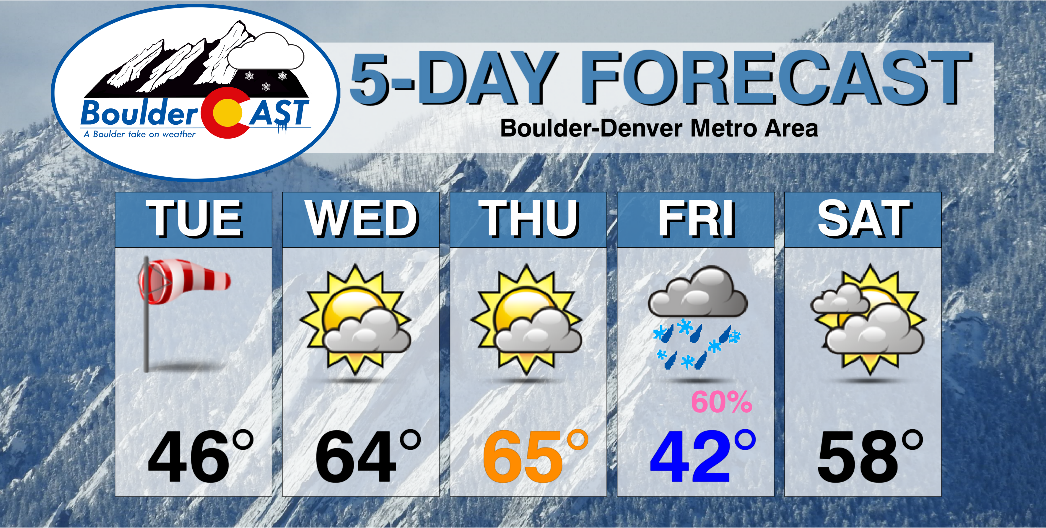
Tuesday: Mostly sunny, windy, and chilly. North-northwest winds of 25-30 mph, gusting up to 45 mph in the morning. Winds weaken during the afternoon, but remain breezy. Look for highs in the mid to upper 40’s on the Plains with upper 30’s in the Foothills. Winds may gust up to 65 mph in the Foothills.
Wednesday: Sunshine in the morning, then increasing high wave clouds in the afternoon with temperatures warmer in the middle 60’s for the Plains with middle 50’s in the Foothills. West winds may gust to 25 mph during the day.
Thursday: A mix of clouds and sun. High temperatures warming into the middle 60’s once again for the Plains and in the middle 50’s in the Foothills.
Friday: A big change, turning colder with overcast skies and the chance of rain and snow through the day. Several inches of accumulation is very likely in the Foothills, but rain vs. snow across the Plains is still uncertain at this time. Highs will be in the low to middle 40’s for the Plains with 30’s in the Foothills.
Saturday: Mostly cloudy, dry, and warmer. Temperatures rebound into the upper 50’s for the Plains with mid 40’s in the Foothills.
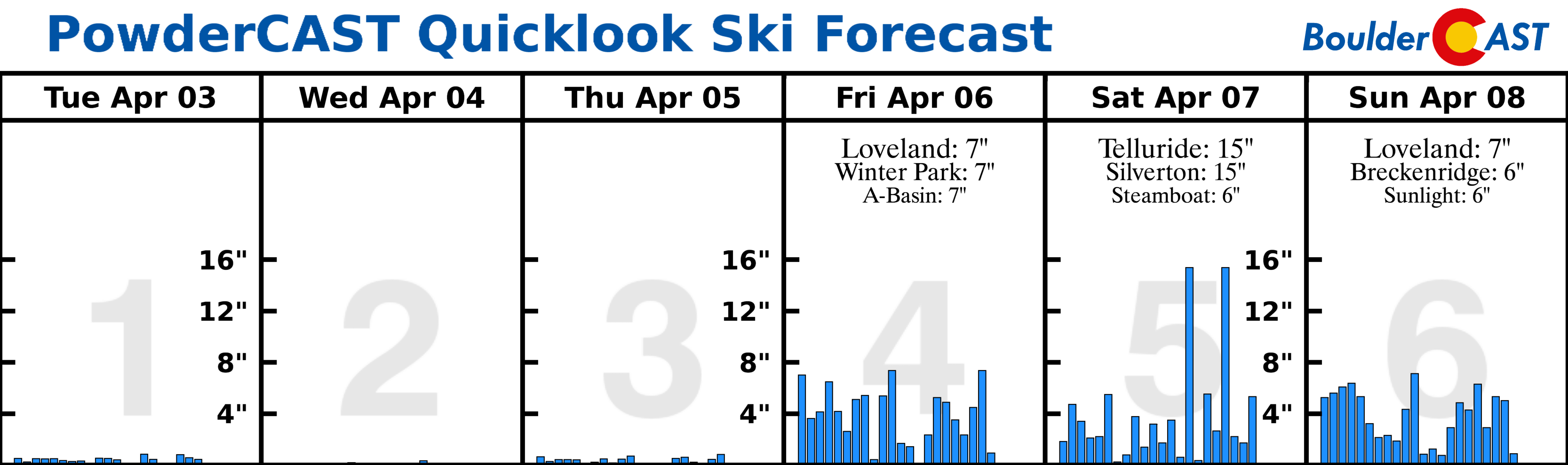
High Country: Light snow will taper off in the High Country today. However, windy conditions remain for much of the week. Dry weather returns Wednesday and Thursday, with snowfall entering the picture late Thursday, Friday, and over the weekend. Significant snow accumulations will be possible by the end of the weekend. Find the latest forecast for all your favorite Colorado ski resorts on our PowderCAST page.
DISCLAIMER: This weekly outlook forecast was created Tuesday morning and covers the entire upcoming week. Accuracy will decrease as the week progresses as this post is NOT updated. To receive daily updated forecasts, subscribe to BoulderCAST Premium.

.
Share our forecast!


You must be logged in to post a comment.