
The week begins warm and breezy, with quiet conditions taking over through Thursday. However we are closely watching the potential for a significant rain and snow event on Friday for the state. Read on for complete details of the week ahead.
Pleasant start to the week
A ridge of high pressure has settled in across the Intermountain West. Can you pick out the cold air over the nation in the figure below? We are sandwiched between a trough of low pressure in the Pacific Northwest and another trough over the Great Lakes. In between is southwesterly flow in the low to mid-levels of the atmosphere across Colorado. Continuing from yesterday’s pleasant day, temperatures will warm further into the low to middle 70’s on Monday, some 10 degrees above average. Expect a mixture of clouds and sunshine as high-level moisture drifts in throughout the day from the Pacific.
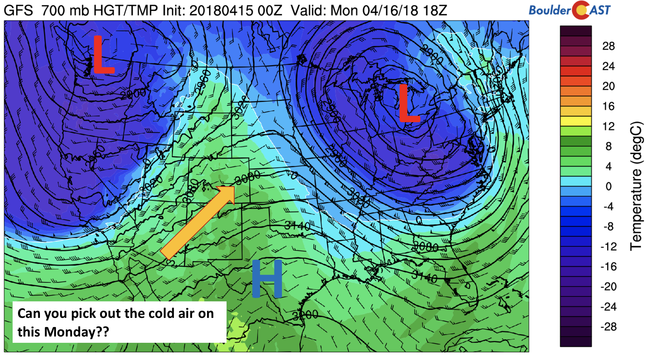
GFS 700 mb temperature and wind this afternoon
Fast-moving system Tuesday
The Pacific trough in the the above image from Monday will transition to the east on Tuesday. The bulk of the energy from the trough is forecast to to push from west to east through Colorado during the day. Upslope conditions will be present over much of the High Country, with 2-5″ of snowfall possible along the Continental Divide through the afternoon and evening. To the east over the Plains, a general downslope pattern will exist given the track of the storm (see below). This coupled with strong low-level winds, will lead to a breezy day across the Denver Metro area. Winds look to be sustained in the 10 to 20 mph range, with gusts up to 45 mph. The strongest winds will be south of Denver. Temperatures will be a much cooler in the middle 50’s thanks to an afternoon cold front advancing in with the trough. While some light rain showers are possible on the Plains, most of us will stay dry under increasing clouds.
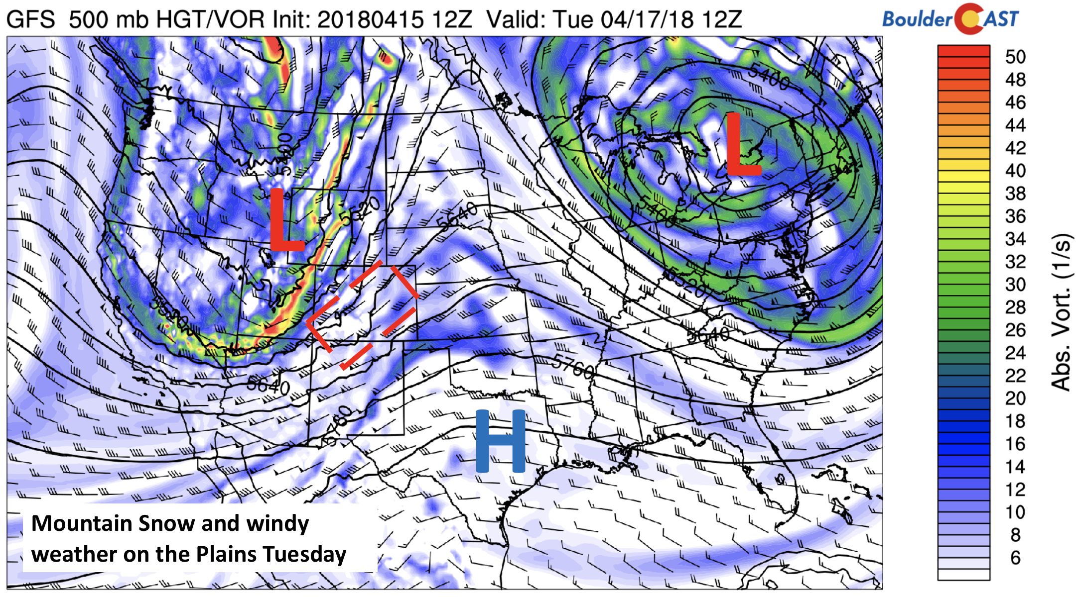
GFS 500 mb absolute vorticity for Tuesday
Calm mid-week
On Wednesday, the trough is forecast to move to our east over Iowa (see below). In its wake, high pressure returns once again, albeit briefly, into the state. Relative humidity levels will decrease as drier air filters in, so we can expect lots of sunshine on Wednesday with temperatures near average the low 60’s. Our next weather-maker starts churning out west offshore of California in the below image. This will be something to watch for Friday….more on this later…

GFS 700 mb relative humidity on Wednesday
Thursday looks to be a transition day as our area will stay under the influence of high pressure. However, easterly flow will start to develop in advance of the approaching trough for Friday. A generally sunny morning giving way to increasing clouds looks to be a good bet this far out. Temperatures will be similar to Wednesday in the 60’s.
Watching a spring storm Friday
We are watching a potent spring storm system forecasted to take aim on the region Friday into Saturday. Several ingredients look to be in place four days out, including low and upper-level lift and plenty of moisture. We will try to detail some of the main points for Friday below.
Lift
The below image shows the GFS forecast of upper-level winds Friday morning. As it stands now, the region may be in the left exit region of a jet streak, boding well for banded precipitation and overall enhancement.
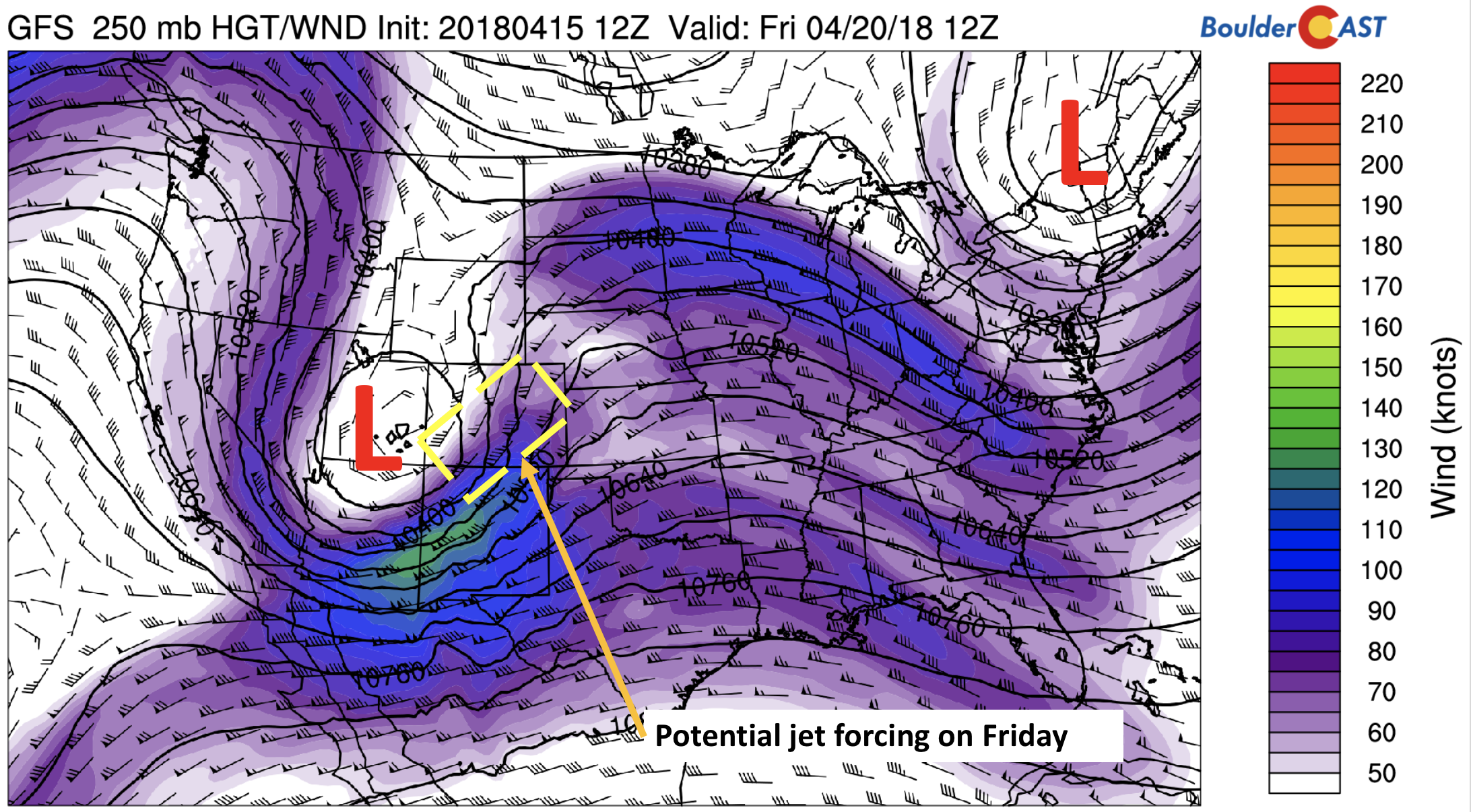
GFS 250 mb upper-level jet stream on Friday
In addition to the upper-level forcing potential, upslope flow will also be a factor. Current model forecasts place a cut-off low across southern portions of the state, putting the Plains of northeast Colorado in that elusive upslope region. The upslope looks deep and strong from Friday late morning into Saturday morning, some of the strongest we have seen so far this winter. We could be in-store for an extended period of precipitation.
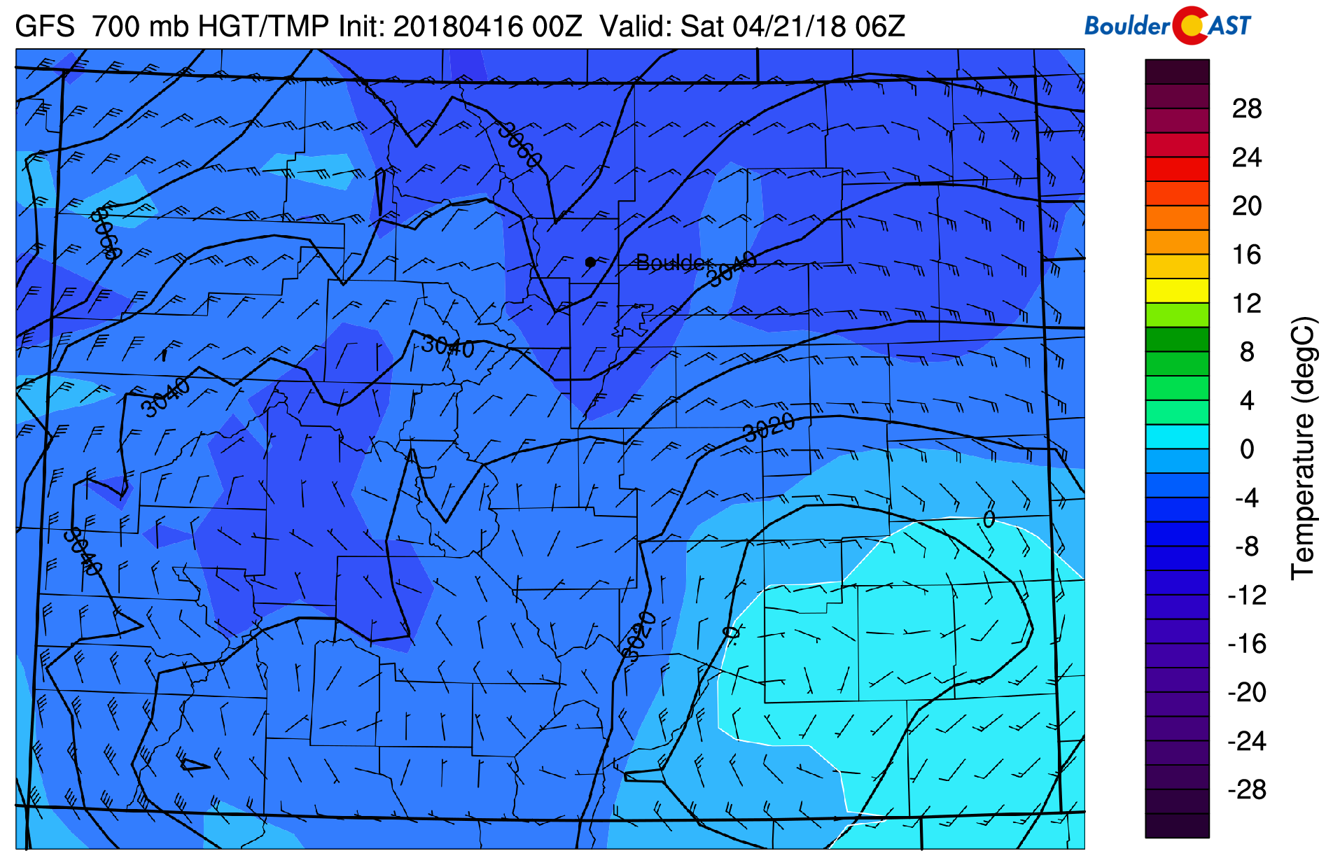
GFS 700 mb temperature and wind forecast for Friday night. Strong and deep upslope is present, but temperatures may be too warm for snow.
Moisture
Moisture also looks plentiful. The image below shows that a deep fetch of Gulf of Mexico moisture gets tapped into, streaming northward through Texas, Kansas, and into Colorado and Wyoming. Needless to say, it will be a juicy atmosphere.
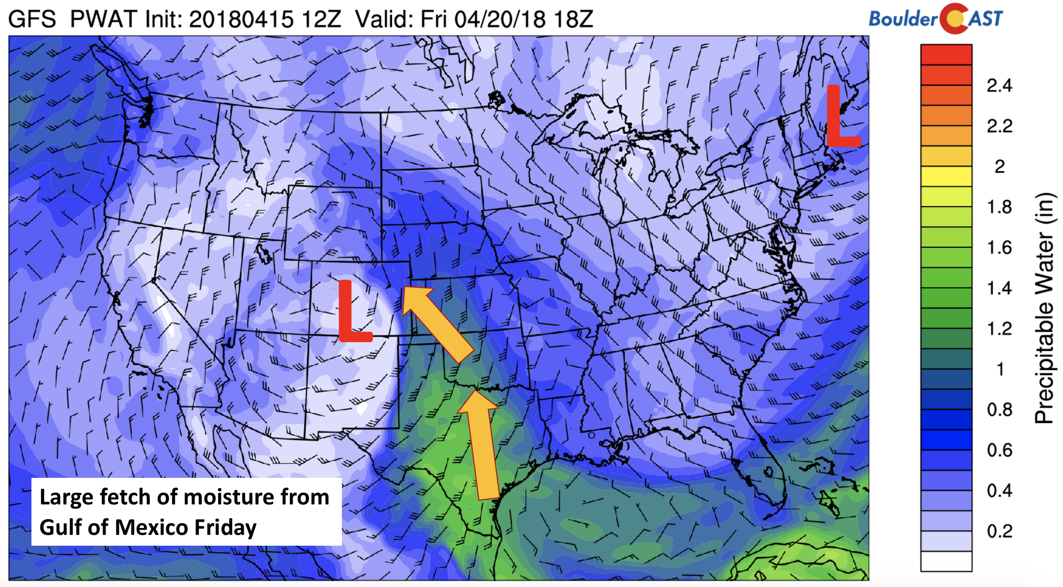
GFS precipitable water for Friday evening
All things considered, we are four days out…so forecasts will likely change, but given the general model agreement over the last few days and the shear strength of the storm, the forecast we have been describing may not be too far off from what actually happens. The GFS (below) shows the low-pressure system across far southeastern Colorado Friday evening, with a large band of precipitation east and northwest of the system. Precipitation type will be a major player, as is usually the case with these spring storms. Temperatures are borderline part of the day with the airmass above freezing and precipitation is likely to fall as rain across the Plains. However, given height falls and dynamic cooling, rain could change to snow at some point Friday evening and night. If this forecast verifies, it will likely be a widespread precipitation event, with significant snow possible in the Foothills.
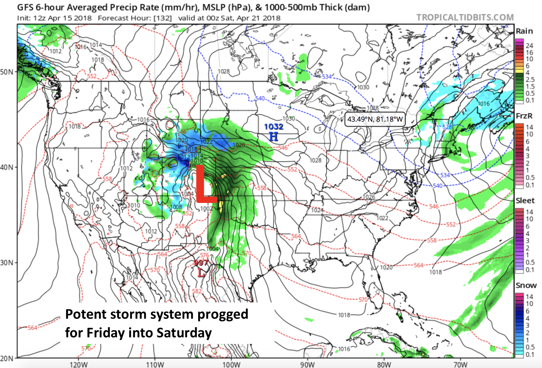
GFS precipitation type and sea-level pressure Friday evening
There is decent agreement in the GFS ensembles that Friday will be rather unsettled. Virtually all of the ensemble members indicate rainfall, with some members changing over to heavy snow Friday evening. As mentioned above, temperatures will be the KEY player in the forecast.
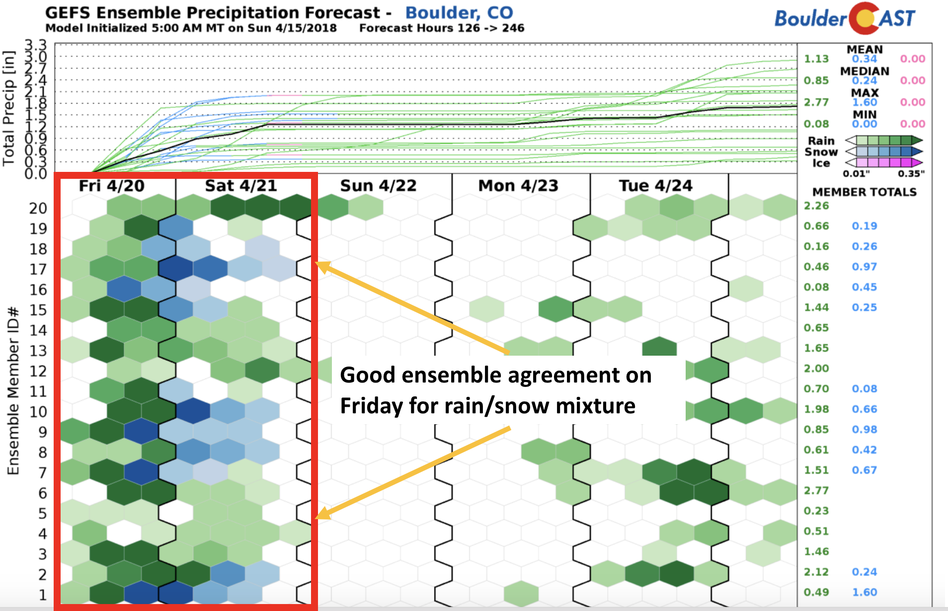
GEFS ensemble forecasted precipitation type for the late week storm
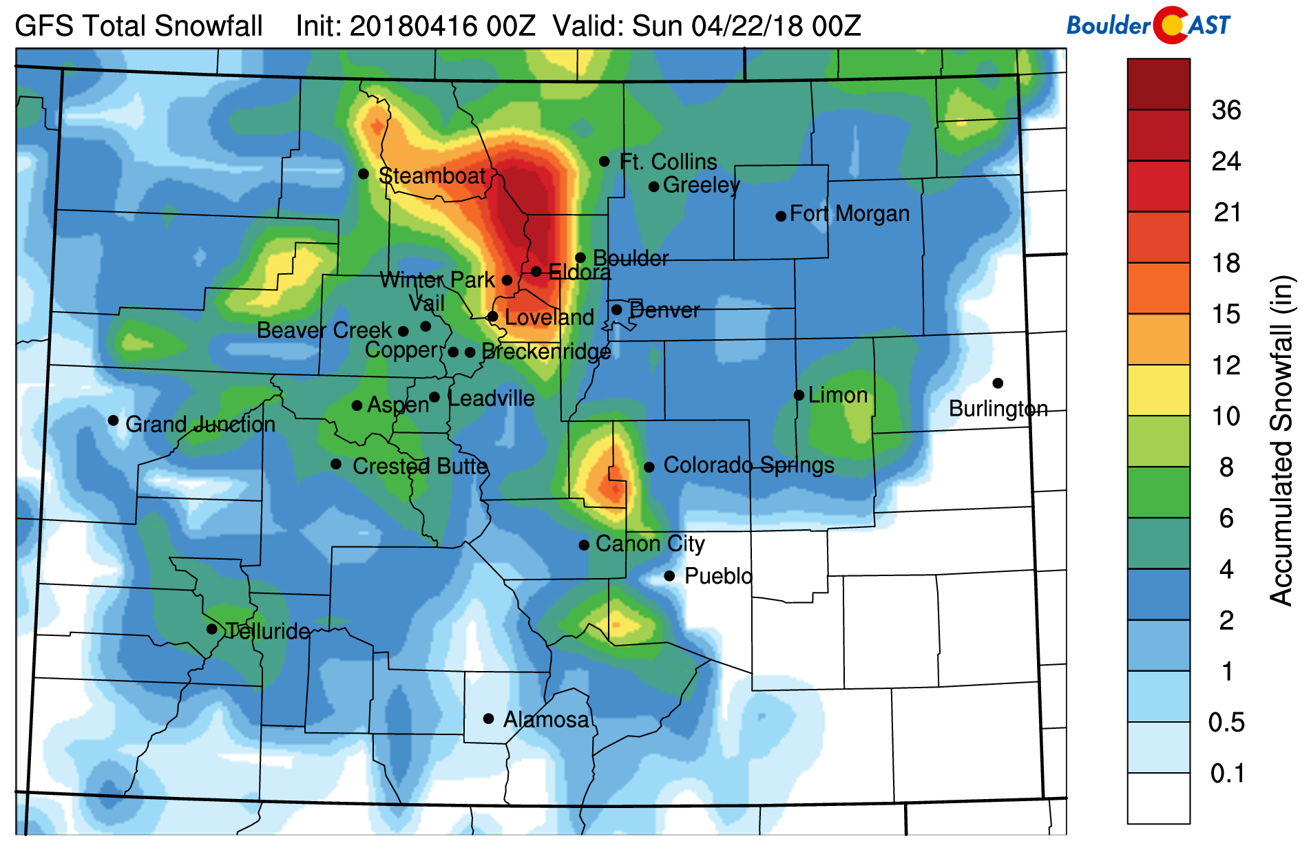
Just for fun, here is the degree of snow potential the models are indicating now for the region. This is not an official forecast by any means, but it does show the prospect for significant snow across the higher elevations west of town (1 to 3 feet).
Stay tuned through the week for updates on the spring storm. Let’s hope for some moisture, and snow (if you aren’t tired of it yet)!
Forecast Specifics:
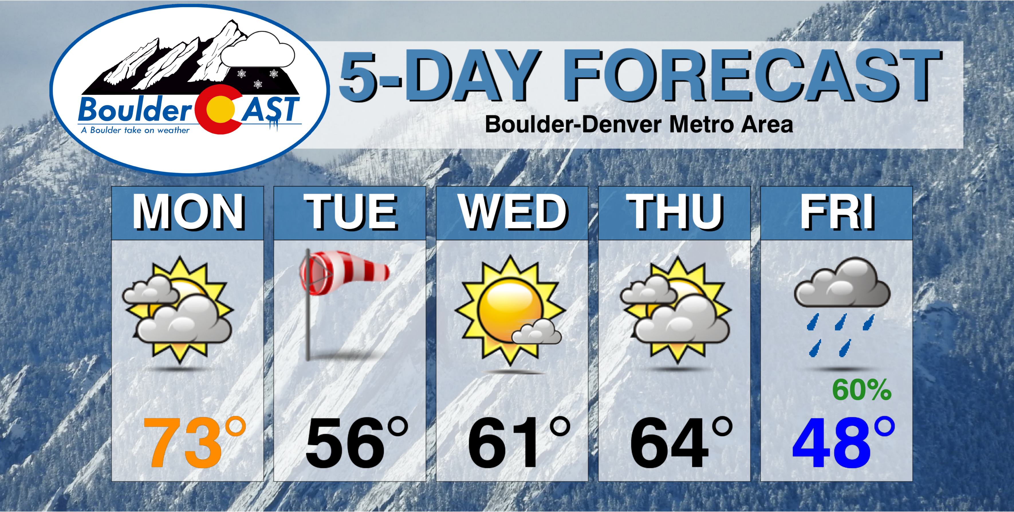
Monday: A mix of high clouds and some sunshine. Highs will be in the low to middle 70’s for the Plains, with low 60’s in the Foothills.
Tuesday: Sunny skies giving way to increasing clouds and windy conditions in the afternoon. Winds may gust to 45 mph out of the west and southwest. A few light sprinkles are possible in the late afternoon – otherwise dry with highs in the middle 50’s for the Plains, and in the lower 40’s in the Foothills.
Wednesday: Calm and mostly sunny with high temperatures near 60 on the Plains, with upper 40’s in the Foothills.
Thursday: Some sun early, then mostly cloudy. Highs will be in the low to middle 60’s on the Plains and upper 40’s in the Foothills.
Friday: We can expect mostly cloudy skies with temperatures turning colder, possibly with highs in the 40’s for the Plains and 30’s over the Foothills. A good threat of precipitation appears imminent, although amounts and type (rain or snow) are uncertain. Right now it looks as though a bulk of the precipitation will fall as rain across the Plains, with significant heavy wet snow in the Foothills and Mountains.
High Country: Several resorts have closed-up shop already. However, for those that are still open, a general 2-5″ of snowfall is possible on Tuesday with a system pushing in from the west. Quiet conditions will take over Wednesday. Another more potent round of snow is possible Thursday night through Saturday, with 6+” of snow possible. Find the latest forecast for all your favorite Colorado ski resorts on our PowderCAST page.
DISCLAIMER: This weekly outlook forecast was created Monday morning and covers the entire upcoming week. Accuracy will decrease as the week progresses as this post is NOT updated. To receive daily updated forecasts, subscribe to BoulderCAST Premium.

.
Share our forecast!


You must be logged in to post a comment.