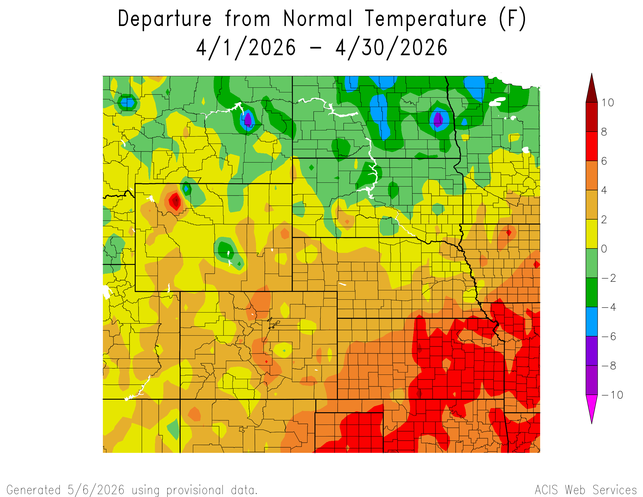
April 2026 wrapped up as another water‑starved month along the Front Range, trading March’s record heat for a parade of fast‑moving systems that looked promising on paper but rarely delivered meaningful moisture. Temperatures still ran warmer than average overall, punctuated by a few sharp cold fronts that briefly returned a wintry feel before the pattern snapped back to mild, windy, and dry. Fire danger stayed elevated on many days, and despite several rounds of light precipitation, Colorado’s snowpack remained historically low heading into May. Let’s take a graphical look at how April unfolded across Boulder, Denver, and the Front Range — and how it stacked up against climatology.
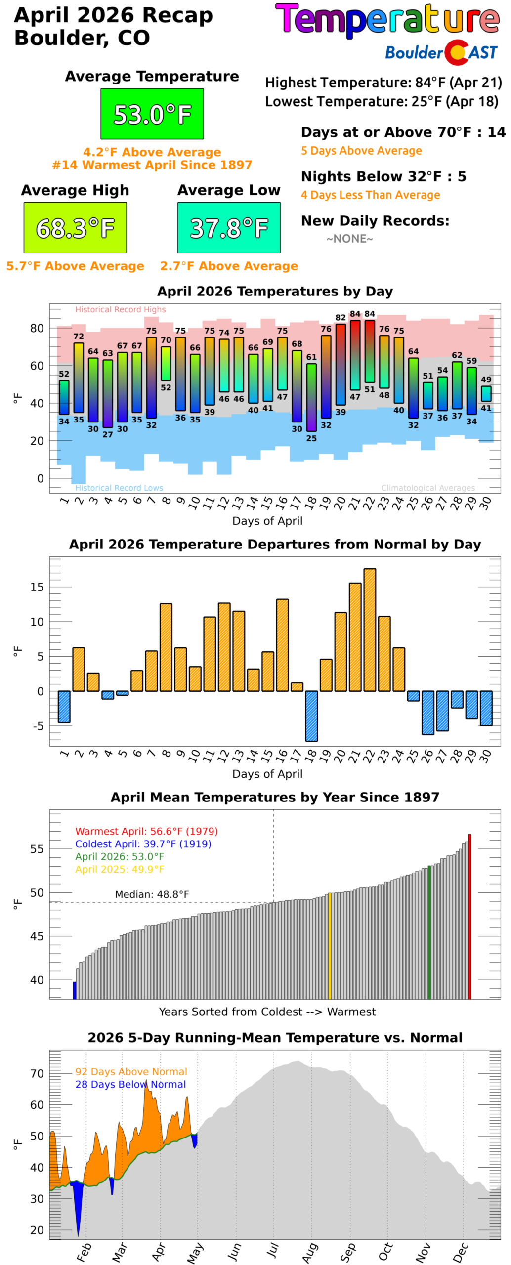
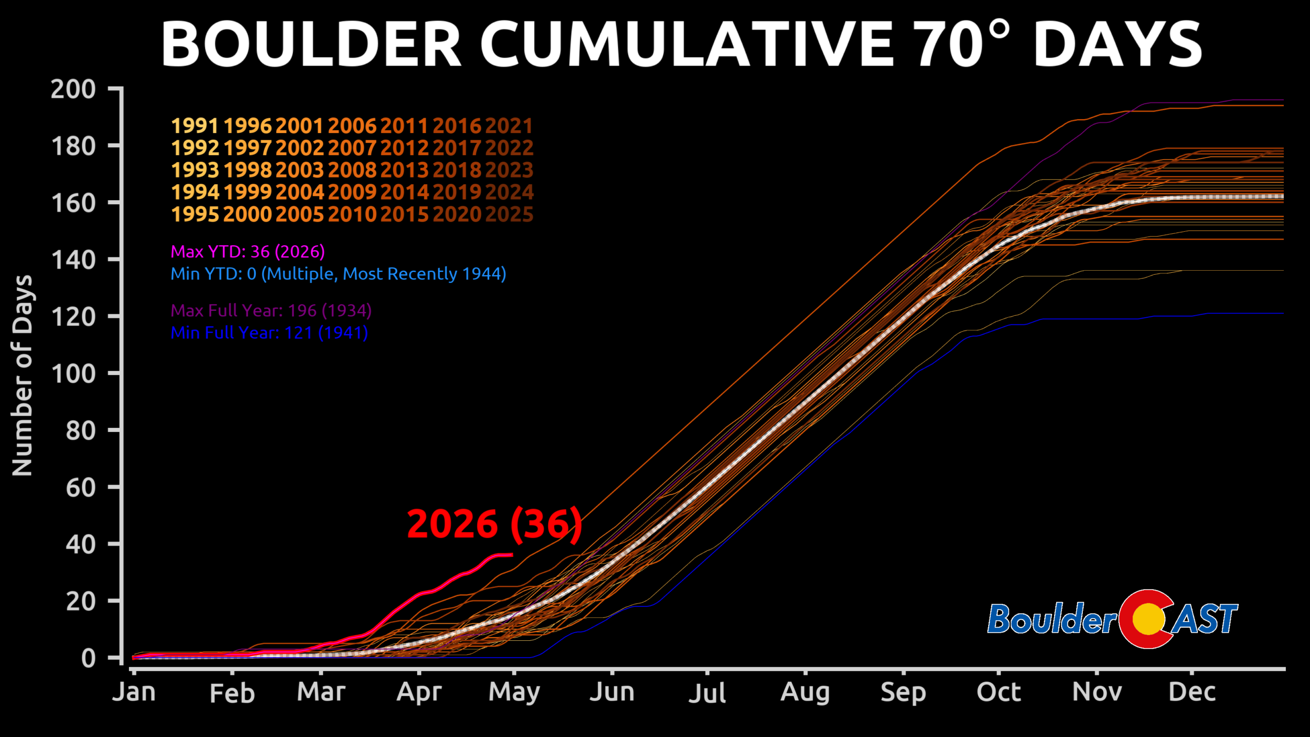
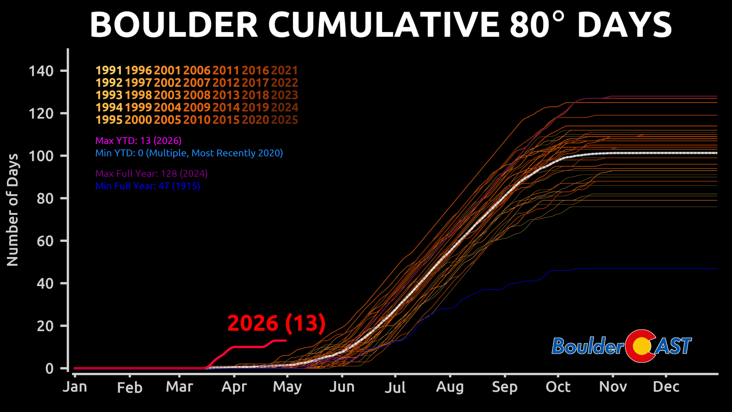
April 2026 Temperatures:
![]()
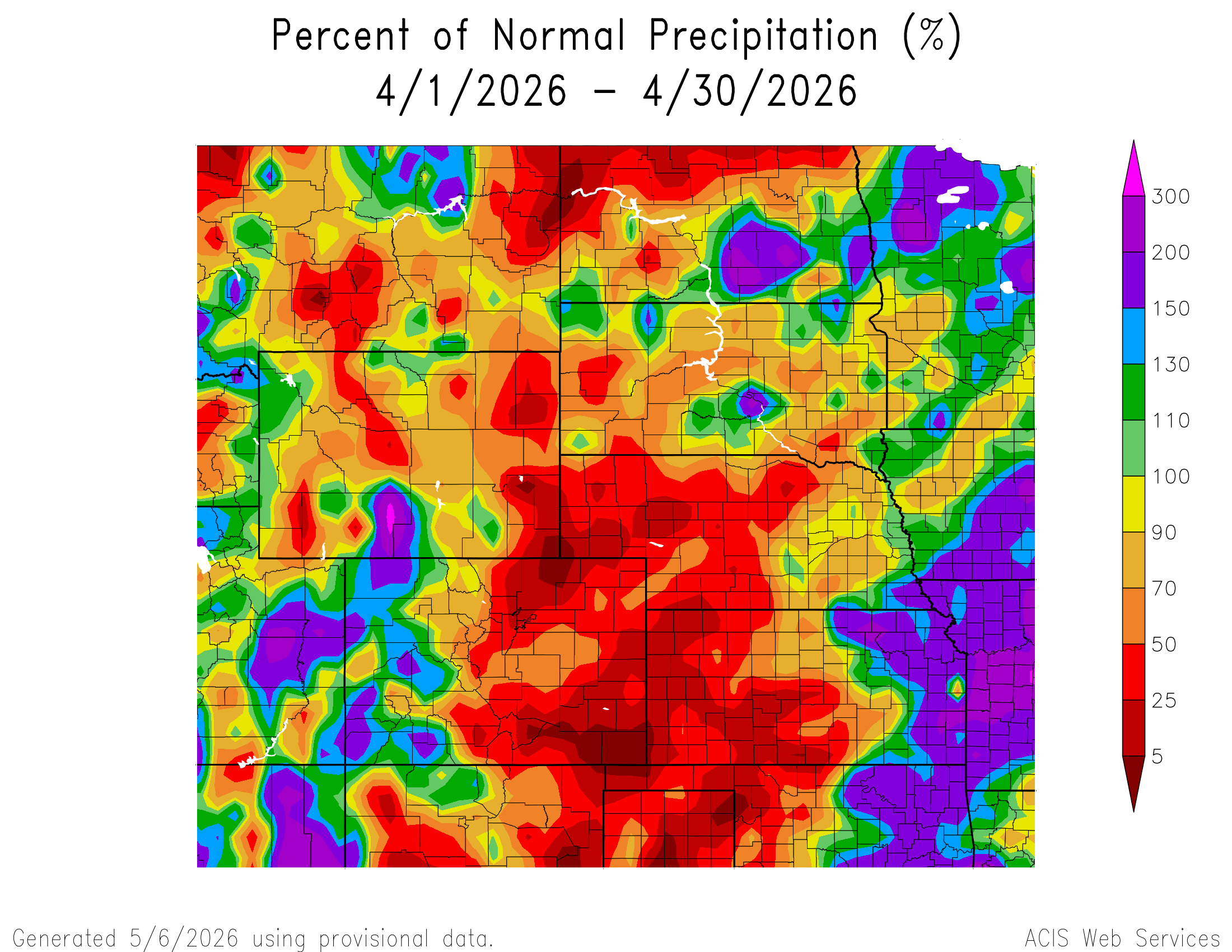
April 2026 Precipitation:
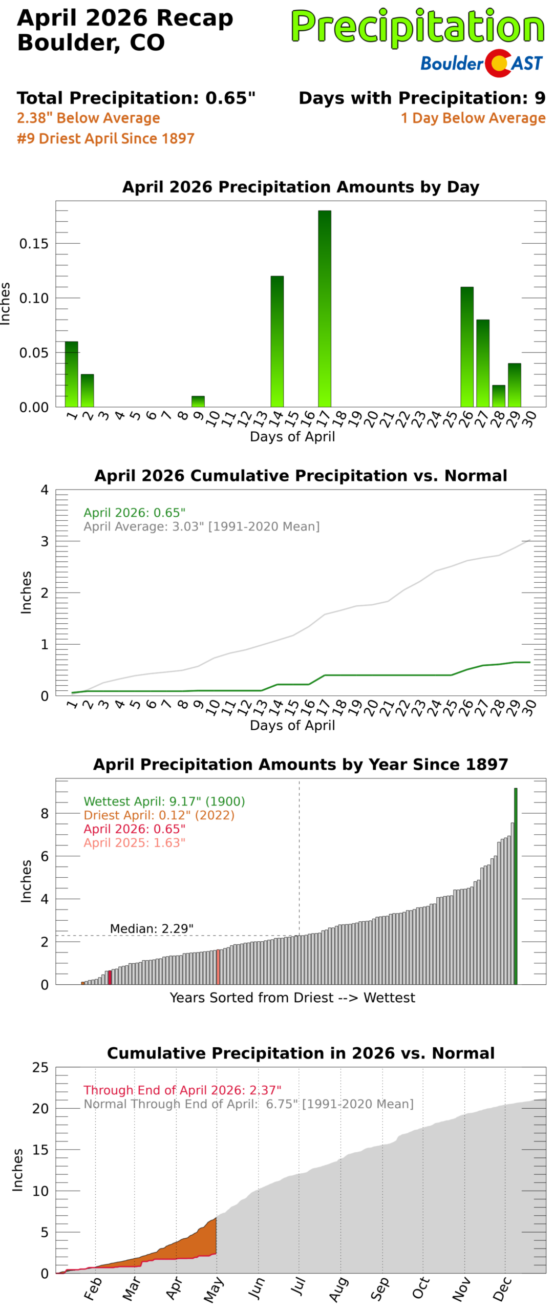
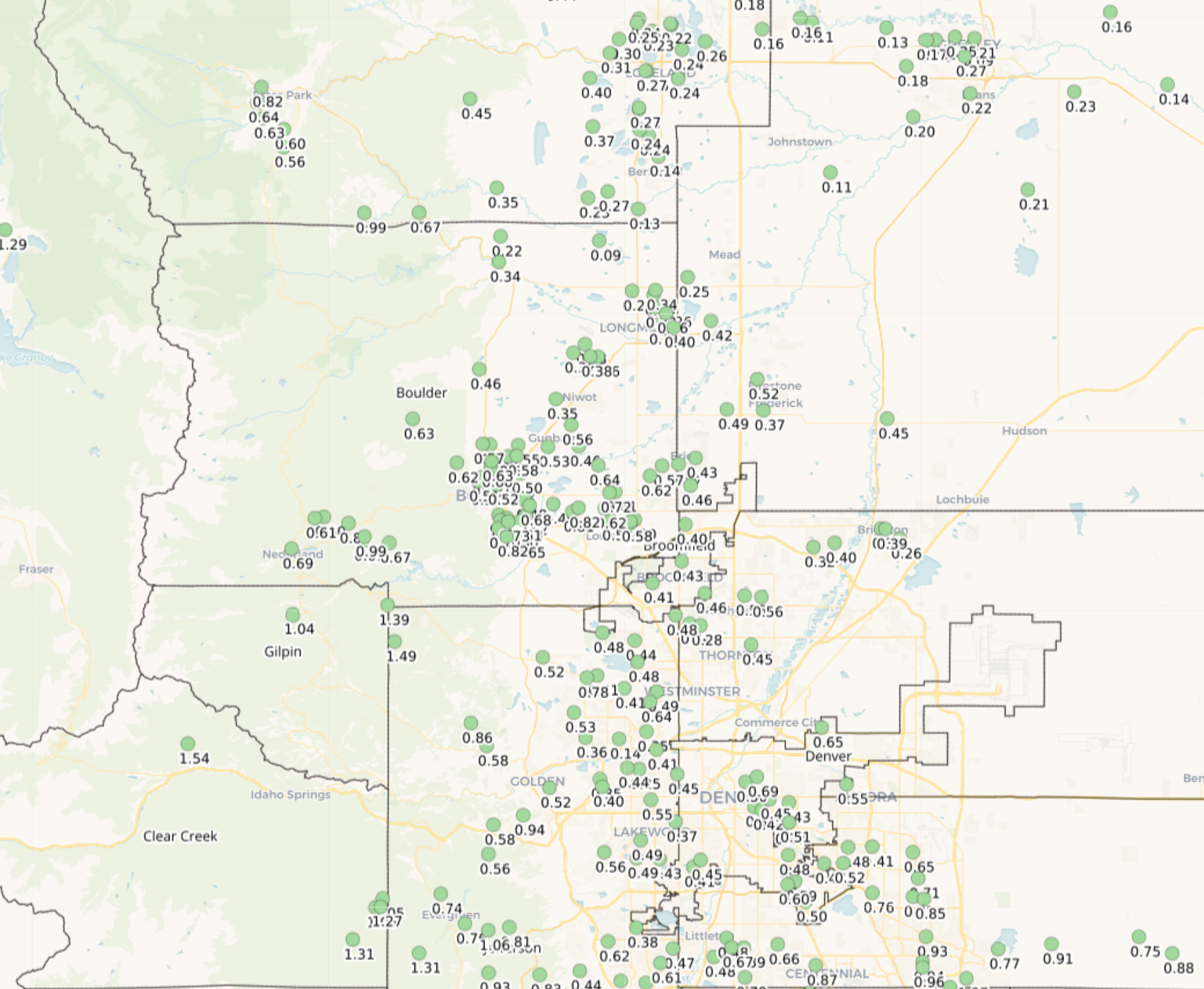
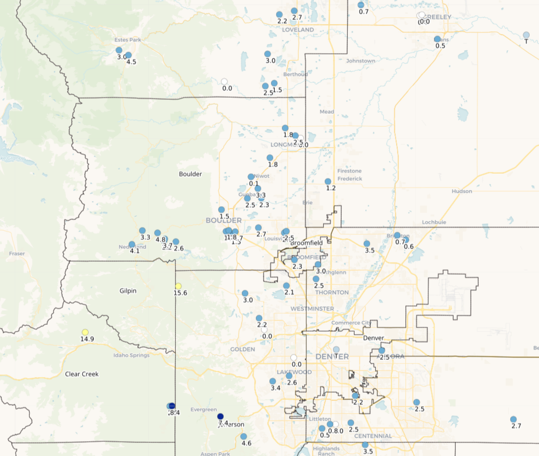
Precipitation totals during April 2026 across the Boulder-Denver Metro area
![]()
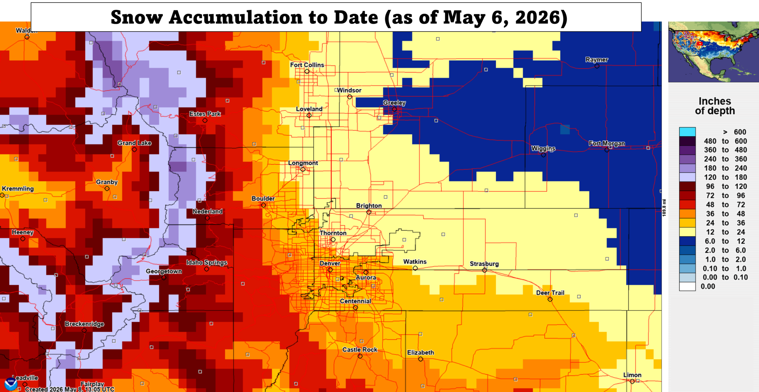
April 2026 Snowfall:
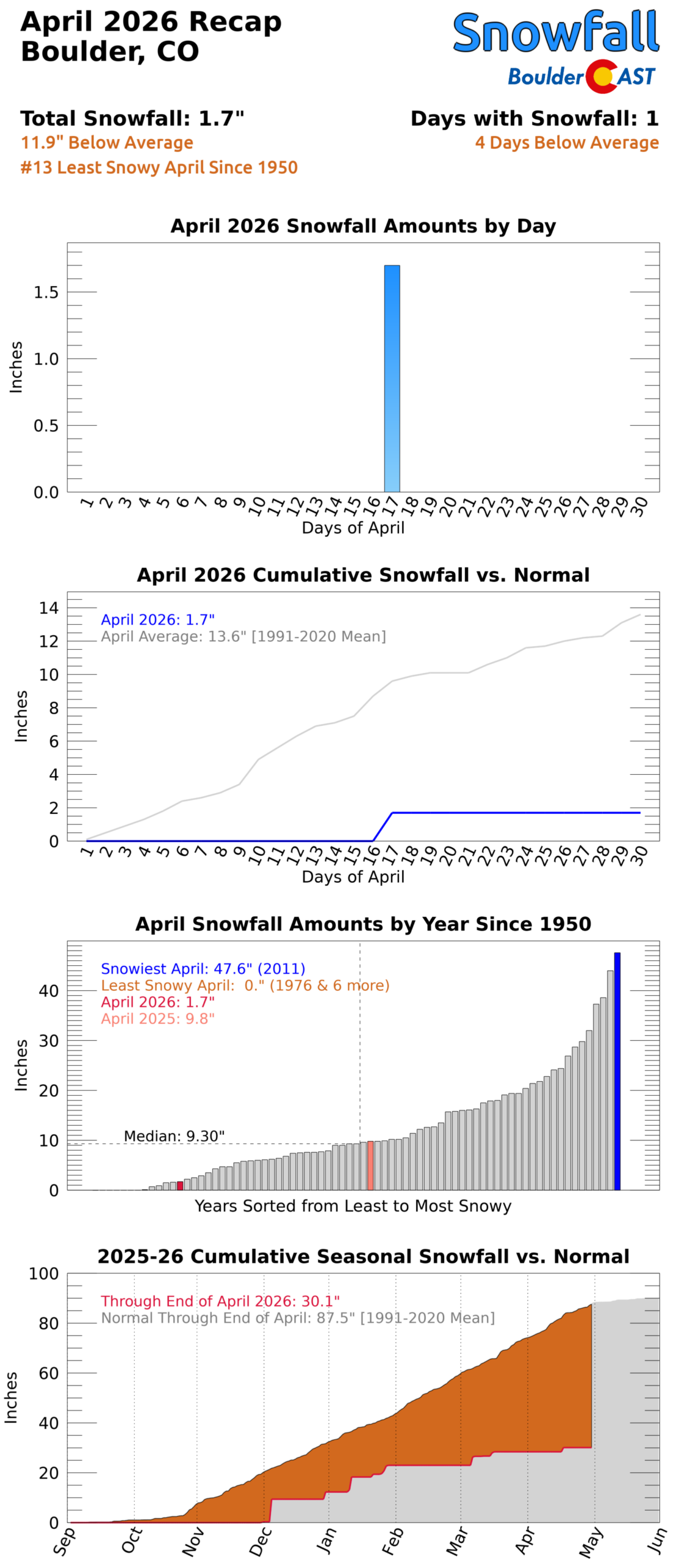
Snowfall totals during April 2026 across the Boulder-Denver Metro area
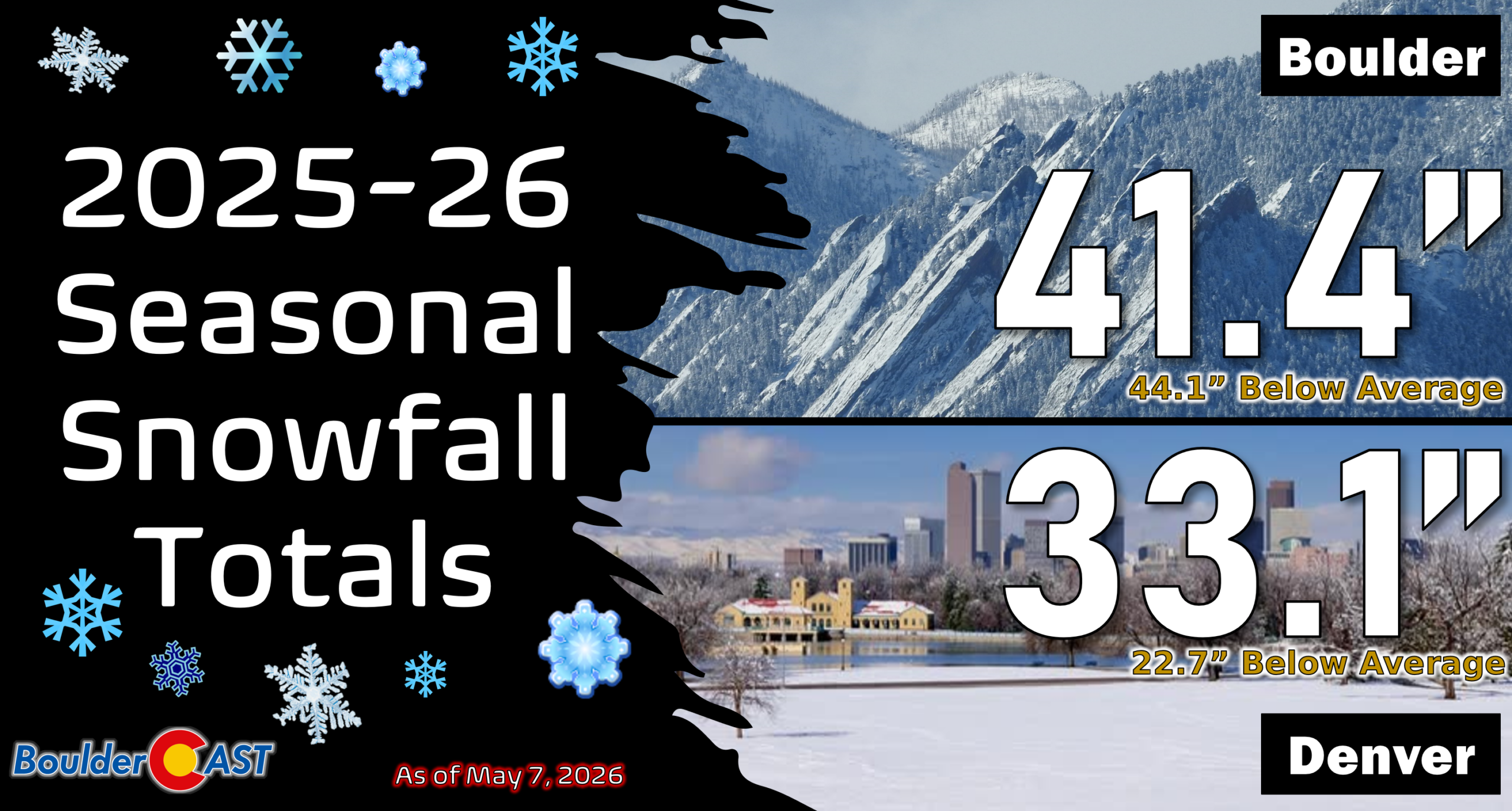
2025-26 Seasonal Snowfall So Far:
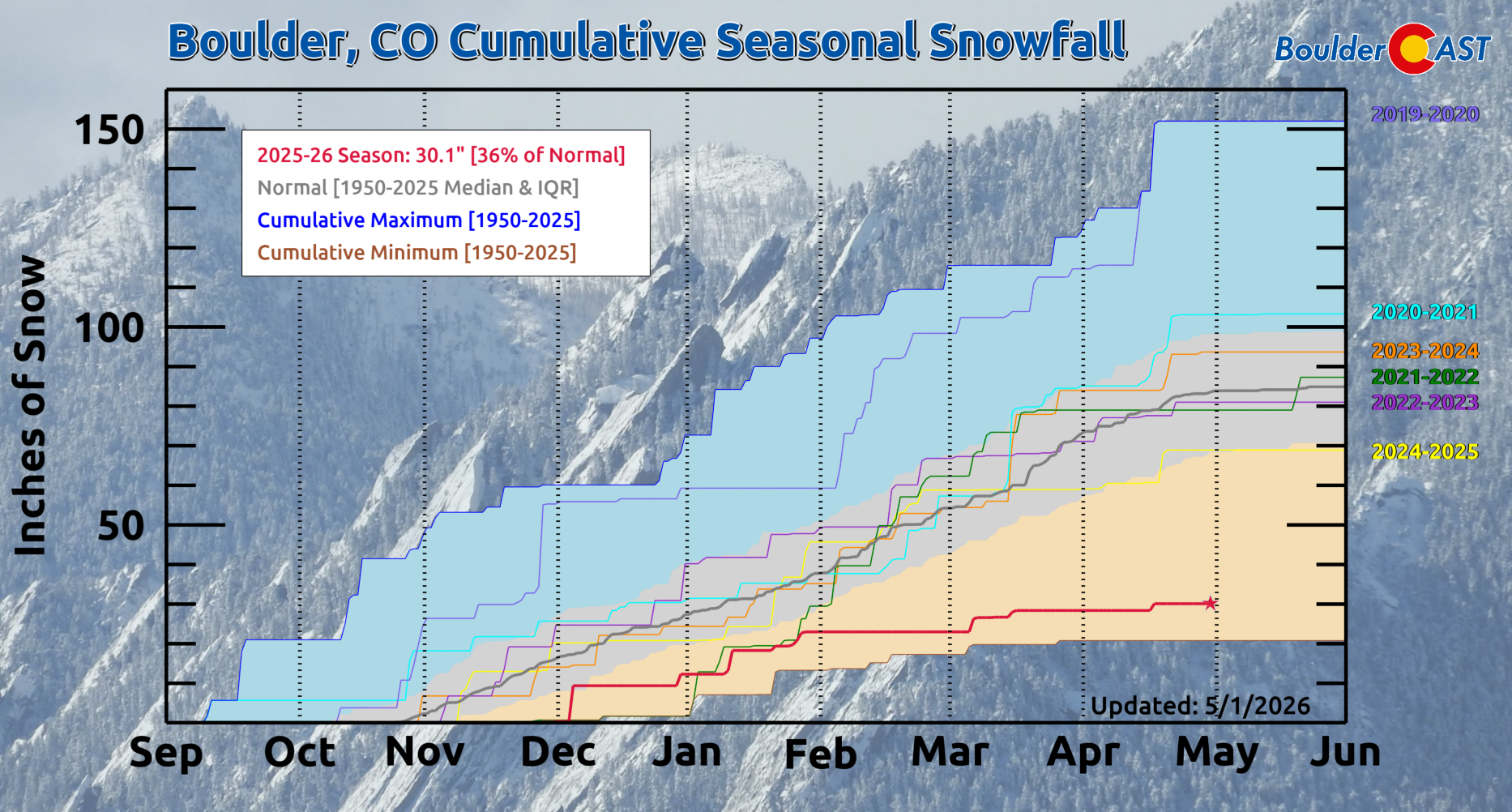
You can find a recap of all the winter storms from the 2025-2026 snow season HERE.
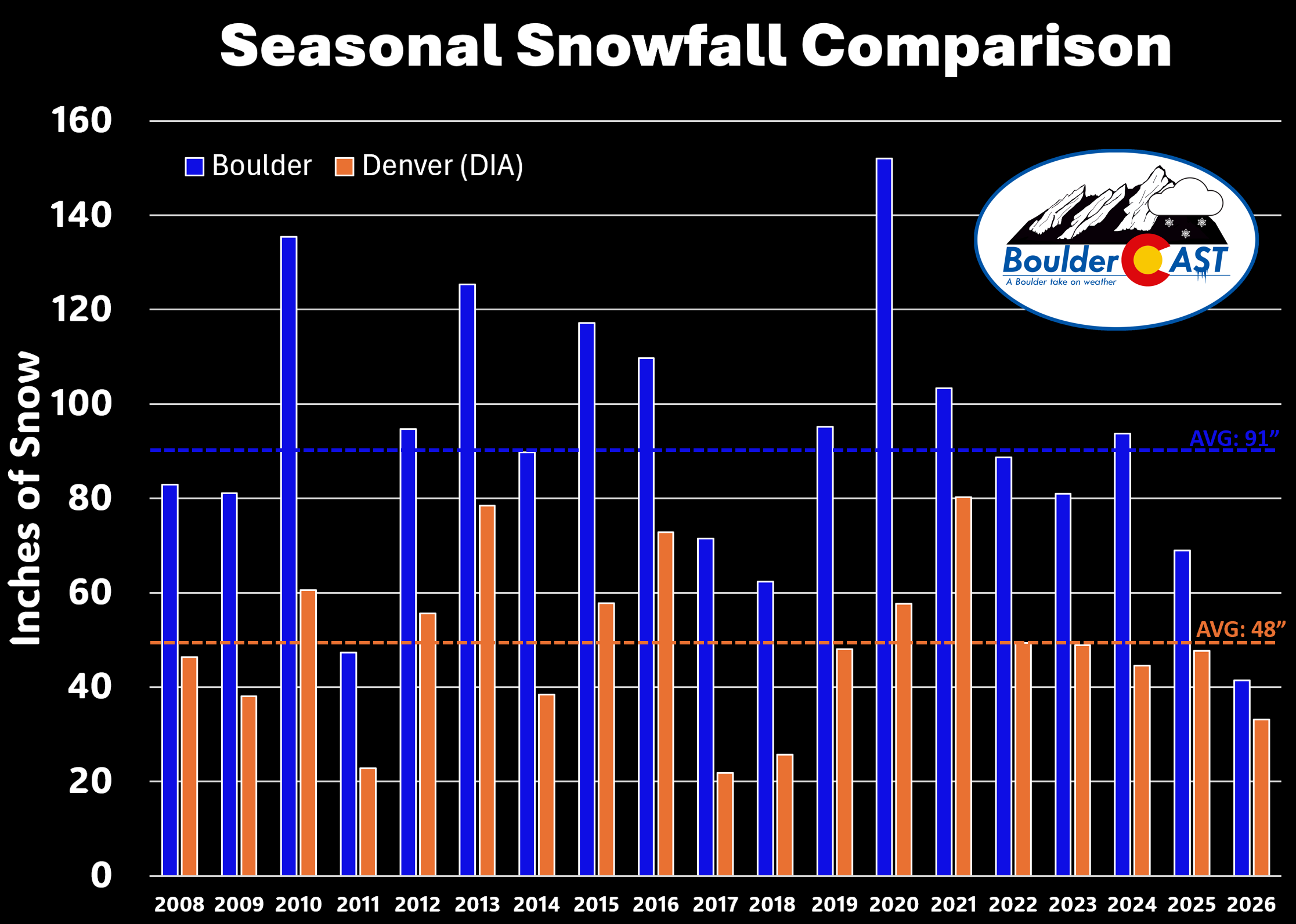
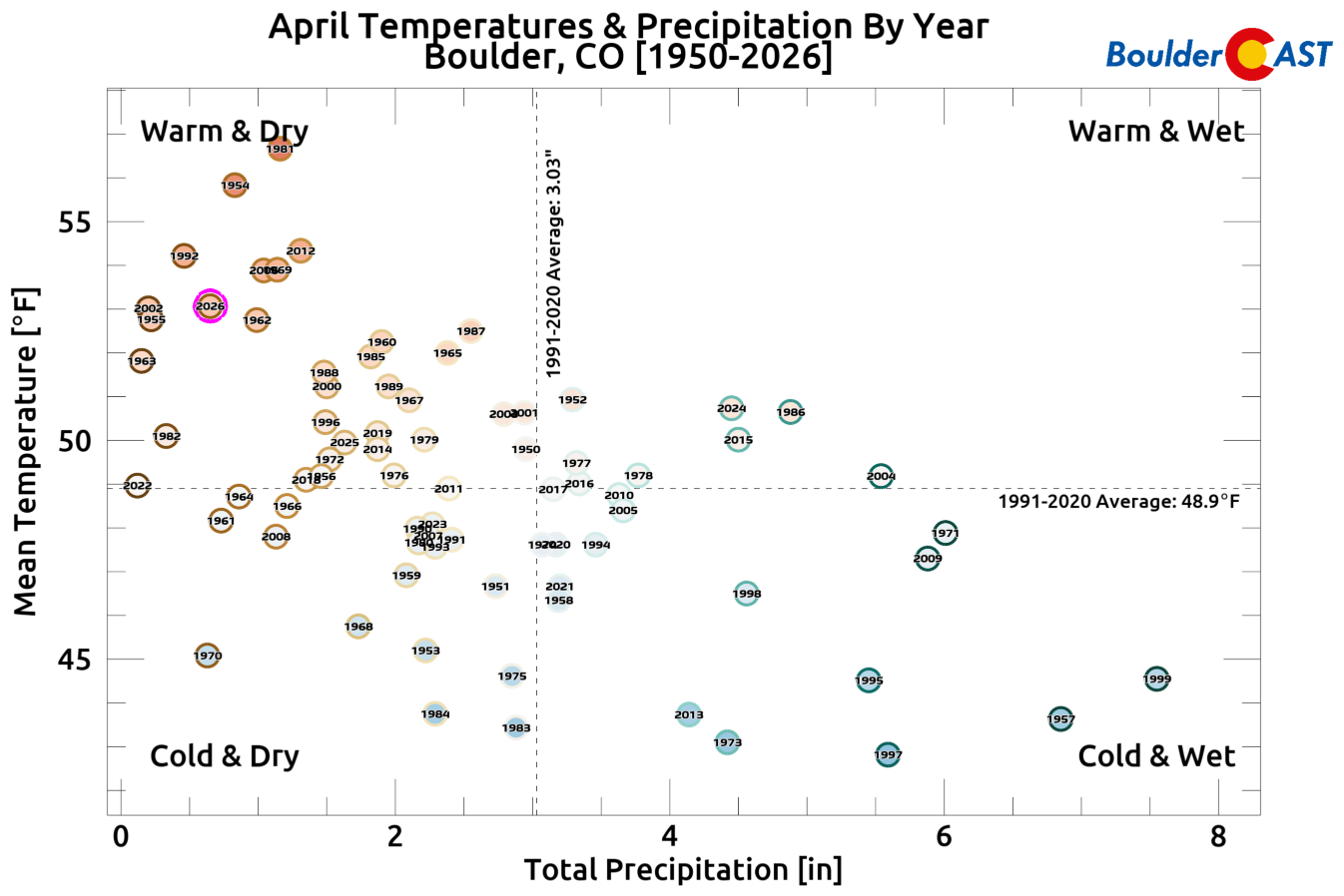
How does April 2026 fit into the last 75 years?
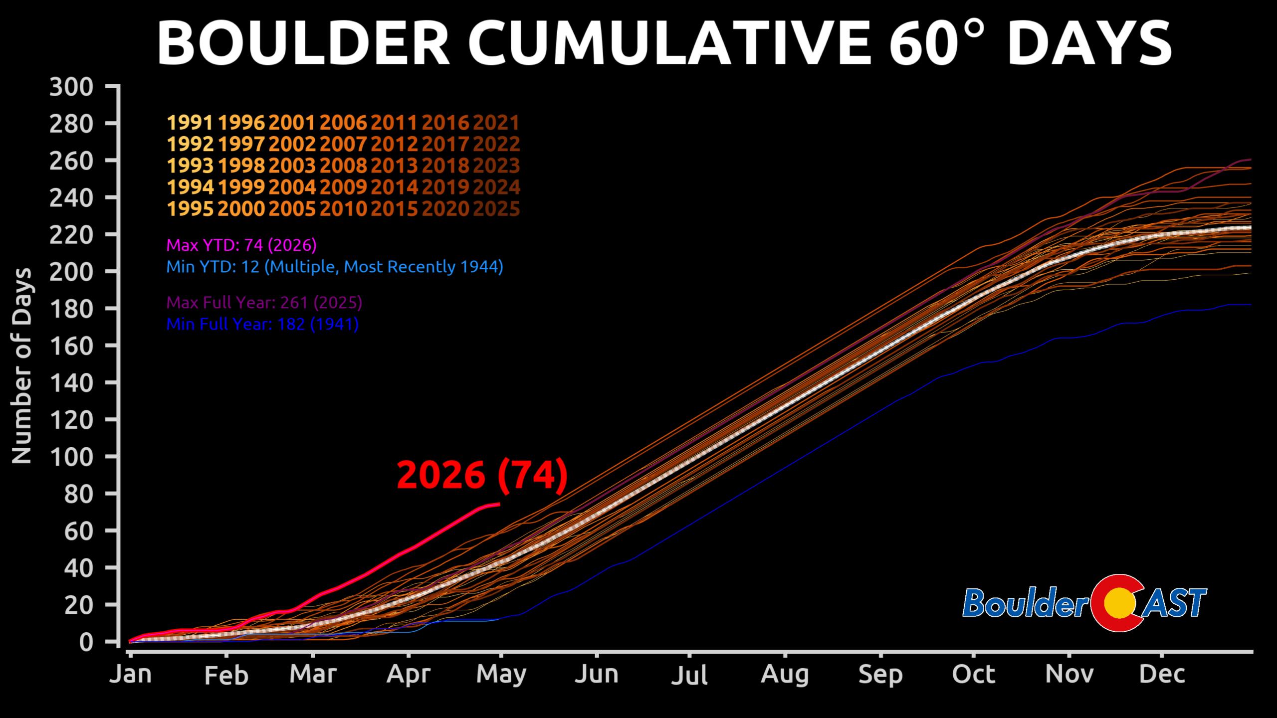
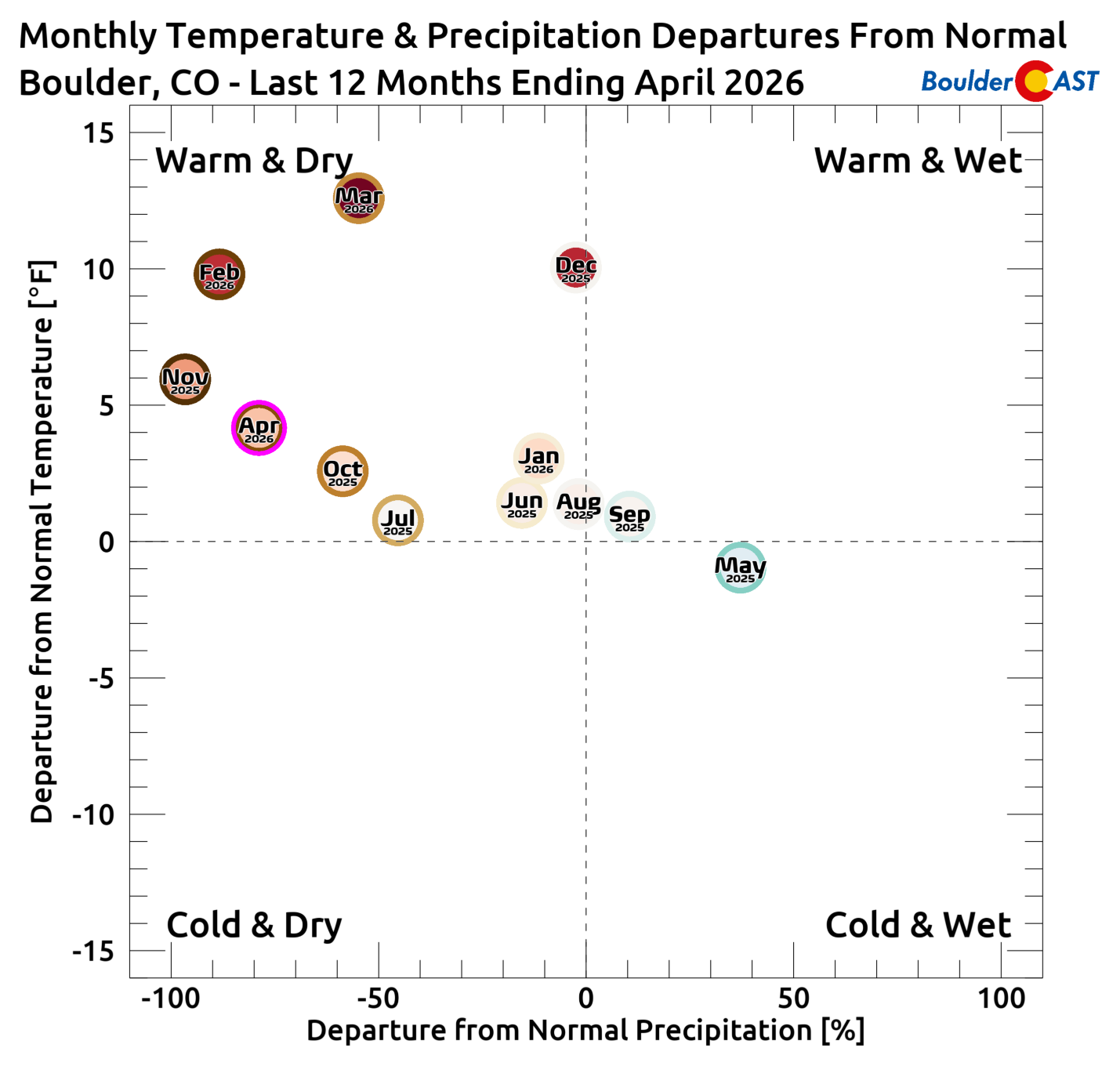
How does April 2026 fit into the last 12 months?
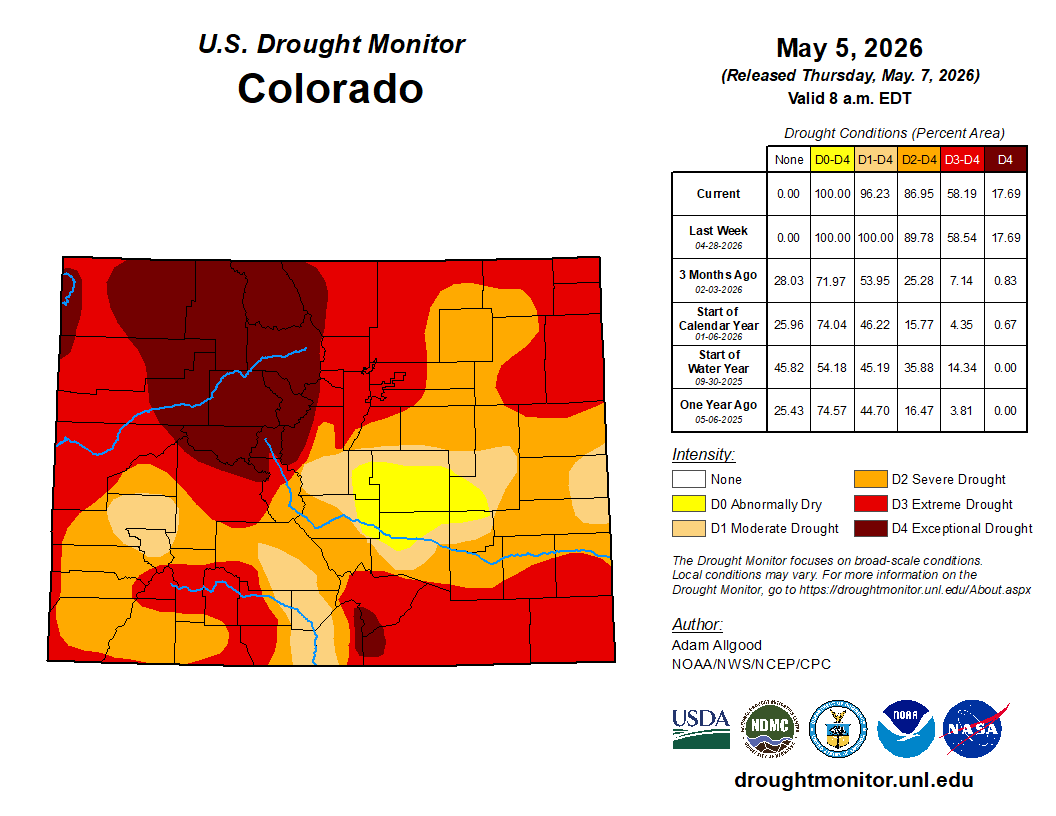
Latest Drought Tracker (as of May 5, 2026)
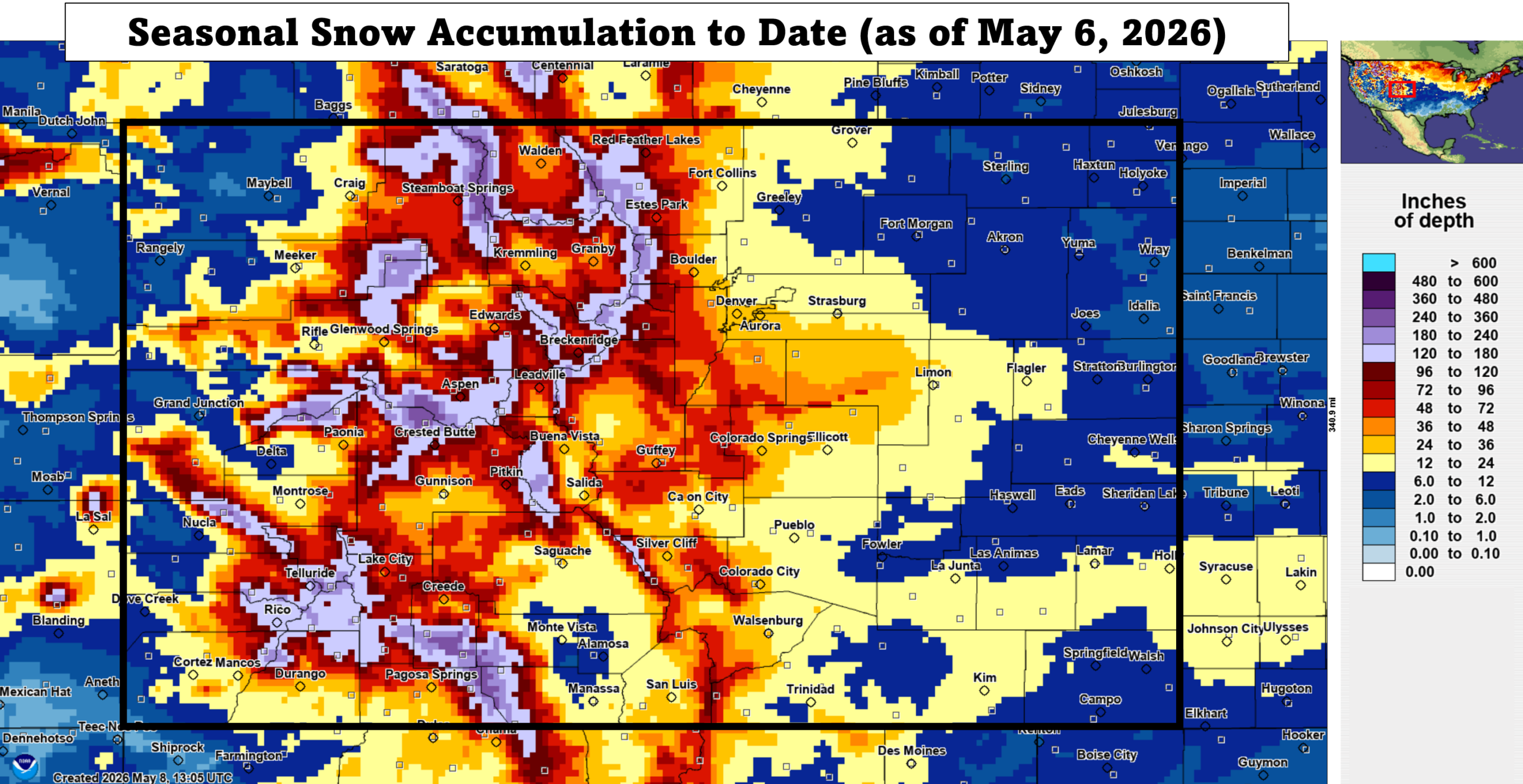
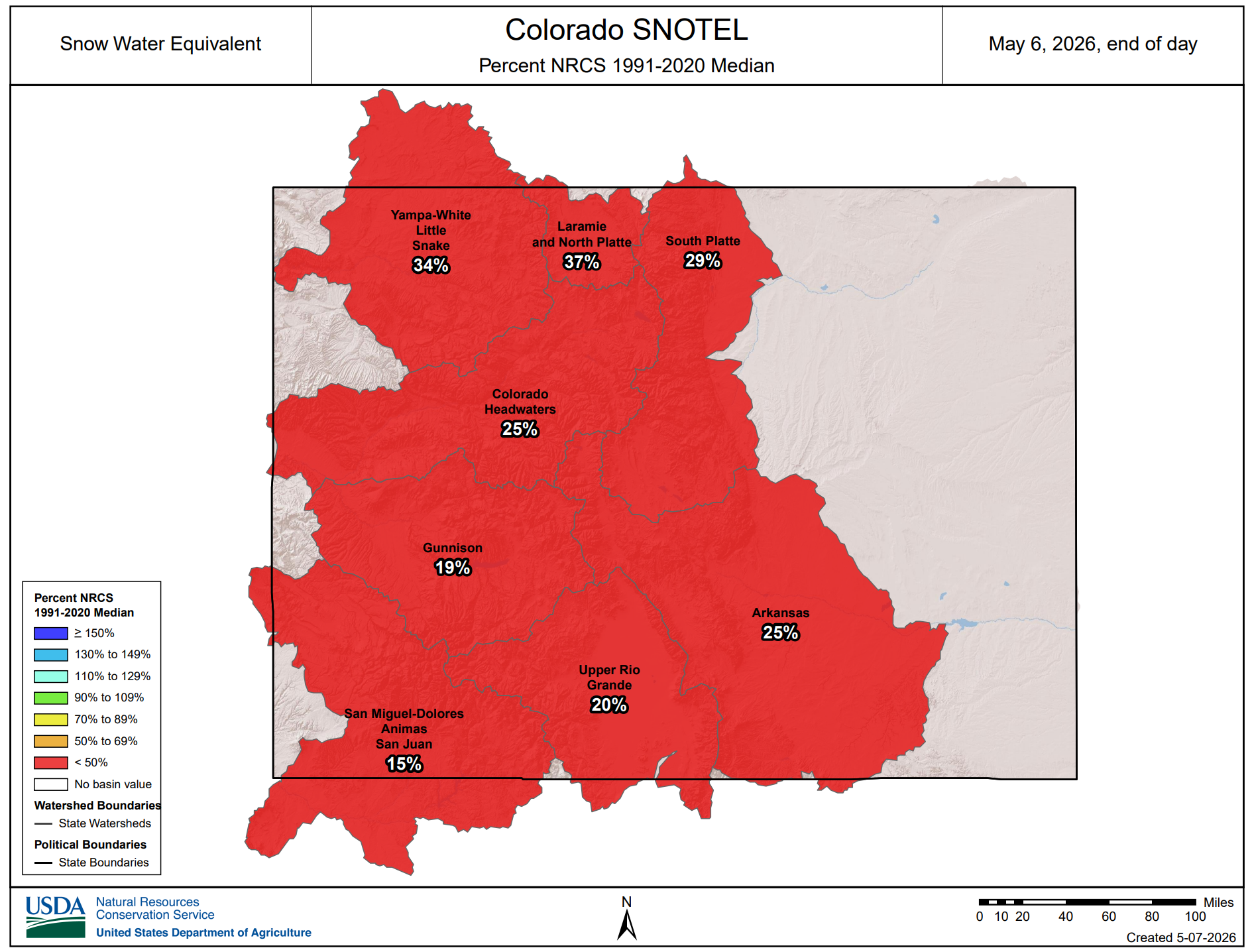
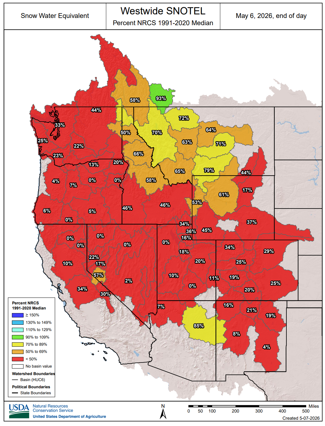
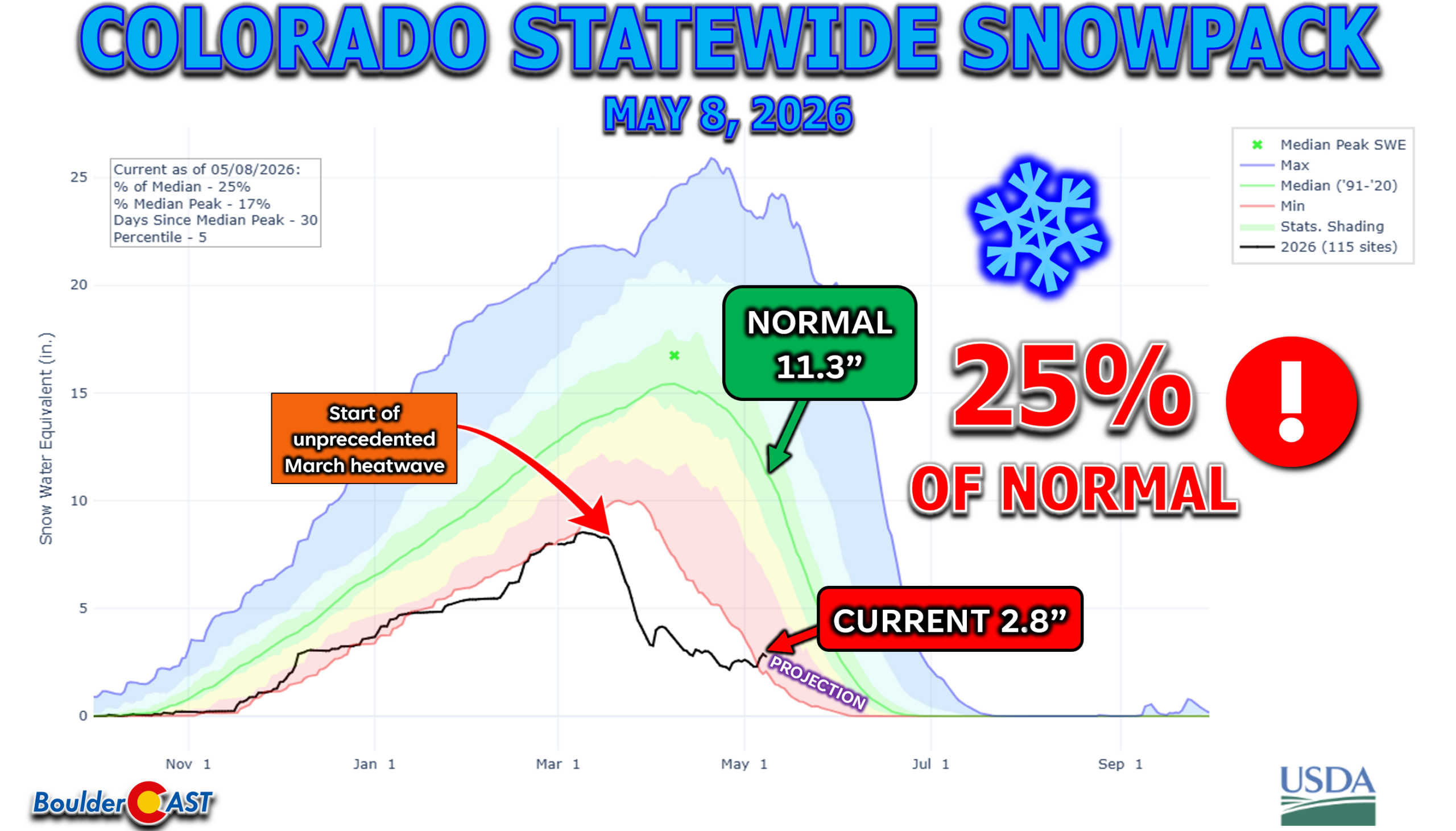
Latest Mountain Snowpack
Colorado is at 25% of normal right now, more or less the same as the 26% it was on April 1, 2026.
April 2026 retold via our Twitter X timeline:
NOTICE: We are now on Threads and Bluesky! Come follow us there, too!
Our top posts of April 2026
Spread the word, share Colorado weather:

Go Premium, get all the perks.
Daily Forecast Updates
Get our daily forecast discussion every morning delivered to your inbox.
All Our Model Data
Access to all our Colorado-centric high-resolution weather model graphics. Seriously — every one!
Ski & Hiking Forecasts
6-day forecasts for all the Colorado ski resorts, plus more than 120 hiking trails, including every 14er.
Smoke Forecasts
Wildfire smoke concentration predictions up to 72 hours into the future.
Exclusive Content
Weekend outlooks every Thursday, bonus storm updates, historical data and much more!
No Advertisements
Enjoy ad-free viewing on the entire site.


You must be logged in to post a comment.