As April winds down, several moisture‑rich systems are lining up along the Front Range, each bringing a mix of clouds, cooler temperatures, rain, and Mountain snow. Most days the forecast is straightforward, but one late‑week setup has quite variable outcomes. If you want to know when the dreariest stretches will be, how much moisture we can realistically expect, and when warmer weather will return, read on for all the details.
This week’s highlights include:
🌧️ Multiple waves of moisture return this week, delivering much‑needed drought relief and reduced fire danger with recurring showers and embedded thunderstorms.
🥶 Cooler‑than‑normal temps dominate, with highs mostly in the 50s and a notably chilly Thursday stuck in the 40s under deeper upslope and colder air advection.
🌫️ Cloudy, dreary pattern early week, featuring stratiform rain, drizzle, and limited instability; isolated thunder possible but no severe threat.
❄️ Mountain snow continues, with 1–5″ common and >6″ on the highest peaks; Steamboat favored via persistent NW‑upslope.
❓ Late‑week system remains uncertain, hinging on phasing between a Baja closed low and a northern trough; current trends favor a weaker, more southern track with lesser Front Range impacts.
🌤️ Weekend turns warmer and drier, as ridging builds in and highs rebound into the mid‑60s to low‑70s; another active pattern may return by early next week.
DISCLAIMER: This weekly outlook forecast is created Monday morning and covers the entire upcoming week. Accuracy will decrease as the week progresses as this post is NOT updated. To receive daily updated forecasts from our team, among many other perks, subscribe to BoulderCAST Premium.

Go Premium, get all the perks.
Daily Forecast Updates
Get our daily forecast discussion every morning delivered to your inbox.
All Our Model Data
Access to all our Colorado-centric high-resolution weather model graphics. Seriously — every one!
Ski & Hiking Forecasts
6-day forecasts for all the Colorado ski resorts, plus more than 120 hiking trails, including every 14er.
Smoke Forecasts
Wildfire smoke concentration predictions up to 72 hours into the future.
Exclusive Content
Weekend outlooks every Thursday, bonus storm updates, historical data and much more!
No Advertisements
Enjoy ad-free viewing on the entire site.
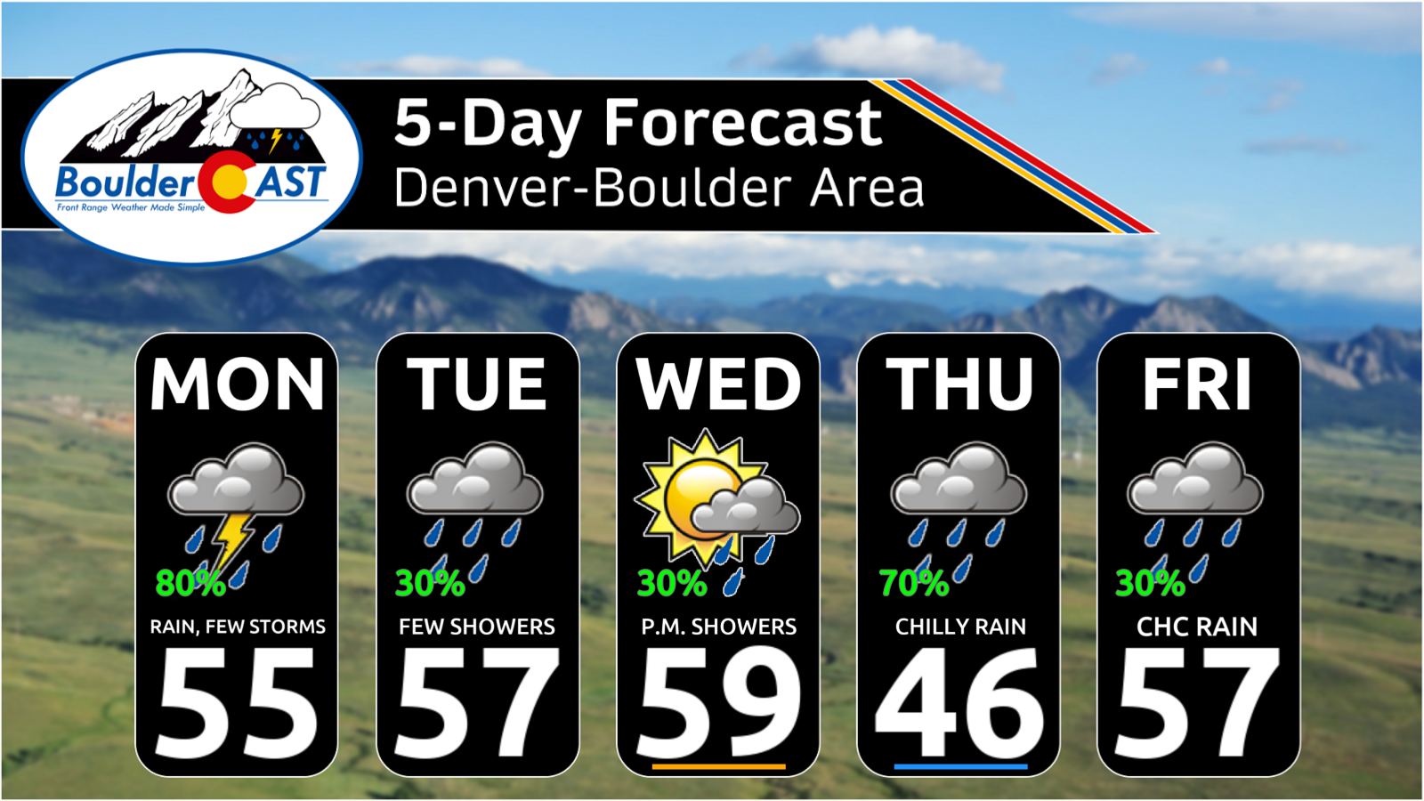
Wet and cooler to end April
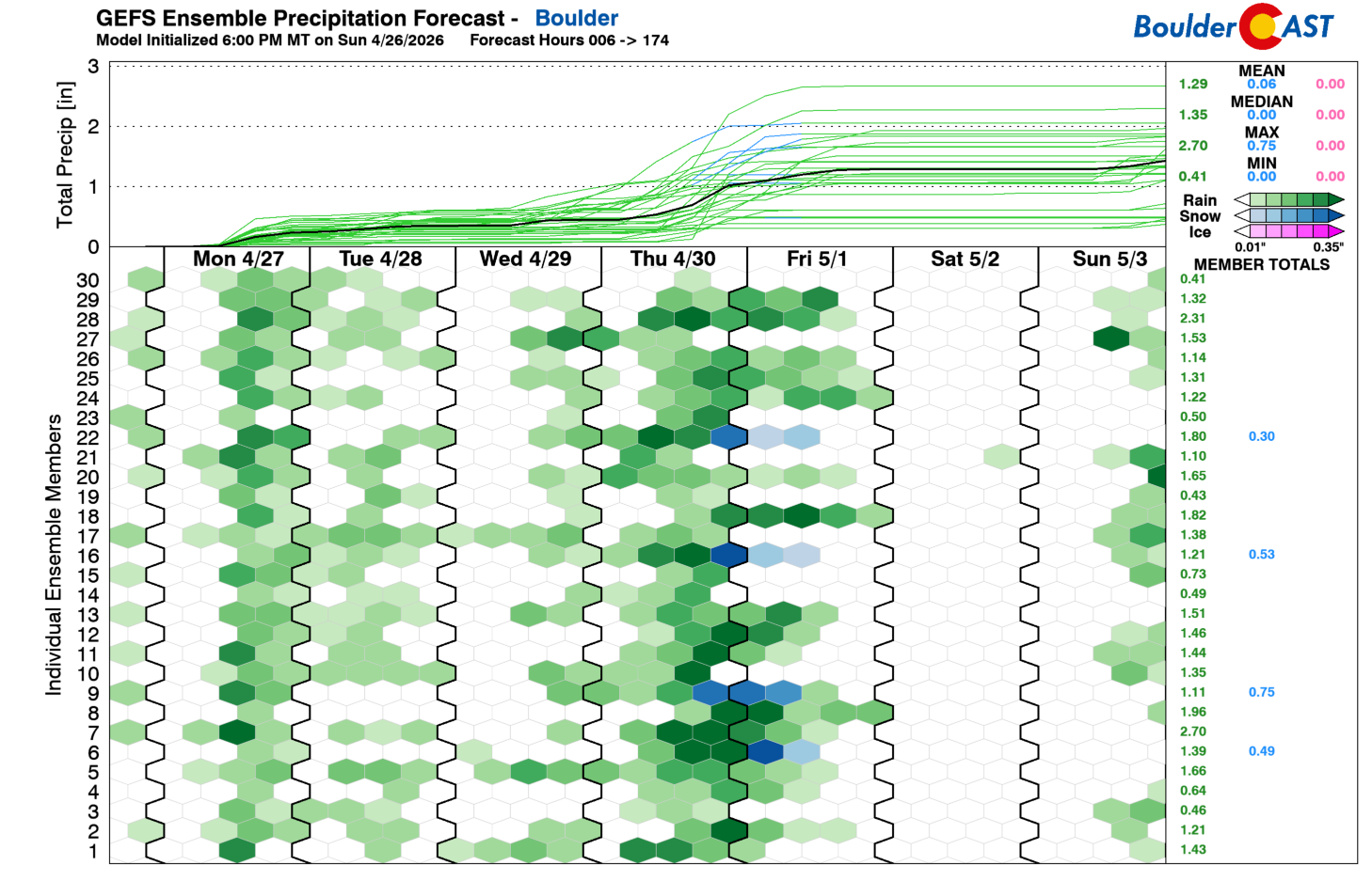
The final stretch of April is poised to finish on a decidedly wetter note. The old saying “April showers bring May flowers” may actually come true this year. After a notably dry spring, the late‑month pattern is at least giving us some atmospheric “bang for our buck.” GEFS ensemble guidance highlights several windows for precipitation across the Boulder area this week. Not every day will be a washout, but the overall theme is clear: cool, cloudy, and frequently damp along the Front Range. By the weekend, a shift toward somewhat drier and warmer conditions appears increasingly likely.
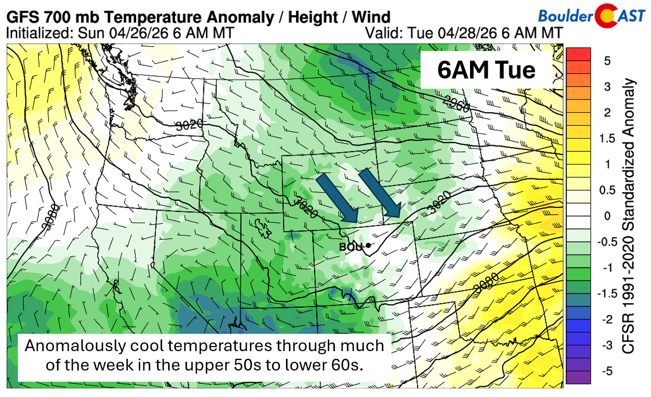
Highs will spend most of the week in the 50s, with Thursday emerging as the coldest day. A more organized system passing to our south will drag a pocket of colder air down from the north, keeping many lower‑elevation locations stuck in the 40s. Tuesday’s anomalously cool temperatures shown below are a good preview of the broader pattern through Friday.
GOES‑East water vapor imagery early Monday shows a highly active western U.S. pattern, with a broad trough draped across the region and several weak embedded shortwaves rotating through. These small but frequent perturbations will be the primary drivers of our recurring precipitation chances this week, each accompanied by periodic injections of cooler air and episodes of upslope flow.
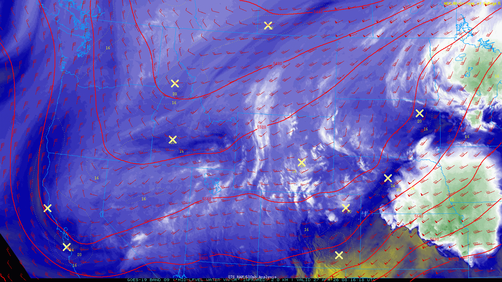
GOES-East water vapor animation from Monday morning, with overlaid 500mb height and wind. It’s a very troughy West right now!
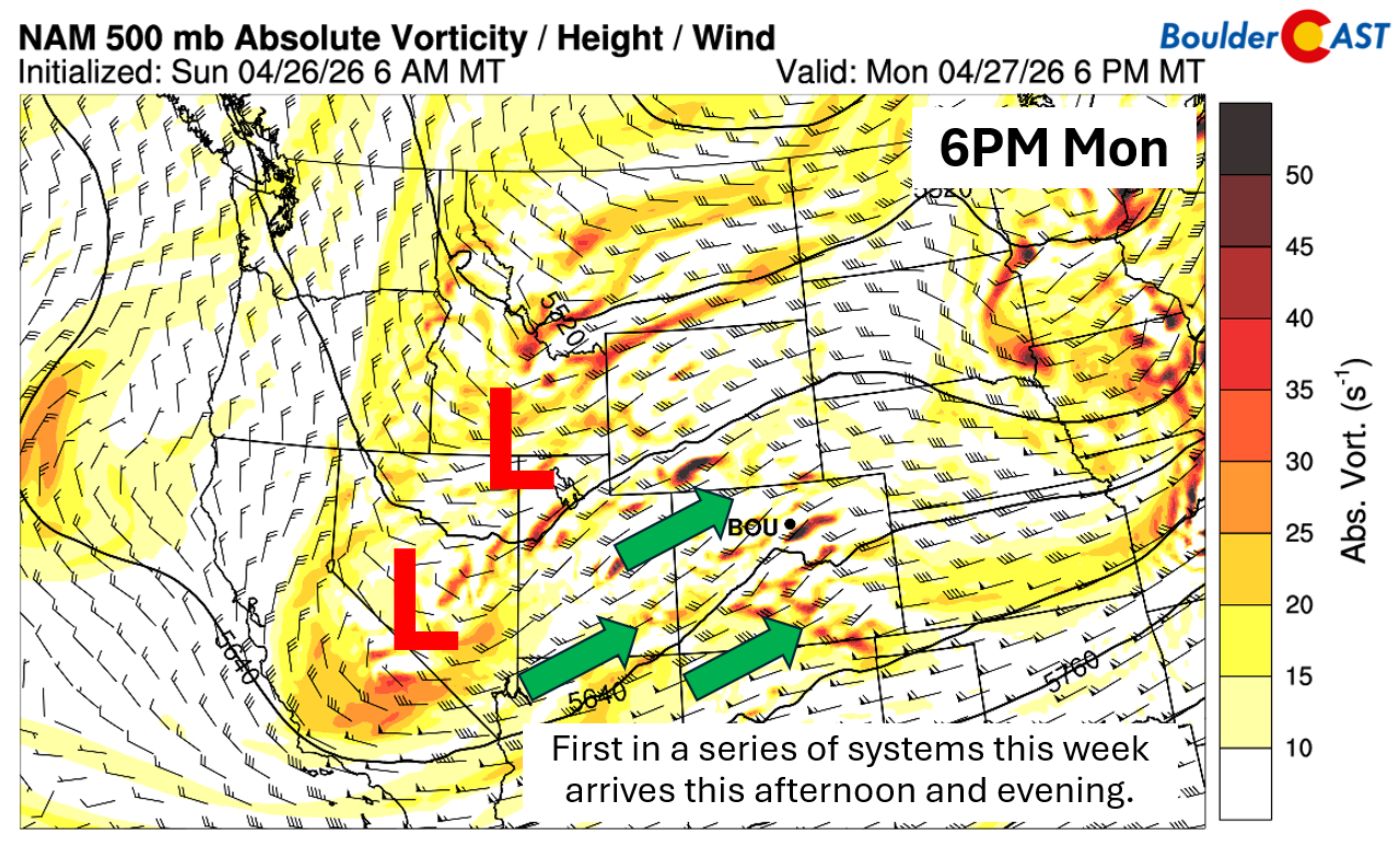
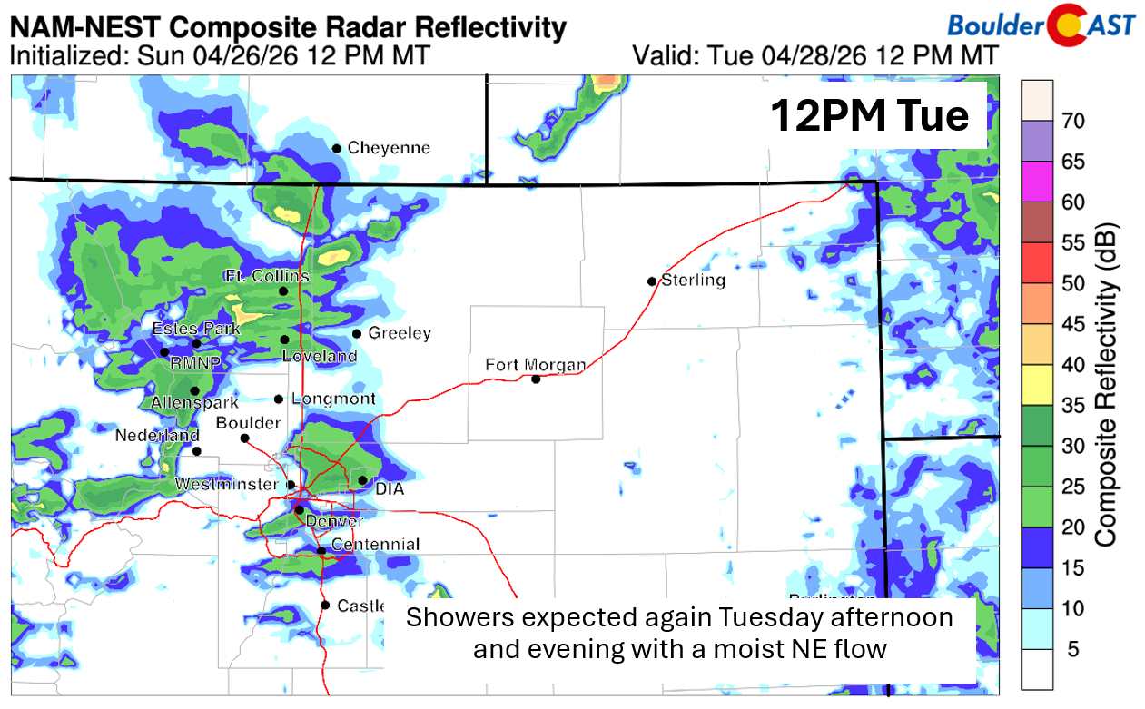
First Wave: Monday & Tuesday
The first in this parade of disturbances arrives Monday afternoon and evening. A pair of loosely connected lows — one over southern Idaho and another over Nevada — will funnel moisture and mid‑level energy into Colorado. As these features shift eastward into Utah and Wyoming on Tuesday, another round of showers is expected Tuesday afternoon and evening.
Instability on Monday is modest but sufficient for embedded thunderstorms within the broader shower shield. Most locations will pick up a tenth of an inch or less, but some locations could exceed a quarter inch. Spring’s convective fingerprints are returning — “locally higher amounts” is once again the name of the game.
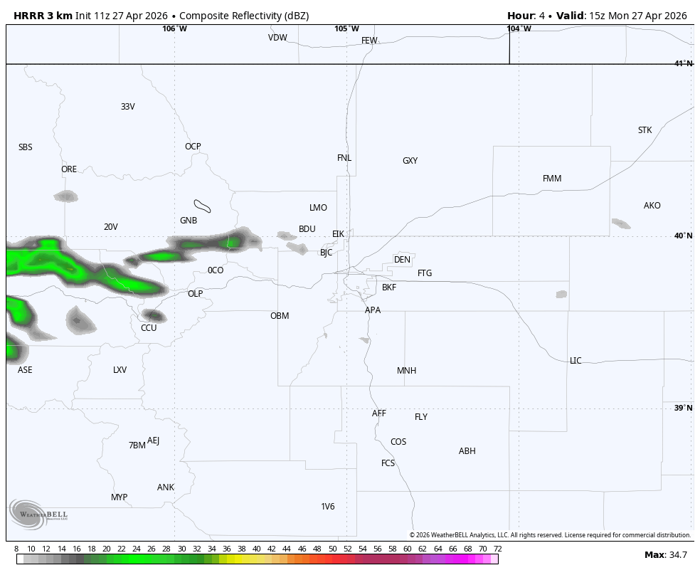
HRRR model simulated radar animation for Monday showing the numerous showers and thunderstorms expected across the Front Range
Tuesday’s setup is cooler and more stable, favoring stratiform rain, drizzle, and low clouds. A stray rumble of thunder can’t be ruled out entirely, but in general it will be a calmer setup. Expect widespread cloud cover both days.
With highs in the 50s across the Plains, snow becomes a factor in the Mountains. A general 1–5 inches is expected Monday into Tuesday across the higher terrain, with the tallest peaks easily exceeding 6 inches. The Park Range near Steamboat is favored for higher totals thanks to a more persistent northwest‑upslope component there early in the week.
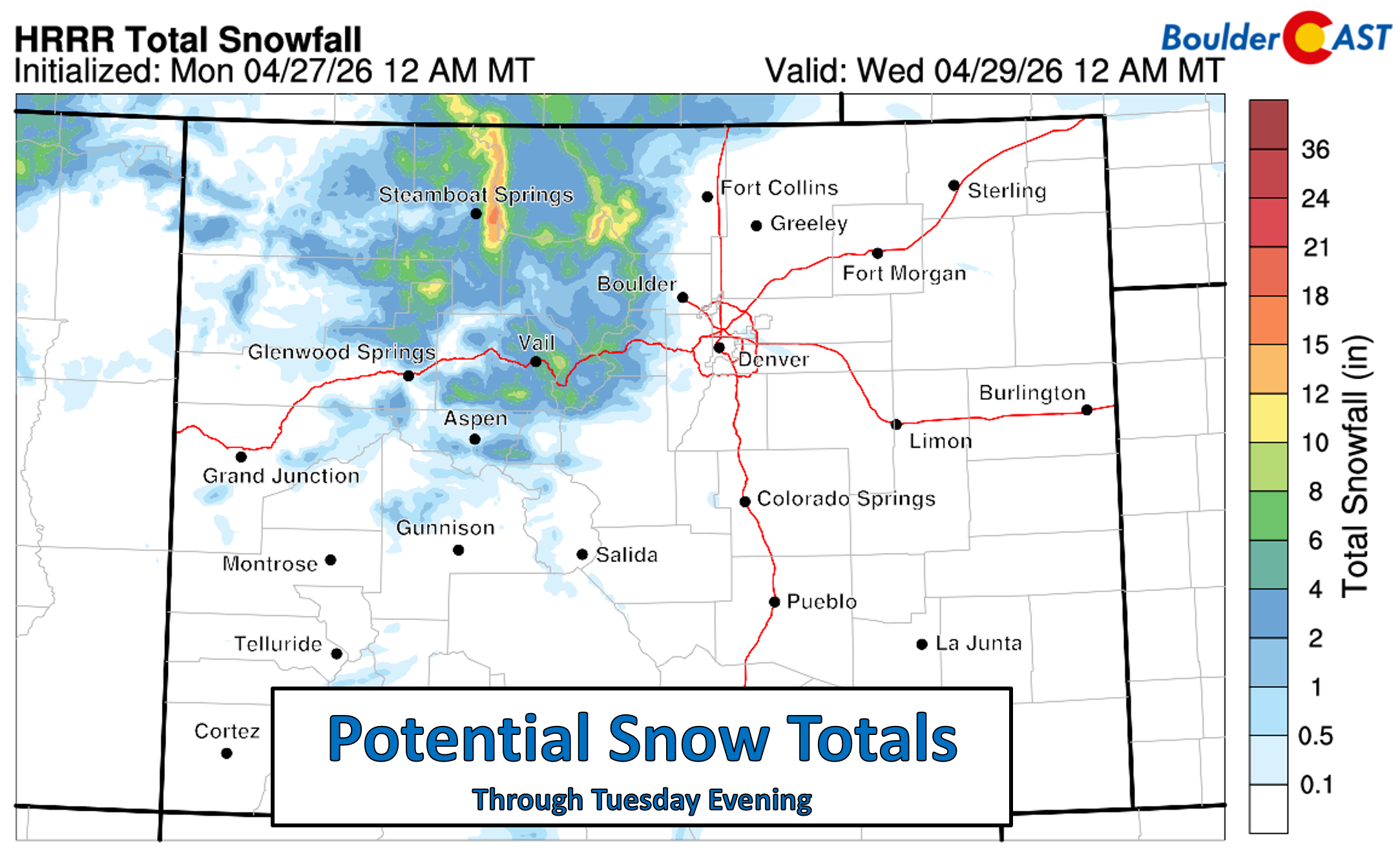
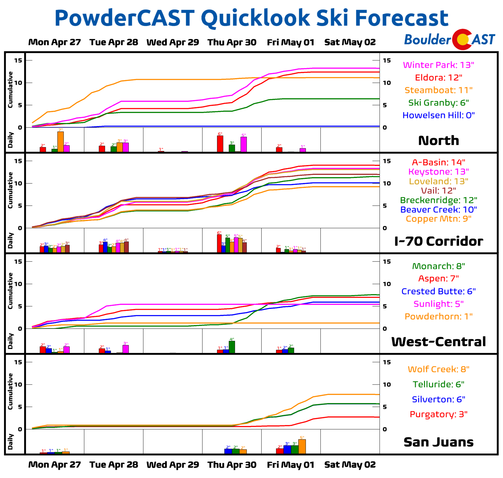
Our PowderCAST ski forecast highlights these early‑week snow chances tied to the eastward‑moving lows. Additional snow is possible later in the week, though confidence drops as the late‑week system may track too far south into New Mexico.
Late‑Week Uncertainty: More Rain? Foothills Snow?
A third system enters the picture Wednesday night through Friday, offering yet another chance for rain — and possibly some Foothills snow — though model guidance remains highly variable. The uncertainty stems from the potential phasing of two distinct features near the Four Corners:
- A warm, moisture‑rich closed low lifting north from the Baja region
- A colder but weaker trough dropping in from the northern Rockies
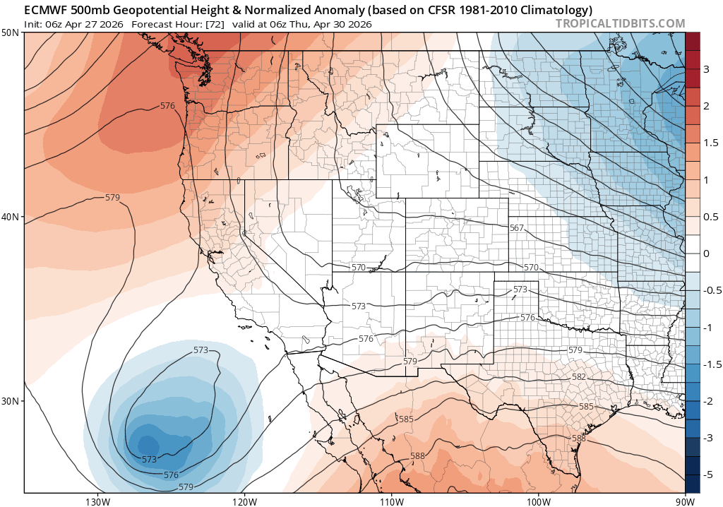
Euro 500mb height anomaly forecast animation for late-week showing the two storm systems which may/may not phase across the Four Corners area.
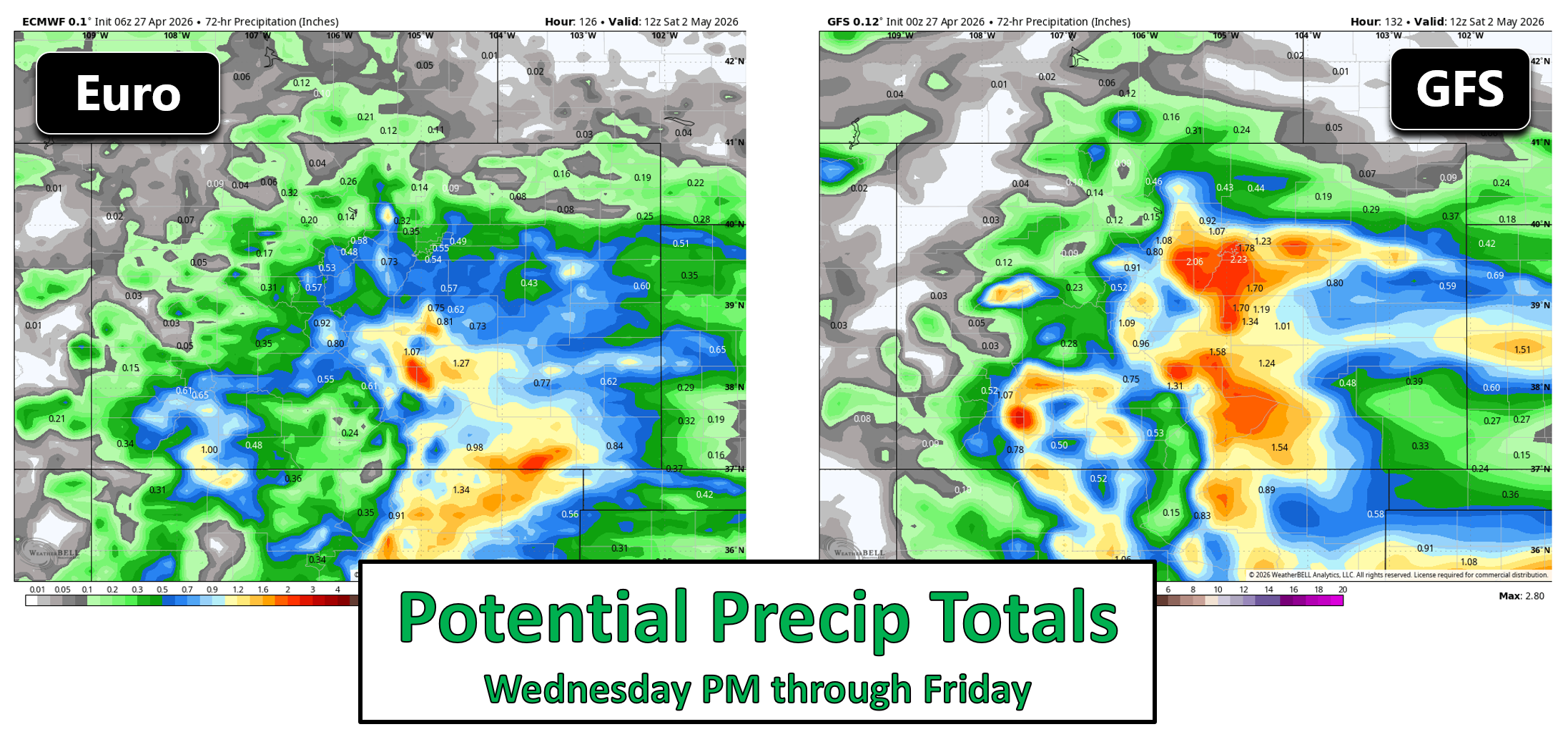
Some guidance (e.g., the Euro) keeps these systems poorly phased, with the colder, drier wave arriving earlier and the warm/moist low coming in later and farther south. This scenario would limit impacts along the Front Range. Other solutions (e.g., the GFS) show better phasing, yielding a longer period of light to moderate precipitation.
At this time, we lean toward the less‑phased, more southern solution — meaning impacts in Boulder and Denver are likely to be muted. Thursday still looks chilly and dreary with highs in the 40s, but the precipitation potential is more uncertain and likely less robust than the wetter model camps suggest. Also keep in mind that the Foothills could see some snow from this late-week storm, though it’s still too uncertain to project snow levels or amounts right now.
By week’s end, most Front Range locations should exceed a half inch of total rainfall, with the Foothills, Palmer Divide, and southeast Colorado favored for 1 inch or more.
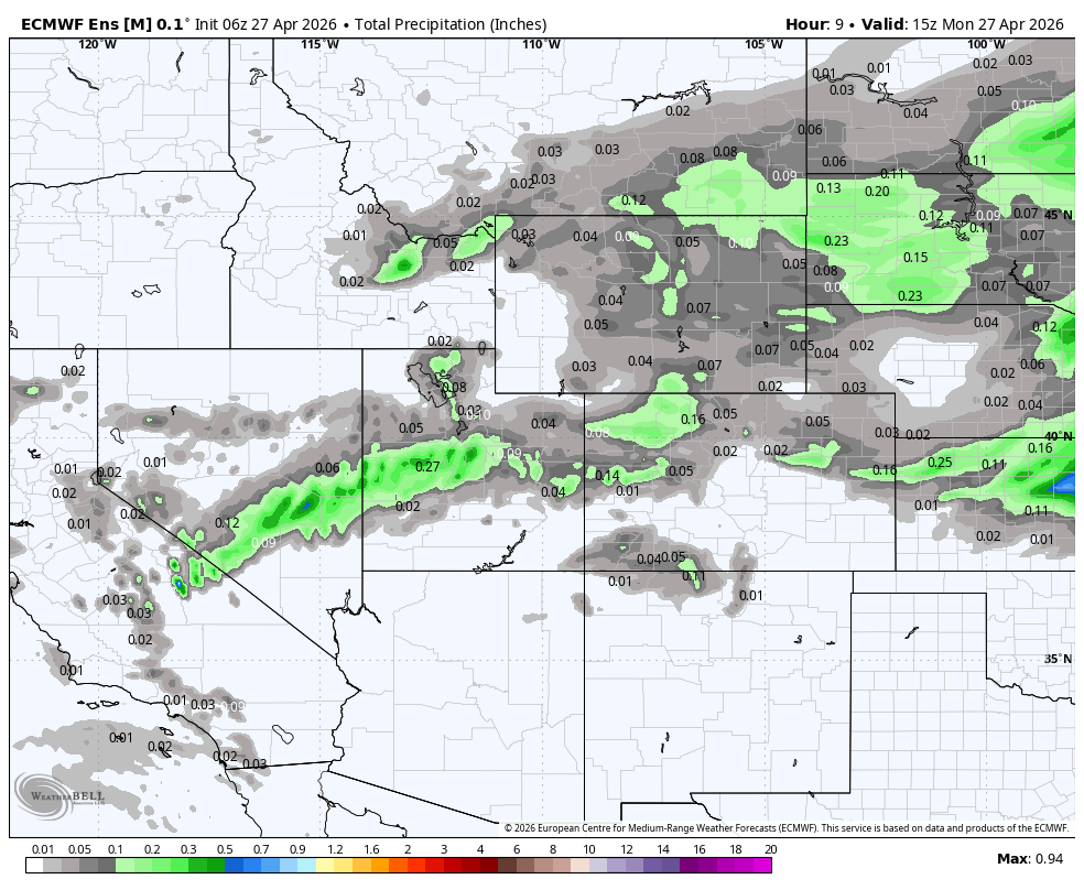
European ensemble mean precipitation forecast animation through Friday night
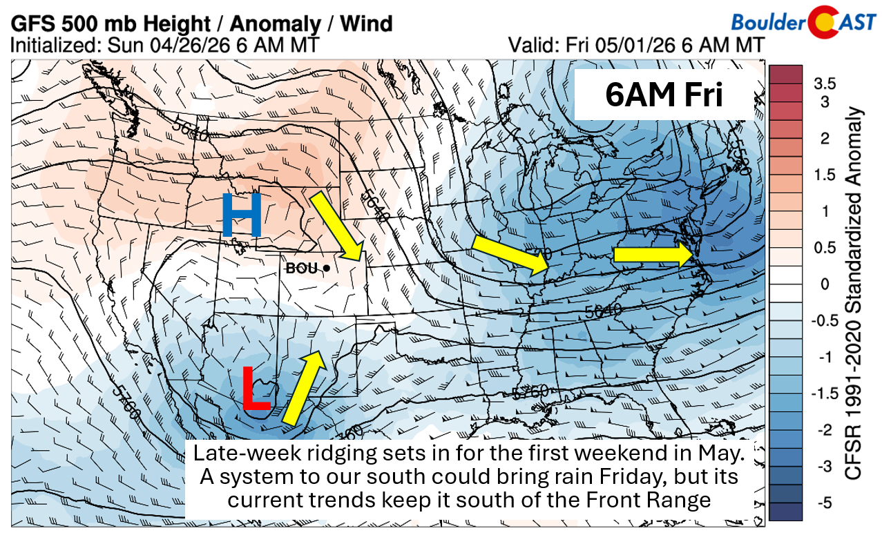
Trending Drier and Warmer for the First Weekend of May
As we head into the weekend, ensemble signals strengthen for weak ridging over Idaho and Wyoming to build southeastward, promoting drying and a warming trend to kick off May. Highs should rebound into the mid‑60s to low‑70s. Rain chances aren’t zero on Friday — especially if the southern‑track system nudges farther north — but current trends keep most of the moisture south of Denver on Friday.
Overall, the five‑day forecast is excellent news for drought relief: daily precipitation chances, cooler temperatures, and absolutely no fire‑weather concerns.
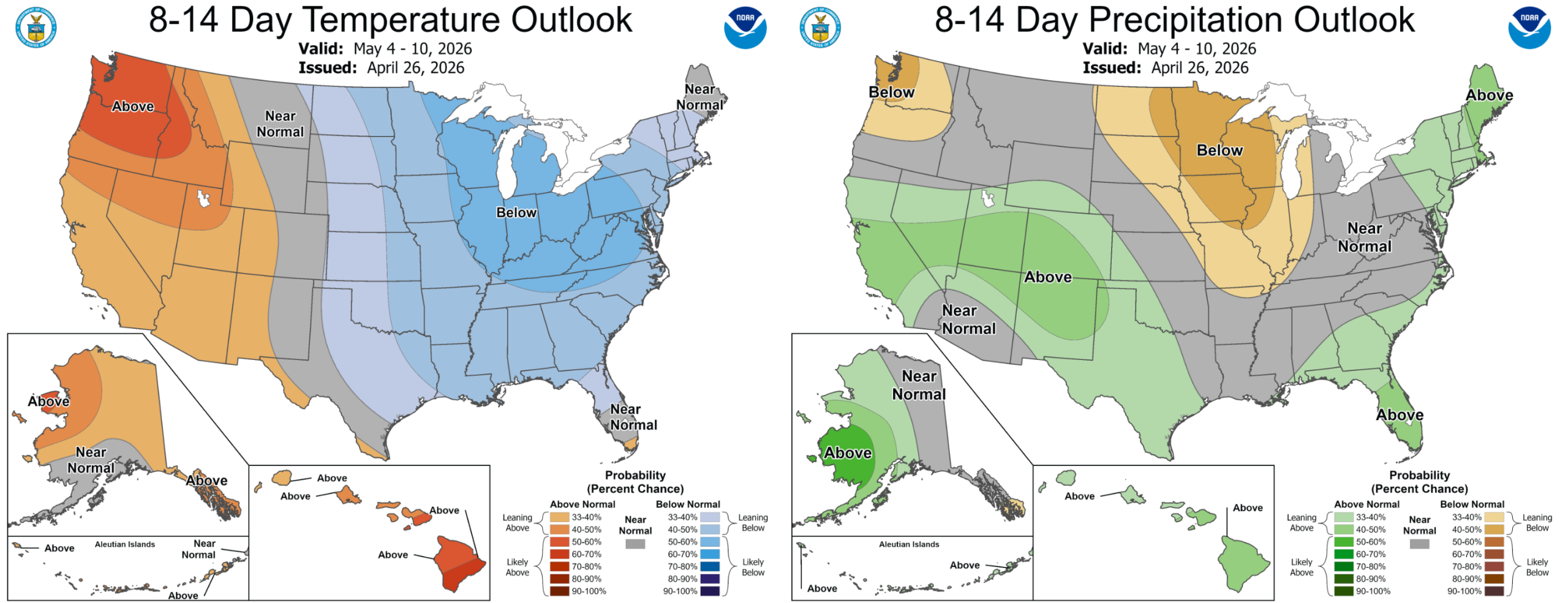
Next week may bring a return to unsettled weather, as ensemble guidance hints at a renewed active pattern with above normal precipitation favored for the central and southern Rockies.
Have a great week!
Forecast Specifics:
Monday and Tuesday: Mostly cloudy with afternoon and evening showers. A few embedded storms are possible. Highs in the mid to upper 50s on the Plains and mid 40s in the Foothills.
Wednesday: Partly to mostly cloudy with scattered showers in the afternoon and evening. Highs near 60 degrees on the Plains. Over the Foothills, expect highs in the middle to upper 40s.
Thursday: Chilly, gloomy and rainy across the lower elevations with some snow in the Foothills. Highs in the 40s on the Plains with 30s in the Foothills.
Friday: Trending drier, though cannot rule out some daytime showers early Friday afternoon with highs in the upper 50s to lower 60s for the Plains and upper 40s in the Foothills.
Weekend: Trending warmer and drier with middle 60s to lower 70s for the first weekend in May. There could be an uptick in wet weather by Sunday afternoon or Monday.
DISCLAIMER: This weekly outlook forecast is created Monday morning and covers the entire upcoming week. Accuracy will decrease as the week progresses as this post is NOT updated. To receive daily updated forecasts from our team, among many other perks, subscribe to BoulderCAST Premium.
Go Premium, get all the perks.
Daily Forecast Updates
Get our daily forecast discussion every morning delivered to your inbox.
All Our Model Data
Access to all our Colorado-centric high-resolution weather model graphics. Seriously — every one!
Ski & Hiking Forecasts
6-day forecasts for all the Colorado ski resorts, plus more than 120 hiking trails, including every 14er.
Smoke Forecasts
Wildfire smoke concentration predictions up to 72 hours into the future.
Exclusive Content
Weekend outlooks every Thursday, bonus storm updates, historical data and much more!
No Advertisements
Enjoy ad-free viewing on the entire site.
Enjoy our content? Give it a share!


You must be logged in to post a comment.