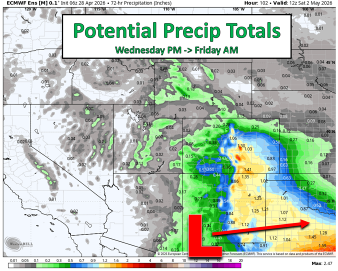
Moderate, moisture‑rich west–southwest flow is hammering into Colorado this morning, and GOES‑East water vapor imagery clearly highlights our second shortwave of the week racing toward the Front Range, now centered near Salt Lake City. That embedded disturbance will continue sliding east through the day, pushing east of Denver by early evening. As it departs, large‑scale ascent fades and rain chances …
Ben grew up in southwestern Pennsylvania and holds both a bachelor's and a master's degree in Meteorology, the latter being from CU Boulder. His hometown received nearly three feet of snow from the Storm of the Century back in March of 1993, sparking his initial interest in impactful weather. Ben currently works on remote sensing and data analysis software at NV5 Geospatial Software in Boulder.
More Posts