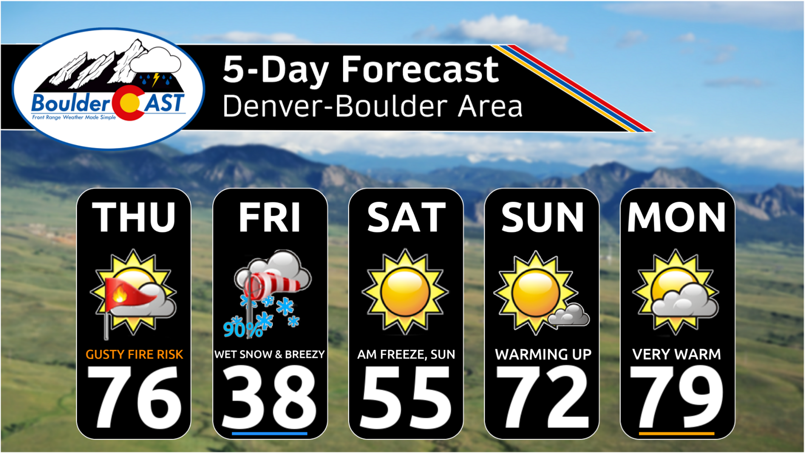
A sharp pattern shift is lining up for the Front Range to end the week, and it’s going to feel a lot different than the stretch of mild, breezy days we’ve been riding lately. Thursday brings one more round of elevated fire danger, but by tonight a much colder airmass barrels in and sets the stage for a quick burst of snowflakes Friday morning — followed by a hard freeze Friday night that may end up being the most impactful part of the whole event. Here’s what to expect as winter makes a brief, timely return to the Denver-Boulder area.
What You Need to Know
🔥 Near‑critical fire danger Thursday with warm downslope winds, single‑digit humidity, and gusts 15 to 35 MPH; Red Flag Warnings south/east of Denver.
🌡️ Cold front blasts in around midnight, dropping temps sharply with our coldest mid‑level airmass in a month settling in by early Friday.
❄️ Snow arrives around sunrise Friday, likely a quick burst tied to the mid‑level front, then lighter snow thereafter. Snow tapering off by afternoon.
📉 Short storm window (~6 hours) as the fast‑moving trough limits accumulation and flips winds to downslope by late-day.
📏 Modest totals: <3″ for lower elevations, <6″ in the Foothills, with most sticking to grass and elevated surfaces. Minor travel impacts only in the higher terrain.
🥶 Hard freeze Friday night (low–mid 20s) with another lighter freeze Saturday night; protect hoses, exposed pipes, and sensitive plants.

Go Premium, get all the perks.
Daily Forecast Updates
Get our daily forecast discussion every morning delivered to your inbox.
All Our Model Data
Access to all our Colorado-centric high-resolution weather model graphics. Seriously — every one!
Ski & Hiking Forecasts
6-day forecasts for all the Colorado ski resorts, plus more than 120 hiking trails, including every 14er.
Smoke Forecasts
Wildfire smoke concentration predictions up to 72 hours into the future.
Exclusive Content
Weekend outlooks every Thursday, bonus storm updates, historical data and much more!
No Advertisements
Enjoy ad-free viewing on the entire site.
A Colder Storm Zeroes In on Colorado
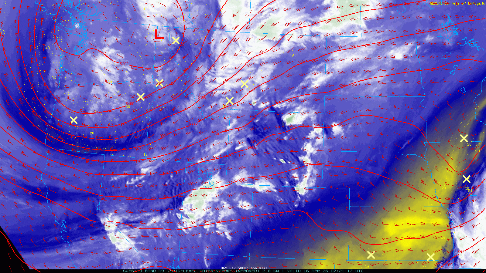
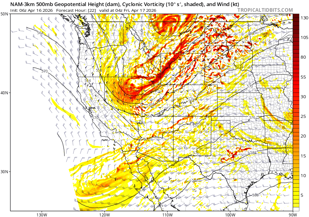
Our second storm system of the week — the one that has consistently signaled a colder punch and a legitimate shot at snow along the Front Range — is now on approach. Early Thursday’s GOES-East water vapor imagery shows a well‑defined trough digging through the Pacific Northwest and northern Rockies. That feature will become our snow‑producer on Friday as it swings southeast into Colorado.
Fire Danger Thursday
Ahead of the trough, southwesterly flow strengthens across the state today as a lee trough deepens over eastern Colorado. This setup is classic for warm, dry downslope winds along the Front Range, and models continue to drive relative humidity into the single digits by Thursday afternoon.
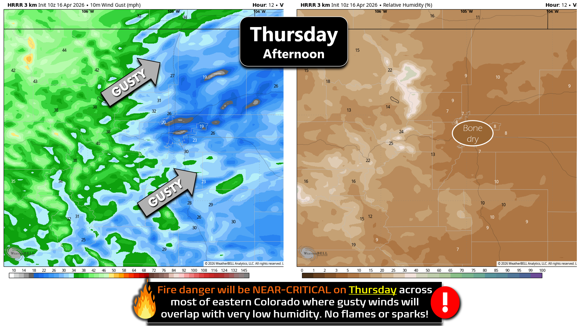
- Peak gusts: 15-30 MPH for Boulder/Denver
- Stronger pockets: Up to ~35 MPH in the Foothills, Palmer Divide, and near the Wyoming border
- Red Flag Warnings: 11 AM–9 PM for areas south and east of Denver

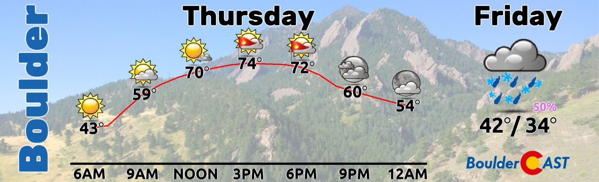
Boulder and Denver are technically not under a Red Flag Warning, but fuels remain dry and humidity will be critically low. Treat Thursday like a fire weather day regardless. No flames or sparks! Highs will surge to the mid‑70s — one last warm, gusty afternoon before the pattern flips.
The Cold Front Arrives Thursday Night
Winds ease Thursday evening, but temperatures stay mild until the front barrels in from the north around midnight. Expect a sharp temperature drop, a burst of northerly winds, and a quick push of cold air southward through the I‑25 Corridor.
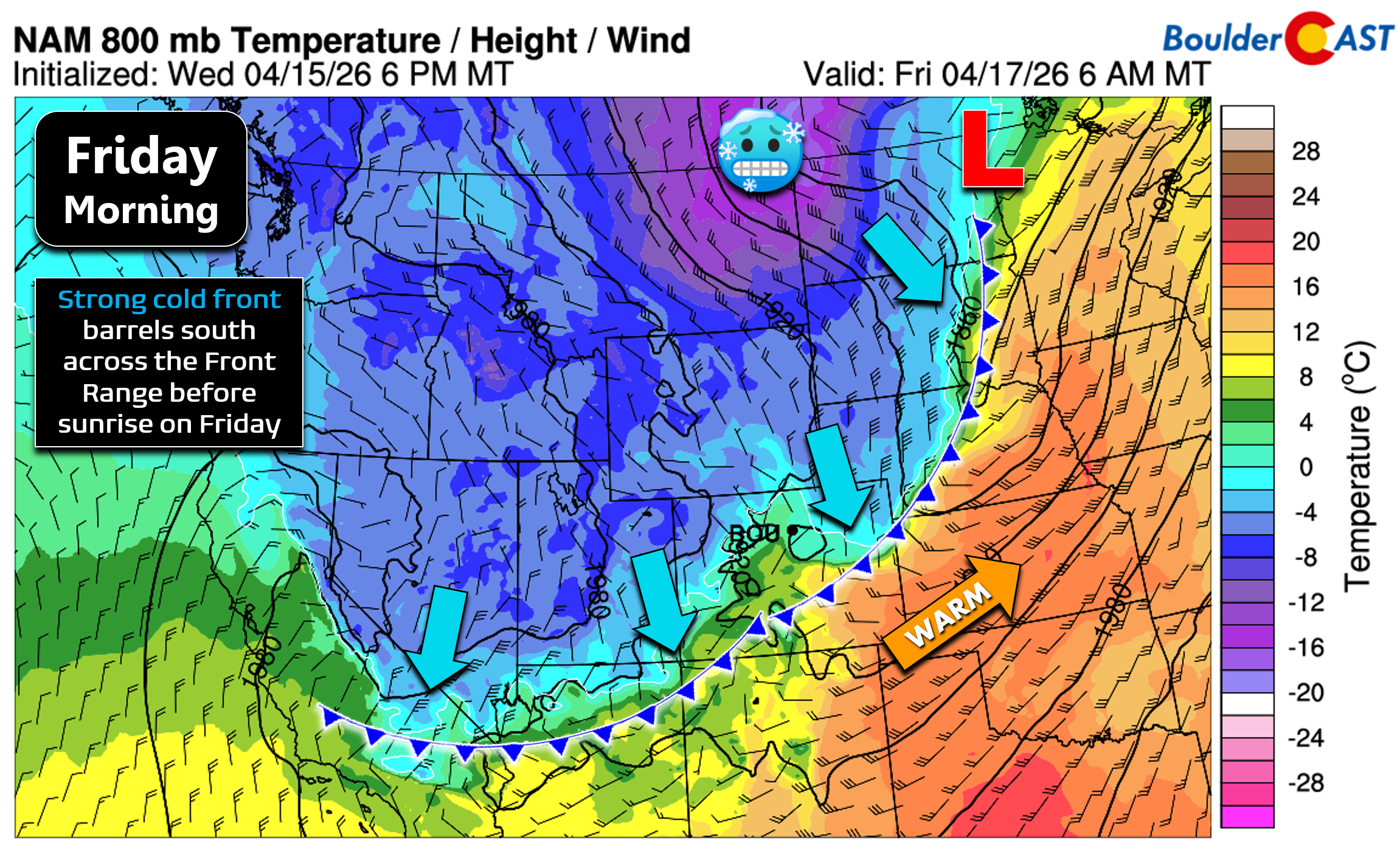
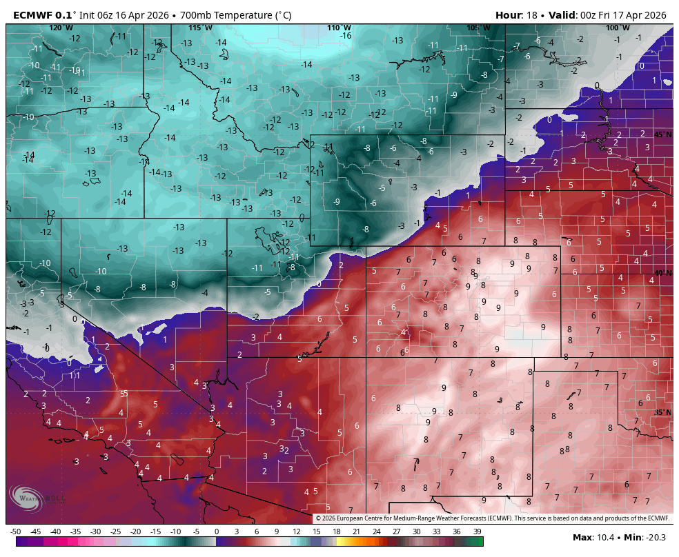
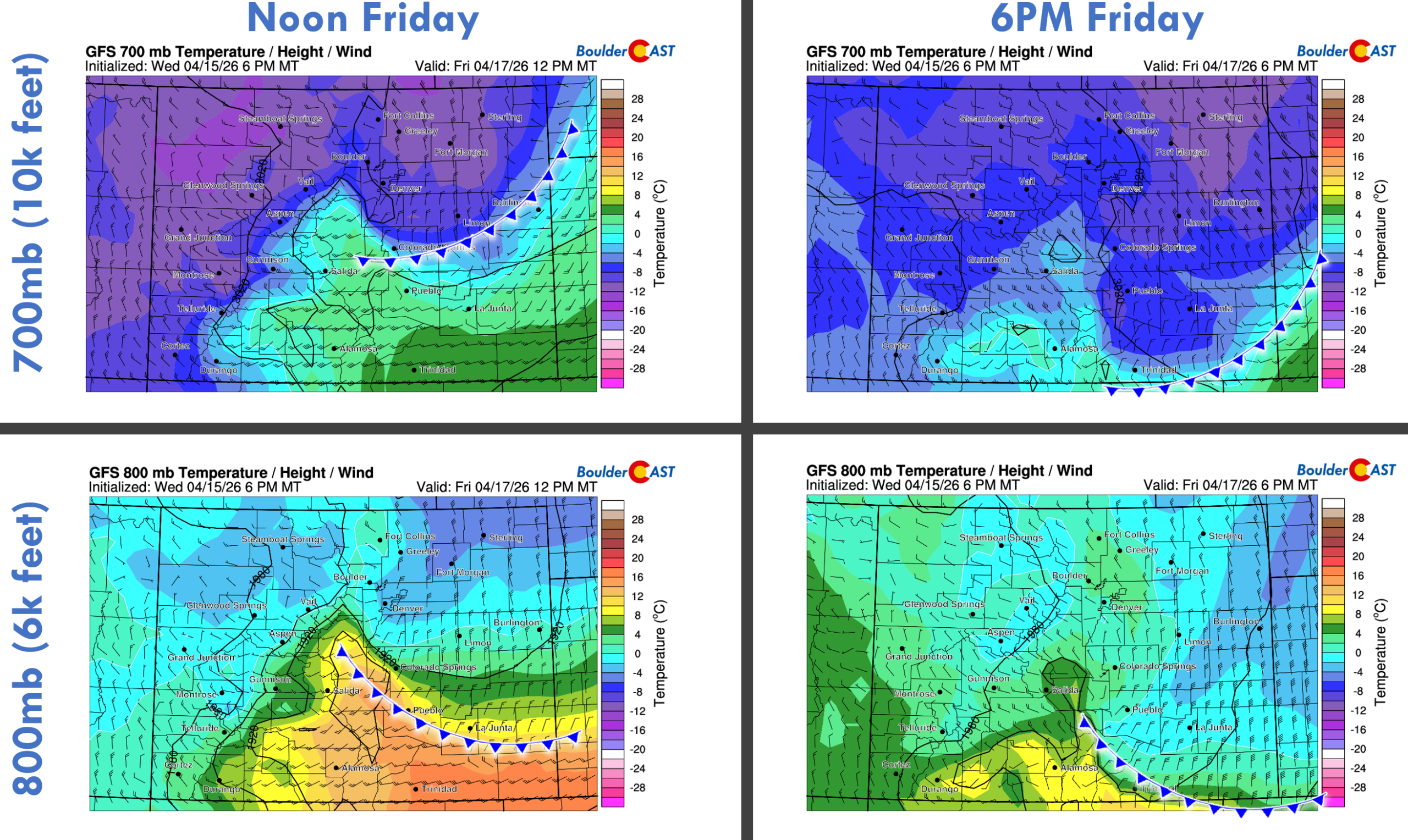
The coldest mid‑level air arrives between 5–9 AM Friday, with 700 mb temperatures plunging to around –10°C, easily cold enough to support all snow during the event. This will be the coldest airmass to reach the Front Range in more than a month.
Snowflakes Return Friday Morning
As the trough swings across the northern Rockies, a compact lobe of energy will round its base and become Colorado’s primary lift mechanism. Combine that with the frontal passage and a period of low‑level upslope, and we should get a quick‑hitting window for precipitation.
Timeline:
- Mountains: Snow begins during the wee morning hours Friday.
- Denver/Boulder: Snow develops near or shortly after sunrise — right around the morning commute.
- Initial type: Maybe a few raindrops at onset, but a rapid changeover to wet snow is expected as the cold air layer deepens
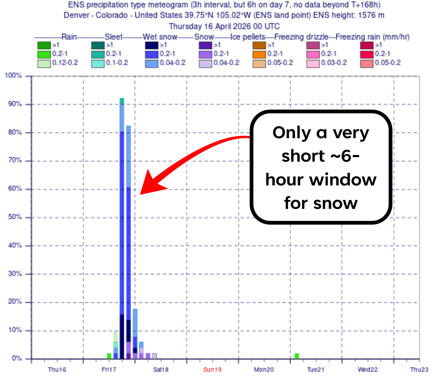
The main concern we have right now is storm speed. Models continue to trend faster with the trough. That will compress the snowfall window to roughly 6 hours, with the best chance for accumulation occurring during the morning hours.
Upslope will be present during the day, even perhaps deep upslope in parts of Jefferson County in the morning, but by late afternoon, winds will quickly flip to downslope as the trough departs, shutting down any lingering snow.
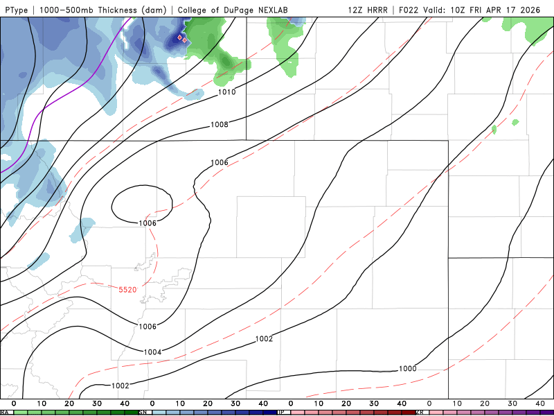
Short-range models, like the HRRR shown below, have so far latched onto the idea of an even shorter event than the global models — basically just a quick burst of moderate to heavy snow during the morning commute hours as the mid-level cold front blows through, then spotty, light, and melty snow through the rest of the morning with snow ending by mid-afternoon.
Despite the excitement for snow again, and the needed moisture, this is going to be a relatively brief and minor resurgence of winter weather for Boulder and Denver. Daytime temperatures on Friday will only be in the low to middle 30s.
Snow Amounts: A Modest Event
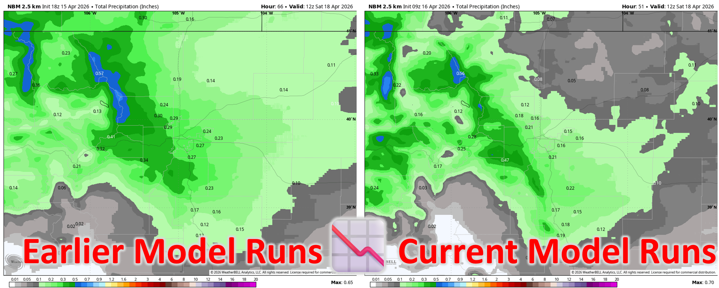
With models having sped the overall storm system up a tad in recent runs, it’s no surprise that precipitation amounts have declined for northeast Colorado and the Front Range. We’ve lost about 40% of the moisture in recent model blends compared to what was being shown just 24 hours ago. We’re now expecting generally under 0.30″ of moisture for the lower elevations, highest south and southwest of Denver where low-level upslope from the north and north-northeast will be best. Up to 0.5″ may fall along the Continental Divide.
Given that the entire event will be unfolding during the daylight hours, with record warm ground temperatures and the strong mid-April sun radiating through the clouds, accumulation potential across the lower elevations will not be significant despite this being a mostly snow event. Assuming a snow ratio around 10:1 for the lower elevations, and 12:1 in the Foothills, this will lead to generally less than 3 inches for the Metro area and less than 6 inches in the Foothills. Our snowfall forecast map for this event is shown below.
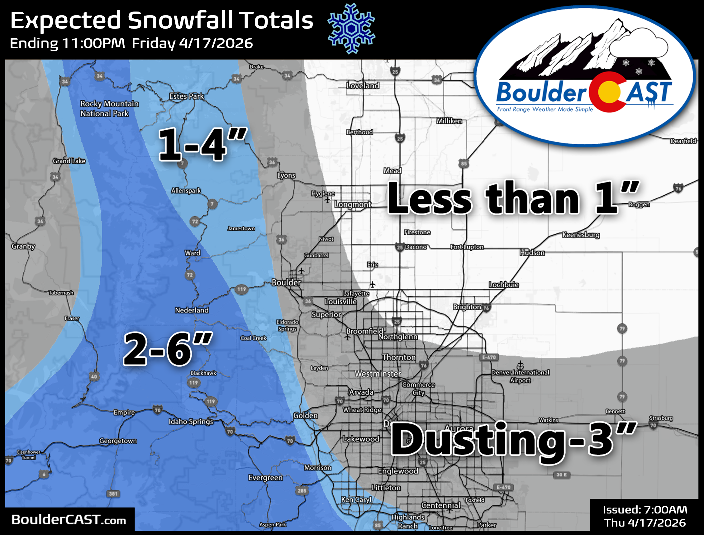
Most of this accumulation will occur on grassy and elevated surfaces, with roads remaining mostly just wet except under the heaviest bursts of snow Friday morning where brief snow-covered or slushy roadways may occur, mainly in the higher terrain. This isn’t a big enough event to cause any concern for leafed out trees—those will be just fine.
Then Comes the Hard Freeze
Arguably the most impactful part of this system arrives after the snow.
As skies clear Friday night and winds relax under subsident flow, temperatures will tank into the low–mid 20s — our first hard freeze since March 15th, the last time it snowed. Even with models backing off slightly on the cold (likely due to lesser snow on the ground), the probability of a hard freeze remains above 90%. You’ll definitely want to drain any above ground pipes, disconnect hoses, and cover or bring indoors your sensitive plants. No need to blow out entire irrigation systems. Hopefully you didn’t cave to the exceptionally warm weather so far this spring by planting your garden already like we’ve heard from a few folks that did!
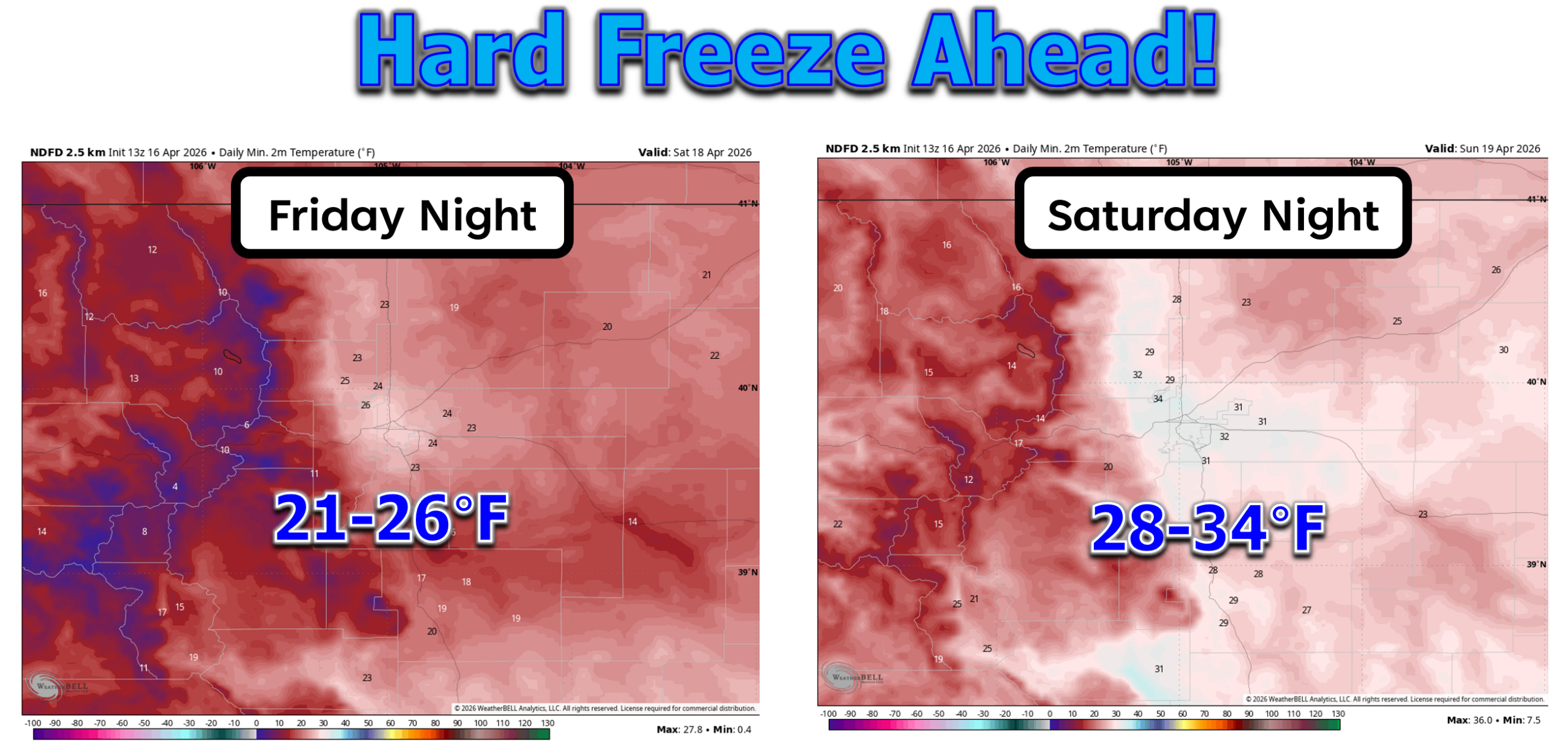
A secondary freeze, though perhaps not a hard one, will occur Saturday night into Sunday morning so you will want to keep those plants and pipes protected at least until the end of the weekend.
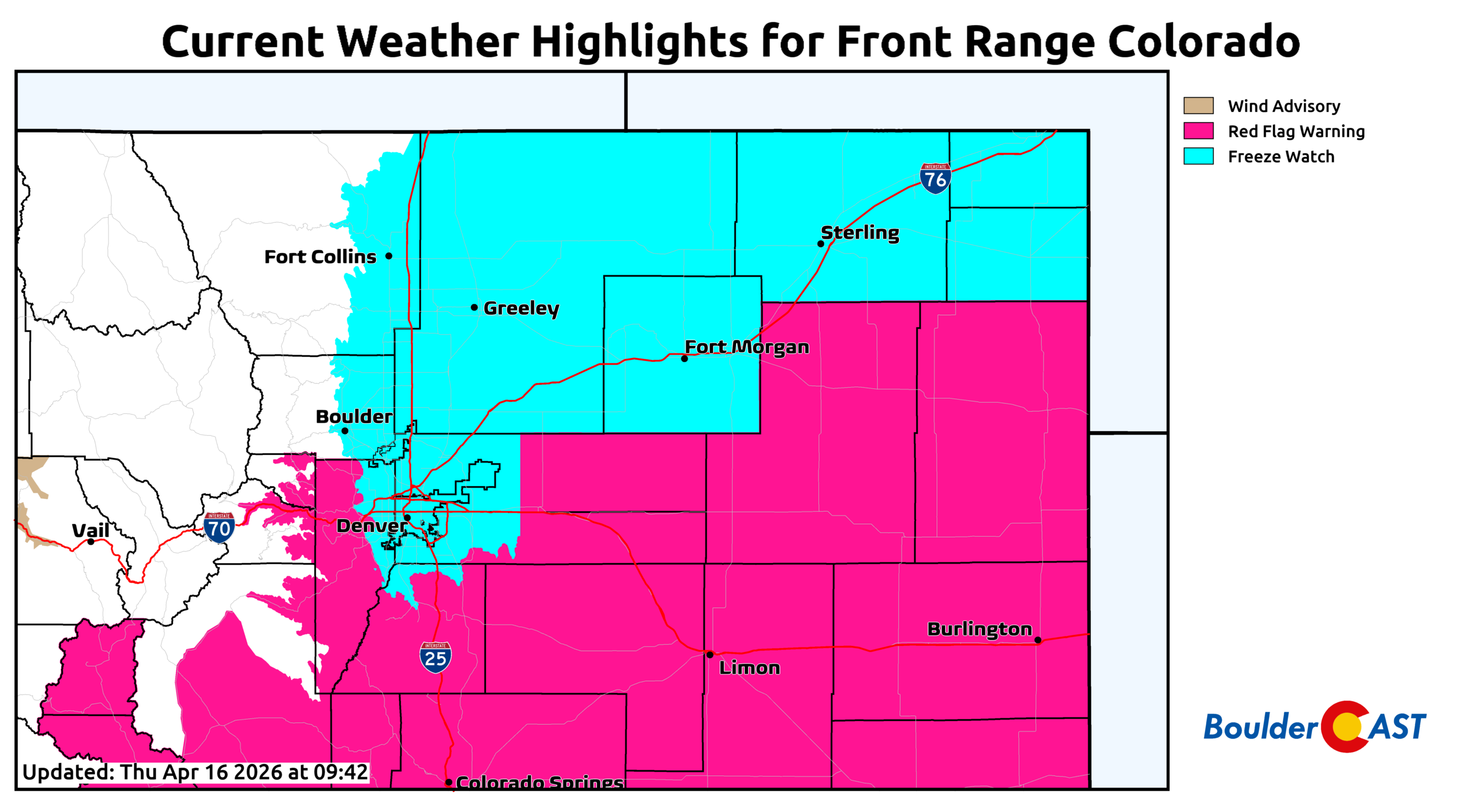
Red Flag Warnings for Thursday. Freeze Watches for Friday night into Saturday morning.
Weekend Outlook
The weekend ahead looks beautiful. Saturday stays chilly with highs in the 50s, but the warmup will be quick. By Sunday and Monday, temperatures rebound into the 70s to near 80°, returning us to well‑above‑normal territory.
Bottom Line
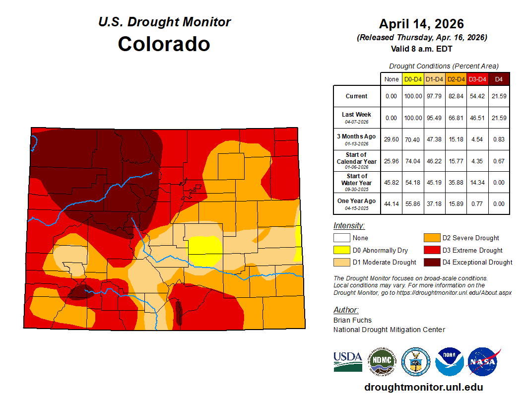
This storm will deliver some welcome moisture and a brief flash of winter, but it won’t make a meaningful dent in the region’s extreme drought. Grassy fuels will dampen for a couple of days, sure, but unless Colorado lands one or two major spring storms in the next six weeks, we’re still on track to enter summer with record‑low snowpack and the worst early‑season drought in more than two decades. The atmosphere just hasn’t shown any interest in producing the big-ticket moisture events we desperately need so far this spring, and both our water supply and air quality are poised to suffer in the months ahead. Real relief may have to wait for whatever the over‑hyped and uncertain “super El Niño” manages to deliver later this year.
Spread the word, share our crazy Colorado weather:
Go Premium, get all the perks.
Daily Forecast Updates
Get our daily forecast discussion every morning delivered to your inbox.
All Our Model Data
Access to all our Colorado-centric high-resolution weather model graphics. Seriously — every one!
Ski & Hiking Forecasts
6-day forecasts for all the Colorado ski resorts, plus more than 120 hiking trails, including every 14er.
Smoke Forecasts
Wildfire smoke concentration predictions up to 72 hours into the future.
Exclusive Content
Weekend outlooks every Thursday, bonus storm updates, historical data and much more!
No Advertisements
Enjoy ad-free viewing on the entire site.


You must be logged in to post a comment.