It’s been over six months now, but winter weather is finally set to return to the Front Range this weekend as the coldest air of the season shows up alongside several inches of fluffy snow. An interesting weather setup will have a stalled jet streak directly over Colorado Saturday evening seeding a lengthy period of scattered heavy snow bands. Snowfall amounts, while still somewhat uncertain, have trended upward and some of us could see up to a foot of snow this weekend! Read on for our latest thoughts on the storm, including when the heaviest snow will be around, how much accumulation to expect and just how cold it will get. We also reveal the entries to our 2023 First Snowfall Contest since a winner for that will surely be crowned this weekend!
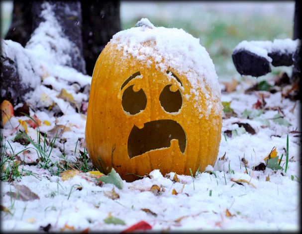
Finally, our first snow of the season!
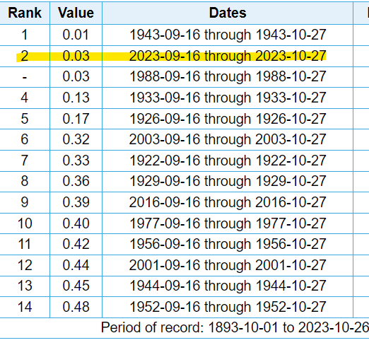
It has been more than six months now, but snow is finally on the way for the Front Range! It’s great to be saying that again! Especially since we are currently experiencing one of the driest autumn stretches on record. Only 0.03″ of rainfall has been observed here in Boulder since mid September — basically just a few spits here and there over the last eight weeks! This bone dry stretch will come to a conclusion this weekend, though. Even better — it’s ending due to the first snowfall of the season!
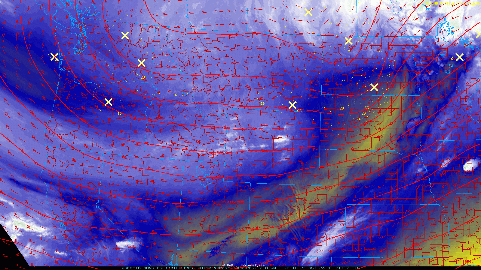
After one more cool and dry day on Friday, our weather will take a drastic turn as we head into the weekend with a stronger, colder storm system set to bear down on Colorado — you know, the one we’ve been discussing all week long. As of Friday morning, the system is already taking shape upstream across the Pacific Northwest, though it doesn’t look all that impressive in the current GOES-East water vapor animation below.
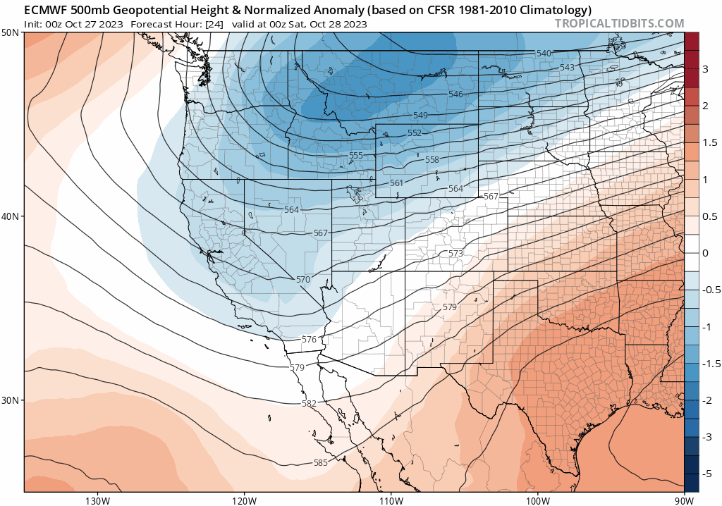
That timid trough across the West will continue to deepen as it slowly rakes across the Rockies in the days to follow, including taking its good old time to pass through the Denver Metro area this weekend. The Euro model’s 500mb height anomaly forecast animation below shows us how this trough is expected to evolve over the next few days. At first glance, there’s really nothing too remarkable about this trough. It comes south, stalls and pivots, and then heads eastward, never giving off formidable vibes in the process.
Despite its appearance, this trough is no lightweight, especially for Colorado which will end up square in the crosshairs of a nasty jet streak this weekend. Jet streaks are areas of faster winds in the upper atmosphere — a feature that allows narrow bands of heavy snow to develop under the right circumstances. And you guessed it, this weekend will be one such circumstance! Late in the day Saturday a jet streak will line up nicely across Colorado putting the Front Range in the favorable left-exit region for ~12 hours.
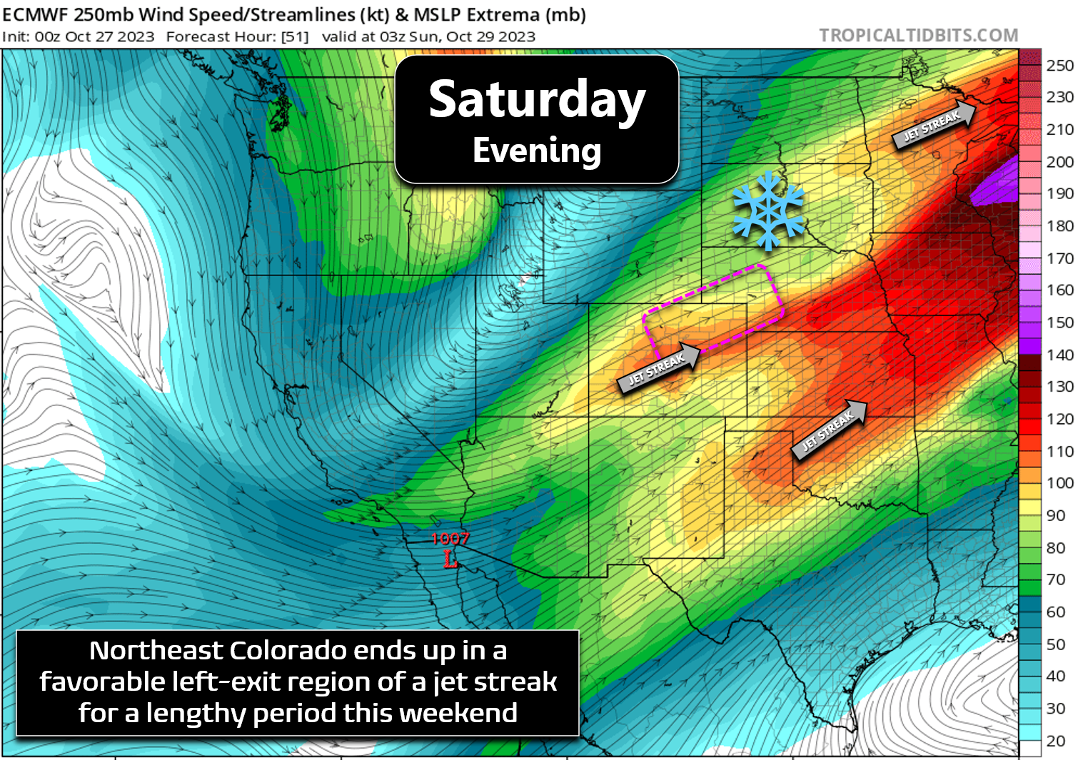
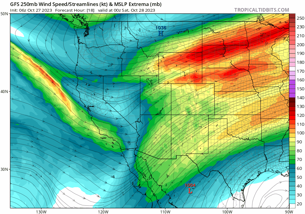
The animation below shows how that specific jet streak actually arrives. Interestingly, the jet that will end up fueling our snowfall here comes from way to the west, looping around the base of the trough. It has very little to do with massive stalled jet over the center of the country.
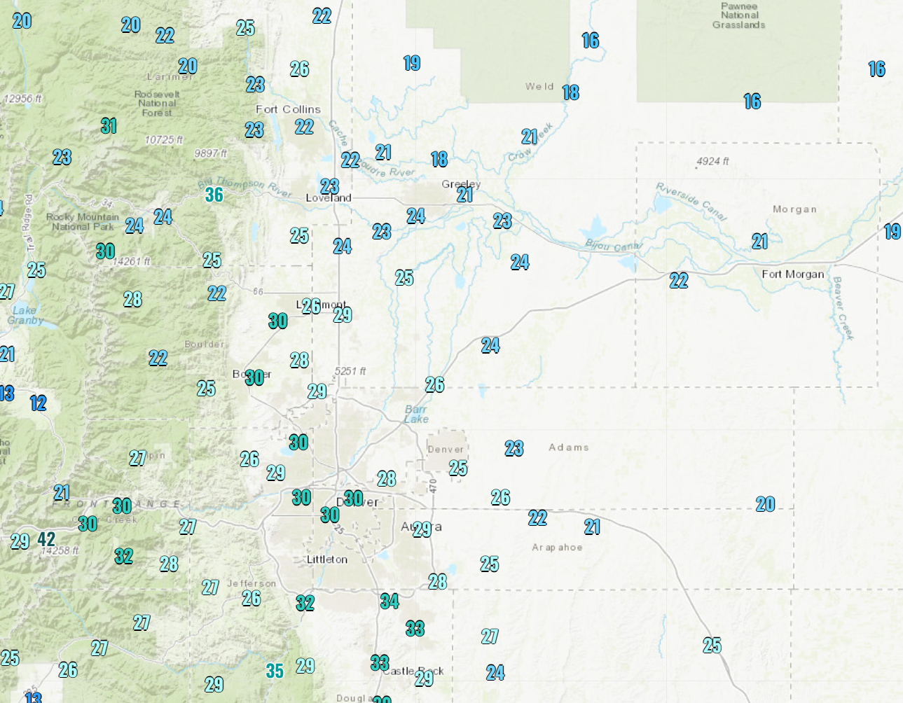
In addition to the favorable jet stream set up, this system is also coming packed with the chilliest air of the season so far. Even before it arrives, we’re already seeing our coldest morning right now in many cities. The morning low temperatures observed on Friday are shown below. 25° at DIA, ~30° in Boulder, 22° in Fort Collins, and teens further east on the Plains.
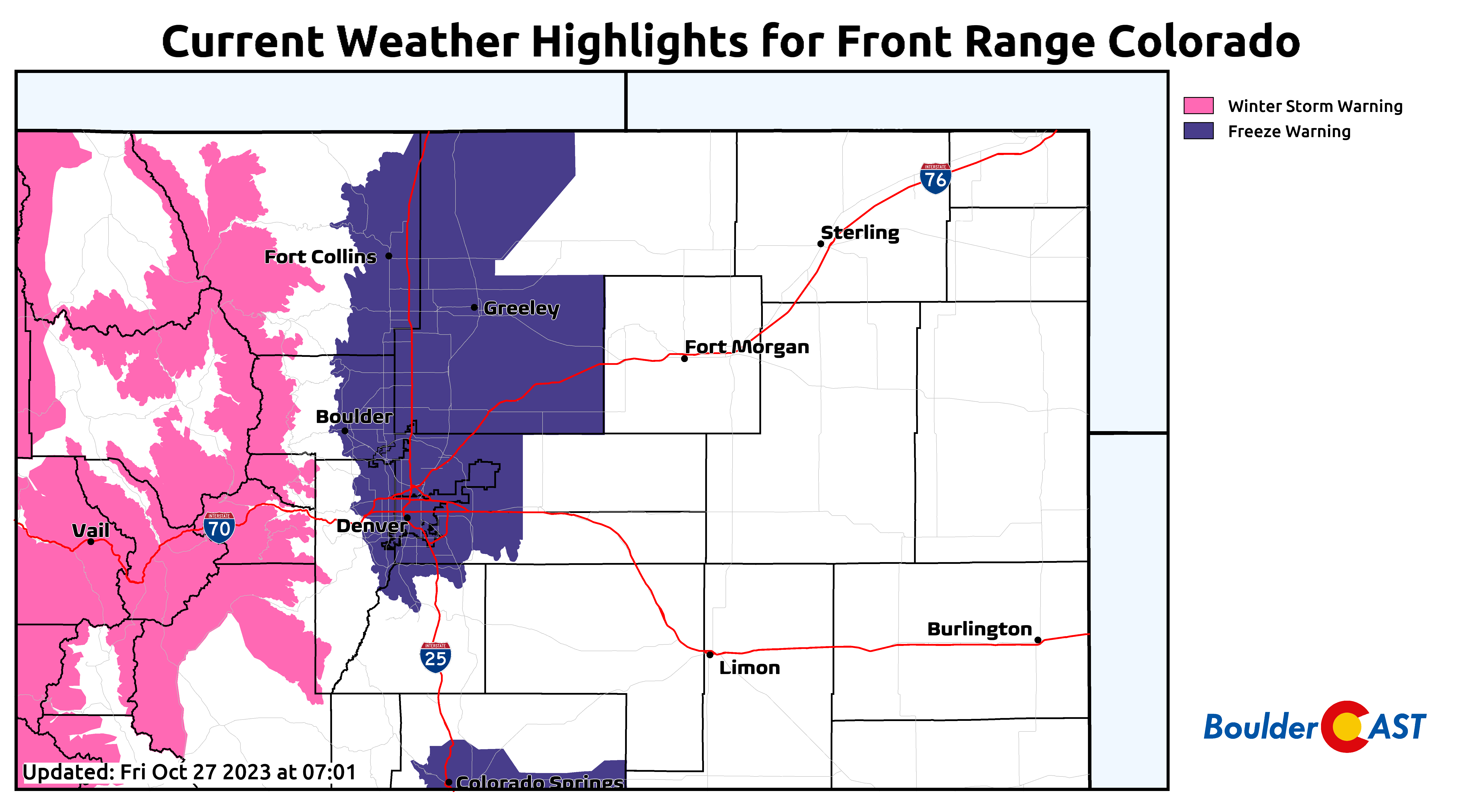
There were still a few parts of the Metro area yet to experience a true freeze to definitively end their growing season, but that discrepancy was conveniently resolved this morning. Thanks, Mother Nature!
The chilly start on Friday is only a taste of what’s to come! A cold Arctic airmass has been lingering up around Montana for the last week or more, but it just never had enough oomph to make it much further southward. The arriving trough and surface low pressure it forms will be enough to finally bring the cold air down into the Front Range on Saturday. The surface low is expected to form across southeast Colorado which will help to pull the cold air in from the north and northeast. This is shown in the graphic below for midday Saturday.
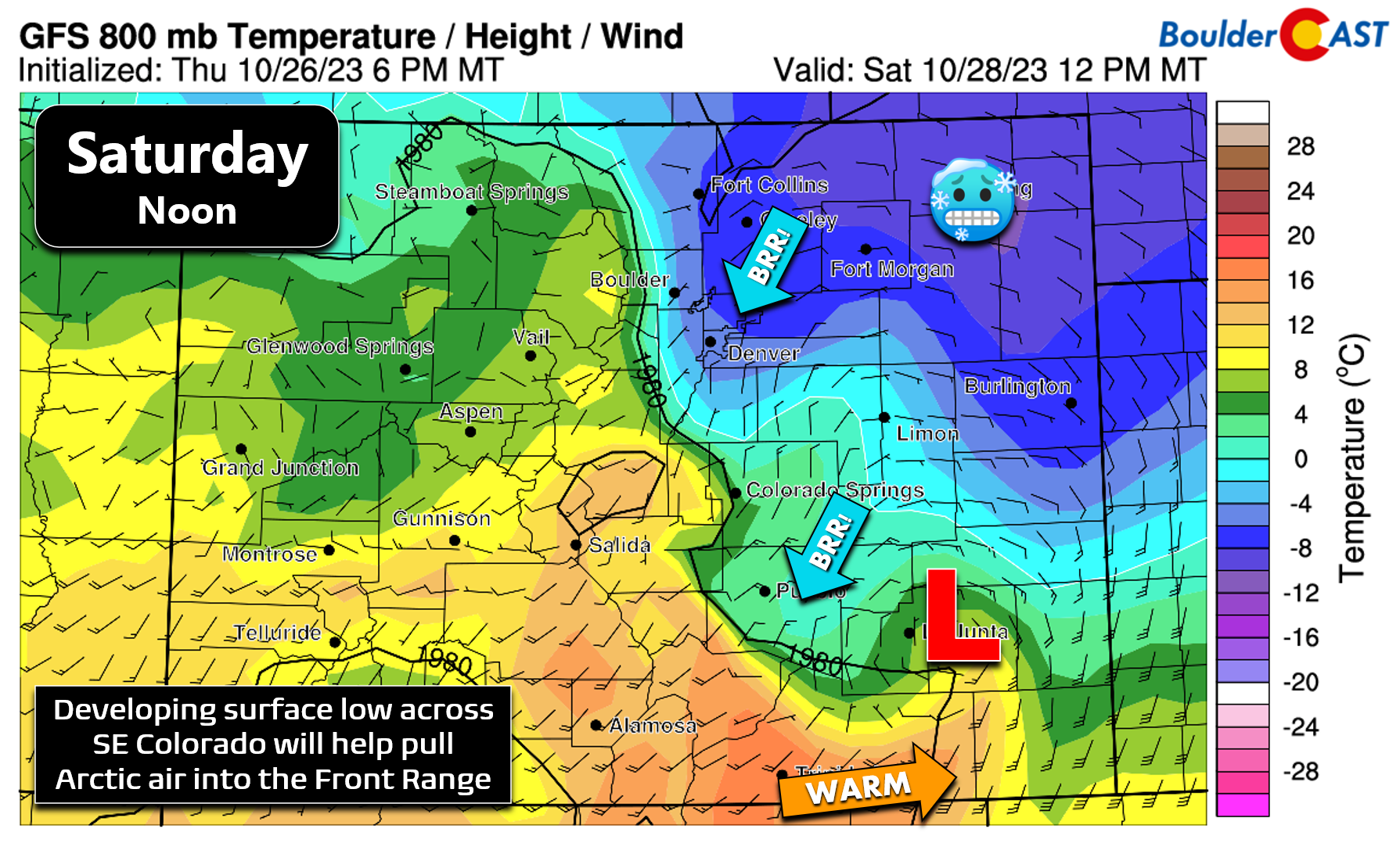
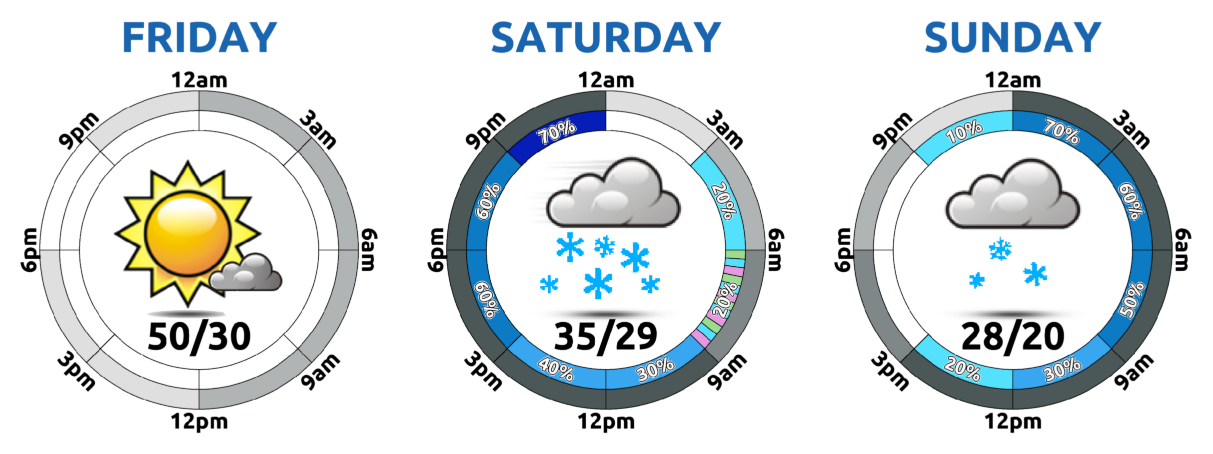
Saturday will be a cold affair overall with the high temperature for the day likely coming in the morning hours and landing somewhere around freezing. There won’t be a distinct “Arctic blast” (front) this weekend like often happens here this time of year. Instead, it will be a more gradual influx of increasingly colder air during the day Saturday this time. Temperatures will generally fall through the day into the lower 20s by evening. Saturday night we drop into the teens and highs on Sunday will be below freezing. So yes, a very hard freeze is on the way with temperatures possibly remaining below freezing for something like 60 consecutive hours (Friday night into Monday morning). Be sure to drain all your above grounds pipes, disconnect hoses, and harvest what remains from your garden. While not 100% required, a full winterization of irrigation systems wouldn’t be the worst decision right about now…
In terms of the snowfall forecast, it’s yet another tricky Front Range weather setup. We certainly do have a lot of good snowfall ingredients coming together this weekend:
- Cold air: Temperatures below freezing for the entire event means this will be all snow. No rain will spoil this winter party! Plus it will be cold enough for healthy snow ratios close to 15:1. Fluffier snow means deeper snow!
- Upslope: Northeasterly upslope flow across the Metro area will be in place all day Saturday into early Sunday. However, it’s not particularly deep or strong. There could be some very minor topographic enhancement on snow amounts on the west/south edges of the Metro, but overall it will be meager. This really isn’t an upslope event.
- Slow moving, pivoting trough: This will keep our area in prime position with broad but weak lift across all of Colorado Saturday into Sunday to mildly enhance snowfall potential
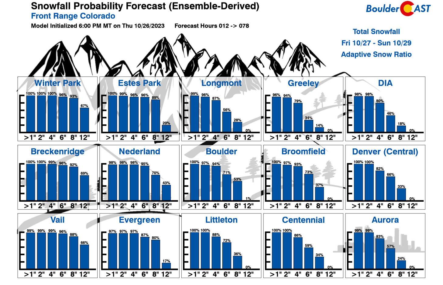
The key ingredient, and unfortunately that one that is also the most unpredictable, is the overhead jet streak. Their heavy snow bands have been advertised for many days now by the models — but their location has been less clear. Where exactly they form and move will ultimately make or break this snowfall event for most of us. Recent model trends have exhibited a slight southward shift in the banding. It was originally lining up over Boulder or even more northward, but now it is more squarely centered over the Front Range and Denver proper. This has led to an upward trend in our expected snowfall totals…
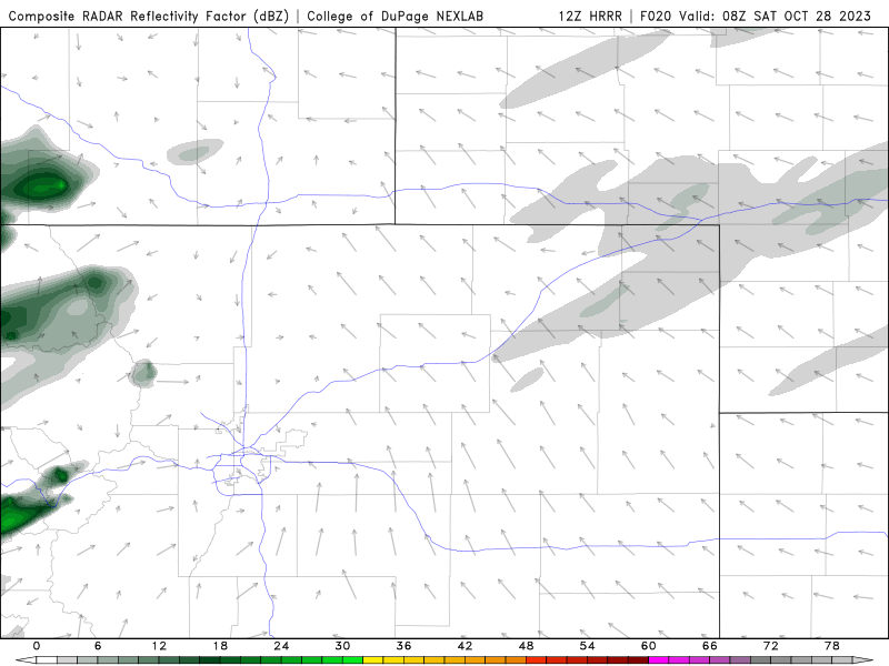
The Friday morning run of the HRRR model below gives us an idea where the bands may align — this is a radar reflectivity forecast. Basically everywhere from Cheyenne to Colorado Springs should get in on at least some banding this weekend. The focus is clearly over the Boulder-Denver area, though!
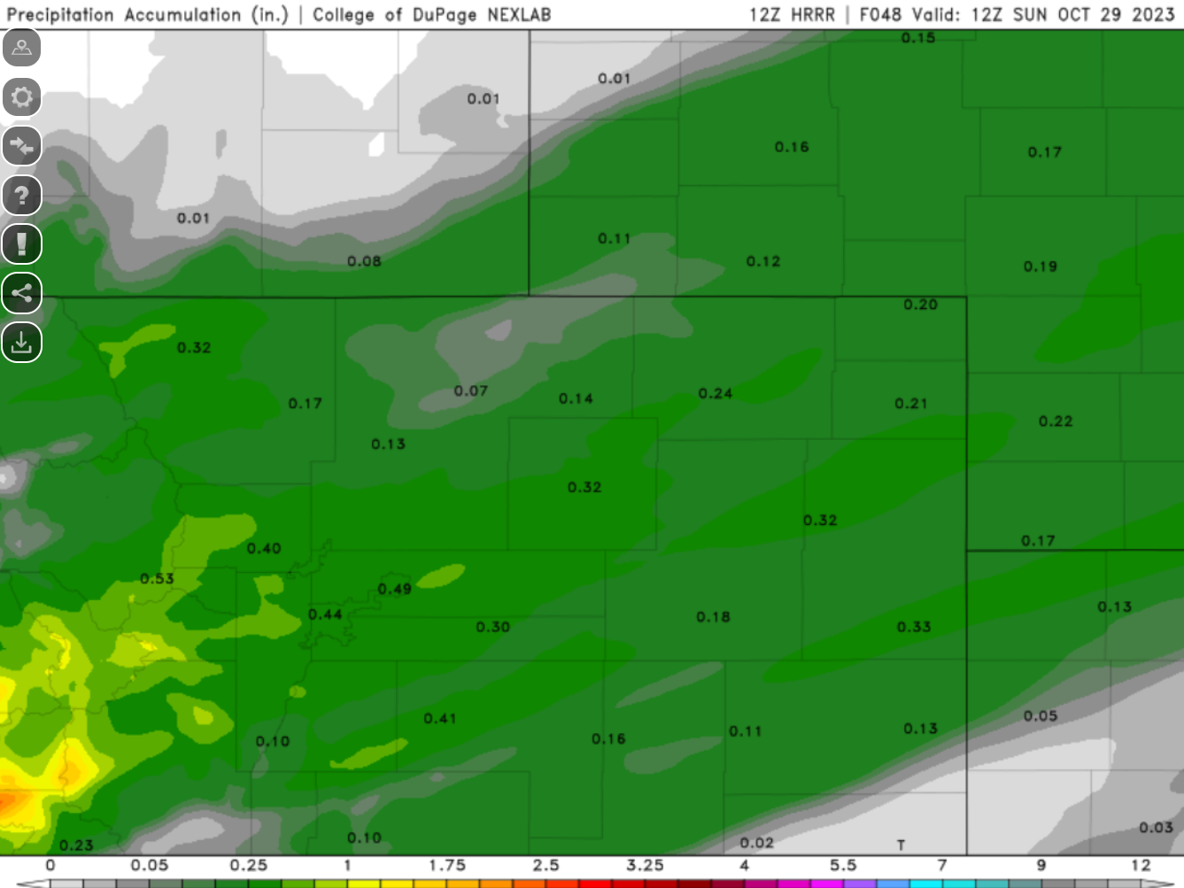
By Sunday morning, repeated hits from snow bands bring moisture totals close to 0.5″ over much of our area according to the HRRR. At the expected 15:1 fluffy snow ratio, this would be ~7″ of snow for our area.
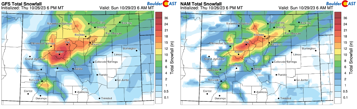
Global models are generally coming in a bit higher. In fact, both the GFS and NAM models have an impressive 0.75″ to 1″ swath of moisture dumping right over Denver.
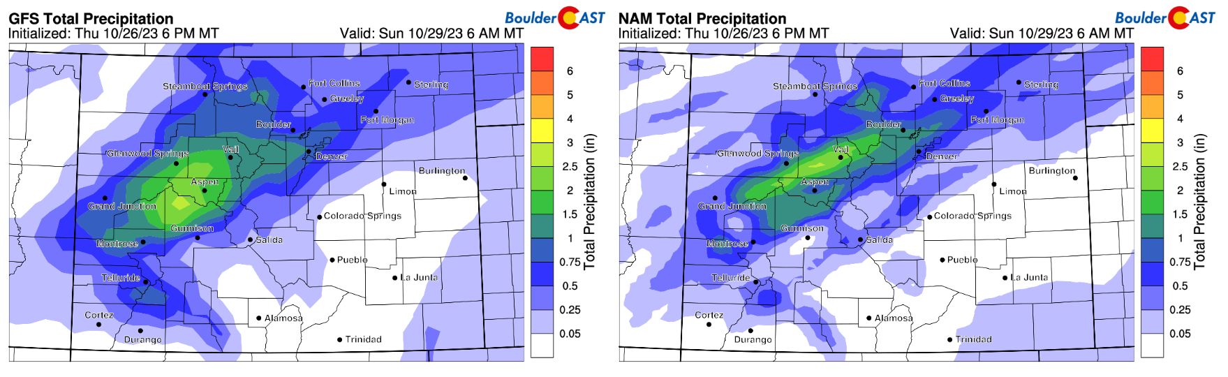
That amount of moisture would equate to around a foot of fluffy snow for the Metro area and that’s exactly what these models are predicting!
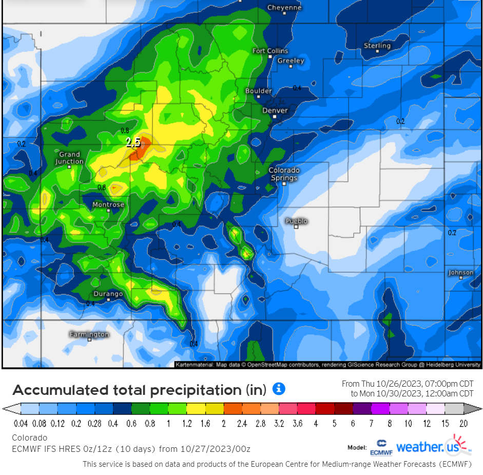
However, the generally very reliable European model is suggesting lesser totals, similar to the HRRR also around 0.5″ in our area. It’s ensembles are also very much clustered around 0.5″ putting more value in this forecast.
So as you can see, the overall forecast is still a tricky one with so much uncertainty regarding the heavier snow bands. However, considering the snow will be the fluffy kind and the fact that the favorable jet setup will persist for 12+ hours here remaining almost stationary, we are optimistic that our first snow of the season will be a fairly decent one!
Our snowfall forecast map for the event is shown below and is a blend of the impressive output we are seeing in the models and knowledge gained from similar past events. This forecast covers all snow falling through Sunday night. Basically we are predicting anywhere from 3 to 10″ of snow for the Denver Metro area and nearby Foothills, highest south and west. Locally up to 12″ will be possible in areas that see the most banding.
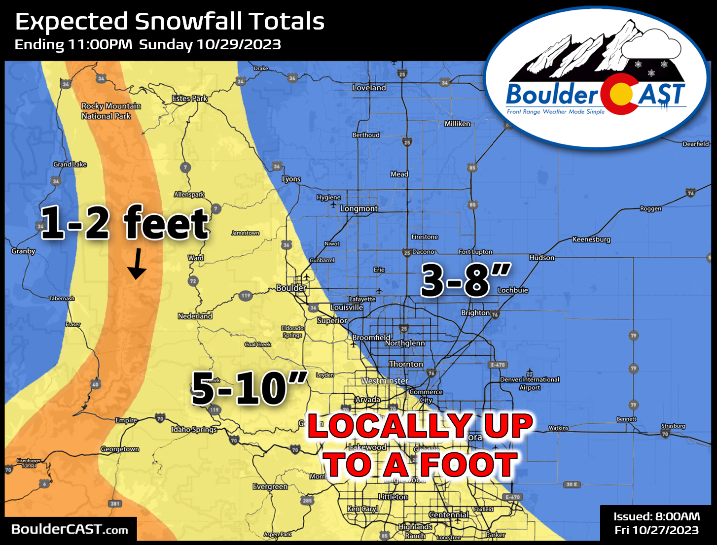
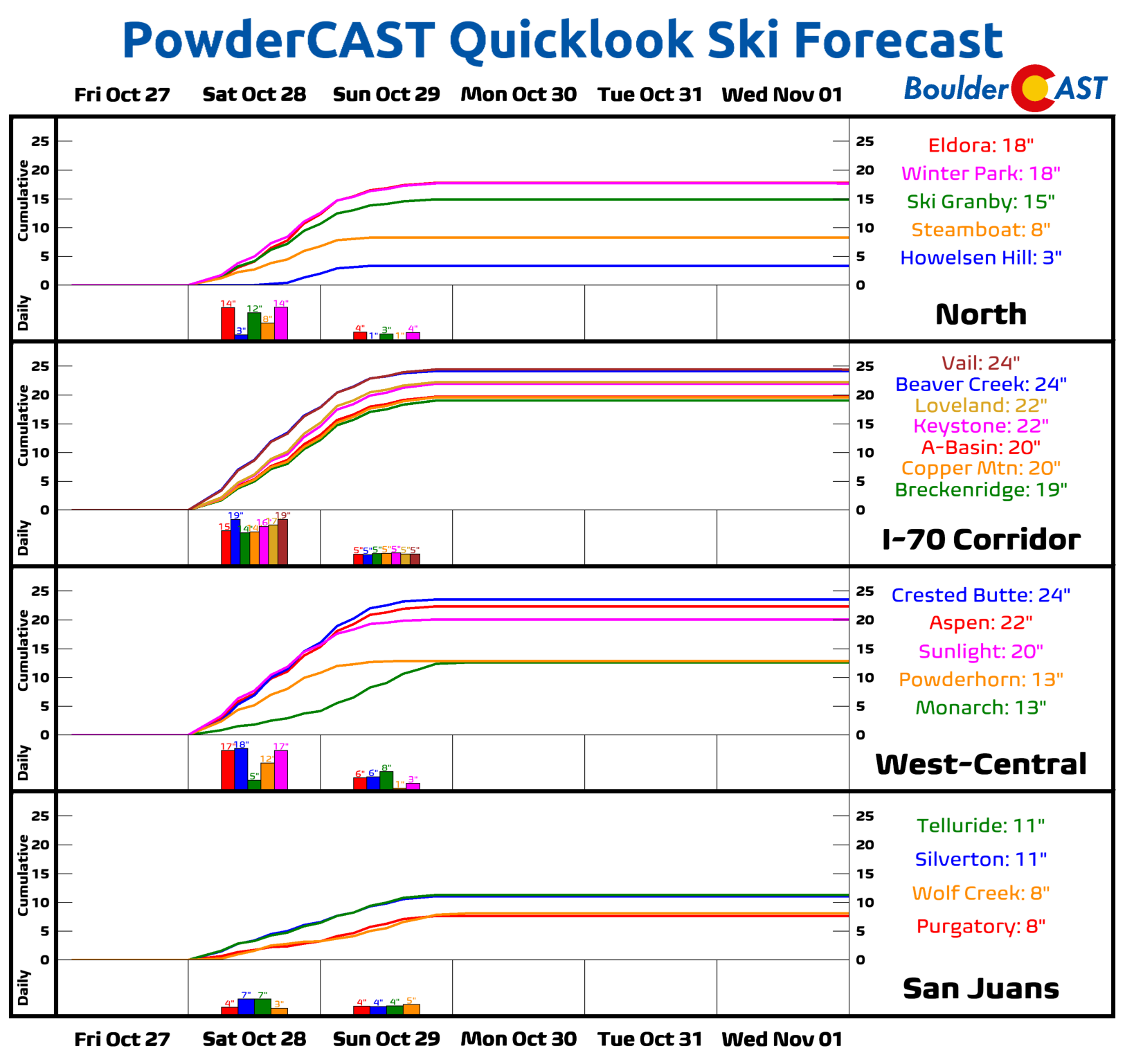
1 to 2 feet are expected in the high Mountains, including most of the ski resorts statewide. Use extreme caution if you are heading west this weekend and especially if over any passes. It will be much worse up there…a definite winter wonderland situation.
Our forecast map fits in well with our latest Snowfall Probabilities, dont you think?
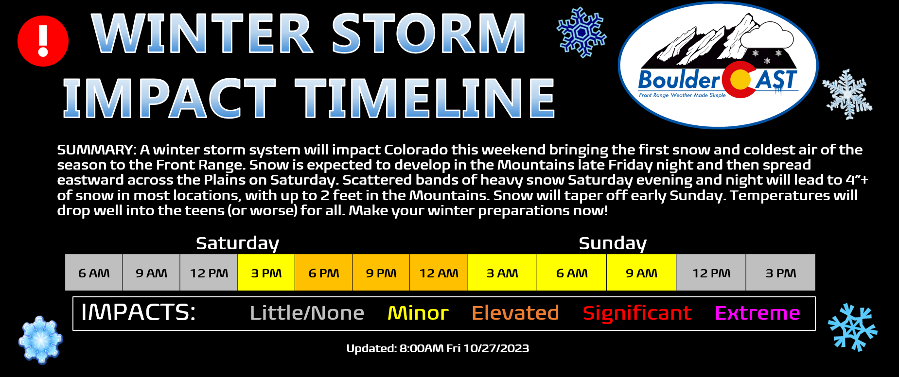
As for timing, snowfall will increase in the Mountains Friday night becoming heavy at times as southwest flow brings in decent Pacific moisture. During the day Saturday, snow will spread eastward across the Plains as temperatures cool and upslope ensues. Much of the day will be cold and gloomy with dry conditions, but the jet will be moving into position by afternoon with bands of heavy snow likely to begin overtaking the area. There could even be some spotty ones in the morning. This banding will increase in coverage and intensity Saturday evening before winding down overnight into Sunday morning. Many of the bands will contain 1-2″ per hour snowfall rates which will make for difficult travel around the region. Expect the worst travel conditions to be Saturday evening and night around the Metro area.
That’s all for now. We’ll continue to monitor the evolving forecast and pass along any updates here as needed. We’ll probably be refining our snowfall forecast map before this storm hits, so be sure to stay subscribed. The next section of this post covers our 2023 First Snowfall Contest entries as there will certainly be a winner crowned this weekend. Feel free to check it out below even if you don’t have any skin in the game!
Get BoulderCAST updates delivered to your inbox:
First Snowfall Contest: May the best forecaster win!
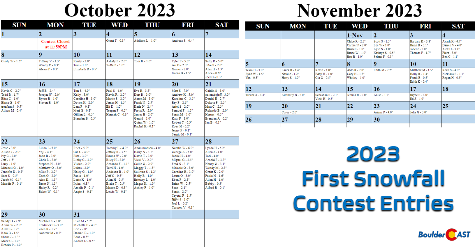
n the announcement post for this contest, we offered a little insight by providing a few of Boulder’s “first snow” statistics. More than 250 of you came up with “educated” guesses for the timing and amount of Boulder’s first snow of the 2023-24 winter season. All of the entries are contained in the calendar view below (click to enlarge):
SUMMARY OF SCORING:
Those who come closest to the actual date of Boulder’s first MEASURABLE SNOW (defined as snowfall at or above 0.1″) win! For verification, we’ll go off the official Boulder climate station located at the NIST building in south Boulder. Only the first calendar date of snow will be used (i.e. if the first snow event spans two days, only the amount of the first day will count). In the event that multiple participants select the same date, the tie-breaker of snowfall amount will be used.
SUMMARY OF PRIZES:
The prizes for the contest are as follows:
- 1st place: 12-month Premium subscription + $30 Amazon Gift Card
- 2nd place: 6-month Premium subscription + $10 Amazon Gift Card
- Anyone who guesses within 1 day OR 0.1″ correct: 2-month Premium subscription
- All other entries: Virtual “pat on the back”
2023 First Snowfall Contest prizes and recognition will be awarded in the days following our first dumping of snow which looks like it will either be October 28th or 29th, based on the latest forecast!

Go Premium, get all the perks.
Daily Forecast Updates
Get our daily forecast discussion every morning delivered to your inbox.
All Our Model Data
Access to all our Colorado-centric high-resolution weather model graphics. Seriously — every one!
Ski & Hiking Forecasts
6-day forecasts for all the Colorado ski resorts, plus more than 120 hiking trails, including every 14er.
Smoke Forecasts
Wildfire smoke concentration predictions up to 72 hours into the future.
Exclusive Content
Weekend outlooks every Thursday, bonus storm updates, historical data and much more!
No Advertisements
Enjoy ad-free viewing on the entire site.
Enjoy our content? Help us out and give it a share:


You must be logged in to post a comment.