
Much-needed light rain and snow showers fell across the area on Sunday, the first precipitation many of us have seen in over two weeks. The period ahead will unfortunately not continue that trend with mostly dry conditions and above normal temperatures expected to close out the month of April. We are watching a potential storm around the Friday timeframe. Once again it looks to offer wind and elevated fire danger, but sadly little in the way of precipitation. Read on for our full outlook of the weather week ahead.
This week’s highlights include:
- Welcomed rain and snow showers fell across the area on Sunday — breaking a two week dry spell
- Staying cool on Monday with clouds and sun
- Warm and mostly dry Tuesday through Thursday as a ridge sets up just east of Colorado
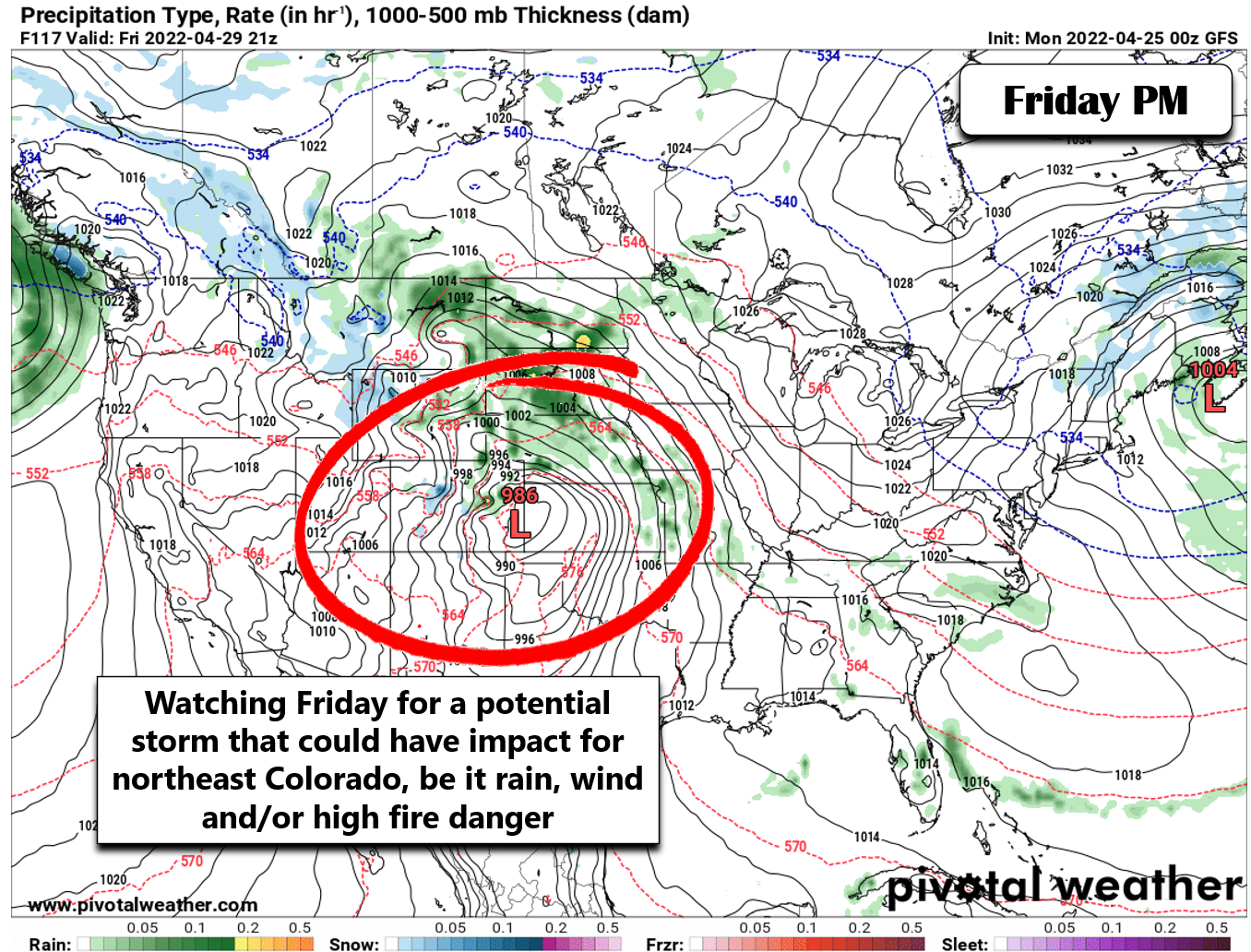
- A late-week storm could bring light rain to the area, but as usual it looks to be more of a wind-producer raising fire concerns once again
- This will be our first snowless April since 1992 in Boulder — with potentially the earliest final snowfall on-record up for grabs as well
- Sorry skiers — the outlook for additional Mountain snow is bleak, too
DISCLAIMER: This weekly outlook forecast is created Monday morning and covers the entire upcoming week. Accuracy will decrease as the week progresses as this post is NOT updated. To receive daily updated forecasts from our team, among many other perks, subscribe to BoulderCAST Premium.

Finally it rained (and snowed!)
For the first time in two weeks, we miraculously had some precipitation fall from the sky Sunday across the Denver Metro area. Most of what fell was west of Interstate 25 as deep northeasterly flow focused the developing showers westward towards the terrain. It was mainly light rain across the lower elevations, but some of you may have seen a few snowflakes mixing in as well in the more intense showers. Higher up, snow did accumulate up to several inches in the Foothills and the Mountains.
It looks like winter this afternoon in western Boulder County. Snow is falling above 7500 feet right now #cowx pic.twitter.com/n01NascdfM
— BoulderCAST Weather (@BoulderCAST) April 24, 2022
Breckenridge skiers were treating to as much as 8 inches of fresh snow this morning!
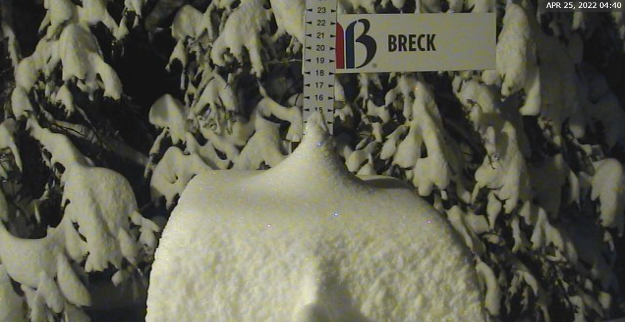
Monday morning view from Breck — 8 inches of new snow!
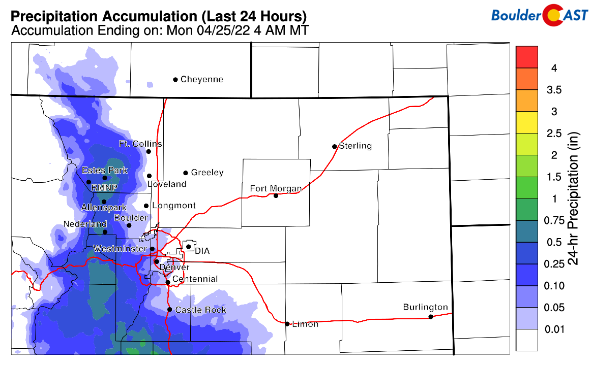
Overall less than 0.05″ fell across the Plains for the most part, but up to a half inch was noted in the higher Foothills.
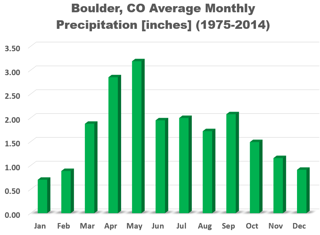
For Boulder, this was the first measurable precipitation we’ve seen in exactly two weeks. We don’t yet know how much rain officially fell last night. However, up until yesterday, this April had only managed to produce 0.12″ of precipitation in Boulder, the driest for the city since 2002. Denver has only seen 0.01″ this month, the all-time driest start to an April on record. This is particularly disheartening as April should be our second wettest month of the year with around 2.8″ of precipitation occurring on average. Considering how dry both March and April have been for us, we really need to turn a corner soon or the neverending threat of wildland fires will only get worse heading into the summer season.
Dry the rest of April
Unfortunately the week ahead doesn’t look to offer much of a reprieve in the form of any precipitation for the lower elevations at least. Similar to the large-scale pattern the last several weeks, the storm track will remain just a bit too far north. We still have some weather to talk about this week, just nothing that will be all that fruitful for the Front Range…
We begin the week with the disturbance responsible for yesterday’s showers pushing off to the east. Like many before it, the main storm system is located way up north of the Great Lakes in Canada, with just a weak trailing trough stretching back into Colorado. Notice the dipping height lines from Minnesota into New Mexico signifying the trough in the GOES-East infrared satellite animation below.
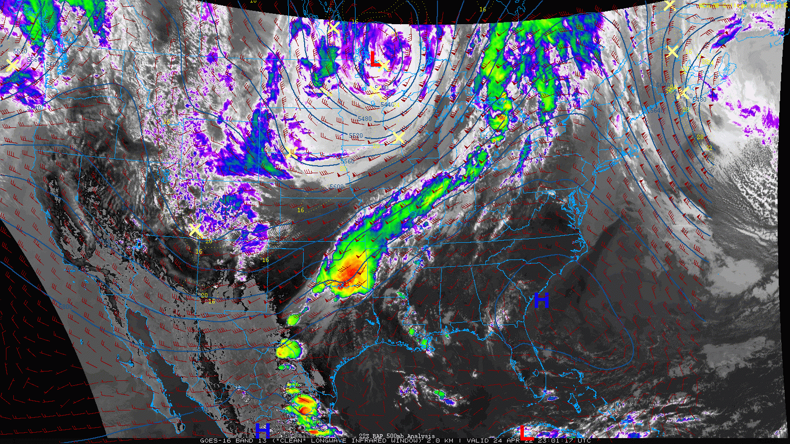
GOES-East infrared satellite animation from early Monday morning (4/25/22)
The leading cold front with this system is trekking eastward across the entire country on Monday and will raise a threat of severe weather in a narrow swath the Canadian border to the Mexican border through the afternoon and evening.
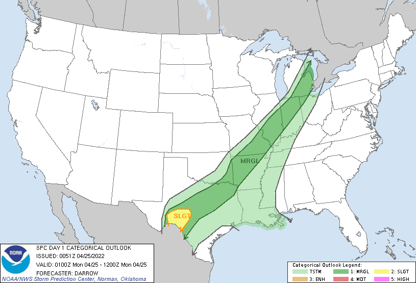
Severe weather outlook for Monday from the SPC
Across Colorado, there will be a few lingering light rain and snow showers and plenty of clouds early Monday morning. This will clear out quickly though as high pressure builds into the area from the west with the return of sunshine. Highs on Monday will reach the upper 50s with decreasing cloudiness.
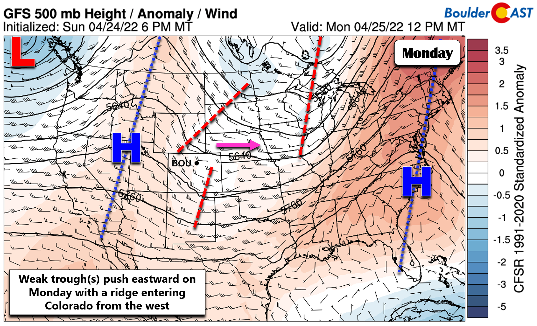
The aforementioned ridge will be the main weather player for us this week as it moves east and stalls out across the center of the country for several days ahead. This will put Colorado upstream from the ridge with generally warm and dry southwest flow over our area. Highs will jump accordingly into the middle to upper 70s Tuesday through Thursday. The only minor concern will be a very weak southern-track disturbance that moves across the state late Wednesday. This could fire off a few showers and storms depending on what time of day it moves through. These would mainly be across the Mountains or way out across the Plains, with the Denver area likely remaining entirely dry.
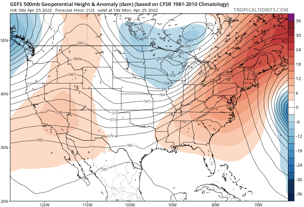
GEFS ensemble mean 500mb height anomaly forecast animation through Thursday night
Late in the week the ridge will breakdown and progress eastward as another storm system makes eventual progress across the northern Rockies. Overall models show this system taking the same northern track we’ve seen too many times of late. The good news is that both the Euro and GFS models do have some measurable precipitation across northeast Colorado and the Mountains. However, it’s unclear if the Front Range will be included as downslope could rule the roost again. We’ll end the week on Friday a tad cooler with highs dropping into the lower 70s. The late-week storm will likely also be accompanied by increased winds and associated fire concerns. It’s too early to say for sure, but Friday is definitely a potential candidate for Red Flag Warnings across portions of eastern Colorado.
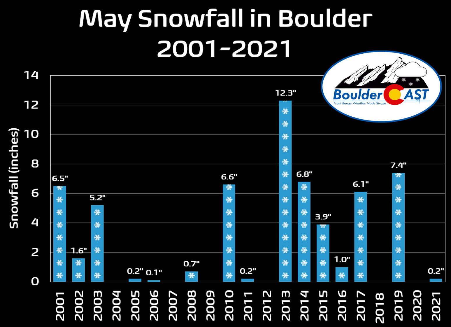
Temperatures won’t be cold enough late week for snow across the lower elevations anyways. Whatever falls, if anything, will be in the form of rain. At this point, it’s almost a guarantee that April will end snowless in Boulder, the first time that’s happened in 30 years. We’re also well-positioned to see our earliest last measurable snowfall on record. The last time we’ve seen snowflakes stick was way back on March 21st. May isn’t a typically very snowy month for us, but we usually do see snow at least one time (see graphic below). Whether that ultimately happens in this black sheep of snow year remains to be seen, however.
Forecast Specifics:
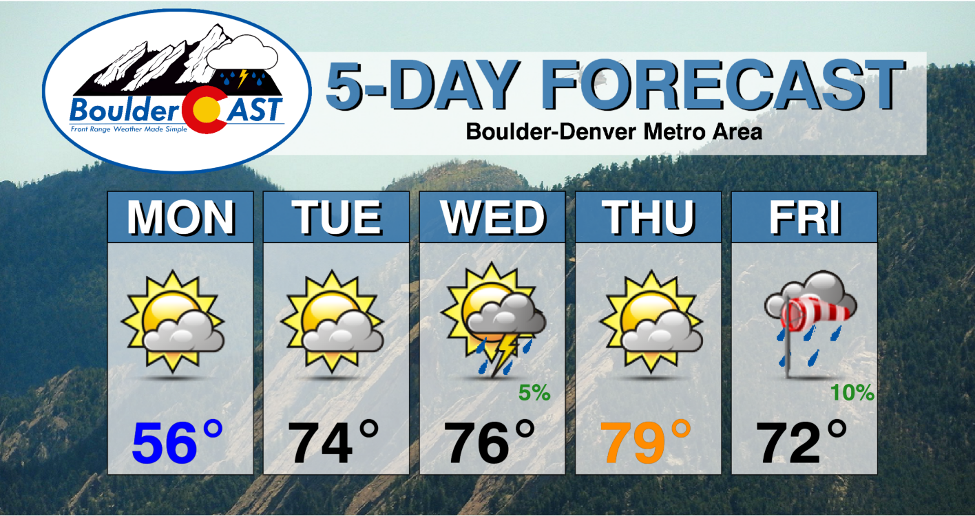
Monday: Decreasing clouds and staying cool. A slight chance of a late-day shower in the Foothills. High temperatures in the middle to upper 50s for the Plains with lower 40s in the Foothills.
Tuesday: Partly cloudy and much warmer with highs in the middle 70s across the Plains with lower 60s in the Foothills.
Wednesday: Partly to mostly cloudy with a slight chance of a late-day thundershower, mainly across the higher terrain. Temperatures reach the middle 70s on the Plains with lower 60s in the Foothills.
Thursday: Partly cloudy with very isolated late day storms, mainly across the higher terrain and east of Denver. Highs in upper 70s across the Plains and in the middle 60s in the Foothills.
Friday: Mild and breezy with a slight chance of showers. Fire danger will be elevated if not critical across portions of eastern Colorado. Highs in the lower 70s across the Plains with lower 60s in the Foothills.
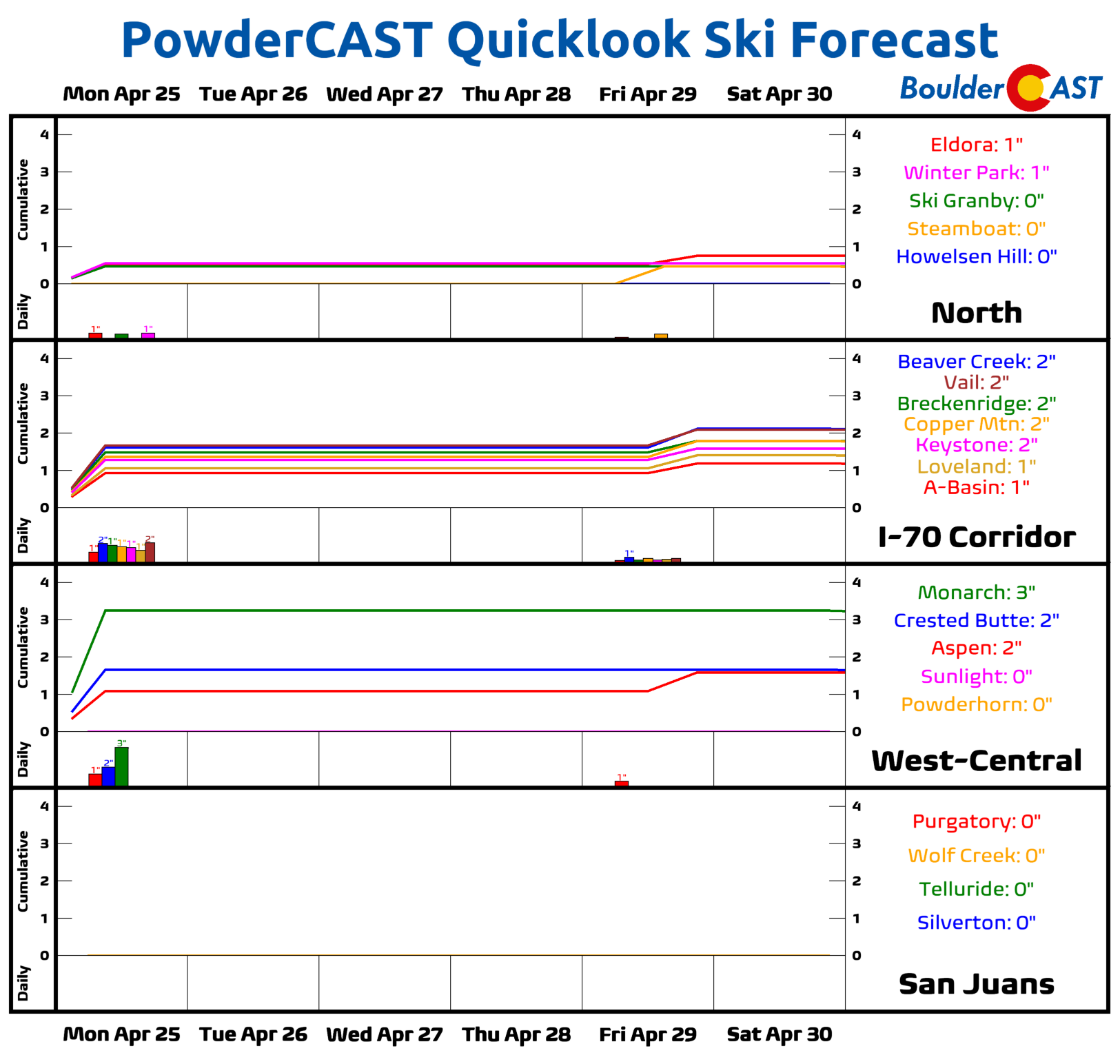
Mountains: The best chance to see accumulating snow in the Mountains this week comes early Monday morning before the weak system quickly departs eastward. Just an additional inch or two is expected in the Mountains along and south of Interstate 70. The rest of the week will be fairly warm in the High Country with just isolated thunderstorms Wednesday through Friday. The outlook for additional snowfall in the ski resorts is bleak.
Help support our team of Front Range weather bloggers by joining BoulderCAST Premium. We talk Boulder and Denver weather every single day. Sign up now to get access to our daily forecast discussions each morning, complete six-day skiing and hiking forecasts powered by machine learning, first-class access to all our Colorado-centric high-resolution weather graphics, bonus storm updates and much more! Or not, we just appreciate your readership!
Spread the word, share the BoulderCAST forecast!


