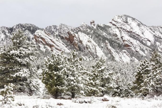
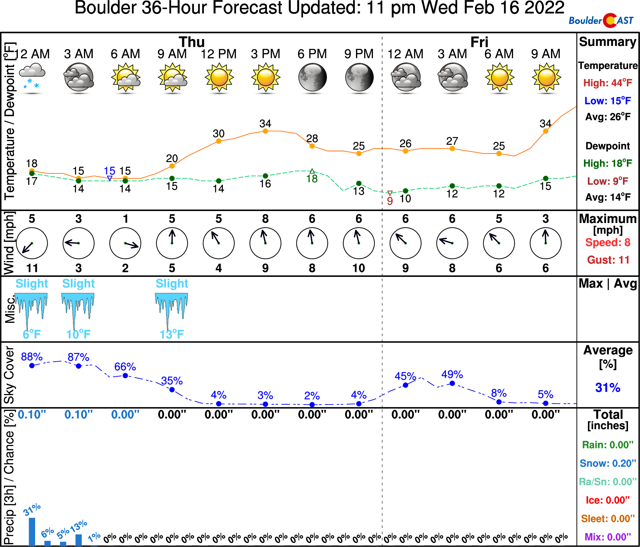
The incredibly snowy start to 2022 continued with yet another snowstorm across the Front Range last evening. The storm played out as we expected with up to 10″ of snow falling in some locations. Let’s take a look at both the storm and seasonal snowfall totals and the current status of the drought. We also peek ahead to the next Arctic blast targeting Colorado early next week.
We discuss Boulder and Denver weather every single day on BoulderCAST Premium. Sign up today to get access to our daily forecast discussions every morning, complete six-day skiing and hiking forecasts powered by machine learning, access to all our Front Range specific weather models, additional storm updates and much more!

At a Glance:
- Snow arrived just in time to make for a treacherous evening commute on Wednesday
- The snowstorm played out as expected with generally 3 to 10″ of snow falling across the Front Range
- Unbelievably, Boulder now has well above normal snowfall for the season thanks to the incredibly snowy start to 2022
- The drought situation has improved considerably across the area, with Boulder now not technically in a drought according to the US Drought Monitor
- We’re already tracking a major Arctic outbreak for eastern Colorado early next week with frigid temperatures and more snow likely
L
ight snow arrived right on schedule Wednesday during the afternoon hours and ramped up just in time for the evening commute. Initially the heaviest snow was focused right over Denver and areas to the south. The radar animation below ends at 5:30PM — smack in the middle of the PM commute window.
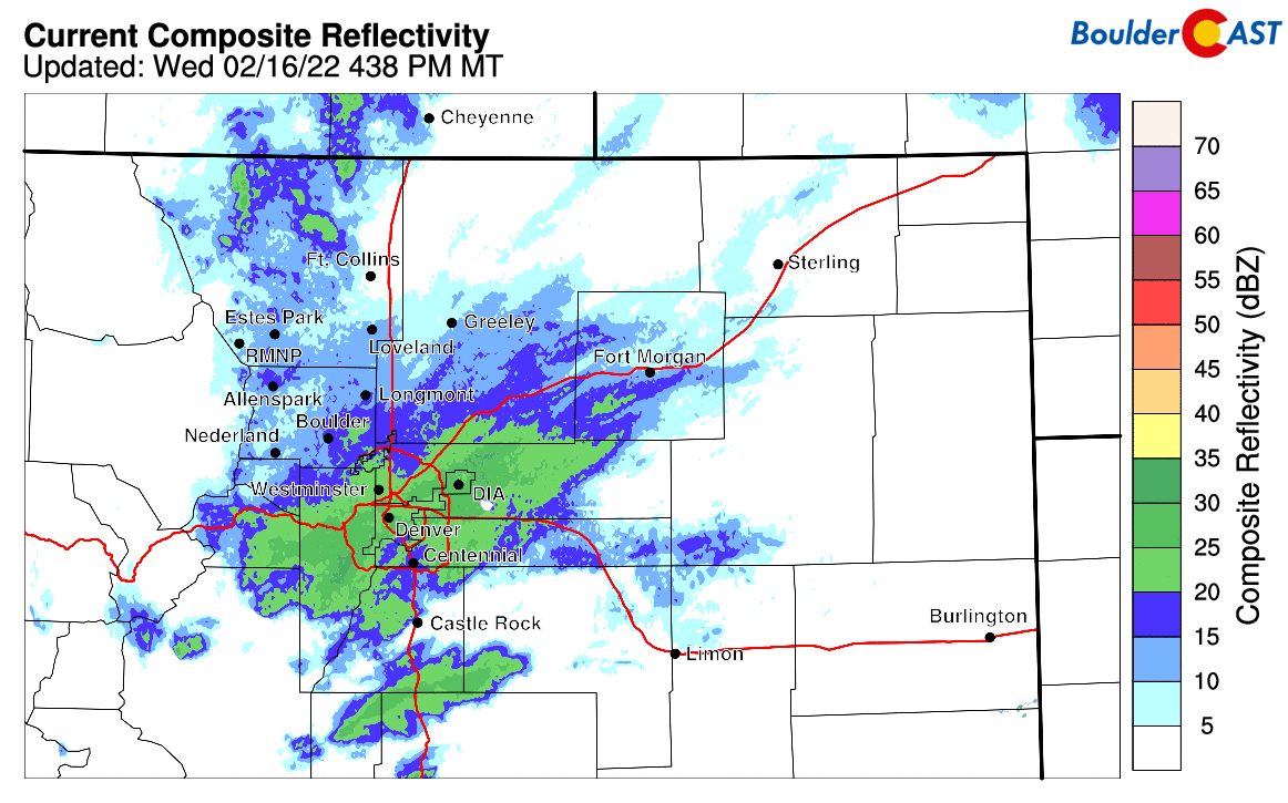
Radar animation ending at 5:30PM on Wednesday 2/16/22. Heavy snow was dumping on Denver during the PM commute.
A plethora of accidents were reported and for a while I-70 westbound was closed heading out of Golden due to safety concerns as heavy snow fell just to the west.
Full Closure Westbound I-70 at C470, mp 260. All traffic being diverted to C470.
US 40 through Mt Vernon Canyon is also closed.Southbound US 285 at Morrison has opened but travel is difficult.
Avoid heading west for a few hours please. S1 https://t.co/hGfvnQgTlP pic.twitter.com/JSpPKIhlDw
— CSP Golden (@csp_golden) February 17, 2022
Later in the evening the more intense snow became focused in and near the Foothills as a surge of low-level upslope ensued. Notice the linear radar enhancement occurring in the below animation stretching south out of Boulder parallel to the Foothills interface. This is the feature we were counting on all along to deliver the highest totals in and near the Foothills. It did eventually materialize for a short while, but wasn’t a major player in this storm’s output. After the very snowy evening, things wrapped up right on schedule a few hours after midnight.
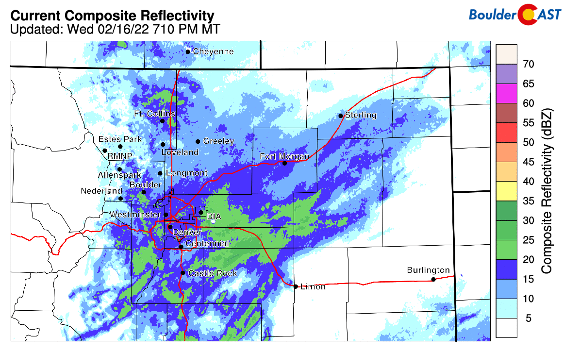
Radar animation ending at 8:00PM on Wednesday 2/16/22. Upslope terrain enhancement is occurring in the lower Foothills, evidenced by the linear feature stretching southward from Boulder.
Our snowfall forecast map for the event issued Wednesday morning is shown below with storm totals overlaid. Green numbers indicate our forecast verified to within 1″. Red did not. As you can see, anywhere from 2 to 10″ of snow fell across the entire area with excellent forecast verification. The heaviest dumping occurred in the Foothills of Jefferson and Boulder Counties. Boulder officially reported 7.3″ of snow, while Denver received 5.0″ a DIA (with a little less downtown).
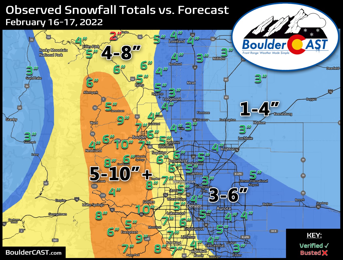
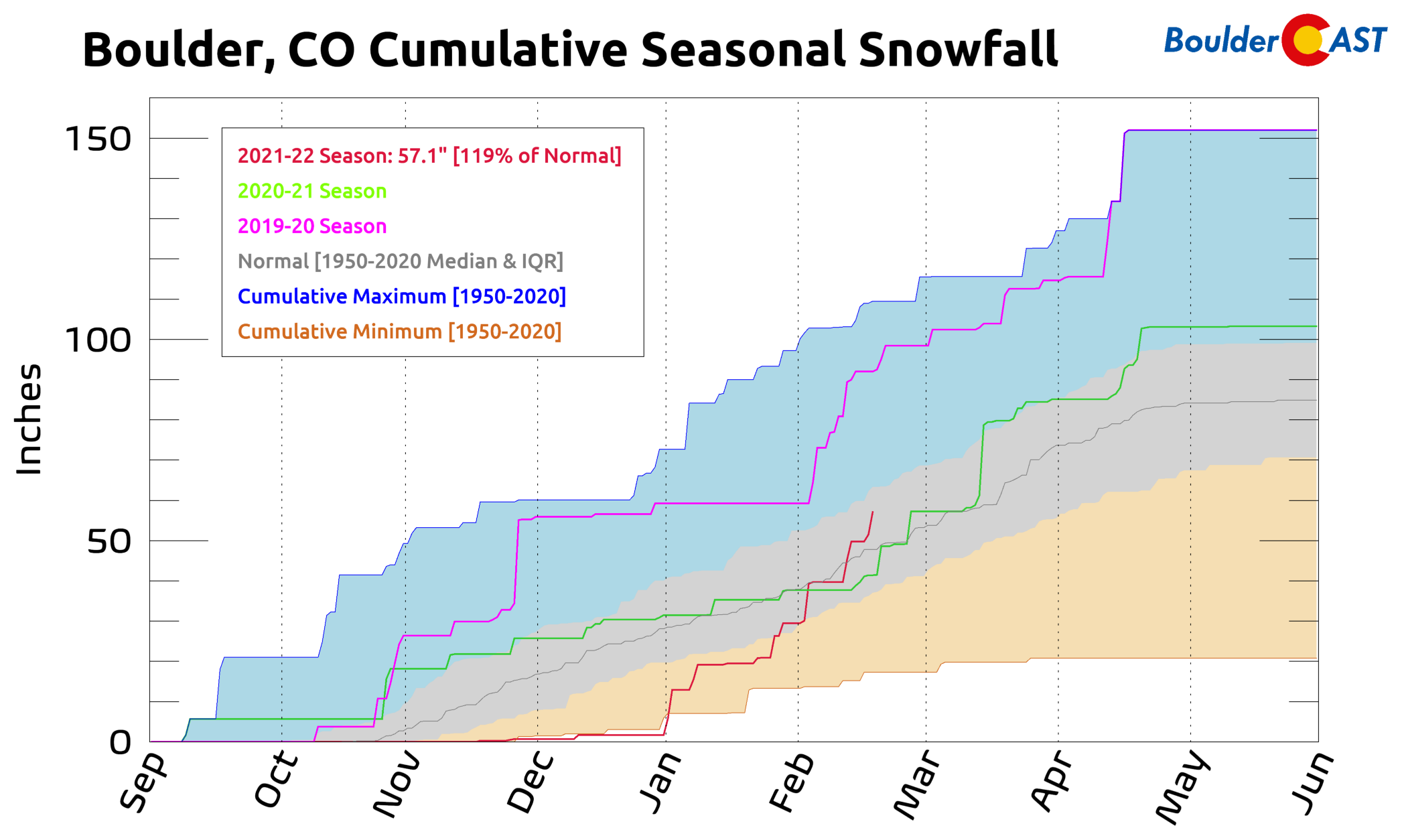
This brings our seasonal snowfall totals to 57″ and 30″ in Boulder and Denver, respectively.
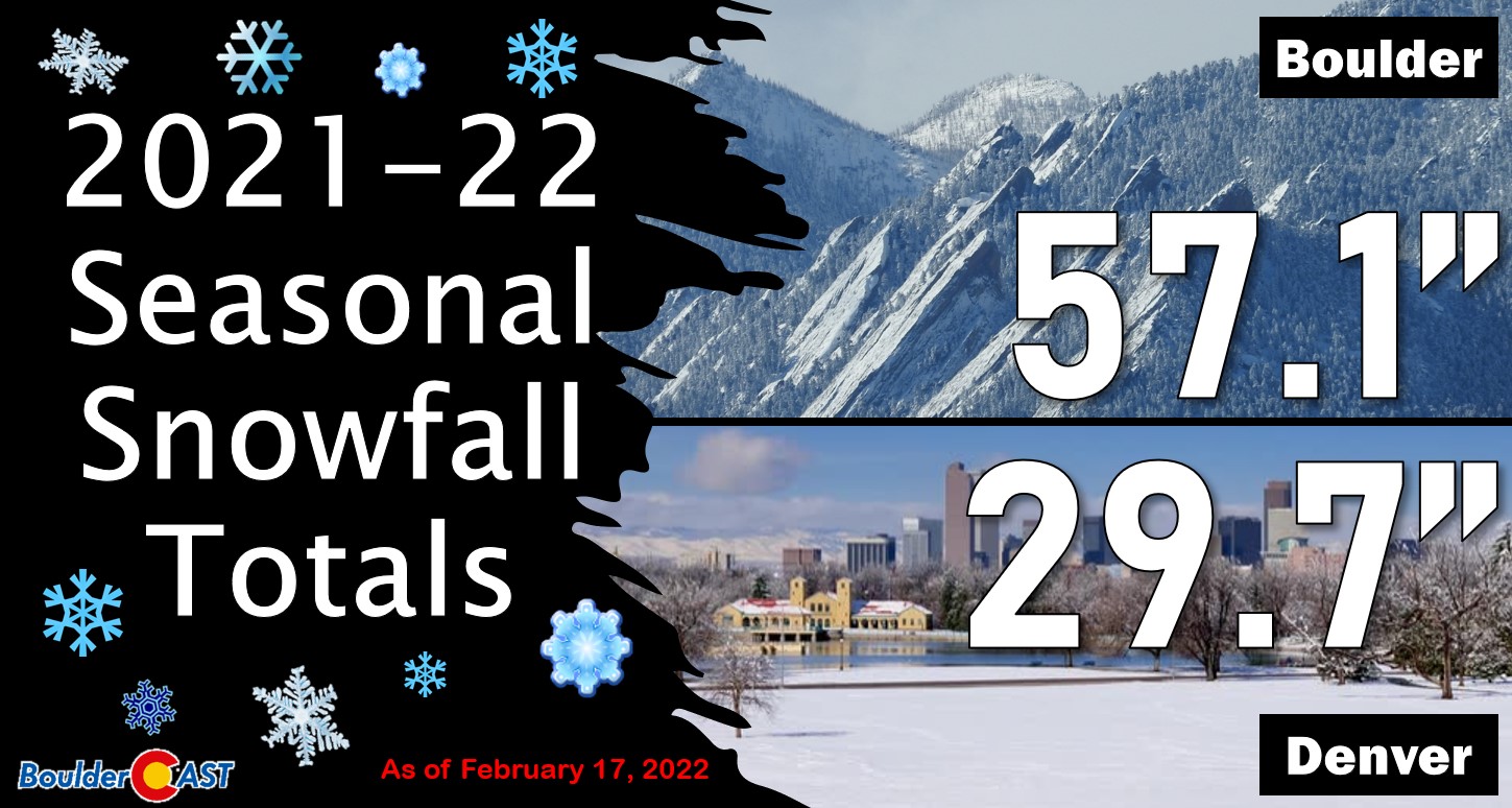
This is the snowiest we’ve ever started a calendar year in both Boulder and Denver. Boulder now has received 119% of the normal snowfall-to-date for the season, with almost all of that falling since New Year’s Eve.
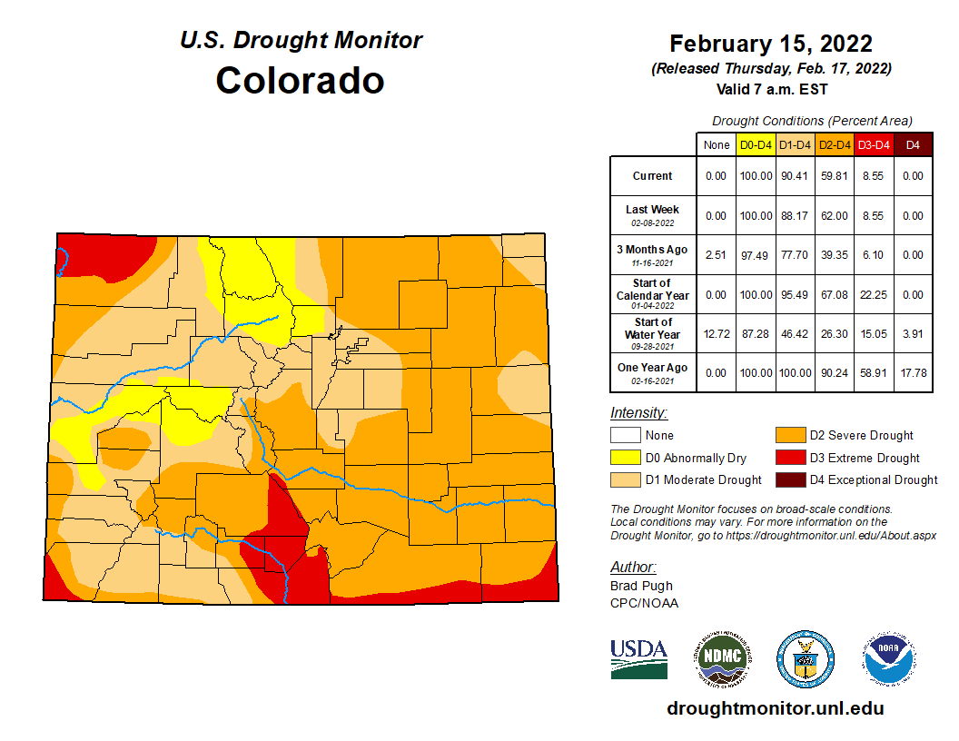
We really can’t stress enough how incredible this record-setting stretch has been for our area and the impact it is having on the ongoing drought. We’ve already seen most of northeast Colorado drop one or two drought classification categories over the last few weeks. In fact, the city of Boulder is no longer technically in a drought — we’ve been downgraded to just Abnormally Dry (D0) by the United States Drought Monitor. We’re hopeful to see more improvement in the coming weeks!
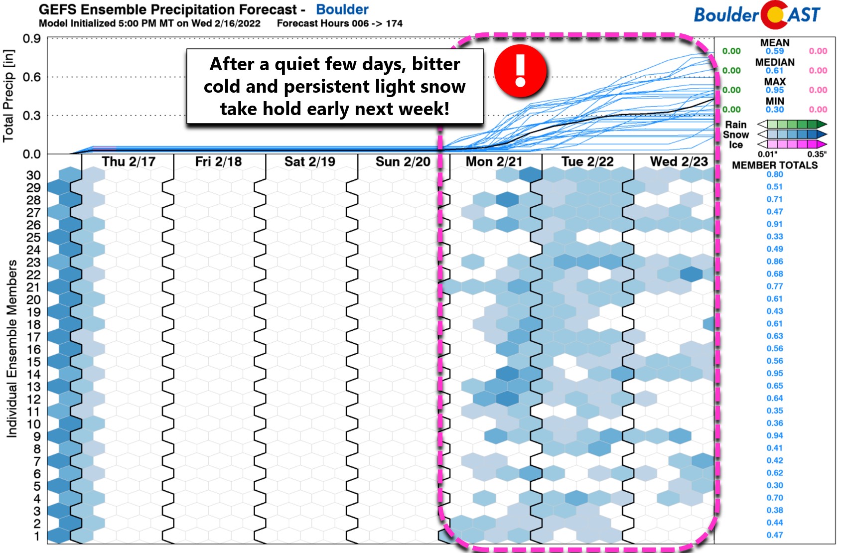
More cold and snow in the works?
A quiet rest of the week and weekend lies ahead, but we’re already seeing strong indication from all the weather models for a major Arctic outbreak to hit eastern Colorado early next week. This bitter cold Canadian airmass will usher in frigid temperatures and unsettled conditions capable of producing light snow spread across multiple days for the Front Range.
We talked more about what will transpire during this next Arctic blast in our Premium Weekend Weather Snapshot posted earlier this morning.
That’s all for now. Enjoy the fresh snow and cold temperatures. Skies will be turning sunny very soon!
We discuss Boulder and Denver weather every single day on BoulderCAST Premium. Sign up today to get access to our daily forecast discussions every morning, complete six-day skiing and hiking forecasts powered by machine learning, access to all our Front Range specific weather models, additional storm updates and much more!
.
Spread the word, share Colorado’s crazy weather:


You must be logged in to post a comment.