⦁❶⦁ A mountain wave will lead to widespread gusty winds today, strongest in and near the Foothills in excess of 50 MPH
⦁❷⦁ Mostly sunny on Tuesday with highs in the middle 50s
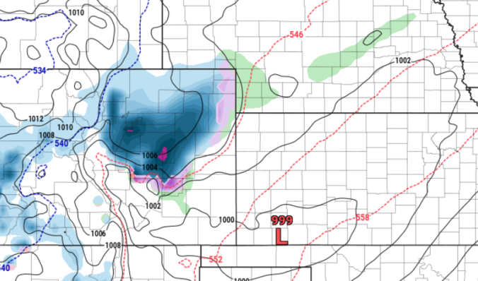
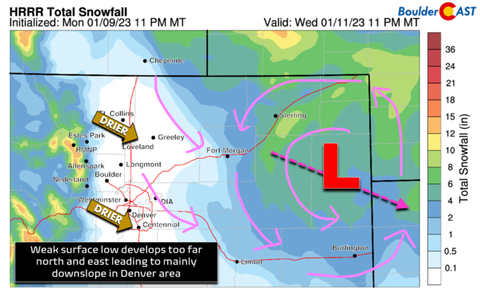
⦁❸⦁ A storm system races across the state on Wednesday, but develops in an unfavorable location too far north and east for Denver — snow chances are not great
⦁❹⦁ Much cooler on Wednesday in the 30s with a slight chance of snow showers — 0 to 1″ of accumulation possible on the grassy surfaces