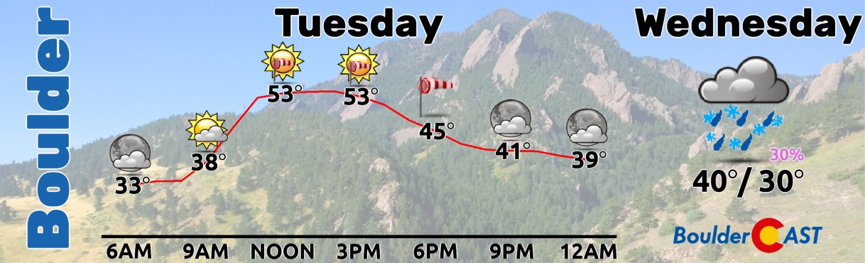
⦁❶⦁ A mountain wave will lead to widespread gusty winds today, strongest in and near the Foothills in excess of 50 MPH
⦁❷⦁ Mostly sunny on Tuesday with highs in the middle 50s
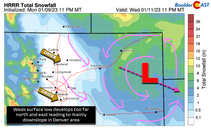
⦁❸⦁ A storm system races across the state on Wednesday, but develops in an unfavorable location too far north and east for Denver — snow chances are not great
⦁❹⦁ Much cooler on Wednesday in the 30s with a slight chance of snow showers — 0 to 1″ of accumulation possible on the grassy surfaces
Do you want the latest BoulderCAST Daily forecast discussion delivered to your inbox every single morning? If so, join BoulderCAST Premium where we talk Boulder and Denver weather every single day.

C
urrent temperatures are already varied out there this morning due to the intrusion of warmer downslope flow in some areas. For example, southern parts of Boulder area in the lower 50s as of 7AM this morning, but the northern parts are in the mid to upper 30s. It’s even colder up towards Longmont and areas east in the South Platte River Valley in the teens.
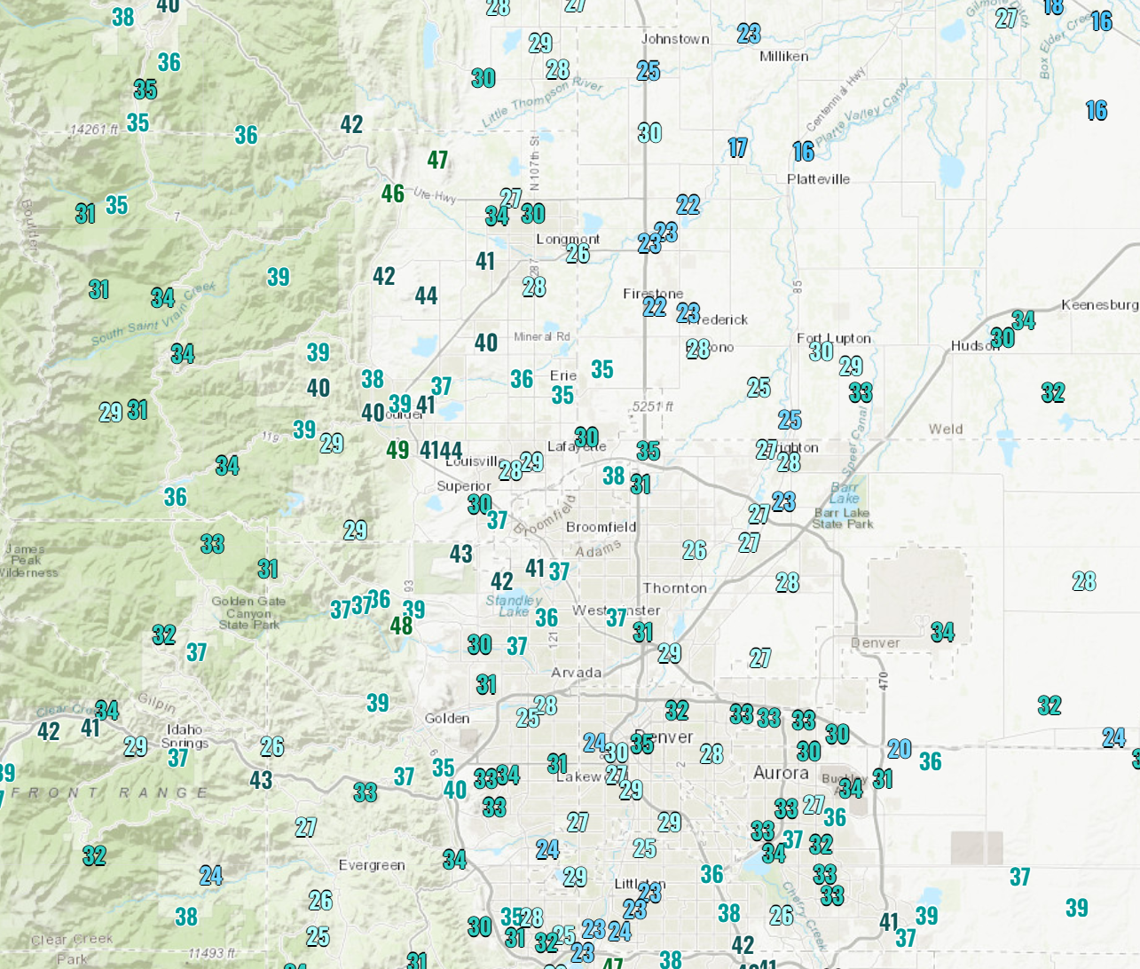
Front Range temperatures as of 6AM this morning
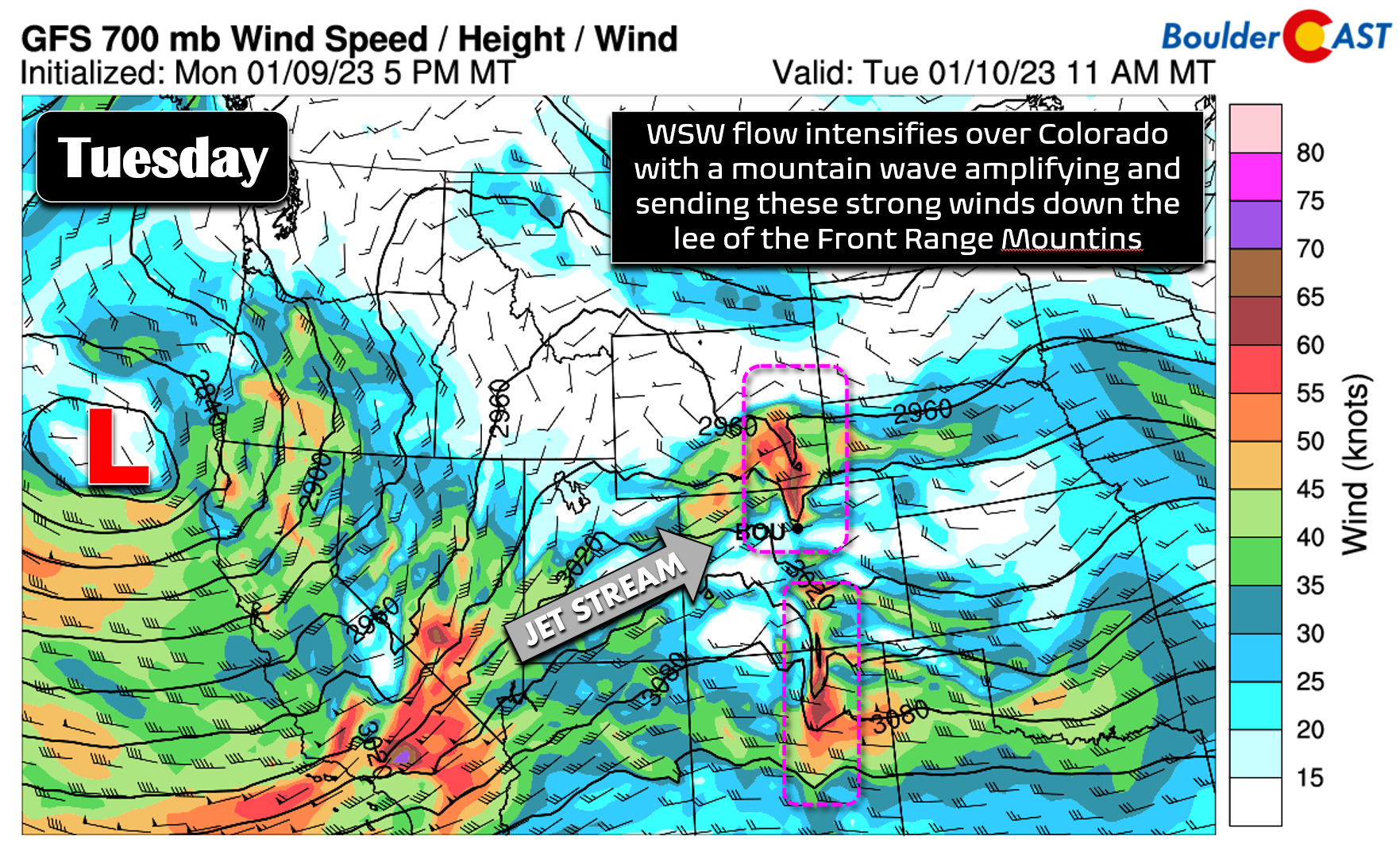
For today the main concern will be those pesky downslope winds which will be on the increase in and near the Foothills under a weak mountain wave setup. The 700mb (~10,000 foot elevation) wind forecast graphic below for midday shows the west-southwest flow being forced downwards in the lee of the Rockies from Denver northward towards central Wyoming. This linear area of increased winds and the accompanying sharp dip in the height lines is clear indication of strong downslope flow across our area.
Notice how the winds spread eastward, down, and away from the Foothills today in the HRRR surface wind gust forecast animation below. Peak wind gusts in the Foothills be be 55+ MPH, in Boulder will be 50+ MPH and in the Denver Metro area will exceed 25 MPH. Winds will be gusty much of the day in the favored spots, from the morning into the evening. Areas along and east of I-25 will see lesser wind duration and intensity — the usual for mountain wave setups.
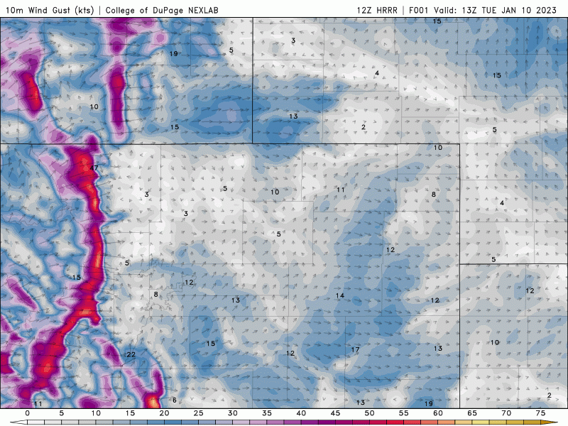
HRRR surface wind forecast animation for Tuesday
Overall expect a breezy to windy day to unfold, especially in Boulder, Broomfield and areas near the Foothills. Once the winds pick up, temperatures will immediately jump into the 50s and stay there the rest of the day. Look for highs in the middle 50s under mostly sunny skies with just a few wave clouds mixed in at times. This should be the warmest day of the week — despite the wind! A somewhat light round of snow will be falling in the Mountains this morning — plan for winter driving conditions along and west of the Continental Divide. There will be a break in the action this afternoon and evening though as the mountain wave picks up.
Our attention quickly shifts to an incoming vigorous storm system from the Pacific tonight and tomorrow. This is yet another remnant of an atmospheric river event pummeling California. It’s residual energy and moisture will translate across the Rockies tonight and pop out across the Plains of Colorado on Wednesday where lee cyclogenesis will unfold with a developing surface low somewhere across eastern Colorado.
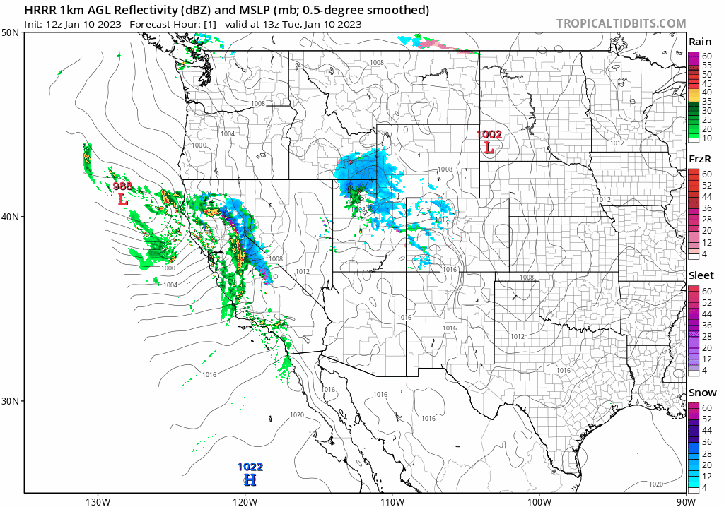
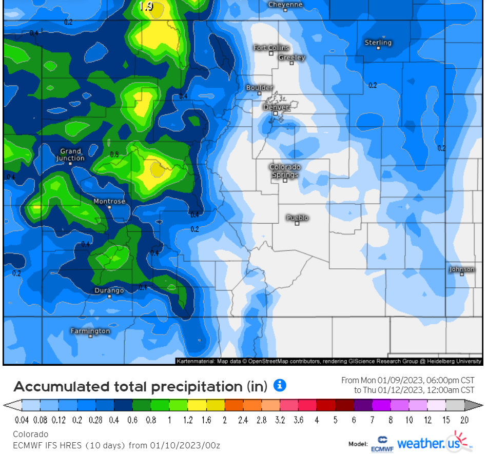
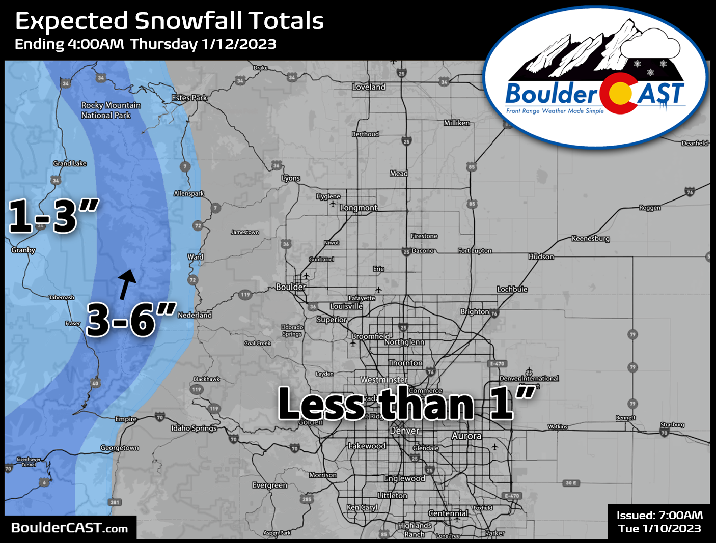
For a while there, it was possible this storm could blow up across southeast Colorado — a more favorable location for Front Range upslope snow — but that really does not appear to be on the table any longer with good agreement between the various models for the surface low quickly developing across northeast Colorado instead (just like in the animation above). The result will be a snow shadow of sorts in our area, with most of the energy passing by and being concentrated out near the surface low in the northeast corner of the state with its intensification increasing downslope flow in the Metro area. While several inches of snow are possible across the eastern Plains, minimal snow is anticipated around Boulder or Denver — anywhere from nothing to 1″.

Just like the HRRR model above, the Euro model confirms almost an identical track and precipitation pattern for eastern Colorado:
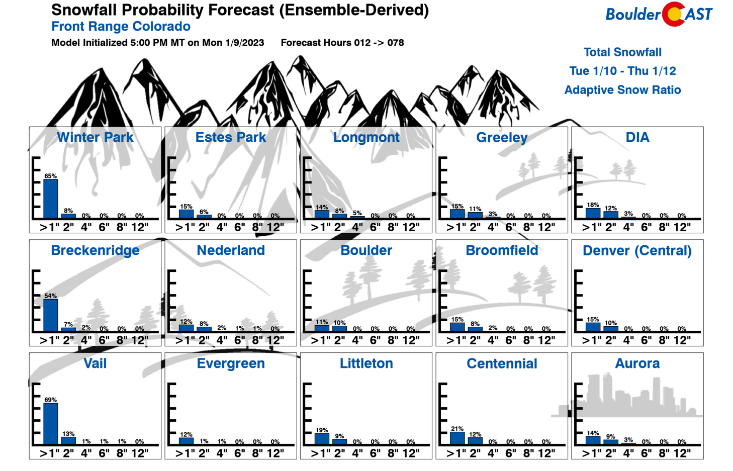
Chances for even light accumulations with this event in our area have fallen of a cliff in the last day or so as models have resolved the surface low further northward. Our Snowfall Probabilities indicate just a ~15% chance in most places to see more than 1″ of snow.
Overall, expect a much cooler day on Wednesday following an early day cold front. There will be more clouds around and some spotty snow showers at times. 1″ or less of accumulation is expected below 8500 feet elevation and up to 3″ for higher locations to the west. Highs will be in the upper 30s to lower 40s. With temperatures largely above freezing during the day, any snow showers that do develop should produce just wet roadways and light accumulation on the grass.
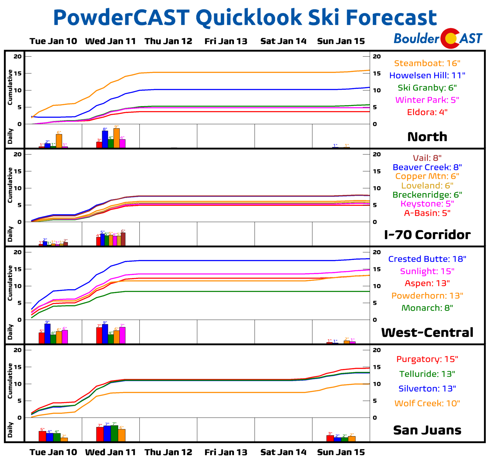
Snow will pick up again Tuesday night across the Mountains and continue through Wednesday with an additional moderate accumulations headed to most ski resorts!
Remember, our daily forecasts are Premium content. Periodically, we open this forecast up to all of our readers. Today is one of those days!
Help support our team of Front Range weather bloggers by joining BoulderCAST Premium. We talk Boulder and Denver weather every single day. Sign up now to get access to our daily forecast discussions each morning, complete six-day skiing and hiking forecasts powered by machine learning, first-class access to all our Colorado-centric high-resolution weather graphics, bonus storm updates and much more! Or not, we just appreciate your readership!


You must be logged in to post a comment.