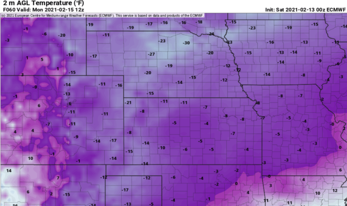
You think it was cold the last few days? Just wait and see what is coming! The coldest temperatures in nearly a decade have settled into the Front Range and it’s only going to get colder. We’re also tracking a rather unique light snowfall event that will spread accumulating snow across the area Saturday afternoon into Sunday. We discuss just how cold it will get and look at the snowfall amounts headed our way.
Author: BoulderCAST Team (Page 28 of 45)
This post had major contributions from at least two members of our team. The more meteorologists the better, right?
Here’s a quick and colorful rundown of our weather during January 2021 and how it relates to climatology.
Jet-forced snow bands could clip southern Denver this evening, little to no snow expected in Boulder
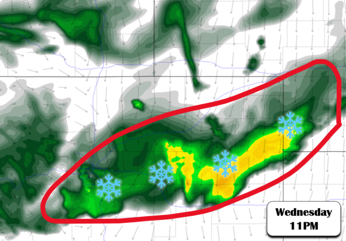
A strong storm system will move into Colorado during the day on Wednesday producing heavy snow in the Mountains. It will then kick eastward across the Denver Metro area Wednesday evening and night with a chance of rain changing to snow. We discuss the timing, amounts and provide our snowfall forecast map. Let’s take a look!
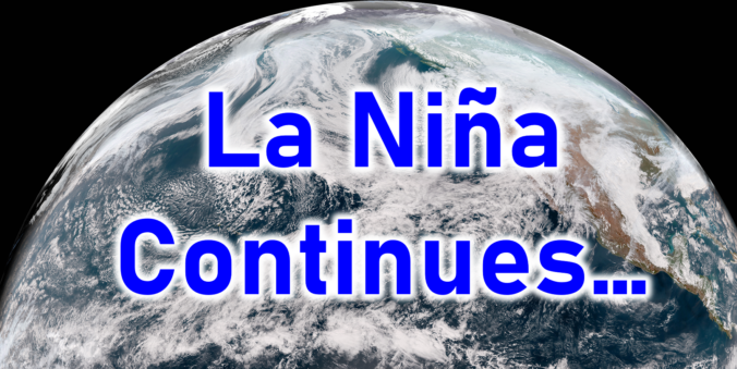
This week’s snow event, while certainly welcomed, is not nearly enough not help the ongoing extreme drought across the entire state of Colorado. With a dry stretch shaping up through the weekend ahead, Boulder will most likely polish off January with its 7th consecutive month of below normal precipitation. We recap the recent “snowstorm”, discuss the current state of the drought, update you on the evolving La Niña, and provide our prediction for what lies ahead the rest of winter.
December 2020 was marred by a series of weak storm systems that resulted in very little snowfall. This lack of moisture further exacerbated the ongoing drought in Colorado and dashed the hopes of many for a white Christmas in our area. Overall, it was yet another warm and fairly dry month. In fact, this was the sixth month in a row that ended warmer and drier than normal. Here’s a quick and colorful rundown of our weather during December and how it relates to climatology.
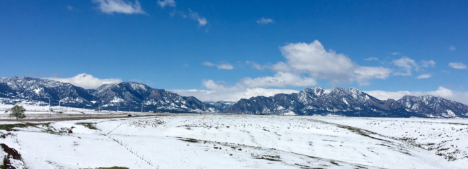
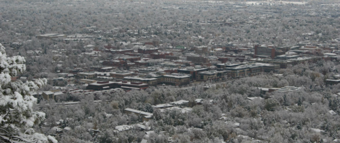
We take a look at regional snow totals from the past few days as the dry pattern finally came to an end for Front Range Colorado.
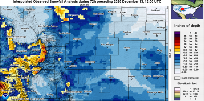
Change is on the horizon for the Boulder and Denver area. Today will be the last warm day before a cold front arrives early Thursday morning followed by two (yes two!) light snow events taking us right into the weekend. Let’s have a look at the timeline and preliminary snowfall amounts as winter weather returns to the Front Range.
UPDATED 6:00AM Thursday: Added our snowfall forecast map for the first wave of snow falling Thursday night through Friday night.
⦁❶⦁ A cold front moved through overnight with cooler temperatures expected today, near 40°F
⦁❷⦁ A slight chance of snow showers this evening for mainly the Foothills and far western suburbs, a dusting of accumulation possible
⦁❸⦁ Temperatures up and down over the weekend into early next week, but no more snow

Live View of Boulder

Current Conditions

Live Radar

Recent Premium Posts

BoulderCAST Daily – Sun 12/14/25 | A warmup after the chilly yesterday afternoon
🌡️ Warmth Returns with no sight of snow: Highs return close to 60 …
BoulderCAST Daily – Sat 12/13/25 | Highs in the 60s this weekend!
🌡️ October Warmth in December: Highs typical for late October will be in …
This Weekend in Colorado Weather: The December that has felt like October continues with bone dry warmth persisting into next week
🌬️ Two more breezy days ahead with gusts 15–25 MPH before the jet …
3-Day Forecast

Trending Content

© 2025 Front Range Weather, LLC