


A stubborn late‑summer pattern is locked in across the Front Range this week. While it won’t bring major shifts, it will deliver subtle day‑to‑day changes worth watching. A strong subtropical ridge keeps monsoonal moisture just high enough for daily storm chances, yet still too disorganized to produce reliable rainfall — a theme all summer. With shifting flow aloft, a mid‑week cold front and moisture bump, and a gradual drying trend late in the week, there’s plenty to unpack, from renewed severe potential to evolving flash‑flood risks and ongoing drought concerns. Read on as we break down the key ingredients driving this persistent — and likely still underperforming — monsoon pattern.
This week’s highlights include:
- 🌦️ Steady monsoon pattern persists with daily afternoon/evening storm chances as a strong subtropical ridge shifts slowly from NM/TX toward AZ.
- 🌀 Westerly–northwesterly flow aloft keeps the deepest moisture aimed at the Great Basin this week, but Colorado stays decently moist through at least Friday.
- ⚠️ Marginal flash flood risk continues most days for Boulder/Denver, with highly uneven storm coverage and localized heavy rain.
- ⛈️ Monday: Moisture ~130% of normal; scattered storms 2–9 PM; low‑end wet microburst threat along the Front Range.
- 🌬️ Tuesday: Weak cool front arrives; highs in the 80s; storm chances drop slightly; stronger storms favored east/southeast toward KS/NE.
- 🌫️ Wednesday: Moisture surges to ~150% of normal; morning stratus may limit heating; if storms develop, shear could support large‑hail potential along and east of I‑25.
- 🌤️ Late-week: Ridge shifts west and moisture decreases; storms become more spotty as temps warm back into the 90s by Friday.
- 🔥 Colorado’s drought has deepened this summer thanks to an underperforming monsoon; an BoulderCAST update later in the week will cover the promising finish to monsoon season and the potential autumn impacts of the rapidly intensifying historic El Niño.
DISCLAIMER: This weekly outlook forecast is created Monday morning and covers the entire upcoming week. Accuracy will decrease as the week progresses as this post is NOT updated. To receive daily updated forecasts from our team, among many other perks, subscribe to BoulderCAST Premium.

Go Premium, get all the perks.
Daily Forecast Updates
Get our daily forecast discussion every morning delivered to your inbox.
All Our Model Data
Access to all our Colorado-centric high-resolution weather model graphics. Seriously — every one!
Ski & Hiking Forecasts
6-day forecasts for all the Colorado ski resorts, plus more than 120 hiking trails, including every 14er.
Smoke Forecasts
Wildfire smoke concentration predictions up to 72 hours into the future.
Exclusive Content
Weekend outlooks every Thursday, bonus storm updates, historical data and much more!
No Advertisements
Enjoy ad-free viewing on the entire site.
Daily Storm Chances Stick Around — But Likely Disappoint Again For Many
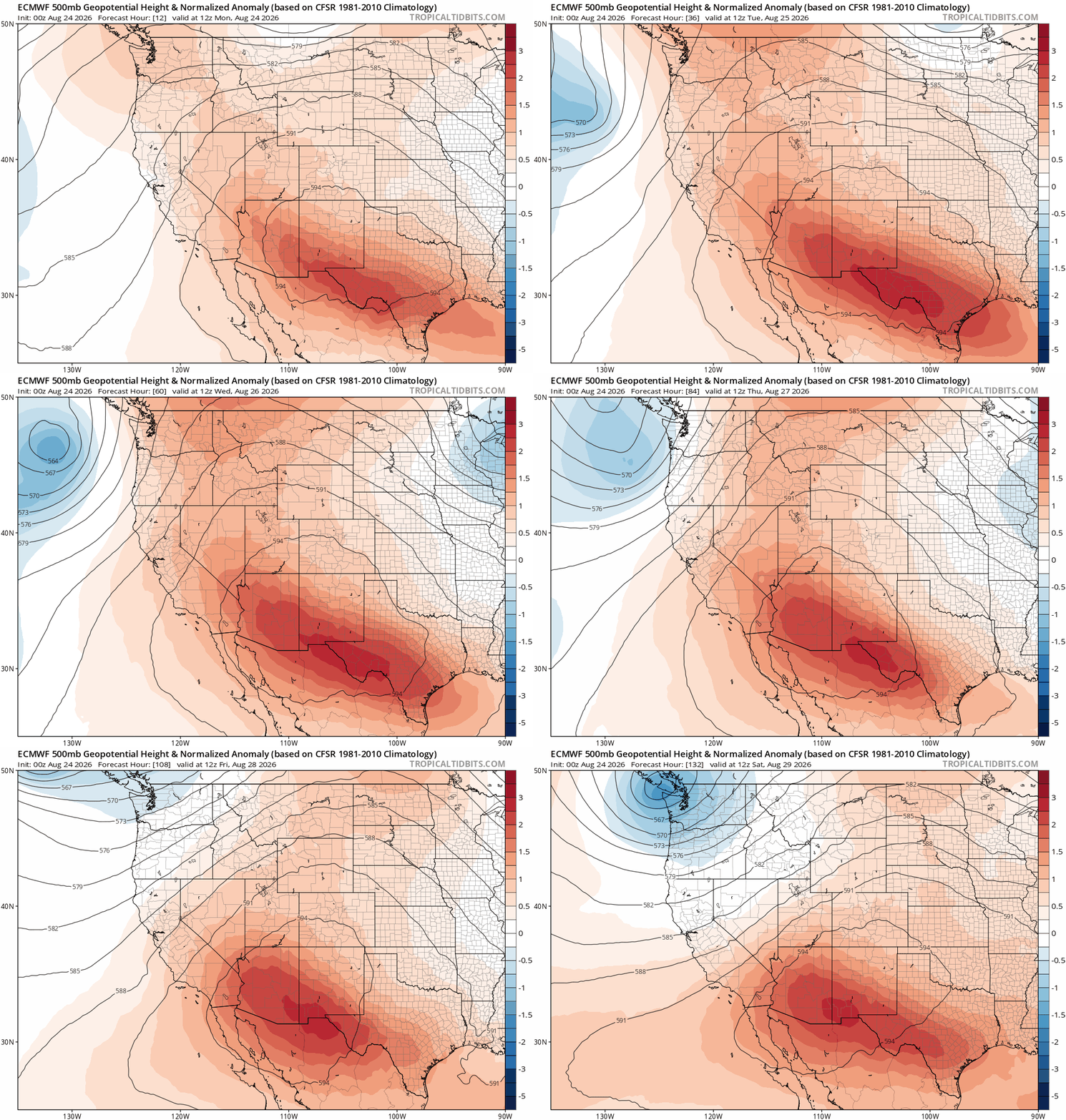
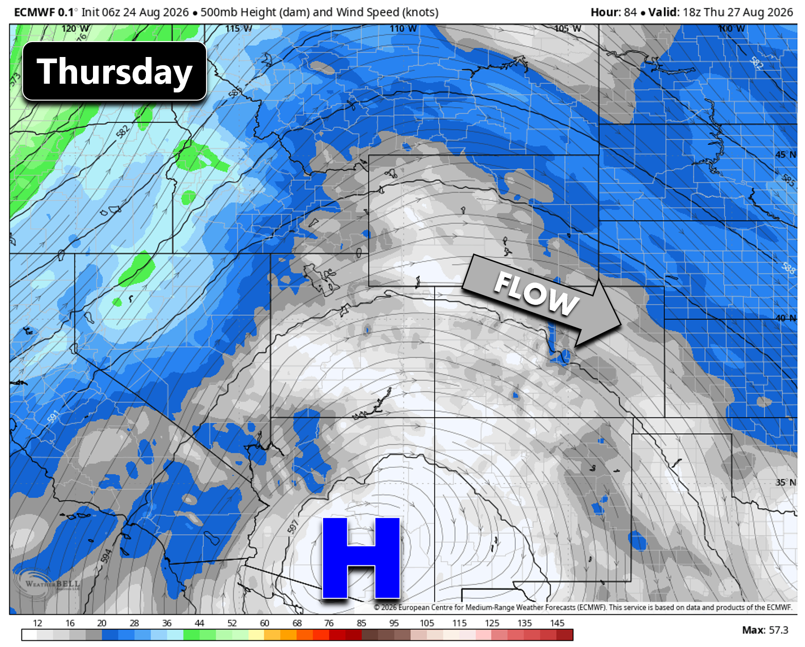
The Front Range is set to stay locked into a familiar late‑summer pattern this week: daily afternoon and evening thunderstorms driven by a steady monsoon regime and a strong subtropical ridge parked just south of Colorado. The ridge — occasionally reaching 6000 meters at 500mb — will begin the week over southern New Mexico and west Texas, but will gradually shift west toward southern Arizona. With the ridge axis positioned just west of the state all week long, westerly to northwesterly flow aloft will dominate.
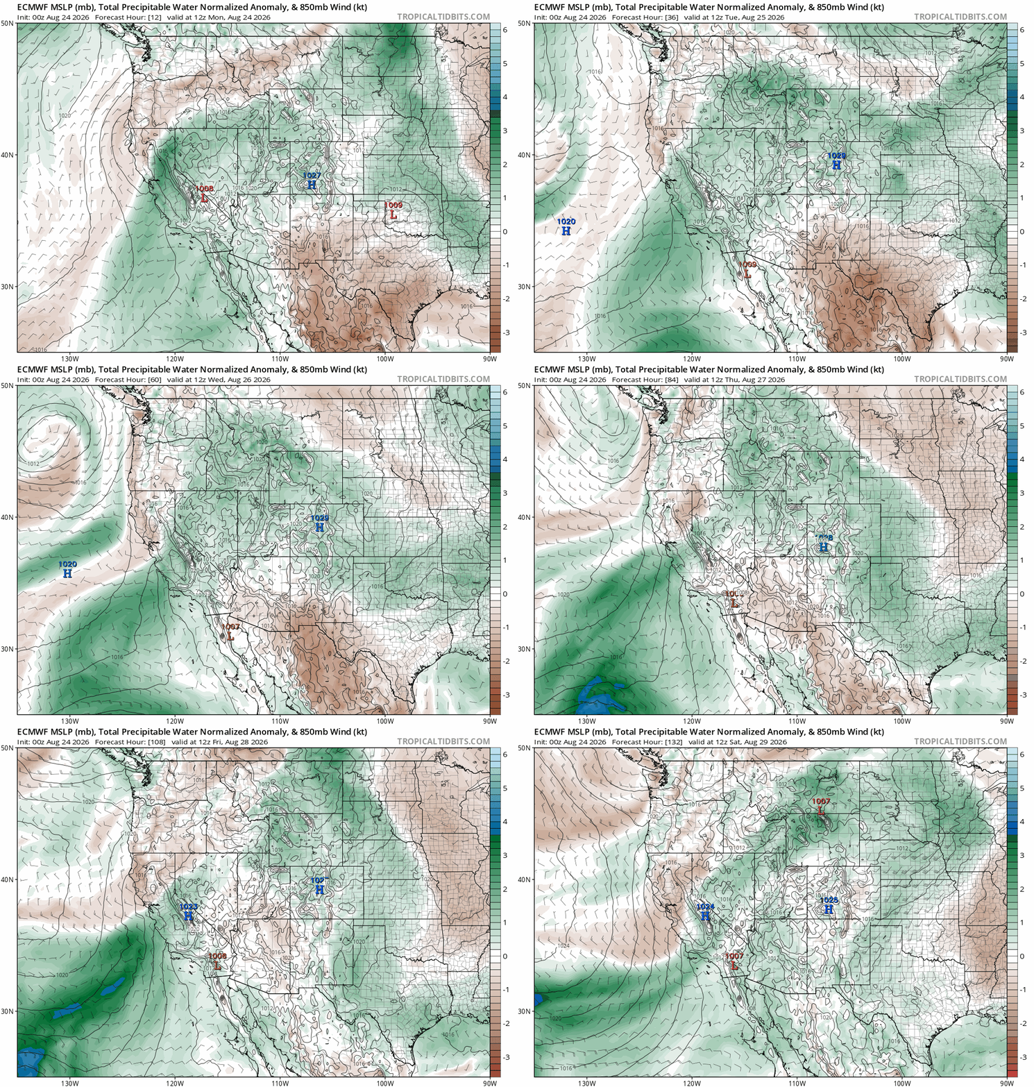
This flow keeps the deepest monsoon moisture aimed at the Great Basin rather than directly at Colorado, but precipitable water values will remain above normal through Friday. The result will be a familiar pattern: scattered afternoon and evening thunderstorms each day, localized heavy rain in spots, and a large variation in who gets wet and who stays dry.
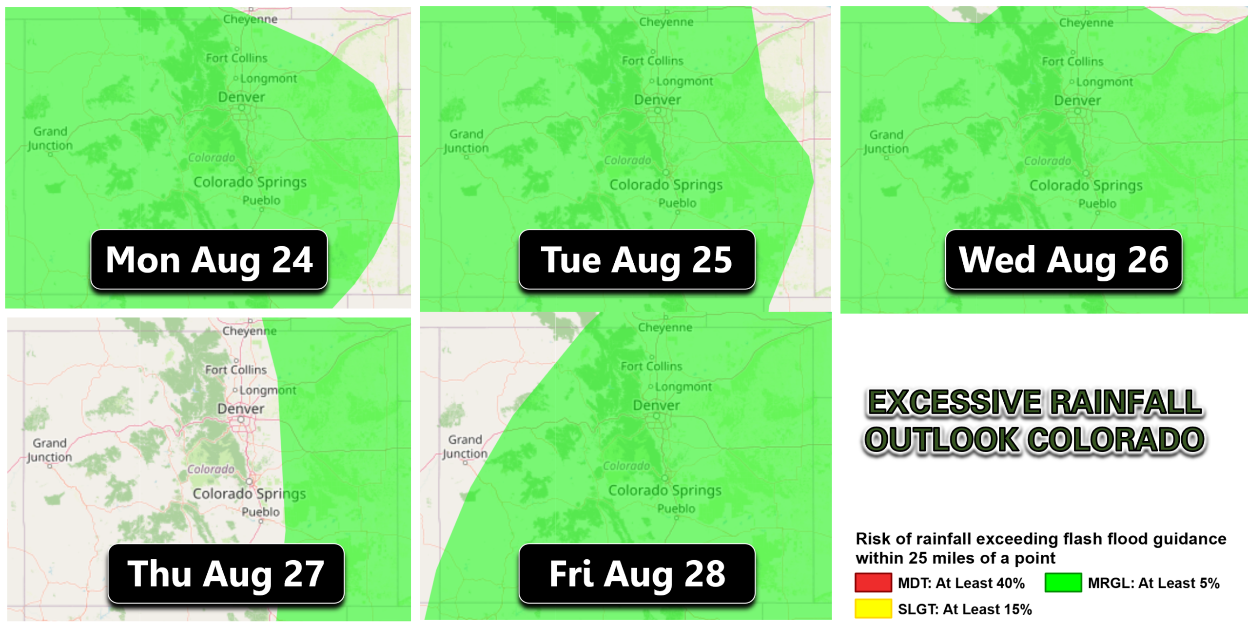
The Weather Prediction Center currently has a Marginal Risk (Level 1/3) for flash flooding across Boulder and Denver every day this week except Thursday — a reflection of the ongoing potential for isolated heavy downpours rather than organized widespread rainfall.
Monday: P.M. Storms with Wet Microburst Threat
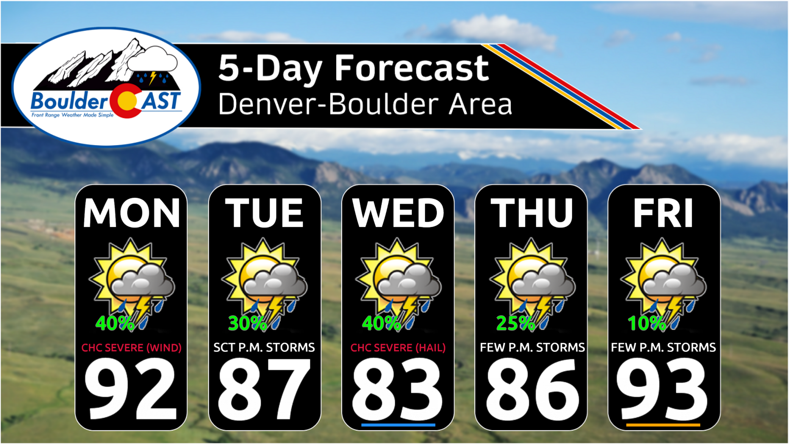
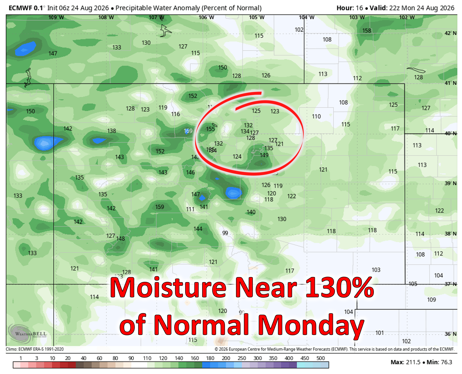
Moisture levels on Monday will be near 130% of normal which will support a round of scattered afternoon and evening storms capable of localized heavy rain.
Initiation will begin over the high terrain early to mid‑afternoon before drifting east toward the I‑25 Corridor.
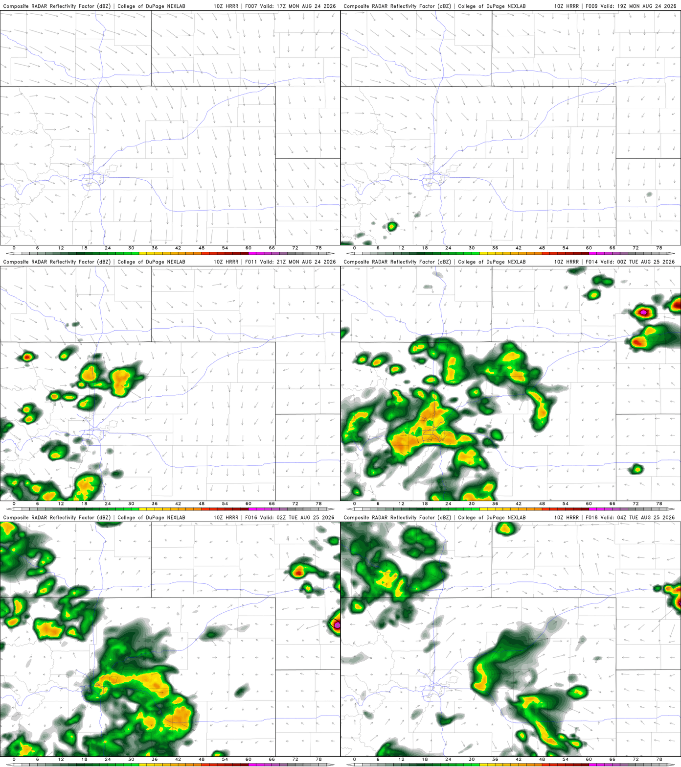
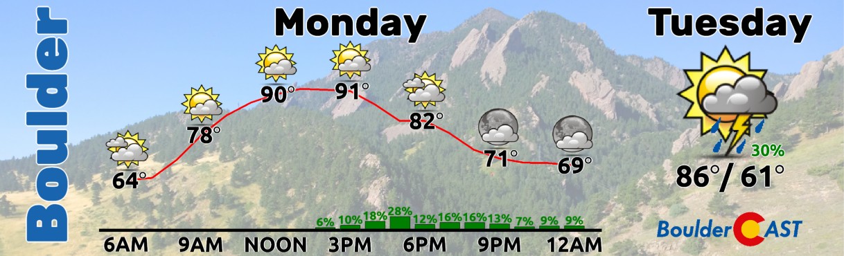
The primary window for ~40% storm chances on Monday comes from 2 to 9PM. Highs will reach the low to middle 90s in most areas before storm clouds fill in.
A few supercells may form in far northeast Colorado where instability and shear are more favorable. Along the Front Range, the primary hazard is a low‑end wet microburst threat, with isolated gusts exceeding 60 MPH and more common outflow winds in the 30–50 MPH range. The Storm Prediction Center has our entire area at Marginal Risk (Level 1 of 5) on Monday.
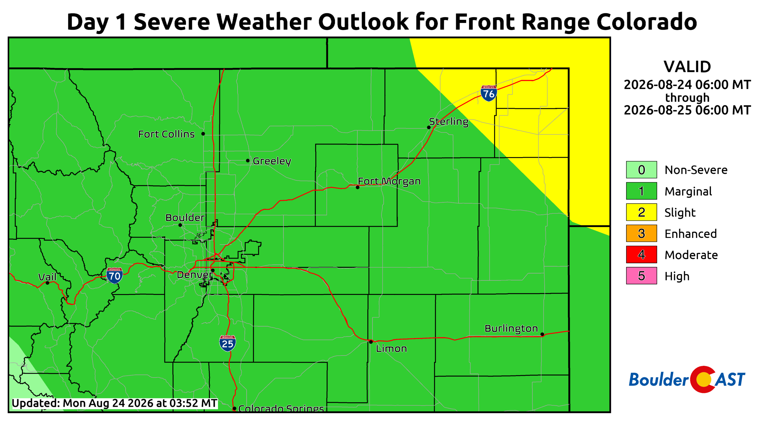
Tuesday: A Weak Front Settles In, More Storms
Moisture content remains similar Tuesday, again near 130% of normal in the Denver area. A subtle frontal boundary will sag southward during the day from the north and northeast. Most guidance brings the front through in the late morning or early afternoon, allowing temperatures to reach the mid to upper 80s beforehand. The front itself does not appear to add much low‑level moisture, so the net effect will likely be fewer storms along the Front Range as cooler surface temperatures inhibit convective development.
East and southeast of Denver toward Kansas and Nebraska, strong to severe storms may develop along the boundary as it moves south through the afternoon. Storm chances locally drop slightly compared to Monday, to around 25%, but any storms that do form will still be capable of brief moderate to heavy rain and gusty outflow winds.
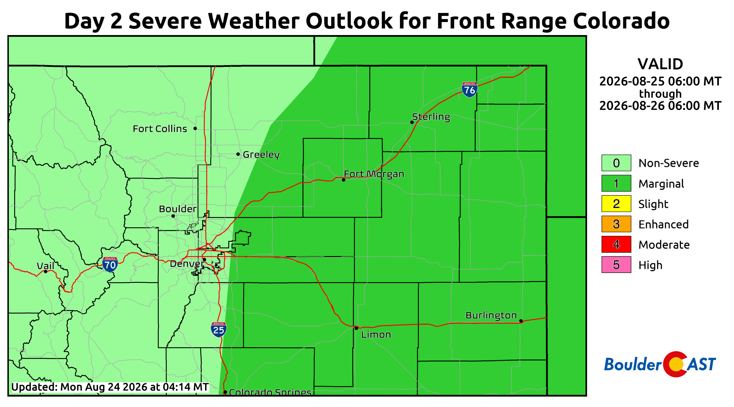
Wednesday: Moisture Surges, Severe Risk Returns, But Will Stratus Be An Issue?
As the cooler airmass settles in Tuesday night into Wednesday, a potential moist outflow from Great Plains storms may push westward into eastern Colorado. This will cause low‑level moisture to surge into the Front Range as surface flow backs into the terrain. Moisture levels Wednesday rise sharply to ~150% of normal in the Boulder–Denver area. While this increase is favorable for storm development, morning low clouds or stratus may become an issue, potentially limiting heating and reducing convective potential later in the day.
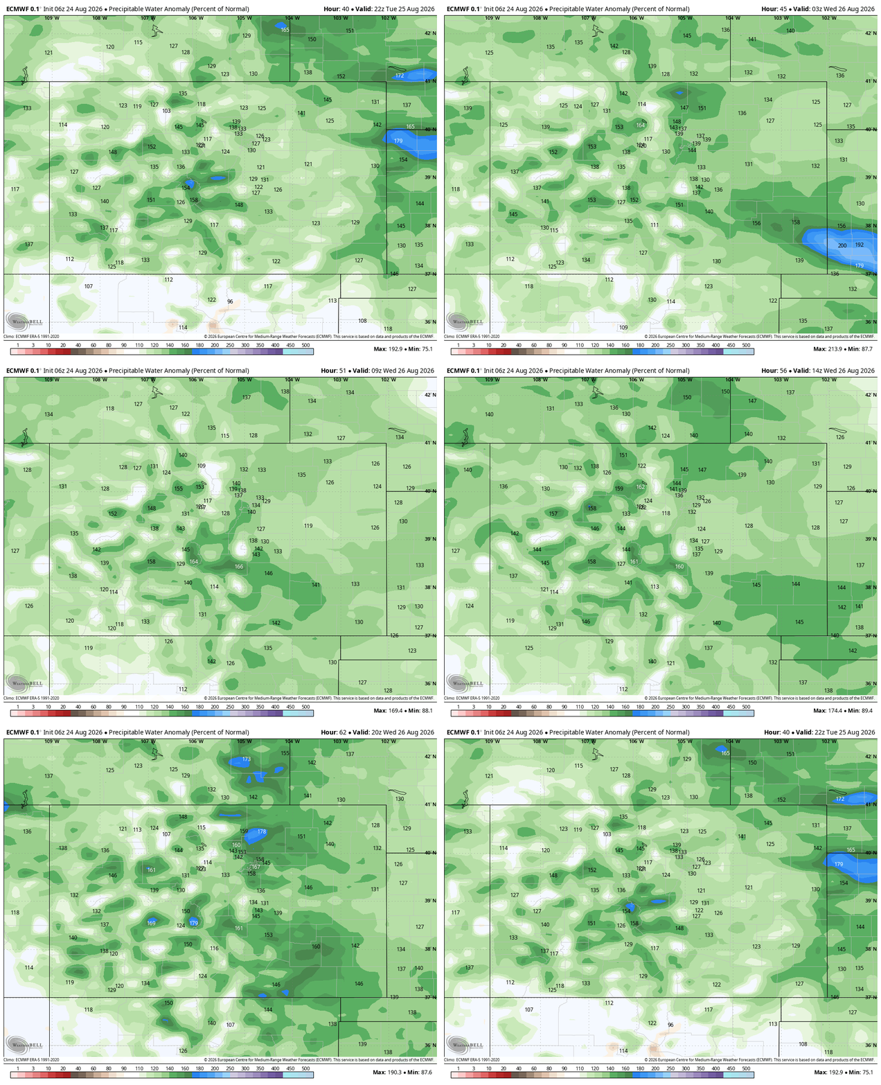
If storms do develop, stronger easterly surface winds will enhance shear profiles and support a renewed severe threat, including storms capable of producing large hail. As of now, the Storm Prediction Center highlights areas east of Interstate 25 under a Marginal Risk, but this hail/supercell threat could shift westward depending on how cloud cover evolves Wednesday morning. High temperatures will remain in the 80s.
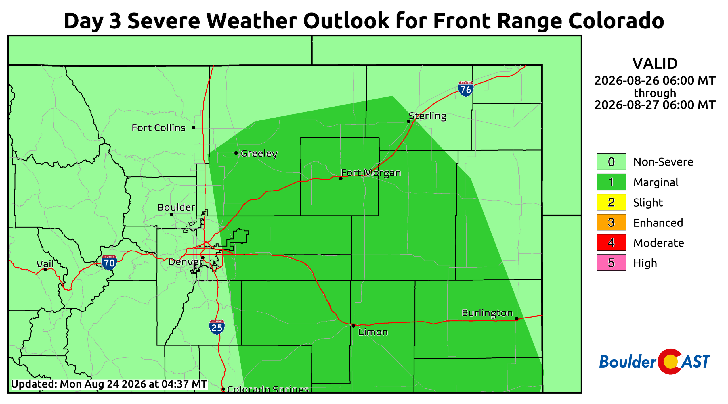
Thursday & Friday: Drying Trend As High Pressure Shifts West
As the high pressure center migrates west into southern Arizona, northwesterly flow will strengthen across the Front Range. This won’t completely shut down monsoon moisture, but it will begin to dry the region out a tad. Moisture drops to ~130% of normal Thursday and ~110% by Friday. This should support widely scattered storms Thursday with activity becoming more isolated Friday.
Temperatures remain in the 80s Thursday before a warming trend pushes readings back into the 90s Friday and into the weekend.
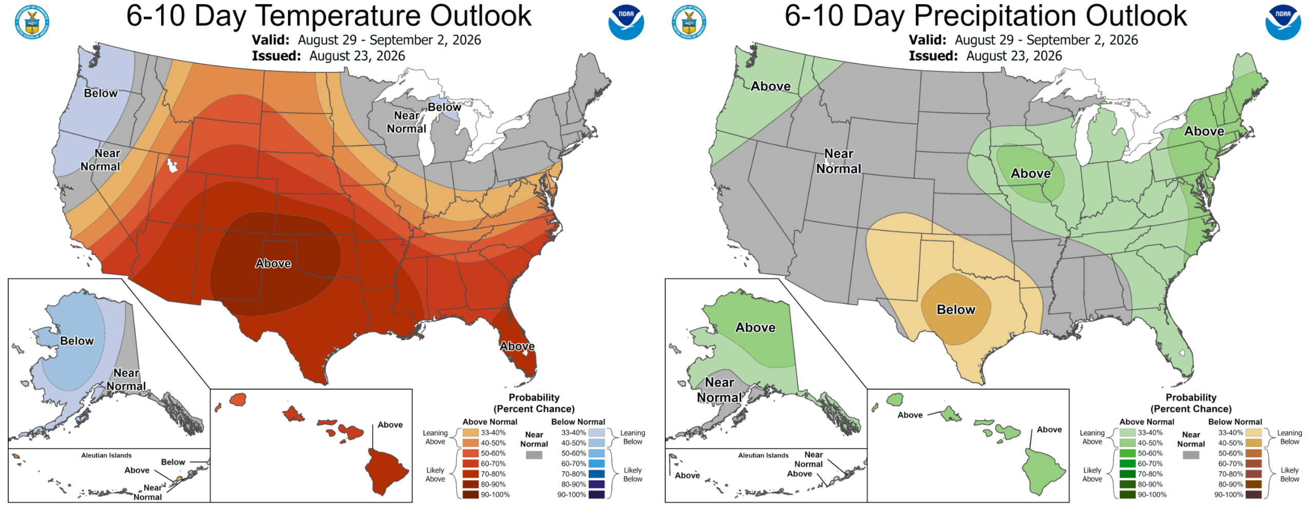
With the large Southwestern ridge expected to remain parked over Arizona, New Mexico, or Texas for the foreseeable future, Colorado will not see any significant pattern changes. The Centennial State will stay hot through the weekend and much of next week. Monsoonal flow will persist, offering at least low‑end chances for showers and storms each day — though as we’ve seen repeatedly this summer, those chances have not translated into widespread beneficial rainfall for most of the Front Range.
Check Back Soon: Drought, Monsoon, El Niño and Autumn Outlook
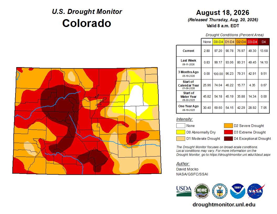
Colorado remains deeply entrenched in drought, which has only intensified this summer as the monsoon has failed to deliver meaningful moisture. Later this week, we’ll provide an update on the monsoon, including whether its persistence into September could salvage part of the season, and what the rapidly intensifying historic El Niño may mean for the Front Range heading into fall. Thanks for reading and check back soon.
Forecast Verification: August 17-21, 2026 (Last Week)
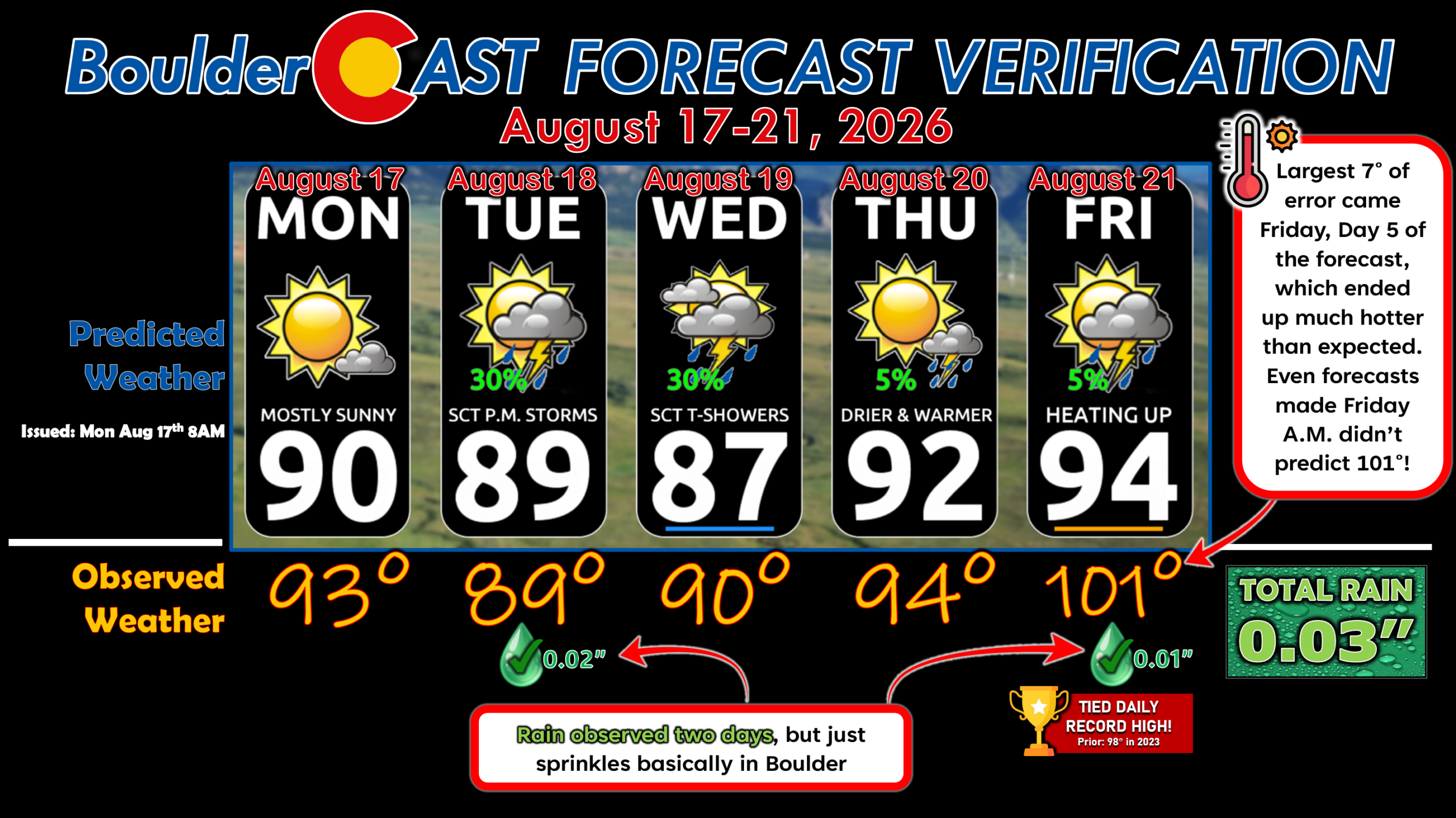
Rainfall was recorded in Boulder on Monday and Friday, but only totaling 0.03″. Temperature forecasts were generally pretty accurate, save for the huge 7° error on Friday when a new daily record high was set at 101°. It ended up getting a lot hotter in the city than expected, as even forecasts that morning were calling for high of 97°. All days during the week had above normal temps.
DISCLAIMER: This weekly outlook forecast is created Monday morning and covers the entire upcoming week. Accuracy will decrease as the week progresses as this post is NOT updated. To receive daily updated forecasts from our team, among many other perks, subscribe to BoulderCAST Premium.
Go Premium, get all the perks.
Daily Forecast Updates
Get our daily forecast discussion every morning delivered to your inbox.
All Our Model Data
Access to all our Colorado-centric high-resolution weather model graphics. Seriously — every one!
Ski & Hiking Forecasts
6-day forecasts for all the Colorado ski resorts, plus more than 120 hiking trails, including every 14er.
Smoke Forecasts
Wildfire smoke concentration predictions up to 72 hours into the future.
Exclusive Content
Weekend outlooks every Thursday, bonus storm updates, historical data and much more!
No Advertisements
Enjoy ad-free viewing on the entire site.
Enjoy our content? Give it a share!











Leave a Reply
You must be logged in to post a comment.