The last weekend of June didn’t just sizzle — it erupted. As a powerful early‑summer trough carved into the Great Basin, the Southwest lit up with new fires and thick smoke thanks to some of the most volatile atmospheric conditions we’ve seen this season. Colorado wasn’t spared, either: several fast‑growing fires ignited across the Western Slope and Mountains, sending plumes straight into the Front Range. And with a stubborn dipole pattern locking in place across the nation, the week ahead promises more wind, more dryness, and more smoke — plus a few twists in the forecast you’ll want to keep an eye on. Let’s break down what’s driving this outbreak, what it means for the Boulder–Denver corridor, and when relief may finally arrive.
This week’s highlights include:
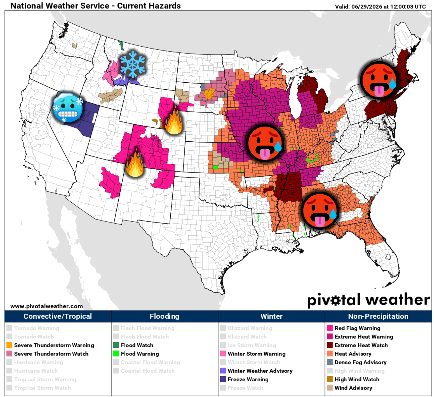
- 🔥 Extreme fire danger exploded across the Four Corners as a powerful June trough delivered high winds, bone‑dry air, and multiple new large fires.
- 💨 Pressure‑gradient‑driven winds + single‑digit humidity created ideal conditions for rapid fire growth; several ignitions appear human‑caused.
- 🏔️ Colorado’s major fires (Snyder, Ferris, Gold Mountain, Willow) remain smaller than neighboring states but are poised to grow under this week’s pattern.
- 🌫️ Smoke remains a daily fixture for the Front Range, with elevated plumes dominating skies and occasional surface intrusions possible.
- 🔥 Critical fire weather persists all week across the Southwest with 10+ consecutive Red Flag days possible in spots — a rare and dangerous stretch.
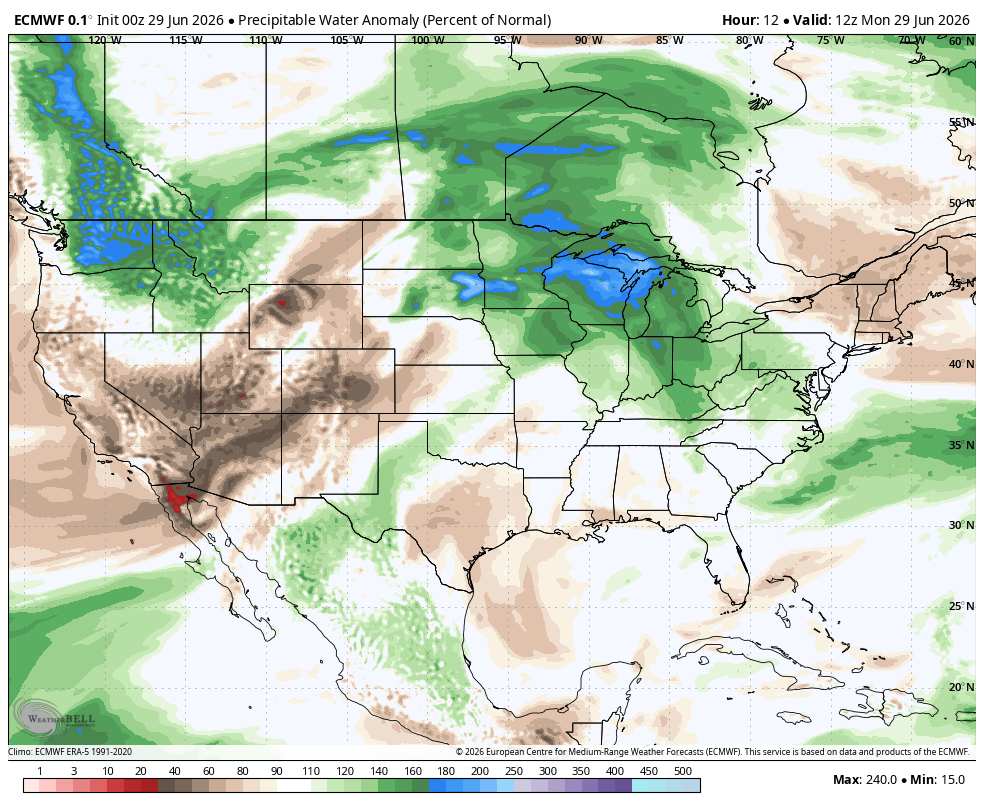
- 🌧️ No meaningful precipitation expected for the Four Corners or the Front Range; only isolated high‑based storms for northern Colorado mid‑week and on July 4th.
- ⏰ Monsoon remains delayed, with long‑range signals hinting at a mid to late July onset — leaving the Southwest (and Colorado) exposed to worsening fire conditions.
DISCLAIMER: This weekly outlook forecast is created Monday morning and covers the entire upcoming week. Accuracy will decrease as the week progresses as this post is NOT updated. To receive daily updated forecasts from our team, among many other perks, subscribe to BoulderCAST Premium.

Go Premium, get all the perks.
Daily Forecast Updates
Get our daily forecast discussion every morning delivered to your inbox.
All Our Model Data
Access to all our Colorado-centric high-resolution weather model graphics. Seriously — every one!
Ski & Hiking Forecasts
6-day forecasts for all the Colorado ski resorts, plus more than 120 hiking trails, including every 14er.
Smoke Forecasts
Wildfire smoke concentration predictions up to 72 hours into the future.
Exclusive Content
Weekend outlooks every Thursday, bonus storm updates, historical data and much more!
No Advertisements
Enjoy ad-free viewing on the entire site.
Four Corners Ongoing Fire Outbreak
Sadly — and exactly as we highlighted in last week’s outlook — the Southwest slipped into extreme fire danger this past weekend as an unusually strong early‑summer trough plunged out of the Pacific Northwest and carved into the Great Basin. The synoptic setup was remarkable: summer snow fell across portions of Idaho, Montana, and Wyoming while, simultaneously, the Four Corners region baked under a tightening pressure gradient and bone‑dry air leading to widespread multi‑day Red Flag Warnings.
The meteorology here is textbook but brutal. The deep trough enhanced mid‑level flow, mixed stronger winds to the surface, and tapped a plume of desiccated air originating in northern Mexico. Fuels across the Southwest — already critically dry after a historically warm, moisture‑starved winter — responded instantly. Several new fires ignited, some possibly from smoldering holdover lightning strikes from the days prior, but the clustering of ignitions near roadways and popular recreation corridors strongly suggests a large human‑caused component, too.
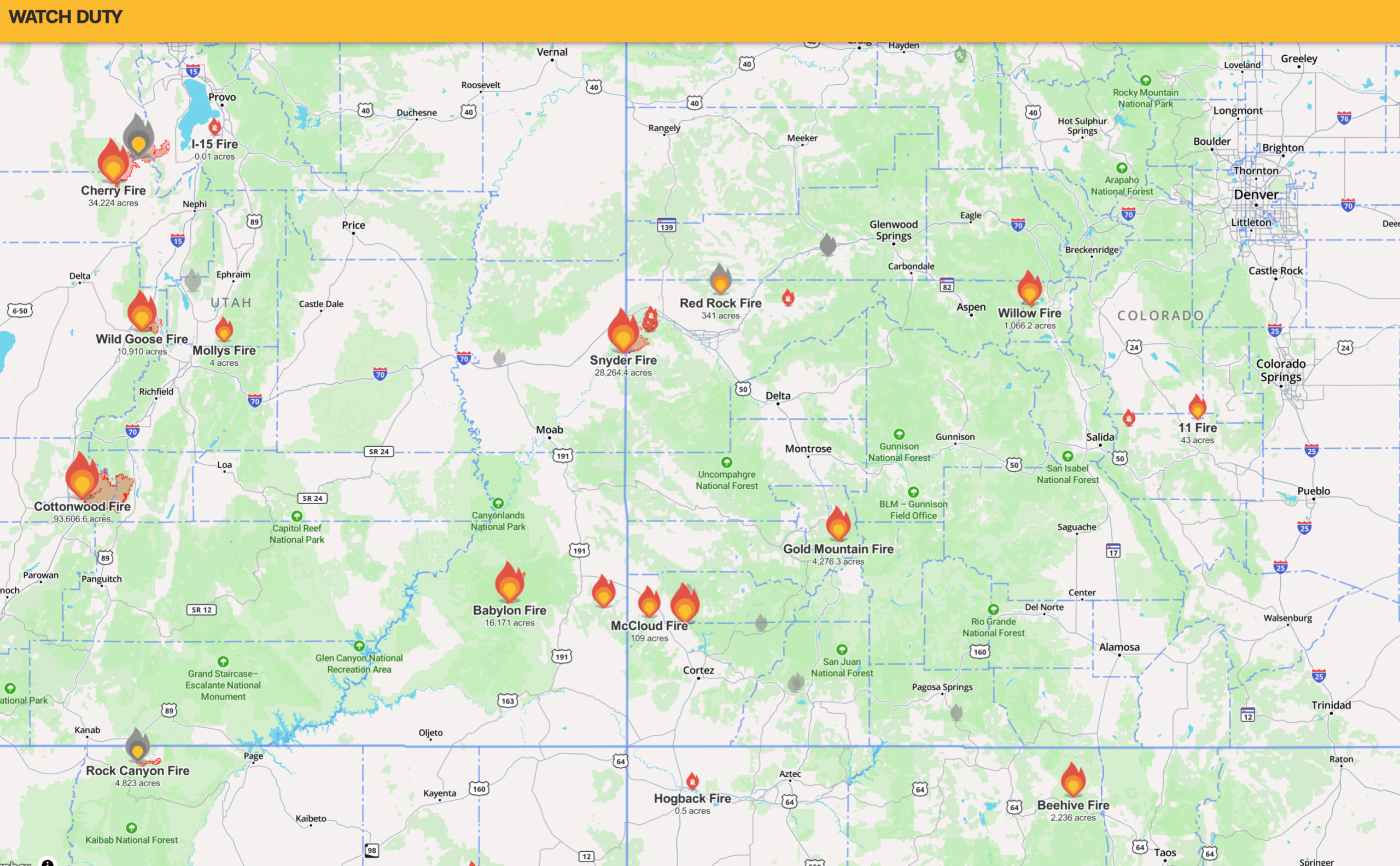
Below are the most consequential fires currently burning in Colorado. Acreage numbers will evolve quickly under this week’s atmospheric setup:
- Snyder Fire — 28,300 acres, 0% contained
- Started Saturday. Roughly 20 miles west of Grand Junction. Technically ignited in Utah and merged with another Utah fire before crossing into Colorado. Currently the state’s largest active fire.
- Ferris Fire — 14,500 acres, 0% contained
- Started Saturday. Burning in remote terrain north of Cortez within the San Juan Mountains. Has merged with another nearby fire.
- Gold Mountain Fire — 4,300 acres, 0% contained
- Started Saturday just north of Ouray. Initial reports suggest ignition along a highway.
- Willow Fire — 1,100 acres, 0% contained
- Started Sunday west of Leadville. Exploded to over 1,000 acres within hours under intense winds and single‑digit humidity.
Colorado’s fires generally remain smaller than those in neighboring states — but only because they’re newer. The atmospheric environment this week will strongly favor continued growth everywhere.
Smoke has been a persistent visitor to the Front Range for two weeks, but the weekend’s surge of new fires dramatically increased upstream emissions.
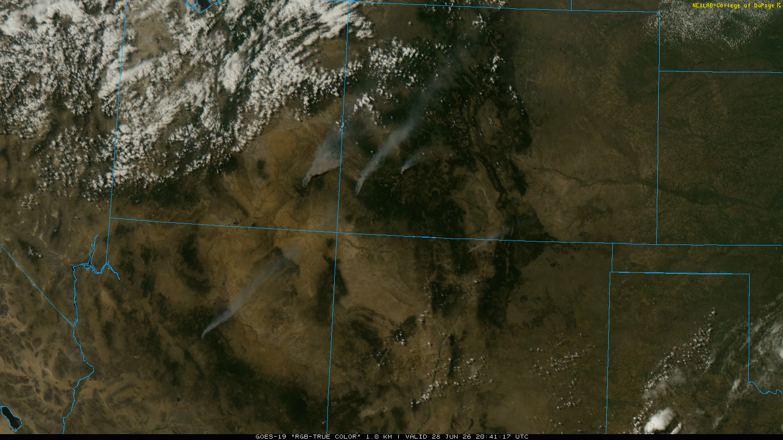
GOES-East visible satellite imagery from Sunday June 28, 2026.
Most of the smoke has remained elevated, producing thick veils aloft, vivid sunsets, and a glowing near‑full moon. However, Denver and Boulder briefly experienced surface‑level smoke Saturday night, with a strong campfire odor noted across the Metro area.
Here’s a look at some of the smoky scenes captured over the last few days locally:
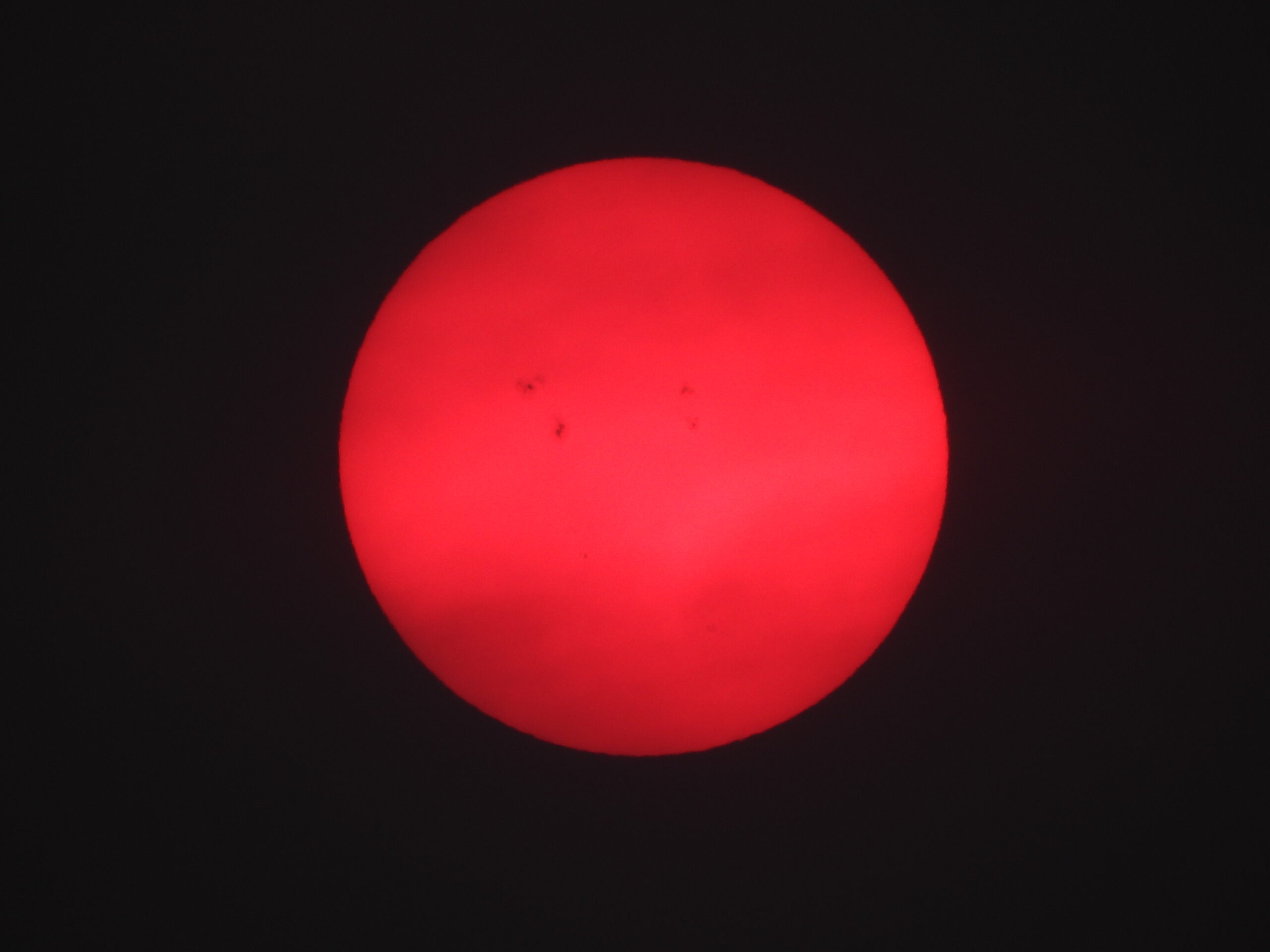
Sunspots visible to the naked eye. WARNING: Don’t look at the sun, even through thick smoke.
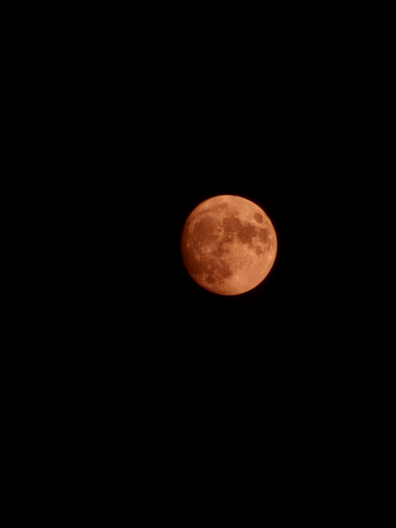
Photo by @AustinHassan1 on X
The Week Ahead: Fire Weather Stays Locked In
The broader pattern responsible for the big fire outbreak is not going anywhere. A strong dipole remains entrenched across the United States:
- A record‑setting heat dome over the eastern U.S.
- Cool, unsettled troughing over the Pacific Northwest and northern Rockies.
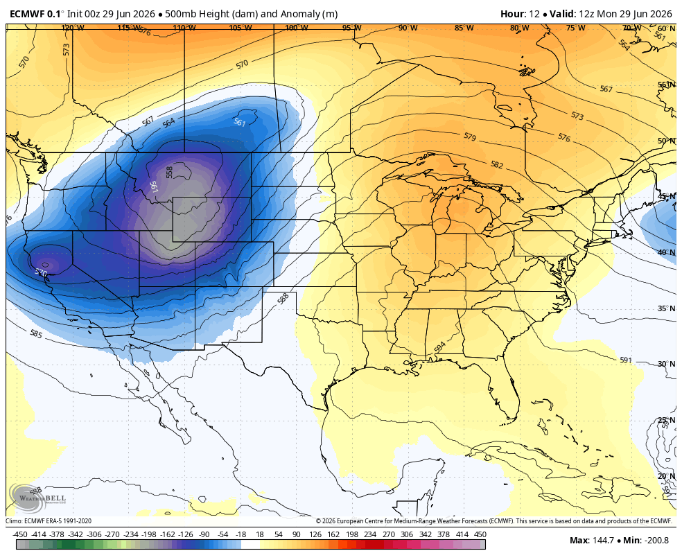
This configuration continues to channel extremely dry Mexican air northward into the Four Corners while maintaining elevated winds across the region — the exact combination that will help sustain critical fire weather.
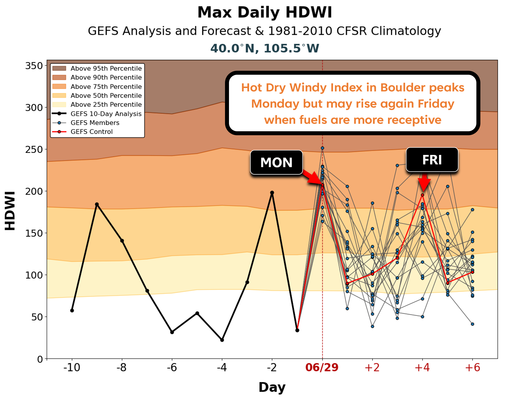
While fire weather conditions likely won’t be as bad as they were Friday through Sunday of this past weekend, they will still be plenty bad enough to support rapid growth of existing fires and new fires through the week. Winds will be strongest across the higher terrain of Colorado Monday and Tuesday (and perhaps Friday), while the driest air will work in Wednesday through Friday. We’re really splitting hairs here, though. Every single day will feature critical humidity over vast portions of the American Southwest, often below 10% and even below 5% on several of the driest days.
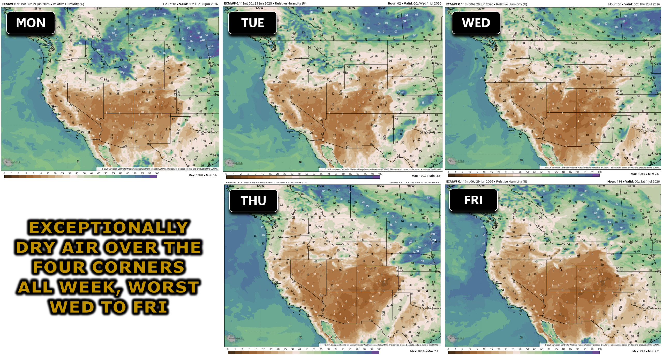
When all said and done, some areas of southwest Colorado and southeast Utah may see 10+ consecutive days of Red Flag Warnings, an exceptionally rare and dangerous stretch. Firefighting resources will be increasingly strained heading into the holiday weekend.
Fuels across Denver and Boulder remain relatively green, limiting the risk for rapid fire spread locally. However, Friday could bring a brief window of elevated fire danger as the driest air of the week noses into the Metro area alongside modest winds.
Smoke Forecast
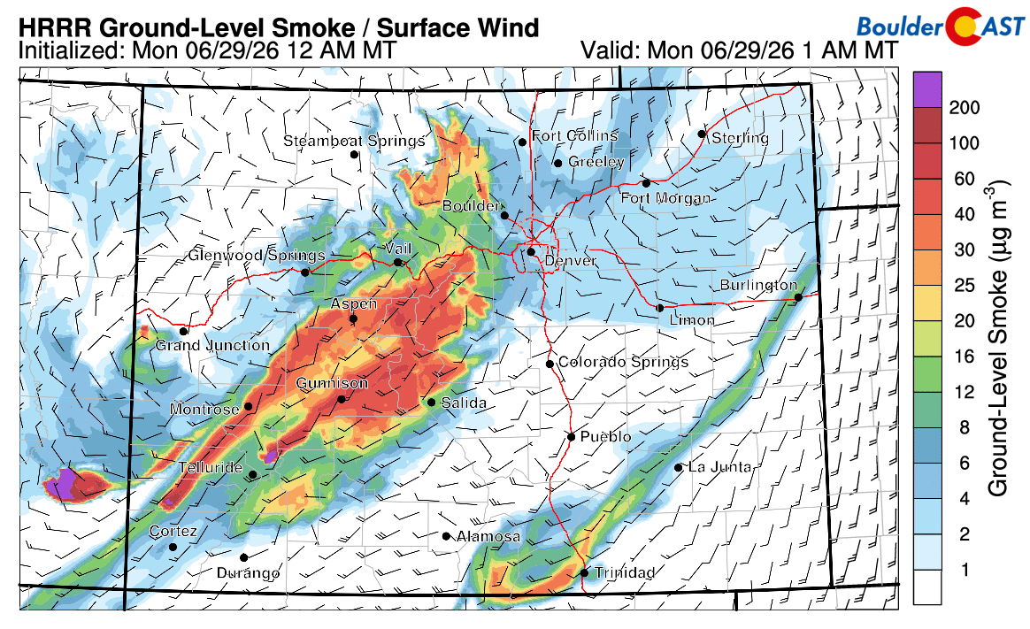
For now, the biggest impact for the Front Range from the smattering of western fires will remain the downstream smoke. Mid‑level flow will continue to favor daily smoke plumes arriving from the west and southwest during the late-day periods.
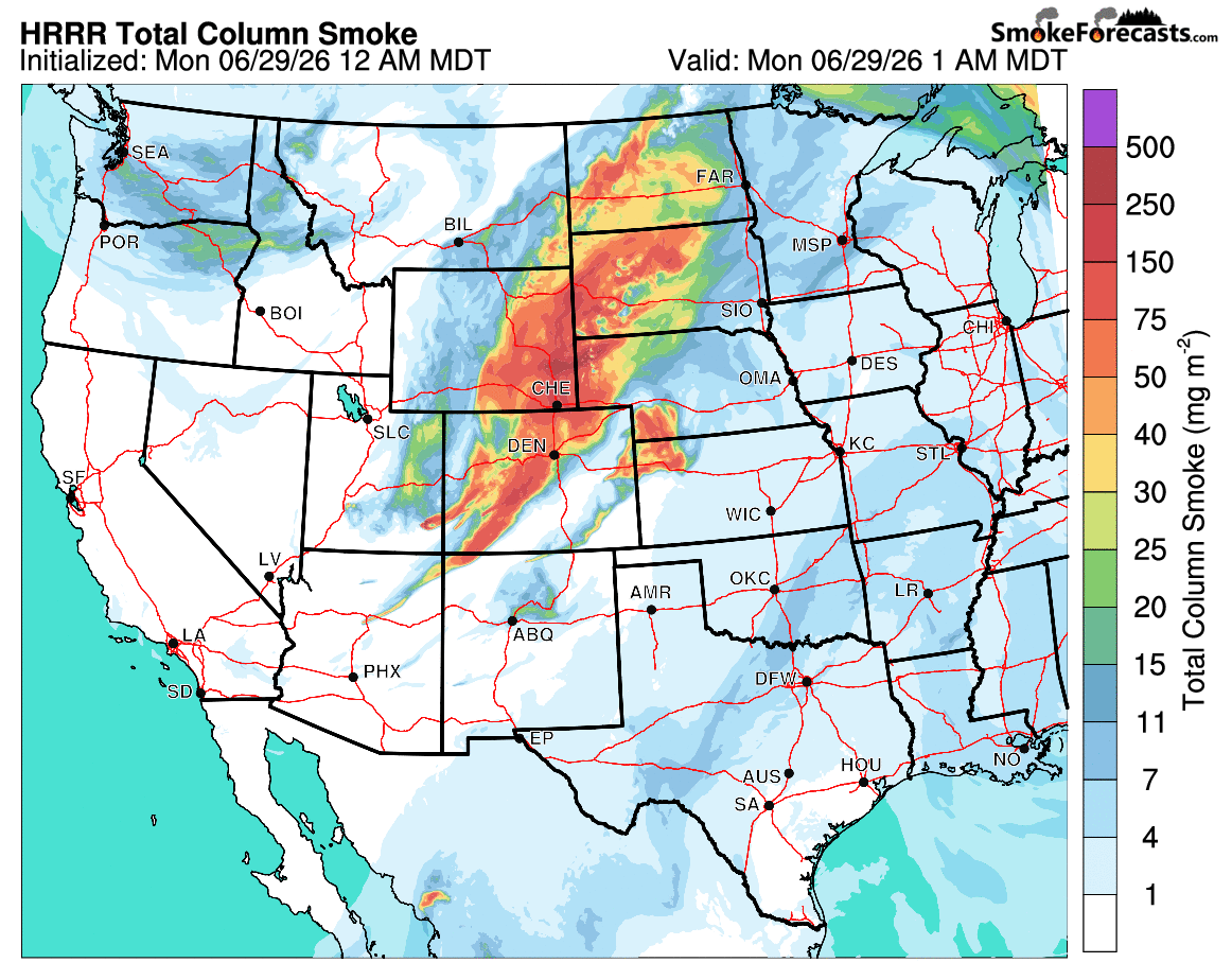
It’s hard to predict how exactly this smoke will behave through the week. For the most part, winds should be strong enough to keep the smoke from pooling too much near ground-level. Right now things look pretty good across Colorado at the surface as of Monday morning, despite so much smoke having blown through overnight. The only real trouble spot is in Grand Valley on the other side of the Continental Divide where the terrain has likely trapped some smoke beneath an inversion.
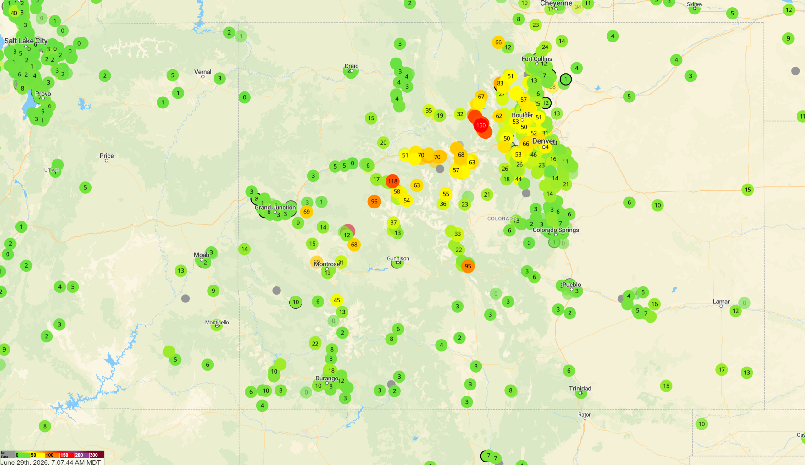
PM2.5 air quality indices as of Monday morning | PurpleAir
Readings may not stay this low in the days ahead, though. Short‑range guidance shows a possible major smoke surge Monday night, though confidence is low. The last forecast run predicted a similar surge Sunday night that never occurred. The forecast animation below shows near-surface smoke concentrations through Tuesday evening. Stay privy to the latest movement of the smoke over on our Colorado Smoke Forecast page.
Precipitation & Temperature Outlook
As far as precipitation this week, the outlook is bleak.
A weak disturbance Tuesday may spark a few high‑based storms north of Denver along a developing Denver Cyclone boundary. Expect gusty outflow winds more than meaningful rainfall from these. Storm chances return this weekend, including isolated late‑day storms on July 4th. Outdoor plans should be fine but keep basic awareness of the low chance for quick‑hitting showers.
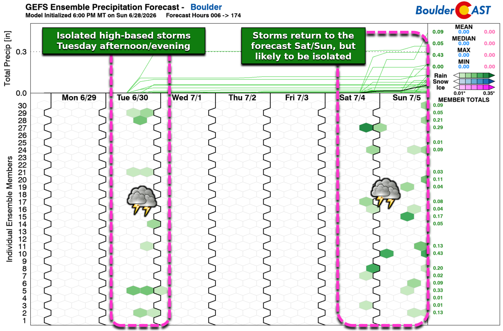
Across the Four Corners: essentially zero precipitation is expected this week. Mother Nature is offering no assistance to firefighters — and in fact will be worsening conditions.
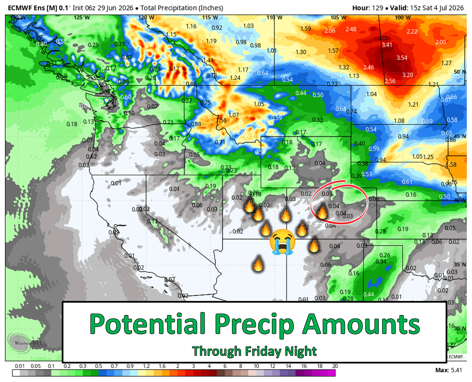
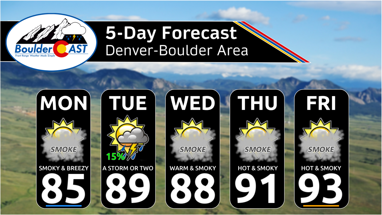
Front Range highs will hover between the mid‑80s and lower 90s, coolest on Monday and hottest on Friday.
Where Is the Monsoon?
In short: not here yet.
There is no current signal for subtropical moisture to push into the Four Corners in the next two weeks. The only encouraging sign is the emergence of a rare summertime moderate El Niño, which historically enhances monsoon strength once it begins.
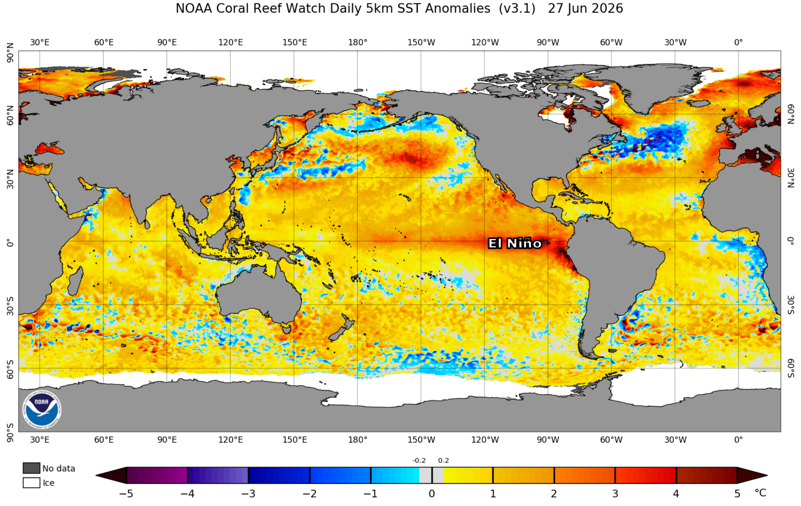
There are some hints in the long-range forecasting that the monsoon faucet could turn on in about three to four weeks in the July 15 to 25 timeframe — roughly two weeks later than normal. Given the ongoing Four Corners fire crisis, this delay is deeply problematic. Sadly things appear to be unfolding just as we predicted in our fire season outlook posted back in April.
Bottom Line
The Southwest — including southwest Colorado — is locked into a prolonged, dangerous fire‑weather pattern ahead featuring extreme dryness, persistent winds, and no precipitation. Existing fires will continue to grow, new fires are likely, and smoke will remain a daily fixture downstream along the Front Range. Fire danger locally stays modest due to recent rains but that could soon be changing. The monsoon remains delayed, and meaningful relief is still weeks away.
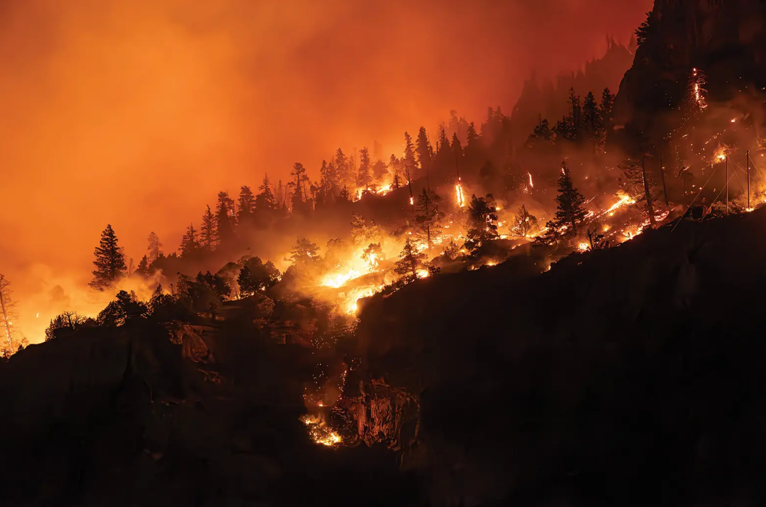
Gold Mountain Fire near Ouray | Photo by Erin McIntyre – Ouray County Plaindealer
Forecast Specifics:
Monday: Sunny skies but filtering through smoke. Breezy with southwest gusts over 20 MPH at times in the afternoon/evening. Critical fire weather conditions in the Mountains. Late-day smoke plumes blow in from the west-southwest. Highs in the middle 80s on the Plains with middle 70s in the Foothills.
Tuesday: Morning sun, then partly cloudy with isolated late-day weak showers and storms. Little rain is expected, but there could be some gusty outflows. Late-day smoke plumes blow in from the west-southwest. Highs in the upper 80s on the Plains with middle 70s in the Foothills.
Wednesday through Friday: Morning sun trending partly cloudy in the afternoons. Hot, dry and smoky. Highs in the upper 80s trending to the lower 90s for the Plains, with middle 70s trending to lower 80s in the Foothills. Late-day smoke plumes blow in from the west-southwest.
Saturday/Sunday: Isolated late day storms and warm with highs in the 80s to lower 90s. Any outdoor holiday festivities or camping in the Mountains should be fine.
DISCLAIMER: This weekly outlook forecast is created Monday morning and covers the entire upcoming week. Accuracy will decrease as the week progresses as this post is NOT updated. To receive daily updated forecasts from our team, among many other perks, subscribe to BoulderCAST Premium.
Go Premium, get all the perks.
Daily Forecast Updates
Get our daily forecast discussion every morning delivered to your inbox.
All Our Model Data
Access to all our Colorado-centric high-resolution weather model graphics. Seriously — every one!
Ski & Hiking Forecasts
6-day forecasts for all the Colorado ski resorts, plus more than 120 hiking trails, including every 14er.
Smoke Forecasts
Wildfire smoke concentration predictions up to 72 hours into the future.
Exclusive Content
Weekend outlooks every Thursday, bonus storm updates, historical data and much more!
No Advertisements
Enjoy ad-free viewing on the entire site.
Enjoy our content? Give it a share!


Leave a Reply
You must be logged in to post a comment.