
The atmosphere is gearing up for one of those classic late‑June stretches where Colorado tries to run every weather storyline at once. Several days of unusually strong flow aloft, deepening upslope moisture, and a parade of shortwaves are about to collide over the Front Range. The result will be day after day of severe thunderstorms. Add in waves of incoming wildfire smoke and a potentially high‑end fire danger setup by the weekend, and there’s plenty to unpack in this week’s forecast. Let’s take a closer look.
This week’s highlights include:
- 🌩️ Outflow boundaries collided Sunday evening, sparking scattered storms across Boulder and Denver, with one severe storm dumping heavy rain on Boulder alongside some hail and a boatload of lightning.
- 🌀 Monday through Thursday brings a multi‑day severe threat as strong zonal flow and daily shortwaves set up a consistently primed environment for intense storms.
- 🌬️ Persistent easterly upslope will pool moisture into the Denver–Boulder area each afternoon, boosting instability and shear for supercells.
- ⚡ SPC highlights the Front Range with repeated severe potential, including long‑lead Slight Risks for Tuesday and Wednesday — rare for our area.
- ⚠️ Large hail, damaging winds, and tornado potential are all on the table each afternoon and evening through Thursday.
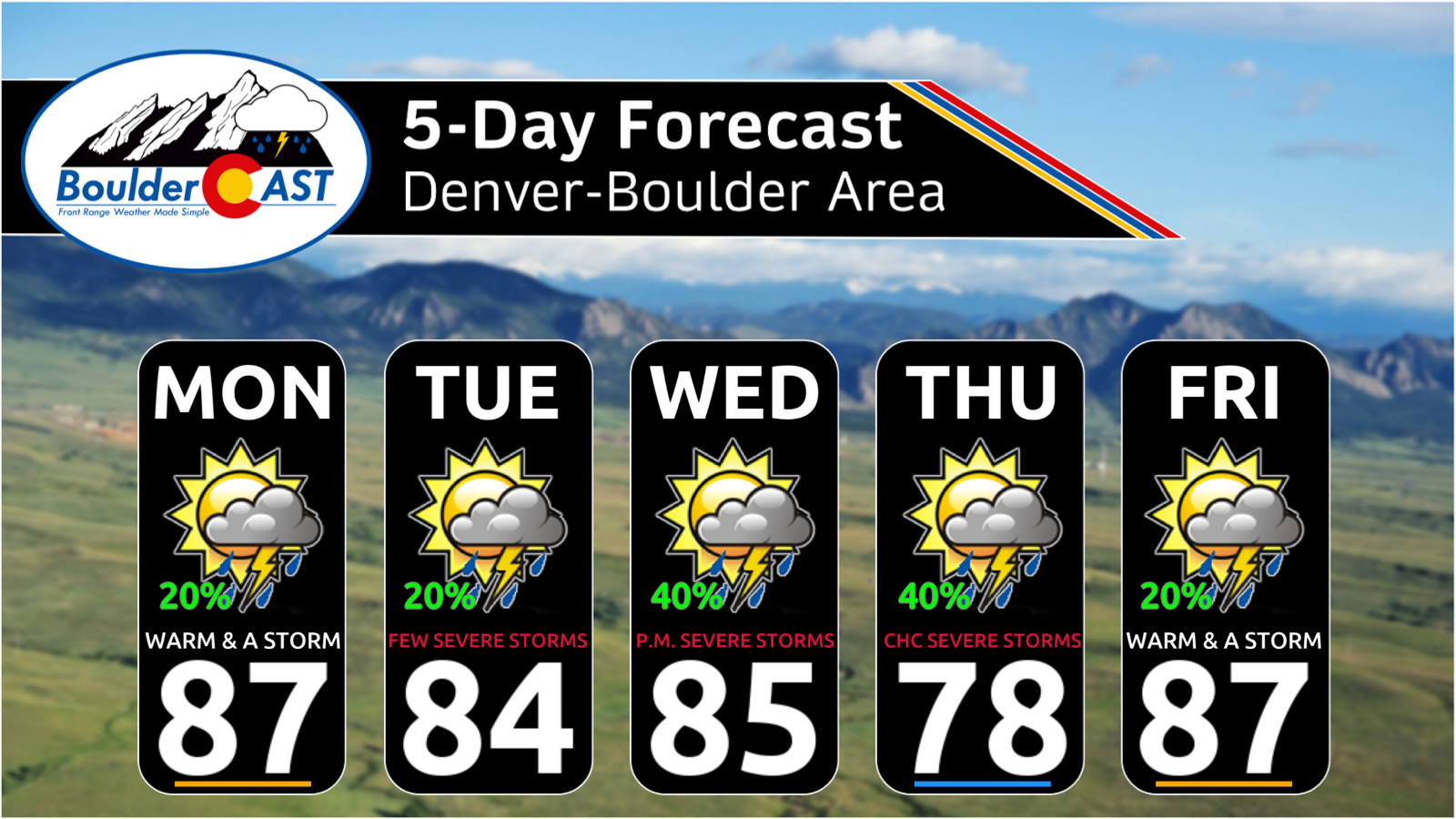
- 🌡️ Temperatures stay comfortable, mainly upper 70s to upper 80s, with higher humidity making things feel a bit stickier than usual.
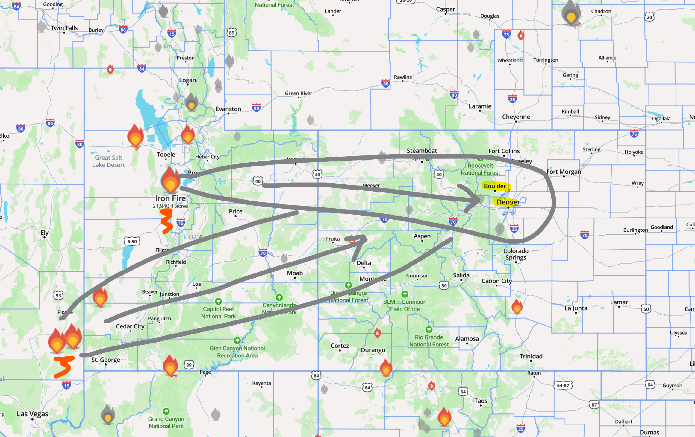
- 🌫️ Smoke returns at times this week, mainly from the 22,000‑acre Iron Fire in Utah, with occasional contributions from other Western fires.
- 🔥 Fire danger spikes over the weekend as a strong trough drives widespread high winds across the West, with critical to extreme fire danger over much of the Southwest, including Colorado. Saturday is the day to watch in Denver.
DISCLAIMER: This weekly outlook forecast is created Monday morning and covers the entire upcoming week. Accuracy will decrease as the week progresses as this post is NOT updated. To receive daily updated forecasts from our team, among many other perks, subscribe to BoulderCAST Premium.

Go Premium, get all the perks.
Daily Forecast Updates
Get our daily forecast discussion every morning delivered to your inbox.
All Our Model Data
Access to all our Colorado-centric high-resolution weather model graphics. Seriously — every one!
Ski & Hiking Forecasts
6-day forecasts for all the Colorado ski resorts, plus more than 120 hiking trails, including every 14er.
Smoke Forecasts
Wildfire smoke concentration predictions up to 72 hours into the future.
Exclusive Content
Weekend outlooks every Thursday, bonus storm updates, historical data and much more!
No Advertisements
Enjoy ad-free viewing on the entire site.
Sunday’s Surprise Storms: Outflow Boundaries Did Their Thing
Even with low overall rain chances on Sunday, the atmosphere still found a way to make things interesting. A cluster of outflow boundaries from strong storms over eastern Colorado drifted westward late in the day, eventually colliding with each other and the terrain right around sunset. That convergence zone was just enough to spark scattered thunderstorms across the Boulder–Denver corridor — something short‑range guidance actually sniffed out quite well. And yes, we did flag the potential:
The strongest storm of the evening pulsed up over the Boulder County Foothills, briefly reaching severe levels with ping‑pong‑ball hail west of town. Thankfully, it weakened as it slid into Boulder proper, dropping only pea‑size hail and a quick burst of heavy rain.
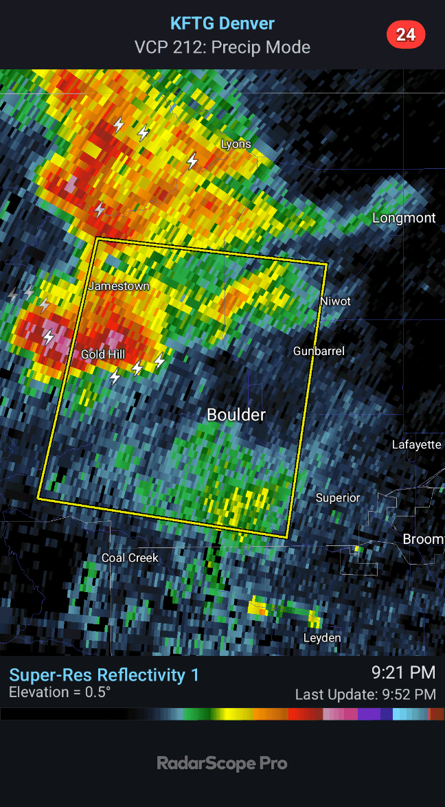
A reader in Gilpin County sent in this fantastic video showing the storm’s structure and near-continuous lightning as it hammered the Boulder area:
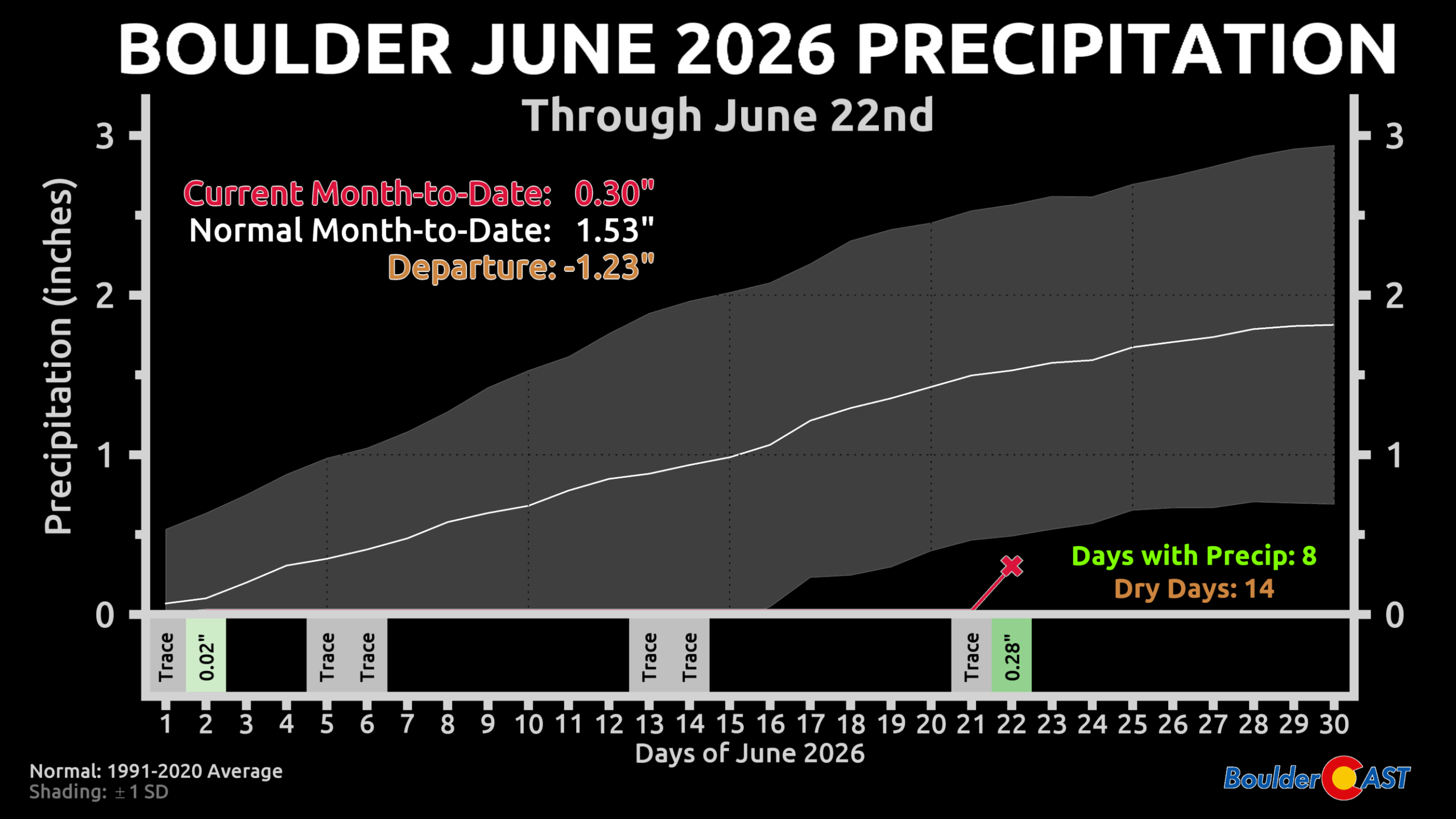
Sunday night’s downpour added 0.28″ to Boulder’s official gauge — the first measurable rain in nearly three weeks and the biggest one‑day total since mid‑May’s drought‑dampening soaker.
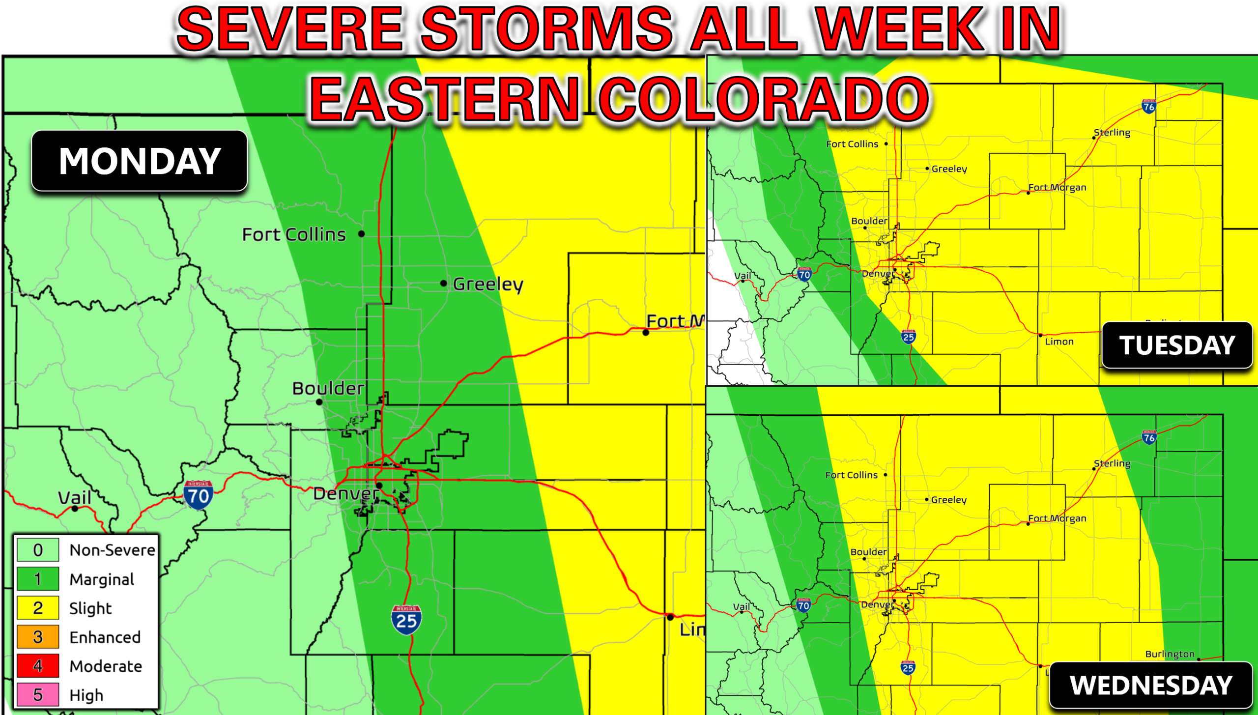
Looking Ahead: Severe Storms Monday Through Thursday
This week’s pattern looks deceptively calm at first glance, but the setup is primed for multiple days of severe weather across eastern Colorado.
The Pattern
- A strengthening ridge over west Texas and New Mexico to our south
- A summer storm track running along the Canadian border to our north
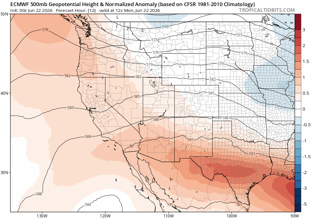
The combination of passing shortwaves to our north and the brewing ridge to our south will lead to a prolonged period of strong zonal flow over northern Colorado most of the week.
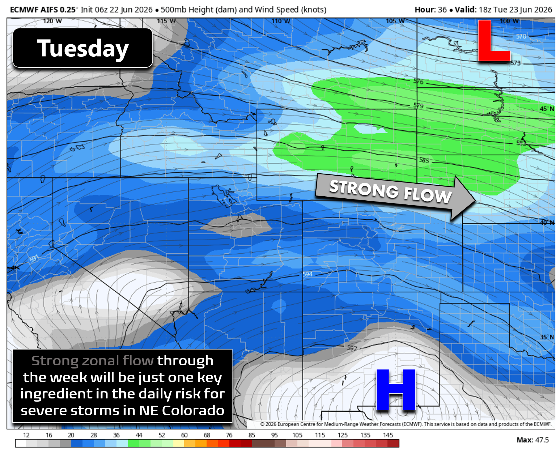
This, in concert with persistent easterly upslope winds at the surface, will lead to a good shear environment day in and day out. That same easterly flow will also help pool moisture westward into the Denver area and Foothills, setting the stage for a consistent, multi-day threat of severe thunderstorms across eastern Colorado with plenty of available moisture and instability.
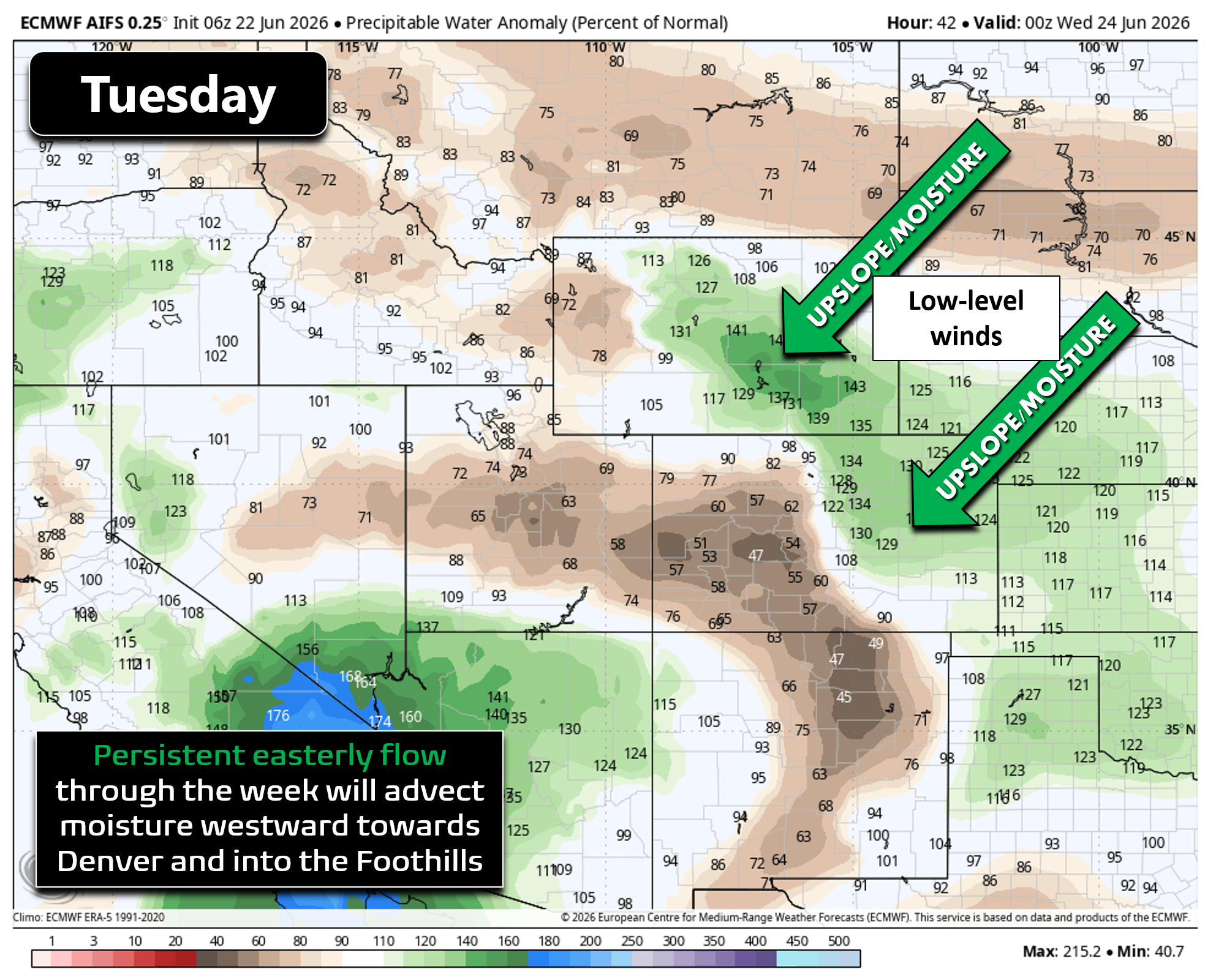
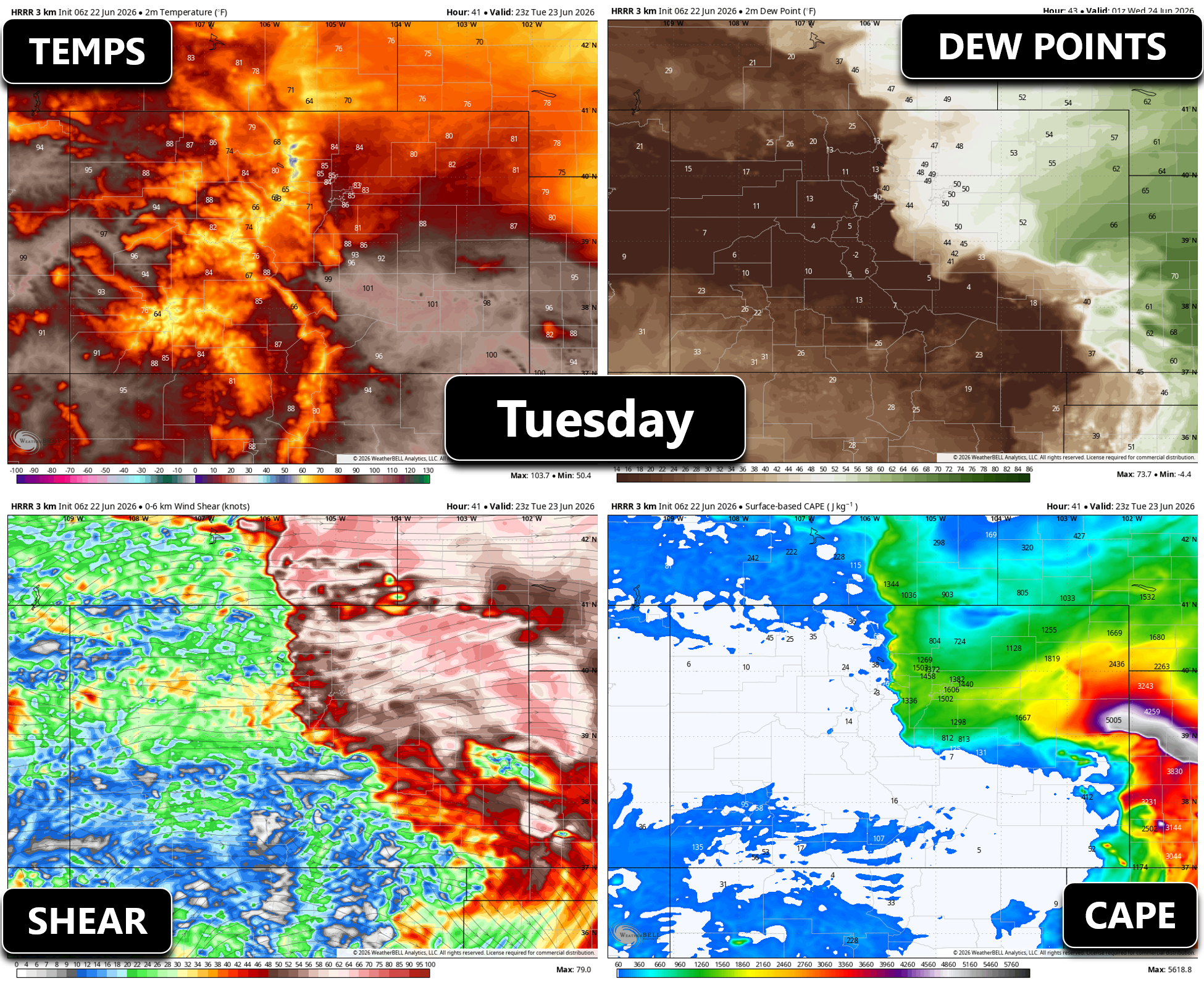
Below are key thunderstorm forecast parameters for just one day this week (Tuesday). All of the ingredients will be in place for severe storms from the Foothills eastward to the Nebraska and Kansas borders (and beyond).
The Persistent Severe Risk
The Storm Prediction Center already includes Boulder and Denver in their severe outlooks for Monday, Tuesday, and Wednesday, including a long‑lead Slight Risk for Tue/Wed — something we rarely see this far west where severe setups are usually marginal.
Expect:
- Long‑lived supercells
- Huge hail, up to baseball sized in the strongest storms in far eastern Colorado
- Damaging winds
- At least some tornado potential each afternoon/evening
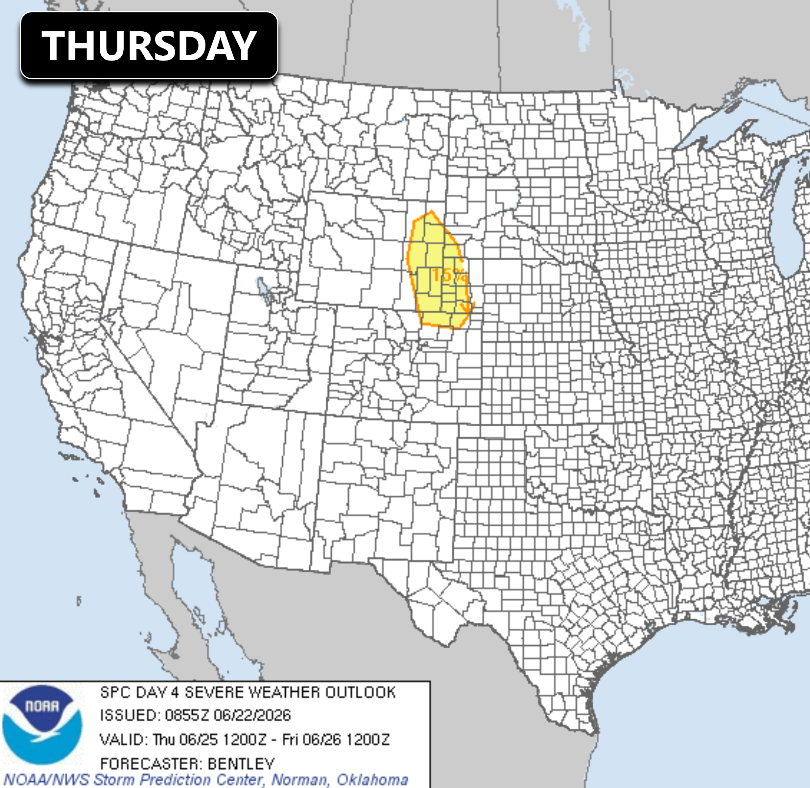
Thursday looks similar, with SPC already highlighting some of northern Colorado in their experimental Day 4 severe outlook.
We’re including late‑day severe storm chances Monday–Thursday this week, though Monday’s activity should stay mostly east of Denver. By Friday, a shortwave ridge slides overhead, weakening mid‑level flow and reducing shear. Storms are still possible, but the severe threat should taper as moisture declines.
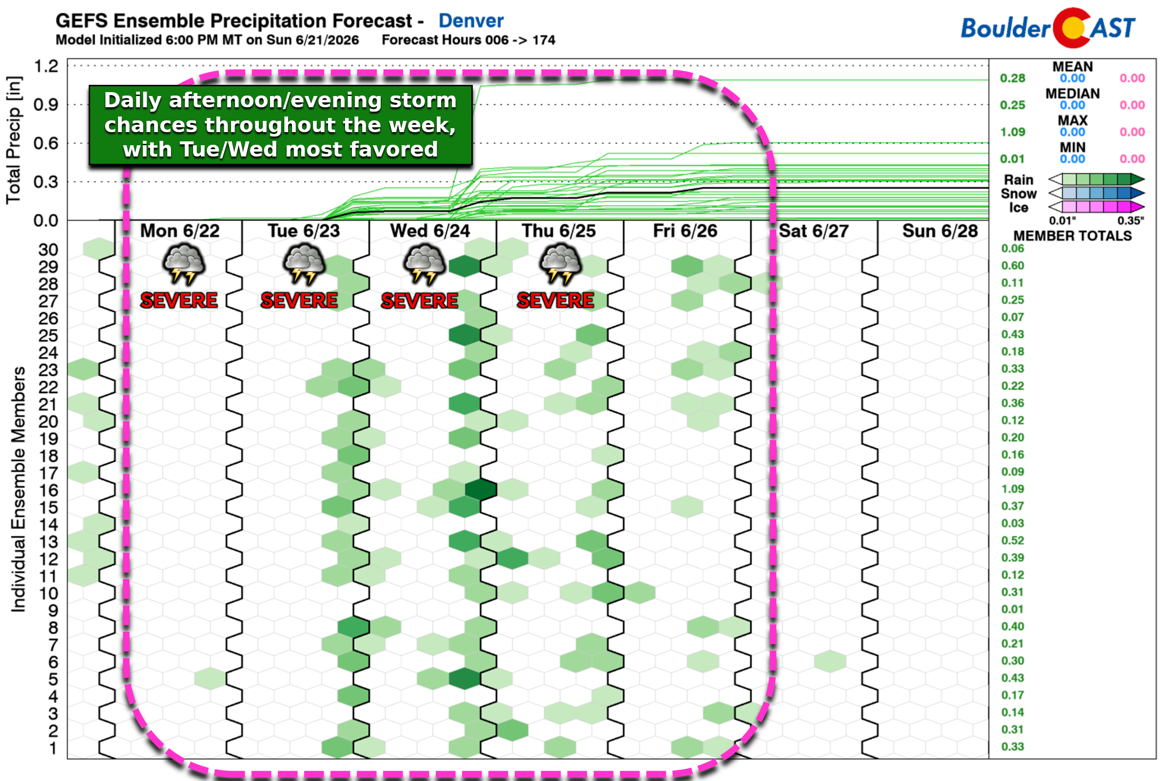
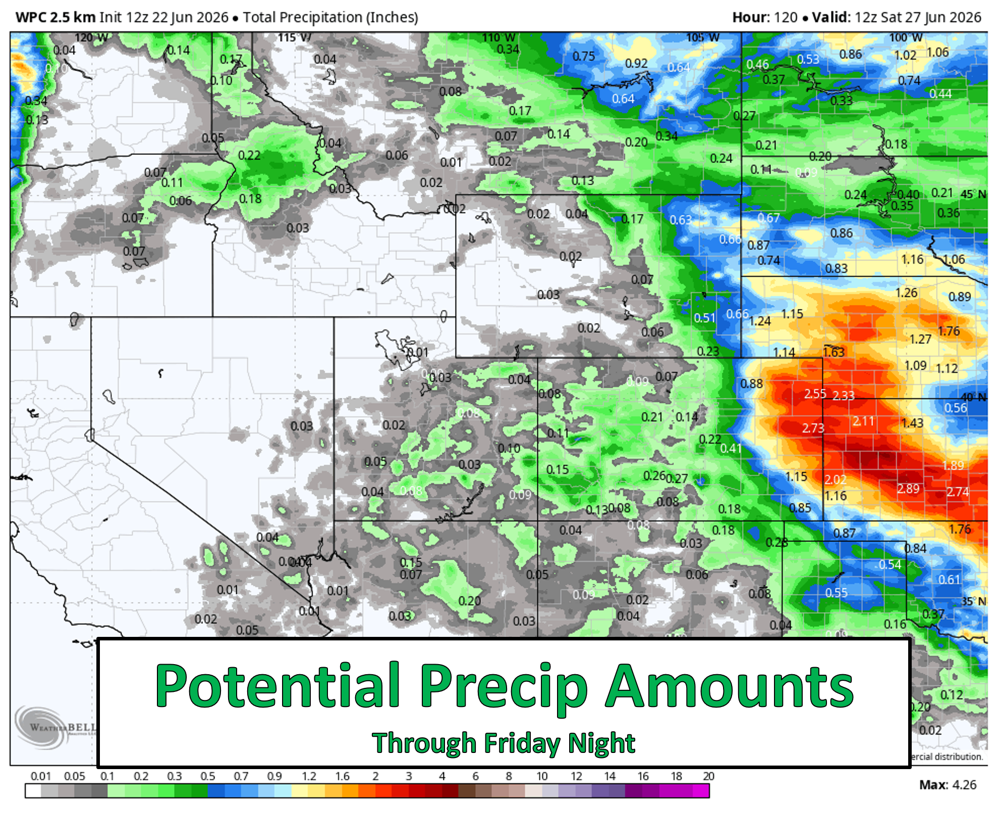
Rainfall totals throughout the week will likely stay under 0.5″ for most of the Metro area, though with so much convection and moisture in play, there is definitely the potential for localized totals over 1 inch. The best chances to see significant rainfall from daily strong to severe storms, including some potential flooding, will be across far eastern Colorado where rainfall amounts of 1 to 2 inches could be common by the end of the week.
Temperatures will stay comfortable through the extended in the upper 70s to upper 80s, which is near or slightly below average. Humidity will be higher than usual, though, so expect a stickier feel even without true summer heat.
A Smoky Week, Then a High‑End Fire Danger Weekend
Another weather storyline for us this week will be persistent blasts of lofted smoke coming into the Denver area from large wildfires burning upstream.
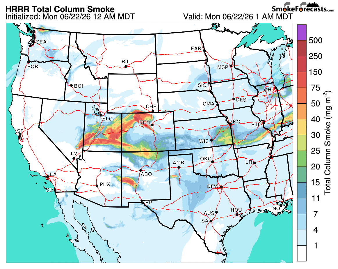
The ~22,000-acre Iron Fire south of Salt Lake City will be the biggest contributor to smoke for us this week, with winds aligning almost perfectly to bring it straight into the Front Range. Additional large fires north of Las Vegas will also contribute at times according to the latest aerosol guidance.
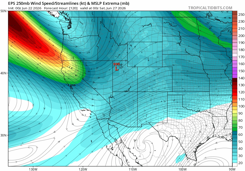
By the weekend, attention shifts to fire danger across the interior West. An unusually strong late‑June trough will dive south from the Pacific Northwest, dragging a powerful jet streak across the region. This will produce a multi‑day wind event over much of the drought‑stricken West, including western Colorado.
Further east, the Hot‑Dry‑Windy Index is projected to spike on Saturday across the Boulder–Denver area, signaling a likely critical fire weather setup should fuels be receptive.
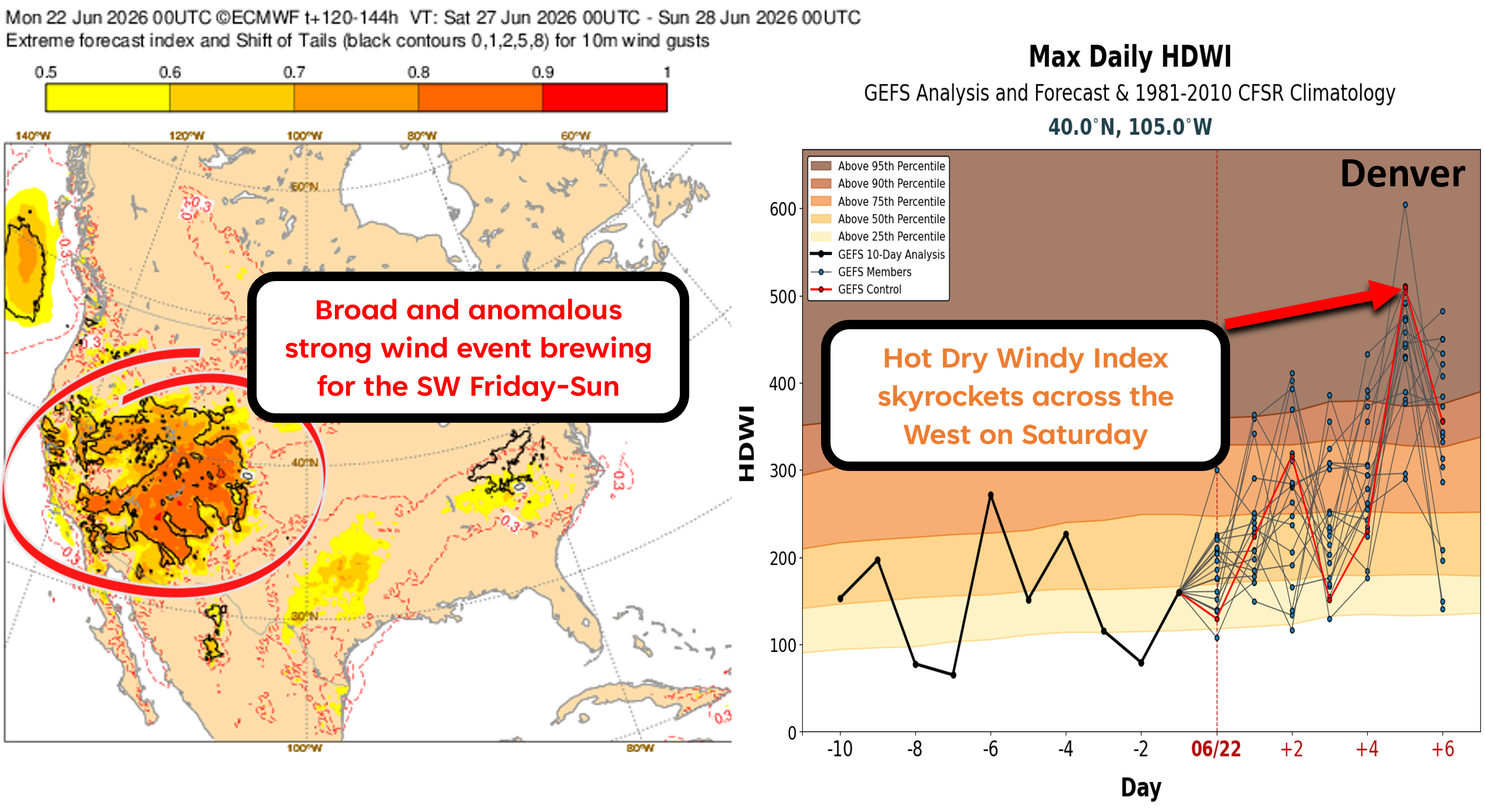
This is a long-winded way of saying that fire danger will become a big story this weekend for the West. Existing fires will spread rapidly, and new ignitions could take off quickly too — especially if high‑based storms develop over the Southwest as models are hinting.
Final Thoughts
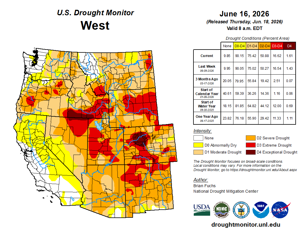
We’re staring down another jam‑packed week in Colorado weather. With multiple severe outbreaks lining up and a surge in fire danger looming for the weekend, we’ll be threading a very fine needle — trying to squeeze out the beneficial moisture while dodging the worst of the severe storms. Every drop matters right now, especially with drought poised to intensify and broader fire restrictions likely as we inch closer to the Fourth of July and all of the illegal fireworks it will surely entail.
Forecast Specifics:
Monday: Partly cloudy and warm with isolated severe supercell thunderstorms, mainly east of Denver. Big hail will be the primary concern. Highs top out in the upper 80s on the Plains with middle 70s in the Foothills.
Tuesday to Thursday: Partly cloudy and seasonal with highs in the upper 70s to middle 80s with widely scattered late-day severe thunderstorms. Big hail up to and larger than 2 inches and a couple tornadoes will be possible.
Friday: Somewhat calmer to end the week with partly cloudy skies and widely scattered late-day run-of-the-mill thunderstorms. High top out in the upper 80s on the Plains with middle 70s in the Foothills.
Saturday: Temperatures in the 90s with gusty southwest winds producing critical fire danger, with potential extreme fire danger in the Mountains.
DISCLAIMER: This weekly outlook forecast is created Monday morning and covers the entire upcoming week. Accuracy will decrease as the week progresses as this post is NOT updated. To receive daily updated forecasts from our team, among many other perks, subscribe to BoulderCAST Premium.
Go Premium, get all the perks.
Daily Forecast Updates
Get our daily forecast discussion every morning delivered to your inbox.
All Our Model Data
Access to all our Colorado-centric high-resolution weather model graphics. Seriously — every one!
Ski & Hiking Forecasts
6-day forecasts for all the Colorado ski resorts, plus more than 120 hiking trails, including every 14er.
Smoke Forecasts
Wildfire smoke concentration predictions up to 72 hours into the future.
Exclusive Content
Weekend outlooks every Thursday, bonus storm updates, historical data and much more!
No Advertisements
Enjoy ad-free viewing on the entire site.
Enjoy our content? Give it a share!


Leave a Reply
You must be logged in to post a comment.